Download to read offline


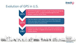

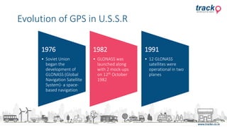


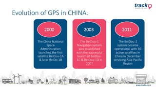


The document outlines the evolution of GPS technology from its inception in the late 1950s, highlighting key milestones such as the launch of the NAVSTAR system in 1973 and the development of GLONASS and Beidou systems by Russia and China, respectively. It emphasizes the transition of GPS from military to civilian use, including legislation in 2000 to provide accurate information to the public. The advancements in GPS technology continue to transform navigation, making it an essential tool in daily life.


![Introduction to gps [compatibility mode]](https://cdn.slidesharecdn.com/ss_thumbnails/introductiontogpscompatibilitymode-131231040925-phpapp01-thumbnail.jpg?width=640&height=640&fit=bounds)


