Downloaded 12 times


![nci.org.au
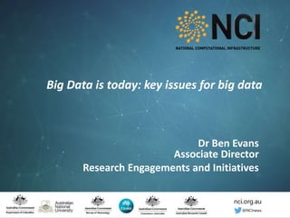
Key Messages for raising a Data Centre in a Big Data World• Scientific Computing scales of today have to be built across collaborations of
national facilities around national institutions that both scale up and scale-
down
• Data needs to be
• born-connected,
• transdisciplinary,
• high quality,
• computationally ready
• Needs expertise around usability and performance tuning to ensure getting the
most out of the data.
• No one [insert grouping] can do it alone.
• No one organisation, no one group, no one country has the required resources or
the expertise.
• Collaborative efforts across disciplines and collaboration across nations
Working Collaboratively in the era of Exascale and Big Data
© National Computational
Infrastructure 2016 Ben Evans, “Preparing for your data future”, July 2016](https://image.slidesharecdn.com/evans-160725034543/85/Big-Data-is-today-key-issues-for-big-data-Dr-Ben-Evans-26-320.jpg)

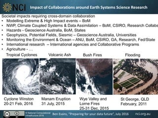
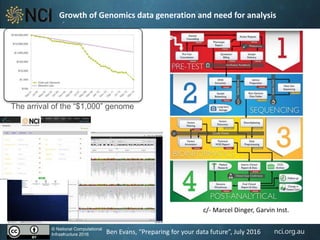
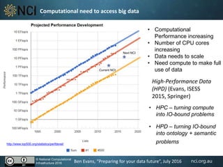
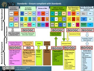
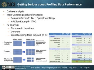
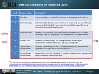
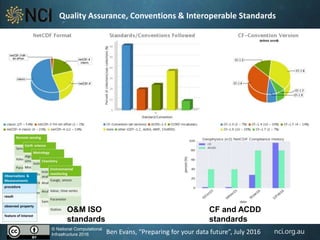
The document discusses the challenges and opportunities associated with big data in the context of collaboration across various scientific domains, particularly in environmental and earth systems research. It emphasizes the need for a national platform to enable access to significant data collections and improve research methods through high-performance computational capabilities. Key aspects include data management, interoperability, and the importance of transdisciplinary approaches to enhance data quality and usability.


