Downloaded 1,569 times


![DURING PREPAREDNESS PHASE
Using historic satellite remote sensing data acquired during floods, it is
possible to provide the chronically flood prone areas in the form of a map
showing severely affected, occasionally affected etc.
Flood monitoring and forecast can be done using hydrodynamic models.
Hydrodynamic models:
Landuse (IRS, SPOT, Landsat and IKONOS)
Soil Type
DEM (ERS, SPOT)
Soil Moisture
Rainfall (Meteorological satellites: GOES and POES, SAR,
NOAA, AHVRR]
Static data (eg. Drainage basin size)
Using flood inundation models in GIS environment, optimum evacuation
plan can be generated for carrying out rescue operations.](https://image.slidesharecdn.com/environmentalmonitoring-160503064212/75/Environmental-monitoring-48-2048.jpg)


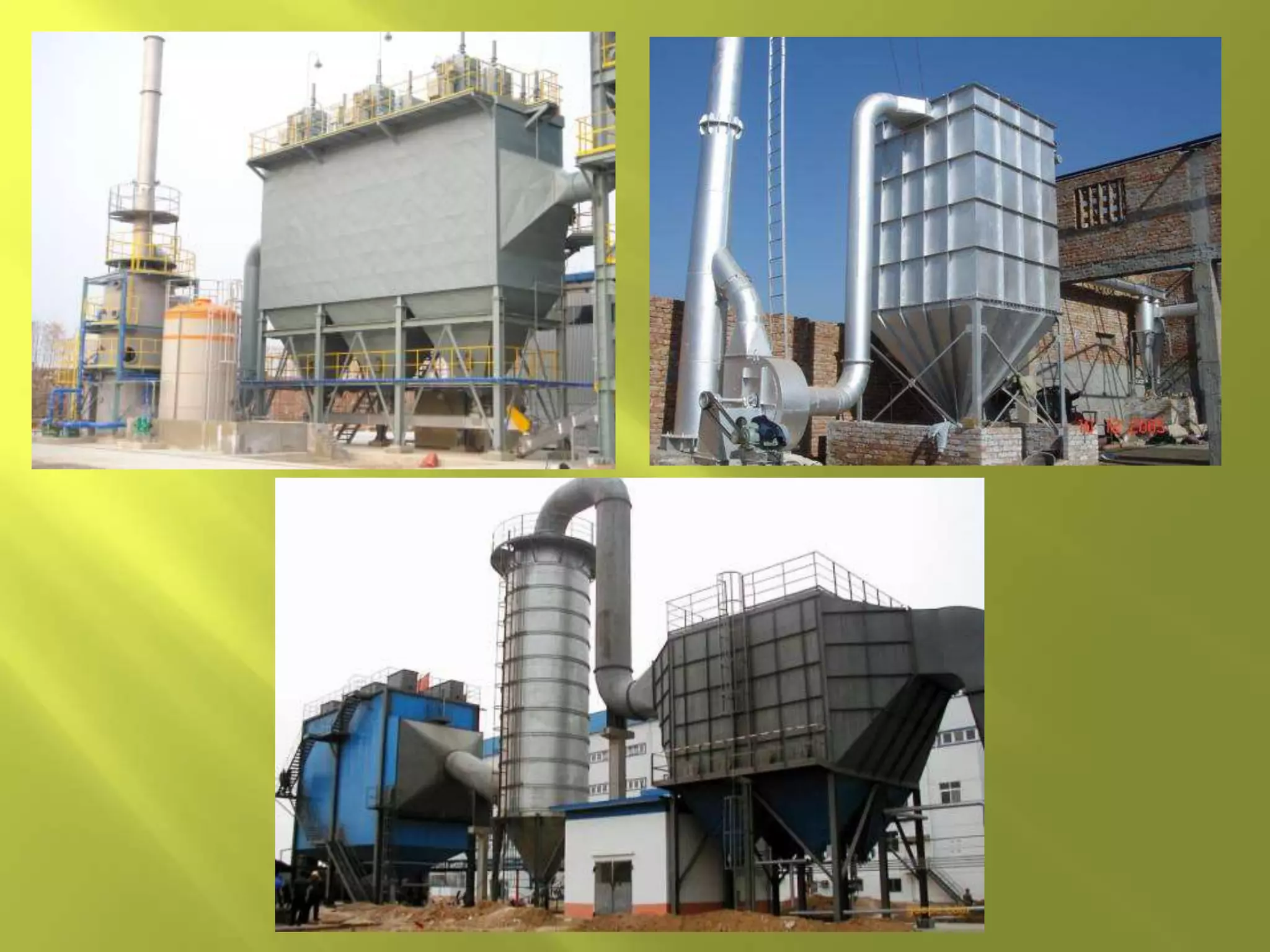
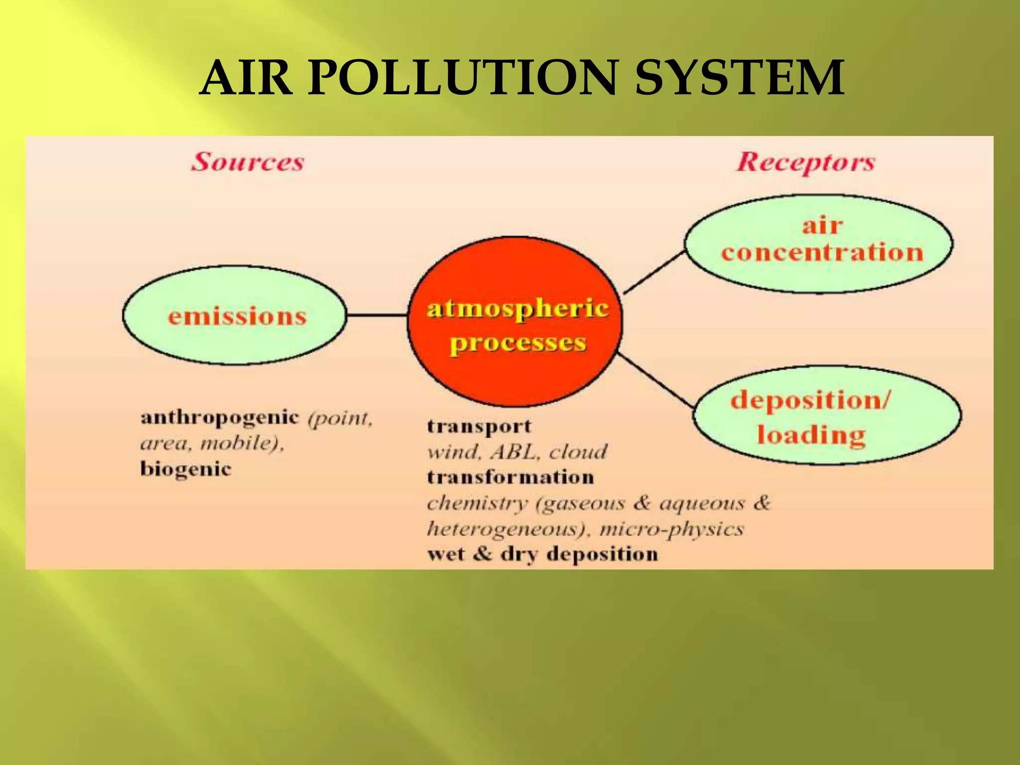
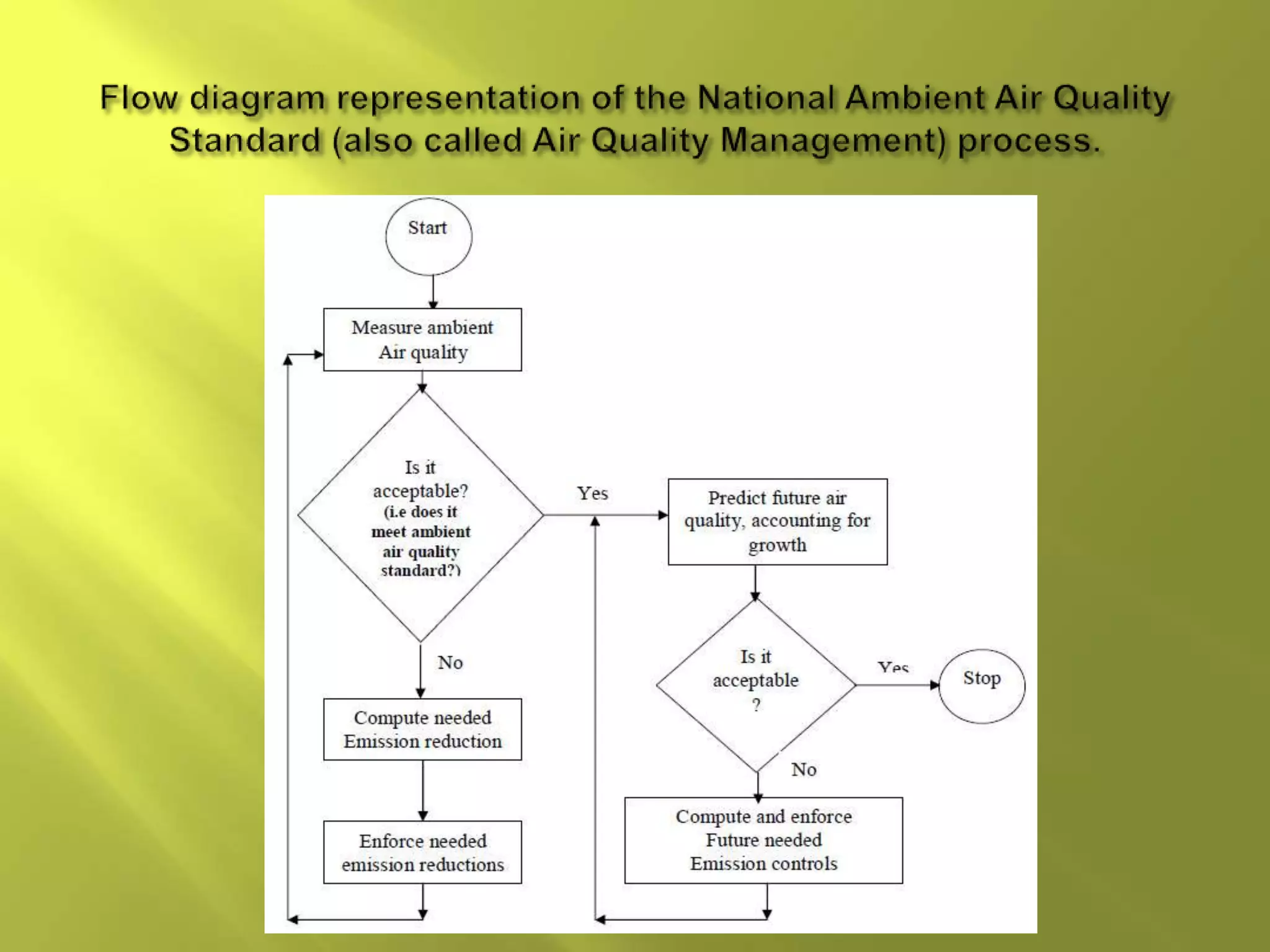
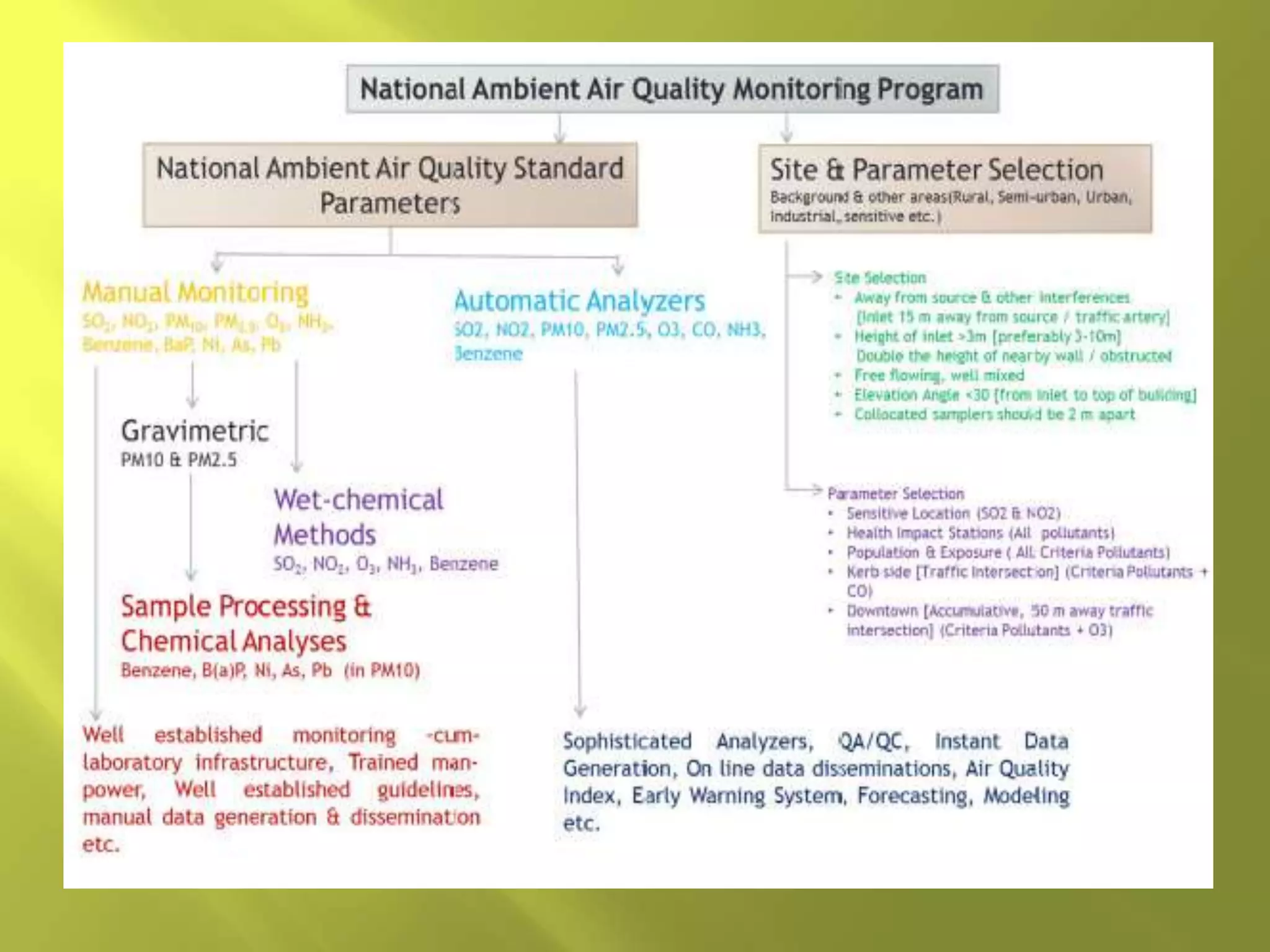
This document discusses environmental monitoring and various methods used for it. It covers the following key points in 3 sentences: Environmental monitoring involves systematically sampling air, water, soil, and biota to observe the environment and gain knowledge. It is undertaken for reasons such as identifying pollution levels, sources, and effects on health. Common monitoring methods include ground-based sampling, modeling, and satellite-based monitoring of various environmental aspects such as atmosphere, land, water quality, and natural hazards.


