Earthquakes are the vibrations caused by rocks breaking under stress. The underground surface along which the rock breaks and moves is called a fault plane
1. The document discusses a class on seismology and measuring the interior of the Earth through earthquake mechanisms.
2. It describes how the orientation of the first P-wave motion indicates compression or dilation and can be used to determine the faulting mechanism.
3. Plots of station locations and first motion polarities on a stereonet are used to delineate the nodal planes and focal mechanism of earthquakes.
This document provides an overview of topics in seismology, including measuring earthquake faults, fault parameters, focal mechanisms, and waveform modeling. It discusses different types of faults like normal faults, reverse faults, and strike-slip faults. It also covers plotting fault planes based on strike and dip, determining fault types from beach ball representations, and using waveform modeling to better resolve earthquake source parameters and focal mechanisms when first motion data is insufficient.
The document discusses research analyzing the relationship between geodetic strain, seismicity, and faulting in Japan. It presents results on fractal analyses of faulting and seismicity, correlations between seismic b-value and strain, temporal and spatial variations in seismicity, and relationships between GPS-derived deformation, strain, fault type and seismic hazard parameters. The overall aim is to evaluate how geodetic strain correlates with earthquake distribution, rate and magnitude over different time periods to improve understanding of seismic hazards.
Approach to understand the solar coronal and chromospheric heating — from Hin...ISAS_Director_Tsuneta
This project aims to understand heating in the solar corona and chromosphere by combining observations from Hinode, IRIS, and CLASP. Hinode has revealed waves and jets in the chromosphere that may play a role in heating. IRIS and CLASP will provide complementary data on magnetic fields, temperatures, densities, and velocities in the chromosphere and transition region. Analyzing coordinated data from these instruments will provide insights needed for the SOLAR-C satellite planned for 2019, including specifications for measuring chromospheric magnetic fields.
ACE made measurements of Earth's dayside magnetosphere on August 25, 1997 as it crossed through different regions. It first passed through the inner magnetosphere, where the magnetic field follows a dipolar structure. It then entered the magnetosheath, where the field lines oscillate and run parallel to the solar wind. Finally, it crossed the bow shock into the interplanetary medium with a weak magnetic field exposed to the solar wind. The measurements confirmed the distinct magnetic properties of Earth's magnetosphere, magnetosheath, and interplanetary regions.
This document compares the statistical properties of solar flares and earthquakes by analyzing event energy distributions, time series, and interevent times from solar flare and earthquake catalogs. It finds that the two phenomena exhibit different scaling statistics, and the same phenomenon observed in different periods or locations cannot be uniformly scaled to a single distribution. This suggests an apparent complexity in impulsive energy release processes that does not follow a common behavior attributable to a universal physical mechanism.
This document summarizes a study of seismic source parameters in the Guerrero subduction zone in Mexico. The authors analyzed strong motion data from 82 earthquakes between magnitudes 3-7 recorded by the Guerrero Accelerograph Array between 1985-1990. They determined seismic moments and stress drops for the events. On average, stress drops were 150 bars, but spatial patterns were observed. Events near the northwest end of the Guerrero seismic gap, adjacent to 1979 and 1985 earthquake aftershock zones, had mixed low and high stress drops. Events near the southeast end, near the 1957 earthquake rupture zone, predominantly had high stress drops. This pattern may be related to differences in the earthquake cycle between the two active regions.
This document discusses variations in multiple atmospheric parameters (outgoing longwave radiation, surface latent heat flux, air temperature, relative humidity, and air pressure) prior to the 2008 Mw 8.0 Wenchuan earthquake in China. The results show significant anomalies in these parameters starting 2 weeks before the quake. Outgoing longwave radiation anomalies were first observed 13 days beforehand and covered an area of 20,000 km2 along the fault zone. Surface latent heat flux showed anomalies the day before the earthquake. The variations are attributed to energy accumulation and release related to the tectonic stress buildup along the fault that caused the earthquake.
This document summarizes a study that performed broadband frequency simulations of strong ground motion in the Sea of Marmara region of Turkey based on fault rupture scenarios. Three earthquake scenarios were modeled involving rupture of the Central Marmara Fault and North Boundary Fault, which pose the largest hazard to Istanbul. A hybrid technique was used that combines deterministic and semi-stochastic methods. The location of the hypocenter was found to be a critical parameter for predicting ground motions in Istanbul. Anelasticity was also found to significantly affect regional attenuation of peak ground accelerations. The simulated ground motions resulted in large acceleration response spectra at long periods that could be critical for building damage in Istanbul during an actual earthquake.
This document summarizes a student's term project on the origin of intraplate earthquakes. It includes an outline, introduction, two case studies on intraplate earthquakes in North China and the New Madrid Seismic Zone, a proposed unified model, and conclusions. The unified model suggests that intraplate earthquakes occur when localized stress buildup at geological features approximates regional tectonic stresses. The conclusions emphasize the roaming nature and lack of periodicity in intraplate seismicity.
The document summarizes a study that characterized the soil conditions at a residential development site in Istanbul, Turkey using engineering seismology techniques. Seismic refraction and reflection surveys were conducted to determine P-wave and S-wave velocity profiles down to 30 meters depth. Three sections with different soil properties were identified. Parameters for geotechnical earthquake engineering were estimated for each section, including maximum soil amplification, natural period of soil column, maximum surface to bedrock acceleration ratio, depth of significant acceleration, maximum soil-rock response, and design spectrum periods. These parameters will be used by engineers for soil classification and structural design.
Seismic Imaging and Inversion by Robert H. Stolt & Arthur b WegleinArthur Weglein
University of Houston Professor Arthur Weglein is the co-author ( with Bob Stolt) of a two volume graduate textbook on “Seismic Imaging and Inversion” published in 2012 by Cambridge University Press.
Monitoring surface deformation combining optical and radar sentinel data gsg ...Pavlos Krassakis
This document discusses monitoring surface deformation in New Zealand caused by a large 2016 earthquake using optical and radar satellite data. It combines differential interferometry (DInSAR) using Synthetic Aperture Radar (SAR) data and offset tracking (OT) to map displacement. DInSAR showed line-of-sight movement while OT mapped movements in east-west and north-south directions. Combining these techniques provided a more complete picture of the complex surface deformation than either method alone. The analysis demonstrated the potential of using multiple earth observation tools to study earthquake impacts.
The document provides an introduction to seismic hazard analysis which includes four main steps:
1) Characterization of seismic sources and estimation of seismicity parameters for each source.
2) Selection of ground motion attenuation models.
3) Quantification of seismic hazard by calculating probabilities of exceeding certain ground motion levels.
4) Mapping of seismic hazard across a region.
It then discusses source characterization in more detail, including defining fault rupture zones, magnitude-area relations, earthquake catalogs, and magnitude frequency distributions models like characteristic and Gutenberg-Richter.
El documento compara las características de un blog y un wiki. Un blog organiza la información cronológicamente y puede perder documentos, mientras que un wiki permite al usuario organizar la información como quiera y no pierde documentos. Un wiki también ordena borradores y permite editar contenido de forma colaborativa.
El documento critica la invasión del espacio público en la Avenida Cero de Cúcuta por vendedores ambulantes y carretas de perros. Menciona que se arrojan basuras en la avenida y se obstaculiza el paso de peatones. Reconoce que estas actividades permiten la subsistencia de familias ante la falta de oportunidades laborales formales. Sin embargo, también señala la presencia de drogadictos disfrazados de artesanos que engañan a estudiantes. Concluye diciendo que debemos aprender a tolerar
Elsa del Castillo, Rectora de la Universidad del Pacífico - CADE Ejecutivos 2015IPAE
Este documento presenta datos e información sobre los jóvenes peruanos. Muestra que el 27% de los peruanos son jóvenes entre 15 y 29 años, y que para el 2021 serán 8'512,764. La mayoría de los jóvenes pertenece a la fuerza laboral pero gana menos de 600 soles al mes. Además, el documento explora las expectativas y prioridades de los jóvenes peruanos, incluyendo su enfoque en mejorar la educación, promover el emprendimiento y fortalecer los valores como la peruanidad.
This document is a collection of photos from various sources related to cannabis or marijuana. The photos are credited to Remolacha.net pics, ALEX AGUIRRE/AGENCIA FOTOS, prensa420, smokershighlife, Heart Industry, Colectivo Desde el 12, and another from Heart Industry. The document encourages the viewer to create their own presentation on SlideShare.
La gestión de proyectos implica resolver problemas e identificar soluciones inteligentes para satisfacer necesidades. El ciclo de gestión de proyectos incluye planificar tareas y recursos, controlar resultados, proponer medidas correctivas, realizar un seguimiento y generar informes. Un director de proyecto debe tener competencias técnicas como gestionar el alcance, costos, calidad y riesgos, así como competencias de comportamiento como el liderazgo, trabajo en equipo y resolución de conflictos.
Wieland Thermal Solutions is a global leader in heat transfer and forming technologies. They design and produce enhanced surface tubes and heat exchangers to maximize heat transfer while minimizing material usage. Their solutions ensure high energy efficiency and are trusted by customers worldwide. Wieland focuses on innovation, collaborates with partners, and has a global network to provide customized solutions and local support to customers.
TOTAL INSTITUTION, DIVORCE AND CHILDREN’S DAYCARE CENTERS(2014)Nathynie Arokianathan
It's basically about:
1. Factors of Difficulties in Resocialization to Prison Life
2. The main reason of divorce in Malaysia
3. Journal review of "Work-care balance among parents-workers in Malaysian urban organizations: Role and quality of children’s day care centres”.
Workplace Wellness Programs & The Law: Your ACA, HIPAA and ERISA Compliance C...Snag
This document discusses workplace wellness programs and related legal compliance. It defines a culture of wellness as one that encourages employees to actively engage in self-care and chronic disease management. It outlines different types of wellness programs, including participatory programs that reimburse gym memberships or reward health assessments, and health-contingent programs that offer rewards for meeting specific health standards or outcomes. The document provides an overview of legal compliance standards for these programs under the Affordable Care Act, HIPAA, ERISA, and other relevant laws.
The document discusses the early history and development of earthquake engineering from the late 19th century through the 1950s. Major events like the 1906 San Francisco earthquake, 1908 Messina earthquake, and 1933 Long Beach earthquake drove advances. Early pioneers developed concepts like seismic coefficients and response spectra. Building codes evolved from constant coefficients to account for building flexibility. The 1957 SEAOC committee aimed to develop a uniform national code addressing property damage.
This document summarizes a study examining the relationship between aseismic transients and seismicity in the Guerrero, Mexico subduction zone between 1995-2006. The authors searched earthquake catalogs for events less than 100km deep within the study area. They determined a completeness magnitude of Mc=4.5 for the NEIC catalog used. Three large aseismic transients in 1998, 2001-2002, and 2006 were found to correlate temporally with increases in seismic activity in the area. Specifically, transients were either preceded or followed by clusters of extensional or shallow thrust earthquakes, respectively, near the trench. This suggests aseismic transients may stress the seismogenic zone and connect distant seismicity clusters in shallow subduction
Probabilistic seismic hazard assessment in the vicinity of MBT and MCT in wes...inventy
Research Inventy : International Journal of Engineering and Science is published by the group of young academic and industrial researchers with 12 Issues per year. It is an online as well as print version open access journal that provides rapid publication (monthly) of articles in all areas of the subject such as: civil, mechanical, chemical, electronic and computer engineering as well as production and information technology. The Journal welcomes the submission of manuscripts that meet the general criteria of significance and scientific excellence. Papers will be published by rapid process within 20 days after acceptance and peer review process takes only 7 days. All articles published in Research Inventy will be peer-reviewed.
This document reassesses the locations and magnitudes of earthquakes in the Eastern Mediterranean and Middle East region from 1900 to 1999. The author compiled a catalog of over 5,000 earthquakes in the region, with a focus on 369 shallow earthquakes (depth less than 40 km) of magnitude 6.0 or greater. Many early earthquake locations and magnitudes from international catalogs were found to be inaccurate and have been re-evaluated based on macroseismic data and other studies. The catalog provides improved parameters for understanding seismic hazards and tectonics in the region.
The document discusses techniques seismologists use to predict earthquakes, including satellite imagery, infrared radiation, and interferometric synthetic aperture radar. It analyzes the 10 areas most overdue for earthquakes based on historical seismic activity and few quakes occurring in 2010. These areas include California, Alaska, Guatemala, Chile/Peru, Turkey, Burma/China, Japan, the Philippines, Afghanistan, and Mongolia. Seismologists study where large quakes have previously struck and use new technologies to detect ground movements and hot spots that could signal future seismic activity.
NISAR
Earthquake! Tracking Location and Impact from Space
NASA
National Aeronautics and Space Administration
NASA-ISRO Synthetic Aperture Radar (NISAR)
By
Dr. Pankaj Dhussa
Earthquakes are caused by the sudden release of built-up stress along geological faults. The document summarizes information about earthquakes in Pakistan including historical quakes, measuring magnitudes, locating epicenters, and classifying earthquake types and effects. It describes the elastic rebound theory of earthquakes, seismic wave propagation, uses of seismographs to measure quakes, and scales for quantifying magnitudes and intensities.
The document describes Natalie Bolen's experience of an earthquake in southern Indiana in 2008. She felt her room shaking and wonders what caused it. The earthquake was located on the New Madrid fault line, a zone of deep cracks in the earth's surface. Scientists use seismographs to measure earthquakes on the Richter scale and by intensity levels. The region has experienced earthquakes since 1811-1812, and there is potential for future quakes due to reactivated ancient faults.
(a) Tectonic InSAR has provided insights into earthquake processes over the past 3 decades since its beginnings in the 1980s. Measurements from over 150 earthquakes have shown that ruptures can be more complex than expected and that surface slip is a poor indicator of slip at depth. Earthquakes have also been found to trigger other quakes dynamically or be structurally controlled.
(b) Interseismic strain accumulation along faults can now be measured using large InSAR data stacks, finding focused strain that may be constant throughout the earthquake cycle. However, uncertainties remain about applicability in all regions.
(c) Postseismic deformation and aseismic slip transients exhibit complex spatial patterns but overall decay
Modling of Fault Directivity of 2012 Ahar-Varzaghan Earthquake with Aftershoc...IOSR Journals
1) The document analyzes the 2012 Ahar-Varzaghan earthquakes in Iran, which included two major quakes measuring Mw 6.4 and 6.2, as well as several major aftershocks including one of Mw 5.5.
2) Using data on 498 aftershocks over 12 months, the authors created maps showing the distribution and trends of aftershocks. The maps revealed a broken plane with aftershocks concentrated in the north and cracking from west to east at lower speeds and intensities.
3) The analysis of aftershock trends indicates the presence of an active latent fault with an east-west orientation in the area, which provides useful information for construction and other activities.
1) Earthquakes regularly occur at plate boundaries in the oceans, such as at subduction zones where one tectonic plate slides under another.
2) Major earthquakes can generate destructive tsunamis by displacing large volumes of water very quickly. These tsunami waves travel across the ocean and grow in height as they reach shorelines.
3) Studying areas like the Nankai Trough off Japan, where great earthquakes repeatedly occur, can provide insights into why and how these quakes happen, and help determine zones that may rupture in future events.
1) Earthquakes regularly occur at plate boundaries in the oceans, such as at subduction zones where one tectonic plate slides under another.
2) Major earthquakes can generate destructive tsunamis by displacing large volumes of water very quickly. These tsunami waves travel across the ocean and grow in height as they reach shorelines.
3) Studying areas like the Nankai Trough off Japan, where great earthquakes repeatedly occur, can provide insights into why and how these quakes happen, and help determine areas at risk for future seismic events.
Earthquake seismology uses seismic waves generated by earthquakes to study the interior of the Earth. Seismic waves are detected by seismographs and include P-waves, S-waves, and surface waves. The location and depth of the initial rupture point within the Earth is known as the hypocenter and epicenter, respectively. Larger earthquakes with shallower depths typically cause more damage. Earthquake magnitude represents the energy released while intensity refers to the strength of shaking experienced at a particular location.
The document summarizes a field report on the 1966 Varto-Ustukran earthquake in eastern Turkey. Some key details:
- The magnitude 6.8 earthquake occurred near the eastern end of the North Anatolian fault system in Turkey on August 19, 1966.
- It killed approximately 2,500 people and injured 1,300, destroying over 19,000 poorly constructed houses and leaving 100,000 homeless.
- The area had experienced foreshocks in the preceding months, including a damaging earthquake on March 7, 1966 and additional events through July 1966.
Earthquakes are the result of abrupt movement along fault fractures in the earth's crust, releasing energy that propagates in the form of seismic waves. The effects of earthquakes vary based on their magnitude and can cause devastating damage to lives, cities, and infrastructure. While earthquakes cannot be predicted with complete accuracy due to the complexity of the mechanisms involved, scientists can provide forecasts of probability for future seismic events based on statistical analysis of past quakes and geological evidence of past fault activity. Major goals of research include improving forecasts to help mitigate earthquake hazards and reduce losses through preparedness and building design.
This document discusses characteristics of ground motions from earthquakes. It covers several topics: direct information that can be obtained from an accelerogram; wave types involved in strong ground motion; factors that affect strong ground motion; empirical and theoretical prediction of ground motions; probabilistic seismic hazard analysis; and uncertainty in ground motion prediction. The document serves as an introduction to key concepts and literature on analyzing ground motion characteristics rather than providing detailed information.
This document describes a study that used GPS measurements taken in 1996, 1999, and 2002 to measure interseismic strain accumulation in the seismic gap between Constitución and Concepción in Chile. GPS stations were set up along two east-west transects and one north-south coastal profile. The measurements found horizontal velocities decreasing from 45 mm/year on the coast to 10 mm/year in the Andes, with negative vertical velocities of around 10 mm/year on the coast. The surface deformation is consistent with elastic loading on the subduction interface, with a dip of 16 degrees, locking depth of 55 km, and convergence of 67 mm/year. Accumulated displacement since the 1835 earthquake exceeds 10 m,
1) The document discusses key concepts related to earthquakes including their location, cause, measurement, and impact.
2) Major concepts explained include the focus (where pressure is released underground), epicenter (location directly above the focus where damage is greatest), and Richter scale (method for measuring earthquake magnitude).
3) The document provides a table listing details of significant earthquakes from 1923 to 2008 including location, year, magnitude on the Richter scale, and deaths.
An earthquake (also known as a quake, tremor or temblor) is the perceptible shaking of the surface of the Earth, which can be violent enough to destroy major
Studi seismologi gempa bumi telah berkembang dari pemahaman kuno hingga penjelasan modern melalui teori tektonik lempeng, memungkinkan pemantauan gelombang seismik untuk memetakan struktur bumi dan memahami mekanisme gempa.
Kemagnetan bumi Magnetism earth magnetism geophysicsYudha Agung
Metode geomagnet digunakan untuk menemukan benda di bawah permukaan bumi dengan memanfaatkan sifat kemagnetan batuan. Bumi memiliki medan magnet yang tidak konstan dan berubah terhadap waktu, sehingga garis medan magnet akan mengikuti pola dipol. Sifat kemagnetan bahan tergantung pada suseptibilitasnya dan dapat berupa ferromagnetik, paramagnetik atau diamagnetik.
Dokumen tersebut menjelaskan susunan geofon dan sumber gelombang dalam metode seismik biasa di lapangan, dengan menggambarkan letak geofon horizontal dan sumber getaran berupa palu yang memukul plat besi. Juga disebutkan berbagai faktor yang mempengaruhi kecepatan gelombang seismik seperti porositas, densitas, suhu, ukuran butiran, saturasi gas, tekanan eksternal, tekanan pori dan tekanan.
Dokumen tersebut membahas pengantar tentang teknik geofisika khususnya metode seismik. Metode seismik didasarkan pada hukum-hukum perambatan gelombang seismik dan dapat digunakan untuk mengetahui struktur bawah permukaan bumi serta eksplorasi sumber daya alam. Terdapat dua jenis metode seismik yaitu refraksi dan refleksi.
Rainfall intensity duration frequency curve statistical analysis and modeling...bijceesjournal
Using data from 41 years in Patna’ India’ the study’s goal is to analyze the trends of how often it rains on a weekly, seasonal, and annual basis (1981−2020). First, utilizing the intensity-duration-frequency (IDF) curve and the relationship by statistically analyzing rainfall’ the historical rainfall data set for Patna’ India’ during a 41 year period (1981−2020), was evaluated for its quality. Changes in the hydrologic cycle as a result of increased greenhouse gas emissions are expected to induce variations in the intensity, length, and frequency of precipitation events. One strategy to lessen vulnerability is to quantify probable changes and adapt to them. Techniques such as log-normal, normal, and Gumbel are used (EV-I). Distributions were created with durations of 1, 2, 3, 6, and 24 h and return times of 2, 5, 10, 25, and 100 years. There were also mathematical correlations discovered between rainfall and recurrence interval.
Findings: Based on findings, the Gumbel approach produced the highest intensity values, whereas the other approaches produced values that were close to each other. The data indicates that 461.9 mm of rain fell during the monsoon season’s 301st week. However, it was found that the 29th week had the greatest average rainfall, 92.6 mm. With 952.6 mm on average, the monsoon season saw the highest rainfall. Calculations revealed that the yearly rainfall averaged 1171.1 mm. Using Weibull’s method, the study was subsequently expanded to examine rainfall distribution at different recurrence intervals of 2, 5, 10, and 25 years. Rainfall and recurrence interval mathematical correlations were also developed. Further regression analysis revealed that short wave irrigation, wind direction, wind speed, pressure, relative humidity, and temperature all had a substantial influence on rainfall.
Originality and value: The results of the rainfall IDF curves can provide useful information to policymakers in making appropriate decisions in managing and minimizing floods in the study area.
Null Bangalore | Pentesters Approach to AWS IAMDivyanshu
#Abstract:
- Learn more about the real-world methods for auditing AWS IAM (Identity and Access Management) as a pentester. So let us proceed with a brief discussion of IAM as well as some typical misconfigurations and their potential exploits in order to reinforce the understanding of IAM security best practices.
- Gain actionable insights into AWS IAM policies and roles, using hands on approach.
#Prerequisites:
- Basic understanding of AWS services and architecture
- Familiarity with cloud security concepts
- Experience using the AWS Management Console or AWS CLI.
- For hands on lab create account on [killercoda.com](https://killercoda.com/cloudsecurity-scenario/)
# Scenario Covered:
- Basics of IAM in AWS
- Implementing IAM Policies with Least Privilege to Manage S3 Bucket
- Objective: Create an S3 bucket with least privilege IAM policy and validate access.
- Steps:
- Create S3 bucket.
- Attach least privilege policy to IAM user.
- Validate access.
- Exploiting IAM PassRole Misconfiguration
-Allows a user to pass a specific IAM role to an AWS service (ec2), typically used for service access delegation. Then exploit PassRole Misconfiguration granting unauthorized access to sensitive resources.
- Objective: Demonstrate how a PassRole misconfiguration can grant unauthorized access.
- Steps:
- Allow user to pass IAM role to EC2.
- Exploit misconfiguration for unauthorized access.
- Access sensitive resources.
- Exploiting IAM AssumeRole Misconfiguration with Overly Permissive Role
- An overly permissive IAM role configuration can lead to privilege escalation by creating a role with administrative privileges and allow a user to assume this role.
- Objective: Show how overly permissive IAM roles can lead to privilege escalation.
- Steps:
- Create role with administrative privileges.
- Allow user to assume the role.
- Perform administrative actions.
- Differentiation between PassRole vs AssumeRole
Try at [killercoda.com](https://killercoda.com/cloudsecurity-scenario/)
Software Engineering and Project Management - Introduction, Modeling Concepts...Prakhyath Rai
Introduction, Modeling Concepts and Class Modeling: What is Object orientation? What is OO development? OO Themes; Evidence for usefulness of OO development; OO modeling history. Modeling
as Design technique: Modeling, abstraction, The Three models. Class Modeling: Object and Class Concept, Link and associations concepts, Generalization and Inheritance, A sample class model, Navigation of class models, and UML diagrams
Building the Analysis Models: Requirement Analysis, Analysis Model Approaches, Data modeling Concepts, Object Oriented Analysis, Scenario-Based Modeling, Flow-Oriented Modeling, class Based Modeling, Creating a Behavioral Model.
VARIABLE FREQUENCY DRIVE. VFDs are widely used in industrial applications for...PIMR BHOPAL
Variable frequency drive .A Variable Frequency Drive (VFD) is an electronic device used to control the speed and torque of an electric motor by varying the frequency and voltage of its power supply. VFDs are widely used in industrial applications for motor control, providing significant energy savings and precise motor operation.
AI for Legal Research with applications, toolsmahaffeycheryld
AI applications in legal research include rapid document analysis, case law review, and statute interpretation. AI-powered tools can sift through vast legal databases to find relevant precedents and citations, enhancing research accuracy and speed. They assist in legal writing by drafting and proofreading documents. Predictive analytics help foresee case outcomes based on historical data, aiding in strategic decision-making. AI also automates routine tasks like contract review and due diligence, freeing up lawyers to focus on complex legal issues. These applications make legal research more efficient, cost-effective, and accessible.
Software Engineering and Project Management - Software Testing + Agile Method...Prakhyath Rai
Software Testing: A Strategic Approach to Software Testing, Strategic Issues, Test Strategies for Conventional Software, Test Strategies for Object -Oriented Software, Validation Testing, System Testing, The Art of Debugging.
Agile Methodology: Before Agile – Waterfall, Agile Development.
Comparative analysis between traditional aquaponics and reconstructed aquapon...bijceesjournal
The aquaponic system of planting is a method that does not require soil usage. It is a method that only needs water, fish, lava rocks (a substitute for soil), and plants. Aquaponic systems are sustainable and environmentally friendly. Its use not only helps to plant in small spaces but also helps reduce artificial chemical use and minimizes excess water use, as aquaponics consumes 90% less water than soil-based gardening. The study applied a descriptive and experimental design to assess and compare conventional and reconstructed aquaponic methods for reproducing tomatoes. The researchers created an observation checklist to determine the significant factors of the study. The study aims to determine the significant difference between traditional aquaponics and reconstructed aquaponics systems propagating tomatoes in terms of height, weight, girth, and number of fruits. The reconstructed aquaponics system’s higher growth yield results in a much more nourished crop than the traditional aquaponics system. It is superior in its number of fruits, height, weight, and girth measurement. Moreover, the reconstructed aquaponics system is proven to eliminate all the hindrances present in the traditional aquaponics system, which are overcrowding of fish, algae growth, pest problems, contaminated water, and dead fish.
Generative AI Use cases applications solutions and implementation.pdfmahaffeycheryld
Generative AI solutions encompass a range of capabilities from content creation to complex problem-solving across industries. Implementing generative AI involves identifying specific business needs, developing tailored AI models using techniques like GANs and VAEs, and integrating these models into existing workflows. Data quality and continuous model refinement are crucial for effective implementation. Businesses must also consider ethical implications and ensure transparency in AI decision-making. Generative AI's implementation aims to enhance efficiency, creativity, and innovation by leveraging autonomous generation and sophisticated learning algorithms to meet diverse business challenges.
https://www.leewayhertz.com/generative-ai-use-cases-and-applications/
DEEP LEARNING FOR SMART GRID INTRUSION DETECTION: A HYBRID CNN-LSTM-BASED MODELijaia
As digital technology becomes more deeply embedded in power systems, protecting the communication
networks of Smart Grids (SG) has emerged as a critical concern. Distributed Network Protocol 3 (DNP3)
represents a multi-tiered application layer protocol extensively utilized in Supervisory Control and Data
Acquisition (SCADA)-based smart grids to facilitate real-time data gathering and control functionalities.
Robust Intrusion Detection Systems (IDS) are necessary for early threat detection and mitigation because
of the interconnection of these networks, which makes them vulnerable to a variety of cyberattacks. To
solve this issue, this paper develops a hybrid Deep Learning (DL) model specifically designed for intrusion
detection in smart grids. The proposed approach is a combination of the Convolutional Neural Network
(CNN) and the Long-Short-Term Memory algorithms (LSTM). We employed a recent intrusion detection
dataset (DNP3), which focuses on unauthorized commands and Denial of Service (DoS) cyberattacks, to
train and test our model. The results of our experiments show that our CNN-LSTM method is much better
at finding smart grid intrusions than other deep learning algorithms used for classification. In addition,
our proposed approach improves accuracy, precision, recall, and F1 score, achieving a high detection
accuracy rate of 99.50%.
Optimizing Gradle Builds - Gradle DPE Tour Berlin 2024Sinan KOZAK
Sinan from the Delivery Hero mobile infrastructure engineering team shares a deep dive into performance acceleration with Gradle build cache optimizations. Sinan shares their journey into solving complex build-cache problems that affect Gradle builds. By understanding the challenges and solutions found in our journey, we aim to demonstrate the possibilities for faster builds. The case study reveals how overlapping outputs and cache misconfigurations led to significant increases in build times, especially as the project scaled up with numerous modules using Paparazzi tests. The journey from diagnosing to defeating cache issues offers invaluable lessons on maintaining cache integrity without sacrificing functionality.
Optimizing Gradle Builds - Gradle DPE Tour Berlin 2024
Eartquake task
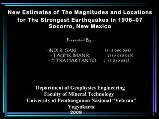
1. New Estimates of The Magnitudes and Locations
for The Strongest Earthquakes in 1906–07
Socorro, New Mexico
Presented By :Presented By :
-- INDI R. SARI (115 0INDI R. SARI (115 0 660 004)0 004)
- TAUFIK IMAN R. (115 060 023)- TAUFIK IMAN R. (115 060 023)
- FITRA HARTANTO (115 0- FITRA HARTANTO (115 0 660 042)0 042)
Department of Geophysics EngineeringDepartment of Geophysics Engineering
Faculty of Mineral TechnologyFaculty of Mineral Technology
University of Pembangunan Nasional “Veteran”University of Pembangunan Nasional “Veteran”
YogyakartaYogyakarta
20092009
2. Socorro is the earthquake capital of New Mexico. A less
than 2% of New Mexico, surrounding the town has
produced nearly 50% of the 30 natural earthquakes of
magnitude 4.5 or greater in the state since 1869. Three of
these shocks occurred during a very strong from 2 July
1906 through early 1907.
3. Abstrac
tRossi-Forel (RF) intensities by Reid (1911) for the three
strongest earthquakes in the 1906–1907 Socorro earthquake
are used to :
• estimate magnitudes
• locations, and
• fault parameters.
RF intensities have been converted to Modified Mercalli (MM)
intensities using the relationships by Richter (1958) and then to
peak ground accelerations (PGAs) using empirical equations
established by Wald et al. (1999).
Further analysis revealed that these earthquakes had to occur
very near Socorro, most likely on the Socorro Canyon fault, a
major Quaternary fault of the Rio Grande rift.
4. earthquakes (M>5.5) on the 30-event list, 12 July 1906, 16 July
1906, and 15 November 1906, occurred during a prolonged
Socorro area that started in July 1906 and continued through
early 1907.
Intensity (Imax) for an earthquake was Io, the earthquake
intensity at the epicenter. This value was then converted to
magnitude using an empirical relation derived by Sanford
(1998) for New Mexico earthquakes :
M = 0.5 + 2/3 Io
where Io is the epicenter Modified Mercalli (MM) intensity.
Introduction
Sanford and Lin (1998) developed a list of the three strongest
5. In Sanford and Lin (1998), two major assumptions were made
in obtaining magnitudes for the three strongest earthquakes in
the 1906–07 : 5.5 (12 July), 5.8 (16 July), and 5.8
(15 November) is :
1. The largest intensities (Imax), which were at Socorro, were
assumed to be Io
2. Socorro damage at the time were used to estimate the
Modified Mercalli Io for the three earthquakes; VII–VIII for
12 July, and VIII for 16 July and 15 November
6.
7. TABLE 1—12 July 1906: locations, observed intensities, distances from Socorro,
peak ground accelerations (PGAs), and magnitudes.
8. TABLE 2—16 July 1906: locations, observed intensities, distances from Socorro,
peak ground accelerations (PGAs), and magnitudes.
9. TABLE 3—15 November 1906: locations, observed intensities, distances from
Socorro, peak ground accelerations (PGAs), and magnitudes.
11. New magnitude estimates
Magnitude can be estimated from the decrease in PGA with
distance. Estimates of magnitude for the three quakes in 1906
were obtained by using the Spudich et al. (1999) attenuation
relation to calculate the earthquake magnitude required to
produce the estimated PGAs at each felt location for all three
shocks.
Revised magnitudes from this procedure were:
12 July 1906 , M = 5.57
16 July 1906 , M = 5.76
15 November 1906 , M = 6.18
12. Fault parameters
Wells and Coppersmith (1994) developed empirical formulas
relating fault rupture parameters to earthquake magnitude.
Below are listed the subsurface mean rupture lengths, mean
downdip rupture widths, and average displacements for
normal faults producing magnitude 5.57, 5.76, and 6.18
earthquakes:
13. Considering in rupture parameters and distances, it
is possible that the 16 July earthquake is a
northerly extension of the 12 July rupture on the
Socorro Canyon fault and the 15 November a
southerly extension of it.
14.
15.
16.
17. • New estimates of the magnitudes and locations of the three
strongest earthquakes during the 1906–07 Socorro area have
been obtained. The revised magnitude estimates: 5.57 (12 July
1906), 5.76 (16 July 1906), and 6.18 (15 November 1906) differ
from earlier estimates (Sanford et al. 2002) but are more robust
because they are based on nearly all the available earthquake
intensity data published by Reid (1911).
• The new analyses place all three earthquake locations very
near Socorro, most likely on the east-dipping Socorro Canyon
fault west of the town, a location in agreement with the general
conclusion of Reid (1911).
• Estimates of rupture parameters for the three earthquakes
indicate that only the 15 November quake could have offset the
surface but probably at less than observable levels.
CONCLUSION
18.
19. Appendix
Relationship of peak horizontal ground acceleration (PGA) to Modified
Mercalli (MM) intensity (adapted from Wald et al. 1999).