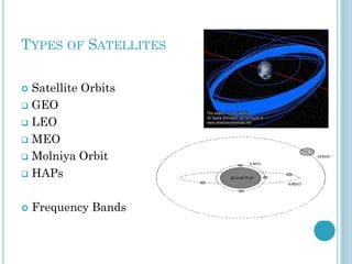
Download as PDF, PPTX


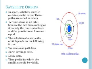
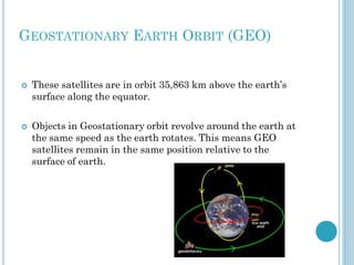
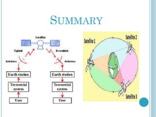
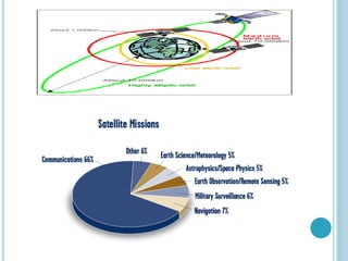


This document provides an outline for a course on digital satellite communications. It begins with course objectives, then provides an introduction to satellite communication principles. The basics section explains how satellite communication works, including earth station components and signal transmission. It also covers satellite types like GEO, LEO and MEO, as well as factors that impair signals. The document discusses frequency bands, network configurations, capacity allocation methods, and applications of satellite technology. Overall it aims to give students an overview of digital satellite communication systems and components.


![Satellite communications[1]](https://cdn.slidesharecdn.com/ss_thumbnails/satellitecommunications1-130416091107-phpapp01-thumbnail.jpg?width=640&height=640&fit=bounds)


