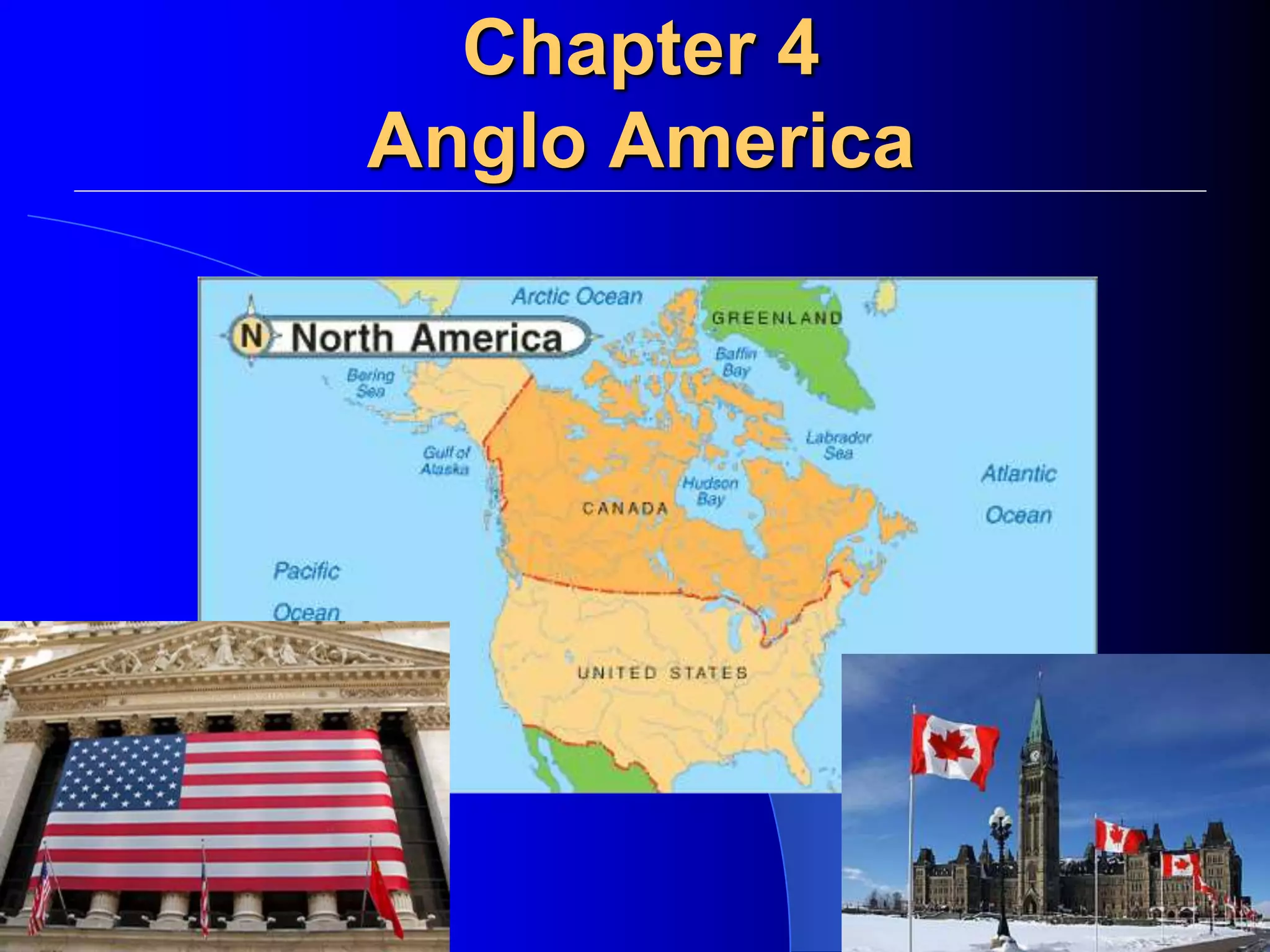
SlideShare a Scribd company logo
Chapter 4
Anglo America
Topography of the US
Landforms
The North American Landscape
Traveling from the East to West
The Atlantic Coastal Plain is a narrow
lowland extending from the
northeastern United States into
Florida.
The Gulf Coastal Plain stretches along
the Gulf of Mexico from Florida to
Texas.
West of the coastal plains are the
Appalachian Highlands. The
Appalachian Mountains are in this
region. This major chain of mountains
runs some 1,600 miles from
Newfoundland to Alabama.
6
Mountain Ranges
 Sierra Nevada, California.
 Rocky Mountains: stretch from Canada through the U.S.
 Appalachian Mountains: stretch length of U.S., from
Georgia to Maine.
http://www.srs.fs.usda.gov/gallery/landscapes_and_vegetation.htm
http://blueridgemountains.com/blue_ridge_mountains.html
The Great Plains spread out west of the Mississippi
River. It was flattened by an ancient Glacier.
The Canadian Shield (an extension of this interior
plain system) is a rocky, flat region that encircles
Hudson Bay.
West of the plains are the Rocky Mountains. The
Rockies are a young and growing range that
extends 3,000 miles from Alaska to New Mexico.
Between the Rockies and the Pacific
Ocean, a series of ranges run parallel to
the Pacific coastline from California to
Alaska. Major earthquakes occur in the
vicinity of the Pacific ranges.
http://worldatlas.com/webimage/countrys/nalnd.htm
http://www.nationalgeographic.com/destinations/Banff_National_Park/
http://www.gorzow.mm.
12
Canadian Shield
 Glaciation.
 Tundra, subarctic climate.
 Stretches over half of Canada.
http://www2.marianopolis.edu/quebechistory/encyclopedia/GeogofCan.htm
http://www.chrisimages.net/JPG Archive/Science Images/Great Plains/
www.fs.fed.us
http://www.wmscnet.com/3506paneof10.jpg
http://www.nativeecosystems.org/centralplains/
http://www.geo.hunter.cuny.e
http://www.accountingdirectory.us/1
http://www.stormtrack.org/forum/viewtopic.php?t=5933
http://tapestry.usgs.gov/features/13coastalplain.html
Water Resources
With access to three oceans and the Gulf of
Mexico, both countries have important shipping
and fishing industries. Inland, large rivers and
lakes serve as sources of transportation,
hydroelectric power, irrigation, fresh water, and
fisheries.
Eight of the world’s 15 largest lakes are found in the United States and
Canada.
The Mississippi River, part of the
continent’s longest and busiest
river system, runs almost the
length of the United States.
Canada’s largest river is the
Mackenzie River, which is part of
a river system that flows across
the Northwest Territories to the
Arctic Ocean.
St. Lawrence Seaway is an
important shipping route that
connects the Great Lakes to the
Atlantic Ocean.
http://www.farewelltospring.com/index.cgi/canada.html
http://www.travelwithachallenge.com/UNESCO-Sites.htm
http://www.o
http://www.itcwebdesigns.com/Cove_Island_Lighthouse_Lake_Huron.jpg
http://www.marill.com/eddaisy/Recent%20Events/family%20reunion/Picnic-Lake-Ontario-Jack-Da.jpghttp://www.richard-seaman.com/USA/Cities/Chicago/PhotoGalleries/
http://www.paconserve.org/coho/Lake-Erie-shoreine-tiny.jpg
http://www.nsc.org/graphics/basin.gif
http://c3po.barnesos.net/homepage/lpl/seattle/
norman.walsh.name
http://webcookie.net/photo/ www.cruise.com
26
The Gulfs
 Gulf of Mexico: South, warm.
 Gulf of Alaska: North, cold.
www.tceq.state.tx.us
home.comcast.net
28
Great Salt Lake, Utah
 Transparent -- Clear, see to bottom.
 Less than 3 feet deep.
 22% salt = 6 times more salty than oceans.
 Float instead of swim.
www.world-maps.co.uk
http://www.crimelibrary.com/notorious_murders/classics/charles_francis_hall/
http://www.eman-rese.ca/eman/network/higharc.htm
http://tea.armadaproject.org/rosenberg/5.27.2000.html
http://fatlab.biology.dal.ca/docs/labrador.html
Natural Resources
Both countries have vast forest resources. 1/3 of the United States is covered in forest.
1/2 of Canada is covered in forest.
The United States and Canada are both rich in resources. This has attracted immigrants
and made both countries global economic powers.
Both countries are large (Canada 2nd largest, US 3rd largest) and contain some of the most
fertile soils in the world. Because of this, North America is the world’s leading food
exporter.
Abundant minerals and fossil fuels gave both countries the means to industrialize rapidly.
Both countries have substantial deposits of coal, natural gas, and oil.
Climate and Vegetation
Shared Climates
The Arctic coastlines of Alaska
and Canada have a Tundra
climate and vegetation. Winters
here are long and bitterly cold.
The land is a huge, treeless plain.
Much of the rest of Canada and
Alaska have a Subarctic climate,
with very cold winters and short,
mild summers. Needle-leafed
evergreens cover the region.
The Rocky Mountains and the
Pacific ranges have Highland
climates. Temperature and
vegetation vary with elevation
and latitude.
Shared Climates
Northern portions of the United
States and much of southern
Canada have a Humid
Continental climate. The four
season climate attracts large
populations.
The Pacific coast from northern
California to southern Alaska has
a Marine West Coast Climate.
This climate is affected by Pacific
Ocean currents and the coastal
mountains. Vegetation includes
deciduous trees, needle-leafed
evergreens, and giant California
redwoods.
Warmer American Climates
The southern states have a
Humid Subtropical climate.
Moist air from the Gulf of
Mexico brings rain. The
combination of mild
temperatures and adequate
rainfall provides a long
growing season for a variety of
crops.
The Great Plains have a
Steppe Climate. The weather
is dry, with only about 15
inches of rain annually.
The southwestern states have
a Desert Climate, with less
than ten inches of rain each
year.
The central and southern coasts of
California have a Mediterranean Climate.
The islands of Hawaii have a Tropical Wet
Climate that supports lush rain forests.
Southern Florida has a Tropical Wet and
Dry Climate. It is always warm, but has wet
and dry seasons.
Human Environment Interaction
Crossing the Distances
When Europeans came, they set up
colonies along the Atlantic Coast and then
moved inland. They created overland
trails and used inland waterways. To
connect bodies of water, they built a
network of canals.
North America’s most important
deepwater shipping route—the St.
Lawrence Seaway —connects the Great
Lakes to the Atlantic Ocean using a series
of locks.
Locks are sections of a waterway with
closed gates where water levels are raised
or lowered.
Railroad building began in North America in the early 19th century. The first
transcontinental railroad, crossing the United States, was completed in 1869. A trans-
Canada railroad was completed in 1885.
The development of the automobile in the early 20th century spurred road building.
Today, both the United States and Canada have national highway systems. The
United States has more than 4 million miles of road.
Urban Planning
Most large cities have a moderate climate and located are near water and resources.
Cities with favorable geography must deal with large populations and urban sprawl.
While cities without must adapt to their conditions.
Montreal, Quebec is Canada’s second largest city
and a major port, even though its temperature is
below freezing more than 100 days each year.
Early French explorers liked Montreal’s location—
on a large island where the St. Lawrence and
Ottawa rivers meet.
The French built a permanent settlement there in
1642. The community was founded at the base of
Mount-Royal and grew by spreading around the
mountain. Because of the city’s severe winters,
large areas of Montreal have been developed
underground.
The Hoover Dam is a
Hydroelectric Dam on the
Nevada-Arizona border.
The dam has helped with
irrigation and provided power for
cities like Las Vegas, the fastest
growing city in the United States.
Los Angeles had a mild climate and a desirable location on the Pacific Coast. People
began pouring into this once small Spanish settlement in the 20th century.
By 1990, Los Angeles had the second largest population in the United States. However,
rapid population growth meant air pollution, inadequate water supplies, and
construction on earthquake-threatened land.
Humans have impacted North America through over use. Decades of extensive
farming damaged the Great Plains. This combined with severe drought brought
about the Dust Bowl of the 1930’s.
Geographic
Problems
Seismography Data: 1977-2007
Earthquakes!
Tornadoes Per Year: 1950-2007
Hurricanes
"Hurricane Katrina in 2005 was the largest natural disaster in the history of the United
States. Preliminary damage estimates were well in excess of $100 billion, eclipsing
many times the damage wrought by other hurricanes making landfall in the U.S.
Over 2,000 people lost their lives.
Droughts
More than 700 reservoirs capture flow in major river basins, bringing water to places
that could not otherwise be populated – such as Las Vegas & San Diego – for
agricultural purposes.
The growing urban populations of California use more than 2,500 millions gallons of
water per day.
This demand coupled with climate change has resulted in one of the worst droughts
since the Dust Bowl.
Floods
Floods occurred due to prolonged periods of precipitation causing waters to rise
and overflow the river’s bank.
Since 1900, floods have taken more than 10,000 lives in the U.S.
In 1993, the Mississippi River and the Missouri River flooded approximately 20
million acres across the U.S. Midwest costing upwards of $30 billion.
Human Geography of Anglo
America
Population Patterns
U.S. Population
313,818,286
♦One birth every 8 seconds.
♦One death every 13 seconds.
♦One international migrant (net) every
22 seconds.
♦Net gain of one person every 10 seconds.
 People
– 5% of Earth’ population live in the U.S and Canada
 US = 300 millionCanada = 33 million
– All are immigrants
 Native Americans thousands of years ago
 Waves of Europeans/Asians/Africans in past 400
years
– Sought political/religious freedom
– Improved economic opportunity
– Enslaved Africans
 Population Density and Distribution
– US and Canada are vastly different
 US = 78 people per sq mi. Canada = 8 per sq. mi.
– Canada
 90% live along US border
 Rugged terrain and brutal climate make most of Canada inhospitable
to human inhabitation
Population Patterns
 Population Density and Distribution
– US and Canada are vastly different
 US = 78 people per sq mi. Canada = 8 per sq. mi.
– United States
 Population Centers
– Northeast and Great Lakes
– Pacific Coast
– Sunbelt
 Sparsely populated areas
– Alaska
– Great Basin and Great Plains
– US and Canada have experienced urbanization
 The concentration of population in cities
– Jobs, education, health care and cultural opportunities draw people to
cities
– Metropolitan areas = city with +50,000 people and its outlying
communities called suburbs
 80% of the U.S.
 Coastal Cities
– People tend to live along the ocean coast
– Megalopolis – “great city”
• Combines Boston-New York-Philadelphia-Baltimore-
Washington DC
• Over 42 million residents
– Other coastal cities include: Miami, New Orleans, Houston, Los
Angeles, Vancouver
• All are major port cities
 Inland Cities
– People tend to live along inland lakes and rivers as well
– Great Lakes and St. Lawrence River Cities
• Quebec, Montreal, Ottawa, Toronto, Buffalo,
Cleveland, Detroit, Milwaukee, Chicago
– Mississippi River System Cities
• Winnipeg, Minneapolis, St. Louis, Pittsburgh,
Cincinnati, New Orleans, Memphis, Nashville
– Other inland cities grew from being commercial hub
• Kansas City, Dallas, Atlanta, Charlotte, Calgary,
Edmonton, Phoenix, Oklahoma City, Las Vegas
Culture
&
Lifestyles
•Both Canada and the US are multicultural
societies.
•Canadians speak both
French and English.
•Both have religious freedoms
•Both are mobile societies – automobiles.
•High SOL (average income $35,000
a year).
Sports and Recreation
•Football (American and Canadian)
•Ice Hockey
•Baseball •Soccer •Basketball
The United States: History
Britain’s 13 American colonies began to resent policies forced on them by a distant
government. Their protests led to the American Revolution (1775–1783) and the
founding of the United States of America.
The U.S. Constitution was adopted in 1787.
The United States: History
69
In 1803, the United States nearly doubled in size
when the government purchased from France the
vast plains region between the Mississippi River
and the Rocky Mountains.
This territory became known as the Louisiana
Purchase.
The United States: History
70
Sectionalism began growing.
People placed loyalty to a region above loyalty
to the nation.
Rising political and economic tensions between
an agricultural South and a more industrialized
North led, to the Civil War (1861-1865).
The United States: History
The second half of the 19th century saw Westward Expansion, pioneers headed west
in covered wagons. To make way for white settlers, the U.S. government removed
Native Americans from the land by treaty or by force.
When the transcontinental railway was completed in 1869, railroads brought people to
the West and western cattle and products to markets in the East.
The United States: History
Urbanization – the movement of
people into cities.
Some of the new immigrants headed out West. Others settled in rapidly growing and
industrializing urban areas. Americans from rural areas also came to cities to work.
The United States was being transformed from a rural, agricultural nation to an
urban, industrialized one.
Industrialization – transition from
an agricultural society to one
based on industry
Industrial
Revolution
(Early 1900s)
Steam Power
Diesel Machinery
Electricity
The United States: History
The United States was seen as an isolationist country (avoid conflict not directly related
to territorial self defense) by many because of its slow entry into the conflict in Europe
during WWI & WWII.
World War I: 1914-1919.
The United States had a healthy economy despite going through the Great Depression
and Dust Bowl during the 1930s.
World War II: 1939-1945.
When World War II ended in 1945, the United States was the only major nation that had
escaped physical damage.
The United States: History
The United States had teamed up with the
Soviet Union to defeat Germany, but when
the war ended distrust between the two allies
led to the cold war.
Cold War - was the period of conflict, tension
and competition between the United States
and the Soviet Union 1940’s until the 1990’s.
There was never a direct military
engagement between the U.S. and the
Soviet Union, but there was half a century of
military buildup, and political battles for
support around the world
The United States: History
75
During the Cold War the United States played an active role in trying to contain the
spread of communism.
A major political topic today is how best to deal with the threat of Terrorism.
The United States: History
During the last half of the 20th century, Americans experienced prosperity.
Many people began migrating from cities to surrounding suburbs.
The civil rights and women’s rights movements worked for equality.
Immigrants from Latin America and Asia arrived looking for political stability and
economic opportunities.
The United States: History
History of Canada
People from Asia crossed a land bridge
into North America thousands of years
ago.
Some remained in what are now the
Canadian Arctic and Alaska.
These people were ancestors of the
Inuit, or Eskimos.
The earliest Canadian literature was the
oral tradition of First Nations peoples.
Early visual art included Inuit carvings and
the totem poles of the First Nations peoples
of the West Coast.
Later, European settlers influenced the
literature and artistic traditions.
History of Canada
In 1497, John Cabot landed in Newfoundland and claimed the region for England.
Then, during the 16th and 17th centuries, French explorers claimed much of North
America for France.
To both countries, the coastal fisheries and the inland fur trade were important.
Soon, the French and British challenged each other’s territorial claims.
Britain defeated France in the French and Indian War, 1754 to 1763, forcing France
to surrender its territory. But French settlers remained.
History of Canada
By the end of the 18th century, Canada had become a land of two distinct
cultures—Roman Catholic French and Protestant English.
In 1791, the British government split Canada into two provinces.
Upper Canada (later, Ontario) had an English-speaking majority, while Lower Canada
(later, Quebec) had a French-speaking population.
History of Canada
In 1872, the government began construction of a
transcontinental railroad.
In 1885, the main railway line, from Montreal to
Vancouver, was completed.
When gold was discovered in the Yukon, fortune
hunters from around the world headed to Canada.
Not long after, copper, zinc, and silver deposits were
found, prompting the building of new railroads and
towns. At the same time, immigrants from other
parts of Europe were coming to Canada.
For much of the time after settlement, Canadians
had lived in rural areas and engaged in farming.
But as population grew and natural resources were
developed, Canada became increasingly urban and
industrial.
History of Canada
Government
One of the strengths of the United States is the political system created by the U.S.
Constitution, adopted in 1787.
The United States is a representative democracy, where the people rule through
elected representatives.
Amendment – in U.S. history, official changes made to the Constitution.
Bill of Rights – the first 10 amendments to the United States Constitution.
U.S. Government
Canada was recognized as an independent nation by Britain in 1931.
However, Canada’s symbolic head of states remains the British monarch.
Canada has a parliamentary government, a system where legislative and executive
functions are combined in a legislature called a parliament.
The majority party’s leader becomes prime minister.
Canada’s Government
Economics
Three factors have contributed to the overall
success of the American economy—an
abundance of natural resources, a skilled labor
force, and a stable political system that has
allowed the economy to develop.
The economy is run largely on free enterprise.
Private individuals own most of the resources,
technology, and businesses and can operate
them with little government control.
The government places some regulations on
companies to protect the Market System such as
law declaring monolopies illegal.
Monopoly – total control of a type of industry by
one person or one company.
The U.S. Economy
The United States not only feeds itself but
also helps to feed the world.
The industrial output of the United States is
larger than that of any other country in the
world.
The American economy today is driven by
service industries. Three out of four
Americans now work in service-related jobs.
This economic phase is called a post-
industrial economy.
The U.S. Economy
The United States is the world’s major trading
nation, leading the world in the value of its
exports and imports.
Many American corporations engage in business
worldwide and are called multinationals.
Still, the U.S. has a trade deficit (spending
more money on imports than earning on exports).
This is due to the high cost of American goods
and the tariffs (taxes) placed upon them.
The U.S. Economy
No other country exports more wood pulp and
paper products than Canada.
Mining is a major industry because of
Canada’s extensive mineral deposits.
Three ocean coastlines provide Canadians
with an abundance of fish, and Canada
exports more fish than any other country.
Like the US, Canada has a modern post-
industrial economy where most of its citizens
make their living in service industries.
Canada’s spectacular natural beauty has
made tourism one of the fastest growing of the
service industries.
Canada’s economy has always relied on trade.
In 1994, Canada and the United States, along
with Mexico, signed the North American Free
Trade Agreement (NAFTA).
Canada’s Economy
90
NAFTA (North American Free Trade Agreement) was created to facilitate trade
between Canada, The United States, and Mexico.
Canada is the United States biggest trading partner.
NAFTA
Regions
The region’s coastal and inland waters turned it
into the heart of trade, commerce, and industry
for the nation.
The Northeast is one of the most heavily
industrialized and urbanized areas in the world.
Coal, iron ore, and oil fueled industrialization.
Traditional industries still play a role in the
region’s economy, but most Northeasterners are
now employed in manufacturing and service
industries.
The U.S. Northeast
The U.S. Northeast
I. Geopolitical Locations:
1. New York
2. Boston
3. Philadelphia
*Most densely populated region in US.
II. Climate: Humid Continental
4 distinct seasons
Freezing cold winters
Hot steamy summers
III. Vegetation
Mixed forests, deciduous, coniferous
New York, New York!
• Shaped by immigration, industrialization, and urbanization.
• IMMIGRATION: movement of people.
• INDUSTRIALIZATON: use of machines for manufacturing goods.
• URBANIZATION: growth & concentration of people living in cities.
• One of the first cities of importance in the U.S.
• Melting pot of U.S.
• Economic center of U.S., & the world.
Boston: The Hotbed of Revolution
• Oldest U.S. cities. Puritans founded in 1630.
• Boston Massacre, 1770.
• Boston Tea Party, 1773.
• Battle of Bunker Hill, 1775.
•Industrialization, 1890s.
• Fishing, Maritime activities.
• Urban renewal program, 1957.
• Today, vital economic and medical sectors of U.S.
• Has one of the highest standard of living in U.S.
Philadelphia: The Birth of Liberty
• Founded in 1682.
• Declaration of Independence signed, 1776.
• U.S. Constitution signed, 1787.
•Home of the Liberty Bell.
• Destination for Irish immigrations, 1840s.
• Manufacturing giant in early years of industrialization.
• Production of coal, steel.
• Led to region being known as The Rust Belt.
•Today, shifted to economic and technology.
The South is often referred to as the “sunbelt” because of its climate.
Agriculture was the South’s first economic activity, and cotton, tobacco, fruits, peanuts,
and rice are still grown there. Livestock production is important, too.
The introduction of air conditioning in the 1950s and the region’s vast stores of energy
resources encouraged industrialization.
In recent times, the South has attracted many manufacturing and service industries.
The U.S. South
The U.S. Southeast
I. Geopolitical Locations
1. Jamestown
2. Charleston
3. New Orleans
4. Houston
*Wide coastal plain. No dry season.
II. Climate: Humid Subtropical
Mild winters
Hot summers
Gulf of Mexico.
III. Vegetation
Mixed forests, swamp, everglades.
Charleston, SC:
The South’s First Port
Jamestown, VA:
The First Settlement
New Orleans, LA: The Big Easy
Bought from Napolean (France) in 1803.
Louisiana Purchase doubled size of U.S.
Major port THEN and NOW for U.S.
Houston, Texas
• Home of the fourth largest city in U.S.
• Pre-Civil War: Agriculture (cotton), slavery.
• Confederate.
• Post-Civil War: Agriculture, fishing.
•Today, oil & gas exploration is BIG business.
The U.S. Midwest
Because of its central location, the Midwest is called the American heartland.
Vast, largely flat plains are a distinctive feature of the region. So are numerous
waterways, including the Great Lakes and the Mississippi River.
The Midwest is the nation’s “breadbasket.” Fertile soil, adequate rainfall, and a
favorable climate enable Midwesterners to produce more food and feed more people
than farmers in any comparable area in the world.
The U.S. Midwest
I. Geopolitical Locations
1. Chicago
2. Kansas-Nebraska
* “Breadbasket of America”
II. Climate: Humid Continental
4 distinct seasons
Freezing cold winters
Hot steamy summers
III. Vegetation
Mixed forests, deciduous, coniferous
Chicago Skyline: The “Second” City
• Established 1833. Population: 200.
• Today, third largest U.S. city.
• Growth result of immigration, Great Lakes, & the Mississippi River.
• Manufacturing, railroad, labor unions.
• Home of Stephen Douglas, Abraham Lincoln, Barack Obama.
The U.S. West
Some areas are sparsely settled, but California
is the nation’s most populous state, because of
excellent farmland, good harbors, and a mild
climate.
The West is the most rapidly growing region in
the United States.
The region’s growth was helped by the
introduction of air conditioning and by
irrigation.
The U.S. West
I. Geopolitical Locations
1. Los Angeles
2. Hollywood
3. Seattle
4. Portland
5. Hoover Dam
Hydroelectric powerplant located on borders of
Nevada-Arizona. Supplies irrigation / electricity
to western cities such as Las Vegas.
6.NATURAL HAZARDS!
II. Climate: MULTIPLE
Highlands: Mountain ranges.
Climate changes with elevation.
Steppe/Desert (Arid/semiarid):
Winters pleasant with little rain.
Summers are hot and dry.
Marine West Coast (Pacific):
Rainy winters.
Warm, drier summers.
Tropical climates: Hawaii.
III. Vegetation: Varies with Climate
Los Angeles: The City of Angels?
•1847: U.S. territory following U.S. win of Mexican-American war.
•Major port and railroad connects West-to-East.
•Beginning of film industry.
•Today, second largest city in U.S.
Hollywood: City of Lost Dreams
109
Seattle, WA Portland, OR
•Oregon trail.
•Timber, fishing.
•Pacific, west coast marine.
•Today, urban center.
•Economies: Range from agriculture
(inland) to timber (mountain) to hi-tech
industries (cities).
•Gold rush.
•Port, shipbuilding, lumber.
•Pacific, west coast marine.
•Today, urban center.
•Economies: Range from timber
(mountain) to hi-tech industries (cities)
& development of “green” energy.
 Second largest country in the world.
 Shares over 5,000 miles of border with the U.S.
 90% of Canada’s population lives within 100 miles of the
U.S.-Canadian border.
 1/3 of Canada’s population lives in Toronto, Montreal, &
Vancouver.
Canada’s Facts
Ottawa: Canada’s Capital
• 1857: Queen Victoria declares Ottawa to be the capital of Canada.
• Humid Continental climate. 4 distinct seasons!
• Urban center with outlying suburbs. Fourth largest city in Canada.
112
Canada’s Northwest Territories
Directly east of the Pacific Provinces lie the Northwest Territories, which extend into
the Arctic. Nunavut was carved out of the eastern half of the Northwest Territories in
1999.
Canada’s Northern Territories
• Yukon, Northwest, Nunavut.
•Major towns: Whitehorse, Yellowknife & Iqaluit.
• MacKenzie River is Canada’s largest river and flows into the Arctic Ocean.
•Sparsely populated. Rural.
•Subarctic & Tundra climates.
•Economy fueled by vast amounts of natural resources:
•Minerals: nickel, copper, uranium mining.
•Forestry / pulp manufacturing.
•Hydroelectric energy.
Eastern Canada is the location of the four
Atlantic Provinces—Prince Edward Island,
New Brunswick, Nova Scotia, and
Newfoundland.
The Atlantic Provinces are home to just eight
percent of Canada’s population. The small
population is due largely to the provinces’
rugged terrain and severe weather.
Fishing and logging are important in all four
provinces.
In Nova Scotia, shipbuilding and trade provide
more employment and revenue.
And Newfoundland’s hydroelectric-power
resources supply power to Quebec and parts
of the northeastern United States.
Canada’s Atlantic Provinces
 Newfoundland, New Brunswick, Nova Scotia, &
Prince Edward Island.
 St. Lawrence River connects the inner
portions of southern Canada to the Atlantic
Ocean using LOCKS.
 Humid Continental climate.
– 4 distinct seasons.
 Resources/Economy:
– Fishing / fish harvesting.
 Vegetation: Mixed forests.
– Coniferous and deciduous.
Canada’s Maritime (Atlantic) Provinces
The Prairie Provinces — Manitoba, Saskatchewan, and Alberta—are part of the Great
Plains of North America.
They are the center of Canada’s agricultural yield, responsible for 50% of the nation’s
agricultural production.
In addition, about 60 percent of Canada’s mineral output comes from this region.
Alberta itself has the nation’s largest known deposits of coal and oil and produces 90%
of Canada’s natural gas.
Canada’s Prairie Provinces
117
 Manitoba, Saskatchewan, & Alberta.
 Urban centers: Edmonton, Calgary, Winnipeg.
 Steppe climate. Arid/semi-arid or dry.
 Economy: Farming (wheat), petroleum, coal.
Canada’s Prairie Provinces
Canada’s westernmost province is British Columbia.
Nearly all of it lies within the Rocky Mountains range. Over
half of the land is densely forested, and nearly one-third is
frozen tundra, snowfields, and glaciers.
This is the location of British Columbia’s two largest cities,
Victoria and Vancouver.
The economy is built on logging, mining, and hydroelectric-
power production.
The Yukon Territory lies north of British Columbia and is
largely unspoiled wilderness.
Canada’s Pacific Provinces
119
 Vancouver, British Columbia.
 1/2 the Province’s population lives in
Vancouver.
 Marine West Coast climate.
 Economy: Tourism, financial investment,
and technology.
Canada’s Western Province
Vancouver
British Columbia

More Related Content

What's hot

World political region
World political regionWorld political region
World political region
Al Jubaer
 
North america
North americaNorth america
North america
iqbal muhammed
 
Environmental geography
Environmental geography Environmental geography
Environmental geography
Mahamudul Hasan
 
South america physical
South america physicalSouth america physical
South america physicallschmidt1170
 
Settlement Characteristics
Settlement CharacteristicsSettlement Characteristics
Settlement Characteristicswhiskeyhj
 
Geographic Concepts
Geographic ConceptsGeographic Concepts
Geographic Concepts
aaurorap
 
Physical Geography of Latin America
Physical Geography of Latin AmericaPhysical Geography of Latin America
Physical Geography of Latin America
karrinem
 
Political Geography.pptx
Political Geography.pptxPolitical Geography.pptx
Political Geography.pptx
eshitaakter2
 
Maps and globes
Maps and globesMaps and globes
Maps and globes
sanj_1911
 
RURAL SETTLEMENT
RURAL SETTLEMENTRURAL SETTLEMENT
RURAL SETTLEMENT
Rafiul Alam
 
United States Climate
United States ClimateUnited States Climate
United States Climatewintersteen
 
Geography of southeast asia
Geography of southeast asiaGeography of southeast asia
Geography of southeast asiahookc
 
Social geography
Social geographySocial geography
Social geography
djdhir
 
Asia
AsiaAsia
Welcome to Geography - Introduction
Welcome to Geography - IntroductionWelcome to Geography - Introduction
Welcome to Geography - Introduction
Steven Heath
 
Mountains, Plateaus and Plains
Mountains, Plateaus and PlainsMountains, Plateaus and Plains
Mountains, Plateaus and Plains
racquel escano
 
Asia
AsiaAsia
Types and Pattern of Rural Settlement
Types and Pattern of Rural SettlementTypes and Pattern of Rural Settlement
Types and Pattern of Rural Settlement
Vaibhav Baramate
 
Types of regions_08
Types of regions_08Types of regions_08
Types of regions_08cindipatten
 

What's hot (20)

World political region
World political regionWorld political region
World political region
 
North america
North americaNorth america
North america
 
Environmental geography
Environmental geography Environmental geography
Environmental geography
 
South america physical
South america physicalSouth america physical
South america physical
 
Settlement Characteristics
Settlement CharacteristicsSettlement Characteristics
Settlement Characteristics
 
Geographic Concepts
Geographic ConceptsGeographic Concepts
Geographic Concepts
 
Physical Geography of Latin America
Physical Geography of Latin AmericaPhysical Geography of Latin America
Physical Geography of Latin America
 
Political Geography.pptx
Political Geography.pptxPolitical Geography.pptx
Political Geography.pptx
 
Maps and globes
Maps and globesMaps and globes
Maps and globes
 
RURAL SETTLEMENT
RURAL SETTLEMENTRURAL SETTLEMENT
RURAL SETTLEMENT
 
United States Climate
United States ClimateUnited States Climate
United States Climate
 
Geography of southeast asia
Geography of southeast asiaGeography of southeast asia
Geography of southeast asia
 
Social geography
Social geographySocial geography
Social geography
 
Asia
AsiaAsia
Asia
 
Welcome to Geography - Introduction
Welcome to Geography - IntroductionWelcome to Geography - Introduction
Welcome to Geography - Introduction
 
Mountains, Plateaus and Plains
Mountains, Plateaus and PlainsMountains, Plateaus and Plains
Mountains, Plateaus and Plains
 
Asia
AsiaAsia
Asia
 
Types and Pattern of Rural Settlement
Types and Pattern of Rural SettlementTypes and Pattern of Rural Settlement
Types and Pattern of Rural Settlement
 
South america
South  americaSouth  america
South america
 
Types of regions_08
Types of regions_08Types of regions_08
Types of regions_08
 

Similar to Chapter 4 Anglo America (US& Canada)

Geography North America
Geography North AmericaGeography North America
Geography North America
Pinecrest Academy Nevada
 
Social studies class 2b north america
Social studies class 2b north americaSocial studies class 2b north america
Social studies class 2b north americaryaninshanghai
 
North america map study
North america map studyNorth america map study
North america map studylschmidt1170
 
North america map study
North america map studyNorth america map study
North america map studylschmidt1170
 
Geography of the united states
Geography of the united statesGeography of the united states
Geography of the united statesAaron Carn
 
Lecture 5 (1)
Lecture 5 (1)Lecture 5 (1)
Lecture 5 (1)
barkasivv
 
Lecture 5 (1)
Lecture 5 (1)Lecture 5 (1)
Lecture 5 (1)
barkasivv
 
ITFT- america physical Features
ITFT-  america physical FeaturesITFT-  america physical Features
ITFT- america physical Features
Aruna Poddar
 
Western united-states
Western united-statesWestern united-states
Western united-states
Subrata Mandal
 
World geography north and south america
World geography  north and south americaWorld geography  north and south america
World geography north and south america
Bheekam Singh
 
North America Geog
North America GeogNorth America Geog
North America Geog
Donald Johnson
 
Nature in the U.S.A.
Nature in the U.S.A.Nature in the U.S.A.
Nature in the U.S.A.Daniela Arrus
 
The East: Land and Water
The East: Land and WaterThe East: Land and Water
The East: Land and Water
hschiesher
 
5.1 - North American Landforms and Resources
5.1 - North American Landforms and Resources5.1 - North American Landforms and Resources
5.1 - North American Landforms and Resources
Dan Ewert
 
5.1 landforms and resources
5.1   landforms and resources5.1   landforms and resources
5.1 landforms and resourcesJohn Hext
 
Geography of the United States of America
Geography of the United States of AmericaGeography of the United States of America
Geography of the United States of America
Ayu Monita
 
Geography of North america
Geography of North americaGeography of North america
Geography of North america
Furqaan Thakur
 

Similar to Chapter 4 Anglo America (US& Canada) (20)

Geography North America
Geography North AmericaGeography North America
Geography North America
 
Social studies class 2b north america
Social studies class 2b north americaSocial studies class 2b north america
Social studies class 2b north america
 
GEOusandcanada1
GEOusandcanada1GEOusandcanada1
GEOusandcanada1
 
North america map study
North america map studyNorth america map study
North america map study
 
North america map study
North america map studyNorth america map study
North america map study
 
Geography of the united states
Geography of the united statesGeography of the united states
Geography of the united states
 
Lecture 5 (1)
Lecture 5 (1)Lecture 5 (1)
Lecture 5 (1)
 
Lecture 5 (1)
Lecture 5 (1)Lecture 5 (1)
Lecture 5 (1)
 
ITFT- america physical Features
ITFT-  america physical FeaturesITFT-  america physical Features
ITFT- america physical Features
 
Western united-states
Western united-statesWestern united-states
Western united-states
 
World geography north and south america
World geography  north and south americaWorld geography  north and south america
World geography north and south america
 
North America Geog
North America GeogNorth America Geog
North America Geog
 
Nature in the U.S.A.
Nature in the U.S.A.Nature in the U.S.A.
Nature in the U.S.A.
 
The East: Land and Water
The East: Land and WaterThe East: Land and Water
The East: Land and Water
 
Chapter 5
Chapter 5Chapter 5
Chapter 5
 
5.1 - North American Landforms and Resources
5.1 - North American Landforms and Resources5.1 - North American Landforms and Resources
5.1 - North American Landforms and Resources
 
The east, land and water
The east, land and waterThe east, land and water
The east, land and water
 
5.1 landforms and resources
5.1   landforms and resources5.1   landforms and resources
5.1 landforms and resources
 
Geography of the United States of America
Geography of the United States of AmericaGeography of the United States of America
Geography of the United States of America
 
Geography of North america
Geography of North americaGeography of North america
Geography of North america
 

More from Minister Terron Brooks

World regional geography course schedule Spring 2015
World regional geography course schedule Spring 2015World regional geography course schedule Spring 2015
World regional geography course schedule Spring 2015
Minister Terron Brooks
 
Map test 3 Study Guide Europe and Russia
Map test 3 Study Guide Europe and Russia Map test 3 Study Guide Europe and Russia
Map test 3 Study Guide Europe and Russia
Minister Terron Brooks
 
Chapter 5 Europe
Chapter 5 EuropeChapter 5 Europe
Chapter 5 Europe
Minister Terron Brooks
 

More from Minister Terron Brooks (6)

World regional geography course schedule Spring 2015
World regional geography course schedule Spring 2015World regional geography course schedule Spring 2015
World regional geography course schedule Spring 2015
 
Map test 3 Study Guide Europe and Russia
Map test 3 Study Guide Europe and Russia Map test 3 Study Guide Europe and Russia
Map test 3 Study Guide Europe and Russia
 
Map test 2 anglo america study guide
Map test 2 anglo america study guideMap test 2 anglo america study guide
Map test 2 anglo america study guide
 
World geography exam 1 study guide
World geography exam 1 study guideWorld geography exam 1 study guide
World geography exam 1 study guide
 
World Geography syllabus spring 2015
World Geography syllabus spring 2015World Geography syllabus spring 2015
World Geography syllabus spring 2015
 
Chapter 5 Europe
Chapter 5 EuropeChapter 5 Europe
Chapter 5 Europe
 

Recently uploaded

The French Revolution Class 9 Study Material pdf free download
The French Revolution Class 9 Study Material pdf free downloadThe French Revolution Class 9 Study Material pdf free download
The French Revolution Class 9 Study Material pdf free download
Vivekanand Anglo Vedic Academy
 
Instructions for Submissions thorugh G- Classroom.pptx
Instructions for Submissions thorugh G- Classroom.pptxInstructions for Submissions thorugh G- Classroom.pptx
Instructions for Submissions thorugh G- Classroom.pptx
Jheel Barad
 
Synthetic Fiber Construction in lab .pptx
Synthetic Fiber Construction in lab .pptxSynthetic Fiber Construction in lab .pptx
Synthetic Fiber Construction in lab .pptx
Pavel ( NSTU)
 
special B.ed 2nd year old paper_20240531.pdf
special B.ed 2nd year old paper_20240531.pdfspecial B.ed 2nd year old paper_20240531.pdf
special B.ed 2nd year old paper_20240531.pdf
Special education needs
 
Sha'Carri Richardson Presentation 202345
Sha'Carri Richardson Presentation 202345Sha'Carri Richardson Presentation 202345
Sha'Carri Richardson Presentation 202345
beazzy04
 
Fish and Chips - have they had their chips
Fish and Chips - have they had their chipsFish and Chips - have they had their chips
Fish and Chips - have they had their chips
GeoBlogs
 
Additional Benefits for Employee Website.pdf
Additional Benefits for Employee Website.pdfAdditional Benefits for Employee Website.pdf
Additional Benefits for Employee Website.pdf
joachimlavalley1
 
2024.06.01 Introducing a competency framework for languag learning materials ...
2024.06.01 Introducing a competency framework for languag learning materials ...2024.06.01 Introducing a competency framework for languag learning materials ...
2024.06.01 Introducing a competency framework for languag learning materials ...
Sandy Millin
 
Basic phrases for greeting and assisting costumers
Basic phrases for greeting and assisting costumersBasic phrases for greeting and assisting costumers
Basic phrases for greeting and assisting costumers
PedroFerreira53928
 
The Challenger.pdf DNHS Official Publication
The Challenger.pdf DNHS Official PublicationThe Challenger.pdf DNHS Official Publication
The Challenger.pdf DNHS Official Publication
Delapenabediema
 
How to Make a Field invisible in Odoo 17
How to Make a Field invisible in Odoo 17How to Make a Field invisible in Odoo 17
How to Make a Field invisible in Odoo 17
Celine George
 
Introduction to Quality Improvement Essentials
Introduction to Quality Improvement EssentialsIntroduction to Quality Improvement Essentials
Introduction to Quality Improvement Essentials
Excellence Foundation for South Sudan
 
Thesis Statement for students diagnonsed withADHD.ppt
Thesis Statement for students diagnonsed withADHD.pptThesis Statement for students diagnonsed withADHD.ppt
Thesis Statement for students diagnonsed withADHD.ppt
EverAndrsGuerraGuerr
 
CLASS 11 CBSE B.St Project AIDS TO TRADE - INSURANCE
CLASS 11 CBSE B.St Project AIDS TO TRADE - INSURANCECLASS 11 CBSE B.St Project AIDS TO TRADE - INSURANCE
CLASS 11 CBSE B.St Project AIDS TO TRADE - INSURANCE
BhavyaRajput3
 
Template Jadual Bertugas Kelas (Boleh Edit)
Template Jadual Bertugas Kelas (Boleh Edit)Template Jadual Bertugas Kelas (Boleh Edit)
Template Jadual Bertugas Kelas (Boleh Edit)
rosedainty
 
aaaaaaaaaaaaaaaaaaaaaaaaaaaaaaaaaaaaaaaaa
aaaaaaaaaaaaaaaaaaaaaaaaaaaaaaaaaaaaaaaaaaaaaaaaaaaaaaaaaaaaaaaaaaaaaaaaaaaaaaaaaa
aaaaaaaaaaaaaaaaaaaaaaaaaaaaaaaaaaaaaaaaa
siemaillard
 
1.4 modern child centered education - mahatma gandhi-2.pptx
1.4 modern child centered education - mahatma gandhi-2.pptx1.4 modern child centered education - mahatma gandhi-2.pptx
1.4 modern child centered education - mahatma gandhi-2.pptx
JosvitaDsouza2
 
MARUTI SUZUKI- A Successful Joint Venture in India.pptx
MARUTI SUZUKI- A Successful Joint Venture in India.pptxMARUTI SUZUKI- A Successful Joint Venture in India.pptx
MARUTI SUZUKI- A Successful Joint Venture in India.pptx
bennyroshan06
 
How to Break the cycle of negative Thoughts
How to Break the cycle of negative ThoughtsHow to Break the cycle of negative Thoughts
How to Break the cycle of negative Thoughts
Col Mukteshwar Prasad
 
ESC Beyond Borders _From EU to You_ InfoPack general.pdf
ESC Beyond Borders _From EU to You_ InfoPack general.pdfESC Beyond Borders _From EU to You_ InfoPack general.pdf
ESC Beyond Borders _From EU to You_ InfoPack general.pdf
Fundacja Rozwoju Społeczeństwa Przedsiębiorczego
 

Recently uploaded (20)

The French Revolution Class 9 Study Material pdf free download
The French Revolution Class 9 Study Material pdf free downloadThe French Revolution Class 9 Study Material pdf free download
The French Revolution Class 9 Study Material pdf free download
 
Instructions for Submissions thorugh G- Classroom.pptx
Instructions for Submissions thorugh G- Classroom.pptxInstructions for Submissions thorugh G- Classroom.pptx
Instructions for Submissions thorugh G- Classroom.pptx
 
Synthetic Fiber Construction in lab .pptx
Synthetic Fiber Construction in lab .pptxSynthetic Fiber Construction in lab .pptx
Synthetic Fiber Construction in lab .pptx
 
special B.ed 2nd year old paper_20240531.pdf
special B.ed 2nd year old paper_20240531.pdfspecial B.ed 2nd year old paper_20240531.pdf
special B.ed 2nd year old paper_20240531.pdf
 
Sha'Carri Richardson Presentation 202345
Sha'Carri Richardson Presentation 202345Sha'Carri Richardson Presentation 202345
Sha'Carri Richardson Presentation 202345
 
Fish and Chips - have they had their chips
Fish and Chips - have they had their chipsFish and Chips - have they had their chips
Fish and Chips - have they had their chips
 
Additional Benefits for Employee Website.pdf
Additional Benefits for Employee Website.pdfAdditional Benefits for Employee Website.pdf
Additional Benefits for Employee Website.pdf
 
2024.06.01 Introducing a competency framework for languag learning materials ...
2024.06.01 Introducing a competency framework for languag learning materials ...2024.06.01 Introducing a competency framework for languag learning materials ...
2024.06.01 Introducing a competency framework for languag learning materials ...
 
Basic phrases for greeting and assisting costumers
Basic phrases for greeting and assisting costumersBasic phrases for greeting and assisting costumers
Basic phrases for greeting and assisting costumers
 
The Challenger.pdf DNHS Official Publication
The Challenger.pdf DNHS Official PublicationThe Challenger.pdf DNHS Official Publication
The Challenger.pdf DNHS Official Publication
 
How to Make a Field invisible in Odoo 17
How to Make a Field invisible in Odoo 17How to Make a Field invisible in Odoo 17
How to Make a Field invisible in Odoo 17
 
Introduction to Quality Improvement Essentials
Introduction to Quality Improvement EssentialsIntroduction to Quality Improvement Essentials
Introduction to Quality Improvement Essentials
 
Thesis Statement for students diagnonsed withADHD.ppt
Thesis Statement for students diagnonsed withADHD.pptThesis Statement for students diagnonsed withADHD.ppt
Thesis Statement for students diagnonsed withADHD.ppt
 
CLASS 11 CBSE B.St Project AIDS TO TRADE - INSURANCE
CLASS 11 CBSE B.St Project AIDS TO TRADE - INSURANCECLASS 11 CBSE B.St Project AIDS TO TRADE - INSURANCE
CLASS 11 CBSE B.St Project AIDS TO TRADE - INSURANCE
 
Template Jadual Bertugas Kelas (Boleh Edit)
Template Jadual Bertugas Kelas (Boleh Edit)Template Jadual Bertugas Kelas (Boleh Edit)
Template Jadual Bertugas Kelas (Boleh Edit)
 
aaaaaaaaaaaaaaaaaaaaaaaaaaaaaaaaaaaaaaaaa
aaaaaaaaaaaaaaaaaaaaaaaaaaaaaaaaaaaaaaaaaaaaaaaaaaaaaaaaaaaaaaaaaaaaaaaaaaaaaaaaaa
aaaaaaaaaaaaaaaaaaaaaaaaaaaaaaaaaaaaaaaaa
 
1.4 modern child centered education - mahatma gandhi-2.pptx
1.4 modern child centered education - mahatma gandhi-2.pptx1.4 modern child centered education - mahatma gandhi-2.pptx
1.4 modern child centered education - mahatma gandhi-2.pptx
 
MARUTI SUZUKI- A Successful Joint Venture in India.pptx
MARUTI SUZUKI- A Successful Joint Venture in India.pptxMARUTI SUZUKI- A Successful Joint Venture in India.pptx
MARUTI SUZUKI- A Successful Joint Venture in India.pptx
 
How to Break the cycle of negative Thoughts
How to Break the cycle of negative ThoughtsHow to Break the cycle of negative Thoughts
How to Break the cycle of negative Thoughts
 
ESC Beyond Borders _From EU to You_ InfoPack general.pdf
ESC Beyond Borders _From EU to You_ InfoPack general.pdfESC Beyond Borders _From EU to You_ InfoPack general.pdf
ESC Beyond Borders _From EU to You_ InfoPack general.pdf
 

Chapter 4 Anglo America (US& Canada)

  • 2.
  • 5. The North American Landscape Traveling from the East to West The Atlantic Coastal Plain is a narrow lowland extending from the northeastern United States into Florida. The Gulf Coastal Plain stretches along the Gulf of Mexico from Florida to Texas. West of the coastal plains are the Appalachian Highlands. The Appalachian Mountains are in this region. This major chain of mountains runs some 1,600 miles from Newfoundland to Alabama.
  • 6. 6 Mountain Ranges  Sierra Nevada, California.  Rocky Mountains: stretch from Canada through the U.S.  Appalachian Mountains: stretch length of U.S., from Georgia to Maine.
  • 7.
  • 9. The Great Plains spread out west of the Mississippi River. It was flattened by an ancient Glacier. The Canadian Shield (an extension of this interior plain system) is a rocky, flat region that encircles Hudson Bay. West of the plains are the Rocky Mountains. The Rockies are a young and growing range that extends 3,000 miles from Alaska to New Mexico. Between the Rockies and the Pacific Ocean, a series of ranges run parallel to the Pacific coastline from California to Alaska. Major earthquakes occur in the vicinity of the Pacific ranges.
  • 12. 12 Canadian Shield  Glaciation.  Tundra, subarctic climate.  Stretches over half of Canada.
  • 14. http://www.chrisimages.net/JPG Archive/Science Images/Great Plains/ www.fs.fed.us http://www.wmscnet.com/3506paneof10.jpg
  • 17. Water Resources With access to three oceans and the Gulf of Mexico, both countries have important shipping and fishing industries. Inland, large rivers and lakes serve as sources of transportation, hydroelectric power, irrigation, fresh water, and fisheries.
  • 18. Eight of the world’s 15 largest lakes are found in the United States and Canada.
  • 19. The Mississippi River, part of the continent’s longest and busiest river system, runs almost the length of the United States. Canada’s largest river is the Mackenzie River, which is part of a river system that flows across the Northwest Territories to the Arctic Ocean. St. Lawrence Seaway is an important shipping route that connects the Great Lakes to the Atlantic Ocean.
  • 21.
  • 23.
  • 26. 26 The Gulfs  Gulf of Mexico: South, warm.  Gulf of Alaska: North, cold.
  • 28. 28 Great Salt Lake, Utah  Transparent -- Clear, see to bottom.  Less than 3 feet deep.  22% salt = 6 times more salty than oceans.  Float instead of swim.
  • 30.
  • 33. Natural Resources Both countries have vast forest resources. 1/3 of the United States is covered in forest. 1/2 of Canada is covered in forest.
  • 34. The United States and Canada are both rich in resources. This has attracted immigrants and made both countries global economic powers. Both countries are large (Canada 2nd largest, US 3rd largest) and contain some of the most fertile soils in the world. Because of this, North America is the world’s leading food exporter. Abundant minerals and fossil fuels gave both countries the means to industrialize rapidly. Both countries have substantial deposits of coal, natural gas, and oil.
  • 36. Shared Climates The Arctic coastlines of Alaska and Canada have a Tundra climate and vegetation. Winters here are long and bitterly cold. The land is a huge, treeless plain. Much of the rest of Canada and Alaska have a Subarctic climate, with very cold winters and short, mild summers. Needle-leafed evergreens cover the region. The Rocky Mountains and the Pacific ranges have Highland climates. Temperature and vegetation vary with elevation and latitude.
  • 37. Shared Climates Northern portions of the United States and much of southern Canada have a Humid Continental climate. The four season climate attracts large populations. The Pacific coast from northern California to southern Alaska has a Marine West Coast Climate. This climate is affected by Pacific Ocean currents and the coastal mountains. Vegetation includes deciduous trees, needle-leafed evergreens, and giant California redwoods.
  • 38. Warmer American Climates The southern states have a Humid Subtropical climate. Moist air from the Gulf of Mexico brings rain. The combination of mild temperatures and adequate rainfall provides a long growing season for a variety of crops. The Great Plains have a Steppe Climate. The weather is dry, with only about 15 inches of rain annually. The southwestern states have a Desert Climate, with less than ten inches of rain each year.
  • 39. The central and southern coasts of California have a Mediterranean Climate. The islands of Hawaii have a Tropical Wet Climate that supports lush rain forests. Southern Florida has a Tropical Wet and Dry Climate. It is always warm, but has wet and dry seasons.
  • 41. Crossing the Distances When Europeans came, they set up colonies along the Atlantic Coast and then moved inland. They created overland trails and used inland waterways. To connect bodies of water, they built a network of canals. North America’s most important deepwater shipping route—the St. Lawrence Seaway —connects the Great Lakes to the Atlantic Ocean using a series of locks. Locks are sections of a waterway with closed gates where water levels are raised or lowered.
  • 42. Railroad building began in North America in the early 19th century. The first transcontinental railroad, crossing the United States, was completed in 1869. A trans- Canada railroad was completed in 1885. The development of the automobile in the early 20th century spurred road building. Today, both the United States and Canada have national highway systems. The United States has more than 4 million miles of road.
  • 43. Urban Planning Most large cities have a moderate climate and located are near water and resources. Cities with favorable geography must deal with large populations and urban sprawl. While cities without must adapt to their conditions.
  • 44. Montreal, Quebec is Canada’s second largest city and a major port, even though its temperature is below freezing more than 100 days each year. Early French explorers liked Montreal’s location— on a large island where the St. Lawrence and Ottawa rivers meet. The French built a permanent settlement there in 1642. The community was founded at the base of Mount-Royal and grew by spreading around the mountain. Because of the city’s severe winters, large areas of Montreal have been developed underground. The Hoover Dam is a Hydroelectric Dam on the Nevada-Arizona border. The dam has helped with irrigation and provided power for cities like Las Vegas, the fastest growing city in the United States.
  • 45. Los Angeles had a mild climate and a desirable location on the Pacific Coast. People began pouring into this once small Spanish settlement in the 20th century. By 1990, Los Angeles had the second largest population in the United States. However, rapid population growth meant air pollution, inadequate water supplies, and construction on earthquake-threatened land.
  • 46. Humans have impacted North America through over use. Decades of extensive farming damaged the Great Plains. This combined with severe drought brought about the Dust Bowl of the 1930’s.
  • 49. Tornadoes Per Year: 1950-2007
  • 50. Hurricanes "Hurricane Katrina in 2005 was the largest natural disaster in the history of the United States. Preliminary damage estimates were well in excess of $100 billion, eclipsing many times the damage wrought by other hurricanes making landfall in the U.S. Over 2,000 people lost their lives.
  • 51. Droughts More than 700 reservoirs capture flow in major river basins, bringing water to places that could not otherwise be populated – such as Las Vegas & San Diego – for agricultural purposes. The growing urban populations of California use more than 2,500 millions gallons of water per day. This demand coupled with climate change has resulted in one of the worst droughts since the Dust Bowl.
  • 52. Floods Floods occurred due to prolonged periods of precipitation causing waters to rise and overflow the river’s bank. Since 1900, floods have taken more than 10,000 lives in the U.S. In 1993, the Mississippi River and the Missouri River flooded approximately 20 million acres across the U.S. Midwest costing upwards of $30 billion.
  • 53. Human Geography of Anglo America
  • 55. U.S. Population 313,818,286 ♦One birth every 8 seconds. ♦One death every 13 seconds. ♦One international migrant (net) every 22 seconds. ♦Net gain of one person every 10 seconds.
  • 56.  People – 5% of Earth’ population live in the U.S and Canada  US = 300 millionCanada = 33 million – All are immigrants  Native Americans thousands of years ago  Waves of Europeans/Asians/Africans in past 400 years – Sought political/religious freedom – Improved economic opportunity – Enslaved Africans
  • 57.  Population Density and Distribution – US and Canada are vastly different  US = 78 people per sq mi. Canada = 8 per sq. mi. – Canada  90% live along US border  Rugged terrain and brutal climate make most of Canada inhospitable to human inhabitation
  • 58. Population Patterns  Population Density and Distribution – US and Canada are vastly different  US = 78 people per sq mi. Canada = 8 per sq. mi. – United States  Population Centers – Northeast and Great Lakes – Pacific Coast – Sunbelt  Sparsely populated areas – Alaska – Great Basin and Great Plains
  • 59. – US and Canada have experienced urbanization  The concentration of population in cities – Jobs, education, health care and cultural opportunities draw people to cities – Metropolitan areas = city with +50,000 people and its outlying communities called suburbs  80% of the U.S.
  • 60.  Coastal Cities – People tend to live along the ocean coast – Megalopolis – “great city” • Combines Boston-New York-Philadelphia-Baltimore- Washington DC • Over 42 million residents – Other coastal cities include: Miami, New Orleans, Houston, Los Angeles, Vancouver • All are major port cities
  • 61.  Inland Cities – People tend to live along inland lakes and rivers as well – Great Lakes and St. Lawrence River Cities • Quebec, Montreal, Ottawa, Toronto, Buffalo, Cleveland, Detroit, Milwaukee, Chicago – Mississippi River System Cities • Winnipeg, Minneapolis, St. Louis, Pittsburgh, Cincinnati, New Orleans, Memphis, Nashville – Other inland cities grew from being commercial hub • Kansas City, Dallas, Atlanta, Charlotte, Calgary, Edmonton, Phoenix, Oklahoma City, Las Vegas
  • 63. •Both Canada and the US are multicultural societies. •Canadians speak both French and English. •Both have religious freedoms •Both are mobile societies – automobiles. •High SOL (average income $35,000 a year).
  • 64.
  • 65.
  • 66. Sports and Recreation •Football (American and Canadian) •Ice Hockey •Baseball •Soccer •Basketball
  • 68. Britain’s 13 American colonies began to resent policies forced on them by a distant government. Their protests led to the American Revolution (1775–1783) and the founding of the United States of America. The U.S. Constitution was adopted in 1787. The United States: History
  • 69. 69 In 1803, the United States nearly doubled in size when the government purchased from France the vast plains region between the Mississippi River and the Rocky Mountains. This territory became known as the Louisiana Purchase. The United States: History
  • 70. 70 Sectionalism began growing. People placed loyalty to a region above loyalty to the nation. Rising political and economic tensions between an agricultural South and a more industrialized North led, to the Civil War (1861-1865). The United States: History
  • 71. The second half of the 19th century saw Westward Expansion, pioneers headed west in covered wagons. To make way for white settlers, the U.S. government removed Native Americans from the land by treaty or by force. When the transcontinental railway was completed in 1869, railroads brought people to the West and western cattle and products to markets in the East. The United States: History
  • 72. Urbanization – the movement of people into cities. Some of the new immigrants headed out West. Others settled in rapidly growing and industrializing urban areas. Americans from rural areas also came to cities to work. The United States was being transformed from a rural, agricultural nation to an urban, industrialized one. Industrialization – transition from an agricultural society to one based on industry Industrial Revolution (Early 1900s) Steam Power Diesel Machinery Electricity The United States: History
  • 73. The United States was seen as an isolationist country (avoid conflict not directly related to territorial self defense) by many because of its slow entry into the conflict in Europe during WWI & WWII. World War I: 1914-1919. The United States had a healthy economy despite going through the Great Depression and Dust Bowl during the 1930s. World War II: 1939-1945. When World War II ended in 1945, the United States was the only major nation that had escaped physical damage. The United States: History
  • 74. The United States had teamed up with the Soviet Union to defeat Germany, but when the war ended distrust between the two allies led to the cold war. Cold War - was the period of conflict, tension and competition between the United States and the Soviet Union 1940’s until the 1990’s. There was never a direct military engagement between the U.S. and the Soviet Union, but there was half a century of military buildup, and political battles for support around the world The United States: History
  • 75. 75 During the Cold War the United States played an active role in trying to contain the spread of communism. A major political topic today is how best to deal with the threat of Terrorism. The United States: History
  • 76. During the last half of the 20th century, Americans experienced prosperity. Many people began migrating from cities to surrounding suburbs. The civil rights and women’s rights movements worked for equality. Immigrants from Latin America and Asia arrived looking for political stability and economic opportunities. The United States: History
  • 78. People from Asia crossed a land bridge into North America thousands of years ago. Some remained in what are now the Canadian Arctic and Alaska. These people were ancestors of the Inuit, or Eskimos. The earliest Canadian literature was the oral tradition of First Nations peoples. Early visual art included Inuit carvings and the totem poles of the First Nations peoples of the West Coast. Later, European settlers influenced the literature and artistic traditions. History of Canada
  • 79. In 1497, John Cabot landed in Newfoundland and claimed the region for England. Then, during the 16th and 17th centuries, French explorers claimed much of North America for France. To both countries, the coastal fisheries and the inland fur trade were important. Soon, the French and British challenged each other’s territorial claims. Britain defeated France in the French and Indian War, 1754 to 1763, forcing France to surrender its territory. But French settlers remained. History of Canada
  • 80. By the end of the 18th century, Canada had become a land of two distinct cultures—Roman Catholic French and Protestant English. In 1791, the British government split Canada into two provinces. Upper Canada (later, Ontario) had an English-speaking majority, while Lower Canada (later, Quebec) had a French-speaking population. History of Canada
  • 81. In 1872, the government began construction of a transcontinental railroad. In 1885, the main railway line, from Montreal to Vancouver, was completed. When gold was discovered in the Yukon, fortune hunters from around the world headed to Canada. Not long after, copper, zinc, and silver deposits were found, prompting the building of new railroads and towns. At the same time, immigrants from other parts of Europe were coming to Canada. For much of the time after settlement, Canadians had lived in rural areas and engaged in farming. But as population grew and natural resources were developed, Canada became increasingly urban and industrial. History of Canada
  • 83. One of the strengths of the United States is the political system created by the U.S. Constitution, adopted in 1787. The United States is a representative democracy, where the people rule through elected representatives. Amendment – in U.S. history, official changes made to the Constitution. Bill of Rights – the first 10 amendments to the United States Constitution. U.S. Government
  • 84. Canada was recognized as an independent nation by Britain in 1931. However, Canada’s symbolic head of states remains the British monarch. Canada has a parliamentary government, a system where legislative and executive functions are combined in a legislature called a parliament. The majority party’s leader becomes prime minister. Canada’s Government
  • 86. Three factors have contributed to the overall success of the American economy—an abundance of natural resources, a skilled labor force, and a stable political system that has allowed the economy to develop. The economy is run largely on free enterprise. Private individuals own most of the resources, technology, and businesses and can operate them with little government control. The government places some regulations on companies to protect the Market System such as law declaring monolopies illegal. Monopoly – total control of a type of industry by one person or one company. The U.S. Economy
  • 87. The United States not only feeds itself but also helps to feed the world. The industrial output of the United States is larger than that of any other country in the world. The American economy today is driven by service industries. Three out of four Americans now work in service-related jobs. This economic phase is called a post- industrial economy. The U.S. Economy
  • 88. The United States is the world’s major trading nation, leading the world in the value of its exports and imports. Many American corporations engage in business worldwide and are called multinationals. Still, the U.S. has a trade deficit (spending more money on imports than earning on exports). This is due to the high cost of American goods and the tariffs (taxes) placed upon them. The U.S. Economy
  • 89. No other country exports more wood pulp and paper products than Canada. Mining is a major industry because of Canada’s extensive mineral deposits. Three ocean coastlines provide Canadians with an abundance of fish, and Canada exports more fish than any other country. Like the US, Canada has a modern post- industrial economy where most of its citizens make their living in service industries. Canada’s spectacular natural beauty has made tourism one of the fastest growing of the service industries. Canada’s economy has always relied on trade. In 1994, Canada and the United States, along with Mexico, signed the North American Free Trade Agreement (NAFTA). Canada’s Economy
  • 90. 90 NAFTA (North American Free Trade Agreement) was created to facilitate trade between Canada, The United States, and Mexico. Canada is the United States biggest trading partner. NAFTA
  • 92. The region’s coastal and inland waters turned it into the heart of trade, commerce, and industry for the nation. The Northeast is one of the most heavily industrialized and urbanized areas in the world. Coal, iron ore, and oil fueled industrialization. Traditional industries still play a role in the region’s economy, but most Northeasterners are now employed in manufacturing and service industries. The U.S. Northeast
  • 93. The U.S. Northeast I. Geopolitical Locations: 1. New York 2. Boston 3. Philadelphia *Most densely populated region in US. II. Climate: Humid Continental 4 distinct seasons Freezing cold winters Hot steamy summers III. Vegetation Mixed forests, deciduous, coniferous
  • 94. New York, New York! • Shaped by immigration, industrialization, and urbanization. • IMMIGRATION: movement of people. • INDUSTRIALIZATON: use of machines for manufacturing goods. • URBANIZATION: growth & concentration of people living in cities. • One of the first cities of importance in the U.S. • Melting pot of U.S. • Economic center of U.S., & the world.
  • 95. Boston: The Hotbed of Revolution • Oldest U.S. cities. Puritans founded in 1630. • Boston Massacre, 1770. • Boston Tea Party, 1773. • Battle of Bunker Hill, 1775. •Industrialization, 1890s. • Fishing, Maritime activities. • Urban renewal program, 1957. • Today, vital economic and medical sectors of U.S. • Has one of the highest standard of living in U.S.
  • 96. Philadelphia: The Birth of Liberty • Founded in 1682. • Declaration of Independence signed, 1776. • U.S. Constitution signed, 1787. •Home of the Liberty Bell. • Destination for Irish immigrations, 1840s. • Manufacturing giant in early years of industrialization. • Production of coal, steel. • Led to region being known as The Rust Belt. •Today, shifted to economic and technology.
  • 97. The South is often referred to as the “sunbelt” because of its climate. Agriculture was the South’s first economic activity, and cotton, tobacco, fruits, peanuts, and rice are still grown there. Livestock production is important, too. The introduction of air conditioning in the 1950s and the region’s vast stores of energy resources encouraged industrialization. In recent times, the South has attracted many manufacturing and service industries. The U.S. South
  • 98. The U.S. Southeast I. Geopolitical Locations 1. Jamestown 2. Charleston 3. New Orleans 4. Houston *Wide coastal plain. No dry season. II. Climate: Humid Subtropical Mild winters Hot summers Gulf of Mexico. III. Vegetation Mixed forests, swamp, everglades.
  • 99. Charleston, SC: The South’s First Port Jamestown, VA: The First Settlement
  • 100. New Orleans, LA: The Big Easy Bought from Napolean (France) in 1803. Louisiana Purchase doubled size of U.S. Major port THEN and NOW for U.S.
  • 101. Houston, Texas • Home of the fourth largest city in U.S. • Pre-Civil War: Agriculture (cotton), slavery. • Confederate. • Post-Civil War: Agriculture, fishing. •Today, oil & gas exploration is BIG business.
  • 102. The U.S. Midwest Because of its central location, the Midwest is called the American heartland. Vast, largely flat plains are a distinctive feature of the region. So are numerous waterways, including the Great Lakes and the Mississippi River. The Midwest is the nation’s “breadbasket.” Fertile soil, adequate rainfall, and a favorable climate enable Midwesterners to produce more food and feed more people than farmers in any comparable area in the world.
  • 103. The U.S. Midwest I. Geopolitical Locations 1. Chicago 2. Kansas-Nebraska * “Breadbasket of America” II. Climate: Humid Continental 4 distinct seasons Freezing cold winters Hot steamy summers III. Vegetation Mixed forests, deciduous, coniferous
  • 104. Chicago Skyline: The “Second” City • Established 1833. Population: 200. • Today, third largest U.S. city. • Growth result of immigration, Great Lakes, & the Mississippi River. • Manufacturing, railroad, labor unions. • Home of Stephen Douglas, Abraham Lincoln, Barack Obama.
  • 105. The U.S. West Some areas are sparsely settled, but California is the nation’s most populous state, because of excellent farmland, good harbors, and a mild climate. The West is the most rapidly growing region in the United States. The region’s growth was helped by the introduction of air conditioning and by irrigation.
  • 106. The U.S. West I. Geopolitical Locations 1. Los Angeles 2. Hollywood 3. Seattle 4. Portland 5. Hoover Dam Hydroelectric powerplant located on borders of Nevada-Arizona. Supplies irrigation / electricity to western cities such as Las Vegas. 6.NATURAL HAZARDS! II. Climate: MULTIPLE Highlands: Mountain ranges. Climate changes with elevation. Steppe/Desert (Arid/semiarid): Winters pleasant with little rain. Summers are hot and dry. Marine West Coast (Pacific): Rainy winters. Warm, drier summers. Tropical climates: Hawaii. III. Vegetation: Varies with Climate
  • 107. Los Angeles: The City of Angels? •1847: U.S. territory following U.S. win of Mexican-American war. •Major port and railroad connects West-to-East. •Beginning of film industry. •Today, second largest city in U.S.
  • 108. Hollywood: City of Lost Dreams
  • 109. 109 Seattle, WA Portland, OR •Oregon trail. •Timber, fishing. •Pacific, west coast marine. •Today, urban center. •Economies: Range from agriculture (inland) to timber (mountain) to hi-tech industries (cities). •Gold rush. •Port, shipbuilding, lumber. •Pacific, west coast marine. •Today, urban center. •Economies: Range from timber (mountain) to hi-tech industries (cities) & development of “green” energy.
  • 110.  Second largest country in the world.  Shares over 5,000 miles of border with the U.S.  90% of Canada’s population lives within 100 miles of the U.S.-Canadian border.  1/3 of Canada’s population lives in Toronto, Montreal, & Vancouver. Canada’s Facts
  • 111. Ottawa: Canada’s Capital • 1857: Queen Victoria declares Ottawa to be the capital of Canada. • Humid Continental climate. 4 distinct seasons! • Urban center with outlying suburbs. Fourth largest city in Canada.
  • 112. 112 Canada’s Northwest Territories Directly east of the Pacific Provinces lie the Northwest Territories, which extend into the Arctic. Nunavut was carved out of the eastern half of the Northwest Territories in 1999.
  • 113. Canada’s Northern Territories • Yukon, Northwest, Nunavut. •Major towns: Whitehorse, Yellowknife & Iqaluit. • MacKenzie River is Canada’s largest river and flows into the Arctic Ocean. •Sparsely populated. Rural. •Subarctic & Tundra climates. •Economy fueled by vast amounts of natural resources: •Minerals: nickel, copper, uranium mining. •Forestry / pulp manufacturing. •Hydroelectric energy.
  • 114. Eastern Canada is the location of the four Atlantic Provinces—Prince Edward Island, New Brunswick, Nova Scotia, and Newfoundland. The Atlantic Provinces are home to just eight percent of Canada’s population. The small population is due largely to the provinces’ rugged terrain and severe weather. Fishing and logging are important in all four provinces. In Nova Scotia, shipbuilding and trade provide more employment and revenue. And Newfoundland’s hydroelectric-power resources supply power to Quebec and parts of the northeastern United States. Canada’s Atlantic Provinces
  • 115.  Newfoundland, New Brunswick, Nova Scotia, & Prince Edward Island.  St. Lawrence River connects the inner portions of southern Canada to the Atlantic Ocean using LOCKS.  Humid Continental climate. – 4 distinct seasons.  Resources/Economy: – Fishing / fish harvesting.  Vegetation: Mixed forests. – Coniferous and deciduous. Canada’s Maritime (Atlantic) Provinces
  • 116. The Prairie Provinces — Manitoba, Saskatchewan, and Alberta—are part of the Great Plains of North America. They are the center of Canada’s agricultural yield, responsible for 50% of the nation’s agricultural production. In addition, about 60 percent of Canada’s mineral output comes from this region. Alberta itself has the nation’s largest known deposits of coal and oil and produces 90% of Canada’s natural gas. Canada’s Prairie Provinces
  • 117. 117  Manitoba, Saskatchewan, & Alberta.  Urban centers: Edmonton, Calgary, Winnipeg.  Steppe climate. Arid/semi-arid or dry.  Economy: Farming (wheat), petroleum, coal. Canada’s Prairie Provinces
  • 118. Canada’s westernmost province is British Columbia. Nearly all of it lies within the Rocky Mountains range. Over half of the land is densely forested, and nearly one-third is frozen tundra, snowfields, and glaciers. This is the location of British Columbia’s two largest cities, Victoria and Vancouver. The economy is built on logging, mining, and hydroelectric- power production. The Yukon Territory lies north of British Columbia and is largely unspoiled wilderness. Canada’s Pacific Provinces
  • 119. 119  Vancouver, British Columbia.  1/2 the Province’s population lives in Vancouver.  Marine West Coast climate.  Economy: Tourism, financial investment, and technology. Canada’s Western Province Vancouver British Columbia

Editor's Notes

  1. Jamestown: First colony, founded to make money, unsuccessful. Geography: swampy, mosquitos, disease, died. Charleston: First southern port of U.S., used to transport goods. Plantations, slavery. SC first state secede, ALincoln elected. Confederate, Civil War, 1860s. Today, one most important ports for U.S., navy.