Case Studies of detailed explanation of Hydro graphic survey, R.T.K. GPS, Seismic designing, profile survey etc involved in the construction and Designing aspects of Mammary Railway Tunnel under the sea.
The presentation will Show you how a gyroscope is working and why it is very useful to use a gyro in tunnelling. Several examples from practice will explain this.
Tunnel T80 across Pir Panjal Mountain Range: The Longest Transportation Tunne...Hitesh Khanna
The Presentation Covers the General Technical Features of Tunnel T 80 across Pir Panjal Mountain Range, for Kashmir Rail Link. This presentation was made at Civil Engineering Society, IIT Kanpur on 30th September 2013.
Presentation about Ircon's SGEDT project in Malaysia.Hitesh Khanna
This presentation was presented in Indian Railway's IPWE Seminar in January 2013 at Chennai. It depicts the innovations and new Technologies (in the context of Indian Railways) adopted on the project, and the various technical issues, and how they were dealt with.
This presentation was given as part of a site visit to the Kwun Tong line extension in Hong Kong on the morning of Saturday 25th October 2014. The visit was organised between the APM HK branch and the Nishimatsu Construction Company ltd.
This was an opportunity to see the progress of the Kwun Tong Line Extension (KTE).
The current railway network has not covered some of the more densely populated areas such as Ho Man Tin, Hung Hom and Whampoa. Additionally, the frequent traffic jams from the Cross Harbour Tunnel during peak hours cause great inconvenience to commuters.
The Mass Transit Railway (MTR) Corporation has long been planning to launch the Kwun Tong Line Extension project (KTE) to alleviate the serious traffic congestion. MTR was authorised to proceed with the project in 2010 and the construction of the new rail line commenced in 2011.
The alignment of KTE will be extended from the existing Yau Ma Tei Station to Whampoa via Ho Man Tin with 2 new stations to be built.
The contract of construction of the new Ho Man Tin Station and a tunnel from Yau Ma Tei to Whampoa was awarded to Nishimatsu Construction Company Limited. Meanwhile the Chun Wo – Hip Hing joint venture is in charge of the construction contract for Whampoa Station and overrun tunnel. The project is currently underway at a cost of around HK$5.3 billion (in December 2009 prices).
This site visit will take you to see the Ho Man Tin Station construction work, followed by the Yau Ma Tei to Whampoa Tunnel, HMT Station cavern and a general view of the tunnelling and station (which has been formed within the cavern area) works.
Necessity/advantage of a tunnel, Classification of Tunnels,
Size and shape of a tunnel, Alignment of a Tunnel, Portals and Shafts,
Methods of Tunneling in Hard Rock and Soft ground, Mucking, Lighting
and Ventilation in tunnel, Dust control, Drainage of tunnels, Safety in
tunnel construction.
DUAL BAND GNSS ANTENNA PHASE CENTER CHARACTERIZATION FOR AUTOMOTIVE APPLICATIONSjantjournal
High-accuracy Global Navigation Satellite System (GNSS) positioning is a prospective technology that will be used in future automotive navigation systems. This system will be a composite of the United States' Global Positioning System (GPS), the Russian Federation's Global Orbiting Navigation Satellite System (GLONASS), China Beidou Navigation Satellite System (BDS) and the European Union’s Galileo. The major improvement in accuracy and precision is based on (1) multiband signal transmitting, (2) carrier phase correction, (3) Real Time Kinematic (RTK). Due to the size and high-cost of today’s survey-grade antenna solutions, this kind of technology is difficult to use widely in the automotive sector. In this paper, a low-cost small size dual-band ceramic GNSS patch antenna is presented from design to real sample. A further study of this patch antenna illustrates the absolute phase center variation measured in an indoor range to achieve a received signal phase error correction. In addition, this low-cost antenna solution is investigated when integrated into a standard multi-band automotive antenna product. This product is evaluated both on its own in an indoor range and on a typical vehicle roof at an outdoor range. By using this evaluation file to estimate the receiver position could achieve phase motion error-free result.
DUAL BAND GNSS ANTENNA PHASE CENTER CHARACTERIZATION FOR AUTOMOTIVE APPLICATIONSjantjournal
High-accuracy Global Navigation Satellite System (GNSS) positioning is a prospective technology that will
be used in future automotive navigation systems. This system will be a composite of the United States'
Global Positioning System (GPS), the Russian Federation's Global Orbiting Navigation Satellite System
(GLONASS), China Beidou Navigation Satellite System (BDS) and the European Union’s Galileo. The
major improvement in accuracy and precision is based on (1) multiband signal transmitting, (2) carrier
phase correction, (3) Real Time Kinematic (RTK). Due to the size and high-cost of today’s survey-grade
antenna solutions, this kind of technology is difficult to use widely in the automotive sector. In this paper, a
low-cost small size dual-band ceramic GNSS patch antenna is presented from design to real sample. A
further study of this patch antenna illustrates the absolute phase center variation measured in an indoor
range to achieve a received signal phase error correction. In addition, this low-cost antenna solution is
investigated when integrated into a standard multi-band automotive antenna product. This product is
evaluated both on its own in an indoor range and on a typical vehicle roof at an outdoor range. By using
this evaluation file to estimate the receiver position could achieve phase motion error-free result.
A Fully Automated System for Monitoring Pit Wall DisplacementsJOSE ESPEJO VASQUEZ
ABSTRACTO.
El Monitoreo automatizado de taludes empinados, excavaciones y terraplenes altos; permite la detección temprana de la inestabilidad y se puede utilizar para evitar o mitigar las posibles fallas de taludes.
Los sistemas que utilizan múltiples y diferentes tipos de sensores se han desarrollado y probado con éxito en la Mina Highland Valley Copper en la Columbia Británica. Estos sistemas utilizan estaciones totales robóticas (RTS) como principales sensores de medición, con levantamientos repetidas en intervalos predefinidos seleccionados para optimizar la eficiencia operativa.
Esta metodología ha sido desarrollada para mejorar el sistema de exactitud y fiabilidad mediante la reducción de los efectos de errores sistemáticos creados por la refracción atmosférica e instrumento inestable y posiciones de punto de referencia. La inclusión de sensores GPS para monitorear las posiciones RTS crea flexibilidad operativa adicional y mantiene la integridad del sistema cuando las estaciones de referencia disponibles son insuficientes.
Tower verticality for Tall Building using DGPSAM Publications
With growing demands of urban infrastructure, tall buildings are resorted to as an ideal solution for the
space in our already overcrowded cities like Mumbai. First and for most challenges in construction of tall is ensuring
verticality. The present day planer must plan must consider factors like wind loads, crane loads, construction sequence,
and other factors while planning. In constructing of a high rise building there are usually a lot of movement at upper
levels, these are factors affect verticality which tends to sway. Presently there are methods such as Plumb bob,
Construction laser, Total Station etc. However there are glaring common disadvantages in all this which lack of
accuracy. Application of GPS has accounted obviated certain, however development of Differential Geographic
Positioning System (DGPS) as it offers solution to mitigate most of problem. This paper shows application of DGPS on
one of the site in Mumbai for tower verticality.
Study of Dynamic Analysis for Immersed Tube Tunnelijceronline
The main aim of the project is to connect the two coats of the Dharamtar creek i.e. Rewas in Alibaug and Karanja in Uran by an immersed tunnel. The construction of proposed immersed tunnel will reduce the travel time from Mumbai to Alibaug from 3 hours to 1 hour. But this reduction in time includes the consideration of the sea-link from Sewri to Nhava Seva (Uran).Which was proposed by government and is already under construction. Thus construction of this immersed tunnel will ease the transportation of the city. In this study, a preliminary analysis of IZMIR immersed tube is carried out for validating purpose. The static analysis of the tunnel was made in finite element program. The vertical displacement of the tube unit under static loads was calculated. Afterwards, the seismic analysis was made to investigate stresses developed due to both racking and axial deformation of the tunnel during an earthquake. It was found that, maximum stress due to axial deformation is longer than compressive strength of the concrete. The high stresses in the tube occur, because of the tube stiffness.
Development of Methodology for Determining Earth Work Volume Using Combined S...IJMER
International Journal of Modern Engineering Research (IJMER) is Peer reviewed, online Journal. It serves as an international archival forum of scholarly research related to engineering and science education.
International Journal of Modern Engineering Research (IJMER) covers all the fields of engineering and science: Electrical Engineering, Mechanical Engineering, Civil Engineering, Chemical Engineering, Computer Engineering, Agricultural Engineering, Aerospace Engineering, Thermodynamics, Structural Engineering, Control Engineering, Robotics, Mechatronics, Fluid Mechanics, Nanotechnology, Simulators, Web-based Learning, Remote Laboratories, Engineering Design Methods, Education Research, Students' Satisfaction and Motivation, Global Projects, and Assessment…. And many more.
Similar to Case studies of surveys involved in Railway Tunnel constructed under sea. (20)
Honest Reviews of Tim Han LMA Course Program.pptxtimhan337
Personal development courses are widely available today, with each one promising life-changing outcomes. Tim Han’s Life Mastery Achievers (LMA) Course has drawn a lot of interest. In addition to offering my frank assessment of Success Insider’s LMA Course, this piece examines the course’s effects via a variety of Tim Han LMA course reviews and Success Insider comments.
Operation “Blue Star” is the only event in the history of Independent India where the state went into war with its own people. Even after about 40 years it is not clear if it was culmination of states anger over people of the region, a political game of power or start of dictatorial chapter in the democratic setup.
The people of Punjab felt alienated from main stream due to denial of their just demands during a long democratic struggle since independence. As it happen all over the word, it led to militant struggle with great loss of lives of military, police and civilian personnel. Killing of Indira Gandhi and massacre of innocent Sikhs in Delhi and other India cities was also associated with this movement.
Palestine last event orientationfvgnh .pptxRaedMohamed3
An EFL lesson about the current events in Palestine. It is intended to be for intermediate students who wish to increase their listening skills through a short lesson in power point.
Welcome to TechSoup New Member Orientation and Q&A (May 2024).pdfTechSoup
In this webinar you will learn how your organization can access TechSoup's wide variety of product discount and donation programs. From hardware to software, we'll give you a tour of the tools available to help your nonprofit with productivity, collaboration, financial management, donor tracking, security, and more.
Synthetic Fiber Construction in lab .pptxPavel ( NSTU)
Synthetic fiber production is a fascinating and complex field that blends chemistry, engineering, and environmental science. By understanding these aspects, students can gain a comprehensive view of synthetic fiber production, its impact on society and the environment, and the potential for future innovations. Synthetic fibers play a crucial role in modern society, impacting various aspects of daily life, industry, and the environment. ynthetic fibers are integral to modern life, offering a range of benefits from cost-effectiveness and versatility to innovative applications and performance characteristics. While they pose environmental challenges, ongoing research and development aim to create more sustainable and eco-friendly alternatives. Understanding the importance of synthetic fibers helps in appreciating their role in the economy, industry, and daily life, while also emphasizing the need for sustainable practices and innovation.
Embracing GenAI - A Strategic ImperativePeter Windle
Artificial Intelligence (AI) technologies such as Generative AI, Image Generators and Large Language Models have had a dramatic impact on teaching, learning and assessment over the past 18 months. The most immediate threat AI posed was to Academic Integrity with Higher Education Institutes (HEIs) focusing their efforts on combating the use of GenAI in assessment. Guidelines were developed for staff and students, policies put in place too. Innovative educators have forged paths in the use of Generative AI for teaching, learning and assessments leading to pockets of transformation springing up across HEIs, often with little or no top-down guidance, support or direction.
This Gasta posits a strategic approach to integrating AI into HEIs to prepare staff, students and the curriculum for an evolving world and workplace. We will highlight the advantages of working with these technologies beyond the realm of teaching, learning and assessment by considering prompt engineering skills, industry impact, curriculum changes, and the need for staff upskilling. In contrast, not engaging strategically with Generative AI poses risks, including falling behind peers, missed opportunities and failing to ensure our graduates remain employable. The rapid evolution of AI technologies necessitates a proactive and strategic approach if we are to remain relevant.
The French Revolution, which began in 1789, was a period of radical social and political upheaval in France. It marked the decline of absolute monarchies, the rise of secular and democratic republics, and the eventual rise of Napoleon Bonaparte. This revolutionary period is crucial in understanding the transition from feudalism to modernity in Europe.
For more information, visit-www.vavaclasses.com
Unit 8 - Information and Communication Technology (Paper I).pdfThiyagu K
This slides describes the basic concepts of ICT, basics of Email, Emerging Technology and Digital Initiatives in Education. This presentations aligns with the UGC Paper I syllabus.
Read| The latest issue of The Challenger is here! We are thrilled to announce that our school paper has qualified for the NATIONAL SCHOOLS PRESS CONFERENCE (NSPC) 2024. Thank you for your unwavering support and trust. Dive into the stories that made us stand out!
Macroeconomics- Movie Location
This will be used as part of your Personal Professional Portfolio once graded.
Objective:
Prepare a presentation or a paper using research, basic comparative analysis, data organization and application of economic information. You will make an informed assessment of an economic climate outside of the United States to accomplish an entertainment industry objective.
Francesca Gottschalk - How can education support child empowerment.pptxEduSkills OECD
Francesca Gottschalk from the OECD’s Centre for Educational Research and Innovation presents at the Ask an Expert Webinar: How can education support child empowerment?
Francesca Gottschalk - How can education support child empowerment.pptx
Case studies of surveys involved in Railway Tunnel constructed under sea.
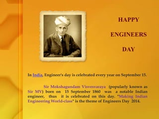
1. In India, Engineer's day is celebrated every year on September 15.
Sir Mokshagundam Visvesvaraya (popularly known as
Sir MV) born on 15 September 1860 was a notable Indian
engineer, thus it is celebrated on this day. "Making Indian
Engineering World-class" is the theme of Engineers Day 2014.
HAPPY
ENGINEERS
DAY
2. Hard work performed in a disciplined manner will in
most cases keep the worker fit and also prolong his life.
To give real service, you must add something which
cannot be bought or measured with money.
The way to build a nation is to build a good citizen. The
majority of the citizens should be efficient, of good character
and possess a reasonable high sense of duty.
INSPIRATIONAL QUOTES BY
MOKSHAGUNDAM VISVESVARAYYA
5. DEFINITION OF CASE STUDIES
IF ANY STUDY IS DONE TO GET THE
COMPLETE PICTURE OF TOPIC OR IN DEEP
RESEARCH ON A TOPIC, GROUP, PERSON & WORK
ETC., IS KNOWN AS CASE STUDIES.
12. OUR EXAMPLE
NOW WE ARE GOING TO PRESENT YOU THE
CASE STUDIES THAT ARE CARRIED ON ONE OF THE GREAT
CIVIL ENGG WONDER.
NOTE:- THIS IS ONLY EXAMPLE OF 5 SLIDES FOR BETTER UNDERSTANDING OF
CASE STUDIES DEFINITION.
14. 1. MARMARAY TUNNEL PROJECT
Marmaray is a rail transport project in the Turkish city of Istanbul. It is
an under sea rail tunnel under the Bosphorus strait, along the sea of Marmara
from Halkali on the European side to Gebze on the Asian side.
The Marmaray project was divided in to the two main contracts. The
Bosphorus crossing (BC1) contract covers the 13.6km and remaining is surface
portion .
The tunnel is the deepest immersed structure (55 m below the sea level) in
the world.
Construction of Marmaray tunnel started in 2004, with an initial target
opening date of April 2009. After multiple delays it is opened on October 2013.
15. The total BC1 contract there is 9.8 km of bored tunnel, 2.4 km built
using cut-and-cover methods and the remaining 1.4 km as an immersed tunnel.
17. 2. MARMARAY BOSPHORUS CROSSING PROJECT SURVEYING ACTIVITY AND
GEODETIC MONITORING
Various surveying works are carried out in the construction
of Bosphorus crossing project of Marmaray tunnel.
A. Hydrological Surveying and Modeling
B. Seismic Designing of Marmaray Tunnel
C. Real Time Kinematics (R.T.K) GPS technique
D. Geodetic surface network
E. Tunnels and Geodetic Underground Network
F. Deformations and Transversal Profiles Surveys
18. Hydrological survey is carried out to find the alignment of
tunnel at appropriate position. For this a single-beam sonar is used.
(a) Hydrological Survey and modelling
19. Single beam echo sounders use one emitting and receiving “transducer”, which
releases a series of energy pulses in the form of sound waves
It is installed under the boat and scans the under terrain of the sea weather it is
undulating or leveled, depth also can be determined by using this
Figure of Single Beam Sonar ( Echosounder)
20.
21.
22. The primary tectonic feature affecting the project area is the Marmaray
fault system on the South side of the project area. The main Marmara fault , exhibits
features typically associated with a strike-slip fault.
(b) Seismic Designing of the marmaray tunnel
23. The figure shows us the motion and direction of tectonic plates. This is done to
assess the seismic hazards. It can be done by using G.P.S. (Global Positioning System)
24. G.P.S aids us in better understanding our planet by allowing us to measure
how the surface of earth moves. Much of this motions cause earthquakes.
This is the image analyzed by the G.P.S. in detecting the tectonic plate movements
25. The velocity vectors shown determined as a result of Global Positioning
System (GPS) measurements and the long term seismicity indicates that this strand
is more active.
26. Therefore, for this project minimum seismic design requirements are
based on a single-level earthquake.
Both probabilistic and deterministic approaches were used to assess the
seismic hazards. The project design basis earthquake corresponds to a MW=7.5
(moment magnitude).
27. Real Time Kinematic (RTK) GPS technique was effectively
used in Bathymetric map production, filling works in the sea bottom, leveling,
digging and immersion of the tube.
RTK GPS measurement technique is used in BC1 project to immerse the
tunnels in desired position by carrying the tunnel with ships.
In practice RTK systems use as a single base station receiver and a
number of rover units.
(c) REAL TIME KINEMATICS (RTK) GPS MEASUREMENT
TECHNIQUE AND USING ON IMMERSED TUNNEL
28. The ability to determine positions with accuracy in real time within the project
area is very important therefore a carrier phase-based RTK GPS system was
established.
The Base station broadcasts the phase of the carrier that is measured from the
satellites, and the rover units compare their own phase measurements with
those received from the base station.
29. During immersion of the tunnel elements are carried out by
accurately determining the position of the immersion operation vessel
using RTK GPS installed on the operation vessel.
30. A multi-beam sonar is used in monitoring the element position and shape
of the sea bottom while immersing the tunnel.
31. To make the final
connection between an
element already in
position, as the next
element is lowered to
bottom the distance
between the two elements,
the axial deviation, and the
orientation deviation are
measured using ultrasonic
distance measurements
sensors installed on the
opposing end surfaces of
the elements.
32. In BC1 project the tunnels must be positioned, in the
horizontal and vertical dimensions, to within ±100 mm (total tolerance) of
their designed locations.
In BC1 project, 44 mm of total tolerance is reserved for
surveying error with the remaining portion of the tolerance 66 mm budgeted
for TBM (Tunnel Boring Machine) variations.
(d) GEODETIC SURFACE NETWORK
33. For the BC1 project a high accuracy horizontal control network was
formed in 2004 to be used in constructing structures and the above mentioned
tolerance for deformation measurements.
34. The horizontal control network has two levels ; primary and secondary.
The primary control network consists of 10 pillars and the secondary
horizontal control network consists of 17 pillars.
These control network is laid to define the local movement.
The GPS receivers were used for the horizontal control network
measurements with the differential techniques to guarantee an accuracy
of ±4 mm for relative position of pillars.
Standard
deviation
Maximum value Minimum value Mean Value
Latitude, ϕ 0.005 0.002 0.004
Longitude, λ 0.005 0.002 0.004
Ellipsoid height, h 0.010 0.004 0.008
Table 1 Accuracy information of horizontal control network (in m)
35. Difference between the first and second campaign.
Position Mean value / m
Latitude, ϕ 0.016
Longitude, λ 0.022
Ellipsoid height, h 0.040
In 2012, a new GPS observation campaign of the surface network was
executed in order to verify the local movement of the horizontal control network.
36. In this way the design of the vertical surface network consists of
66 benchmarks distributed throughout the project area by using the Wild
N3 precise leveling instrument and invar rod.
Fig of Wild N3 leveling instrument and Invar rod
37. In urban areas, the TBM (Tunnel Boring Machine) is most
commonly used for tunnel construction. TBM tunnel consists of several typical
phases including preparatory tasks, working shaft construction, initial set up, tunnel
construction, and removal shaft construction.
The TBM dig the three bored tunnels in BC1 project.
Tunnel 1 on the European continent : 2345 m
Tube 2 on the Asian continent : 2150 m
Tube 3 on the Asian continent : 4620 m
(e) TUNNELS AND GEODETIC UNDER GROUND NETWORK
39. The TBM is guided with the Tacs guidance system based
on the tunnel control network.
The Tacs guidance system continuously define the TBM position and
compares it with the design tunnel axis.
40. The Tacs system receives input measurements from a laser theodolite,
which is placed on a bracket attached to the left upper wall of the tunnel. The
guidance station bracket is incrementally moved forward as the TBM advances
41. In this section, the studies undertaken concerning tunnel 1 is examined in
detail.
In order to perform redirection using the laser theodolite within the
forecast tolerance, the geodetic network within the tunnel should be very accurately
positioned.
The effect of lateral refraction and lateral temperature gradient can produce
a severe error especially in a tunnel environment.
Therefore geodetic underground network formed for tunnel 1 consists of a
total of 109 benchmarks, 49 benchmarks in Tube 1 and 60 in Tube 2. The
benchmarks in tunnel were located at intervals of approximately 50 m.
42. Leica DNA03 level
Instruments used in tunnels geodetic
underground network construction
Leica DNA03
levels and leica TC1201
total stations were used for
the leveling and angle-
distance measurements.
The accuracy of
the measurements is
typically ±0.3 mm/km for
precise leveling and 1” for
angles and 1 mm +2 ppm
for distances with total
stations.
43. Image of Leica TC 1201 Total
station.
The network adjustment was
also achieved using HANNA
software developed by the
Institute of Geodesy, University
of Hannover.
44. The construction and operation of tunnel projects can result in a
damage to surfaces or sub surface structures. In a metropolitan city like Istanbul
where housing and historical structures are very intensive. Hence it is very
important to determine the deformations on the surface and in the structures due to
bored tunnels.
Deformations in tunnel borings occur in two ways;
1. Deformations on the surface due to volume loss
2. Deformations due to the pressure on the tunnel perimeter applied by the mass
over the tunnel
(f) DEFORMATIONS AND TRANSVERSAL PROFILES SURVEYS
45. 1. Deformations on the surface due to volume loss
The surface settlement trough assumes a bell-shaped curve centered on the
tunnel axis. The surface settlement is determined as follows.
46. As-built surveys are prepared after the completion of a construction project. This survey
shows the as-built locations of improvements and utilities as opposed to the designed location.
The
Transversal
Profile
survey
In this project the reference profile area was calculated as 38.046 m². According to this
information the over profile and under profile areas were determined for each transversal profile.
The profile monitoring system consists of an optical technique using a high specification
robotic total station (Leica TCA 1201). The transversal profile survey was executed every 7.5 m of the
tunnel. The Leica TMS (Tunnel Measurement System) is used for data processing, as shown in fig.
47.
48.
49.
50.
51.
52.
53.
54.
55.
56. So this is the Case Studies of Marmaray
tunnel BC1 project
57. After the Marmaray project Turkey is starting a new project by using
the same survey as mentioned above. It is similar to the BC1 project. It is signed
to implementation on 26 Feb 2011.