2. LIST OF BLOODLESS WARS
• McGowan's War
• Kettle War
• Aroostook War
• Pig War (aside from the death of a pig)
• Dodge City War
• Red River Bridge War
• Lobster War
• Honey War
3. LIST OF BLOODLESS WARS
• Anglo-Swedish War (1810–12)
• Three Hundred and Thirty Five Years' War
• Huéscar-Danish War
• 1987 Sino-Indian skirmish
• Turbot War
• Invasion of the Gambia
4. MCGOWAN'S WAR
McGowan's War was a bloodless war that took
place in Yale, British Columbia in the fall of 1858.
The conflict posed a threat to the newly
established British authority on the British Columbia
mainland (which had only just been declared a
colony the previous summer), at the onset of the
Fraser Canyon Gold Rush. It was called Ned
McGowan's War after one of the conflict's main
antagonists.
5. KETTLE WAR
The Kettle War (Dutch: Keteloorlog or Marmietenoorlog)
was a military confrontation between the troops of the
Holy Roman Empire and the Republic of the Seven
Netherlands on 8 October 1784. It was named the Kettle
War because the only shot fired hit a soup kettle.
After the Dutch Revolt, the northern Netherlands formed
their own republic, while the southern Netherlands
remained with Spain. Since 1585, the northern
Netherlands had closed off the Scheldt, so that the
harbours of Antwerp and Ghent could not be reached by
trade ships, and this remained so after the revolt.
Location River Scheldt, off Saeftinghe
Result Treaty of Fontainebleau
6. AROOSTOOK WAR
The Aroostook War (sometimes called the Pork and Beans War was a military
and civilian-involved confrontation in 1838–1839 between the United States
and the United Kingdom over the international boundary between the British
colony of New Brunswick and the U.S. state of Maine. Two Canadian
militiamen were injured by black bears prior to the diplomatic compromise.
Top-level diplomats from the US and Britain met in Washington and forged a
peaceful compromise, the Webster–Ashburton Treaty in 1842. It fixed the
permanent border. The term "war" was rhetorical; local militia units were
called out but never engaged in actual combat. The event is best described
as an international incident.
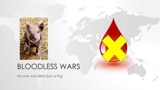
7. PIG WAR (1859)
The Pig War was a confrontation in 1859
between the United States and the United
Kingdom over the British–U.S. border in the
San Juan Islands, between Vancouver
Island (present-day Canada) and the State
of Washington. The Pig War, so called
because it was triggered by the shooting of
a pig, is also called the Pig Episode, the Pig
and Potato War, the San Juan Boundary
Dispute and the Northwestern Boundary
Dispute. Aside from the death of one pig,
this dispute was a bloodless conflict.
Proposed boundaries:
The lines are as shown on maps
of the time. The modern
boundary follows straight line
segments and roughly follows the
blue line. The modern eastern
boundary of San Juan County
roughly follows the red line.
9. DODGE CITY WAR
The Dodge City War was a bloodless conflict that took place
between Luke Short and the Dodge City mayor, who tried to
force Short to close the Long Branch Saloon and leave town.
Luke called on several friends, including Wyatt Earp and Bat
Masterson, who supported him during his confrontation from
April 28 to June 7, 1883. The event is best remembered because
it produced one of the most iconic photos of Western gamblers
and gunfighters who played roles in the history of the Wild West.
10. DODGE CITY WAR
Dodge City Peace Commission, early
June, 1883. The men went to Dodge
armed to support Luke Short in a
confrontation with business interests
that wanted to force him out of town.
The title of "peace commission" (later
applied to the photo) was ironic. Their
presence did produce a peaceful
resolution. According to a biography
of Wyatt Earp by Casey Tefertiller, the
photo was taken in the Conkling Studio
at Dodge City in June 1883 and first
appeared in the National Police
Gazette on 21 July, 1883. From left to
right, standing: W.H. Harris, Luke Short,
Bat Masterson, W.F. Petillon. Seated:
Charlie Bassett, Wyatt Earp, Frank
McLain (possibly "M. C. Clark"; see
Dodge City Peace Commission), and
Neal Brown It's a "published pre-1923"
historical photo
11. RED RIVER BRIDGE WAR
The Red River Bridge War was a boundary conflict between the U.S. states of
Oklahoma and Texas over an existing toll bridge and a new free bridge
crossing the Red River.
The Red River Bridge Company, a private firm owned by Benjamin Colbert,
had been operating a toll bridge between Colbert, Oklahoma, and Denison,
Texas, carrying U.S. Route 69 and U.S. Route 75. Texas and Oklahoma had
jointly built a new, free span northwest of the existing toll bridge.
On July 10, 1931, the Red River Bridge Company obtained an injunction
against the Texas Highway Commission (now Texas Department of
Transportation), keeping it from opening the new bridge. The company said
that the highway commission had promised in July 1930 to buy the old toll
bridge for $60,000 (equal to $918,287 today). In reaction to the injunction,
the Governor of Texas, Ross S. Sterling, ordered that the new free bridge be
barricaded from the Texas end.
12. LOBSTER WAR
The Lobster War (also known as the Lobster
Operation) was a dispute over spiny lobsters
which occurred from 1961 to 1963 between
Brazil and France. The Brazilian government
refused to allow French fishing vessels to catch
spiny lobsters 100 miles (160 km) off the Brazilian
northeast coast, arguing that lobsters "crawl
along the continental shelf", while the French
maintained that "lobsters swim" and that
therefore, they might be caught by any fishing
vessel from any country. The dispute was
resolved unilaterally by Brazil, which extended
its territorial waters to a 200-mile zone, taking in
the disputed lobsters' bed.
A Brazilian Air Force
Boeing B-17 Flying
Fortress flying over the
French escort vessel
Tartu, off the coast of
Brazil in 1963.
13. HONEY WAR
The Honey War was a bloodless territorial dispute in 1839 between Iowa
Territory and Missouri over their border.
The dispute over a 9.5-mile (15.3 km) wide strip running the entire length of the
border, caused by unclear wording in the Missouri Constitution on boundaries,
misunderstandings over the survey of the Louisiana Purchase, and a
misreading of Native American treaties, was ultimately decided by the United
States Supreme Court in Iowa's favor. The decision was to affirm a nearly 30-
mile (48 km) jog in the nearly straight line border between extreme southeast
Iowa and northeast Missouri at Keokuk, Iowa that is now Iowa's southernmost
point.
Before the issue was settled, militias from both sides faced each other at the
border, a Missouri sheriff collecting taxes in Iowa was incarcerated, and three
trees containing beehives were cut down.
14. THE MAPS SHOWS THE LANDS DISPUTED IN THE HONEY
WAR BETWEEN MISSOURI AND IOWA. IT IS BASED ON THE
TEXT OF THE COURT DECISION SETTLING THE DISPUTE.
15. ANGLO-SWEDISH WAR (1810–1812)
During the Napoleonic Wars until 1810,
Sweden and Great Britain were allies in
the war against Napoleon. As a result
of Sweden's defeat in the Finnish War
and the Pomeranian War, and the
following Treaty of Fredrikshamn and
Treaty of Paris, Sweden declared war
on Great Britain. The bloodless war,
however, existed only on paper, and
Britain was still not hindered in
stationing ships at the Swedish island of
Hanö and trade with the Baltic states.
16. THREE HUNDRED AND THIRTY FIVE
YEARS' WAR
The Three Hundred and Thirty Five Years' War (Dutch:
Driehonderdvijfendertigjarige Oorlog, Cornish: Bell a dri hans pymthek
warn ugens) was an alleged state of war between the Netherlands
and the Isles of Scilly (located off the southwest coast of Great Britain),
and its existence is disputed. It is said to have been extended by the
lack of a peace treaty for 335 years without a single shot being fired,
which would make it one of the world's longest wars, and a bloodless
war. Despite the uncertain validity of the declaration of war, and thus
uncertainty about whether or not a state of war ever actually existed,
peace was finally declared in 1986, bringing an end to any
hypothetical war that may have been legally considered to exist.
17. THREE HUNDRED AND THIRTY FIVE
YEARS' WAR
Map the opposants of the 335 years
war : Dutch Republic in green, Isles of
Scilly in red.
Date March 30, 1651 – April 17, 1987
Location
Isles of Scilly
Result Status quo ante bellum
18. HUÉSCAR-DANISH WAR
When the Iberian Peninsula was conquered by Rome, Osca was a town of
the Turdetani, and incorporated into the Roman province of Hispania
Baetica. However, purportedly ancient coins from this town are not
genuine.
Between 1809 and 1981, Huéscar was technically at war with Denmark, as a
result of the Napoleonic wars over Spain, where Denmark supported the
French Empire. This official declaration of war was forgotten until it was
discovered by a local historian in 1981, followed by the signing of a peace
treaty on 11 November 1981 by the city mayor and the Ambassador of
Denmark. Not a single shot was fired during the 172 years of war, and
nobody was killed or injured.
19.
20. 1987 SINO-INDIAN SKIRMISH
The 1987 Sino-Indian
skirmish was the third
military conflict between
the Chinese People's
Liberation Army Ground
Force and Indian Army
that occurred at the
Sumdorong Chu Valley,
with the previous one
taking place 20 years
earlier.
Locator map
of the state of
Arunachal
Pradesh, India
with district
boundaries.
21. TURBOT WAR
The Turbot War (known in Spain as Guerra del Fletán) was an international
fishing dispute and bloodless conflict between Canada and Spain, and their
respective supporters.
On 9 March 1995, Canadian officials from the Canadian Fisheries Patrol vessel
Cape Roger boarded the Spanish fishing trawler Estai from Galicia in
international waters 220 nautical miles (410 km; 250 mi) off Canada's east
coast baseline after firing three 50-caliber machine-gun bursts over its bow.[4]
They arrested the trawler's crew then forced the Estai to a Canadian harbor.
Canada claimed that European Union factory ships were illegally overfishing
Greenland halibut (also known as Greenland turbot) in the Northwest Atlantic
Fisheries Organization (NAFO) regulated area on the Grand Banks of
Newfoundland, just outside Canada's declared 200-nautical-mile (370 km)
exclusive economic zone (EEZ).
23. ECOWAS MILITARY INTERVENTION IN
THE GAMBIA
The ECOWAS military intervention in the Gambia or the ECOWAS Mission in
The Gambia (abbreviated ECOMIG) – code-named Operation Restore
Democracy – is an ongoing military intervention in the Gambia by several
West African countries. The intervention was launched to resolve a
breakdown of internal order in the government of the Gambia that resulted
from a dispute over the country's presidency. The dispute had led to a
constitutional crisis in the country. The intervention began in January 2017,
and in June 2017, the term of the ECOWAS military mission was extended by a
year.
The brief period of open conflict at the beginning of the mission was
precipitated by the refusal to step down from power of Yahya Jammeh, the
long-standing President of the Gambia, after he disputed the victory of
Adama Barrow in the 2016 presidential election.
24. ECOWAS MILITARY INTERVENTION IN
THE GAMBIA
A few hours after the initial
incursion, the three
countries gave Jammeh a
last chance to step down.
He then stepped down and
left the country on 21
January.
Barrow returned to the
country on 26 January 2017