1. The document discusses OpenStreetMap, a collaborative project to create a free editable map of the world.
2. It highlights how OpenStreetMap data is open and can be freely used, edited, and shared compared to proprietary map data.
3. The document outlines several humanitarian and community mapping projects using OpenStreetMap data, including mapping regions in the developing world and crisis response mapping.
The Golden Age of GIS - Keynote for GIS day 2019Martijn van Exel
How Open Data enables the GIS of Today. A talk I did at UvU in Orem, Utah for GIS day 2019. I talked about the big role open data, and OpenStreetMap in particular, plays in today's geo world.
Slightly meta presentation giving a brief overview of the talks at the 2008 State of the Map conference. Doesn't cover all talks and for most only gives the speaker name, title of their talk and relevant URL, but might be useful for some people.
Presentation by Dr. Nama Budhathoki of Kathmandu Living Labs on joint Crisis Informatics workshop organized by Kathmandu Living Labs, Harvard Humanitarian Initiative and University of Colorado Boulder to draw lessons from Nepal Earthquake 2015.
From geovisualisation to neocartography: Maps in a digital worldBenjamin Hennig
Presentation by Benjamin D. Hennig at the first Neocartography Commission session is set to start directly after the Society of Cartographers conference, and will be held from 3-45pm to 7-15pm at University College London on Wednesday 5th September. More at http://www.viewsoftheworld.net/?p=2566
From Global to Local: Mobile, Mapping and ActionChristian Kreutz
Location, mobile phones and the Internet, combined together, are becoming an attractive amalgam for new opportunities. There is a fascinating trend to see the convergence of mobile technologies connected to the Internet and the rising importance of location. This is not just another hype, but could really be interesting for the non-profit arena.
ESA Ramani Huria: Mapping for Flood Resilience, Fusing Remote Sensing and Com...Mark Iliffe
Presentation to the European Space Agency at their Earth Observation conference at ESRIN, Italy in September 2016. Licensed using a Creative Commons share-a-like non commercial license.
Arup smart cities. An overview regarding the impact smart cities will have on economic development, resource efficiency and great places to live and work.
Как продавать, не продавая или 10 космических вопросов. Mikhail Ozernov
Дилемма настоящего: покупатель не хочет, чтобы ему навязывали и продавали, а продавец хочет чтобы его продукт хотели, знали и покупали сами. Как добиться взаимности, если продавец – рекламное или digital-агентство, а покупатель – рекламодатель, который хорошо знает «кухню активных продаж»? Инсайты крупных клиентов о том, какие ошибки не совершать. Источник www.gapfinders.com
OpenStreetMap and CycleStreets: collaborative map-making and cartography in t...CycleStreets
Abstract: The arrival of web-based mapping from Google and others has revolutionised, in the space of only five years, the way many people interact with maps and map data. And the success of projects such as Wikipedia highlight how collation of small amounts of information from large numbers of people - an approach called 'crowdsourcing' - can challenge traditional models of data collection and ownership. Bringing these concepts together is OpenStreetMap, a collaborative project to create a free editable map of the world. Well-established enterprises such as the Ordnance Survey are coming under increased pressure from this new model, and large companies such as MapQuest and Microsoft are starting to use and invest in it. Martin Lucas-Smith, Webmaster in the Department, and one of two main developers of the leading UK-wide cycle journey planner website, CycleStreets, will discuss OpenStreetMap, its use within a wide range of systems (from cartography, routing, and even its central role helping deal with the Haiti disaster) and discuss the challenges it poses to traditional forms of cartography and data collection.
Humanitarian OpenStreetMap Team at UNGIWG 10
Presentation compiled by Nicolas Chavent
Presentation presented by Sandra Sudhoff
(many thanks Nicolas and Sandra!)
Volunteered Geographic Information and OpenStreetMapchippy
Short introduction to the subject of Volunteered Geographic Information and outlining some of the characteristics, issues themes of VGI
and then a comprehensive talk about the OpenStreetMap Project.
By Tim Waters, at AGI Northern Group (SIG), April 2009, Manchester University
---
This presentation for Research Dive UN Global Pulse event in November 2018
---
When we talk about financial inclusion, we always talk about access for financial services and the financial literacy level. Adding geospatial data in research can help the readers understanding the phenomena in some area. There are a lot of source for geospatial data, one of the source is OpenStreetMap. OpenStreetMap is one of free and open-source platform who provide maps for everyone. OpenStreetMap give us spatial data in various ways and if we talk about financial inclusion, we can use OpenStreetMap data to know the financial services location. This slide will talk about the benefit of using geospatial data, especially OpenStreetMap data for enhance the research in financial inclusion sector
Introduction to OpenStreetMap and Humanitarian OSM Team for Plan Internationa...chippy
Presentation about OSM for Humanitarian use at Plan International Mapping Workshop, Woking, Nov. 2012.
Getting started with OSM: http://learnosm.org
About HOT: http://hot.openstreetmap.org/
Current HOT projects: http://hot.openstreetmap.org/projects
This presentation is available with video on:
http://www.youtube.com/watch?v=6SEQPNFO1q0
(also included after the last slide)
see also www.stateofthemap.org
www.addismap.com/bandira
www.openstreetmap.org.et
"Impact of front-end architecture on development cost", Viktor TurskyiFwdays
I have heard many times that architecture is not important for the front-end. Also, many times I have seen how developers implement features on the front-end just following the standard rules for a framework and think that this is enough to successfully launch the project, and then the project fails. How to prevent this and what approach to choose? I have launched dozens of complex projects and during the talk we will analyze which approaches have worked for me and which have not.
The Art of the Pitch: WordPress Relationships and SalesLaura Byrne
Clients don’t know what they don’t know. What web solutions are right for them? How does WordPress come into the picture? How do you make sure you understand scope and timeline? What do you do if sometime changes?
All these questions and more will be explored as we talk about matching clients’ needs with what your agency offers without pulling teeth or pulling your hair out. Practical tips, and strategies for successful relationship building that leads to closing the deal.
UiPath Test Automation using UiPath Test Suite series, part 3DianaGray10
Welcome to UiPath Test Automation using UiPath Test Suite series part 3. In this session, we will cover desktop automation along with UI automation.
Topics covered:
UI automation Introduction,
UI automation Sample
Desktop automation flow
Pradeep Chinnala, Senior Consultant Automation Developer @WonderBotz and UiPath MVP
Deepak Rai, Automation Practice Lead, Boundaryless Group and UiPath MVP
GraphRAG is All You need? LLM & Knowledge GraphGuy Korland
Guy Korland, CEO and Co-founder of FalkorDB, will review two articles on the integration of language models with knowledge graphs.
1. Unifying Large Language Models and Knowledge Graphs: A Roadmap.
https://arxiv.org/abs/2306.08302
2. Microsoft Research's GraphRAG paper and a review paper on various uses of knowledge graphs:
https://www.microsoft.com/en-us/research/blog/graphrag-unlocking-llm-discovery-on-narrative-private-data/
Essentials of Automations: Optimizing FME Workflows with ParametersSafe Software
Are you looking to streamline your workflows and boost your projects’ efficiency? Do you find yourself searching for ways to add flexibility and control over your FME workflows? If so, you’re in the right place.
Join us for an insightful dive into the world of FME parameters, a critical element in optimizing workflow efficiency. This webinar marks the beginning of our three-part “Essentials of Automation” series. This first webinar is designed to equip you with the knowledge and skills to utilize parameters effectively: enhancing the flexibility, maintainability, and user control of your FME projects.
Here’s what you’ll gain:
- Essentials of FME Parameters: Understand the pivotal role of parameters, including Reader/Writer, Transformer, User, and FME Flow categories. Discover how they are the key to unlocking automation and optimization within your workflows.
- Practical Applications in FME Form: Delve into key user parameter types including choice, connections, and file URLs. Allow users to control how a workflow runs, making your workflows more reusable. Learn to import values and deliver the best user experience for your workflows while enhancing accuracy.
- Optimization Strategies in FME Flow: Explore the creation and strategic deployment of parameters in FME Flow, including the use of deployment and geometry parameters, to maximize workflow efficiency.
- Pro Tips for Success: Gain insights on parameterizing connections and leveraging new features like Conditional Visibility for clarity and simplicity.
We’ll wrap up with a glimpse into future webinars, followed by a Q&A session to address your specific questions surrounding this topic.
Don’t miss this opportunity to elevate your FME expertise and drive your projects to new heights of efficiency.
Dev Dives: Train smarter, not harder – active learning and UiPath LLMs for do...UiPathCommunity
💥 Speed, accuracy, and scaling – discover the superpowers of GenAI in action with UiPath Document Understanding and Communications Mining™:
See how to accelerate model training and optimize model performance with active learning
Learn about the latest enhancements to out-of-the-box document processing – with little to no training required
Get an exclusive demo of the new family of UiPath LLMs – GenAI models specialized for processing different types of documents and messages
This is a hands-on session specifically designed for automation developers and AI enthusiasts seeking to enhance their knowledge in leveraging the latest intelligent document processing capabilities offered by UiPath.
Speakers:
👨🏫 Andras Palfi, Senior Product Manager, UiPath
👩🏫 Lenka Dulovicova, Product Program Manager, UiPath
Kubernetes & AI - Beauty and the Beast !?! @KCD Istanbul 2024Tobias Schneck
As AI technology is pushing into IT I was wondering myself, as an “infrastructure container kubernetes guy”, how get this fancy AI technology get managed from an infrastructure operational view? Is it possible to apply our lovely cloud native principals as well? What benefit’s both technologies could bring to each other?
Let me take this questions and provide you a short journey through existing deployment models and use cases for AI software. On practical examples, we discuss what cloud/on-premise strategy we may need for applying it to our own infrastructure to get it to work from an enterprise perspective. I want to give an overview about infrastructure requirements and technologies, what could be beneficial or limiting your AI use cases in an enterprise environment. An interactive Demo will give you some insides, what approaches I got already working for real.
DevOps and Testing slides at DASA ConnectKari Kakkonen
My and Rik Marselis slides at 30.5.2024 DASA Connect conference. We discuss about what is testing, then what is agile testing and finally what is Testing in DevOps. Finally we had lovely workshop with the participants trying to find out different ways to think about quality and testing in different parts of the DevOps infinity loop.
Epistemic Interaction - tuning interfaces to provide information for AI supportAlan Dix
Paper presented at SYNERGY workshop at AVI 2024, Genoa, Italy. 3rd June 2024
https://alandix.com/academic/papers/synergy2024-epistemic/
As machine learning integrates deeper into human-computer interactions, the concept of epistemic interaction emerges, aiming to refine these interactions to enhance system adaptability. This approach encourages minor, intentional adjustments in user behaviour to enrich the data available for system learning. This paper introduces epistemic interaction within the context of human-system communication, illustrating how deliberate interaction design can improve system understanding and adaptation. Through concrete examples, we demonstrate the potential of epistemic interaction to significantly advance human-computer interaction by leveraging intuitive human communication strategies to inform system design and functionality, offering a novel pathway for enriching user-system engagements.
Slack (or Teams) Automation for Bonterra Impact Management (fka Social Soluti...Jeffrey Haguewood
Sidekick Solutions uses Bonterra Impact Management (fka Social Solutions Apricot) and automation solutions to integrate data for business workflows.
We believe integration and automation are essential to user experience and the promise of efficient work through technology. Automation is the critical ingredient to realizing that full vision. We develop integration products and services for Bonterra Case Management software to support the deployment of automations for a variety of use cases.
This video focuses on the notifications, alerts, and approval requests using Slack for Bonterra Impact Management. The solutions covered in this webinar can also be deployed for Microsoft Teams.
Interested in deploying notification automations for Bonterra Impact Management? Contact us at sales@sidekicksolutionsllc.com to discuss next steps.
2. About ME brainoff.com Mapufacture Helping Build the GeoWeb mapufacture.com WaterWiki first public UN wiki waterwiki.net OpenStreetMap Foundation Board Member Brighton, UK Developing World “ building digital technology for our planet”
3. = + what is openstreetmap? the openstreetmap “one-liner”
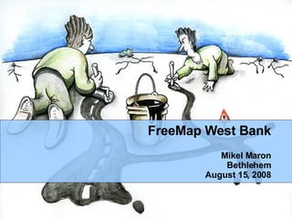
42. JumpStart International and FreeMap West Bank * Public Domain Data * Seperate server * Import into OSM at conclusion for ongoing maintenance and improvement http://westbank.freemap.in/
68. “ we feel that communities can harness the power of new geo-spatial imaging and mapping technologies to strengthen their demands for secure tenure and housing rights open and vibrant public spaces and ecological conservation and sustainable development in the mega-city.”
73. navigation (Bangalore Startups) urban planning, redevelopment, empowerment (CRIT/PUKAR) political participation agriculture (Trivandrum Agriculture Department) ecology (Biodiversity Survey, Madhav Gadgil) riverbank erosion in West Bengal (WBUT) humanitarian response
74. tracking taxis/safety data collection for rural development, and models for transitioning to open GIS data collection (professor shah's project) monitoring rainfall, collecting and disseminating data to forms, calculating land use unchecked mining operations in the north of West Bengal humanitarian response