
More Related Content
What's hot
What's hot (20)
Similar to Berlin. Planning, regeneration and transformation.
Similar to Berlin. Planning, regeneration and transformation. (20)
Recently uploaded
Recently uploaded (20)
Berlin. Planning, regeneration and transformation.
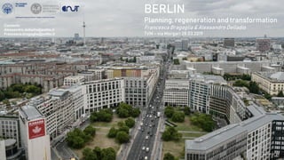
- 1. BERLIN Planning, regeneration and transformation Francesca Bragaglia & Alessandro Delladio 7VM – via Morgari 28.03.2019 Contacts: Alessandro.delladio@polito.it Francesca.bragaglia@polito.it
- 2. TABLE OF CONTENTS PLANNING 1. Germany – administrative organization 2. Evolution of Spatial Planning Acts in Germany 3. Planning levels and tools in Germany 4. Berlin – framework 5. Berlin - Planning documents REGENERATION 6. The urban regeneration process 7. A program of urban regeneration for the city of Berlin 8. Urban requalification program TRANSFORMATION 9. Which kind of transformation? Some cases
- 3. PLANNING
- 5. 2. EVOLUTION OF SPATIAL PLANNING ACTS IN GERMANY Federal Building Act (Bundesbaugesetz) • Plan Notation Ordinance (Planzeichenwerordnung) • Land Utilisation Ordinance – 1962 (Baunutzungsverordnung) Federal Spatial Planning Act (Raumordnung sgesetz – ROG) Urban Development Promotion Act (supplement of the FBA) Federal Building Code (FBA + UDPA) Reunification of Germany Building and Spatial Planning Act (FBC + spatial planning laws across W/E Germany) Federal Building Code (transposition of EU directives) • 2001: EIA Amending Directive, IPPC Directive and other environmental protection directives • 2004: SEA Directive and European Law Adaption Act for the Construction Sector 1960 1965 1971 1986 1990 1998 2001 2004
- 6. 3. PLANNING LEVELS AND TOOLS Federal spatial planning Parliament & Government National planning framework Foundations and principles on the planning system State spatial planning Land State Development Plan – State Spatial Structure – State Development programme Landscape plans and programs Regional planning Land Planning Regions Regional plan – Regional Spatial Structure programme – Area Development plan Local planning Municipality Land Use Plan Local Development Plans
- 7. Ku’damm Straße Kaiser-Wilhelm-Gedächtniskirche Zoologischer Garten Governative district Leipzigerplatz Potsdamerplatz Museumsinsel Karl Marx Alee East Side Gallery Tempelhof 4.BERLIN Credits: Thomas Wolf Credits: Alessandro Delladio Credits: AvdaCredits: Aazarus Credits: Alessandro Delladio Credits: Jean-Pierre Dalbéra Credits: Francesca Bragaglia
- 8. 1950 First Land Use Plan (afer WWII) 1961 Construction of the Wall & Buildings Plan for the West side 1964 Second Land Use Plan (West side) 1969 General Development Plan (East side) 1984 IBA & third Land Use Plan (West side) 1990 Reunification of Germany and of the Berlin City 1991 Germany Capital City: from Bonn to Berlin 1992 – early 2000s Economical crisis of the reunified city 1994 Fourth Land Use Plan for the whole city 4.BERLIN Credits: Lorenzo AttardoCredits: WikimediaCredits: Thierry Noir
- 9. DATA: City of Berlin, 2015 4.1 BERLIN SOME DATA INHABITANTS: 3.711.931 (2017) SURFACE: 891,8 km²
- 10. DATA: City of Berlin, 2015 4.2 BERLIN, STILL «POOR BUT SEXY»? Klaus Wowereit, former city major (2001-2014) 15.999 13.899 17.025 18.908 45.756 63.974 80.109 104.209 0 20.000 40.000 60.000 80.000 100.000 120.000 140.000 1991 2001 2011 2017 Structural change in the berlin economy GROSS VALUE ADDED (Millions €) manufacturing industry GROSS VALUE ADDED (Millions €) service industry
- 11. Who owns the dwellings in Berlin? Berlin Constitution, Article 28, “Every person has the right to appropriate housing. The state supports the development and maintenance of appropriate housing, especially for people with low income…” 9th October 2018 'Poor but sexy' no more: property boom drives out Berlin's artists The German capital once attracted talent from across the world with its cheap rents, but gentrification is making an exodus already seen in London and New York 4.2 BERLIN, still «POOR BUT SEXY»? DATA: City of Berlin, 2015
- 12. 5. BERLIN - PLANNING DOCUMENTS Berlin + State of Brandenburg Joint planning for Berlin-Brandenburg Spatial structure plans for the entire region or certain locations within the federal states are prepared in collaboration. This task is discharged by the Joint Spatial Planning Department of Berlin-Brandenburg (GL). Regional Development Programme 2007 Landesentwicklungsprogramm (LePro) State Development Plan for the Capital Region Berlin- Brandenburg Landesentwicklungsplan Hauptstadtregion Berlin- Brandenburg (LEP HR) State Development Plan for the Location and the Development of the new International Airport - BBI Landesentwicklungsplan Flughafenstandortentwicklung (LEP FS) LePro 2007
- 13. FEDERAL LEGISLATION BERLIN PLANNING LEGISLATION BERLIN ENVIRONMENTAL LEGISLATION Land Use Plan - Flächennutzungsplanung Sectoral Development Plans - Stadtentwiklungspläne (housing, industry, climate, energy and drains, transport, public utilities) Landscape Programme - Landschafstsprogramm Local Development Plans - Bebauungspläne Intermediate Area Plans - Bezirksentwicklungsplanung (for each city district) Local Landscape Plans - Landschaftspläne Strategic Area Planning Concepts – Stadtplanerische Konzepte (Tegel airport, City West, Nördlicher Cityrand, Spreeraum Friedrichshain-Kreuzberg, Südliche Friedrichstadt) Area Planning Concepts - Planwerke (Nordostraum, Westraum, Innere Stadt, Südostraum) Berlin + State of Brandenburg Joint planning for Berlin-Brandenburg 5. BERLIN - PLANNING DOCUMENTS
- 14. 5. BERLIN – PLANNING DOCUMENTS STRATEGIC PLAN STRATEGIC DEVELOPMENT CONCEPT Stadtentwicklungnsconzept Berlin 2030 Strategies: 1. Strengthening the economy with smart knowledge 2. Unleashing strengths through creativity 3. Safeguarding employment through education and skills 4. Reinforcing neighbourhood diversity 5. City and green growing together 6. Laying the groundwork for a climate-friendly metropolis 7. Improving accessibility and city- friendly mobility 8. Shaping the future together City of Berlin, 2015
- 16. REGENERATION
- 17. It is very difficult to give a clear and unique definition of urban regeneration, because the approaches to regeneration have been very different depending on the socio-economic and economic circumstances and today the crisis is changing again the urban regeneration agenda. In any case, with urban regeneration we mean the season of the “European Lesson”, characterized by the integrated approach to urban issues that has diametrically changed the way of acting on areas in crisis. The main goal of urban regeneration esperciences is fighting against socio-economic malaise at the local level, the consequent action model is a place-based action model, whose aim was breaking the cumulative process by valorising local resources, with an Integrated Area Development (IAD) approach (Saccomani, 2016). The basic areas of intervention of urban regeneration are the physical, the economic, the social and the environmental dimensions (…) (Roberts, Skyes, Granger, 2016) Nb: Urban regeneration is not just about physical transformation! URBAN REGENERATION KEYWORDS: AREA-BASED APPROACH, INTEGRATED APPROACH, PARTICIPATION, PUBLIC-PRIVATE PARTNERSHIP What is urban regeneration? 6. THE URBAN REGENERATION PROCESS
- 18. 6. THE URBAN REGENERATION PROCESS
- 19. The "Social City" urban regeneration program helps to stabilise and recover the most disadvantaged districts in urban, economic and social terms. In response to this situation, the Berlin Senate introduced intervention strategy to support social urban development in the affected neighborhoods. The Berlin Quartiersmanagement program is at the heart of this strategy. Which areas are involved in QuartiersManagement? Since 1999, the program “Social City“ has worked towards the stabilization and development of areas facing social discrimination. Unemployment, dependence on state aid and the issues arising from a lack of social and ethnical integration affect the everyday life and the future prospects of the people living in those areas. Based on socio-demographic indicators, the neighborhoods were initally classified as either prevention areas or areas for medium to large-scale intervention and are now provided with technical and financial support at different levels. 7. A PROGRAM OF URBAN REGENERATION FOR THE CITY OF BERLIN
- 21. 7. SCHILLERPROMENADE QUARTIERSMANAGEMENT (SCHILLERKIEZ – BERLIN) • The area is well connected by public transport and has a good potential for development since the Tempelhof airport has been closed. • The proportion of migrant population is at about 52%. • High unemployment and fluctuation rates in the area were arguments to designate the neighborhood as a Neighborhood Management area in 1999.
- 22. 7. SCHILLERPROMENADE QUARTIERSMANAGEMENT (SCHILLERKIEZ – BERLIN) Current actions: Education, training, youngs: Improvement of the educational offer; Improvement of facilities for young people; Parental work / local education networks Work and business: Networking the local economy with social and cultural institutions; Initiation of trade network / commercial customers Neighborhood: construction of a civic center; Strengthening self- organization Public space: Renewal of the road network and sidewalks; Public spaces recovery; better lighting; better awareness of waste issues Participation, networking and involvement of partners: Better and more direct communication with the inhabitants; Neighborhood activities in order to boost integration and the activation of residents
- 25. Stadtumabau-Programm The program, developed by the Federal Government, makes an effective nationwide contribution to the functioning and social stability of cities and municipalities. The public projects implemented provide additional impetus for private investment and initiatives. In Berlin, some of the urban redevelopment projects are co- financed by the European Regional Development Fund. The overarching objective for all urban redevelopment areas is their structural improvement and long-term stabilization through structural adaptations to demographic, economic, social and climatic changes. 8. URBAN REQUALIFICATION PROGRAM
- 26. TRANSFORMATION
- 27. In Berlin it is possible to observe different forms of urban transformation and different levels of citizens involvement: 9. WHICH KIND OF TRANSFORMATION?
- 28. SPACE AREA (ha) Brownfields 500 Abandoned infrastructures 100 Buildings in the easter part of the city 140 Disused cemeteries 143 Small building plots (1000 ca.) 170 9.1 BERLIN – TEMPORARY USE Empty spaces: 14,4% Berlin’s green and open spaces 3,4% City’s total area ≠ dead spaces TEMPORARY USE – ZWISCHENNUTZUNG (informal & formal) Flea markets, beer gardens, urban beaches and open air bars (over 60), community gardens, alternative living projects… Credits: Alessandro Delladio Credits: Lorenzo Attardo
- 29. 9.2 TEMPELHOF AIRPORT - BERLIN • Tempelhof airport closed in 2008 • 300 hectares of green area in a central district of the city, great economic value of the area • Area owned by the municipality of Berlin • Different ideas on the future of the area: for the municipality of Berlin an area where to develop new residences, offices and shops; for the inhabitants of the area and of Berlin it is a common good to be preserved as a public park.
- 30. 9.2 TEMPELHOF AIRPORT • The 100% Tempelhofer Feld association of inhabitants manages to collect the necessary signatures to request a referendum on the future of TempelhofIn • 2014 the majority of Berliners vote to leave the area as a public park • In the area several associations have started temporary uses (e.g. community gardens) The inhabitants' project…
- 39. The development of the areas along the Spree river start immediately after the reunification of the city. In 1990/1992 the banks of the Spree were included in the plan to convert the port area of Ostbahnof, which, in line with the strategic guidelines of Planwerk Innestadt, provides a new skyline on the eastern waterfront, consisting of major architectural emergencies for tertiary activities. In 2001, the fusion of the Friedrichshain and Kreuzberg districts introduced the opportunity to draw up an unified development plan which would include the conversion of the western waterfront. The document "Leitblid Spreeraum Friedrichshain-Kreuzberg“ (2002), provides: 1. a cycle/pedestrian path along the river 2. a public park 3. 30 thousand new jobs 9.3 SPREERAUM
- 40. 9.3 SPREERAUM: HOLZMARKT “The Holzmarkt is the complete antiapproach to urban space development. It doubts everything, and questions every standard” Johannes Husten (Holzmarkt activist) Occupied by squatter groups in 1990, the area became immediately an informal space for creativity and public initiatives. In the middle of 90s was founded an association for the management of the area setting the basis for protests against the implementation of the Mediaspree project. Holzmarkt contains permanent infrastructure of more or less general character as well as dynamic structures for temporary changes. It is considered one of the most successfull examples of bottom-up (better, self organized) initiatives of social regeneration of an urban area after the reunification of Berlin. Credits: Lorenzo Attardo Credits: Lorenzo Attardo Credits: Lorenzo Attardo Source: Hanna Larqvist
- 41. PHASES OF THE PROTEST 2007 – Against the Mediaspree Project was submitted the petition “Mediaspree Versenken!” (Mediaspree sink!) by the activists of the group «Spreeufer fur alle!» 2008 – On July 13, a local consultative referendum was called in which 87% of voters (30,000 people) votes for the maintenance of temporary uses and existing activities on the banks of the river. 2008 - An Special (non-binding) Commission for the Spreeraum is formed at local level, made up of politicians from the district, four deputies from the city, representatives of the Senate, the landlords of the areas and citizens, with the aim of working on proposals for alternative transformations to the Mediaspree project. MEDIASPREE PROJECT Facts: 2002 – Urban Development Programme Stadtbaum Ost (public funds are invested for the development of the eastern side of the Spree-waterfront); 2004 – fundation of the joint public and private company «Mediaspree e. V.»; 2005 – Urban Development Programme Stadtbaum West (public funds are invested for the development of the western side of the Spree-waterfront); 2008 – Ending of public funds and dissolution of «Mediaspree e. V.» company Area: The area lies between the Jannowitz- and Elsen- bridges, the S-Bahn railway and the Schesische Straße. Dimension: 180ha Property: Mixed public-private property (big real estate companies, Berlin Land and Senate) Expected transformations: development of the tertiary sector along the waterfront, localization of creative industries, re-functionalisation of abandoned areas and areas for temporary use Credits: Ulrich Hofmann and Adrian Lang Credits: Christian Link 9.3 SPREERAUM: MEDIASPREE
- 42. Before our trip to Berlin a reading suggestion to better understand the recent dynamics of the city… TO CONCLUDE Internazionale, 25/31 gennaio 2019 • Numero 1291: - «Berlino. Una città al bivio» (Beier L.-O., Schmundt H., Weiderman V.) - «La casa bene comune» (Götz S.) Colomb, C. (2012), “Staging the new Berlin. Place marketing and the politics of urban reinvention post-1989”, Routledge, London Mazzoleni C. (2009), «La costruzione dello spazio urbano, l’esperienza di Berlino», FrancoAngeli, Milano
- 43. REFERENCES Cassens, H. J. (2002), “Regional Planning in Germany. Some key aspects and experiences” Colomb, C. (2012), “Staging the new Berlin. Place marketing and the politics of urban reinvention post-1989”, Routledge, London CEC – Commission of the European Communities (1997), “The EU Compendium of Spatial Planning Systems and Policies”, Regional Development Studies, 28, Luxembourg: European Communities. COMMIN – The Baltic spatial conceptshare (2007), “The Structure of Government and Administration and Planning System in the Federal Republic of Germany” De Girolamo F. (2014), «Ruolo della temporaneità nei processi di rigenerazione delle aree-intervallo. Il caso Mediaspree», Tesi di Dottorato, Università «La Sapienza» di Roma Genz, C. (2015), ”The Wide Field of Participation. An essay on the struggle for citizen participation and the future of the Tempelhof Field” Hilbrandt, H. (2017), “Insurgent participation: consensus and contestation in planning the redevelopment of Berlin-Tempelhof airport”, Urban Geography, 38(4), 537-556 Kabisch, N., & Haase, D. (2014). Green justice or just green? Provision of urban green spaces in Berlin, Germany. Landscape and Urban Planning, 122, 129-139. Larqvist H. (2015), ”FREE BERLIN! Enable urban space for creativity, inspired by free space in Berlin”, Master Thesis, Chalmers University of Technology Mertins G. e Paal M. (2006), “Regional planning in Germany. Institutional framework, instruments and effectiveness” Muñoz Gielen, D., Tasan-Kok, T. (2010), “Flexibility in Planning and the Consequences for Public-value Capturing in UK, Spain and the Netherlands”. European Planning Studies Quartiers Management - Schiller promenade, https://www.quartiersmanagement-berlin.de/quartiere/schillerpromenade.html (accessed 25.03.2019) Stadt Berlin – Senatsverwaltung für Stadtentwicklung und Umwelt (2015a), Berlin Strategy – Urban Development Concept Berlin 2030 Stadt Berlin – Senatsverwaltung für Stadtentwicklung und Umwelt (2015b), Land Use Plan Berlin - Background and Contents Turowski, G. (2002), «Spatial Planning in Germany: structures and concepts». Akademie für Raumforschung und Landesplanung, Hannover, ARL