Download to read offline
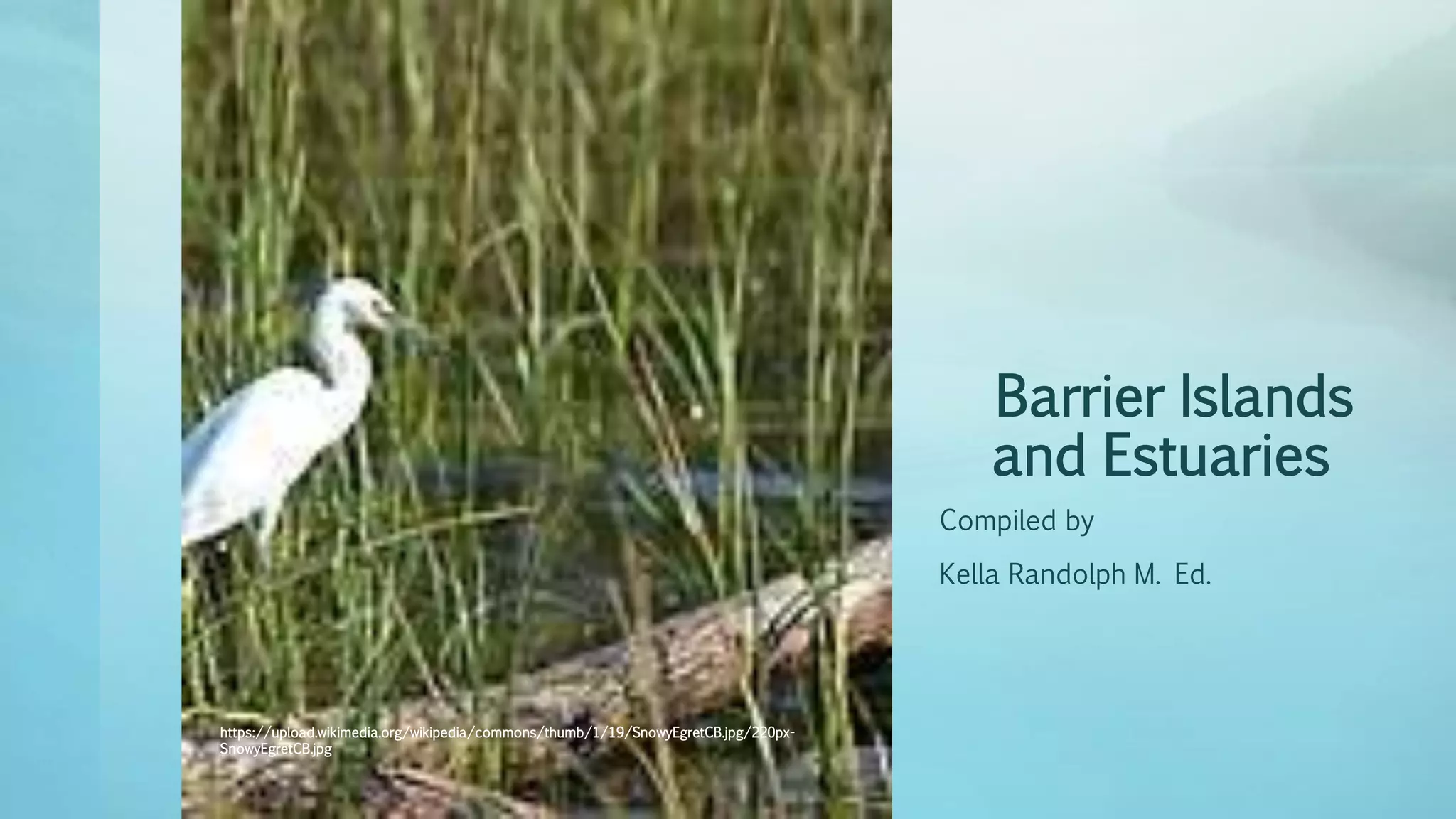
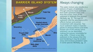


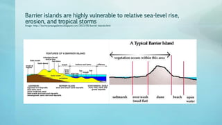

Estuaries are coastal ecosystems where fresh river water mixes with salt ocean water, creating unique environments that support diverse wildlife and human activities. The balance of sediment in estuaries is crucial for both plant growth and marine traffic, with too much or too little sediment posing risks to their health and accessibility. Barrier islands protect these ecosystems but are vulnerable to natural threats, leading to ongoing conservation efforts.


![Koppen classification and land area characteristics [autosaved]](https://cdn.slidesharecdn.com/ss_thumbnails/koppenclassificationandlandareacharacteristicsautosaved-210129205232-thumbnail.jpg?width=640&height=640&fit=bounds)


