Download to read offline
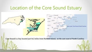
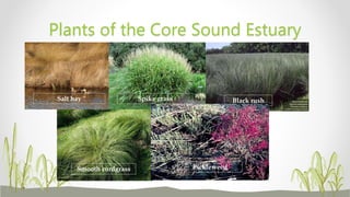
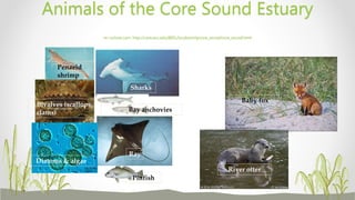
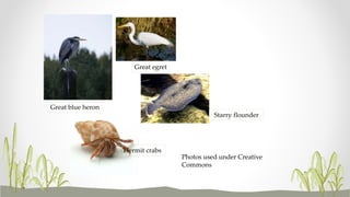
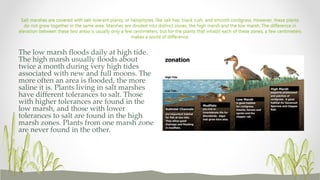
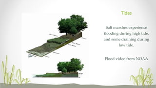
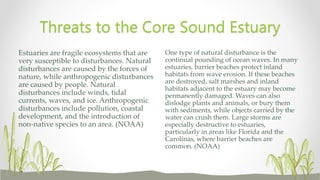


The document summarizes information about the Core Sound Estuary located in North Carolina. It describes the estuary's location, importance, plant and animal life, feeding rivers and streams, and threats. Key points include that Core Sound is a bay fed by rivers that mixes fresh and salt water, supporting ecosystems and fisheries. Salt marshes contain plants like cordgrass and provide habitat divided into low and high zones. Threats include pollution from sewage, development, and changes to natural disturbances.


![Koppen classification and land area characteristics [autosaved]](https://cdn.slidesharecdn.com/ss_thumbnails/koppenclassificationandlandareacharacteristicsautosaved-210129205232-thumbnail.jpg?width=640&height=640&fit=bounds)


