Bangalore city has grown rapidly from a population of around 1 million in 1950 to over 10 million currently. The city obtains most of its water supply from the Cauvery River over 100 km away and faces shortages. Electricity demand has grown to 2300 MW per day but power cuts still occur due to infrastructure issues. Waste generation is expected to rise significantly in coming decades putting pressure on existing management systems. The city's transportation network relies heavily on buses but metro expansion aims to provide improved public transit options. Proper urban planning will continue to be needed to support sustainable growth of infrastructure for Bangalore's large population.
Urban Design-Literature study St. Marks Road, BangaloreAnsh Agarwal
Urban Planning
Literature study of St. Marks Road, Bangalore.
Includes:
1. Road Details
2. Survey Details & Analysis
3. Action Needed
4. Proposals
5. Action Made
6. Before & After Scenerio
7. Anatomy of Changes
INTRODUCTION
COORDINATES - 23.22 ON 72.680 E ELEVATION - 265 feet (81 m)*
LOCATED 23 KM NORTH OF AHEMDABAD (FIN CAP. OF GUJARAT)
PLANNED IN 1960S BY, PRAKASH M APTE & H. K. MEWADA,
AFTER PARTITION OF BOMBAY * STATE : AHEMDABAD WAS MADE AS THE CAPTAL OFGUJARAT
AREA TOTAL 177KM2 ELEVATION : 8IM ( 266 FT)
POPULATION (2011)
TOTAL: 206,167 DENSITY : 1,200/KM2
CLIMATE*
TROPICAL WET AND DRY CLIMATE•
SUMMER MAXIMUM - 36 to 42 °C MINIMUM - 19 to 27 C
WINTER MAXIMUM - 29 C MINIMUM - 14°C
MONSOON: THE AVERAGE ANNUAL RAINFALL IS AROUND 803.4 MM
LANGUAGES
GUJARATI, HINDI, AND ENGLISH• 54% GREEN COVER ON ITS LAND AREA
• THE CITY SITS ON THE BANKS OF THE SABARMATI RIVER, IN NORTH-CENTRALEAST GUJARAT
HISTORY
IN 1960, THE INDIAN STATE OF BOMBAY WAS SPLIT INTO TWO STATES, MAHARASHTRA AND GUJARAT LEAVING GUJARAT WITHOUT A CAPITAL CITY.
AT THE TIME AHMEDABAD WAS SELECTED TO BE THE FIRST CAPITAL OF THE NEWLY CREATED STATE.
• IT WAS LATER PROPOSED THAT A NEW CAPITAL CITY BE CONSTRUCTED FOR THE STATE.
• GANDHINAGAR GOT AN IDENTITY OF ITS OWN WHEN THE STATE OF MUMBAI WAS DIVIDED INTO TWO SEPARATE STATES OF GUJARAT AND MAHARASHTRA.
• IN THE BEGINNING, AHMEDABAD - A COMMERCIAL HUB OF GUJARAT WAS CHOSEN AS THE STATE CAPITAL AND IT WAS PROPOSED THAT A NEW CAPITAL SHOULD BE CONSTRUCTED ALONG THE LINE OF OTHER NEW STATE CAPITALS, PARTICULARLY CHANDIGARH
• THEREFORE TWO WELL-KNOWN INDIAN ARCHITECTS, H.K. MEWADA AND PRAKASH M. APTE (WHO WORKED AS BEGINNER FOR THE CHANDIGARH CITY) DESIGNED THE NEW STATE CAPITAL*
NAMED AFTER MAHATMA GANDHI THE FOUNDATION STONE OF THIS CITY WAS LAID ON 1965 AND IN 1971 THE CAPITAL WAS SHIFTED FROM AHMEDABAD TO GANDHINAGAR
PLANNING
• PLANNED AND IMPLEMENTED BETWEEN 1965-1970
• DETERMINATION TO MAKE GANDHINAGAR A PURELY INDIAN ENTERPRISE, PARTLY BECAUSE GUJARAT WAS THE BIRTHPLACE OF GANDHI.
• TO ESTABLISH AND MAINTAIN A SEPARATE IDENTITY FOR THE NEW CITY THE SURROUNDING AREA OF ABOUT 39 VILLAGES WAS BROUGHT UNDER A PERIPHERY CONTROL ACT (AS IN CHANDIGARH)
• THE AREA LATER CONSTITUTED A SEPARATE ADMINISTRATIVE DISTRICT OF GANDHINAGAR.
• THE CITY WAS PLANNED FOR A POPULATION OF 150,000 BUT CAN ACCOMMODATE DOUBLE THAT POPULATION WITH INCREASE IN THE FLOOR SPACE RATIO FROM 1 TO 2 IN THE AREAS RESERVED FOR PRIVATE DEVELOPMENT.
• THE RIVER BEING THE BORDER ON THE EAST, AND THE INDUSTRIAL AREA TO THE NORTH, THE MOST LOGICAL FUTURE PHYSICAL EXPANSION OF THE CITY WAS ENVISAGED TOWARDS THE NORTH-WEST
This presentation covers the Urban Planning stages of Bhubaneswar, one of India's first modern cities along with Jamshedpur and Chandigarh. This city, the current capital of the coastal state of Odisha, was planned the German architect and urban planner, Otto Konigsberger, who also happens to be the author of 'Manual of Tropical Housing and Building.'
Early experiments started in 2014 with Traffic Police as they are engaged in the management of traffic of the city. Through better design, signal timing could be reduced, pedestrian safety could be increased and public space could be created. With help of chalk, paint and bollards, these experiments have been transformative. CGM team helped create more of such quick turnaround projects in 6 cities. Here is a compilation of the main ones.
this presentation is about the problems in gurugram with the perspective of sustainability which arised due to some reasons. this also shows the zoning plan of the city.
The case study is about the india's most well planned city that is Jaipur, Rajasthan. what is the urban sprawl in that city and how it grows that will expained in that.
Salt Lake City is a planned satellite town in the Indian state of West Bengal. It was developed between 1958 and 1965 to accommodate the burgeoning population of Kolkata.
A study on best practices of Water Supply infrastructures in 3 Indian cities and 2 International cities- towards the partial fulfillment of credits for the course CB1- Infrastructure and Transport Planning at the School of Planning and Architecture, New Delhi (November 2019)
Rainwater harvesting in a megacity presentation for BWSSBzenrain man
How a city strategy for water management can incorporate rainwater harvesting too.
Policies and bye-laws , demonstration , from the house to the city as an approach.
DRINKING WATER SUPPLY SCHEMES FOR SOLAPUR TOWN DEVELOPMENT, PROBLEMS & FUTUR...SHRINIVAS VADAGBALKAR
Attempts are made to take a total review of various water supply schemes implemented for Solapur citizens since last 125 years. Detail studies are carried out to give the management practices and plans for growing population in future.
Development and assessment of drinking water supply schemes for solapur townSHRINIVAS VADAGBALKAR
Attempts are made to take a total review of various water supply schemes implemented for Solapur citizens since last 125 years. Based on data the present status is discussed and accordingly suggestions are given for better management in future.
Smart Projects for Smart Cities: The Government Way (Updated to Nov 2015)Anupam Saraph
This is a case study illustrating how bad projects are the norm in smart cities. It illustrates the bad governance and failure of the Ministry of Environment, Ministry of Urban Affairs, the State government and the Urban Local Body to protect public interest.
This case study demonstrates with the example of one stream of how the Pune Municipal Corporation and the JNNURM have been instrumental in destroying urban streams across Pune. JNNURM has funded similar projects across the country.
This has resulted in heavy costs to citizens, particularly:
• 66 Crores of tax money wasted on one streami alone in private interest to steal the green belt and water stream
• Project aimed to continuously waste more money in private interest to destroy all natural streams in Pune and in every urban centre under JNNURM
• Approximately 90 crores worth of wetland and green belt stolen from the public in Devnadi alone
• Water table for entire Baner in Pune (aprox 10 sq Km) destroyed (aprox annual cost of replacing the services 5X the current annual supply of water by tanker mafia)
• Pollution of the ground water and spread of water borne disease by laying sewage lines in the stream (Aprox 44 crores per year in purified drinking water costs for Baner alone + medical expenses to treat water borne disease and mosquito borne disease)
• Crime, failure of the Development Plan by promoting slums to grab the land of the river (Cost to mental health, peace and well being for entire Baner; crime rate up in Baner by more than 100% in last 5 years)
• Risk of damage by flooding increased at least 60 fold as the stream is channelized, constricted and flow changed to 1/60 of its avg. width
• Biodiversity and lungs of the Baner area destroyed by removing the trees and vegetation from the green belt and the river
Model Attribute Check Company Auto PropertyCeline George
In Odoo, the multi-company feature allows you to manage multiple companies within a single Odoo database instance. Each company can have its own configurations while still sharing common resources such as products, customers, and suppliers.
We all have good and bad thoughts from time to time and situation to situation. We are bombarded daily with spiraling thoughts(both negative and positive) creating all-consuming feel , making us difficult to manage with associated suffering. Good thoughts are like our Mob Signal (Positive thought) amidst noise(negative thought) in the atmosphere. Negative thoughts like noise outweigh positive thoughts. These thoughts often create unwanted confusion, trouble, stress and frustration in our mind as well as chaos in our physical world. Negative thoughts are also known as “distorted thinking”.
Palestine last event orientationfvgnh .pptxRaedMohamed3
An EFL lesson about the current events in Palestine. It is intended to be for intermediate students who wish to increase their listening skills through a short lesson in power point.
Ethnobotany and Ethnopharmacology:
Ethnobotany in herbal drug evaluation,
Impact of Ethnobotany in traditional medicine,
New development in herbals,
Bio-prospecting tools for drug discovery,
Role of Ethnopharmacology in drug evaluation,
Reverse Pharmacology.
The Roman Empire A Historical Colossus.pdfkaushalkr1407
The Roman Empire, a vast and enduring power, stands as one of history's most remarkable civilizations, leaving an indelible imprint on the world. It emerged from the Roman Republic, transitioning into an imperial powerhouse under the leadership of Augustus Caesar in 27 BCE. This transformation marked the beginning of an era defined by unprecedented territorial expansion, architectural marvels, and profound cultural influence.
The empire's roots lie in the city of Rome, founded, according to legend, by Romulus in 753 BCE. Over centuries, Rome evolved from a small settlement to a formidable republic, characterized by a complex political system with elected officials and checks on power. However, internal strife, class conflicts, and military ambitions paved the way for the end of the Republic. Julius Caesar’s dictatorship and subsequent assassination in 44 BCE created a power vacuum, leading to a civil war. Octavian, later Augustus, emerged victorious, heralding the Roman Empire’s birth.
Under Augustus, the empire experienced the Pax Romana, a 200-year period of relative peace and stability. Augustus reformed the military, established efficient administrative systems, and initiated grand construction projects. The empire's borders expanded, encompassing territories from Britain to Egypt and from Spain to the Euphrates. Roman legions, renowned for their discipline and engineering prowess, secured and maintained these vast territories, building roads, fortifications, and cities that facilitated control and integration.
The Roman Empire’s society was hierarchical, with a rigid class system. At the top were the patricians, wealthy elites who held significant political power. Below them were the plebeians, free citizens with limited political influence, and the vast numbers of slaves who formed the backbone of the economy. The family unit was central, governed by the paterfamilias, the male head who held absolute authority.
Culturally, the Romans were eclectic, absorbing and adapting elements from the civilizations they encountered, particularly the Greeks. Roman art, literature, and philosophy reflected this synthesis, creating a rich cultural tapestry. Latin, the Roman language, became the lingua franca of the Western world, influencing numerous modern languages.
Roman architecture and engineering achievements were monumental. They perfected the arch, vault, and dome, constructing enduring structures like the Colosseum, Pantheon, and aqueducts. These engineering marvels not only showcased Roman ingenuity but also served practical purposes, from public entertainment to water supply.
Students, digital devices and success - Andreas Schleicher - 27 May 2024..pptxEduSkills OECD
Andreas Schleicher presents at the OECD webinar ‘Digital devices in schools: detrimental distraction or secret to success?’ on 27 May 2024. The presentation was based on findings from PISA 2022 results and the webinar helped launch the PISA in Focus ‘Managing screen time: How to protect and equip students against distraction’ https://www.oecd-ilibrary.org/education/managing-screen-time_7c225af4-en and the OECD Education Policy Perspective ‘Students, digital devices and success’ can be found here - https://oe.cd/il/5yV
The Indian economy is classified into different sectors to simplify the analysis and understanding of economic activities. For Class 10, it's essential to grasp the sectors of the Indian economy, understand their characteristics, and recognize their importance. This guide will provide detailed notes on the Sectors of the Indian Economy Class 10, using specific long-tail keywords to enhance comprehension.
For more information, visit-www.vavaclasses.com
How to Split Bills in the Odoo 17 POS ModuleCeline George
Bills have a main role in point of sale procedure. It will help to track sales, handling payments and giving receipts to customers. Bill splitting also has an important role in POS. For example, If some friends come together for dinner and if they want to divide the bill then it is possible by POS bill splitting. This slide will show how to split bills in odoo 17 POS.
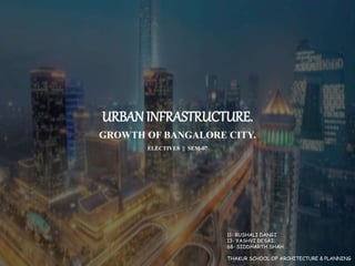
1. URBAN INFRASTRUCTURE.
GROWTH OF BANGALORE CITY.
ELECTIVES || SEM-07
11- RUSHALI DANGI
13- YASHVI DESAI
68- SIDDHARTH SHAH
THAKUR SCHOOL OF ARCHITECTURE & PLANNING
2. BANGALORE CITY
EVOLUTION
EVOLUTION OF BANGLORE CITY FROM 1537 TO 2001
EVOLUTION OF BANGLORE CITY IN TERMS OF
BUILT UP AREA FROM 1937 TO 2014
TOPOGRAPHY OF BANGALORE IS GENERALLY FLAT
The City took shape as a fortified settlement
under the ruler Kempe Gowda of the Vijayanagar
state when he established the mud fort in year
1537.
The city has grown rapidly in the past few decades
from pensioner’s paradise to the information
technology capital of India.
3. BANGALORE CITY
TIMELINE
BANGLORE IN 1850
In 1537 CE, Kempe Gowda — a feudatory ruler under the
Vijayanagar Empire established a mud fort considered to
be the foundation of modern Bangalore.
Within the fort, the town was divided into smaller
divisions, each called a "Pete“.
The town had two main streets—Chikkapete
Street, which ran east-west, and Doddapete
Street, which ran north-south.
Their intersection formed the Doddapeté
Square—the heart of Bangalore.
4. BANGALORE
BOUNDARIES
DIVISION OF 5 MUNICIPAL CORPORATION
ZONE MAP OF BANGALORE
The “Old Petta”, the historical heart of the city,
constitutes a very important Centre of wholesale and
retail activities.
The North-East- form a second commercial hub in the
Cantonment area.
In the East, Chennai railway lime and Whitefield Road
are important corridors that includes the International
Technology Park Ltd.
5. BANGALORE
ADMINISTRATIVE
AREAS
South-East- Electronic city area with large Public and
Private software and IT enterprises.
Western zone- Housing sector for most manufacturing
workers
North-south axis- Households for those engaged in
trade and business.
North- East- Households for those engaged in public
and administrative services.
7. BANGALORE CITY
POPULATION
The index of ageing increased rapidly from 18 elderly
to 100 children in 1991 to 32 elderly to 100 children in
2011.
Especially the middle age group of 25 to 44 has
increased tremendously from 30% in 1991 to 37% in
2011 reflecting the higher in-migration.
8. BANGALORE CITY
PROPOSAL- 2015
CONCEPT- FIVE CONCENTRIC BELTS
1st Belt - The core area consisting of the
historic Petta, the Administrative Centre and
the Central Business District;
2nd Belt - Peri-central area with older
planned residential areas surrounding the
core area;
3rd Belt - Recent extensions (2003) of the City flanking both
sides of the Outer Ring Road, a portion of which lacks services
and infrastructure facilities and is termed as a shadow area;
4th Belt - New layouts with some vacant lots and agricultural
lands; and
5th Belt - Green belt and agricultural area in the City's
outskirts including small villages.
11. BANGALORE CITY
PROPOSAL- 2031
PROPOSED PUBLIC TRANSPORT NETWORK MAP
The circulation network has identified radial
and ring roads to create more opportunities
for mobility within the metropolitan area and
the larger region.
The proposed circulation network will have
about 800 Kms (including existing 375 kms)
of Primary Arterial which has 26 radials and
5 rings.
The primary circulation network embraces
completely new ring road (Inner Peripheral
Ring Road) apart from the completion of the
Intermediate Ring Road and the Peripheral
Ring Road.
RMP 2031 has proposed 36 intermodal
interchange stations intersections of two or
more public transit corridors.
In order to restrict the freight movement
inside the city, eight logistic hubs of 100
acres each is proposed at the periphery of
major highways.
Logistic Hubs are proposed on Bannerughatta
Road, Tumkuru Road (outside BMA), Mysore
Road, Mallur Road, Bellary Road, Old Madras
Road, Hosur Road and Sarjapura Road.
12. DRINKING WATER SOURCE FOR CITY
• BWSSB currently supplies approximately 900 million liters (238 million gallons) of water to the city per day, despite a municipal demand of 1.3 billion liters.
• Water for the city (with a population of 10 million) comes from a number of sources, with 80% of it coming from the Cauvery River.
• Water is also drawn from the Arkavathy River, but the supply does not meet the demand
• The majority of the water for Bangalore is imported by the BWSSB from the Cauvery River, over 100 kilometers (62 mi) south of the city
• Up to 20% of the normal water supply for Bangalore comes from the Arkavathy River, from two reservoirs built on the river, the Hesaraghatta (or Hesseraggatta)
which was built in 1894 and the Tippagondanahalli Reservoir (or T G Halli), which was built in 1933
13. GROUND WATER SOURCE FOR THE CITY
• Ground water tables tend to be rising in central parts of Bangalore, where pipes
are laid.
• This is said to be due to leakages.
• Recharge from leakages has been large enough that even the shallow aquifers in
these parts of Bangalore are getting full (eg: Frazer town around Ulsoor lake).
• However this leakage is getting mixed with the leakage from the sewage pipes.
• So though the ground water levels are going up, the quality is not good.
• In outer areas of Bangalore, groundwater levels are going down
14. • An expert committee constituted by the government in
1958 examined four alternative water sources and
recommended Cauvery water source as the best suited
alternative for growing Bangalore.
• The other sources examined by the Committee were
Arkavathi, Hemavathi and Shimsha.
• The Government implemented the Cauvery Water Supply
Project in 1964.
• To implement this project the Bangalore Water Supply and
Sewerage Board (BWSSB) was established in September
1964.
HISTORY OF WATER SUPPLY FOR THE CITY
15. WATER DEMAND OF BANGALORE CITY
Bangalore’s water supply:
• Kaveri = 1350 MLD
• NRW (49.25%)= 664 MLD
• Human supply= 68 lpcd
• Rainfall= 20.77 TMC
Bangalore’s water demand:
• Total- human + vegetation
• Human (2011)= 1275 MLD
• Human (2017)= 1595 MLD
• Vegetation (2014)= 1752 MLD
16. BANGALORE CITY
ELECTRICITY SUPPLY
• Bangalore’s daily power
demand is about 2300 MW
(Mega Watt).
• That is, 2300 MW of
power is transmitted
throughout the day to the
city on average (there are
sharp differences in peak
and non-peak hour
consumption though).
• Bangalore consumes about
one-third of the state’s
total power.
• Karnataka’s average
demand is 6000 MW per
day.
• Karnataka Power
Corporation Ltd (KPCL) is
the state agency that gets
power from different
generating stations.
• KPCL also buys power from
other states when
required.
• (KPTCL) is in charge of
transmitting power to
different ESCOMs,
including BESCOM.
17. BANGALORE CITY
ELECTRICITY SUPPLY
Hydel power:
• The state has over 15 hydel power stations.
• BESCOM gets 12% of state’s hydel power for its entire
area which also includes Tumkur, Chitradurga,
Davanagere etc
Thermal power:
• Thermal power comes from coal, gas and diesel
stations.
• Unlike hydel power, thermal power is stable as long as
there is no shortage of coal/diesel.
Central Generating Stations (CGS):
• CGS are thermal/nuclear stations.
• The state in which the station is located, will get
majority of the power while neighbouring states will
get a smaller share.
• Karnataka gets about 1000 MW from CGS, on average.
Non Conventional Energy Projects (NCEPs):
• This power is produced not by government agencies,
but by Independent Power Producers (IPPs). NCE
sources mainly are wind, sun, biomass etc.
• For instance, in sugar and steel factories, while
production process goes on, power can be generated
simultaneously.
• The factories use part of this power for themselves,
and sell the excess to the state.
• Udupi Power Corporation Ltd (UPCL), a major IPP,
produces power from imported coal.
POWER SOURCES OF BANGALORE
18. • These are not problems which are
associated with increased load, but also
with the rain and wind there are issues
with snapped cables and other
problems.
• These issues will be sorted once all the
major transmission lines are
underground.
• We have already started taking some
of the power lines below the ground to
negate the effect of rain and wind or
tree feelings in general
BANGALORE CITY
ELECTRICITY SUPPLY
• The major issues resulting
in power cuts in any area
are power shortage and
lack of proper network
infrastructure.
19. BANGALORE CITY
WASTE MANAGEMENT
Waste quantity expected in next 20 years
Urban waste composition
MSW waste collection process for residential/commercial areas
• At present, 10% of solid waste is
recycled in Bengaluru.
• Most of the literature reported that the
waste generation rate is 0.4–0.6
kg/capita/day.
• The proposed waste generation rate is
about 0.5 kg/capita/day in Bengaluru.
MSW collection system
• BBMP handles about 30%
of solid waste, and the
remaining waste activity is
outsourced (starting from
primary collection to
disposal).
• Solid waste collection is
carried out in two phases.
• The first phase is a
primary collection, in which
the solid waste is collected
on auto tipper and
pushcarts.
20. BANGALORE CITY
WASTE MANAGEMENT
Location of unauthorized dump sites in and around
Bangalore City
• The waste sites that were earlier in the periphery of
the corporation limits of. Bengaluru City are now in the
development zone of a more magnificent Bengaluru City
Unauthorized dumping along with wards in and around Bangalore City.
• These structures built on these dumpsites
can undergo distress due to the high
settlement and cause failures due to the
low strength of the dumped waste.
Major arterial and sub-arterial road network along
with dump sites in and around Bangalore City.
Sl.No Zone Existing Disposal Site/Facility
1 South Bingipura, Mavallipura, KCDC
2 East MSGP, Mavallipura, KCDC,
3 West Terra firma, Mavallipura, KCDC
4 Yelahanka Mavallipura, Terrafirma
5 Bommanahalli Bingipura, Laxmipura
6 Mahadevapura Terrafirma
7 Dasarahalli MSGP
8 Raja Rajeshwari Nagar MSGP/Terrafirma
• These dumps
can also cause
groundwater
contamination
due to leaching
of waste by
the percolation
of rainwater.
Existing treatment and disposal facilities in BBMP.
21. BANGALORE CITY
WASTE MANAGEMENT
Major issues in transporting waste:
• Due to open beds in tractors and trucks, the waste spills
from the truck, during transport, thereby causing a nuisance.
• Loading of waste by manual without the use of the protective
gears is dangerous to the health of workers.
• The secondary storage system is not synchronized with the
transport system. Problems arise when a transport fleet is
modernized because waste at secondary storage system is
still dumped on the ground.
• Due to an inadequate number of vehicles, the area cannot be
serviced properly.
• Due to inadequate workshop facilities and maintenance
procedures, the vehicles are poorly maintained. This problem
leads to break down of trucks and become out of service for a
long time.
Reclamation of landfill:
• At present, Bengaluru can handle the municipal
solid waste of about 2100 TPD only.
• The existing capacity of a waste treatment
facility at Mavallipura is 600 TPD, Karnataka
Composting Development Corporation Ltd (KCDC)
is 300 TPD, and Terra Firma is about 1500 TPD.
• To achieve 100% processing of waste in
Bengaluru, Government has sanctioned six new
facilities.
• These new facilities are being set up at the
following locations: Kannahalli is 500 TPD,
Seegihalli is 200 TPD, Doddabidarakallu is 200
TPD, Lingaderenahalli is 200 TPD, Subrayanpalya
is 200 TPD, Chikkanagamangala is 500 TPD, KCDC
(upgradation) is 500 TPD.
25. BANGALORE CITY
TRANSPORTATION
Major nodes of Bangalore city
• Buses operated by Bangalore Metropolitan Transport
Corporation are an important means ofpublic transport
available in the city.
• BMTC provides an option of a bus pass to frequent
users• BMTC runs air-conditioned luxury buses on
major routes• The Karnataka State Road Transport
Corporation operates 6,918 buses on 6,352 schedules.
• The main bus depots that BMTC maintains are the
Kempegowda Bus Station.
26. BANGALORE
TRANSPORTATION
• Bangalore has a radio-concentric system structured by
ring roads, five major radial roads and five secondary
radial roads that converge towards the center of the
city.
• The major and secondary radial roads that form a ten-
pointed star constitute the organizational system of
the city and are important as they support both
industrial and commercial development.