The document summarizes plans for managing coastal storm risk in Jamaica Bay, New York. It discusses the US Army Corps of Engineers' process for formulating alternatives, addressing sea level rise, and evaluating alternatives for the East Rockaway Inlet to Rockaway Inlet and Jamaica Bay reach. High-level details are provided on recommended plans for the Atlantic shorefront, Back Bay flooding risk reduction features, and nature-based features in Jamaica Bay. The schedule and opportunities for public involvement in the ongoing New York-New Jersey Harbor and Tributaries Coastal Storm Risk Management Feasibility Study are also outlined.
Jason Winner, Conservation GIS Manager for Scenic Hudson presents on the new Sea Level Rise Mapper.
The mapper is a tool for communities and stakeholders to use to create visualizations of future scenarios of sea level rise. With these maps and information, Scenic Hudson is supporting communities' efforts to develop adaptation plans by helping them to:
- create maps of the extent and impacts of inundation and flood zone expansion
- understand the locations of key built and natural resources
- create graphics that illustrate different sea level rise scenarios in specific communities or stretches of the river
- estimate the risks to infrastructure and natural resources and the likelihoods of different inundation events
- develop alternative adaptation scenarios and weigh their cost and benefits with respect to built infrastructure and natural resources
** The Sea Level Rise Mapper can be found on Scenic Hudson's website at: http://www.scenichudson.org/slr/mapper
For more information, contact Jason Winner at Scenic Hudson at (845) 473-4440 ext 223, or jwinner@scenichudson.org
Amy Wolfe, Trout Unlimited, "A Decade of Progress for the West Branch Susqueh...Michael Hewitt, GISP
This presentation will discuss the accomplishments of the West Branch Susquehanna Restoration Initiative over the past ten years as made through the efforts of TU and member agencies and organizations of the West Branch Susquehanna River Task Force and West Branch Susquehanna Restoration Coalition, as well as the needs and challenges that remain on the horizon as work continues toward the recovery of the West Branch Susquehanna Watershed.
Muskegon Lake, located in Muskegon, Mich., has been listed as a Great Lakes Area of Concern due to a significant loss of wildlife habitat and degraded water quality. This presentation will discuss how an organized grassroots effort has successfully received state and federal funding to implement large-scale ecological restoration projects throughout the lake.
Positive Declaration for Pilgrim Pipeline from NY DEC & Thruway AuthorityMarcellus Drilling News
A document instruction the proposed Pilgrim Pipeline, which is really two pipelines (one heading south from Albany to NJ carrying Bakken oil, the other north from NJ to Albany carrying gasoline and other refined products) will need to complete a full environmental review before the project will be considered. Both anti-fossil fuel freaks and the pipeline builders welcomed the news (strangely).
Shawn Rummel, Trout Unlimited, "Recovery of Coldwater Ecosystems Following Tr...Michael Hewitt, GISP
This project aims to provide a better understanding of how post-treatment monitoring should be conducted in order to ensure that both the water quality and biological communities are responding positively to the treatment. Preliminary results have shown improvements in water quality following treatment of AMD as well as a shift in the benthic macorinvertebrate community from pollution tolerant taxa to pollution sensitive taxa.
NYNJHAT Presentation slides for Jamaica Bay Task Force Meeting 17 Nov 22.pdfecowatchers
Army Corps of Engineers tenatively selected plan for storm surge protection in the Jamaica Bay Area based on the recently released Harbor and Tributaries Coastal Storm Risk Management Study (HATS)
Municipal Adaptations to Create Resilient Beach CommunitiesSMRPC
Getting municipal decision-makers the
information they need, and a forum to
actually make decisions about adapting to
sea level rise and becoming more resilient
to storms & hazards.
Use of MIKE 21/3 in the Hydraulic Analysis for the Dublin Port ABR Project - ...Stephen Flood
2015 DHI UK & Ireland Symposium
KEYNOTE: Use of MIKE 21/3 in the Hydraulic Analysis for the Dublin Port ABR Project
Adrian Bell (RPS),
Tuesday 21 April 2015 at 10:30 - 11:00
This project essentially looked at the stability of a deepened approach channel and examined the impact of the dredging and disposal for the scheme in support of a public planning hearing. The modelling used coupled MIKE 21 FM HD-SW-ST models as well as well as MIKE 21 and MIKE 3 FM HD and MT models.
Fall 2023 JBTF presentation on Additional HRE project areas. .pptxecowatchers
The Jamaica Bay Ecowatchers present their assessment on additional areas within Jamaica Bay that should be included in the Hudson Raritan Esturary Comprehensive Restoration Project plan
The NYC DEP Feasibility study that takes a look at the current nitrogen removal efforts, where the four waste treatment plants are now in terms of Nitrogen loading reductions and future technologies that have been studied for possible implementation at these plants.
Modeling the Effects of Sea Level Rise on Coastal Wetlands
Marc Carullo, GIS/Environmental Analyst, Massachusetts Office of Coastal Zone Management (CZM)
Understanding Who is AT RISK - Flood extent modellingAlex Nwoko
Understanding Flood Risk Using Surface Flood Extent Modelling. This study used ArcMap and HECRAS to evaluate flood risk exposure of River Wansbeck in Morpeth, UK.
This presentation was given as part of the EPA-funded Catchment Science and Management Course focusing on Integrated Catchment Management, held in June 2015. This course was delivered by RPS Consultants. If you have any queries or comments, or wish to use the material in this presentation, please contact catchments@epa.ie
It is increasingly being recognised internationally that integrated catchment management (ICM) is a useful organising framework for tackling the ongoing challenge of balancing sustainable use and development of our natural resource, against achieving environmental goals. The basic principles of ICM (Williams, 2012) are to:
• Take a holistic and integrated approach to the management of land, biodiversity, water and community resources at the water catchment scale;
• Involve communities in planning and managing their landscapes; and
• Find a balance between resource use and resource conservation
ICM is now well established in Australia, New Zealand, and the United States. In Europe the ICM approach has been proposed as being required to achieve effective water and catchment management, and is the approach being promoted by DEFRA for the UK, where it is called the “Catchment Based Approach” (CaBA). The principles and methodologies behind ICM sit well within the context of the Water Framework Directive with its aims and objectives for good water quality, sustainable development and public participation in water resource management. In Ireland it is proposed that the ICM approach will underlie the work and philosophy in developing and implementing future River Basin Management Plans.
Similar to ACOE Coastal Storm Management Alternative for Jamaica Bay Communities (20)
NPS presentation Jamaica Bay Task Force Meeting 2022-11-17.pdfecowatchers
an update by the National Parks Service on plans for the management of the east and west ponds and the feedback received from stakeholders after the recent comment period
Spring 2022 Task Force Meeting presentation on Adjacent Sediment Slurry Enric...ecowatchers
adjacent sediment slurry enrichment proposals for Jamaica Bay. Also known as Thin Layer Placement this process as many opportunities for Jamaica Bay Wetland restoration
Jamaica Bay Wildlife refuge west pond proposal for protecting the south shore...ecowatchers
Alex Zablocki director of the Jamaica Bay Rockaway parks Conservancy presented on the plan that his organization has created for protecting the west pond thru the use of a wetland restoration project
Ribbed Mussel ability to remove Nitrogen from water bodies.ecowatchers
Professor Chester Zarnock explains recently completed and published study showing the benefits of ribbed mussels in a salt marsh including their denitrification potential
NYC DEP update on Ribbed Mussel potential for treating pathogens in water bodiesecowatchers
John Mcloughlin managing director of NYC DEP office of Ecosystem services and Green infrastructure research gives updates on the research they have done on using natural features such as ribbed mussels to remove pathogens from water bodies
Shirley Chisholm State Park-Brooklyn Update on phase two workecowatchers
An update by Leslie Wright director of NY state Parks on the planned future work for phase two in the newly created Shirley Chisholm State Park in Brooklyn NY
update by the Jamaica Bay Ecowatchers on sunset cove restoration project as the project is now completed for the phase 1 construction and plans for the volunteer planting and phase 2 construction
"Understanding the Carbon Cycle: Processes, Human Impacts, and Strategies for...MMariSelvam4
The carbon cycle is a critical component of Earth's environmental system, governing the movement and transformation of carbon through various reservoirs, including the atmosphere, oceans, soil, and living organisms. This complex cycle involves several key processes such as photosynthesis, respiration, decomposition, and carbon sequestration, each contributing to the regulation of carbon levels on the planet.
Human activities, particularly fossil fuel combustion and deforestation, have significantly altered the natural carbon cycle, leading to increased atmospheric carbon dioxide concentrations and driving climate change. Understanding the intricacies of the carbon cycle is essential for assessing the impacts of these changes and developing effective mitigation strategies.
By studying the carbon cycle, scientists can identify carbon sources and sinks, measure carbon fluxes, and predict future trends. This knowledge is crucial for crafting policies aimed at reducing carbon emissions, enhancing carbon storage, and promoting sustainable practices. The carbon cycle's interplay with climate systems, ecosystems, and human activities underscores its importance in maintaining a stable and healthy planet.
In-depth exploration of the carbon cycle reveals the delicate balance required to sustain life and the urgent need to address anthropogenic influences. Through research, education, and policy, we can work towards restoring equilibrium in the carbon cycle and ensuring a sustainable future for generations to come.
Artificial Reefs by Kuddle Life Foundation - May 2024punit537210
Situated in Pondicherry, India, Kuddle Life Foundation is a charitable, non-profit and non-governmental organization (NGO) dedicated to improving the living standards of coastal communities and simultaneously placing a strong emphasis on the protection of marine ecosystems.
One of the key areas we work in is Artificial Reefs. This presentation captures our journey so far and our learnings. We hope you get as excited about marine conservation and artificial reefs as we are.
Please visit our website: https://kuddlelife.org
Our Instagram channel:
@kuddlelifefoundation
Our Linkedin Page:
https://www.linkedin.com/company/kuddlelifefoundation/
and write to us if you have any questions:
info@kuddlelife.org
WRI’s brand new “Food Service Playbook for Promoting Sustainable Food Choices” gives food service operators the very latest strategies for creating dining environments that empower consumers to choose sustainable, plant-rich dishes. This research builds off our first guide for food service, now with industry experience and insights from nearly 350 academic trials.
UNDERSTANDING WHAT GREEN WASHING IS!.pdfJulietMogola
Many companies today use green washing to lure the public into thinking they are conserving the environment but in real sense they are doing more harm. There have been such several cases from very big companies here in Kenya and also globally. This ranges from various sectors from manufacturing and goes to consumer products. Educating people on greenwashing will enable people to make better choices based on their analysis and not on what they see on marketing sites.
Natural farming @ Dr. Siddhartha S. Jena.pptxsidjena70
A brief about organic farming/ Natural farming/ Zero budget natural farming/ Subash Palekar Natural farming which keeps us and environment safe and healthy. Next gen Agricultural practices of chemical free farming.
ACOE Coastal Storm Management Alternative for Jamaica Bay Communities
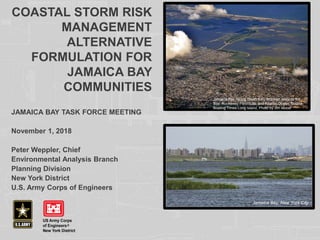
1. COASTAL STORM RISK
MANAGEMENT
ALTERNATIVE
FORMULATION FOR
JAMAICA BAY
COMMUNITIES
JAMAICA BAY TASK FORCE MEETING
November 1, 2018
Peter Weppler, Chief
Environmental Analysis Branch
Planning Division
New York District
U.S. Army Corps of Engineers
Jamaica Bay, facing South from Brooklyn towards the
Bay, Rockaway Peninsula, and Atlantic Ocean. Source:
Boating Times Long Island, Photo by Jim Mobel
Jamaica Bay, New York City
2. 2
CORPS OF ENGINEERS
PLAN FORMULATION PROCESS
• Identify problems and opportunities
• Inventory and forecast conditions
• Formulate alternatives to manage the risk of flooding from
coastal storms
• Evaluate alternatives
o Plans are screened for completeness, effectiveness, efficiency, and acceptability
o Compare reduced damages of proposed alternatives against without project conditions
to determine benefits
o Perform an initial evaluation of environmental impacts
o Compare benefits to costs for each alternative
To be economically justified a plan must have a benefit-to-cost ratio (BCR)
greater than one
• Compare alternatives
• Select alternative
3. ADDRESSING SEA LEVEL RISE
3
• Adapting to sea level rise is NOT optional and it is a
shared responsibility.
• Incorporates the most recent, sound science analyses of
how to adapt coastal storm risk measures to increased
future sea level in their design and analyses.
• This includes assessing risk and uncertainty based on an
uncertain future.
5. BACKGROUND ON ROCKAWAY REFORMULATION
Draft Report Released August 2016 wide-ranging public and agency
comments were received
Tentatively Selected Plan in the 2016 Draft Report recommended a
comprehensive $3B plan (which has since been revised) but included:
Storm surge barrier across Jamaica Bay inlet
Atlantic Shorefront seawall dune and beach system with groin
enhancement
Smaller features in the Back-Bay to manage risk for frequent flooding
when the barrier would remain open
The $5B “perimeter plan” of floodwalls and tributary gates around
Jamaica Bay was screened out in favor of the above
Public and Agency Input called for further analysis of proposed storm surge
barrier across Jamaica Bay
Numerous comments requested the inclusion of additional natural and
nature-based features (NNBFs) in Jamaica Bay
Equally, there were many comments requesting that the study be expedited
to construct the Atlantic Shorefront feature earlier than proposed
Draft Revise Report Released August 2018.
Comment period closed October 22, 2018
5
6. RECOMMENDED PLAN
ATLANTIC SHOREFRONT REACH
• Reinforced
vegetated dune
and beachfill with
structure crest of
+17 ft NAVD88,
dune crest of +18
ft NAVD88 for
35,000 LF from
Beach 9th Street to
Beach 149th
Street, and include
sand tapers at the
ends of the project
• 5 groin extensions,
1 optional groin
rehabilitation
• 13 new groins
• Obtaining sand
from borrow area
located
approximately 2
miles south of the
Rockaway
Peninsula and
about 6 miles east
of the Rockaway
Inlet.
6
8. DRAFT BARRIER ALIGNMENT
ALTERNATIVES EVALUATED (CIRCA 2016)
Three alignments of the storm surge barrier originally considered
- Hydrodynamic modeling undertaken for design of openings
- Effects of scour on Gil Hodges Bridge eliminated C-1W
- Impacts to existing utilities considered
C-1E is the preferred alignment, C-2 is close in comparison
9. HIGH FREQUENCY FLOODING RISK REDUCTION
FEATURES (HFFRRFS)
• Due to the scale, complexity, and cost of the
proposed storm barrier, and the need for
additional study, the barrier was moved to
New York/New Jersey Harbor and Tributaries
Feasibility Study which came out of the
North Atlantic Coast Comprehensive Study
(NACCS)
• High Frequency Flooding Risk Reduction
Features (HFFRRFs, formerly ‘Residual Risk
Features’) are designed to complement a
potential future storm surge barrier
• In order to be recommended, each element
must be justified as stand-alone feature
(without the proposed storm surge barrier)
and have a positive benefit-to-cost ratio
9
New York and New Jersey Harbor and
Tributaries Study Area—The study team is
evaluating a suite of storm surge barriers in
the region to evaluate potential for regional
storm risk management measures
10. BACK BAY FLOODING
10
3yr RP (2068) Flood Extent Verified
5yr RP (2068) Flood Extent Verified
10yr RP (2068) Flood Extent Verified
Flood extents calculated
only within HFFRRF study
area. Excludes Broad
Channel and areas outside
(west) of storm surge barrier
alignment C-1E
11. NATURE BASED FEATURES
LOCATIONS ANALYZED
3 Sites at Arverne
1 Site at
Edgemere
1 Site at Norton
Basin
1 Site at
Bayswater
2 Sites at
Mott’s
Basin
NNBF PROTOTYPE
DEVELOPMENT
NNBFs created to accommodate a
variation in coastal edge conditions.
Two main variations are distinguished:
Horizontal space available between the
urban developed edge and the water line
Existing plant species composition and the
need to either extend the existing
coastline or cut back the existing bank line
to accommodate a suitable habitat for
wetland creation/enhancement
Rapidly descending bathymetry near
shoreline
Limited horizontal width between front toe
of new shoreline slope and flood control
structure on back edge
Already existing living shoreline habitats
performing CSRM function
Presence of heavy anthropogenic
infrastructure along shoreline (e.g. docks,
piers).
Gray feature structures set far back from
shoreline…no interactive capacity.
Combinations of all these factors (most
likely scenario)
Does not increase risk of wildlife hazards
to planes; habitat type restrictions near
JFK airport
DID NOT SITE NNBFS WHERE
THERE IS…
12. 12
12
OLD HOWARD
BEACH
CANARSIE
HEAD OF BAY
NORTON BASIN
MOTTS BASIN
INWOOD
BAYSWATER
PARK
Flood extents calculated only within
HFFRRF study area. Excludes
Broad Channel and areas outside
(west) of storm surge barrier
alignment C-1E
ROSEDALE
MEADOWMERE
LAWRENCE
BROAD
CHANNEL
STRUCTURAL
SCREENED,
NONSTRUCTURAL
PASSED
MID-ROCKAWAY
BACK-BAY W/
NNBFs
High Frequency Flooding Risk Reduction
Features - SCREENING RESULTS
• 3 sites are in the Final Plan, including 5 NNBFs at the
Mid-Rockaway Back-Bay site
• Non-structural plan for Broad Channel screened using
data and experience from Build it Back
13. RECOMMENDED PLAN
JAMAICA BAY REACH
13
NNBF considered but not
recommended in this location:
• Existing high quality mudflat and
mussel habitat already
performing NNBF functions
• Avoid habitat exchange
Motts Basin North HFFRRF
14. RECOMMENDED PLAN
JAMAICA BAY REACH
14
HFFRRF Projects
Mid-Rockaway HFFRRF
Arverne Area/Subreach
(left)
Mid-Rockaway HFFRRF
Edgemere Area/Subreach
• NNBFs are integral features to control erosion
on the berm which will be overtopped
frequently throughout the project life
• NNBF+berm design is more cost effective than
alternative non-erodible floodwall
• BCR underestimates benefits due to “leaving
benefits on the table”
15. 15
New York-New Jersey Harbor and Tributaries
Coastal Storm Risk Management Feasibility Study
ALTERNATIVES OVERVIEW
• Alternative 1: No Action
• Alternative 2: Harbor Wide Gate and Beach Restoration
• Alternative 3A/3B: Multiple Bay/Basin Gate and Floodwalls & Levee Systems
• Alternative 4: Individual Waterbody Gate and Floodwalls & Levees
• Alternative 5: Perimeter Only
New York Harbor.
17. ALTERNATIVES 2-5
• Alternative No. is a reference to the scale of solution and general strategy
• Siting and quantities are approximate for screening purposes and will be refined
• Design level 1% event (mean) + RSLC + Wave Run-up (measure and location specific)
• Focus on biggest cost drivers (storm surge barrier) in each alternative
• Nonstructural, NNBF, and perimeter structural placeholders to be refined in future
formulation
17
New York-New Jersey Harbor and Tributaries
Coastal Storm Risk Management Feasibility Study
Alt. 2 Alt. 3A Alt. 3B Alt. 4 Alt. 5
In-Water
Measures
Land-Based
Measures
23. 23
New York-New Jersey Harbor and Tributaries
Coastal Storm Risk Management Feasibility Study
Alternatives at AMM
Best performing alternatives
(Draft Interim Report)
TSP and Draft Report
Work needed to identify TSP
Parametric analyses
ADM and optimization
Recommended Plan
24. FACTORS CONSIDERED - ALTERNATIVE SCREENING
1. Hydrodynamic Modeling
Induced Flooding during Storms
Tidal Influences
2. Relative Sea Level Change
Based on intermediate
3. Period of Analysis
50 year period may limit full evaluation given many measures will
likely have far longer period of utility
4. Operations and Maintenance Assumptions
Storm event condition selected for surge gate operation has
substantial effects on plan selection
5. Benefits Model
24
New York-New Jersey Harbor and Tributaries
Coastal Storm Risk Management Feasibility
Study
25. 25
New York-New Jersey Harbor and Tributaries
Coastal Storm Risk Management Feasibility Study
ENVIRONMENTAL CONSIDERATIONS
Changes to tidal range/regime, flow velocity, salinity concentrations, sedimentation rates,
scour, and elevation
Water quality, dissolved oxygen, nutrients, and phytoplankton biomass (i.e.
eutrophication), and pathogenic bacteria
Anadromous/catadromous fish migration and aquatic species
Marsh inundation
Air quality
Transportation (marine vessels, etc.)
Aesthetics and recreation
National Historic Landmarks and
Historic Properties
Listed species and critical habitat
Noise and vibration
Bay bottom impacts, as well as landside impacts
Location of Superfund, National Priority List, and other contaminated sites
Jamaica Bay, New York City
26. 26
New York-New Jersey Harbor and Tributaries
Coastal Storm Risk Management Feasibility Study
PUBLIC INVOLVEMENT
Scoping Period through November 5th
Release of the Draft Interim Report – Winter 2019
Public/ Agency Reviews with Public Meetings
Draft Feasibility Report and Tier 1 EIS – Spring 2020
Public/ Agency Reviews with Public Meetings
Optimization of the Selected Plan
Final Feasibility Report and Tier 1 EIS – Spring 2021
Chief’s Report – Summer 2022
Public Involvement during Pre-Construction Engineering
and Design Phase –Tier 2 EIS
*The red boxes indicate the best opportunities for the public to
provide input to the study.
The scoping period extends until
November 5, 2018. Comments
and input submitted by this
deadline will be used to develop
the Draft Interim Report.
Comments received after the
deadline are welcome and will be
used to help identify the Tentatively
Selected Plan (TSP) in 2020.
Once the Draft Interim Report is
released, the public and agencies
will have a chance to review and
submit comments and public
meetings will be held as part of the
public review period. The
comments are used to inform the
agency as it moves to identifying
the TSP.
27. 27
New York-New Jersey Harbor and Tributaries
Coastal Storm Risk Management Feasibility Study
STUDY SCHEDULE
Milestones
Milestones Dates*
Draft Interim Report Winter 2018/2019
Draft Feasibility Report and Tier 1 EIS Spring 2020
Final Feasibility Report and Tier 1 EIS Spring 2021
Chief’s Report (for Congress) Summer 2022
* The schedule is contingent upon available funding, non-federal partner
support, and concurrence by Corps higher-authority offices.
28. 28
New York-New Jersey Harbor and Tributaries
Coastal Storm Risk Management Feasibility Study
HOW TO STAY INVOLVED
Project Webpage
http://www.nan.usace.army.mil/Missions/Civ
il-Works/Projects-in-New-York/New-York-
New-Jersey-Harbor-Tributaries-Focus-Area-
Feasibility-Study/
Stakeholder Mailing List
Email
NYNJHarbor.TribStudy@usace.army.mil
if you would like to join our mailing list
and receive periodic updates.
Scoping Comments
Send any questions and/or comments
to
NYNJHarbor.TribStudy@usace.army.
mil
OR
Fill out and submit a comment card at
a scoping meeting
Scoping Comment Period open
through November 5, 2018
29. 29
JAMAICA BAY PLANNING REGION EFFORTS
Elders Point East and
West Marsh Islands
Restoration (Mitigation
for NY Harbor and CAP
Beneficial Use of
Dredged Material):
Constructed 2007 & 2010
Black Wall and
Rulers Bar Marsh
Islands Restoration
(NY Harbor Sand
Placement):
Constructed 2012
and differential cost
paid for by sponsor.
Existing
Rockaway
Project:
Constructed 1977
and Repaired in
2014.
Proposed Ecosystem Restoration Sites
Jamaica Bay
Navigation Channel:
O&M Dredging in 2019
(subject to availability
of funds)
Plumb Beach
CSRM Project
(CAP Beneficial
Use of Dredged
Material):
Constructed
2012/2013
Gerritsen Creek
Restoration (CAP
Section 1135):
Constructed 2011
Hudson Raritan
Estuary (HRE)
Proposed Restoration
Sites
Yellow Bar Hassock
Marsh Island
Restoration (CAP
Beneficial Use of
Dredged Material):
Constructed 2012
East Rockaway
Inlet Navigation
Channel: O&M
Dredging in 2019
(subject to
availability of Funds)
Spring Creek South
CSRM/Restoration
(NYSDEC/FEMA IIS):
60% designs completed
and EA public release
August 2018
Spring Creek North
Restoration (CAP Section
1135): Report approved
Mar 2018 and D&I PPA
scheduled Jul 2018
30. SPRING CREEK SOUTH
FEMA HAZARD MITIGATION GRANT
PROGRAM (HMGP) PROJECT
Goals
• Manage coastal storm risk with Natural/nature-based features;
Decrease risk of fire
• Align with NPS Gateway National Recreation Area (GNRA)
Management Plan
• Coordinate with complementary Jamaica Bay projects
• Recommended Plan
Berm - 19 feet NAVD 88; 50-foot-wide path at crest
Tie-ins at Belt Parkway and Addabbo Bridge
Freshwater wetlands
Flap gates
Local access points; Improved edge aesthetic