
Recommended
Recommended
More Related Content
Similar to NYNJHAT Presentation slides for Jamaica Bay Task Force Meeting 17 Nov 22.pdf
Similar to NYNJHAT Presentation slides for Jamaica Bay Task Force Meeting 17 Nov 22.pdf (20)
More from ecowatchers
More from ecowatchers (20)
Recently uploaded
Recently uploaded (20)
NYNJHAT Presentation slides for Jamaica Bay Task Force Meeting 17 Nov 22.pdf
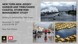
- 1. NEW YORK-NEW JERSEY HARBOR AND TRIBUTARIES COASTAL STORM RISK MANAGEMENT STUDY Briefing to Jamaica Bay Task Force November 17, 2022 6:30-8:30 PM, ET New York District
- 2. 2 DRAFT REPORT Found at https://www.nan.usace.army.mil/NYNJHATS
- 4. 4 NEW YORK-NEW JERSEY HARBOR AND TRIBUTARIES COASTAL STORM RISK MANAGEMENT FEASIBILITY STUDY STUDY AREA • The largest and most densely populated of the 9 NACCS Focus Areas • Area covers 2,150+ square miles and 900+ miles of affected shoreline • 25 counties in New York & New Jersey • Affected population of roughly 16 million people, including New York City and the six most populated cities in New Jersey COASTAL STORM RISKS & DAMAGES • Significant Life/Safety Risk and over 275,000 Structures in Potential Impact Area • Incorporates Dozens of Other Ongoing and Planned CSRM Projects in Study Area • Present Value Damages for 100-Year Storm Range from $100+B for Intermediate Sea Level Rise to over $350B for High Sea Level Rise Projection STUDY SCOPE • Study Cost: $19.4M, cost-shared 50/50 with NYSDEC and NJDEP thru July 2022, and 100% federal thereafter. • Study Schedule: Assistant Secretary of the Army for Civil Works Approved (7 Apr 21) Second Exemption for Study Extension to 2024 Completion • Funding: Federal funding ($1.45M) resumed in October 2021 following lapses in fiscal years 2020 and 2021. Study also received $6,724,000 of DRSAA funds. • Study Scope: WRDA 2020 includes study specific language STUDY SCHEDULE • Draft Feasibility Report and integrated Tier 1 Environmental Impact Statement Released for extended public day review with meetings planned throughout area (comment closing date January 6, 2023). Virtual meetings starting October 24th, 27th and November 5th. • See WWW.NAN.USACE.ARMY.MIL/NYNJHATS for dates, times and locations of public in- person meetings in November and December. • Final Chief of Engineers Report Approved to be Completed in June 2024
- 5. 5 ALTERNATIVE PLANS – PROS & CONS WITH EACH Alternative 1: No action Alternative 2: Harbor-wide storm surge barrier + shore-based measures Alternative 3A: Multi-basin storm surge barriers + shore-based measures Alternative 3B: Multi-basin storm surge barriers + shore-based measures Alternative 4: Single-basin storm surge barriers + shore-based measures Alternative 5: Shore-based measures only • Alternatives span spectrum from large in-water storm surge gates to numerous shoreline-based structures. Alternatives also have (or will have) complementary non-structural and natural and nature-based features (where feasible). • Best Solution Appears to Involve Multiple, Layered Features • Possible Phased Implementation: 1) Short-term: Construct Actionable Features, 2) Mid-Term: Further Evaluate, Design and possibly Construct Complex Features, 3) Long-Term: Adapt and expand features due to further sea level rise and climate change
- 6. 6 FUTURE WITHOUT-PROJECT (FWOP) CONDITION Assumptions • Investments in coastal storm risk management / resiliency projects will continue – Federal, state, local government investment – Private investment • Relative sea level rise over time – Used USACE intermediate projection for comparing plans in Draft Report – Considering ALL USACE sea level rise projections in future study plan formulation 1% flood extent (with intermediate RSLC)
- 7. 7 OTHER CONSTRUCTED AND ONGOING PROJECTS (BLUE) ASSUMED AS PART OF FUTURE BASELINE CONDITION
- 8. 8 USACE RELATIVE SEA LEVEL CHANGE AT BATTERY COMPARED TO STATES AND CITY PROJECTIONS Economic Period of Analysis Planning Horizon Base Year 2044 Study Authorization and Design Construction Operation, Maintenance and Adaptation (if/as warranted)
- 9. 9 COMPOSITE: ALTERNATIVE PLANS SHOWING STORM SURGE BARRIER LOCATIONS CONSIDERED Alternative 2 Alternative 3B Alternative 3A Alternative 4 • All alternative plans will include nonstructural measures, as feasible, for areas with unaddressed coastal storm risk • All alternative plans will include natural and nature- based features where applicable and feasible Alternative 5 (shore-based measures only) not shown in figure
- 10. 10 PROJECT COSTS (INTERMEDIATE RSLC) Alternative Construction Duration (years) Years of Full Benefits* First Costs (not including contingency) Contingency OMRR&R and IDC (PV) Total (Present Value)** 2 32 32 $70.6B $41.7B $37.3B $150.2B 3A 24 40 $48.9B $28.0B $18.7B $95.7B 3B 14 50 $35.6B $17.1B $23.5B $76.2B 4 14 50 $28.8B $14.2B $19.4B $62.5B 5 5 50 $10.1B $5.9B $9.8B $25.8B * - USACE policy only allows a maximum of 50 years of benefits in the economic evaluation, but the alternatives and measures are planned for permanent implementation with an at least one-hundred-year planning horizon ** - Adaptation costs for higher sea level rise projections are under refinement and have not been included in the total cost estimates at this time
- 11. 11 PROJECT BENEFITS & COSTS – ON AN AVERAGE ANNUAL BASIS (INTERMEDIATE RSLC) Alternative Average Annual Cost Average Annual Benefits* Net Benefits* Benefit to Cost Ratio 2 $5.0B $4.6B -$0.5B 0.91 3A $3.2B $6.4B $3.2B 1.99 3B $2.6B $6.3B $3.7B 2.45 4 $2.1B $5.0B $2.9B 2.39 5 $0.9B $1.9B $1.0B 2.21 * Benefits currently based on estimated damages avoided to structures in study area. Critical infrastructure and other possible benefits under refinement and have not been included in the net benefit calculations at this time.
- 12. 12 ALTERNATIVE 3B – THE TENTATIVELY SELECTED PLAN 62.75% Study Area at Direct Risk Benefited Alternative 3B includes: • Jamaica Bay and Southern Brooklyn Storm Surge Gate and Shoreline-based Measures • Kill Van Kull and Arthur Kill Storm Surge Gates with Shoreline-based tie-ins • Storm Surge Gates and Shoreline-based tie-ins for Gowanus, Newtown and Flushing Creeks • Shoreline-based measures for Lower Manhattan, East Harlem, and Jersey City • Numerous other complementary structural, non- structural, and NNBFs (not shown here) to complement measures listed above and better manage remaining residual risk (many under development & evaluation)
- 13. 13 ADDITIONAL CONSIDERATIONS WITH STORM-SURGE BARRIERS – RISK REDUCTION FEATURES AND INDUCED FLOODING-MITIGATION FEATURES Risk Reduction Features BEHIND the Storm Surge Barriers Induced Flooding- Mitigation Features (as applicable) OUTSIDE the Storm Surge Barriers
- 14. 14 TENTATIVELY SELECTED PLAN FEATURE IN DETAIL Note Induced Flooding- Mitigation Features Outside of Storm Surge Barrier Note Risk Reduction Features behind Storm Surge Barrier South Brooklyn and Jamaica Bay Area
- 15. 15 Jamaica Bay Storm Surge Barrier: 2 – 200 foot wide Sector Gates 15 Auxiliary Lift Gates Total Length in Water: 3,800 feet Crest elevation*: 18 feet (NAVD88) Sheepshead Bay Storm Surge Barrier: 100 foot wide Sector Gate 2 Auxiliary Lift Gates Total Length in Water: 800 feet Crest elevation*: 17 feet (NAVD88) Gerritsen Creek Storm Surge Barrier: 115 foot wide Vertical Lift Gate 2 Auxiliary Lift Gates Total Length in Water: 400 feet Crest elevation*: 17 feet (NAVD88) Shoreline-Based Tie-In’s: Total Length: 116,000+ feet Measures include: Floodwalls, levees, reinforced dunes, pedestrian and vehicle gates, elevated promenades, seawalls, and tide gates SOUTH BROOKLYN SHORELINE-BASED MEASURES AND JAMAICA BAY STORM SURGE BARRIER * - For currently selected design storm event
- 16. 16 • Layout and measures are conceptual and preliminary. • Risk reduction features are designed to address more frequent coastal flooding in red shaded areas to complement shoreline-based measures and storm surge barriers in southern Brooklyn and Queens encompassing Jamaica Bay that address more severe coastal flooding for broader green shaded area. • Elevation of risk reduction features currently targeted for +10 ft. NAVD88, with assumed +7 ft. NAVD88 closure criteria for the main Jamaica Bay storm surge barriers (all elevations correlated to water elevation predictions at the Battery – for commonality), but this may change in terms of elevation, layout, and measures from further evaluation and optimization of main storm surge closure gate operation criteria. RISK REDUCTION FEATURE DETAILS
- 17. 17 RISK REDUCTION FEATURE DETAIL – FRESH CREEK BASIN • Shoreline-based features only – floodwalls (along E 108th St) and revetments at select shoreline areas
- 18. 18 OLD HOWARD BEACH & HAMILTON BEACH RISK REDUCTION FEATURES • Currently comprised of berms, floodwalls and navigable gates • The gate structures have not been selected or designed – they could be sector gates, vertical lift gates or other type of navigable structural measure. • They would need further considerable environmental and engineering evaluation.
- 19. 19 RISK REDUCTION FEATURES – BROAD CHANNEL AREA • Currently comprised of berms, bulkheads and road raisings • They would need further considerable environmental and engineering evaluation.
- 20. 20 RISK REDUCTION FEATURES – HEAD OF BAY • Currently comprised of berms, bulkheads, deployable flood barriers, floodwalls and navigable gates. • The gate structures have not been selected or designed – they could be sector gates, vertical lift gates or other type of navigable structural measure. • They would need further considerable environmental and engineering evaluation.
- 21. 21 DRAFT TIER 1 EIS: REPORT ORGANIZATION Review Aid: StoryMap https://hats-cenan.hub.arcgis.com/ ENVIRONMENTAL CONSEQUENCES Potential for Adverse Impacts by Measure Type Chapter 6 • Defining Tier 1 Scope of Direct, Indirect, and Cumulative Impacts - BROADLY • Estimating Beneficial Environmental Effects (“+”) • Estimating In-Kind Mitigated Impacts • Identifying Out-Of-Kind Mitigated Impacts • Incorporating Cooperating Agency and Stakeholder Input ENVIRONMENTAL CONSEQUENCES Applied Scoring Methodology Chapter 6 EXISTING CONDITIONS Chapter 2 - 50 environmental resources assessed - Organized by Planning Region - Draft Tier 1 assesses Structural Measures only - Final Tier 1 will also assess ringwalls, nonstructural, and Natural and Nature-Based Features
- 22. 22 WANT TO LEARN MORE? Start Here CONNECT WITH THE STUDY TEAM Email: NYNJHarbor.TribStudy@usace.army.mil Mail: Mr. Bryce W. Wisemiller, Project Manager Ms. Cheryl R. Alkemeyer, NEPA Lead U.S. Army Corps of Engineers New York District U.S. Army Corps of Engineers New York District Jacob K. Javits Federal Building, Room 17-401 Jacob K. Javits Federal Building, Room 17-420 c/o PSC Mail Center c/o PSC Mail Center 26 Federal Plaza 26 Federal Plaza New York, New York 10278 New York, New York 10278 WWW.NAN.USACE.ARMY.MIL/NYNJHATS
- 23. 23 SCHEDULE Action/Milestone Date Execute Feasibility Cost-Sharing Agreement (study start) ✅ 15 July 2016 Release Interim Report ✅ 19 February 2019 Public Meetings for Interim Report ✅ March - October 2019 Delay due to lack of Federal funding ✅ February 2020 – September 2021 Federal funding resumption ✅ October 2021 FCSA Amendment Execution ✅ 28 June 2022 Tentatively Selected Plan Milestone ✅ 26 July 2022 Release Draft Integrated Feasibility Report and Tier 1 EIS ✅ Late September 2022 (90+ day review period) Public Meetings for Draft Report October – December 2022 (In-person and additional virtual public meetings in November-December. Locations TBD.) Public Comment Closing Date January 6, 2023 Agency Decision Milestone April 2023 Submit Final Integrated Feasibility Report and Tier 1 EIS January 2024* Chief of Engineer’s Report Approval (study end) June 2024* * Schedule may be revised due to actual federal funding resumption shift in 2022
- 24. 24 • The Tentatively Selected Plan (Alternative 3B) is preliminary and conceptual – Considerable work remains to be done – Future work will be informed by and focus on issues raised by the public and agencies • There are many resources on the study website https://www.nan.usace.army.mil/NYNJHATS – Draft Integrated Feasibility Report and integrated Tier 1 Environmental Impact Statement – Readers Guide – StoryMap Hub • This is one of a series of public meetings – There will be in-person and additional virtual public meetings – Meeting information will be posted to the study website and shared via email • Your feedback is an important part of the study process IN SUMMARY
- 25. 25 YOUR FEEDBACK IS IMPORTANT The Study Team is here today to answer your questions and hear your feedback Written Comments • Send all written comments for the record via email or mail • The public comment period closes January 6, 2023 Mr. Bryce W. Wisemiller, Project Manager U.S. Army Corps of Engineers New York District Jacob K. Javits Federal Building, Room 17-401 c/o PSC Mail Center 26 Federal Plaza New York, New York 10278 917-790-8307 nynjharbor.tribstudy@usace.army.mil More Opportunities to Provide Feedback • There will be in-person and additional virtual public meetings • Meeting information will be posted to the study website and shared via email Ms. Cheryl R. Alkemeyer, NEPA Lead U.S. Army Corps of Engineers New York District Jacob K. Javits Federal Building, Room 17-420 c/o PSC Mail Center 26 Federal Plaza New York, New York 10278 917-790-8723 nynjharbor.tribstudy@usace.army.mil
- 26. 26 QUESTIONS?