Rockefeller-on-Doan explores park landscape in the hand of natural and human forces. Find evidence for the rise of local bedrock, for bulldozing glacial ice and for Doan Brook’s cutting of a beloved ravine.Review the impacts of park development, including the outstanding Cleveland Cultural Gardens. See the recently completed Doan Brook Enhancement Project in terms of stormwater mediation and the restoration of local natural habitats.
Ms. Tulbure's 3rd grade class each created one slide for this presentation. The students researched their landform and created original artwork to accompany their writing.
This presentation – a work-in-progress – curates photos, posters and screenshots from Yosemite National Park from official and independent sources. You are welcome to adapt and reuse the materials with the attribution-sharealike license. We welcome your interaction -- comments, questions, suggestions, shares, clips, favorites, likes and hearts.
Wiki
http://planeta.wikispaces.com/yosemite
Visiting Badlands National Park is like taking a Science class This area of the vast American grassland was once an ancient seabed, and over time, has eroded away into intricate rocky formations of multicolored buttes, canyons and delicate spires.
Even a glancing look at the eroded buttes, pinnacles and spires in the 244,000-acre park shows horizontal bands throughout the formation, each band with its own science story much like a time machine.The Badlands feature an alien landscape of ravines, ridges and colored rock layers. Badlands National Park in South Dakota is a must-see for National Park, fossil, and geology enthusiasts.
What two major geological changes resulted across the North American c.docxSUKHI5
What two major geological changes resulted across the North American continent during, and because of, the planet’s last period of heavy glaciations (the last ice age) when massive sheets of ice expanded across Canada and the northern half of the United states, as well as other areas of the northern hemisphere.
Solution
Glacial stages in North America
Northern hemisphere glaciation during the last ice ages. The set up of 3 to 4 km thick ice sheets caused a sea level lowering of about 120 m.
The major glacial stages of the current ice age in North America are the Illinoian, Sangamonian and Wisconsin stages. The use of the Nebraskan, Afton, Kansan, and Yarmouthian (Yarmouth) stages to subdivide the ice age in North America have been discontinued by Quaternary geologists and geomorphologists. These stages have all been merged into the Pre-Illinoian Stage in the 1980s.[18][19][20]
During the most recent North American glaciation, during the latter part of the Wisconsin Stage (26,000 to 13,300 years ago), ice sheets extended to about 45 degrees north latitude. These sheets were 3 to 4 km thick.[19]
This Wisconsin glaciation left widespread impacts on the North American landscape. The Great Lakes and the Finger Lakes were carved by ice deepening old valleys. Most of the lakes in Minnesota and Wisconsin were gouged out by glaciers and later filled with glacial meltwaters. The old Teays River drainage system was radically altered and largely reshaped into the Ohio River drainage system. Other rivers were dammed and diverted to new channels, such as the Niagara, which formed a dramatic waterfall and gorge, when the waterflow encountered a limestoneescarpment. Another similar waterfall, at the present Clark Reservation State Park near Syracuse, New York, is now dry.
The area from Long Island to Nantucket was formed from glacial till, and the plethora oflakes on the Canadian Shield in northern Canada can be almost entirely attributed to the action of the ice. As the ice retreated and the rock dust dried, winds carried the material hundreds of miles, forming beds of loess many dozens of feet thick in the Missouri Valley. Isostatic rebound continues to reshape the Great Lakes and other areas formerly under the weight of the ice sheets.
The Driftless Zone, a portion of western and southwestern Wisconsin along with parts of adjacent Minnesota, Iowa, and Illinois, was not covered by glaciers.
.
“The Plains of Abraham: A History of North Elba and Lake Placid — Collected Writings of Mary MacKenzie” was published in 2007 by Nicholas K. Burns Publishing, a one-man publishing house in Utica, New York. When the book finally went to press, much of the material gathered from the late Mrs. MacKenzie’s files by editor Lee Manchester had to be put aside to keep the volume from becoming too big to print; even so, “The Plains of Abraham” ran to more than 400 pages in length. Rather than leave completely aside the rest of the material that had been edited for “The Plains of Abraham,” Manchester decided to make it available in a small, paperback edition. TO PURCHASE A BOUND, PRINT EDITION, GO TO http://stores.lulu.com/marymackenzie
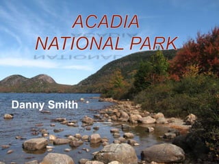
2. location
• The park is located in
North Eastern Maine on
the Atlantic Ocean.
• The majority of the
park’s terrain is located
on Mt. Desert Island,
about 150 miles from
Portland and 100 miles
from the Canadian
border.
3. Park History
• The area first was inhabited
by the Wabanaki people.
• In the fall of 1604, Samuel
de Champlain observed a
high-notched island
composed of seven or eight
mountains rising to bare-
rock summits from slopes
of birch, fir, and pine. He is
credited wit being the first
to discover the park
4. Park history
• Landscape architect Charles Eliot is credited with the idea for
the park. George B. Dorr, called the "father of Acadia," along
with Charles's father Charles W., the president of Harvard,
supported the idea both through donations of land and through
advocacy at the state and federal levels.
• It first attained federal status when President Woodrow Wilson,
established it as Sieur de Monts National Monument on July 8,
1916, administered by the National Park Service. On February
26, 1919, it became a national park, with the name Lafayette
National Park in honor of the Marquis de Lafayette, an
influential French supporter of the American Revolution.
• The park's name was changed to Acadia National Park on
January 19, 1929.
• It is the oldest National Park east of the Mississippi
5. Great fire of 1947
• Beginning on October 17, 1947, 10,000 acres of the park were
burned in a fire that began along the Crooked Road several
miles west of Hulls Cove.The forest fire was one of a series of
fires that consumed much of Maine's forest as a result of a dry
year. The fire burned until November 14, and was fought by the
Coast Guard, Army, Navy, local residents, and National Park
Service employees from around the country.
• Restoration of the park was supported, substantially, by the
Rockefeller family, particularly John D. Rockefeller, Jr.
Regrowth was mostly allowed to occur naturally and the fire
has been suggested to have actually enhanced the beauty of
the park, adding diversity to tree populations and depth to its
scenery.
6.
7. wildlife
• The park is home to over 40 different species of wildlife, including
red and gray squirrels, chipmunks, white-tailed deer, moose,
beaver, porcupine, muskrats, foxes, coyote, bobcats, and black
bears.
• Many other marine species have been observed in the
surrounding area and waters .Excavations of old Indian sites in
the Mount Desert Island region have yielded remains of the native
mammals. Although beaver were trapped to extinction on the
island, two pairs of beaver that were released in 1920 by George
B. Dorr at the brook between Bubble Pond and Eagle Lake have
repopulated it.
• The Great Fire of 1947 cleared the eastern half of the island of its
coniferous trees and permitted the growth of aspen, birch, alder,
maple and other deciduous trees which enabled the beaver to
thrive.
• Species that used to inhabit the island include the mountain lion
(or puma) and the gray wolf. It is thought that these predators
have been forced to leave the area due to the dramatic decrease
8.
9. Geological history
• Granite underlies most of
Acadia, including much of
Mount Desert Island, Isle au
Haut and all of the park on
SchoodicPeninsula. This
resistant bedrock makes up
the high elevations and steep
valleys that give the park its
rugged character. Granites at
Acadia vary slightly in texture,
color, percentages of
accessory minerals and
chemical, and a number of
sub-types have been
described and mapped
10. Geological history
• 500 million years ago, Mount Desert Island began taking shape on the
ocean floor. Erosion swept sediments from the North American
continental plate - sand, silt, and mud, and later volcanic ash and
seaweed, out to sea. There they slowly amassed and hardened into
what would become some of the island bedrock. Very large in size,
these sedimentary deposits were built and then leveled by the heat
and pressure of continental drift three times over the next 100 million
years.
• Magma, or molten rock, further transformed this sedimentary rock.
Churning and rising through the earth's crust, the magma eventually
weakened and consumed the overlying bedrock, producing diorite and
then the coarse-grained granite that defines much of the island today.
Later intrusions of magma created the dark basalt dikes that course
like thick veins through the Schoodic Peninsula section of the park.
For millions of years, until the onset of the Ice Age, erosion gradually
molded a single ridge of gently sloping mountains running from east to
west.
11. Geological history
• The biggest force that sculpted Acadia was the continental glaciers that
blanketed New England 2 to 3 million years ago. Many of the park's
features were carved out by the brute force of these immense sheets of
ice: Jordan and Long ponds, Echo and Eagle lakes, and the stunningly
beautiful Somes Sound, a narrow but deep inlet of seawater surrounded by
steep cliffs. The glaciers were staggering in weight and size; geologists
estimate their thickness at anywhere from 3,000 to 9,000 feet. Completely
refashioning the lay of the land, glaciers hewed out a series of 17 individual
mountains separated by U-shaped valleys running from north to south. The
last of the glaciers, the one whose imprint remains most visible on the
island today, advanced out of Canada around 100,000 years ago, crept
slowly across New England, and eventually spread 150 miles out to sea.
This glacier not only dug out deep valleys and lake basins, but also
engulfed and reshaped the mountain peaks, rounding and polishing the
northern slopes and fracturing the southern faces into a series of sheer
granite steps.
• As the ice sheet traveled, it gathered up large rocks and carried them
considerable distances. Known as erratics, these boulders can be seen at
the summit of Cadillac and South Bubble mountains, testimony to the
strength of the glaciers.
12. Geological history
• Climatic changes eventually halted the glaciers' progress
around 18,000 years ago. As the ice sheet receded, the ocean
advanced, flooding the valleys and cutting the island off from
the mainland. Acadia's coastal headlands had sunk beneath
the glaciers' crushing weight. But as the ice sheet receded, the
mountains and hills gradually rebounded and regained some of
their former stature. Nonetheless, due to melting of the polar
ice caps, the ocean is slowly overtaking the depressed land at
a rate of two inches every hundred years, creating a "drowned
coast.”
• The smaller islands that ring Acadia were once mountain
summits, just as the bays that surround them were once river
valleys. Everywhere Acadia reveals the imprint of the glaciers
that covered it 100,000 years ago. Today, the sea remains the
key agent of change at Acadia. Daily, it buffets the steep face
of Otter Cliffs, while polishing the pink and blue-gray
cobblestones at Little Hunters Beach, and grinding rock
particles finer still, mixing them with shell fragments, and
depositing them at Newport Cove, the only sand beach on
Acadia's coastline.
13.
14. Cadillac mountain
• At 1,532 feet, Cadillac Mountain is the highest point along
the North Atlantic seaboard and is the first place to view
sunrise in the United States from October 7 through March
6. It is one of over 20 mountains on Mount Desert Island,
Maine, that were pushed up by earth's tectonic and
volcanic forces millions of years ago. Were it not for the
once huge glaciers that sheared off their tops, they would
be even higher than what we see today. The northside is
on the left and the steeper slope or the down side is on the
right.
• Formerly known as Green Mountain, it was named
“Cadillac Mountain” in 1918 after French explorer Antoine
Laumet de la Mothe, sieur de Cadillac
16. Somes sound
• Its deepest point is
approximately 175
feet, and it is over 100
feet deep in several
places. The sound
almost splits the island
in two. While often
described as the "only
fjord on the East
Coast”, it lacks the
extreme vertical relief
and anoxic sediments
associated with
Norwegian fjords, and
is now called a fjard
by officials, a smaller
drowned glacial
embayment.
17. Somes sound history
• Repeated glaciations during the past two million years have eroded and
deepened Somes Sound more than the adjacent mountains. About
14,000 years ago, the edge of the melting glaciers stood at the mouth of
Somes Sound, and the other ponds of Mt. Desert Island, long enough to
build a morainal deposit of boulders, sand and mud up to 10 m high in
The Narrows. Because of the enormous weight of the glacier, the crust of
Maine was depressed under their load, and ocean water flooded Somes
Sound after the ice retreated. Once the great ice sheet had melted, the
land rebounded to its "normal" elevation, and the sound became a lake.
• By about 7,000 years ago, the ocean had risen to the elevation of the
moraine in The Narrows and eroded shorelines into it. The ocean kept
rising and eventually topped the moraines and the lake became marine.
Meanwhile, as the organic matter from the lake became buried by marine
mud, bacteria consumed the plant remains and generated methane. The
methane continues to escape to this day, and its escape has formed the
large depressions (pockmarks) on the bottom of the sound.
18. Otter cliff
• At 110 feet high, it is
one of the highest
headlands north of
Rio de Janeiro.
• Over countless
centuries, the rocks
have been pounded
by the sea and
eroded by both water
and against each
other after being
deposited by huge
glaciers that once
moved across the
land here on the
island