Mount Pelly Cambridge Bay Nunavut - Ovayok
•Download as PPT, PDF•
0 likes•207 views

Esker landmark Cambridge Bay Nunavut Kitikmeot

Recommended
More Related Content
What's hot
What's hot (20)
Similar to Mount Pelly Cambridge Bay Nunavut - Ovayok
Similar to Mount Pelly Cambridge Bay Nunavut - Ovayok (20)
Recently uploaded
Recently uploaded (20)
Mount Pelly Cambridge Bay Nunavut - Ovayok
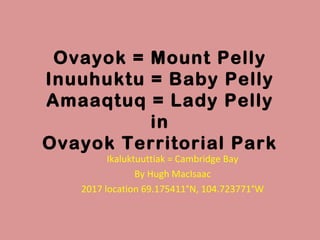
- 1. Ovayok = Mount Pelly Inuuhuktu = Baby Pelly Amaaqtuq = Lady Pelly in Ovayok Territorial Park Ikaluktuuttiak = Cambridge Bay By Hugh MacIsaac 2017 location 69.175411°N, 104.723771°W
- 6. Who was Pelly? Sir John Henry Pelly (1777-1852) an Englishman, a Governor of the Hudson's Bay Company. His parents Captain John Hinde Pelly (1744–1818) and mother Sally Hitchen Blake worked for the East India Company. Several landforms were named in his honor. In Saskatchewan, the HBC post, Fort Pelly bears his name, as well as the unincorporated Town of Pelly. In the Yukon, Pelly Banks, Pelly Crossing, Pelly Formation, Pelly Lakes, Pelly Mountains, and the Pelly River bear his name. In the Northwest Territories, these include Pelly Island and Pelly Lake. And in Nunavut, there is Mount Pelly, Pelly Bay, and Pelly Point.
- 7. Ovayok is a hill of glacial till covered with lichen and little ground cover. The moss has the strangest brown date seed fruit that hangs over the leafy green and plants like thyme. There are many arctic blooms in summertime. The wind can blow incredibly and when it stops, there are swarms of mosquitos. Ovayok. He was a giant traveling with baby Pelly, and lady Pelly. Once upon a time they lay down in this area to die. You can see the beach striations that look like layers on the hill of Ovayok. His ribs are formed from ephemeral streams that flow down his sides. From the top of this hill the land rolls out flatly. The view clearly shows the horizon and curvature of the earth.
- 9. Ovayok, Inuuhuktu and Amaaqtuq are Eskers. Ovayok is tall = 183m. One can see the ribs of the giant on the sides of Ovayok. Inuit Legend tells a tale of tragedy. This family of giants crossing Victoria Island were starving and looking for food. Poor Ovayok died first, then son Inuuhuktu and then the mother Amaaqtuq (packing baby).
- 10. What is an Esker? AN ESKER IS A LONG, narrow, often snakelike ridge of sand and gravel deposited on top of the ground where a glacier has retreated. Most eskers are a single ridge, but there are also braided ridges, similar in shape to river tributaries. The esker got its name from an Irish Gaelic word, eiscir, which means “ridge of gravel.”
- 11. Eskers range from a few meters high to over 200m high. However, most are 30m or less. Some are a few km long, and others can be as long as 500 km. You may think of an esker formed of glacial till, till of sand and gravel, deposited on the bottom of an in-ice river.
- 13. Eskers are used by animals to travel on because they are usually dry and raised above the muskeg or tundra and good den sites. Nunavummiut use eskers for camping, viewing wildlife, burial sites, ceremonial sacred places and as landmarks for travelling. Next slide view of Ikaluktutiak, serenity and beauty, … see all over!
- 15. GEOMORPHOLOGY Words A Lateral Morraine - parallel ridges of debris deposited along the sides of a glacier or alluvial fan. B Kame Terraces – beside a melting glacier, sand and gravel deposited in lakes that slump down on the valley sides. C Glacial Till - Material ground and melted out and deposited underneath the glacier ice. D Eskers - Sinuous ridges of gravel and sand that form below tunnels under the ice. E Kames - Hills of gravel and sand formed when the Moulin/glacial mill, drains water through the ice. F Kettles - Circular holes in the kame terraces form when ice blocks left in the sediment melt Strand lines - high water mark Diamicton – poorly sorted sediment, till. Crag and Tail – plucked rock and smooth tail shows movement of ice. Flutings - Drumlins – form under ice, show direction smooth tail see photo Pingos - hydro laccolith Scours – erosion by glacial action Depressions called "moulins" form on top of the glacier, where melt water funnels down to the base of the ice. Rivers of ice and lakes in the ice.
- 17. At one time the 3 giants were joined, it was one large long esker. Erosion has separated them. The weight of 1 km thick ice has melted off the land, the land has rebounded up, isostatic rebound. The ocean levels have dropped showing beach ridges; evident on Ovayok. One can sometimes see shells on the land among the moss.
- 19. The North East side of Ovayok has 2 lakes, a few cabins and abandoned cabins. Good Char fishing to the North. Blueberries grow on the northeast side but seldom ripen that area. Inuit forebears are believed to have inhabited the area since 1000 years ago. Ancient tent circles and artifacts are found in the area. Grizzly bear have been spotted in the area 2 years ago.
- 20. Mt Pelly Past beach strand lines
- 21. Ribs of the giant
- 27. Glacial polish
- 28. Drumlins
- 33. Hide
- 37. Searching on Lady Pelly
- 44. THE END
Editor's Notes
- Atop Mt Pelly
- Whale Cove area, showing old tent ring.