2. What do you think our
region would be?
What characteristics
define our region?
3. T-Chart: Atlantic Canada
Physical Features
• Gros Morne National Park
(Nfld)
• Fundy Bay
• Mt. Carleton
• Poley Mountain
• Hopewell Rocks
• Fjords (Gros Morne)
• Les marais de Sackville
• Sable Island
• Kejimkujik
• Cape Breton/ The Cabot Trail
Cultural Features
• Bridge to PEI
• Fort Lawrence
• Fort Beausejour
• The Causeway
• Halifax harbor
• Hartland covered bridge
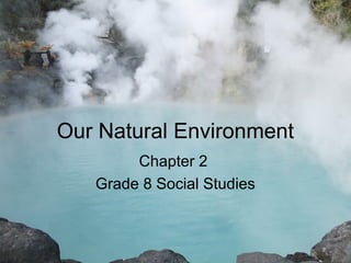
4. Atlantic Canada as a Region
Canada, with its area of 9 984 670 km², is the second
largest country in the world. In a country so large,
people in one area may have little contact with those
who live in another area. As a result, people often
identify most closely with those who live in a region
close to their local community.
Geographers define a region as an area that shares
common features that make it different from other
areas. These features may include…
Language, ways of making a living, cultural
expressions, physical environment, climate, or
location.
5. The Atlantic Provinces As a Canadian
Region
New Brunswick, Nova Scotia, Prince
Edward Island and Newfoundland &
Labrador make up the Atlantic Region
of Canada. They are known as the
Atlantic provinces because their
shores border on the Atlantic Ocean.
These provinces are also grouped
together because they are located next
to each other and can be identified by
certain physical features.
6. How Large Is Atlantic Canada ???
Region Province Area (km²)
Atlantic Newfoundland & Labrador 405 212
Prince Edward Island 5 660
Nova Scotia 55 284
New Brunswick 72 908
Central Quebec 1 542 056
Ontario 1 076 395
Prairie Manitoba 647 797
Saskatchewan 651 036
Alberta 661 848
Pacific British Columbia 944 735
Northern Territiories Yukon 482 443
Northwest Territories 1 346 106
Nunavut 2 093 190
Canada 9 984 670
9. Food for thought.
• “Daylight Savings Time” - All provinces in
Canada, except for Saskatchewan, move
their clocks forward by one hour in the
spring.
• It is not considered practical in
Saskatchewan. Why do you think this is?
10.
11. Time Zones – What ????
Oreo Cookie Commercial
http://www.youtube.com/watch?
v=Yl95nIN3Jx8
Review Presentation – Time zones
Atlas, pg. 52
12. Landforms In Atlantic Canada
• Much of Atlantic Canada is known for
its rugged terrain, dotted with
thousands of lakes and ponds, and its
coastline, broken with bays and inlets.
Nevertheless, the region has a wide
variety of physical features.
13. In Northern New Brunswick, much of the
land is hills and mountains.
* A mountain can be defined as a mass of
land that is significantly higher (600 meters
or more ) than the surrounding area.
14. The highest land in Nova Scotia is found on
Cape Breton Island. Other parts such as the
Springhill to Stellarton and Annapolis Royal
to Windsor areas are also hilly.
In Prince Edward Island, the highest land is
found in the hills of the central region.
The most striking physical feature in
Newfoundland are the Long Range
Mountains which run along its western side.
15. The mountains in Newfoundland are part of the
Appalachian Mountains, which extend across the
rest of the Atlantic region and into the United
States as far south as the state of Georgia.
These mountains were formed by folding – a
bending of the earth’s crust.
They were once high and jagged, but over the last
300 million years erosion has reduced them to low
mountains and rolling hills.
video
16.
17.
18. New Brunswick’s Highest Peak
• Mount Carleton
• 1st
highest point in our
region.
• Elevation = 817m
21. Tallest Mountain In the World
• Formed 60 million
years ago
• 8850 meters
• Summit separates
Nepal & Tibet (India)
• First climbed 1953
• Corpses remaining on
Everest: 120
• Most cause of death:
avalanches
23. The Power of a Glacier
• A fiord is a long, narrow inlet of the sea,
bordered by steep mountain slopes.
• Fiords are found along the coast of
Labrador.
• Fiords were formed during the ice age
when glaciers scoured these valleys,
changing the V-Shape of the valley to a U-
Shape.
• Once the ice melted, the fiord was filled
with water.
25. Fiords
Page 25
<< TEXT >>
Figure 2.9
Describe the
sequence in the
development of a
fiord
( 3 stage process)
26. Explore our Region
Use the following chart to research places in the
Atlantic Region. Choose a place/town in each
province of the Atlantic provinces – and find what
physical/natural features define them.
Example: Lunenburg, NS
Find absolute location, landforms, water forms,
natural resources, climate and transportation links
in and out of the area
27. Unit Review
Province PEI Nwfnld NS NB
Place Name:
Location
Landforms
Water forms
Nat. Resources
Climate
Transportation
31. • Swamps:
Occur where
water collects
in pools. In
forested
areas,
swamps
contain
mature trees
such as black
spruce.
32. • Lake:
A large body
of water that
is completely
surrounded
by land.
33. • Bogs:
Composed
mainly of
peat, a thick
mass of
decomposing
plants. Within
bogs -
mosses, low
shrubs and
black spruce
grow. Bogs
are only fed
by rain or
snow.
36. • Rivers:
Is a long,
narrow body of
water that flows
in a channel
from high to low
land and
empties into a
body of water
such as an
ocean or a lake.
37. • Wetlands:
Areas that are
waterlogged;
They are neither
solid ground nor
open water.
May take the
form of bogs,
fens, swamps,
or marshes.
38. • Bay:
A body of
water partly
surrounded by
land and
having an
opening to the
sea.
39. Review
• Define « Region »?
• Atlantic Provinces – 4 provinces
– Why are they called that?
• Area of Canada, compared to the rest of the
world?
– largest prov./terri., smallest prov./terri., N.-B.?
• Time Zones
– World?... In Canada?
• Name the time zones in Canada
– Who invented time zones?
– Why does Newfoundland have their own time zone?
40. Review
• Definition of a mountain
• Fiord – definition
– Know the diagram of the formation of a fiord –
before / during / after glaciation
• Different water forms in Atlantic Canada