
Recommended
More Related Content
What's hot
What's hot (19)
Similar to Geological Evidence in the San Francisco Bay Region
Similar to Geological Evidence in the San Francisco Bay Region (20)
Recently uploaded
Recently uploaded (20)
Geological Evidence in the San Francisco Bay Region
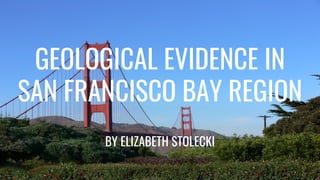
- 1. GEOLOGICAL EVIDENCE IN SAN FRANCISCO BAY REGION BY ELIZABETH STOLECKI
- 2. San Francisco Bay Region The San Francisco Bay region is underlain by some of the most complex and active geology in the world. The earth here is made up of everything from iron- and magnesium-rich rocks formed deep in the interior of our planet to sand and gravel recently deposited by our streams and rivers. All of these rocks are constantly being bent and tilted by the forces that also drive our San Andreas, Hayward, and other faults. The same forces that cause earthquakes have shaped the landscape that makes the region unique: the hills, the valleys, and the Bay itself. That landscape is still being formed, the Earth's forces driving hills and mountains up, rain and gravity dragging them back down, sometimes in massive landslides or dangerous flows of mud and debris. *Image shows current formation of the Bay Area from an ariel view (Google Maps)
- 3. The Bay in the Beginning ● The bay is very young on a geological time scale—just 10,000 or so years old. (Hindberg,1993) ● 20,000 years ago San Francisco Bay was a series of broad, dry valleys within the Coast Ranges. (Hindberg, 1993) ● With much of Earth’s water frozen in glaciers, the sea level was much lower than it is today and more land was exposed. ● An enormous inland sea called Corcoran Lake covered what is now the Central Valley. *Image shows California coastline 14,000 years ago.
- 4. Forming the Bay ● As the ice age ended about 10,000 years ago, the glaciers began to melt and the Sacramento and San Joaquin rivers carried huge flows of water and sediment down from the Sierra Nevada Mountains. (Eisenhart, 2001) ● Sea levels began to rise, and water entered the Coast Ranges through the Golden Gate. San Francisco Bay began to fill with seawater at the rate of about one inch per year, a rapid fill in a geologic time frame ● On the gentle slopes of the South Bay, the seawater advanced southward by several inches each day. ● After a few thousand years, the rate of rising sea levels began to slow. Sediments from area rivers began to accumulate along the shallow shores of the new bay, creating marshes and mudflats that supported plant and animal life. *Photos show Bay Area pastime and formations
- 5. The Bay Today ● Since its birth, San Francisco Bay has been a defining feature of our region. ● The region is continually evolving—through natural processes as well as human influence. ● Over the last 150 years humans have greatly altered the landscape and continue to do so. ● Sea level, as a result of climate change, is expected to rise 16 inches by 2050, which will also raise the level of the Bay. (Bailey & Howernd, 2012)*Photo shows the sea level rise in San Francisco from 1850-2010
- 6. Ferns ● Point Reyes is home to 13 species of ferns including the five-finger fern, California maiden-hair, wood fern, and bracken. ● At Pinnacles ferns live in both the wet and very dry parts of the park. ● A fern is any one of a group of about 20,000 species of plants classified in the phylum or division Pteridophyta, also known as Filicophyta. (Cordez, 2009) ● With about 12,000 species, they are by far the largest group of seedless vascular plants. (Cordez, 2009) ● Unlike many other vascular plants, ferns do not have seeds or flowers but instead reproduce through spores. *Image is of a California Fern from Point Reyes.
- 7. Evolution of Ferns ● Ferns are one of the earth's oldest inhabitants. ● The ferns constitute an ancient division of vascular plants, some of them as old as the Carboniferous Period, beginning about 358.9 million years ago, and perhaps older. ● Millions of years ago the “button fern” had ancestors covering the world before the age of dinosaurs. ● Eons of time passed and great oceans submerged the fern forests. ● Compression and volcanic activity on layers of sediment eventually created today's world-wide beds of fossil fuel. ● Ten thousand species of ferns exist in the world today.
- 8. California Sea Lion ● With a plentiful supply of food from the Bay and an environment protected from predators, the PIER 39 Marina proved to be an ideal living situation for the sea lions. ● California sea lions are known for their intelligence, playfulness, and noisy barking. ● Their color ranges from chocolate brown in males to a lighter, golden brown in females. ● California sea lions are opportunistic eaters, feeding on squid, octopus, herring, rockfish, mackerel, and small sharks. ● In turn, sea lions are preyed upon by Orcas (killer whales) and great white sharks. *The photo above is of California Sea LIons at Pier 39 in San Francisco, CA (Ghetty images)
- 9. Evolution of California Sea Lion ● A few California sea lions began “hauling out” on PIER 39’s K-Dock shortly after the Loma Prieta earthquake hit San Francisco in October 1989. ● By January 1990, the boisterous barking pinnipeds started to arrive in droves and completely took over K-Dock, much to the exasperation of PIER 39’s Marina tenants. ● Sea lions migrate to areas across the Pacific Coast, from Vancouver to the southern tip of Baja. Most pups are born on the Channel Islands located off Southern California in June. ● Although once depleted, California sea lion populations have rebounded due to the protections afforded by the Marine Mammal Protection Act. ● Of the five species of sea lions worldwide, the California sea lion is the only one whose population is expanding. Other species are either in decline or limited to very small populations. ● Their population is growing steadily, and California sea lions can be seen in many coastal spots such as the Monterey Coast Guard jetty and PIER 39 in San Francisco.
- 10. Castle Rock State Park ● An outstanding feature of Castle Rock State Park are the sculpted rock outcrops that are found in many areas of the park, but primarily along Castle Rock Ridge. ● These rock outcrops, called bosses by geologists, are formed from very thick layers of Vaqueros Sandstone which have been exposed at the surface. ● The smooth and rounded rock shapes are interrupted by unique formations called collectively tafoni. ● Geologists believe that finger pockets to whole cave systems are carved out of the rock by a chemical “cavernous weathering” process which occurs because of the rock, rainwater, and the wet winters and dry summers of California’s Mediterranean climate. *This photo was taken at Castle Rock State Park. It shows the very interesting rock outcrops.
- 11. Evolution of Castle Rock State Park ● It passes natural rock formations; these are huge rocks that have cavernous holes and gorgeous natural shapes. ● The park’s Vaqueros sandstone is a sedimentary rock that is similar to mortar. ● It is formed of large-grained sand held together with a cementing material, primarily calcium carbonate. ● Over time, perhaps hundreds of years, the crust grows harder and harder as more and more cementing material is moved from the interior to the exterior. ● This results in ever-enlarging caves, some of which are as much as 15 to 20 feet wide, 10 to 12 feet high and 8 to 10 feet deep. (Langdoc, 1997) ● The cementing calcium carbonate is not evenly distributed, nor is it uniform in concentration or chemical content. This helps to account for the unending variety and size of the sculpturesque formations and surfaces found in the park’s rocks.
- 12. * The map and cross section show the distribution of the five major Franciscan rock units that underlie San Francisco. San Francisco rests on a foundation of Franciscan rocks. Although there are many different types of Franciscan rocks, they share a common parentage in that they were all brought together in the Franciscan subduction zone during the collision between the Farallon plate and the North American plate in Jurassic and Cretaceous time from 65 to 175 million years ago. (Nessar, 2001)
- 13. San Francisco Mint ● The San Francisco Mint is located on the top of a hill with steep serpentine slopes dropping off on three sides. ● Considerable weathering has caused the rock slopes to unravel to the point where the property was threatened. ● There are dark green blocks of serpentine, almost as big as boulders held in zones of lighter green, greasy-feeling, fine-grained serpentine. ● Since this rock must be faulted to be brought to the surface, it's appearance is characterized by intense deformation. ● One distinctive feature of serpentine are "slickensides". You may find chunks of serpentine with tiny grooves on one side. These grooves come from the pressure of rocks grinding past one another in a fault zone. ● You will also notice small white veins throughout the rock. These veins formed when hot water shot through the rock deep inside the earth's crust. *At the San Francisco Mint you see outcrops of blue-gray, jumbled rock. This is serpentine.
- 14. The Colma Formation ● The Colma is mostly comprised of sandy deposits laid down between 80,000 and 120,000 years ago, during the last major interglacial period. ● The origins of the poorly consolidated Colma sands are unclear, but they appear to represent shallow bay-to-dune, and valley-fill debris deposits. ● The formation extends under the San Francisco Bay and may be found as high as 500 feet above sea level. ● High sea levels, produced when much of the ice on the continents melted, allowed shallow marine rocks to be deposited on parts of the San Francisco Peninsula at that time. ● The rocks are mostly of shallow bay origin below the 200 foot elevation contour and are valley slope-debris at higher elevations * Silty deposits of the Colma Formation form low bluffs at the north end of Baker Beach.
- 15. Alcatraz Island ● The whole San Francisco Bay is located on a complex of rocks called Franciscan, because they formed in a homonymous ancient subduction zone that existed since early Cretaceous. ● Alcatraz Island is one of several islands in the San Francisco Bay that show us interesting variations of the Franciscan Complex rocks of several different terrains. ● The Alcatraz terrane is characterized by thick bedded sandstones. ● During the glacial stages of the Pleistocene, when sea level was exceptionally low, there was no water in San Francisco Bay and Alcatraz Island was connected by land to San Francisco ● The steep cliffs on the southwest shore of Alcatraz Island are formed from thick beds of the Alcatraz sandstone. *Alcatraz Island is the best place in the Bay Area to see the Alcatraz terrane of the Franciscan. This photo was taken on the east side of Alcatraz
- 16. The Law of Original Horizontality Layers of shale exposed in a road cut along the Mt. Hamilton Road in Santa Clara County were probably originally formed from clay-rich sediments deposited in deep water. With time the mud was compacted and cemented into shale. The law of original horizontality suggests these strata were originally flat lying. Tectonic forces subsequently tilted the rocks, possibly concurrent with the uplift of the Coast Ranges. The law of superposition says that lower areas will fill in first, with younger sedimentary deposits accumulating on top (oldest rocks on the bottom, youngest on top). *Photo taken at Mt. Hamilton Road in Santa Clara County
- 17. Angular Unconformity The southeast Bay Area hills contain two juxtaposed Mesozoic terranes, the Franciscan melange and the Coast Range Ophiolite with the overlying Great Valley Sequence. These rocks are overlain by Cenozoic strata along a faulted angular unconformity. Early Cenozoic rocks (older than middle Miocene) are present only as fault slivers in the area, but well developed Miocene and Pliocene rocks and four distinct mapped units of Plio-Pleistocene gravels are extensive in the area. *This diagram shows a map of the San Francisco Bay Area showing the location of the southeast Bay Area hills, as well as the general trend of major faults and the Silver Creek thrust An angular unconformity is an unconformity where horizontally parallel strata of sedimentary rock are deposited on tilted and eroded layers, producing an angular discordance with the overlying horizontal layers. The whole sequence may later be deformed and tilted by further orogenic activity. *Above is a diagram of angular unconformity
- 18. References PART 1 ● Ferns. (n.d.). Retrieved August 10, 2018, from https://www.nps.gov/pore/learn/nature/ferns.htm ● Geology. (n.d.). Retrieved August 12, 2018, from http://www.sfnps.org/geology ● Geology of Lake Merced. (n.d.). Retrieved August 06, 2018, from http://www.lmtf.org/FoLM/Data/SFSUReports/geology.htm ● History.com Staff. (2009). San Francisco. Retrieved August 03, 2018, from https://www.history.com/topics/san-francisco ● Introduction to Geology. (n.d.). Retrieved August 12, 2018, from http://geologycafe.com/class/chapter2.html ● Kiehn, D. (2017, June 28). Alcatraz Island: A History of 'The Rock' On-Screen. Retrieved August 09, 2018, from https://www.kcet.org/shows/artbound/alcatraz-island-a-history-of-the-rock-on-screen ● Kinematics of syn-tectonic unconformities and implications for the tectonic evolution of the Hala'alat Mountains at the northwestern margin of the Junggar Basin, Central Asian Orogenic Belt. (2014, September 09). Retrieved August 08, 2018, from https://www.sciencedirect.com/science/article/pii/S167498711400111X
- 19. References PART 2 ● Plant Species Lists | Point Reyes National Seashore Association. (n.d.). Retrieved August 12, 2018, from http://www.ptreyes.org/activities/plant-species-lists ● Plants of the Presidio of San Francisco. (n.d.). Retrieved August 12, 2018, from https://www.inaturalist.org/guides/604 ● Recommended Plants. (2014, March 11). Retrieved August 08, 2018, from https://www.sfparksalliance.org/our-work/stewardship/street-parks/recommended-plants ● Rocks and Geology in the San Francisco Bay Region. (n.d.). Retrieved August 12, 2018, from https://pubs.usgs.gov/bul/2195/ ● ROCKS AND LAYERS. (n.d.). Retrieved August 05, 2018, from https://pubs.usgs.gov/gip/fossils/rocks-layers.html ● Sea Lions and The Sea Lion Story. (n.d.). Retrieved August 07, 2018, from https://www.pier39.com/the-sea-lion-story/ ● The Colma Formation. (n.d.). Retrieved August 11, 2018, from https://www.nps.gov/prsf/learn/nature/the-colma-formation.htm