5 themes of geography
•Download as PPTX, PDF•
4 likes•3,623 views

This document outlines the 5 themes of geography which provide an effective framework for teaching geography. The 5 themes are: 1) Location, which identifies places on Earth using coordinates and relative location. 2) Place, which describes the human and physical characteristics of locations. 3) Human-Environment Interaction, which considers how humans adapt to and modify their environments. 4) Movement, which studies migration and transportation across places. 5) Region, which divides the world into meaningful geographic units based on characteristics like boundaries, connections, or perceptions.

Recommended
More Related Content
What's hot
What's hot (20)
Viewers also liked
Similar to 5 themes of geography
Similar to 5 themes of geography (20)
More from Roi Fernandez
More from Roi Fernandez (20)
Recently uploaded
Recently uploaded (20)
5 themes of geography
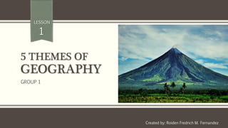
- 1. 5 THEMES OF GEOGRAPHY Created by: Roiden Fredrich M. Fernandez LESSON 1 GROUP 1
- 2. Provides an effective organization of the teaching of geography. Provides an organizing framework for the presentation of geographic materials. Adopted in 1984 by the National Council for Geographic Education and the Association of American Geographers Five Themes of Geography
- 3. Five Themes of Geography
- 4. 1. LOCATION used to identify a point or an area on the Earth’s surface or elsewhere. Location can be absolute or relative. THEME 1
- 5. Latitude Latitude (shown as a horizontal line) is the angular distance, in degrees, minutes, and seconds of a point north or south of the Equator. Lines of latitude are often referred to as parallels.
- 6. Longitude Longitude (shown as a vertical line) is the angular distance, in degrees, minutes, and seconds, of a point east or west of the Prime (Greenwich) Meridian. Lines of longitude are often referred to as meridians. .
- 8. Absolute Location A location can be absolute (specific) as in coordinates of a map using longitude and latitude Example: Coordinates of CMULHS 7° 51′ 2″ N, 125° 2′ 59″ E (Read as 7 degrees 51 minutes 2 seconds NORTH And 125 degrees 2 minutes 59 seconds EAST)
- 9. Relative Location Relative location is the location of a place relative to another place (ie south, north, downhill, or uphill.)
- 10. 2. PLACE Describes the human and physical characteristics of a location. THEME 2
- 11. Physical characteristics Includes a description such things as the mountains, rivers, beaches, topography, and animal and plant life of a place.
- 12. Human characteristics Includes the human-designed cultural features of a place, from land use and architecture to forms of livelihood and religion to food and folk ways to transportation and
- 13. 3. HUMAN-ENVIRONMENT INTERACTION This theme considers how humans adapt to and modify the environment. Humans shape the landscape through their interaction with the land; this has both positive and negative effects on the environment. THEME 3
- 14. Examples of Human-Environment Interaction Winter Summer Places attracts people for different reasons. Wearing light clothing in hot places and warm clothing for cool places.
- 15. 4. MOVEMENT This theme studies movement and migration across the planet. THEME 4
- 16. Examples of Movement Migration of Homo Sapiens Transportation
- 17. 5. REGION Region divides the world into manageable units for geographic study. Regions have some sort of characteristic that unifies the area. Regions can be formal, functional, or vernacular. THEME 5
- 18. Formal Region Formal regions are those that are designated by official boundaries, such as cities, states, counties, and countries. For the most part, they are clearly indicated and publicly known.
- 19. Functional Region Functional regions are defined by their connections. For example, the Regions of the Philippines.
- 20. Vernacular Region Vernacular regions are perceived regions, such as "The South," "The Midwest," or the "Middle East;" they have no formal boundaries but are understood in our mental maps of the world. Examples; 1. Citizens of the United States are generally known as Americans from America. 2. Filipino’s speak Tagalog