
Recommended
Recommended
More Related Content
Similar to Enticer Trail: Road-to-Trail Conversion
Similar to Enticer Trail: Road-to-Trail Conversion (20)
Recently uploaded
Recently uploaded (20)
Enticer Trail: Road-to-Trail Conversion
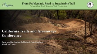
- 1. From Problematic Road to Sustainable Trail Enticer Flow Trail: Road-to-Trail Conversion California Trails and Greenways Conference Presented by: Andrew Pellkofer & Nate Knudsen March 28th, 2018
- 2. From Problematic Road to Sustainable Trail Enticer Flow Trail: Road-to-Trail Conversion Principal: TRAIL Laboratories Graduate Student: Chico State University Parks & Recreation Dept. Background B.S. Environmental Mgmt. & Protection M.A. Parks & Rec. Administration (2018) Watershed Mgmt. & Restoration Specialist Equipment Operator Andrew Pellkofer
- 3. From Problematic Road to Sustainable Trail Enticer Flow Trail: Road-to-Trail Conversion Nate Knudsen Executive Director: Redding Trail Alliance Owner: 2K Creative Background Riding MTB since 99’, recovering illegal trail builder, dog owner, and all around nice guy
- 4. Forest Roads Trails by default Familiar trail experience?
- 5. From Problematic Road to Sustainable Trail Enticer Flow Trail: Road-to-Trail Conversion What if we tried something different?
- 6. A Common Tread Provide access, not a quality experience What it used to look like…
- 7. A Common Tread Additional management issue, low quality experience It had sweet jumps too!
- 8. Forest Roads There’s a lot out there Coghlan, G.; Sowa, R. National Forest Road System and Use (Draft Report); USDA Forest Service: Washington, DC, USA, 1998 USDA Forest Service Road Management: National Statistics Non-System • ~ 130,000 additional miles (60K not inventoried) • Outside of FS planning process • Not built to technical or engineering standards System • 370,000 miles • $8.4 billion dollar maintenance backlog • 20% provided annually
- 9. Forest Roads There’s a lot out there Coghlan, G.; Sowa, R. National Forest Road System and Use (Draft Report); USDA Forest Service: Washington, DC, USA, 1998 USDA Forest Service Road Management: California Statistics Non-System • 4,430 miles • ~7,560 miles non-inventoried System • 44,200 miles • Level 2: 24,600 miles • Level 1: 6,730 miles potential for trails?
- 10. Forest Roads Case Study in Detection: Swanton Pacific Ranch – Cal Poly White.R.A, Dietterick, B.C., Mastin.T., and Strohman.R. (2010) Forest Roads Mapped Using LiDAR in Steep Forested Terrain. Remote Sensing, 2(4), 1120-1141 Legacy roads, skids, and trails : 18 miles!! Forest Roads Mapped Using LiDAR in Steep Forested Terrain Area: 2.03 sq.mi. Active roads: 2.48 miles
- 11. Forest Roads Built like this until 1975!! Photos: Cal Fire
- 12. Forest Roads 1973 Forest Practices Act helps change things Photos and Figures: Pacific Watershed Associates
- 13. Forest Roads Influence on hillslope hydrology Corridors for travel, become corridors for water Photo: Pacific Watershed Associates Subsurface flow Intercepted by road Capture and concentration Delivery to waterways?
- 14. Forest Roads An overwhelming and underfunded management issue Potential negative results… Photos: Pacific Watershed Associates
- 15. Forest Roads An overwhelming and underfunded management issue Research: Source: Cal Fire • Legacy roads that predate current Forest Practice Rules and Forest Service BMP’s are major sources of sediment • Roads often produce at least 2/3 of management related sediment in forest watersheds Figure: MacDonald and Others 2004
- 16. Forest Roads A hidden opportunity? A resource issue becomes a recreation opportunity…
- 17. Trails for Play Arguably the most common non-system MTB trail type Commonly missing from most trail systems …can we address watershed health and illegal trail building with conversion of legacy roads? • Lack of knowledge • Too much risk • No relationship with land manager • Require a lot of soil
- 18. Buried Treasure Soil for days Jumps, rollers and berms require A LOT of soil… Photos and Diagrams: Pacific Watershed Associates …and these roads have it!
- 19. From Problematic Road to Sustainable Trail Enticer Flow Trail: Road-to-Trail Conversion Let’s examine the potential! Project Location & History
- 20. Location Redding, CA. Photo: Redding-Real-Estate Photo: Visit Redding Photo: Visit Redding
- 21. A Long History of Mountain Biking Redding, CA. Photo: cbklunkers Photo: cbklunkers Photo: Unknown Photo: ibiscycles
- 22. A Long History of Mountain Biking Redding, CA. Photo: shastalemurian Photo: shastalemurian Photo: anewscafe
- 23. Building the Foundations for an Active Community Trails, trails, and more trails
- 24. The Results A LOT of trail, very similar experience
- 25. Trail Stewardship Redding Trail Alliance Mission To create high quality trail experiences by advocating for, building, and maintaining trails which are progressive, diverse, and promote community
- 26. Swasey Recreation Area Location Map
- 27. Analysis of Trail Experiences Swasey Recreation Area Miles of Trail by Difficulty, Primary User Experience, and Trail Class Swasey Recreation Area, Redding CA. Primary User Objective Difficulty and Trail Class Miles Singletrack - Black Singletrack - Green Mixed - Green Machine Built - Blue Machine Built - Green Double Track - Blue 0 2 4 6 8 10 12 14 16 18 Challenge Escape Play
- 28. Trail User Objective A Missing Experience at Swasey Recreation Area Play Progression Risk Variety
- 29. Trail Specific Planning Conceptual Design
- 30. Trail Specific Planning General Examples of Trail Features Types Photos and Diagrams: BLM Guidelines to a Quality Trail Experience
- 31. Trail Design Traditional Approach Diagram: Pacific Watershed Associates Diagram: CA State Parks Diagram: CA State Parks
- 32. Trail Design Traditional Approach Photos: Pacific Watershed Associates
- 33. Trail Design An Alternative Approach • All skill levels • Insloped tread • Convex shape • Single or progressive radius Berm Turn • Add length • Control speed • Improve drainage • Good solution for steeper sections of road Berm Turn
- 34. Trail Design An Alternative Approach Tabletop Jump • All skill levels • Progression • Multiple lips (take-off) • Air time not mandatory Tabletop Jump • Control speed • Improve drainage • Oversized grade reversal • Good for lower to moderately steep sections of road
- 35. Trail Design An Alternative Approach Gap Jump • Advanced skill level • Mandatory (mostly) • High challenge • Optional line Gap Jump • Control speed • Improve drainage • Oversized grade reversal • Good for lower to moderately steep sections of road
- 36. Trail Design An Alternative Approach • All ability levels • Spacing controls experience (jump, manual, pump) Rollers • Improves drainage • Waterbar / crossdrain • Good for lower gradient or flat sections Rollers
- 37. Field Design Site Assessment & Construction Planning Opportunities Available soil in fill slope Short low grade segment Good backslope for berm Issues Entrenched tread Poor drainage Increasing average grade Roller Berm turn Drain Harvest soil for features, export extra Solutions
- 38. Field Design Site Assessment & Construction Planning Solutions Drain Harvest soil for features, export excess Back to back berms Tabletop jump Opportunities Available soil in fill slope Good backslope for berm Available soil in jump Issues Entrenched tread Poor drainage Steep overall gradient User built feature Narrow corridor
- 39. Construction Standards IMBA Trail Solutions
- 40. Construction Standards Forest Road Best Management Practices (BMP’s)
- 41. From Problematic Road to Sustainable Trail Enticer Flow Trail: Road-to-Trail Conversion Construction Team Timing Equipment Field Application
- 42. Construction Planning Knowledgeable operator(s) • MTB specific experience • Familiar with BMP’s and forest road construction Team Experienced trail crew • MTB specific experience • Good riders • Shaping talent is a must
- 43. Construction Planning Timing Soil Moisture Figures: Soil Compaction Handbook - MultiQuip Proper soil moisture • 11% of dry weight • Hand test Protect resources • Spring is best • Becoming more important to consider
- 44. Construction Planning Equipment Type • Excavator(s) • Tracked haulers • End dump trucks • Dozers? • Plate compactors Size • Road size • Design requirements
- 68. Results Project Costs Distance: 1.0 mile Labor: $19,865 Equipment: $8,489 Supplies & Materials: $1,182 User Data (online survey & trail counter) Passes/day: 50 50% - respondents from out-of-area 62% - intermediate riders 51% - very high quality experience (40% rate high) 84% - would like to see more trails like this Age of Users Frequency of Use
- 69. Special Thanks Brian Sindt Bill Kuntz Shawn Stapleton Photos & Video Jaret Brantley & Mike Ruffell Ryan Schuppert Kyle Adams Phil Noll Kyle Bickford
- 70. Questions Andrew Pellkofer 530-514-0908 andrew@traillabs.co Thank You! Nate Knudsen 530-515-0908 nathanlknudsen@gmail.com