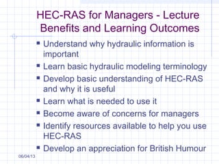
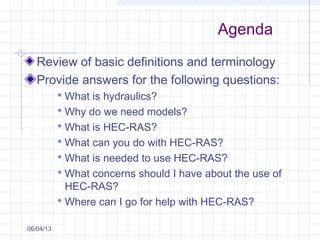
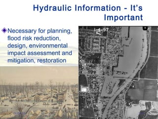
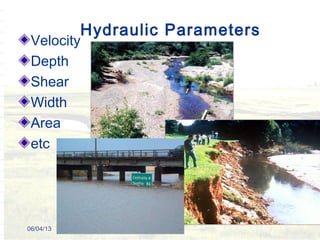
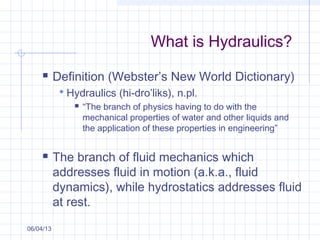
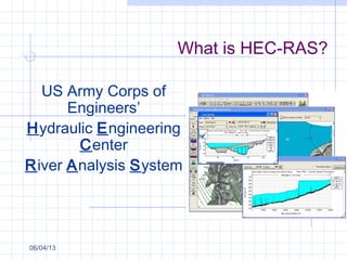
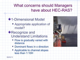
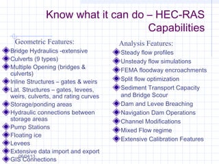
HEC-RAS for Managers
Presented by
Raymond Walton, Ph.D., P.E,.
D.WRE, F.ASCE
06/04/13
With thanks to
Dr. James L. Martin
and
From NRCS workshop
by Reep, 2004
HEC-RAS for Managers - Lecture
Benefits and Learning Outcomes
 Understand why hydraulic information is
important
 Learn basic hydraulic modeling terminology
 Develop basic understanding of HEC-RAS
and why it is useful
 Learn what is needed to use it
 Become aware of concerns for managers
 Identify resources available to help you use
HEC-RAS
 Develop an appreciation for British Humour
06/04/13
Agenda
Review of basic definitions and terminology
Provide answers for the following questions:
 What is hydraulics?
 Why do we need models?
 What is HEC-RAS?
 What can you do with HEC-RAS?
 What is needed to use HEC-RAS?
 What concerns should I have about the use of
HEC-RAS?
 Where can I go for help with HEC-RAS?
06/04/13
Hydraulic Information - It’s
Important
Necessary for planning,
flood risk reduction,
design, environmental
impact assessment and
mitigation, restoration
06/04/13 1a-4
Hydraulic Parameters
Velocity
Depth
Shear
Width
Area
etc
06/04/13
What is Hydraulics?
 Definition (Webster’s New World Dictionary)
 Hydraulics (hi-dro’liks), n.pl.
 “The branch of physics having to do with the
mechanical properties of water and other liquids and
the application of these properties in engineering”
 The branch of fluid mechanics which
addresses fluid in motion (a.k.a., fluid
dynamics), while hydrostatics addresses fluid
at rest.
06/04/13
Background – Areas of Hydraulics
 Pressure flow (e.g., closed conduits)
 Free surface flow (e.g., rivers and
streams)
 HEC-RAS is primarily devoted to
addressing free surface flow; however, it
does have capabilities to consider culverts
and limited abilities to represent closed
conduits06/04/13
Background – Hydraulic Parameters
 Characteristics that define the properties of
flowing liquid.
 For free surface flow, primary parameters
include:
 Depth
 Flow area
 Velocity
06/04/13
Hydraulic models calculate
these parameters
Background – Types of Flow
 Steady Flow – At any point, depth and
velocity remains constant with respect to
time, such as a constant discharge in a
long straight canal.
06/04/13
Background – Types of Flow
06/04/13
Unsteady flow – Depth and/or velocity
changes in magnitude or direction with
respect to time, such as a flood hydrograph
or a curve in a channel.
Background – Types of Flow
Uniform Flow
 At a given instance, depth and velocity
remains constant with respect to distance
along a streamline (streamlines must be
straight and velocity is constant, such as in
a canal)
 Slope of the water surface, channel bed
and total head line are all the same.
06/04/13
Background – Types of Flow
Non Uniform (varied) Flow
 Examples: flow in a bend or at expansions
or contractions in the flow area.
06/04/13
Basic Open Channel
Flow Concepts
Steady vs. Unsteady
Uniform vs. Varied
Classification of Open Channel Flow
T1,T2
T1
T2
Background – Normal Depth
a.k.a., Steady Uniform Flow
Calculated using Manning’s equation
Q = 1.486/n A R2/3
S0
1/2
Why is this important?
06/04/13
Background – Critical Depth
Flow Regime
Fr = ratio of the inertia force over the gravitational force
Classification of Open Channel Flow
gD
V
Fr =
Where:
V = Velocity
D = Hydraulic Depth
g = acceleration of gravity
(1)
Fr < 1 The flow is
Subcritical
Fr = 1 The flow is at
Critical depth
Fr > 1 The flow is
Supercritical
Background – Critical Depth
Flow Regime (Cont.)
 Wave propagations
Wave Celerity
Classification of Open Channel Flow
gDc =
Flow
Still Water
Subcritical Critical Supercritical
c > V c = V c < V
(2)
Equations for Basic Profile
Calculations
Water surface profiles are computed from one cross section to the next
by solving the Energy equation with an iterative procedure called the
standard step method.
The Energy equation is written as follows:
eh
g
V
yz
g
V
yz +++=++
22
2
11
11
2
22
22
αα
Where: y1, y2 = Water depths cross sections
z1, z2 = Elevation of bed above project datum (e.g., NAVD)
V1, V2 = Average velocities (total discharge/total flow area)
α1, α2 = Velocity weighting coefficients
g = Gravitational acceleration
he = Energy head loss
Background – Critical Depth
 Specific Energy is the total of the potential and kinematic energy
g
V
yE
2
2
α
+= (5)
Specific Energy
Where:
E = Specific energy
y = Flow depth
z = Height above
datum
α = Velocity weighting
coefficients
V = Velocity
g = Gravitational
acceleration
0
1
2
3
4
5
6
7
8
9
10
11
12
13
14
15
16
17
18
0 5 10 15 20 25
Specific Energy (ft)
FlowDepth(ft)
y
2g
V2
Basic Open Channel
Flow Concepts
 Critical depth (Yc) is the depth associated with the minimum specific
energy
 Dependent on cross section geometry and flow.
Specific Energy – Critical Depth
0
1
2
3
4
5
6
7
8
9
10
11
12
13
14
15
16
17
18
0 5 10 15 20 25
Specific Energy (ft)
WaterSurface(ft)
Supercritical Flow
Subcritical Flow
Yc
SEmin
y
2g
V2
Background – Types of Flow
Gradually Varied Flow (GVF)
 Where changes in cross section take place
very gradually with distance along the
channel, acceleration effects are negligible
 Changes include geometry, obstructions
and balance between resisting forces and
force of gravity tending to accelerate the
flow
 HEC-RAS calculates water surface profiles
under GVF conditions06/04/13
Background – Types of Flow
Rapidly Varied Flow (RVF)
 Examples: Waterfalls, hydraulic jumps and
steep channels (greater than 10 percent
slope)
 HEC-RAS can not directly represent RVF
06/04/13
Basic Open Channel
Flow Concepts
Gradually Varied vs. Rapidly Varied
Classification of Open Channel Flow
Hydraulic Computer
Models: Why do we care?
Direct Measurements:
hard, expensive,
dangerous
Analytical: predictive
06/04/13
Background
One, Two and Three Dimensional Flow
06/04/13
X direction
Ydirection
Z
direction
Background – 1 Dimensional Flow
Changes in flow velocity are restricted to only
one direction (X).
Models readily available
Well understood
Commonly used
06/04/13
X
Direction
Background – 2 Dimensional Flow
Changes in flow velocity are restricted to only
two directions (X, Y)
Better answers?
Great visualization tool
Accounts for momentum transfer
Use in confluences/complex areas
06/04/13
Two-Dimensional Modeling
X
Direction
YDirection
Background – 3 Dimensional Flow
Changes in flow velocity occur in three
directions (X,Y,Z)
Data for calibration?
When necessary?
Sophisticated
Computer intensive
06/04/13
Background – What is a model?
A mathematical representation
(approximation) of physical processes.
Useful for
 Characterization of existing conditions
 Evaluation of proposed conditions
 Estimation/mitigation of potential impacts
06/04/13
Background – Modeling
Wisdom
06/04/13
“All models are wrong. Some are useful”
George E.P. Box, UCL Mathematician
and Statistician (Un. Wisconsin)
“Everything should be made as simple as
possible, but not simpler ” Albert Einstein
"For every complex problem there is
a simple solution, and it is wrong."
H.L. Mencken
Background – More Modeling
Wisdom
06/04/13
“The model is never wrong. The modeler
often is”
Ray Walton, UCL Mathematician
and (part-time) Statistician (Un. Florida)
What is HEC-RAS?
US Army Corps of
Engineers’
Hydraulic Engineering
Center
River Analysis System
06/04/13
The HEC-RAS Modeling System
1D River Hydraulics
Graphical User Interface
Steady & Unsteady Flow
Bridges, Culverts, Dams,
weirs, levees, gates, etc…
Data storage/management
Graphics, Tabular Output &
Reporting
GeoRas – ArcGIS
More coming………
06/04/13
History of HEC-RAS Development
In the beginning, there was HEC-2 and UNET and
HEC-6, and ……
1D Steady Flow Analysis
 FY 1992 - 1999
 Produced Steady flow versions of HEC-RAS (Beta 1&2,
Versions 1.0 - 1.2, 2.0 – 2.2)
1D Unsteady Modeling for River Analysis
 FY 2000 – 2005
 Versions 3.0 – 3.1.3
1D Steady and Unsteady Hydraulics. Sediment
Transport and Water Quality Modeling, Version 4.0,
March of 2008
 Now up to Version 4.1.0 (2010)
1D/2D/(3D?) Steady and Unsteady Hydraulics and
dynamic groundwater, Version 5.0, stay tuned!!!06/04/13
HEC-RAS is software that allows the
user to perform one dimensional
steady and unsteady flow river
hydraulics calculations.
- Public domain and freely distributed
by the Corps of Engineers
- Support available from private
vendors
go to:
www.hec.usace.army.mil/software/hec-ras/
06/04/13 1-36
What is HEC-RAS?
Graphical User Interface (GUI) – Allows
efficient input of data and evaluation of output
Data Storage and Management – Provides
ability to create, store and combine data files
containing hydrologic, geometric, and
hydraulic design data into unique
combinations
06/04/13
What Units Can HEC-RAS
Use?
SI units (meters, seconds, etc.)
Units from less-developed countries (e.g.,
“U.S. Customary”)
06/04/13
RAS Project Schematic
•Existing
•Proposed
•Existing 10yr,
100yr, & 500yr
•10% Increase
•Existing
•Existing +10% Q
•Proposed
•Proposed +10%
Geometry
 Cross Section
 Spacing
 Structures
 Manning’s n
Flows
 Calibration Data
06/04/13
06/04/13
06/04/13
06/04/13
06/04/13
06/04/13
06/04/13
06/04/13
Culverts
06/04/13
Weirs or Dams
Treated as in-line
structure
Can be modeled
using elevation-
control or time-control
Can be controlled with
scripts
06/04/13
Gates
06/04/13
Variety of gate types
Can be modeled
using elevation-
control or time-control
Can be controlled with
scripts
GIS Interface
Interface with GIS software for efficient
data input and output display and
evaluation - Identify areas of flood
inundation
HEC-GeoRAS
More GIS tools
06/04/13
Hydraulic Design Functions
 Bridge scour
 Uniform Flow
 Stable channel
design
 Sediment transport
capacity
 Sediment Impact
Assessment
(SIAM)
06/04/13
Sediment Transport and Budgets
06/04/13
Water Quality (including temperature)
06/04/13
Graphical
Tabular
Profile
Section
06/04/13
06/04/13
From NRCS workshop by Reep, 2004
06/04/13
From NRCS workshop by Reep,
2004
06/04/13
From NRCS workshop by Reep, 2004
06/04/13
06/04/13
06/04/13
06/04/13
What concerns should Managers
have about HEC-RAS?
1-Dimensional Model
 Appropriate application of
model?
Recognize and
Understand Limitations
 Flow is gradually varied with
distance
 Dominant flows in x direction
 Applicable to channel slopes
less than 1:10H
06/04/13
Know what it can do – HEC-RAS
Capabilities
Bridge Hydraulics -extensive
Culverts (9 types)
Multiple Opening (bridges &
culverts)
Inline Structures – gates & weirs
Lat. Structures – gates, levees,
weirs, culverts, and rating curves
Storage/ponding areas
Hydraulic connections between
storage areas
Pump Stations
Floating ice
Levees
Extensive data import and export
GIS Connections
Steady flow profiles
Unsteady flow simulations
FEMA floodway encroachments
Split flow optimization
Sediment Transport Capacity
and Bridge Scour
Dam and Levee Breaching
Navigation Dam Operations
Channel Modifications
Mixed Flow regime
Extensive Calibration Features
Geometric Features: Analysis Features:
06/04/13
Water Surface Profile Plots
Cross Sections
Rating curves
Stage and flow hydrographs
Generalized profile plot of any
variable (I.e velocity)
3D view of river system
Graphical Animations
250+ output variables at every
cross section per profile
Detailed output tables for XS
and all structures
Summary output tables
User define output
Extensive Manuals
 User’s Manual
 Hydraulic Reference Manual
 Applications Guide
Online Help System
Example Data Sets
Graphical Output: Tabular Output:
Documentation:
06/04/13
Know what it can do – HEC-RAS
Capabilities (continued)
What concerns should Managers
have about HEC-RAS?
(continued)
Input Data
 Remember: Garbage In, Garbage Out (GIGO)
 Need enough to get the job done (spacing)
 Data can be expensive to collect
 Look for existing data sources
 Pay attention to datums
 LiDAR data can be inaccurate
 Use model to guide data collection
06/04/13
What concerns should Managers
have about HEC-RAS? (continued)
Calibration/Validation
 What is calibration?
 When is it “calibrated”?
 What is validation?
 What if data for calibration/validation are
unavailable?
06/04/13
What concerns should Managers
have about HEC-RAS? (continued)
Rigid bed assumption
 Hydraulic calculations are all made with a
rigid bed assumption
 Hydraulic roughness can change with
bedform (dunes, gravel bars, debris)
 Bedforms can change with sediment input
and temperature (seasonality)
 Sediment transport / Unstable channels
 Lateral channel migration not considered
06/04/13
What concerns should Managers
have about HEC-RAS? (continued)
Sensitivity of results
 Conduct a sensitivity analysis/risk
assessment
 Look at accuracy of involved input data
 Topography/geometry
 Hydrology
 Hydraulic roughness
 Structures/Modeling techniques
 Look at accuracy of output application
 Mapping accuracy
06/04/13
What concerns should Managers
have about HEC-RAS? (continued)
Any idiot can use it
Need qualified users
 Qualifications, Training and
Experience
Provide QA/QC
 Appropriate application
 Input, Output
06/04/13
What is so great about HEC-RAS?
Public Domain/Free/Widely used
Supported by Corps of Engineers
Continuing Improvement
 2-D capabilities being developed
 Expected by end of 2012
Graphical Abilities
Good Documentation
Training Available
06/04/13
HEC-RAS - Documentation
 User’s Manual: provides an introduction and overview of
the modeling system, installation instructions, how to get
started, a simple example, detailed descriptions of each of the
major modeling components, and how to view graphical and
tabular output
 Hydraulic Reference Manual: describes the theory
and data requirements for hydraulic calculations
 Applications Guide: contains a series of examples that
demonstrate various aspects of HEC-RAS.
06/04/13
The HEC-RAS software is an
engineering tool.
Not a replacement for sound
engineering.
06/04/13
Questions?Questions?
06/04/13

2011 ras for_managers_11-22

  • 1.
    HEC-RAS for Managers Presentedby Raymond Walton, Ph.D., P.E,. D.WRE, F.ASCE 06/04/13 With thanks to Dr. James L. Martin and From NRCS workshop by Reep, 2004
  • 2.
    HEC-RAS for Managers- Lecture Benefits and Learning Outcomes  Understand why hydraulic information is important  Learn basic hydraulic modeling terminology  Develop basic understanding of HEC-RAS and why it is useful  Learn what is needed to use it  Become aware of concerns for managers  Identify resources available to help you use HEC-RAS  Develop an appreciation for British Humour 06/04/13
  • 3.
    Agenda Review of basicdefinitions and terminology Provide answers for the following questions:  What is hydraulics?  Why do we need models?  What is HEC-RAS?  What can you do with HEC-RAS?  What is needed to use HEC-RAS?  What concerns should I have about the use of HEC-RAS?  Where can I go for help with HEC-RAS? 06/04/13
  • 4.
    Hydraulic Information -It’s Important Necessary for planning, flood risk reduction, design, environmental impact assessment and mitigation, restoration 06/04/13 1a-4
  • 5.
  • 6.
    What is Hydraulics? Definition (Webster’s New World Dictionary)  Hydraulics (hi-dro’liks), n.pl.  “The branch of physics having to do with the mechanical properties of water and other liquids and the application of these properties in engineering”  The branch of fluid mechanics which addresses fluid in motion (a.k.a., fluid dynamics), while hydrostatics addresses fluid at rest. 06/04/13
  • 7.
    Background – Areasof Hydraulics  Pressure flow (e.g., closed conduits)  Free surface flow (e.g., rivers and streams)  HEC-RAS is primarily devoted to addressing free surface flow; however, it does have capabilities to consider culverts and limited abilities to represent closed conduits06/04/13
  • 8.
    Background – HydraulicParameters  Characteristics that define the properties of flowing liquid.  For free surface flow, primary parameters include:  Depth  Flow area  Velocity 06/04/13 Hydraulic models calculate these parameters
  • 9.
    Background – Typesof Flow  Steady Flow – At any point, depth and velocity remains constant with respect to time, such as a constant discharge in a long straight canal. 06/04/13
  • 10.
    Background – Typesof Flow 06/04/13 Unsteady flow – Depth and/or velocity changes in magnitude or direction with respect to time, such as a flood hydrograph or a curve in a channel.
  • 11.
    Background – Typesof Flow Uniform Flow  At a given instance, depth and velocity remains constant with respect to distance along a streamline (streamlines must be straight and velocity is constant, such as in a canal)  Slope of the water surface, channel bed and total head line are all the same. 06/04/13
  • 12.
    Background – Typesof Flow Non Uniform (varied) Flow  Examples: flow in a bend or at expansions or contractions in the flow area. 06/04/13
  • 13.
    Basic Open Channel FlowConcepts Steady vs. Unsteady Uniform vs. Varied Classification of Open Channel Flow T1,T2 T1 T2
  • 14.
    Background – NormalDepth a.k.a., Steady Uniform Flow Calculated using Manning’s equation Q = 1.486/n A R2/3 S0 1/2 Why is this important? 06/04/13
  • 15.
    Background – CriticalDepth Flow Regime Fr = ratio of the inertia force over the gravitational force Classification of Open Channel Flow gD V Fr = Where: V = Velocity D = Hydraulic Depth g = acceleration of gravity (1) Fr < 1 The flow is Subcritical Fr = 1 The flow is at Critical depth Fr > 1 The flow is Supercritical
  • 16.
    Background – CriticalDepth Flow Regime (Cont.)  Wave propagations Wave Celerity Classification of Open Channel Flow gDc = Flow Still Water Subcritical Critical Supercritical c > V c = V c < V (2)
  • 17.
    Equations for BasicProfile Calculations Water surface profiles are computed from one cross section to the next by solving the Energy equation with an iterative procedure called the standard step method. The Energy equation is written as follows: eh g V yz g V yz +++=++ 22 2 11 11 2 22 22 αα Where: y1, y2 = Water depths cross sections z1, z2 = Elevation of bed above project datum (e.g., NAVD) V1, V2 = Average velocities (total discharge/total flow area) α1, α2 = Velocity weighting coefficients g = Gravitational acceleration he = Energy head loss
  • 18.
    Background – CriticalDepth  Specific Energy is the total of the potential and kinematic energy g V yE 2 2 α += (5) Specific Energy Where: E = Specific energy y = Flow depth z = Height above datum α = Velocity weighting coefficients V = Velocity g = Gravitational acceleration 0 1 2 3 4 5 6 7 8 9 10 11 12 13 14 15 16 17 18 0 5 10 15 20 25 Specific Energy (ft) FlowDepth(ft) y 2g V2
  • 19.
    Basic Open Channel FlowConcepts  Critical depth (Yc) is the depth associated with the minimum specific energy  Dependent on cross section geometry and flow. Specific Energy – Critical Depth 0 1 2 3 4 5 6 7 8 9 10 11 12 13 14 15 16 17 18 0 5 10 15 20 25 Specific Energy (ft) WaterSurface(ft) Supercritical Flow Subcritical Flow Yc SEmin y 2g V2
  • 20.
    Background – Typesof Flow Gradually Varied Flow (GVF)  Where changes in cross section take place very gradually with distance along the channel, acceleration effects are negligible  Changes include geometry, obstructions and balance between resisting forces and force of gravity tending to accelerate the flow  HEC-RAS calculates water surface profiles under GVF conditions06/04/13
  • 21.
    Background – Typesof Flow Rapidly Varied Flow (RVF)  Examples: Waterfalls, hydraulic jumps and steep channels (greater than 10 percent slope)  HEC-RAS can not directly represent RVF 06/04/13
  • 22.
    Basic Open Channel FlowConcepts Gradually Varied vs. Rapidly Varied Classification of Open Channel Flow
  • 23.
    Hydraulic Computer Models: Whydo we care? Direct Measurements: hard, expensive, dangerous Analytical: predictive 06/04/13
  • 24.
    Background One, Two andThree Dimensional Flow 06/04/13 X direction Ydirection Z direction
  • 25.
    Background – 1Dimensional Flow Changes in flow velocity are restricted to only one direction (X). Models readily available Well understood Commonly used 06/04/13 X Direction
  • 26.
    Background – 2Dimensional Flow Changes in flow velocity are restricted to only two directions (X, Y) Better answers? Great visualization tool Accounts for momentum transfer Use in confluences/complex areas 06/04/13
  • 27.
  • 28.
    Background – 3Dimensional Flow Changes in flow velocity occur in three directions (X,Y,Z) Data for calibration? When necessary? Sophisticated Computer intensive 06/04/13
  • 29.
    Background – Whatis a model? A mathematical representation (approximation) of physical processes. Useful for  Characterization of existing conditions  Evaluation of proposed conditions  Estimation/mitigation of potential impacts 06/04/13
  • 30.
    Background – Modeling Wisdom 06/04/13 “Allmodels are wrong. Some are useful” George E.P. Box, UCL Mathematician and Statistician (Un. Wisconsin) “Everything should be made as simple as possible, but not simpler ” Albert Einstein "For every complex problem there is a simple solution, and it is wrong." H.L. Mencken
  • 31.
    Background – MoreModeling Wisdom 06/04/13 “The model is never wrong. The modeler often is” Ray Walton, UCL Mathematician and (part-time) Statistician (Un. Florida)
  • 33.
    What is HEC-RAS? USArmy Corps of Engineers’ Hydraulic Engineering Center River Analysis System 06/04/13
  • 34.
    The HEC-RAS ModelingSystem 1D River Hydraulics Graphical User Interface Steady & Unsteady Flow Bridges, Culverts, Dams, weirs, levees, gates, etc… Data storage/management Graphics, Tabular Output & Reporting GeoRas – ArcGIS More coming……… 06/04/13
  • 35.
    History of HEC-RASDevelopment In the beginning, there was HEC-2 and UNET and HEC-6, and …… 1D Steady Flow Analysis  FY 1992 - 1999  Produced Steady flow versions of HEC-RAS (Beta 1&2, Versions 1.0 - 1.2, 2.0 – 2.2) 1D Unsteady Modeling for River Analysis  FY 2000 – 2005  Versions 3.0 – 3.1.3 1D Steady and Unsteady Hydraulics. Sediment Transport and Water Quality Modeling, Version 4.0, March of 2008  Now up to Version 4.1.0 (2010) 1D/2D/(3D?) Steady and Unsteady Hydraulics and dynamic groundwater, Version 5.0, stay tuned!!!06/04/13
  • 36.
    HEC-RAS is softwarethat allows the user to perform one dimensional steady and unsteady flow river hydraulics calculations. - Public domain and freely distributed by the Corps of Engineers - Support available from private vendors go to: www.hec.usace.army.mil/software/hec-ras/ 06/04/13 1-36
  • 37.
    What is HEC-RAS? GraphicalUser Interface (GUI) – Allows efficient input of data and evaluation of output Data Storage and Management – Provides ability to create, store and combine data files containing hydrologic, geometric, and hydraulic design data into unique combinations 06/04/13
  • 38.
    What Units CanHEC-RAS Use? SI units (meters, seconds, etc.) Units from less-developed countries (e.g., “U.S. Customary”) 06/04/13
  • 39.
    RAS Project Schematic •Existing •Proposed •Existing10yr, 100yr, & 500yr •10% Increase •Existing •Existing +10% Q •Proposed •Proposed +10%
  • 40.
    Geometry  Cross Section Spacing  Structures  Manning’s n Flows  Calibration Data 06/04/13
  • 41.
  • 42.
  • 43.
  • 44.
  • 45.
  • 46.
  • 47.
  • 48.
  • 49.
    Weirs or Dams Treatedas in-line structure Can be modeled using elevation- control or time-control Can be controlled with scripts 06/04/13
  • 50.
    Gates 06/04/13 Variety of gatetypes Can be modeled using elevation- control or time-control Can be controlled with scripts
  • 51.
    GIS Interface Interface withGIS software for efficient data input and output display and evaluation - Identify areas of flood inundation HEC-GeoRAS More GIS tools 06/04/13
  • 52.
    Hydraulic Design Functions Bridge scour  Uniform Flow  Stable channel design  Sediment transport capacity  Sediment Impact Assessment (SIAM) 06/04/13
  • 53.
    Sediment Transport andBudgets 06/04/13
  • 54.
    Water Quality (includingtemperature) 06/04/13
  • 55.
  • 56.
  • 57.
    From NRCS workshopby Reep, 2004 06/04/13
  • 58.
    From NRCS workshopby Reep, 2004 06/04/13
  • 59.
    From NRCS workshopby Reep, 2004 06/04/13
  • 60.
  • 61.
  • 62.
  • 63.
    What concerns shouldManagers have about HEC-RAS? 1-Dimensional Model  Appropriate application of model? Recognize and Understand Limitations  Flow is gradually varied with distance  Dominant flows in x direction  Applicable to channel slopes less than 1:10H 06/04/13
  • 64.
    Know what itcan do – HEC-RAS Capabilities Bridge Hydraulics -extensive Culverts (9 types) Multiple Opening (bridges & culverts) Inline Structures – gates & weirs Lat. Structures – gates, levees, weirs, culverts, and rating curves Storage/ponding areas Hydraulic connections between storage areas Pump Stations Floating ice Levees Extensive data import and export GIS Connections Steady flow profiles Unsteady flow simulations FEMA floodway encroachments Split flow optimization Sediment Transport Capacity and Bridge Scour Dam and Levee Breaching Navigation Dam Operations Channel Modifications Mixed Flow regime Extensive Calibration Features Geometric Features: Analysis Features: 06/04/13
  • 65.
    Water Surface ProfilePlots Cross Sections Rating curves Stage and flow hydrographs Generalized profile plot of any variable (I.e velocity) 3D view of river system Graphical Animations 250+ output variables at every cross section per profile Detailed output tables for XS and all structures Summary output tables User define output Extensive Manuals  User’s Manual  Hydraulic Reference Manual  Applications Guide Online Help System Example Data Sets Graphical Output: Tabular Output: Documentation: 06/04/13 Know what it can do – HEC-RAS Capabilities (continued)
  • 66.
    What concerns shouldManagers have about HEC-RAS? (continued) Input Data  Remember: Garbage In, Garbage Out (GIGO)  Need enough to get the job done (spacing)  Data can be expensive to collect  Look for existing data sources  Pay attention to datums  LiDAR data can be inaccurate  Use model to guide data collection 06/04/13
  • 67.
    What concerns shouldManagers have about HEC-RAS? (continued) Calibration/Validation  What is calibration?  When is it “calibrated”?  What is validation?  What if data for calibration/validation are unavailable? 06/04/13
  • 68.
    What concerns shouldManagers have about HEC-RAS? (continued) Rigid bed assumption  Hydraulic calculations are all made with a rigid bed assumption  Hydraulic roughness can change with bedform (dunes, gravel bars, debris)  Bedforms can change with sediment input and temperature (seasonality)  Sediment transport / Unstable channels  Lateral channel migration not considered 06/04/13
  • 69.
    What concerns shouldManagers have about HEC-RAS? (continued) Sensitivity of results  Conduct a sensitivity analysis/risk assessment  Look at accuracy of involved input data  Topography/geometry  Hydrology  Hydraulic roughness  Structures/Modeling techniques  Look at accuracy of output application  Mapping accuracy 06/04/13
  • 70.
    What concerns shouldManagers have about HEC-RAS? (continued) Any idiot can use it Need qualified users  Qualifications, Training and Experience Provide QA/QC  Appropriate application  Input, Output 06/04/13
  • 71.
    What is sogreat about HEC-RAS? Public Domain/Free/Widely used Supported by Corps of Engineers Continuing Improvement  2-D capabilities being developed  Expected by end of 2012 Graphical Abilities Good Documentation Training Available 06/04/13
  • 72.
    HEC-RAS - Documentation User’s Manual: provides an introduction and overview of the modeling system, installation instructions, how to get started, a simple example, detailed descriptions of each of the major modeling components, and how to view graphical and tabular output  Hydraulic Reference Manual: describes the theory and data requirements for hydraulic calculations  Applications Guide: contains a series of examples that demonstrate various aspects of HEC-RAS. 06/04/13
  • 73.
    The HEC-RAS softwareis an engineering tool. Not a replacement for sound engineering. 06/04/13
  • 74.