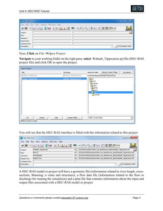
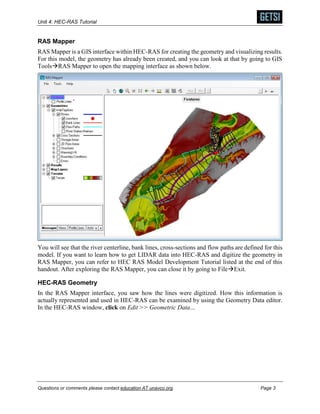
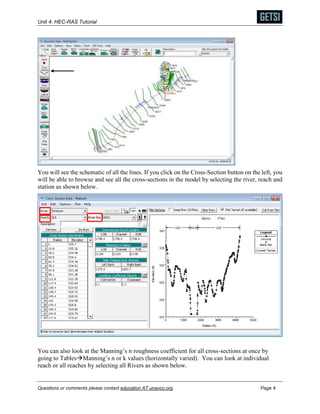
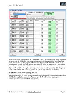
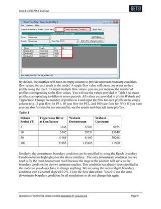
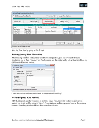
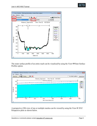
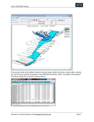
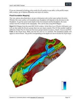
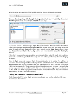
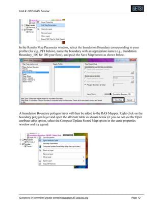
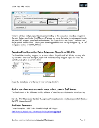
This document provides a tutorial for using HEC-RAS software to create flood inundation maps. It explains how to open and explore an existing HEC-RAS model for the Wabash and Tippecanoe Rivers, run steady flow simulations by specifying boundary conditions and flow data, visualize water surface profiles and results, and create flood inundation maps by overlaying water depth results on topography in RAS Mapper. The overall goal is to demonstrate the workflow and key steps in using HEC-RAS to model river hydraulics and map flood hazards.


![Hec ras 4.1-applications_guide[1]](https://cdn.slidesharecdn.com/ss_thumbnails/hec-ras4-140906052124-phpapp01-thumbnail.jpg?width=640&height=640&fit=bounds)


![谷歌留痕技术教程[ 𝙩𝙤𝙥 𝟮𝟯𝟯. 𝙘 𝙤𝙢 ]](https://cdn.slidesharecdn.com/ss_thumbnails/top233-260130173900-2eb784f9-thumbnail.jpg?width=640&height=640&fit=bounds)


