
Recommended
More Related Content
Similar to Photogrammetry surveying: Key to 3D modeling and accurate mapping
Similar to Photogrammetry surveying: Key to 3D modeling and accurate mapping (20)
Recently uploaded
Recently uploaded (20)
Photogrammetry surveying: Key to 3D modeling and accurate mapping
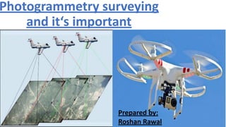
- 1. Photogrammetry surveying and it‘s important Prepared by: Roshan Rawal
- 2. Photogrammetric surveying:advance technology : •The word Photogrammetry composed of the words photo, gram and metry which mean light,calculation and measurement respectively ie. Measurement from photo. •It’s a art, science and technology of obtaining reliable information about physical object, environment by means of photograph in order to primarily determine geometric characteristics such as size, form and position of the object •Photogrammetry gathers measurements and data about an object by analyzing the change in position from two different images. It uses things like perspective, advanced processing software and photo analysis to get the job done. •The photograph either taken from the air or from the station on the ground. According to this photogrammetry classifying in two categories 1. Aerial photogrammetry : 2. Terrestrial photogrammetry:
- 3. • Aerial photogrammetry: photograph taken from by a camera mounted in an aircraft flying over the area. Mapping of the terrestrial photography is the best mapping procedure yet developed(advance technology) for large project and invaluable for military intelligence. • Vertical photography: Angle between camera axis and vertical line is less than 3 degree. • Oblique:more than 3 degree. • Forward overlap: between two image • Lateral or side overlap: overlap between between imgae from adjacent line of flight
- 4. 2. Terrestrial photogrammetry: These images are taken from a fixed position on the ground with a camera’s axis parallel to the Earth. Data about the camera’s position, such as its coordinates, are collected at the time the photo is taken. The instruments used for terrestrial photography are often theodolites, though regular cameras are sometimes used as well. Terrestrial photogrammetry for surveying typically requires fewer resources and skilled technicians to accomplish, but it may take longer to cover a large portion of land. The principle underlying the method of terrestrial photogrammetry is exactly similar to that of plane table surveying, i.e. if the directions of same objects photographed from two extremities of measured base are known, their position can be located by the intersection of two rays to the same object. However, the difference between this and plane tabling is that more details are at once obtained from the photographs and their subsequent plotting etc. is done by the office while in plane tabling all the detailing is done in the field itself.
- 5. •Principle of streoscopy: “if two overlapping air photograph containing the same object,taken from the different Position are viewed through a stereoscope and under certain condition corresponding object will fuse together and terrain appear in three dimension. Stereoscopy: it is the production of the illusion of depth in a photograph, movie, or other two-dimensional image by the presentation of a slightly different image to each eye, which adds the first of these cues (stereopsis). The two images are then combined in the brain to give the perception of depth. Streoscope( त्रि वमद शर्शि): a device by which two photographs of the same object taken at slightly different angles are viewed together, creating an impression of depth and solidity. Greek roots, stereo, "solid or three-dimensional," and phone, "voice. The fundamental principle used in photogrammetry is triangulation. By taking photographs from at least two different locations, so-called 'lines of sight' can be developed from each camera to points on the object.
- 6. •Triangulation is the principle used by both photogrammetry and theodolites to produce 3-dimensional point measurements. By mathematically intersecting converging lines in space, the precise location of the point can be determined. However, unlike theodolites, photogrammetry can measure multiple points at a time with virtually no limit on the number of simultaneously triangulated points. •triangulation is also the way your two eyes work together to gauge distance (called depth perception).
- 7. Method to view streoscope pair • Crosss eyes view • Anaglyphs
- 8. •However, aerial photogrammetry is often unable to show all the details of the objects that were captured. For example, in the 3D models it is not possible to show all the details of the buildings such as building interfaces and facades. Therefore, a necessity for another technology is emerged to merge with, such as close-range photogrammetry. Close range photograph: Close-range photogrammetry (CRP) is a special type of terrestrial photogrammetry that used to collect data about the objects such as lengths, size, shape, and position from two or more images taking from different stations by using a digital camera mounted on the ground and facing the object as shown in Figure
- 10. Importance of photogrammetry: 1. To create 3D model:(digital elevation model) •three-dimensional representation of an object created by plotting individual points in 3D space on the X, Y, and Z-axis. The points are connected by geometric shapes, such as triangles, lines, or curved surfaces, to form the model. The points are connected by geometric shapes, such as triangles, lines, or curved surfaces, to form the model.
- 11. •The way photogrammetry works is it looks at photos of a subject taken from two or more locations. It uses the different perspectives from the images, along with the location data of where the images were taken, to triangulate the locations of points on the subject. •To get the best results of creating a 3D model with your drone, you need to do two things. First, you need to make sure there is a 60 to 70 percent overlap in your aerial photos. This helps the triangulation process be more accurate and track the same points between images. •The second thing you want to do is to make sure you capture photos of your subject at different angles and altitudes. Typically you want to capture straight down images from around 150-200 feet. Then you want to circle your subject at a high altitude with a 30º degree angle, at a middle altitude with around a 45º degree angle, and a lower altitude with a 70º degree angle
- 12. •You can create a 3D model by hand using 3D modeling software, by using an algorithm, or by scanning a physical object. You can use a variety of available software applications to process your images and create your model.
- 14. •Architecture and engineering firms are using 3D models to create realistic and detailed context models for their buildings and development projects. Architects use these context models to present how their finished project will look and to present their project to investors and key stakeholders. • •
- 15. •Engineering •Since photogrammetry is so dependent on accurate measurements, it’s no surprise that one of the first industries to adopt this technology is engineering. When building complex structures, buildings, or other feats of technology, everything needs to be as accurate as possible. •By using photographs from drones, engineers are able to evaluate a construction project on a step-by-step basis to ensure everything runs smoothly. Another valuable way to utilize this technology in this industry is to show clients and construction workers perspective images. Thanks to 3D renderings, it’s easier than ever to create in-progress visuals or prospective results.
- 16. •Topographical Mapping – •The plotting of map detail and contours is normally carried out using aerial photogrammetric methods •These methods are used for both original survey and revision, and replace classical ground methods except where the task is so small that flying is uneconomical •The technique needs a certain amount of ground surveyed control, but this requirement is being continually reduced with the improvement of aerial triangulation techniques to provide supplementary control. • A final field check is necessary
- 18. •Calculation of catchment area:
- 19. •Town and city planning:
- 20. Road and railway enginneering: an extremely important advanatage of photogrammetry is that road surveys can be done without closing lanea, disturbing traffic. Once the road is photographed, measurement of road feature, including elevation data, is done in the office, not field •Study of geology of soil and crop patterns: •Preliminary surveying: •Town and country planning: •Mining prospects •Military intelligence: World war ii gave rise to new development of aerial photography techniques. •Water supply and power scheme •Application in the department of transportation:
- 21. Advantages • It can be used in locations that are difficult,unsafe, or impossible to acess. • It provide the broad view of the project area. Identify the both topographic and cultural feature. • Aerial photogrammetry can provide information of large area with very less time. • )Information to the concerned authorities, public etc can be easily conveyedthrough aerial photograph • aerial photogrammetry is the most popular in architecture and land development because it saves time and reduces cost during data collection in comparison with fieldwork, which may take days to complete work. It is also used by the government for city planning and when conducting environmental research. Disadvantaged • Can’t used in densely forest area. • Costly for small area mapping.(highly equipped and manpower and instrument are used) • Weather conditions affect the aerial photograph. • Also seasonal conditions affect. Snow cover will give a false ground impression.(November through march is best for aerial photograph)
- 22. •Scale of photograph: Scale= photo distance between two point/ real distance between two point =focal length /distace of aircraft from ground.[using similar triangle properties]
- 24. Thank you!