ICT role in 21st century education and it's challenges.
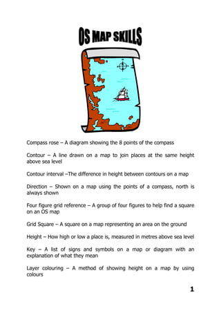
Os maps pack
1. Compass rose – A diagram showing the 8 points of the compass
Contour – A line drawn on a map to join places at the same height
above sea level
Contour interval –The difference in height between contours on a map
Direction – Shown on a map using the points of a compass, north is
always shown
Four figure grid reference – A group of four figures to help find a square
on an OS map
Grid Square – A square on a map representing an area on the ground
Height – How high or low a place is, measured in metres above sea level
Key – A list of signs and symbols on a map or diagram with an
explanation of what they mean
Layer colouring – A method of showing height on a map by using
colours
1
2. Map – A drawing which shows part of the earths’ surface from directly
above on a reduced scale
North sign – A map will always have a north sign pointing north, usually
towards the top of the map
Ordnance survey map – The official government organisation
responsible for producing maps in the UK
Plan – A detailed map of a small area
Point of a compass – A method giving direction using north, east etc.
Relief – The shape of the land surface and its height above sea level
Scale – The link between the distance on a map and its real distance on
the ground
Scale line – A short line on a map, which shows how far real distances
are
Six figure grid references – A group of six figures used to give an exact
position on a map
Spot height – A point on a map with a number giving its height above
the sea in metres
Symbols – A simple drawing or sign used to give information and save
space on a map
Triangular pillar – A concrete pillar used by surveyors to find the exact
height and position of a place
2
3. 3
MY LOCAL AREA
1. Go to Bing Maps
2. Enter the post code of your house
3. A street map will download, with the exact location of your home
4. Make sure you have chosen the London street map
5. Copy and paste this map into a word processing or desktop publishing
programme, or just print it out
6. Use software tools to add symbols of places or things that are familiar to
you, like bus stop, shops, park, traffic lights etc. or just draw them on by hand.
7. Mark your route from your house to school, or somewhere else that you
walk to regularly such as a park, friend's house, shop, tube etc.
8. Write a description of your route. There is no need to try to include
everything, but you must be very accurate. Describe the physical and human
features you see on your route, describe which roads you walk along and try
to use compass directions rather than left or right. E.g. walk north along
Cromwell road and turn east at the red post box next to the big tree.
9. LESSON 1; 1). Pack pages 3-8; My Local Area
2). EXTRA CREDIT; Pack p8 Google Earth
DATE MARKED:
GRADE: A B C D
MERIT: 1 2
ORDER MARK:
DETENTION:
COMMENT:
TARGET:
9
10. How can we show direction?
Foundations p126; Draw an 8 point compass;
Foundations p127; Ex 3
10
11. COMPASS DIRECTIONS
STUDENT A
1. Start in the black square. Go north one square. Draw a picture of a sun in this
square.
2. Go east two squares. Draw a picture of a picnic site in this square.
3. Go south two squares. In this square write the name of the country you live in.
4. Go west two squares, then south one square. Write your teacher’s name in this
square.
5. Go back to the north-west corner square, and then go east three squares. In this
square, draw a church with a tower.
6. Go south two squares. Draw a picture of a bridge in this square.
7. Go west two squares, then north one square. In this square write today’s date.
8. In the square north of this, draw a picture of a telephone.
9. Go back to the square with the drawing of a bridge. In the square south of this,
write down the capital city of Scotland.
10. Go west three squares, then north one square. In this square draw a picture of a
forest.
11. Go to the square south of the drawing of a picnic site. In this square draw a light
house.
12. Go east two squares. In this square write the name of the ocean between Britain
and America.
STUDENT B GRID
1 2 3 4
5 6 7 8
9 10 11 12
13 14 15 16
17 18 19 20
11
12. COMPASS DIRECTIONS
STUDENT B
1. Start in the black square. Go south two squares. Draw a picture of a river in
this square.
2. Go east two squares. Draw a picture of a tree in this square.
3. Go north four squares. Write the name of the capital of America.
4. Go back to the square with the drawing of a river. Go north one square. Draw a
tent in this square.
5. Go west one square, then north three squares. Draw a picture of a railway in
this square.
6. In the square to the east of this, draw a picture of a footprint.
7. Go south one square, then east two squares. In this square, draw a flower.
8. Go back to the black square. Go west one square. In this square write the name
of the capital of France.
9. Go south one square. Write the name of the country where kangaroos live.
10. Go east three squares. Draw a picture of an elephant in this square.
11. Go to the square to the west of the flower. Write in this square the name of the
highest mountain in Britain.
12. Go west two squares. Write the name of your class in this square.
STUDENT A GRID
1 2 3 4 5
6 7 8 9 10
11 12 13 14 15
16 17 18 19 20
12
13. LESSON 2; Doddle; Direction and Location super quiz
DATE MARKED:
GRADE: A B C D
MERIT: 1 2
ORDER MARK:
DETENTION:
COMMENT:
TARGET:
13
14. How can we measure distance?
Foundations p128 and 129; Ex 1 to 5
14
18. 18
SYMBOLS
Look at the map of All Saints Road. The buildings are shown but some features
are missing. These are listed below the map in the key.
Your task is to complete the map by drawing the symbols in the correct places.
The symbols are given in the key.
First complete the key by writing in the meaning of each symbol. The key for the
Ordnance Survey map in your Foundations book will help you.
19. LESSON 4; Doddle; Maps, direction and scale skills quiz
DATE MARKED:
GRADE: A B C D
MERIT: 1 2
ORDER MARK:
DETENTION:
COMMENT:
TARGET:
19
20. What are grid references?
Foundations p133 Ex 1 to 5;
20
22. LESSON 5; 1. Pack p21; 4 figure grid references
2. Doddle; OS maps and grid reference skills quiz
DATE MARKED:
GRADE: A B C D
MERIT: 1 2
ORDER MARK:
DETENTION:
COMMENT:
TARGET:
22
23. How do we use 6 figure grid references?
Foundations p134/5 Ex 1 and 2;
23
30. How do contours show height and relief?
Foundations p138 and 139 Ex 1 and 2;
30
31. LESSON 7; 1. Pack p29; Height on maps
2. Pack p30; Foundations p139 exercise 1 and 2
DATE MARKED:
GRADE: A B C D
MERIT: 1 2
ORDER MARK:
DETENTION:
COMMENT:
TARGET:
31
52. LESSON 8; 1. Revision
2. Doddle; Maps and enquiry super quiz
3. Pack p42 to 51; My Patch (due in two
weeks time)
DATE MARKED:
GRADE: A B C D
MERIT: 1 2
ORDER MARK:
DETENTION:
COMMENT:
TARGET:
52
54. OS MAP SKILLS HOMEWORK
Lesson 1; 1). Pack pages 3-8; My Local Area
2). EXTRA CREDIT; Pack p8 Google Earth
Lesson 2; Doddle; Direction and Location super quiz
Lesson 3; Doddle; Direction and Scale mini quiz
Lesson 4; Doddle; Direction and scale skills quiz
Lesson 5; 1. Pack p21; 4 figure grid references
2. Doddle; OS maps and grid reference skills quiz
Lesson 6; Pack p25/26; Paradise Island
Lesson 7; 1. Pack p29; Height on maps
2. Pack p30; Foundations p139 exercise 1 and 2
Lesson 8; 1. Revision
2. Doddle; Maps and enquiry super quiz
3. Pack p42 to 51; My Patch (due in two weeks time)
Extra extension work/independent learning;
Doddle -browse in all resources for energy and
resources; https://www.doddlelearn.co.uk
54