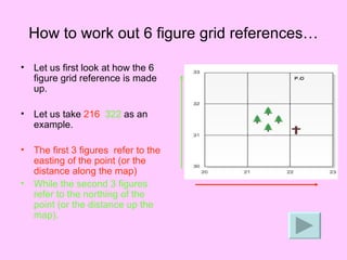
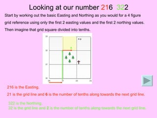
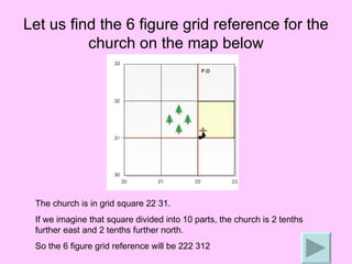
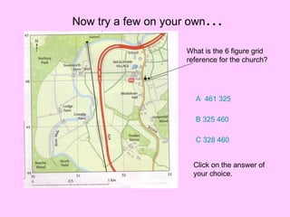
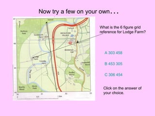
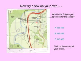
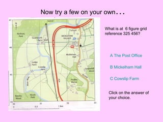
The document discusses 6 figure grid references, which provide more precise locations than 4 figure grid references by dividing grid squares into tenths. It explains that the first 3 figures indicate easting and the second 3 indicate northing. Several examples are given of determining 6 figure grid references from maps and vice versa. The reader is then prompted to answer practice questions to test their understanding.