2. Contents
Introduction
Sattelite
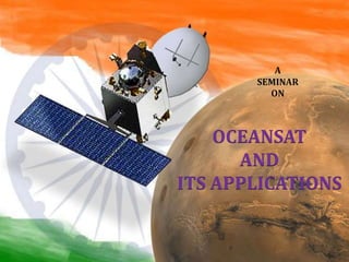
Ocean Sat
Types of Ocean Sat
Oceansat-1
Oceansat-2
Oceansat-3
Applications
Applications in various fields
Conclusions
References
3. Satellite:
- An object revolving around the earth in an
orbit .
- It covers large area of information.
- Satellites can travel around planets or
around stars.
Introduction
5. CARTOSAT - 1
PAN - 2.5M, 30 KM,
F/A
RESOURCESAT-1
LISS-III - 23 M; 4 XS
LISS-IV - 5.8 M; 3-XS
AWIFS - 70 M; 4-XS
CARTOSAT-2
PAN - 1M
MEGHA-
TROPIQUES
SAPHIR
SCARAB &
MADRAS
2003
2004
2005
2005
IRS-1C (1995) LISS-III (23/70M),
STEERABLE PAN (5.8 M);
WiFS (188M)
IRS-1D (1997) LISS-III (23/70M,
STEERABLE PAN (5.8 M);
WiFS (188M)
IRS-P2 (1994)
LISS-II
IRS-P3 (1996)
WiFS, MOS
X-Ray,
IRS-P4 (1999) OCEANSAT
OCM (360m), MSMR
IRS-1A & 1B ( 1988 & 91)
LISS-1&2 (72/36M,
4 BANDS; VIS & NIR)
IRS SERIES
6. OCEAN-SAT
IRS-P4 (OCEANSAT) is the first
satellite primarily built for Ocean
applications.
Weight - 1050 kg.
Orbit - 720 km.
• Placed in a Polar Sun Synchronous launched by PSLV-C2 from SHAR
Centre, Sriharikota on May 26, 1999.
OceanSat 1AND 2 Both is built for Ocean applications.
•It carries two Payloads: Ocean Color Monitor (OCM) and Multi-frequency
Scanning Microwave Radiometer (MSMR).
•OCM provides valuable data which are used for various applications both
within India and by International users.
7. Contd…
OCM data built for atmospheric correction data regarding Chlorophyll
concentration, total suspended matter (TSM), estimation of primary
productivity, detection of algal blooms, atmospheric vertical profiles of
temperature, pressure and humidity, wind fields over ocean surface, sea
state, Ocean dynamics , and bio-physical parameters.
It will be equipped with three payload: OCM, Scatterometer and ROSA.
OCM was also present on OCEANSAT-I, Scatterometer and ROSA are
new instruments.
8. Oceansat 1:-
This satellite carries Ocean Colour Monitor (OCM) and a Multi -
frequency Scanning Microwave Radiometer (MSMR) for oceanographic
studies.
IRS-P4 thus vastly argument the IRS satellite system of ISRO comprising
four satellites, IRS-1B, IRS-1C, IRS-P3 and IRS-1D and extend remote
sensing applications to several newer areas.
It carries two payloads
Ocean Colour Monitor (OCM)
Multi-frequently Scanning Microwave Radiometer (MSMR)
Mission completed on August 8, 2010 after serving for 11 years and 2
months
9. History;
•Oceansat-1 was launched by ISRO's PSLV-C2 on 26 May 1999 from the
First Launch Pad of Satish Dhawan Space Centre in Sriharikota, India.
•It was the third successful launch of PSLV.
•It was the 8th satellite of the IRS satellite series of India.
Payloads
Ocean Colour Monitor (OCM):-It is a solid state camera literally
designed primarily to monitor the colour of the ocean, thereby useful for
documenting chlorophyll concentration, phytoplankton blooms,
atmospheric aerosols .
Multi-frequently Scanning Microwave Radiometer (MSMR):-It
collects data by measuring microwave radiation passing through the
atmosphere over the ocean. This offers information including sea surface
temperature, wind speed, cloud water content, and water vapour content.
10. Detail Of Oceansat-1
Launch date May 26, 1999
Launch site SHAR, Sriharikota
Launch vehicle PSLV - C2
Orbit Polar Sun Synchronous
Altitude 720 km
Inclination 98.28 deg
Period 99.31 min
Local time of Eq. crossing 12 noon
Repetitivity cycle 2 days
Size 2.8m x 1.98m x 2.57m
Mass at lift off 1050 kg
Length when fully deployed 11.67 m
Attitude and Orbit Control 3-axis body-stabilised using Reaction Wheels,
Magnetic Torquers and Hydrazine Thrusters
Power 9.6 Sq.m Solar Array generating 750w Two 21 Ah Ni-
C d Battries
Mission Completed On August 8, 2010
11. 1. Ground resolution[m]
Real time mode[full resolution mode] :- 360[across-track]
236[along-track]
2. Swath[km] :- 1420
Specifications of IRS-P4 OCM[ocean sat 1]
12. Oceansat-2
Launched by PSLV-C14 from Satish Dhawan Space Centre, Sriharikota on
Sept. 23, 2009.
It carries three payloads:
1. Ocean Colour Monitor (OCM)
2. Ku-band Pencil Beam scatterometer (SCAT) developed by ISRO
3. Radio Occultation Sounder for Atmosphere (ROSA) developed by the
Italian Space Agency.
• Oceansat-2 is envistigated to
provide continuity of operational
services of Oceansat-1(IRS-P4) with
enhanced application potential.
13. History ;
The scientific payload contains three instruments. Two are Indian and one is from
the Italian Space Agency.
Payloads
Ocean Colour Monitor (OCM) - OCM is a 8-band multi-spectral camera operating
in the Visible – Near IR spectral range. This camera provides an instantaneous
geometric field of view of 360 meter and a swath of 1420 km.
Scanning Scatterometer (SCAT) - SCAT is an active microwave device designed
and developed at ISRO/SAC, Ahmedabad. It will be used to determine ocean surface
level wind vectors through estimation of radar backscatter. By using two offset
feeds at the focal plane of the antenna, two beams are generated which will
conically scan the ground surface.
Radio Occultation Sounder for Atmospheric Studies (ROSA) - ROSA is a
new GPS occultation receiver provided by ISA (Italian Space Agency). The objective
is to characterize the lower atmosphere and the ionosphere, opening the
possibilities for the development of several scientific ,new radio occultation data
sets.
14. Detail Of Oceansat-2
Launch date Sept 23, 2009
Launch site SHAR, Sriharikota
Launch vehicle PSLV - C14
Orbit Polar Sun Synchronous
Altitude 720 km
Inclination 98.28°
Period 99.31 minutes
Local time of Eq. crossing 12 noon ± 10 minutes
Repetitivity cycle 2 days
Size OCM, SCAT and ROSA
Mass at lift off 960 kg
Power 15 Sq.m Solar panels generating 1360W, Two 24 Ah Ni-
Cd Battries
Mission Life 5 years
18. OCEANSAT-3:
•It carries Thermal IR Sensor, channel Ocean Color Monitor,
Scatterometer and Passive Microwave Radiometer.
•IR Sensor and Ocean Color Monitor would be used in the analysis for
operational Potential Fishing Zones.
•Satellite is mainly for Ocean biology and sea state applications.
•It is slated to the launched aboard PSLV in 2012-13.
19. Data Quality
The quality of the data
products issued by the wind
component (negligible error)
is smaller than 2 m/s and a
bias of less than 0.5 m/s in
wind speed.
20. Applications
Using Oceansat 50 km wind product can been validated by comparing
the scatterometer retrievals with that of ocean surface wind.
The assessment of the Oceansat data reveals that the data quality is
promising and that an initial processing issue which prevents a proper
wind computation in locations with low winds has now been much
improved.
A wind product distribution is available for within 10 minutes after the
input data in the reception and the output will be available for the user
within 1 to 1.5 hour.
All obtained values can be corrected in a fairly simple way.
The performance of the products issued by the wind component
(negligible error) is smaller than 2 m/s and a bias of less than 0.5 m/s
in wind speed.
21. Applications in Various fields
Sea-state forecast: waves, circulation and ocean MLD (Mixed Layer
Depth)
Monsoon and cyclone forecast - medium and extended range
Observation of Antarctic sea ice
Fisheries and primary production estimation
Detection and monitoring of phytoplankton blooms
Study of sediment dynamics
Potential Fishing Zone Advisories
Ocean State Forecasting
Ocean and coastal studies
22. Conclusions
OceanSat 1 AND 2 Both is built for Ocean
applications.
Oceansat 2 Is a technically improved version of ocean
sat 1.
IR Sensor and Ocean Color Monitor would be
used in the analysis for operational Potential
Fishing Zones.
Weather scientists will have an opportunity to study
advanced meteorological and oceanographic
applications over the oceanic regions around India
even under cloudy conditions
23. References
2006, Anji Reddy.M, A Text book of Remote Sensing and
Geographical Information System, B.S.Publications, 3rd Edition, ,
Pp: 109-115.
1985,HaroldL.Levin,PhysicalGeology,Saunderscollege(Mexi
co city Riode Janeioro Madrid )publications, 2nd addition,
Pp:450-453
http://www.qrg.northwestern.edu/projects/vss/docs/space-
environment/1-what-is-an-orbit.html
http://www.isro.org/satellites/irs-p4_oceansat.aspx
http://www.isro.org/rep2005/EOS.htm
http://overseasindian.in/2009/april/news/20092004-
113702.shtml