Unit 1: Geographic tools. Introducing Physical Geography.
•
3 likes•810 views

Unit 1 of Geography: Geographic Tools. Introducing Physical Geography. Third Year of Secondary School. This unit was created in the School Year 2019-2020. It was designed in Valencia, for the IES Juan de Garay's students. Teacher: Pau Tobar.

Recommended
More Related Content
What's hot
What's hot (20)
Similar to Unit 1: Geographic tools. Introducing Physical Geography.
Similar to Unit 1: Geographic tools. Introducing Physical Geography. (20)
More from Pauhistoria
More from Pauhistoria (20)
Recently uploaded
Recently uploaded (20)
Unit 1: Geographic tools. Introducing Physical Geography.
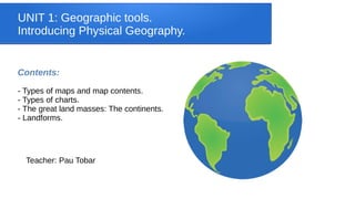
- 1. UNIT 1: Geographic tools. Introducing Physical Geography. Contents: - Types of maps and map contents. - Types of charts. - The great land masses: The continents. - Landforms. Teacher: Pau Tobar
- 2. GEOGRAPHIC TOOLS: Maps ● Definition: A map is a two dimensional representation of the Earth’s surface or part of it. ● The are different types of maps: ● Physical maps: Representing physical elements (landforms, rivers, seas…). ● Political maps: Showing cities and countries or regional borders. They usually include seas and oceans. ● Topographical maps: Including information about physical and human factors. They are represented in a large-scale and use contour lines. ● Thematic maps: Depicting information on a specific aspect (population, climate,etc)
- 7. MAP CONTENTS ● Title: It points the map’s topic. ● Orientation: Depicted by an arrow. The top is usually North. ● Scale: Proportion between the size of the map and the reality. A small scale represents huge territories with fewer details, but a large scale represents smaller territories with more details. They could be fractional scales or graphic scales. ● Key: Explains the set of symbols or colours used to represent information on the map. It is usually depicted in a box on a square of the map. ● Geographic coordinates: Uses parallels and meridians to locate an exact point on the Earth.
- 8. SCALE
- 10. TEST YOURSELF
- 11. TAKE A LOOK! Explore this geographic resource created by the Valencian government
- 12. GEOGRAPHIC TOOLS: CHARTS ● Definition: A sheet of information in the form of a table or a graph ● Types of charts: – Pie chart: proportion – Bar chart: comparison – Line chart: evolution
- 14. THE GREAT LAND MASSES. THE CONTINENTS ● The Blue Planet: More than two-thirds of the Earth are covered by oceans. The emerged lands form continents. There are six continents on the Earth, but in some countries, North and South America are distinguished as different continents.
- 15. TEST YOURSELF!
- 16. LANDFORMS Watch this video and, on the drawing, identify some of the landforms described.
- 17. TEST YOURSELF!
- 18. TEST YOUR SELF!
- 19. FIND OUT NEW LANDFORMS ON INTERNET!
- 20. WORK IN GROUP: USE GOOGLE EARTH! Find examples of the main landforms on Google Earth. Make a screenshot and gather it in a Google Drive folder. Send me your work!
- 21. END OF UNIT 1: SEE YOU SOON!