SlideShare a Scribd company logo
1 of 76
CAPACITY BUILDING PROGRAMME
ORGANISED BY DAV CENTRE FOR ACADEMIC EXCELLENCE
( HR ZONE – B,E,&G)
Social Science – Middle Level
Topic- Use of Map, Globe and Atlas
Presented by
Jyoti
OBJECTIVES OF THE SESSION
Use of map, globe and atlas as an important resource
Enhance spatial thinking
Provide concrete base of knowledge and skill
Create interest in all disciplines of social science
Application of knowledge in the real world
Development of 21st century skill
MAPS,GLOBE AND ATLAS
GLOBES
• A globe is a small-scale three
dimensional MODEL OF THE EARTH.
• It is mounted on an axis so that it
can be rotated freely just like an
earth.
• The line of latitude and longitude
are drawn on it.
• On an outline map of world draw a line on a
prime meridian.
• Fold the map from this line
• Tear your map into two pieces.
• Now paste the from other end.
• What is your observation now?
AVTIVITY -2
MAKE YOUR GLOBE
Making a globe is a fun challenge
Students can learn that how the curvature
Of the Earth is difficult to reproduce on a flat piece
Of paper which features of the Earth may distorted
While these are placed on the flat paper
ADVANTAGE AND DISADVANTAGE OF GLOBE
flattened at the poles and
bulging at the equator.
• Bulky and can not be stored easily
• Shows exact shape of the
earth- spherical slightly
• The shape of continents and
oceans are shown accurately.
• The different physical features
are also marked more or less
accurately.
• It can not show the details of
landforms and location of small
towns.
• It can not provide detail information
about climate, vegetation agriculture
etc.
• Although larger globes show some
details they are difficult to carry and
handle
Globe is a spherical representation of a
Earth.
Limitations:
• Three dimensional
• Difficult to carry.
• Gives limited information.
That why we need maps.
MAP
• A map is a essential tool of a
geographer.
• It is a representation of the earth as
whole or part of the earth drawn on a
flat surface.
• It can show continents courtiers cities
and even a local area with all details
 Spatial thinking : Identifying, analyzing, and understanding the location, scale,
patterns, and trends and their relation to each other.
 Spatial thinking allows students to comprehend and analyze phenomena
related to the places and spaces around them.
Spatial thinking and map skills in students
• To represent a larger area on a small piece of paper.
• To show a phenomenon or process we can’t see with our eyes
• To present information concisely
• To enhance map skills.
• For better understanding of location and global relationship.
OBJECTIVES
• To understand map language, i.e., cardinal
directions, map symbols & scale.
• To identify location of continent and oceans in
reference to hemisphere and directions.
• To correlate different political, geographical,
cultural and economic aspects.
PAPYRUS
• Its not a new phenomenon and has been practiced since the ancient times.
• They were made from animal skin parchment papyrus and clay tablets
• The science of map making is called as
CARTOGRAPHY (Carte- in French
means “MAP” graphic- DRAWING).
• A person who draws map is called as
CARTOGRAPHER.
• Cartographer show the curved surface
of the earth on a flat map is known as
MAP PROJECTION.
TYPES
OF
MAPS
POLITICAL MAPS
PHYSICAL MAP
TOPOGRAPHICAL MAP
OR CONTOUR MAP
CLIMATIC MAP
TOURIST MAP
THEMATIC MAP
POLITICALMAPS
Shows the boundaries
of administrative units
such as countries,
state and district
Different types of
boundary are shown
with different symbols
PHYSICAL
MAP
Shows the landforms and
the water bodies on the
earth surface such as
mountain, plateaus plains,
rivers lakes, sea etc.
Climatic map
• Shows weather condition like
temperature, pressure wind
direction and rainfall
Thematic map
• Shows the distribution of
forest, crops, minerals and
vegetation.
Topographical map shows
a great details of both
man made and natural
features with the help of
conventional symbols
Imaginary line joining
place above the mean
sea level is known as
CONTOUR
All over the world it is
used by geographers,
geologist defense
personal and
surveyors
• A map how ever has a disadvantages.
• A flat map can not accurately show the
curved surface of the earth.
• When a map is drawn the shape and size
get distorted.
• The maximum distortion occurs in the
region of poles and less at equatorial
region.
USES OF
MAP
Easy to handle and can
carry everywhere
Provides lots of
information for planning
such a road residential
complex's etc.
It is useful to sailors,
pilots miners engineers
etc..
Army depend on maps
for information
SKETCH Very often people give
directions to a
particular place by
making a rough drawing
to show the route.
This includes landmarks
and name of the street.
Such diagram is called as
sketch.
Rough map is drawn
without any scale,
conventional sign and
symbol, directions and
distance.
PLA
N
DETAILED DRAWING OF A
SMALLAREA
PLAN SHOWS A SMALL
AREA ON A LARGE SCALE
EG- INTERIOR OF HOUSE ,
AN OFFICE BUILDING OR
EVEN YOUR CLASS ROOM
MAP SHOWS A LARGE
AREA ON A SMALL SCALE
A compass is a tool to tell directions of north , south, east ,west, which are designated on a map using
A compass rose
A compass rose ,a drawing showing different directions on a map, it is usually found somewhere
on the edge of a map . It shows the four cardinal directions, which are north south east west .
On the most paper maps north points up and south points down ,east point right and west point left
If you go clockwise around the compass rose , use the mnemonic “ Never Eat Soggy Waffles”
to remember the order of first initial of the words
ACTIVITY 3
COMPASS ROSE
ACTIVITY 4
USE OF
COMPASS ROSE
AVTIVITY 5
FUN ACTIVITY
MAP BASED TEACHING
HISTORY
KNITTING EVENTS THROUGH MAPS
INDIA
BRITAIN
Timeline of events
DATES EVENTS
1885
1905
1906
1907
1909
1915
1916
1916
1919
1919
1919
1920
1922
1927
1929
1930
1935
1939
1942
1942
1945
1946
1947
Formation of Indian National Congress
Partition of Bengal
Formation of Muslim league
Surat Session of Congress
Morley- Minto Reforms
Arrival of Mahatma Gandhi on the Indian Political Scene
Home Rule League
Lucknow Pact
Government of India Act of 1919
Rowlatt Act
Jallianwala Bagh Massacre
Non- Cooperation Movement
Chauri- Chaura Incident
Simon Commission
Lahore Session of Congress
Dandi March/ Civil Disobedience Movement
Government of India Act, 1935
Beginning of Second World War
Cripps Mission
Quit India Movement
End of Second World War
Cabinet mission
India became Independent
BOMBAY
4/16/2024
Formed in
December, 1885 by
A. O. Hume.
First meeting of the
INC took place in
Bombay under the
presidentship of W.C.
Bannerjee.
Task 1
4/16/2024
Locate and label the following on the political map of India
Regional associations prior to
the formation of the INC
1876 Indian association
Puna Sarvjanik Sabha
All India Conference 1883
West Bengal except Darjeeling
Assam
Bangladesh
4/16/2024
ote: while explaining connect partition of Bengal with present political divisions.
Meghalaya
SWADESHI MOVEMENT
Swadeshi Movement spread
from Bengal to Maharashtra and
Punjab.
Tools for achieving Swaraj
Swadeshi
Boycott
National Education
TASK 2
On the political map of India,
mark the states to which the
following Moderate leaders
belong:-
 Gopal Krishna Gokhale
 Dadabhai Naoroji
 Surendra Nath Banerjee
 Pheroz Shah Mehta
 Mahadev Govind Ranade
 Badruddin Tyabji
CALCUTTA SESSION OF CONGRESS, 1906
Presided over by
Dadabhai Naoroji
Purpose:
 Attainment of
Swaraj- self-
government
Calcutta
SURAT SESSION OF CONGRESS, 1907
Split between the
Moderates and the Radicals.
Moderates led by Gopal
Krishna Gokhale and
Pheroze Shah Mehta.
Radicals led by Lal, Bal
and Pal.
Surat
TASK 3
On the political map of
India, mark the states to
which the following
Radical leaders belong:-
Lala Lajpat Rai
Bal Gangadhar Tilak
Bipin Chandra Pal
HOME RULE LEAGUE, 1916
Established by Mrs.
Annie Besant in Madras
and Bal Gangadhar Tilak
in Maharashtra.
Purpose:
To attain self-
government
Madras
HOME RULE LEAGUE
LUCKNOW PACT OF 1916
•Moderates and
Radicals reunited :
to strengthen the
National Movement.
signed a joint pact with
Muslim League.
jointly demanded for
self- rule.
Lucknow
Mohandas
Karamchand Gandhi
in South Africa
Note: The students
should locate South
Africa on the political
map of world.
 Introduced the technique of non-
violent agitation, called Satyagraha.
Established Sabarmati Ashram in
Gujarat for social reform.
First movement, in support of
peasants, began in Champaran in
Bihar in 1917.
Sabarmati
Champaran
The Advent of Mahatma Gandhi
THE ALLIES
THE CENTRAL POWERS
 FRANCE
 BRITAIN
 RUSSIA
 ITALY
 JAPAN
 GREECE
 PORTUGAL
 ROMANIA
 GERMANY
 AUSTRIA-
HUNGARY
 TURKEY
 BULGARIA
TASK- 4
 On the world political map, locate and label the countries
that participated in the First World War.
JALLIANWALA BAGH MASSACRE
•April 13, 1919
•Baisakhi, Golden Temple, Amritsar
•Peaceful protest
•Against the arrest of two leaders
•General Dyer ordered to open fire
•Innocent and unarmed men,
women and children died.
•Whole country stunned.
•Martial law imposed in Punjab
•People tortured, Newspaper
banned, Mails censored
Amritsar
Non-Cooperation Movement, 1920
Nagpur
Ratification of Gandhi’s
call for Non- Cooperation
Movement in the
Congress Session at
Nagpur in December,
1920.
 First mass movement.
Launched against the
injustices done by the
British in Punjab.
1922, CHAURI CHAURA
Chauri - Chaura
Chauri Chaura in Uttar
Pradesh
Police fire upon a group
of demonstrators.
Agitated mob set police
station on fire.
22 policeman burnt
alive.
Non- Cooperation
Movement called off.
PEASANTS AND WORKERS’ MOVEMENTS
To oppose
British exploitation
High Taxes.
Sardar Vallabhbhai
Patel took up the cause
for peasants of
Bardoli in Gujarat.
Bardoli
SIMON COMMISSION, 1927
Lahore
Simon Commission sent to
India.
Congress opposed the
Commission.
Boycotted by the Congress
and Muslim League with
black flags.
Lala Lajpat Rai injured
while protesting in Lahore
and later succumbed to his
injuries.
LAHORE SESSION, 1929
Lahore
DANDI MARCH
TASK 5
Locate and
label Dandi on
the political
map of India
SE
CO
ND
WO
RL
D
WA
R(1
939
-
45)
THE ALLIES THE AXIS
 THE U. K.
 FRANCE
 SOVIET UNION
 THE U.S.A.
 GERMANY
 ITALY
 JAPAN
TASK- 6
 On the world political map, locate and label the
countries that participated in the Second World
War.
Subhash
Chandra Bose
was ready to join
hands with
Germany and
Japan to get the
British out of
India.
GERMANY
JAPAN
FORMATION OF INDIAN NATIONAL ARMY
 Rabindra Nath Tagore
 Sarojini Naidu
 Vallabhbhai Patel
 Dadabhai Naoroji
 Bal Gangadhar Tilak
 Khan Abdul Gaffar Khan
 Mahatma Gandhi
 Lala Lajpat Rai, Bal
Gangadhar Tilak, Bipin
Chandra Pal
 Nightingale of India
 Mahatma Babu
 Frontier Gandhi Badshah
Khan
 Lok Manya
 Lal, Bal, Pal
 Iron Man
 Knighthood
 Grand Old Man of India
IDENTIFY THE TITLES GIVEN TO OUR LEADERS AND PASTE THEIR PICTURES
IN THE STATES TO WHICH THEY BELONGED
Lahore
Dandi
Sabarmati
Surat
Bardoli
Mumbai
Madras
Nagpur
Calcutta
Champaran
Lucknow
Chauri Chaura
Amritsar
TASK 8 RECAPITULATION
Mention the
important
events of our
struggle for
freedom related
to the places
mentioned in
the given map.
TOWARDS INDEPENDENCE
MAP BASED TEACHING
POLITICAL SCIENCE
KNITTING ADVENT OF CONSTITUTION
THROUGH MAPS
WORLD POLITICAL MAP
TASK 1
Mark the following on the world political map
 Constitutions which are a
result of political revolutions
Constitution of France
Constitution of The United
States of America
 Constitution which is a
result of gradual evolution
Constitution of The United
Kingdom
TASK 2
Countries from whom India adopted varied features enshrined in our
Constitution
INDIAN
CONSTITUTIO
N
UNITED
KINGDOM
UNITED
STATES
OF
AMERICA
CANADA
RUSSIA
IRELAND
FRANCE
Note: Locate and label the above mentioned countries on the map.
TASK 3
 Draw the flags of the
following countries and
paste them at the
appropriate locations in
the map:-
 India
 The United Kingdom
 The United States Of
America
 Canada
 Russia
 Ireland
 France
TA
SK
4  Mark at least two countries in each
continent having democratic form of
government.
MAP BASED TEACHING
GEOGRAPHY
KNITTING RESOURCES THROUGH MAPS
Democratic Republic of Congo
Cameroon
Equatorial Guinea
Gabon Republic of Congo
Note: Discuss how the human needs and wants are neither uniform in all parts of the world nor static over
the years
PYGMIES OF AFRICA
Early Human Civilisations
Note: Emphasis on how utility and value of a resource varies from time to time and place to place
Wind Energy
Note: Discuss the wind producing countries like Germany, Spain, France, U.K. etc. Have a general discussion on why wind energy is
more developed in these countries. Mentions India's 4th position in the wind energy production.
U.S.A
CHINA
INDIA
Task
 Find out the top 8 wind producing countries of the world and
show it in the outline political map of the world.
Afghanistan
Benin
Burundi
Chad
Democratic Republic of Congo
China
India
Note: Why some of the countries of the World are developing. Discuss the factors responsible for it.
New Zealand
Australia
Switzerland
Netherland
U.S.A.
Canada
Germany
Note: Give more examples of developed countries and share the experience of the countries visited by the students
ATLAS
The Atlas is a reference source we use when we need to find out information about countries
And places in the world
WHY IS AN ATLAS CALLED AN ATLAS
The ancient Greeks believed that Atlas was a hero who carried the world on his shoulder in
Space. We use the word atlas to describe a book of maps because they hold the world
LEARNING OBJECTIVES
An Atlas is a collection of maps it is typically a map of Earth or a region of Earth. It enables comparisons
Between maps in order to recognise correlations between them
Atlas provide extra information about the maps, as it contains extra information
For example if you are looking at an atlas of stars and planets,
there may be information about the different constellations
ACTIVITY :- CREATE ATLAS FOR CLASS
Students will create a blank booklet
The will paste different types of maps
Cut out and paste different types of definitions and information regarding map
INTERACTIVE WORKSHEETS( NEARPOD)
GENERAL INSTRUCTIONS
OPEN THE LINK IN THE CHATBOX
JOIN THE LESSON

More Related Content

Similar to USE_OF_MAP_GLOBE_AND_ATLAS_27-8-2022.pptx

Exploring our geographic world by tessie calimag bb.
Exploring our geographic world by tessie calimag bb.Exploring our geographic world by tessie calimag bb.
Exploring our geographic world by tessie calimag bb.Tessie Calimag
 
Globes and maps for class 6
Globes and maps for class 6Globes and maps for class 6
Globes and maps for class 6Akanksha
 
Exploring our geographic world by tessie calimag bb.
Exploring our geographic world by tessie calimag bb.Exploring our geographic world by tessie calimag bb.
Exploring our geographic world by tessie calimag bb.Tessie Calimag
 
Intro to world geography skills
Intro to world geography skillsIntro to world geography skills
Intro to world geography skillskarrinem
 
Unit 1, part 3 the study of geography, cartographers' tools
Unit 1, part 3 the study of geography, cartographers' toolsUnit 1, part 3 the study of geography, cartographers' tools
Unit 1, part 3 the study of geography, cartographers' toolsmontathomas
 
map_projections_powerpoint3.ppt
map_projections_powerpoint3.pptmap_projections_powerpoint3.ppt
map_projections_powerpoint3.pptDeshDeepak68
 
The geographer’s tools
The geographer’s toolsThe geographer’s tools
The geographer’s toolsAaron Carn
 
Notes on different terms of Geography
Notes on different terms of GeographyNotes on different terms of Geography
Notes on different terms of Geographyaprilrousseau
 
World geography intro powerpoint
World geography  intro powerpointWorld geography  intro powerpoint
World geography intro powerpointconfused1913
 
VI CLASS 3rd LESSON MAPS.pptx
VI CLASS  3rd  LESSON MAPS.pptxVI CLASS  3rd  LESSON MAPS.pptx
VI CLASS 3rd LESSON MAPS.pptxMamillaBabu
 
Chapter- 3 MAPS 1.pptx.pptx
Chapter- 3 MAPS 1.pptx.pptxChapter- 3 MAPS 1.pptx.pptx
Chapter- 3 MAPS 1.pptx.pptxMamillaBabu
 
L.NO.3 .GLOBE AND THE MAPS.pptx
L.NO.3 .GLOBE AND THE MAPS.pptxL.NO.3 .GLOBE AND THE MAPS.pptx
L.NO.3 .GLOBE AND THE MAPS.pptxMVHerwadkarschool
 
5 themes and map skills
5 themes and map skills 5 themes and map skills
5 themes and map skills Úcar Marian
 

Similar to USE_OF_MAP_GLOBE_AND_ATLAS_27-8-2022.pptx (20)

Maps and globes
Maps and globesMaps and globes
Maps and globes
 
Exploring our geographic world by tessie calimag bb.
Exploring our geographic world by tessie calimag bb.Exploring our geographic world by tessie calimag bb.
Exploring our geographic world by tessie calimag bb.
 
Globes and maps for class 6
Globes and maps for class 6Globes and maps for class 6
Globes and maps for class 6
 
Exploring our geographic world by tessie calimag bb.
Exploring our geographic world by tessie calimag bb.Exploring our geographic world by tessie calimag bb.
Exploring our geographic world by tessie calimag bb.
 
Intro to world geography skills
Intro to world geography skillsIntro to world geography skills
Intro to world geography skills
 
Topic 6 power point
Topic 6 power pointTopic 6 power point
Topic 6 power point
 
Unit 1, part 3 the study of geography, cartographers' tools
Unit 1, part 3 the study of geography, cartographers' toolsUnit 1, part 3 the study of geography, cartographers' tools
Unit 1, part 3 the study of geography, cartographers' tools
 
map_projections_powerpoint3.ppt
map_projections_powerpoint3.pptmap_projections_powerpoint3.ppt
map_projections_powerpoint3.ppt
 
map projections.ppt
map projections.pptmap projections.ppt
map projections.ppt
 
Types of Maps.ppt
Types of Maps.pptTypes of Maps.ppt
Types of Maps.ppt
 
The geographer’s tools
The geographer’s toolsThe geographer’s tools
The geographer’s tools
 
Notes on different terms of Geography
Notes on different terms of GeographyNotes on different terms of Geography
Notes on different terms of Geography
 
World geography intro powerpoint
World geography  intro powerpointWorld geography  intro powerpoint
World geography intro powerpoint
 
VI CLASS 3rd LESSON MAPS.pptx
VI CLASS  3rd  LESSON MAPS.pptxVI CLASS  3rd  LESSON MAPS.pptx
VI CLASS 3rd LESSON MAPS.pptx
 
Chapter- 3 MAPS 1.pptx.pptx
Chapter- 3 MAPS 1.pptx.pptxChapter- 3 MAPS 1.pptx.pptx
Chapter- 3 MAPS 1.pptx.pptx
 
Types of Maps.ppt
Types of Maps.pptTypes of Maps.ppt
Types of Maps.ppt
 
Geography Handbook
Geography HandbookGeography Handbook
Geography Handbook
 
L.NO.3 .GLOBE AND THE MAPS.pptx
L.NO.3 .GLOBE AND THE MAPS.pptxL.NO.3 .GLOBE AND THE MAPS.pptx
L.NO.3 .GLOBE AND THE MAPS.pptx
 
SST-1.pptx
SST-1.pptxSST-1.pptx
SST-1.pptx
 
5 themes and map skills
5 themes and map skills 5 themes and map skills
5 themes and map skills
 

Recently uploaded

General AI for Medical Educators April 2024
General AI for Medical Educators April 2024General AI for Medical Educators April 2024
General AI for Medical Educators April 2024Janet Corral
 
IGNOU MSCCFT and PGDCFT Exam Question Pattern: MCFT003 Counselling and Family...
IGNOU MSCCFT and PGDCFT Exam Question Pattern: MCFT003 Counselling and Family...IGNOU MSCCFT and PGDCFT Exam Question Pattern: MCFT003 Counselling and Family...
IGNOU MSCCFT and PGDCFT Exam Question Pattern: MCFT003 Counselling and Family...PsychoTech Services
 
Web & Social Media Analytics Previous Year Question Paper.pdf
Web & Social Media Analytics Previous Year Question Paper.pdfWeb & Social Media Analytics Previous Year Question Paper.pdf
Web & Social Media Analytics Previous Year Question Paper.pdfJayanti Pande
 
Class 11th Physics NEET formula sheet pdf
Class 11th Physics NEET formula sheet pdfClass 11th Physics NEET formula sheet pdf
Class 11th Physics NEET formula sheet pdfAyushMahapatra5
 
Kisan Call Centre - To harness potential of ICT in Agriculture by answer farm...
Kisan Call Centre - To harness potential of ICT in Agriculture by answer farm...Kisan Call Centre - To harness potential of ICT in Agriculture by answer farm...
Kisan Call Centre - To harness potential of ICT in Agriculture by answer farm...Krashi Coaching
 
Nutritional Needs Presentation - HLTH 104
Nutritional Needs Presentation - HLTH 104Nutritional Needs Presentation - HLTH 104
Nutritional Needs Presentation - HLTH 104misteraugie
 
Q4-W6-Restating Informational Text Grade 3
Q4-W6-Restating Informational Text Grade 3Q4-W6-Restating Informational Text Grade 3
Q4-W6-Restating Informational Text Grade 3JemimahLaneBuaron
 
Measures of Dispersion and Variability: Range, QD, AD and SD
Measures of Dispersion and Variability: Range, QD, AD and SDMeasures of Dispersion and Variability: Range, QD, AD and SD
Measures of Dispersion and Variability: Range, QD, AD and SDThiyagu K
 
Paris 2024 Olympic Geographies - an activity
Paris 2024 Olympic Geographies - an activityParis 2024 Olympic Geographies - an activity
Paris 2024 Olympic Geographies - an activityGeoBlogs
 
Disha NEET Physics Guide for classes 11 and 12.pdf
Disha NEET Physics Guide for classes 11 and 12.pdfDisha NEET Physics Guide for classes 11 and 12.pdf
Disha NEET Physics Guide for classes 11 and 12.pdfchloefrazer622
 
9548086042 for call girls in Indira Nagar with room service
9548086042  for call girls in Indira Nagar  with room service9548086042  for call girls in Indira Nagar  with room service
9548086042 for call girls in Indira Nagar with room servicediscovermytutordmt
 
Key note speaker Neum_Admir Softic_ENG.pdf
Key note speaker Neum_Admir Softic_ENG.pdfKey note speaker Neum_Admir Softic_ENG.pdf
Key note speaker Neum_Admir Softic_ENG.pdfAdmir Softic
 
BASLIQ CURRENT LOOKBOOK LOOKBOOK(1) (1).pdf
BASLIQ CURRENT LOOKBOOK  LOOKBOOK(1) (1).pdfBASLIQ CURRENT LOOKBOOK  LOOKBOOK(1) (1).pdf
BASLIQ CURRENT LOOKBOOK LOOKBOOK(1) (1).pdfSoniaTolstoy
 
Sports & Fitness Value Added Course FY..
Sports & Fitness Value Added Course FY..Sports & Fitness Value Added Course FY..
Sports & Fitness Value Added Course FY..Disha Kariya
 
Arihant handbook biology for class 11 .pdf
Arihant handbook biology for class 11 .pdfArihant handbook biology for class 11 .pdf
Arihant handbook biology for class 11 .pdfchloefrazer622
 
Activity 01 - Artificial Culture (1).pdf
Activity 01 - Artificial Culture (1).pdfActivity 01 - Artificial Culture (1).pdf
Activity 01 - Artificial Culture (1).pdfciinovamais
 
social pharmacy d-pharm 1st year by Pragati K. Mahajan
social pharmacy d-pharm 1st year by Pragati K. Mahajansocial pharmacy d-pharm 1st year by Pragati K. Mahajan
social pharmacy d-pharm 1st year by Pragati K. Mahajanpragatimahajan3
 
A Critique of the Proposed National Education Policy Reform
A Critique of the Proposed National Education Policy ReformA Critique of the Proposed National Education Policy Reform
A Critique of the Proposed National Education Policy ReformChameera Dedduwage
 

Recently uploaded (20)

General AI for Medical Educators April 2024
General AI for Medical Educators April 2024General AI for Medical Educators April 2024
General AI for Medical Educators April 2024
 
IGNOU MSCCFT and PGDCFT Exam Question Pattern: MCFT003 Counselling and Family...
IGNOU MSCCFT and PGDCFT Exam Question Pattern: MCFT003 Counselling and Family...IGNOU MSCCFT and PGDCFT Exam Question Pattern: MCFT003 Counselling and Family...
IGNOU MSCCFT and PGDCFT Exam Question Pattern: MCFT003 Counselling and Family...
 
Web & Social Media Analytics Previous Year Question Paper.pdf
Web & Social Media Analytics Previous Year Question Paper.pdfWeb & Social Media Analytics Previous Year Question Paper.pdf
Web & Social Media Analytics Previous Year Question Paper.pdf
 
Class 11th Physics NEET formula sheet pdf
Class 11th Physics NEET formula sheet pdfClass 11th Physics NEET formula sheet pdf
Class 11th Physics NEET formula sheet pdf
 
Kisan Call Centre - To harness potential of ICT in Agriculture by answer farm...
Kisan Call Centre - To harness potential of ICT in Agriculture by answer farm...Kisan Call Centre - To harness potential of ICT in Agriculture by answer farm...
Kisan Call Centre - To harness potential of ICT in Agriculture by answer farm...
 
Nutritional Needs Presentation - HLTH 104
Nutritional Needs Presentation - HLTH 104Nutritional Needs Presentation - HLTH 104
Nutritional Needs Presentation - HLTH 104
 
Q4-W6-Restating Informational Text Grade 3
Q4-W6-Restating Informational Text Grade 3Q4-W6-Restating Informational Text Grade 3
Q4-W6-Restating Informational Text Grade 3
 
Measures of Dispersion and Variability: Range, QD, AD and SD
Measures of Dispersion and Variability: Range, QD, AD and SDMeasures of Dispersion and Variability: Range, QD, AD and SD
Measures of Dispersion and Variability: Range, QD, AD and SD
 
Advance Mobile Application Development class 07
Advance Mobile Application Development class 07Advance Mobile Application Development class 07
Advance Mobile Application Development class 07
 
Paris 2024 Olympic Geographies - an activity
Paris 2024 Olympic Geographies - an activityParis 2024 Olympic Geographies - an activity
Paris 2024 Olympic Geographies - an activity
 
Disha NEET Physics Guide for classes 11 and 12.pdf
Disha NEET Physics Guide for classes 11 and 12.pdfDisha NEET Physics Guide for classes 11 and 12.pdf
Disha NEET Physics Guide for classes 11 and 12.pdf
 
Mattingly "AI & Prompt Design: Structured Data, Assistants, & RAG"
Mattingly "AI & Prompt Design: Structured Data, Assistants, & RAG"Mattingly "AI & Prompt Design: Structured Data, Assistants, & RAG"
Mattingly "AI & Prompt Design: Structured Data, Assistants, & RAG"
 
9548086042 for call girls in Indira Nagar with room service
9548086042  for call girls in Indira Nagar  with room service9548086042  for call girls in Indira Nagar  with room service
9548086042 for call girls in Indira Nagar with room service
 
Key note speaker Neum_Admir Softic_ENG.pdf
Key note speaker Neum_Admir Softic_ENG.pdfKey note speaker Neum_Admir Softic_ENG.pdf
Key note speaker Neum_Admir Softic_ENG.pdf
 
BASLIQ CURRENT LOOKBOOK LOOKBOOK(1) (1).pdf
BASLIQ CURRENT LOOKBOOK  LOOKBOOK(1) (1).pdfBASLIQ CURRENT LOOKBOOK  LOOKBOOK(1) (1).pdf
BASLIQ CURRENT LOOKBOOK LOOKBOOK(1) (1).pdf
 
Sports & Fitness Value Added Course FY..
Sports & Fitness Value Added Course FY..Sports & Fitness Value Added Course FY..
Sports & Fitness Value Added Course FY..
 
Arihant handbook biology for class 11 .pdf
Arihant handbook biology for class 11 .pdfArihant handbook biology for class 11 .pdf
Arihant handbook biology for class 11 .pdf
 
Activity 01 - Artificial Culture (1).pdf
Activity 01 - Artificial Culture (1).pdfActivity 01 - Artificial Culture (1).pdf
Activity 01 - Artificial Culture (1).pdf
 
social pharmacy d-pharm 1st year by Pragati K. Mahajan
social pharmacy d-pharm 1st year by Pragati K. Mahajansocial pharmacy d-pharm 1st year by Pragati K. Mahajan
social pharmacy d-pharm 1st year by Pragati K. Mahajan
 
A Critique of the Proposed National Education Policy Reform
A Critique of the Proposed National Education Policy ReformA Critique of the Proposed National Education Policy Reform
A Critique of the Proposed National Education Policy Reform
 

USE_OF_MAP_GLOBE_AND_ATLAS_27-8-2022.pptx

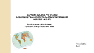
  • 1. CAPACITY BUILDING PROGRAMME ORGANISED BY DAV CENTRE FOR ACADEMIC EXCELLENCE ( HR ZONE – B,E,&G) Social Science – Middle Level Topic- Use of Map, Globe and Atlas Presented by Jyoti
  • 2. OBJECTIVES OF THE SESSION Use of map, globe and atlas as an important resource Enhance spatial thinking Provide concrete base of knowledge and skill Create interest in all disciplines of social science Application of knowledge in the real world Development of 21st century skill MAPS,GLOBE AND ATLAS
  • 3. GLOBES • A globe is a small-scale three dimensional MODEL OF THE EARTH. • It is mounted on an axis so that it can be rotated freely just like an earth. • The line of latitude and longitude are drawn on it.
  • 4. • On an outline map of world draw a line on a prime meridian. • Fold the map from this line • Tear your map into two pieces. • Now paste the from other end. • What is your observation now?
  • 5.
  • 6. AVTIVITY -2 MAKE YOUR GLOBE Making a globe is a fun challenge Students can learn that how the curvature Of the Earth is difficult to reproduce on a flat piece Of paper which features of the Earth may distorted While these are placed on the flat paper
  • 7. ADVANTAGE AND DISADVANTAGE OF GLOBE flattened at the poles and bulging at the equator. • Bulky and can not be stored easily • Shows exact shape of the earth- spherical slightly • The shape of continents and oceans are shown accurately. • The different physical features are also marked more or less accurately. • It can not show the details of landforms and location of small towns. • It can not provide detail information about climate, vegetation agriculture etc. • Although larger globes show some details they are difficult to carry and handle
  • 8. Globe is a spherical representation of a Earth. Limitations: • Three dimensional • Difficult to carry. • Gives limited information. That why we need maps.
  • 9. MAP • A map is a essential tool of a geographer. • It is a representation of the earth as whole or part of the earth drawn on a flat surface. • It can show continents courtiers cities and even a local area with all details
  • 10.  Spatial thinking : Identifying, analyzing, and understanding the location, scale, patterns, and trends and their relation to each other.  Spatial thinking allows students to comprehend and analyze phenomena related to the places and spaces around them. Spatial thinking and map skills in students
  • 11. • To represent a larger area on a small piece of paper. • To show a phenomenon or process we can’t see with our eyes • To present information concisely • To enhance map skills. • For better understanding of location and global relationship. OBJECTIVES
  • 12. • To understand map language, i.e., cardinal directions, map symbols & scale. • To identify location of continent and oceans in reference to hemisphere and directions. • To correlate different political, geographical, cultural and economic aspects.
  • 13. PAPYRUS • Its not a new phenomenon and has been practiced since the ancient times. • They were made from animal skin parchment papyrus and clay tablets
  • 14. • The science of map making is called as CARTOGRAPHY (Carte- in French means “MAP” graphic- DRAWING). • A person who draws map is called as CARTOGRAPHER. • Cartographer show the curved surface of the earth on a flat map is known as MAP PROJECTION.
  • 15. TYPES OF MAPS POLITICAL MAPS PHYSICAL MAP TOPOGRAPHICAL MAP OR CONTOUR MAP CLIMATIC MAP TOURIST MAP THEMATIC MAP
  • 16. POLITICALMAPS Shows the boundaries of administrative units such as countries, state and district Different types of boundary are shown with different symbols
  • 17. PHYSICAL MAP Shows the landforms and the water bodies on the earth surface such as mountain, plateaus plains, rivers lakes, sea etc.
  • 18. Climatic map • Shows weather condition like temperature, pressure wind direction and rainfall
  • 19. Thematic map • Shows the distribution of forest, crops, minerals and vegetation.
  • 20. Topographical map shows a great details of both man made and natural features with the help of conventional symbols Imaginary line joining place above the mean sea level is known as CONTOUR All over the world it is used by geographers, geologist defense personal and surveyors
  • 21. • A map how ever has a disadvantages. • A flat map can not accurately show the curved surface of the earth. • When a map is drawn the shape and size get distorted. • The maximum distortion occurs in the region of poles and less at equatorial region.
  • 22. USES OF MAP Easy to handle and can carry everywhere Provides lots of information for planning such a road residential complex's etc. It is useful to sailors, pilots miners engineers etc.. Army depend on maps for information
  • 23. SKETCH Very often people give directions to a particular place by making a rough drawing to show the route. This includes landmarks and name of the street. Such diagram is called as sketch. Rough map is drawn without any scale, conventional sign and symbol, directions and distance.
  • 24. PLA N DETAILED DRAWING OF A SMALLAREA PLAN SHOWS A SMALL AREA ON A LARGE SCALE EG- INTERIOR OF HOUSE , AN OFFICE BUILDING OR EVEN YOUR CLASS ROOM MAP SHOWS A LARGE AREA ON A SMALL SCALE
  • 25. A compass is a tool to tell directions of north , south, east ,west, which are designated on a map using A compass rose A compass rose ,a drawing showing different directions on a map, it is usually found somewhere on the edge of a map . It shows the four cardinal directions, which are north south east west . On the most paper maps north points up and south points down ,east point right and west point left If you go clockwise around the compass rose , use the mnemonic “ Never Eat Soggy Waffles” to remember the order of first initial of the words
  • 29.
  • 30. MAP BASED TEACHING HISTORY KNITTING EVENTS THROUGH MAPS
  • 32. Timeline of events DATES EVENTS 1885 1905 1906 1907 1909 1915 1916 1916 1919 1919 1919 1920 1922 1927 1929 1930 1935 1939 1942 1942 1945 1946 1947 Formation of Indian National Congress Partition of Bengal Formation of Muslim league Surat Session of Congress Morley- Minto Reforms Arrival of Mahatma Gandhi on the Indian Political Scene Home Rule League Lucknow Pact Government of India Act of 1919 Rowlatt Act Jallianwala Bagh Massacre Non- Cooperation Movement Chauri- Chaura Incident Simon Commission Lahore Session of Congress Dandi March/ Civil Disobedience Movement Government of India Act, 1935 Beginning of Second World War Cripps Mission Quit India Movement End of Second World War Cabinet mission India became Independent
  • 33. BOMBAY 4/16/2024 Formed in December, 1885 by A. O. Hume. First meeting of the INC took place in Bombay under the presidentship of W.C. Bannerjee.
  • 34. Task 1 4/16/2024 Locate and label the following on the political map of India Regional associations prior to the formation of the INC 1876 Indian association Puna Sarvjanik Sabha All India Conference 1883
  • 35. West Bengal except Darjeeling Assam Bangladesh 4/16/2024 ote: while explaining connect partition of Bengal with present political divisions. Meghalaya
  • 36. SWADESHI MOVEMENT Swadeshi Movement spread from Bengal to Maharashtra and Punjab. Tools for achieving Swaraj Swadeshi Boycott National Education
  • 37. TASK 2 On the political map of India, mark the states to which the following Moderate leaders belong:-  Gopal Krishna Gokhale  Dadabhai Naoroji  Surendra Nath Banerjee  Pheroz Shah Mehta  Mahadev Govind Ranade  Badruddin Tyabji
  • 38. CALCUTTA SESSION OF CONGRESS, 1906 Presided over by Dadabhai Naoroji Purpose:  Attainment of Swaraj- self- government Calcutta
  • 39. SURAT SESSION OF CONGRESS, 1907 Split between the Moderates and the Radicals. Moderates led by Gopal Krishna Gokhale and Pheroze Shah Mehta. Radicals led by Lal, Bal and Pal. Surat
  • 40. TASK 3 On the political map of India, mark the states to which the following Radical leaders belong:- Lala Lajpat Rai Bal Gangadhar Tilak Bipin Chandra Pal
  • 41. HOME RULE LEAGUE, 1916 Established by Mrs. Annie Besant in Madras and Bal Gangadhar Tilak in Maharashtra. Purpose: To attain self- government Madras HOME RULE LEAGUE
  • 42. LUCKNOW PACT OF 1916 •Moderates and Radicals reunited : to strengthen the National Movement. signed a joint pact with Muslim League. jointly demanded for self- rule. Lucknow
  • 43. Mohandas Karamchand Gandhi in South Africa Note: The students should locate South Africa on the political map of world.
  • 44.  Introduced the technique of non- violent agitation, called Satyagraha. Established Sabarmati Ashram in Gujarat for social reform. First movement, in support of peasants, began in Champaran in Bihar in 1917. Sabarmati Champaran The Advent of Mahatma Gandhi
  • 45. THE ALLIES THE CENTRAL POWERS  FRANCE  BRITAIN  RUSSIA  ITALY  JAPAN  GREECE  PORTUGAL  ROMANIA  GERMANY  AUSTRIA- HUNGARY  TURKEY  BULGARIA
  • 46. TASK- 4  On the world political map, locate and label the countries that participated in the First World War.
  • 47. JALLIANWALA BAGH MASSACRE •April 13, 1919 •Baisakhi, Golden Temple, Amritsar •Peaceful protest •Against the arrest of two leaders •General Dyer ordered to open fire •Innocent and unarmed men, women and children died. •Whole country stunned. •Martial law imposed in Punjab •People tortured, Newspaper banned, Mails censored Amritsar
  • 48. Non-Cooperation Movement, 1920 Nagpur Ratification of Gandhi’s call for Non- Cooperation Movement in the Congress Session at Nagpur in December, 1920.  First mass movement. Launched against the injustices done by the British in Punjab.
  • 49. 1922, CHAURI CHAURA Chauri - Chaura Chauri Chaura in Uttar Pradesh Police fire upon a group of demonstrators. Agitated mob set police station on fire. 22 policeman burnt alive. Non- Cooperation Movement called off.
  • 50. PEASANTS AND WORKERS’ MOVEMENTS To oppose British exploitation High Taxes. Sardar Vallabhbhai Patel took up the cause for peasants of Bardoli in Gujarat. Bardoli
  • 51. SIMON COMMISSION, 1927 Lahore Simon Commission sent to India. Congress opposed the Commission. Boycotted by the Congress and Muslim League with black flags. Lala Lajpat Rai injured while protesting in Lahore and later succumbed to his injuries.
  • 54. TASK 5 Locate and label Dandi on the political map of India
  • 55. SE CO ND WO RL D WA R(1 939 - 45) THE ALLIES THE AXIS  THE U. K.  FRANCE  SOVIET UNION  THE U.S.A.  GERMANY  ITALY  JAPAN
  • 56. TASK- 6  On the world political map, locate and label the countries that participated in the Second World War.
  • 57. Subhash Chandra Bose was ready to join hands with Germany and Japan to get the British out of India. GERMANY JAPAN FORMATION OF INDIAN NATIONAL ARMY
  • 58.  Rabindra Nath Tagore  Sarojini Naidu  Vallabhbhai Patel  Dadabhai Naoroji  Bal Gangadhar Tilak  Khan Abdul Gaffar Khan  Mahatma Gandhi  Lala Lajpat Rai, Bal Gangadhar Tilak, Bipin Chandra Pal  Nightingale of India  Mahatma Babu  Frontier Gandhi Badshah Khan  Lok Manya  Lal, Bal, Pal  Iron Man  Knighthood  Grand Old Man of India IDENTIFY THE TITLES GIVEN TO OUR LEADERS AND PASTE THEIR PICTURES IN THE STATES TO WHICH THEY BELONGED
  • 59. Lahore Dandi Sabarmati Surat Bardoli Mumbai Madras Nagpur Calcutta Champaran Lucknow Chauri Chaura Amritsar TASK 8 RECAPITULATION Mention the important events of our struggle for freedom related to the places mentioned in the given map.
  • 61. MAP BASED TEACHING POLITICAL SCIENCE KNITTING ADVENT OF CONSTITUTION THROUGH MAPS
  • 63. TASK 1 Mark the following on the world political map  Constitutions which are a result of political revolutions Constitution of France Constitution of The United States of America  Constitution which is a result of gradual evolution Constitution of The United Kingdom
  • 64. TASK 2 Countries from whom India adopted varied features enshrined in our Constitution INDIAN CONSTITUTIO N UNITED KINGDOM UNITED STATES OF AMERICA CANADA RUSSIA IRELAND FRANCE Note: Locate and label the above mentioned countries on the map.
  • 65. TASK 3  Draw the flags of the following countries and paste them at the appropriate locations in the map:-  India  The United Kingdom  The United States Of America  Canada  Russia  Ireland  France
  • 66. TA SK 4  Mark at least two countries in each continent having democratic form of government.
  • 67. MAP BASED TEACHING GEOGRAPHY KNITTING RESOURCES THROUGH MAPS
  • 68. Democratic Republic of Congo Cameroon Equatorial Guinea Gabon Republic of Congo Note: Discuss how the human needs and wants are neither uniform in all parts of the world nor static over the years PYGMIES OF AFRICA
  • 69. Early Human Civilisations Note: Emphasis on how utility and value of a resource varies from time to time and place to place
  • 70. Wind Energy Note: Discuss the wind producing countries like Germany, Spain, France, U.K. etc. Have a general discussion on why wind energy is more developed in these countries. Mentions India's 4th position in the wind energy production. U.S.A CHINA INDIA
  • 71. Task  Find out the top 8 wind producing countries of the world and show it in the outline political map of the world.
  • 72. Afghanistan Benin Burundi Chad Democratic Republic of Congo China India Note: Why some of the countries of the World are developing. Discuss the factors responsible for it.
  • 73. New Zealand Australia Switzerland Netherland U.S.A. Canada Germany Note: Give more examples of developed countries and share the experience of the countries visited by the students
  • 74. ATLAS The Atlas is a reference source we use when we need to find out information about countries And places in the world WHY IS AN ATLAS CALLED AN ATLAS The ancient Greeks believed that Atlas was a hero who carried the world on his shoulder in Space. We use the word atlas to describe a book of maps because they hold the world LEARNING OBJECTIVES An Atlas is a collection of maps it is typically a map of Earth or a region of Earth. It enables comparisons Between maps in order to recognise correlations between them Atlas provide extra information about the maps, as it contains extra information For example if you are looking at an atlas of stars and planets, there may be information about the different constellations
  • 75. ACTIVITY :- CREATE ATLAS FOR CLASS Students will create a blank booklet The will paste different types of maps Cut out and paste different types of definitions and information regarding map
  • 76. INTERACTIVE WORKSHEETS( NEARPOD) GENERAL INSTRUCTIONS OPEN THE LINK IN THE CHATBOX JOIN THE LESSON

Editor's Notes

  1. To discuss difference between map through themes and map after chapter.
  2. Show the location of India on the world map.
  3. Teacher will explain the concept along with its goals The two phases of congress i.e. Moderates and Extremist
  4. Let the students mark these places on the map alongside explanation.
  5. Both World and India map will be used by the students.
  6. To discuss difference between map through themes and map after chapter.
  7. To discuss difference between map through themes and map after chapter.