Unit 2: The physical distribution of human activity: relief, rivers, climes and landscapes
•
3 likes•3,238 views

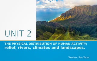
Unit 2 of Geography: The physical distribution of human activity: relief, rivers, climes and landscapes. Third Year of Secondary School. This unit was created in the School Year 2019-2020. It was designed in Valencia, for the IES Juan de Garay's students. Teacher: Pau Tobar.

Recommended
More Related Content
What's hot
What's hot (19)
Similar to Unit 2: The physical distribution of human activity: relief, rivers, climes and landscapes
Similar to Unit 2: The physical distribution of human activity: relief, rivers, climes and landscapes (20)
More from Pauhistoria
More from Pauhistoria (20)
Recently uploaded
Recently uploaded (20)
Unit 2: The physical distribution of human activity: relief, rivers, climes and landscapes
- 1. UNIT 2 THE PHYSICAL DISTRIBUTION OF HUMAN ACTIVITY: relief, rivers, climates and landscapes. Teacher: Pau Tobar
- 2. CONTENTS ● The relief and rivers of Europe ● The relief and rivers of the Iberian Peninsula ● The Earth’s climate zones ● European and Iberian landscapes ● Climate change
- 3. EUROPE: RELIEF, RIVERS AND COASTS ● Main mountain ranges: Ural Mts, Scandinavian Mts, Pyrenees, Alps, Apennines, Carpathians, Balkans and Caucasus. ● Tallest mountains: Elbrus and Mont Blanc. ● Plains: Great European Plain. ● Plateaus: Meseta Central. ● Main rivers: Volga, Dnieper, Danube, Po, Ebre, Guadalquivir, Tagus, Duoro, Loire, Seine, Thames, Rhine and Elbe. ● Main peninsulas: Scandinavian Pen, Jutland, Iberian Pen, Italian Pen, Balkan Pen and Crimean Pen. ● Main islands: Great Britain, Ireland, Iceland, Balearic Is, Corsica, Sardinia, Sicily, Crete and Cyprus. ● Main seas, oceans and coastal landforms: Arctic Ocean, Norwegian Sea, Baltic Sea, North Sea, English Channel, Atlantic Ocean, Strait of Gibraltar, Mediterranean Sea, Tyrrhenian Sea, Adriatic Sea, Aegean Sea, Strait of Bosphorus, Black Sea and Caspian Sea.
- 4. EUROPE: RELIEF, RIVERS AND COASTS It’s strongly advised to go over this map with educational resources such as Interactive Maps in Flash
- 6. TEST YOURSELF! ● Read this description of Europe relief. Work in pairs in order to check the physical map and complete the blanks. Use these keys words: Peninsula, Carpathians, plains, basins, mountainous, plateaus. Land relief in Europe shows great variation within relatively small areas. The southern regions are more ___________, while moving north the terrain descends from the high Alps, Pyrenees, and __________, through hilly uplands, into broad, low northern ___________, which are vast in the east. This extended lowland is known as the Great European Plain. This description is simplified. Sub-regions such as the Iberian Peninsula and the Italian ________ contain their own complex features, as does mainland Central Europe itself, where the relief contains many ___________ , river valleys and ________ that complicate the general trend. Source: Wikipedia
- 7. IBERIAN PENINSULA: RELIEF, RIVERS AND COASTS ● Main mountain ranges: Pyrenees, Iberian range, Catalanides range, Baetic Cordillera, Sierra Morena, Central Chain, Cantabrian Mountains, Leon Mountains and Galician Mountain range. ● Tallest mountains: Teide, Mulhacen and Aneto. ● Basins: Ebro and Guadalquivir. ● Plateaus: Meseta Central. ● Main rivers: Llobregat, Ebre, Turia, Xúquer, Segura, Guadalquivir, Guadiana, Tagus, Duoro and Miño. ● Main coastal landforms: Bay of Biscay, Galician Rias, Punta Estaca de Bares, Cape Finisterre, Cape Saint Vincent, Taugus Estuary, Gulf of Cadiz, Strait of Gibraltar, Gulf of Almeria, Mar Menor, Cape la Nau, Gulf of Valencia, Ebro river delta, Gulf of Roses, Cape Creus, Gulf of Lion. ● Main islands: Balearic Islands (Formentera, Ibiza, Majorca, Minorca) and Canary Islands (Ferro, La Gomera, La Palma, Tenerife, Gran Canaria, Fuerteventura, Lanzarote). ● Main seas, oceans and coastal landforms: Cantabrian Sea, Atlantic Ocean and Mediterranean Sea.
- 8. IBERIAN PENINSULA: RELIEF, RIVERS AND COASTS It’s strongly advised to go over this map with educational resources such as Interactive Maps in Flash
- 10. TEST YOURSELF! Read this description of Spain relief. Work in pairs in order to check the physical map and complete the blanks. Use these keys words: Teide, volcano, mountain ranges, Iberian Peninsula, mountainous, Meseta Central, plains , Mulhacén, plateaus, Pyrenees, rivers. “Mainland Spain is a ________ country, dominated by high __________ and mountain chains. After the ________ , the main _____________ are the Cordillera Cantábrica (Cantabrian Range), Sistema Ibérico (Iberian System), Sistema Central (Central System), Montes de Toledo, Sierra Morena and the Sistema Bético (Baetic System) whose highest peak, the 3,478-metre-high (11,411-foot)________, located in Sierra Nevada, is the highest elevation in the _________. The highest point in Spain is the __________, a 3,718-metre (12,198 ft) active ________ in the Canary Islands. The _____________ ____________ (often translated as "Inner Plateau") is a vast plateau in the heart of peninsular Spain. There are several major _________ in Spain such as the Tagus (Tajo), Ebro, Guadiana, Douro (Duero), Guadalquivir, Júcar, Segura, Turia and Minho (Miño). Alluvial ___________ are found along the coast, the largest of which is that of the Guadalquivir in Andalusia.” Source: Wikipedia
- 11. IBERIAN HYDROGRAPHIC WATERSHEDS A Hydrographic Watershed gather all the main rivers (and their tributaries) which flow into the same sea or ocean. Characteristics: - Cantabrian watershed rivers: Short rivers flowing strongly. - Atlantic watershed rivers: Long rivers that receive water from numerous tributaries. High volume but it lows in summer. - Mediterranean watershed rivers: Short and low flowing rivers (apart from Ebro). They are irregular rivers. They can suffer floods in rainy autumns and even dry up in summer.
- 12. TEST YOURSELF!
- 13. THE EARTH’S CLIMATE ZONES
- 14. FACTORS AFFECTING THE CLIMATE
- 15. THE EARTH’S CLIMATE ZONES: ACCORDING TO LATITUDE
- 16. TEST YOURSELF!
- 17. THE EARTH CLIMATE ZONES
- 18. THE EARTH CLIMATE ZONES
- 19. TEST YOURSELF!
- 21. WORLD CLIMATE GRAPHS Work in pairs: Check if these climate graphs agree with the main characteristics of each climate. Search each country depicted in the graphs in the Earth’s climatic zones map. Check if that kind of climate corresponds to these areas.
- 22. TEST YOURSELF! Work in pairs, find out the type of climates depicted by the charts. Then look for them in the Earth’s climate zones map.
- 23. EUROPEAN LANDSCAPES Work in pairs: Look for a climate graph of these municipalities: Athens, Brest, Moscow, Las Palmas de Gran Canaria, Isafjördur, Breuil Cervinia. Find out the climate they belong to and discuss your conclusions.
- 25. SPANISH LANDSCAPES Work in pairs: Find out the landscapes of each climate graph.
- 26. CLIMATE CHANGE Al Gore explains the Global Warming in this fragment of the film “An Inconvenient truth” (2006). Watch also this other funny fragment.
- 27. CLIMATIC CHANGE: TEST YOURSELF! Causes and consequences: Work in pairs: Find out news and iconic photographs that show each of the consequences of climate change. Explain the climate change causes and consequences in a personal composition. Use the examples of the former exercises to support your arguments. Remember to organize it: Introduction, Body and Conclusions. Share it with your classmate!
- 28. CLIMATE CHANGE: GLOBAL WARMING!
- 29. CLIMATE CHANGE: GLOBAL WARMING IN EUROPE
- 31. CLIMATE CHANGE: CO2 EMISSIONS AND GLOBAL WARMING
- 32. GLOBAL EMISSIONS
- 33. GLOBAL EMISSIONS: THE FOOTPRINT Work in groups: Analyze the emissions charts and read this article published by The Guardian. Summarize and write your conclusions and explain them to the rest of your classmates.
- 34. Work in groups: Choose ten coastal cities in the world and search the surging sea projections on the Climate Center site. Make a screen shot and share it on google drive. Calculate the population living in the affected areas.
- 35. WHAT COULD WE DO? Work in group: How could average people reduce the global warming impact? Summarize the main actions and make a poster publicizing them.