AEC Scan to BIM Modelling
•
0 likes•305 views

3D laser scanners are used to capture point clouds of structures which are then modeled in BIM software like Revit. This allows the accurate recreation of as-built models for renovation, retrofit, and facilities management purposes. A case study describes a hospital that was laser scanned and the data used to create a Revit BIM model for refurbishment planning without multiple site visits.

Recommended
More Related Content
What's hot
What's hot (17)
Similar to AEC Scan to BIM Modelling
Similar to AEC Scan to BIM Modelling (20)
More from Nick Blenkarn
Recently uploaded
Recently uploaded (20)
AEC Scan to BIM Modelling
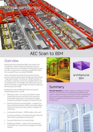
- 1. AEC Scan to BIM Summary 3D Laser Scanners are used to measure accurate point clouds. The point clouds are then 3D modelled ready for BIM, which is used in a variety of formats, for renovation, retrofit, refurbishment and ‘as built’ surveys. Going forward the model is used for the facilities management of the life cycle of a structure or infrastructure. Overview Building Information Modelling (BIM) is the creation and management of data through a building’s life cycle and revolves around the use of intelligent 3D CAD models. Severn can offer a unique service creating accurate BIM 3D models from surveyed 3D laser scan data; SCAN2BIM. Severn Partnership has a fleet of the very latest 3D laser scanners, ideal for quickly capturing large sites and buildings in high levels of detail. This allows our 3D BIM modellers to accurately re-create the as-built site using BIM software such as; Autodesk Revit. The intelligent 3D model allows users to quickly manipulate, change, analyse and adapt all aspects of the existing as-built model. Building Information Modelling 3D laser scanning and modelling applications include: • BIM Ready model – the initial as-built BIM 3D model created from the laser scan data can be used as the primary BIM model, which is manipulated, changed, analysed and adapted throughout the project life cycle • Mechanical Electrical plumbing (MEP) – using the scan data to identify the position of MEP, specialised software can then be used to accurately create an intelligent 3D utilities plan • Computational Analysis – 3D BIM models can be used for Structural Analysis, Finite Element Analysis (FEA) and within other Computational Analysis tools • Surveys for Revit terrain on new build sites • Marketing and Media – models can be visualised and rendered for use in promotional campaigns and media releases
- 2. Scan to BIM Experience • Brighton 3Ts Hospital – Scan to BIM • Scan2BIM – RICS Headquarters, LONDON • Creation of intelligent Autodesk Revit 3D model of the whole West Sussex Hospital site from laser scan data for Laing O’Rourke and BDP • Scan2BIM – Rights of Light, Visual Splay Analysis and initial concept designs for Lambeth town council • The laser scanning and Revit BIM 3D modelling of Harper Adams University’s accommodation blocks • Deliverables are in Revit, Navisworks, Microstation, AutoCAD, CADduct to name a few. Case study Brighton 3Ts Hospital – Scan to BIM Summary 3D Laser scanning used to create Revit Building Information Model (BIM) of the hospital buildings ready for refurbishment – internal layouts & 2D printed elevations. In detail A detail survey control network was established around this complex site (covering a steep crossfall down the slope of a hill). Control was transferred to the top of the building to enable detail 3D laser scanning of the upper floors, M&E equipment and internal floorplans. The laser scanning was extended to include surrounding buildings for planning & design purposes. On the ground, a large undercroft area, plant and piping rooms were surveyed for later use by M&E teams. Multiple teams were on site to complete survey control traverse observations and 3D laser scanning at the time, compressing the work programme. The final model was created in Autodesk Revit with windows as parametric detail and material properties where required. 3D model visualisations were created in 3D studio Max. 3D laser scanning gave the flexibility to gather a huge amount of site data in a short time, such that the phased planning of building renovation, refit & refurbishment could be supported by the required survey information without numerous site re-visits. Once on site, our surveyors liaised with a number of specialisms (structural team, M&E team) to create a range of deliverables as required by each (2D CAD, 3D polylines or Revit BIM) Deliverables • Revit BIM • 3D point cloud • TruView of point cloud • 2D CAD elevations printed from Revit model • Topographical survey data The Maltings 59, Lythwood Road, Bayston Hill, Shrewsbury, Shropshire. SY3 0NA Tel. 0844 880 8247 Fax: 0844 880 8248 webenquiry@severnpartnership.com www.severnpartnership.com Quality data measured safely delivered professionally on time