Presenter utility mapping & detection 2014
•
0 likes•283 views

Utility Mapping - GPR, underground utility tracing, CCTV, CAT

Recommended
Recommended
More Related Content
What's hot
What's hot (17)
Similar to Presenter utility mapping & detection 2014
Similar to Presenter utility mapping & detection 2014 (20)
More from Nick Blenkarn
Recently uploaded
Recently uploaded (20)
Presenter utility mapping & detection 2014
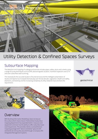
- 1. Utility Detection & Confined Spaces Surveys Overview BIM (Building Information Modelling ) does not stop at the surface which means Severn Partnership’s Subsurface mapping department has expanded both in resource and equipment and even has the ability to offer subsurface laser scanning services. This provides clients a comprehensive mapping package both “above and below” ground with standards set and quality assured through a Company IMS (Integrated Management System). Subsurface Mapping The detection and mapping of underground services include: pipes, cables, ducts and culverts using a range of survey techniques such as GPR, electromagnetic location, manhole inspection and CCTV and even subsurface laser scanning.. The necessity for the accurate location of buried services and the intelligent presentation of results and reports has increased dramatically over the last decade. Legislation, Health and Safety, diversions, connectivity and the increasing complexity of utility networks have all driven the requirement.
- 2. Our Services Include: • Comprehensive Utility Detection Survey • On site “mark up” surveys • Drainage surveys • Manhole inspection • Compilation of existing utility provider statutory records • Pipeline mapping • Borehole and trial-pit utility clearance • Subsurface laser scanning • Confined space surveys • Topographic Survey and laser scanning Case study Wimbledon Crossing Summary Our client required an underground utility survey of the road crossing at Wimbledon depot. The purpose of this was to confirm the position of existing utility services to enable them to run new power cables through the crossing. In detail The area to survey was 500m² at a depth of 3m. This was done with electromagnetic, real time ground probing radar and sound / Dye and Sonde location techniques to establish the position of the majority of buried main external services and a CCTV survey of the existing ducts/pipes. The CCTV survey used a small camera fed down a 30-50mm diameter pipe for approximately 20m. There were six pipes/ducts in total. In addition the underground survey was linked to a Topographical survey of the crossing co-ordinated to OS Grid. This was carried out by traversing and installing survey stations using GPS to fix the Primary survey stations. A robotic total station was then used to carry out the survey. All work conformed to the high level TSA survey approach matrix standard. The Maltings 59, Lythwood Road, Bayston Hill, Shrewsbury, Shropshire. SY3 0NA Tel. 0844 880 8247 Fax: 0844 880 8248 webenquiry@severnpartnership.com www.severnpartnership.com Quality data measured safely delivered professionally on time Client Deliverables • 2D/3D CAD plans • GPR data using specialist software with all GPR features Imported into CAD • BIM • SEEABLE (3D data accessible to all) • Utility Detection Survey Report • Manhole/Drainage schedule • Utilities report - summary of methods used. • Review of data quality (report will show images taken from gpr processing software). • Detail on located utilities and summary and recommendations to aid client objectives. • Manhole schedule - including photographs of all manholes and inspection chambers located on site with detail on pipe size, condition, and depths.