Presenter highways may23
•
0 likes•206 views

Severn Partnership has over 30 years of experience surveying UK highways and bridges, allowing them to collaborate on major infrastructure projects. They provide surveying services for all aspects of roads, including 3D laser scanning to create models and visualizations. Using modern equipment efficiently helps minimize costs while ensuring quality.

Recommended
Recommended
More Related Content
What's hot
What's hot (20)
Similar to Presenter highways may23
Similar to Presenter highways may23 (20)
More from Nick Blenkarn
Recently uploaded
Recently uploaded (20)
Presenter highways may23
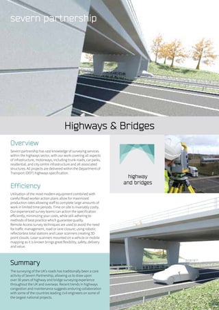
- 1. Highways & Bridges Summary The surveying of the UK’s roads has traditionally been a core activity of Severn Partnership, allowing us to draw upon over 30 years of highway and bridge surveying experience throughout the UK and overseas. Recent trends in highways congestion and maintenance suggests enduring collaboration with some of the countries leading civil engineers on some of the largest national projects. Overview Severn partnership has vast knowledge of surveying services within the highways sector, with our work covering all aspects of infrastructure, motorways, including trunk roads, car parks, residential, and city centre infrastructure and all associated structures. All projects are delivered within the Department of Transport (DOT) highways specification. Efficiency Utilisation of the most modern equipment combined with careful Road worker action plans allow for maximized production rates allowing staff to complete large amounts of work in limited time periods. Time on site is invariably costly. Our experienced survey teams can action the specification efficiently, minimizing your costs, while still adhering to methods of best practice which guarantee quality. Remote Access survey techniques are used to avoid the need for traffic management, road or lane closure; using robotic reflectorless total stations and Laser scanners creating 3D point clouds. Laser scanners mounted on a vehicle or mobile mapping as it is known brings great flexibility, safety, delivery and value.
- 2. Expertise Numerous highway and bridge surveys have been completed over the years, the difference being Severn Partnership has built on this experience and brought further client value by providing increased levels of data and greater visibility to the project. Conventional 2D plans have been upgraded to 3D data sets with laser point clouds, which are then rendered into 3D Models. These are augmented with 360 degree high intensity “pano images” and visualisations. Deliverables include: • Topographical survey (3D DWG) • Registered scan cloud dataset • Hard copy colour plan at defined scale (1:50. 1:100, 1:200, 1:500, 1:1000, 1:1250) • Survey linked to O.S National Grid if required • Digital data as DXF or DWG file • MX Moss data GEN file • Witness diagrams and station descriptions • A well installed, secure network of survey control stations (for future work) Excavation and Volumetrics Utilising the latest survey software, Severn Partnership can offer solutions to compute volumes for excavation in highway related projects. Our ability to construct accurate Digital Terrain Models provides the basis for precise area and volumetric analysis often with quantity surveying implications. Deliverables: • Digital Terrain Models (DTM) • Contour plans • Isopachyte contours • Defined Areas • Volumes: • Cut & Fill • Between surfaces • From a datum level • From a datum plane • From an inclined plane The Maltings 59, Lythwood Road, Bayston Hill, Shrewsbury, Shropshire. SY3 0NA Tel. 0844 880 8247 Fax: 0844 880 8248 webenquiry@severnpartnership.com www.severnpartnership.com Quality data measured safely delivered professionally on time