
Recommended
More Related Content
What's hot
What's hot (20)
Similar to Geological Fieldwork on Sitakund Anticline
Similar to Geological Fieldwork on Sitakund Anticline (20)
Recently uploaded
Recently uploaded (20)
Geological Fieldwork on Sitakund Anticline
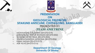
- 1. PRESENTATION ON GEOLOGICAL FIELDWORK SITAKUND ANTICLINE, CHITTAGONG, BANGLADEH PRESENTED BY TEAM AMETRINE I. MOHAMMAD SOLAIMAN (SH-070-019) II. MUHAMMAD ARIFUR RAHMAN (SH-070-002) III. NOUSHIN AKTER TISHA (RH-070-005) IV. WAHIDATUNNESSA MOHONA (SK-070-006) V. IQBAL HASAN (SH-070-013) VI. ASIF ALVE (SH-070-016) Department Of Geology University Of Dhaka
- 2. BRIEF OVERVIEW • Timeline: 4th January – 9th January, 2018 • Location: Sitakund, Chittagong, Bangladesh • Base Camp: YPSA Human Resource Development Center • Number of Studied Sections: 4 Team Leader: Dr. Subrota Kumar Saha Teachers: Dr. Badrul Imam Md. Shakhawat Hossain Md. Yusuf Gazi
- 3. Sitakund
- 4. OBJECTIVES OF GEOLOGICAL FIELDWORK ✓ Producing the geological map of Sitakund from the base map ✓ Identifying and analyzing the Sitakund Anticline ✓ Study the structural, geomorphic, sedimentary & lithological features of the Sitakund Hill Range
- 5. REGIONAL GEOLOGY OF SITAKUND HILL RANGE Region : Sitakund Hill Range is one of the most notable hill ranges in Bangladesh. ❑ 70 km long & 10 km wide. Location (Base Map): ❑ Latitude : 22⁰34’25”N to 22⁰41’10”N . ❑ Longitude : 91⁰37’50”E to 91⁰43’E ❑ Lies in the North-western part of Chittagong city . ❑ Practically a hilly region .
- 6. LOCATION MAP OF SITAKUND ANTICLINE
- 7. AERIAL VIEW OF SITAKUND ANTICLINE (SATELLITE MAP) 3D View of the Anticline
- 8. TECTONIC CAUSE FOR THE FORMATION OF SITAKUND ANTICLINE ❑Collision of Indian plate & Burma Plate. ❑Uprising of landmass at the convergent boundary between two plates. ❑Continuous increase of pressure. ❑Formation of folded regions. ❑Occurrence of fault as a result of excess pressure buildup.
- 9. TECTONIC CAUSE OF THE ANTICLINE Satellite View of The Plates
- 10. TOPOGRAPHIC MAP OF BANGLADESH
- 11. TOPOGRAPHIC MAP OF THE ANTICLINE
- 12. BASE MAP N E S WBase Map Of Sitakund Between Baraiyadhala & Barabkund
- 13. GEOLOGICAL ASPECTS OF SITAKUND HILL RANGE ➢ Structural Features ➢ Geomorphic Features ➢ Various Sedimentary Structures ➢ Lithology of Rocks ➢ Economic Mineral Deposits & Resources
- 14. STUDIED SECTIONS IN THE FIELDWORK 1) Day 1 - Labanakkhya Stream , Shahasradhara Waterfall & Balukhali Stream 2) Day 2 – Baraiyadhala Section & Chagalkainda Stream 3) Day 3 - Microwave Road-Cut Section & Chandranath Temple 4) Day 4 - Barabkund Section
- 17. MICROWAVE ROAD-CUT SECTION CHANDRANATH TEMPLE
- 19. DAY ONE LABANAKKHYA STREAM SHAHASRADHARA WATERFALL BALUKHALI STREAM SECTION
- 20. LOCATION ❑Latitude: 22⁰39’51” N ❑Longitude: 91⁰38’51” E ❑Number of Station: 9 ❑Starting Station: Labanakkhya Stream ❑Ending Station: Balukhali Stream
- 21. MAGNIFIED SECTION ONE ON THE BASE MAP
- 22. GEOMORPHIC FEATURES ➢ Stream ➢ Waterfall ➢ Plunge Pool ➢ Rapid ➢ Pothole ➢ Valley
- 23. STREAM A streamis a body of water with a current confined within a bed and banks. There are hundredsof streams in Sitakund.
- 24. STREAM
- 25. WATERFALL A waterfall is a place where water flows over a vertical drop or a series of steep drops in the course of a stream or river. There was a waterfall at the eastern flank named Shahasradhara Waterfall.
- 26. PLUNGE POOL • A plunge pool is a depression in a stream bed at the base of a waterfall. • It is created by the erosional forces of falling water on the rocks at fall's base where the water impacts. • There we witnessed plunge pool at the bottom of the Shasradhara Waterfall.
- 27. Plunge Pool
- 28. RAPID • Rapid is a fast-flowing and turbulent part of the course of a stream. • They are sections of a stream where the stream bed has a relatively steep slope. • They are the hydrological features between a smoothly flowing part of a stream and a cascade.
- 29. Rapid
- 30. POTHOLE • A pothole is a circular or cylindrical hole in the stream bed which is produced by force of water and abrasion. • A pothole is formed when a circular current of water carrying small pebbles and sediment begins to wear away a rock surface. • We have seen potholes in Balukhali section.
- 31. POTHOLE IN BALUKHALI STREAM
- 32. VALLEY • A valley is a low area between hills, often with a stream running through it. • In geology, a valley is a depression that is longer than it is wide.
- 33. A VALLEY BETWEEN TWO HILLS
- 35. THRUST FAULT • A thrust fault is a break in the Earth's crust, across which younger rocks are pushed above older rocks. • This is reverse fault that dip less than 45⁰. • Hence The hanging wall moves up and over the footwall.
- 37. JOINT • Joint is a fracture in rocks along which no movement has occurred. • They occur in thick beds of sandstone and shale.
- 38. Joint in Fissile Shale
- 39. SEDIMENTARY STRUCTURE ➢ Bedding ➢ Lamination ➢ Lenticular Bedding ➢ Cross Lamination ➢ Concretions ➢ Onion structure ➢ Mud crack ➢ Alternating beds of shale & sandstone
- 40. Bedding in the Waterfall Outcrop
- 43. Lenticular Bedding of Shale Source: Wikipedia
- 44. Concretions • A concretion is a hard, compact mass of matter formed by the precipitation of mineral cement within the spaces between particles, and is found in sedimentary rock or soil.
- 45. CONCRETIONS
- 48. Mud Cracks at the base of stream
- 50. ROCK LITHOLOGY ➢Silty Shale ➢Fissile Shale ➢Laminated Shale ➢Siltstone ➢Mudstone
- 51. ROCK PROPERTIES Shasradhara Waterfall • There most of the rocks are silty clay which are composed of silt and clay. • They are indurated and hard. • Hence the lithology contains sandstone, siltstone, shale and mudstone.
- 52. ROCK PROPERTIES Balukhali Stream •In Balukhali Stream, sandstone and shale are interbedded where sandstone beds are 6-10 inches thick and shale beds are thinner than sandstone beds.d •Hence sandstone bed sometimes contains concretions which can be spherical, ellipsoidal, elongated etc. Their origin is post-depositional, which means that they are diagenetic (composition of CaCO3 and water).
- 53. SILTY SHALE • Mainly thin bedded and platy. • Olive to grey green coloured. • It formed in ancient marine environments in soft sedimentary deposition.
- 54. SILTYSHALE
- 55. FISSILE SHALE • This shale is a fine-grained sedimentary rock that forms from the compaction of silt and clay-size mineral particles. • Fissility is caused by parallel alignment of platy mineral grains.
- 56. LAMINATED SHALE • Grayish blue coloured shale. • It has lenticularbedding with cross lamination. • Lenses of sand and clay are present.
- 57. SILTSTONE • Siltstone is hardened sedimentary rock that is composed primarily of angular silt-sized particles. • It is is not laminated or easily split into thin layers. • It forms where water deposit silt and the silt is then compacted and cemented into a rock.
- 59. MUDSTONE • Gray colour • Moderately compacted, highly porous. • Very fine grained. • Argillaceous • Composed of quartz, mica, feldspar and ferro- magnesium minerals.
- 60. ➢Gas Seepage ➢Gravels ➢Concretions ECONOMIC MINERAL DEPOSITS AND RESOURCES
- 61. • Occurance of natural gas in sitakundanticline. • Number of faults cutting anticlinethat across the gas reservoirand the gases are coming through the fault line. GAS SEEPAGE
- 62. USES OF GAS ✓Gas is the most important and useful resource of our Bangladesh. ✓It is used in factory for commercial production and also used for household work. ✓It is the main resource for electricity and fertilizer production. ✓Gas can also be exported and it is a way to earn foreign currency.
- 63. GRAVELS • Gravel is a loose aggregation of rock fragments. • Gravel deposits are being formed as a result of the weathering and erosion of rocks. • It is an important commercial product, with a number of applications. • Many roadways are surfaced with gravel. • It is also used in construction of building.
- 64. Gravel
- 65. GRAVELS USED IN WALL CONSTRUCTION
- 66. CONCRETIONS • It can be used as building block and also used for many household works due to its hardness.
- 67. Concretions
- 68. Day Two BARAIYADHALA ROAD CUT SECTION ➢ Weather: Sunny ➢Latitude: 22°40’45”N ➢Longitude: 91°38’34”E ➢Number of stations: 9 ➢Starting station: BARAIYADHALA SECTION ➢Last station: CHAGALKAINDA
- 69. Sitakund Upazila, Chittagong ,Bangladesh
- 70. Magnified Section Two on the Base Map
- 71. Hiking Track from Baraiyadhala to CK Section
- 72. Structural features :- • Overturned fold
- 73. Overturned Fold A fold in which both the limbs dip in the same direction is called an overfold or overturned fold. (but less than 45 degrees)
- 74. Overturned fold
- 76. Stream Water that flows naturally along a fixed route formed by a channel cut into rock or ground.
- 77. Waterfall A waterfall is a place where water flows over a vertical drop or a series of steep drops in the course of a stream or river. •
- 78. Cascade ❑ A waterfall descending over a steep , rocky surface. ❑ A series of shallow or step like waterfalls.
- 79. Sedimentary Structure ❑Nodule ❑Onion Structure ❑Lenticular Bed ❑Conglomerate Bed ❑Gravel ❑Boulders
- 80. Nodule A nodule is small, irregularly rounded knot, mass, or lump of a mineral or mineral aggregate that typically has a contrasting composition.
- 81. Onion Structure A sedimentary structure that have an onion like pattern . Reason (hypothetical): - Dewateringof shale due to pressure
- 82. Lenticular Bedding Lenticular bedding is a sedimentary bedding pattern displaying alternating layers of Shale and Sand. Sand lens
- 83. Conglomerate Bed Conglomerate is a sedimentary rock usually composed of rounded quartz pebbles, cobbles, and boulders surrounded by a matrix of sand and finer component and cementing material.
- 84. Gravels Gravels is an aggregate of rounded or angular fragment of rocks and minerals. According to unified classification system, particle sizes ranging from 4.75mm to 76.2mm are categorized as gravel.
- 85. Boulders Boulder is a rock fragment with size greater than 25.6 centimeters or (10.1 in) in diameter.
- 86. Rock Lithology ❑Silty Clay ❑Mudstone ❑Fissile Shale ❑Laminated Shale ❑Calcareous sandstone
- 87. Silty Clay Silt is granular material of a size between sand and clay. Clay is a finely-grained natural rock or soil material . Combination of those are called Silty Clay .
- 88. Mudstone Mudstone, a type of mudrock, is a fine- grained sedimentary rock whose original constituents were clays or muds .
- 89. Fissile Shale Fissility is the ability or tendency of a rock to split along flat planes of weakness .
- 90. Laminated Shale Lamination is a small scale sequence of fine layers . Laminations are normally smaller and less pronounced than bedding. (Less than 1cm ) . Laminated shale is fine grained in size .
- 91. Calcareous Sandstone Calcareous sandstone is a sedimentary rock, formed by the cementation of grains of sand (0.063 to 2 mm in diameter) made with calcium carbonate .
- 92. 40 m 25m= 10m 5m Columnar Section of BARAIYADHALA ROAD CUT SECTION(EASTERN FLANK ) (|||) (||) (|) ROCK TYPEUNIT LITHOLOGY Shale with sandstone (3-5 inch ) Massive Sandstone (slightly laminated, medium to fine grained ) Interbedded Sandstone & Shale (5-8 inch ) lanticular Cross laminated
- 93. C.K-1 (5m) C.K-2 (sin30° x 20)= ( 10m) C.K-3 (5m) Unit Rock Type 20m CHAGOL-KAINDA STREAM SECTION :- Mudstone , Claystone Shale with lenticular bedding Conglomerate Bed , Shale
- 94. CHAGOL-KAINDA STREAM SECTION :- C.K -1 C.K-2 C.K-3 Older to younger
- 95. Economic Rock Deposits & Resources ❑Shale ❑Gravel ❑Boulder
- 96. Uses of Shale ❑Some shales have special properties that make them important resources. ❑Black shales contain organic material that sometimes breaks down to form natural gas or oil. ❑Other shales can be crushed and mixed with water to produce clays that can be made into a variety of useful objects.
- 97. Uses of Gravel ❑In construction, crushed stone is used as an aggregate in concrete mixes. ❑Uses in road base and coverings. ❑Use in concrete, fill (to fill in low spots), asphalt, snow and ice control. ❑ concrete products such as brick, block, pipe, and decorative stone.
- 98. Uses of Boulder ❑Used in artificial landscapes. ❑Boulders are crushed into rock fragments. ❑Used in the bases of large infrastructures. ❑Uses in the dams to protect the river bank.
- 99. Boulders used for home decoration
- 100. Day Three Microwave Road Cut Section Latitude: 22°38’8” N Longitude: 91°40’ 14” E Number of Stations: 8 Starting Station: Sitakund Eco Park Last Station: Chandranath Temple
- 101. Magnified Section Three on the Base Map
- 103. Joint Set Joint is a break in a rock mass where there has been no relative movement of rock on opposite sides of the break. Joint Set is the combination of parallel joints in the rock.
- 104. Geomorphic features Hill Stream Cliff Ridge
- 105. Hill
- 106. Stream A stream is a body of water with a current confined within a bed and banks
- 107. Ridge A ridge or mountain ridge is a geological feature consisting of a chain of mountains or hills that form a continuous elevated crest for some distance.
- 108. Ridge in Sitakund Anticline
- 109. Cliff A cliff is a vertical or nearly verticals,rock exposure. Cliff are Formed as erosion landform by the process of weathering and erosion
- 110. Rock lithology Shale Claystone Mudstone
- 111. Shale Shale is a fine-grained, clastic sedimentary rock composed of mud that is a mix of flakes of clay minerals. Tiny fragments (silt-sized particles) of other minerals, especially quartz and calcite.
- 112. Claystone A claystone is a mudrock which does not split in parallel blocks. In order for a rock to be a claystone, it must be up to half (50%) clay, whose particles measure less than 1/256th of a millimeter.
- 113. Mudstone Mudstone, a type of mudrock, is a fine-grained sedimentary rock whose original constituents were clays or muds. Grain size is up to .0625 millimetres (0.00246 in) with individual grains too small to be distinguished without a microscope
- 114. Sedimentary structure Burrows Pseudo bed Interbedded sandstone Ball and pillow structure Load cast
- 115. Burrows Burrow is a hole or tunnel excavated into the ground by animal. A burrow created a space suitable for habitation, temporary refuge, or as a byproduct of locomotion.
- 116. Pseudo bed a pseudo bedding plane has the appearance of a bedding plane but is not actually a bed.
- 117. Interbedded sandstone Alternating layers of coarse and fine grained sandstone
- 118. Ball & pillow structure Ball & pillow structure are masses of clastic sediment that take the form of isolated pillows or protruding ball structures. These soft-sediment deformations are usually found at the base of sandstone beds that are interbedded with mudstone. Also found in limestone beds that overlie shale. Hemispherical and kidney shape. Range in size from a few inches to several feet.
- 119. Load cast Load cast form on the underside of the overlying denser layer (sands, coarse sands, or gravels), which is superimposed on a less-dense hydroplastic layer (muds, silts or finer sands). The casts take on the form of slight bulges, swellings, deep or rounded sacks, knobby excrescences or highly irregular protuberances.
- 120. Load Cast in Interbedded Sandstone
- 121. Day Four Barabkund Section • Latitude: 22°34’53” N • Longitude: 91°41’8” E • Number of Stations: 8 • Starting Station: CCC High School • Last Station: Barabkund Temple
- 122. Station One
- 123. Hill Cut Section in Station One
- 124. Station Eight: Barabkund Temple
- 125. Structural Features Joint and Joint Sets Local Unconformity
- 127. Local Unconformity An unconformity strictly limited to geographic extent Develops around the margins of a sedimentary basin Sometimes appears like a disconformity Identified by presence of residual soil above the surface of erosion
- 128. Local Unconformity
- 129. Geomorphic Features Hill Gully Valley Streams Streamlets
- 130. Hill
- 131. Gully in Barabkund Stream
- 132. Valley of Barabkund Stream
- 133. Barabkund Stream
- 134. Streamlet
- 135. Sedimentary Structures Bedding Flaser Bedding Lenticular Bedding Lamination Cross Lamination Concretions Onion Structures
- 136. Bedding
- 137. Flaser Bedding Exhibits alternating sand and mud layers Typically forms in tidal environment Sand ripples are filled by mud Mud consolidates rapidly and protects the sand layers from erosion
- 139. Lenticular Bedding Displays alternating layers of clay and sand Mud suspended in the water settles down on top of sand Characterized by sand lenses in mud Found in supratidal and intertidal zones Evidence of tidal current and tidal rhythm
- 141. Lenticular Bedding (Sand lenses in a laminated shale)
- 143. Concretions
- 144. Onion Structure (Oval shaped)
- 145. New Sedimentary Structures Flute Marks Sandstone Band Gravel Bed Convolute Lamination Leaf Impression
- 146. Flute Marks Found most commonly in Turbidite Deposits Grooves are created in fine sediments by currents Sand fills up the grooves Sand gets compacted and turns into sandstone Underlying shale rock erodes away The wavy/groovy bottom of sandstone becomes exposed Flute cast is a very useful paleocurrent indicator
- 148. Sandstone Band
- 150. Gravel Bed Also known as bench gravel A bed of gravel located at the side of a valley Represents parts of bed of the stream Indicates the former location of the stream
- 151. Gravel Bed
- 152. Convolute Lamination Forms from turbidity current Found in shale and fine sand Forms from rapid settlement of turbidites Common in intertidal flat deposits
- 153. Convolute Lamination
- 155. Leaf Impression Found mostly in fissile shale Leaf gets buried in fine sediments rapidly Overburden pressure increases as new sediments accumulate Hydrogen, oxygen and volatile gases are squeezed off the leaf due to pressure Only a thin carbon film of the leaf is left
- 156. Leaf Impression in Fissile Shale
- 158. Rock Lithology Sandstone Claystone Mudstone Fissile Shale Laminated Shale
- 159. Continental bed of Sandstone
- 161. Claystone Beds
- 162. Mudstones in the stream
- 163. Fissile Shale
- 164. Laminated Shale
- 165. Economic Mineral Deposits & Resources Concretions Gravels Gas Seepage
- 166. A Concretion in the stream
- 167. Gravel deposits
- 168. Gravel deposits in Barabkund Stream
- 169. Gravels used in industrial infrastructure
- 170. Road Construction
- 171. Gravels in Yard Decoration
- 172. Gas seepage Gas escapes rapidly through porous material, small holes and faults.
- 175. After gathering various data during the fieldwork, we studied – ❑ The orientation of the axis of the Anticline ❑ The attitude of the fold limbs ❑ The nature of the anticline ❑ Numerous types of sedimentary structures ❑ Lithology of the rocks ❑ Geomorphic features ❑ Structural features ❑ Economic rocks & mineral deposits
- 176. STRUCTURAL FEATURES ✓ Anticline ✓ Thrust Fault ✓ Joint ✓ Local Unconformity
- 178. GEOMORPHIC FEATURES ❑ Gully ❑ Cliff ❑ Hill ❑ Gorge ❑ Cascade ❑ Vegetation & Cultivation
- 179. SEDIMENTARY STRUCTURES ➢ Onion Structure ➢ Lamination ➢ Cross Bedding ➢ Nodules ➢ Concretions ➢ Lenticular Bed ➢ Mud Crack ➢ Alternation of Shale-Sandstone
- 180. SEDIMENTARY STRUCTURES ➢ Boulders ➢ Conglomerate Bed ➢ Burrows Structure ➢ Ball & Pillow Structure ➢ Load Cast ➢ Flaser Bedding ➢ Flute Cast ➢ Leaf Impression ➢ Convolute Lamination
- 181. ECONOMIC MINERAL DEPOSITS & RESOURCES ✓ Gravels ✓ Concretions ✓ Gas Seepage ✓ Conglomerates ✓ Ferromagnesian Minerals
- 182. ANALYSIS OF THE DATA FROM COMPASS CLINOMETER READINGS
- 183. DAY 1 – LABANAKKHYA STREAM Station Location Attitude of Bed Dip Azimuth AD DD 1(a) 22°39′54′′ N 91°38′51″ E 232° 30° SW 1(b) 285° 44° NW 1(c) 256° 36° SW
- 184. Day One Station Number Direction of Dip Amount of Dip 1(a) 256° SW 36° 1(b) 285° SW 44° 1(c) 232° SW 30° 2 142° SE 90° 3 110° SE 85° 4 236° SW 50° 5 342° NW 11° 6 344° NW 20° 7 248° SW 8° 8 76° NE 36° 9 64° NE 40°
- 185. Data Analysis (Anticline) • Strike and dip readings from the first station indicates westerly dipping beds. • Station 3 and 4 represent overturned beds. • Station 5 with gently dipping beds indicates the axis. • Rest of the stations show beds dipping in the east. • This data characterizes a mesoscopic anticline, known as the Sitakund Anticline.
- 186. Data Analysis (Thrust Fault) • Presence of overturned beds in every section gives evidence of a giant Reverse Fault. • Plotting the coordinates of the beds in the base map, we can deduce the fault line. • The fault extends in the northwest and southeast direction. • Sitakund Anticline is a mesoscopic, thrust-faulted anticline.
- 187. Topographic Map of Sitakund Anticline (With Elevation Scale)
- 188. Formation Map of Sitakund Anticline
- 189. Geological Map of Sitakund Anticline