SlideShare a Scribd company logo
1 of 75
Page 1 of 75
Figure 0.1: In font of YPSA
Acknowledgment
Firstly, I want to thank Almighty Allah
for giving me a propitious opportunity
for performing a fieldwork trip to
Sitakund anticline hill tracts,
Chittagong.
This is an untold pleasure for me to
express my deep sense of gratitude to
our honorable teacher, Field Geology
Expert Muhammad Risalat Rafiq,
Assistant professor, Department of
Geology & Mining, University of
Barishal, for his sentient guidance,
lively support, throughout contribution
and discreet co-operation throughout
the field survey.
I also like to express my sense of
gratitude with great pleasure Md.
Abdullah Salman, Lecturer,
Department of Geology & Mining,
University of Barishal, for his
consistent guidance, valuable advice,
and proper instruction throughout the
field survey. His presence encouraged
us with thoughtful instructions and
suggestions.
It was conducted from 27th
December
2021 to 2nd
January 2022, which didn’t
only helps us to complete our field
smoothly and with great pleasure but
also resulted in the completion of this
result and kindly perspective provided
by the diversity of their viewpoint and
experience and their many thoughtful
suggestions they have been made along
the field have led to significant
improvements in my study.
I would like to offer the heartiest
gratitude and appreciation to our
Chairmen, Sukhen Goswami, Assistant
professor, Department of Geology &
Mining, the University of Barishal for
such kind of arrangement of the field
trip, Sitakund Anticline in Chittagong
district.
I would like to thanks immensely for the
quality of support rendered by YPSA
(Young Power in Social Action),
Sitakund branch for providing our
accommodation. YSPA was our Base
Camp.
I thank the chefs who cooked in a
timely. They ensured hygienic food
items for us.
Besides, I show gratitude to the
transport Saudia Paribahan and Pubali-
7 launch to assist us in case of
transportation.
I want to thank our classmates who
work hard for managing this field trip
and also others for supporting them.
I also want to thank local people and
local authorities who give us instruction
when we need it and safely.
Page 2 of 75
Executive Summary
The field report is based on all the
scientific facts and data found during
the brief field survey on the
Shahasradharara section, Barabkund
Hill section, and Chandranath Hill
Section in the Sitakund Anticline area in
Chittagong District. This field report
deals with the physiographic,
structural, stratigraphic, and
sedimentological. And geomorphic
characteristics of Sitakund Anticline
along with practical and economic
aspects.
The Sitakund Anticline is situated in the
southeast part of Bangladesh under
Chittagong District. It is above 75 km
long and 10 km wide and is one of the
westernmost structures of Chittagong
and the Chittagong Hill Tracts. The
Sitakund Anticline range act as a water
divide between Halda Valley and
Swandwip Channel.
Structurally, Sitakund Anticline is one of
the prominent structures of the eastern
folded belt of the Bengal Basin. The
Sitakund Anticline is trending in the
NNW-SSE direction. It is an asymmetric
fold and the western flank of the
anticline is faulted regionally, the
alignment of which runs parallel to the
NNW-SSE trending regional strike.
The Sitakund Anticline is completely
composed of sedimentary rock which
was deposited during the tertiary age in
the marginal marine environment. The
sedimentary beds are mainly composed
of sandstone and shale but at some
places, mudstone, and siltstone are also
found. So, the overall lithology of the
area can be described as the alteration
of sandstone and shale with a minor
presence of mudstone and siltstone at
different sites.
In our investigation, we got some
geomorphic features such as stream,
pool, riffle, rapid, waterfall, slump,
pothole, etc.
The report gives us the study of rock
samples collected from three
consecutive sections. They are the
Shahasradharara section, the
Barabkund Hill Section, and the
Chandranath Hill section. There are
some economical aspects and
importance of this area. It is anticipated
that there is a reservoir of gas and
petroleum in this area. Several gases
seepage that we have found in our
investigation are provides strong
evidence of it. Besides many hard rocks
are supplied from this area for
industrial and construction projects.
These areas also have the importance
of religious views.
Page 3 of 75
Table of Content
Content Page No.
Acknowledgment 01
Executive Summary 02
List of figures 05
List of tables 07
List of Maps 08
Chapter 01: Introduction 09-14
1.1 Background 10
1.2 Scope of Study 10
1.3 Objectives 11
1.4 Previous work 12
1.5 Study area 13
Chapter 02: Physiography 15-20
2.1 Topography 16
2.2 Drainage pattern 18
2.3 Climatology 19
2.4 Population & Culture 20
Chapter 03: Geological Setup 21-26
3.1 Tectonics 22
3.2 Geomorphology 23
3.3 Structural Geology 25
3.4 Petrology 26
Chapter 04: Methodology 27-29
4.1 Method of Study 28
4.2 Lab Investigation 29
4.3 Equipment 29
Chapter 05: Description of Individual Section 30-58
5.1 Shahasradhara Section 31-39
 Measuring the height of the waterfall 34
5.2 Barabkund Hill Section 40-50
 Gas Seepage 41
5.3 Chandranath Hill Section 51-58
Chapter 06: Structure 59-64
6.1 Introduction 60
6.2 Fold 61
6.3 Fault 62
6.4 Joint 63
6.5 Unconformity 64
Page 4 of 75
Chapter 07: Co-relation 65-68
7.1 Lithological Description 66
7.2 Previous Study 67
7.3 Co-relation 68
Chapter 08: Discussion & Conclusion 69-71
8.1 Discussion 70
8.2 Conclusion 71
Reference 72
Geological Map of Sitakund Anticline 73
Page 5 of 75
List of Figure
Figure No. Topics Page No.
0.1 In font of YPSA 01
2.1 Climate graph of Sitakund Anticline in 2020 19
2.2 Local People 20
2.3 Local Cultivation (Bean) 20
3.1 Stream 24
3.2 Gully 24
3.3 Gorge 24
3.4 Waterfall & Plunge pool 24
3.5 Pothole 24
3.6 Rapid 24
3.7 Pool & Riffle 24
3.8 Ridge & Valley 24
3.9 Reverse Fault 25
3.10 Joint 25
4.1 Measuring Attitude of Beds 28
4.2 Taking Photograph 28
4.3 Data Plotting on the Map 28
4.4 Collecting Sample 28
4.5 GPS (Global Positioning System) 29
4.6 Grain Size Comparator 29
4.7 Compass Clinometer 29
4.8 Measuring Tape 29
4.9 Hands Lens 29
4.10 Hammer 29
4.11 Field Notebook 29
4.12 Base Map 29
5.1.1 At the shahasradhara waterfall section 31
5.1.2 Geometrical Configuration of Waterfall 34
5.1.3 Shahasradhara Waterfall and Plunge pool 35
5.1.4 Stream 35
5.1.5 Rapid 35
5.1.6 Ridge & Valley 36
5.1.7 Landslide 36
5.1.8 Bedding 37
5.1.9 Lamination 37
5.1.10 Bioturbation 37
5.1.11 Sandstone 38
5.1.12 Shale 38
5.1.13 Silty Shale 38
Page 6 of 75
5.1.14 Lithological Succession of Shahasradhara Section 39
5.2.1 In font of Agnikand Temple 40
5.2.2 Gas Seepage 41
5.2.3 Stream 45
5.2.4 Pothole 45
5.2.5 Pool & Riffle 46
5.2.6 Point Bar 46
5.2.7 Ridge 46
5.2.8 Gully 46
5.2.9 Gorge 46
5.2.10 Bedding 48
5.2.11 Groove Cast 48
5.2.12 Lenticular Bedding 48
5.2.13 Mud Cast 48
5.2.14 Nodular 48
5.2.15 Lamination 48
5.2.16 Bioturbation 48
5.2.17 Baroz 48
5.2.18 Sandstone 49
5.2.19 Shale 49
5.2.20 Silty Shale 49
5.2.21 Lithological Succession of Barabkund Section 50
5.3.1 Start Point of Chandranath Hill 51
5.3.2 Ridge 55
5.3.3 Y-shaped Valley 55
5.3.4 Bedding 56
5.3.5 Nodular 56
5.3.6 Lamination 56
5.3.7 Silty Shale 57
5.3.8 Sandstone 57
5.3.9 Silty Sandstone 57
5.3.10 Lithological Succession of Chandranath Hill Section 58
6.1 Fold 61
6.2 Anticline of Fold 61
6.3 Fault in Shahasradhara waterfall 62
6.4 Reverse Fault 62
6.5 Joint in Chandranath Hill Section 63
6.6 Joint in Barabkund Section 63
6.7 Local Unconformity 64
Page 7 of 75
List of Table
Table No. Topics Page No.
1.1 Previous work in Sitakund Anticline 12
5.1 Attitude of Bed (Shahasradhara Section) 32
5.2 Attitude of Bed (Barabkund Section) 42
5.3 Attitude of Bed (Chandranath Hill Section) 52
7.1 Correlation 68
Page 8 of 75
List of Map
Map No. Topics Page No.
1.1 Satellite image of Sitakund Anticline 13
1.2 Location map of Sitakund Anticline 14
1.3 Sitakund Anticline In Chittagong District Map 14
2.1 Topographic map of Sitakund Anticline 16
2.2 Physiographic map of Sitakund Anticline 17
2.3 Drainage pattern of Sitakund 18
2.4 River system of Chittagong 18
3.1 Geological Setup of Sitakund Anticline 22
3.2 Sitakund Anticline Fold 25
3.3 Petrological Map of Sitakund Anticline 26
Page 9 of 75
Chapter One
INTRODUCTION
1.1 Background
1.2 Scope of Study
1.3 Objectives
1.4 Previous work
1.5 Study area
Page 10 of 75
1.1 Background
Geology is the study of visual earth
science. Field Studies offer several
unique advantages in solving geological
problems. A purpose may be economic
or scientific. Our purpose was scientific.
Field mapping is fundamental to all
geologic knowledge.
Geological fieldwork usually involves
the study and interpretation of rocks,
topographic forms, etc. Geologic Field
Work is a compulsory course of the
Geology and Mining Department,
which supplements practical
knowledge. The chief purpose of the
fieldwork is to get aquatinted with
different geologic field problems and
interpret them properly.
The geologic fieldwork deals with the
study and explanation of the rocks,
drainage patterns, and structural
features such as fold, fault, joint,
unconformity, and plotting this
geologic data on the base map.
For this reason, the Geology and Mining
Department of the University of
Barishal arranges annual field trips for
students. The department of Geology
and Mining arranged scheduled
fieldwork in Sitakund Hill Range under
the district of Chittagong.
Course Name: Field Geology I
Course Code: GMF 114
Course Credit Hours: 2 Credit
We are fifty-four students of the 1st
year B.S. (Hon’s) Session 2019-2020
made a field tour for six days. Our
investigation was based on the traverse
method. We were divided into nine
groups consisting of six members.
1.2 Scope of Study
In Sitakund Anticline, exposures that
are found along the waterfall area, hill
slopes, river valleys, anticlinal folded
structures, and rock types offer huge
scopes for geological investigations.
Through exposures, we can study its
attitude and lithology and observed
different morphological features and
the change in natural processes. We
prove that it is a clear anticline by
defining the axial plane.
Page 11 of 75
1.3 Objectives
Important Objectives of field report
are:
 To use maps (topographic and
geologic) to estimate distances,
visualize landforms and identify
geographic and geologic
features.
 To identify common minerals in
hand samples and in-field
exposures of rock using visual
clues and to identify the
common form of sedimentary
rock in hand samples and in-field
exposures using observations of
mineral composition and
texture.
 To identify common structures
and bed features in sedimentary
strata. Using a variety of tools
and instrumentation, students
will describe and quantify the
mineral, paleontological
composition, grain distribution,
textural properties, bedforms,
and structures of earth materials
and strata.
 To know how to collect data
process and analyze and
represent the collected data.
 To know how to make a field
report and for realizing about
completing the fieldwork.
 To know how to make a field
report and for realizing about
completing the fieldwork.
 Using observations and
measurements of lithological,
paleontological, and
geochemical properties, to
interpret the history and
environment of the formation of
rock samples and strata.
 To integrate data from
fieldwork, laboratory
measurements, library research,
and the course work to
formulate or evaluate a
hypothesis and to produce and
present oral reports based on
posters or digital media (e.g.
PowerPoint) that clearly and
accurately describe and
illustrate the backgrounds,
methods, data, and
interpretation relevant to a
particular project.
 To demonstrate proficiency
using digital photography and
image processing or drafting
software to generate scientific
illustrations, maps, diagrams, or
graphs. After all, and to will
apply critical thinking skills such
as inductive, deductive, and
mathematical reasoning to solve
geological problems using the
scientific method.
Page 12 of 75
1.4 Previous Work
S.N Geologists/Organization Work Time
01
The Indian Petroleum
Prospecting Company
Drilled three wells 1910-1914
02 The Burma oil company (BUC) Drilled a shallow well 1914
03
The oil and gas development
corporation (OGDC)
Conducted a
geological
investigation of the
area
1963-1964
04
Professor M.A. Latif and M.T.
Hossain.
Mapped the area
Geologically
1963-1965
(winter season only)
05
Professor M.A. Latif and M.T.
Hossain
Published analytic
writings on this hill
range.
1968
06 Momin Ullah
Published analytic
writings on this hill
range.
1978
07
Dr. K.M. Hossain, and Dr. S.H.
Akhter
Published analytic
writings on this hill
range.
1983
08 Petrobangla Drilled a well 1983
Table 1.1: Previous work in Sitakund Anticline
Also, the Geological Survey of Bangladesh, Petrobangla took several projects in this hill
range.
Moreover, students and teachers of the Department of Geology & Mining of the
University of Barishal, Department of Geology of the University of Dhaka, Department
of Geology & Mining of Rajshahi University, and Jahangirnagar University, and many
geologists study every year.
Page 13 of 75
Map 1.1: Satellite image of Sitakund Anticline
1.5 Study Area
Sitakund is one of the most familiar hill
ranges in Bangladesh. Sitakund is an
upazila under the Chittagong District. It
is situated in the northwestern part of
the Chittagong District.
The investigated area lies within the
latitude of 22°30ʼ N to 22°45ʼ N and the
longitudes of 91°35ʼ E to 91°50ʼ E and
is included in the survey of
Bangladesh topo sheet No. 79 N/10.
The distance between Sitakund and
Chittagong is 40 km whereas it is 185
km southeast of Dhaka City, the
capital of Bangladesh. It stands beside
the Dhaka Chittagong Highway and
Dhaka-Chittagong Railway line.
The Sitakund Anticline is about 68 km
long and 12-16 km wide and covers
about 840 sq. km.
Sitakund Anticline extends from Feni
River to Karnaphuli River whereas
Swandip Channel is on the western
side and Halda Valley is on the
eastern side of the hill range.
We went to three sections.
Shahasradhara section is situated on
the eastern side, Barabkund Section is
situated southern side, and
Chandranath Hill Section is situated
on the north-eastern side of Sitakund
Upazila.
Page 14 of 75
Map 1.2 : Location map of Sitakund Anticline
Map 1.3: Sitakund Anticline In Chittagong District Map
Page 15 of 75
Chapter Two
Physiography
2.1 Topography
2.2 Drainage pattern
2.3 Climatology
2.4 Population and Culture
Page 16 of 75
Map 2.1 : Topographic map of Sitakund Anticline
2.1 Topography
The topographic expression of the area
is the abrupt rise of the hill on the
eastern flank whereas the western
flank’s hills are buried under the alluvial
plain. (fig)
The Sitakund hill range is trending
NNW-SSE direction caused by folding.
(fig) The eastern flank of the hill
gradually merges with Halda Valley and
the western flank is abruptly
distributed by a major fault.
The average height of the Sitakund hill
range is 700 feet from sea level. The
height of the highest elevated area is
1156 feet from sea level. Based on the
general topography, the whole hill
range is divided into three major
physiographic zones. They are as
follows:
The Western Zone: This portion is
mainly covered with shallow depth of
alluvium that’s why it is also named “A
Zone of Buried Hill”. This zone extends
from the sea coast to the western
margins of the hills. Since the
sediments are encountered at a
shallow depth of alluvial cover.
The Middle Zone: The middle portion
of the hill range constitutes a strip of
landmasses, that make up the foothills
of the main range. The average
elevation is 100 to 250 feet. Due to
differential weathering, the zone shows
an inversion of topography and results
in a long escarpment. As a result, this
zone is named “The Zone of
Topographic Inversion”.
The Eastern Zone: The eastern
portion represents the maximum
elevation. The highest peak of this zone
is 1156 feet at the Chandranath
Temple. The area is still in its early
geomorphic youth and the work of sub
areal denudation is conspicuous. As a
result, the features like cliffs spur rapid
waterfalls, plunge pools, etc. are
present.
Page 17 of 75
Map 2.2 : Physiographic map of Sitakund Anticline
Page 18 of 75
Map 2.3: Drainage pattern of Sitakund
Map 2.4 : River system of Chittagong
2.2 Drainage Pattern
There are numerous valleys and
streams along and across the Anticline.
The steams are locally known as
‘Chara”. Most of the valleys and
streams of Sitakund are in the youth
stage. Some streams are perennial and
had a very narrow flowage. Two major
types of drainage patterns are seen.
One is the ‘Dendritic’ pattern. There are
no streams that are straight for a
hundred meters. All are curved and
dendritic. Generally found southern
and eastern part and the second is
‘Trellised’ drainage pattern in the north
and North-West part of this area.
But the drainage of this area is mostly
dendritic which indicates that the
underlying bedrock is uniform. In these
dendritic patterned streams or charas,
we found many geomorphic features
such as waterfalls, rapids, etc. The
general characteristics of those streams
in the area are demonstrated and
controlled by the geomorphic feature
available here like waterfalls, rapids,
potholes, gorge, V-shaped valley, etc.
Page 19 of 75
Figure 2.1 : Climate graph of Sitakund Anticline in 2020
2.3 Climatology
The weather on our observation days
was colder to warmer, with a sunny
day, no humidity, no rainfall, and
temperature is 16°C to 21°C. It was a
good time in December we visited
Sitakund. There are three distinct
seasons in the Sitakund area. They are
described below-
The summer: Begins in March
continues up to May with moderate
precipitation. As this mountainous area
has a huge amount of plantations so
summer heat is not so unbearable.
The monsoon: Starts in June and lasts
till October. During monsoon, the sky is
often overcast with dark clouds, and it
rains heavily accomplished by gusty
wind and occasionally with a cyclonic
storm.
The winter: It begins in November and
continues up to February, with cool,
calm, and pleasant weather.
Page 20 of 75
Figure 2.2 : Local People
Figure 2.3 : Local Cultivation (Bean)
2.4 Population and Culture
According to the census of 2001,
Sitakundhad a population of 298,528
distributed to55,837 units of
households (average household size
5.3), including 163,561 men and
134,967 women, or a gender ratio
of121:100. The average population of
component administrative units of the
Upazila is 4,072 for wards, 1,666 for
mahallas, 29,853 for unions, 5,060 for
mulas(revenue villages), and 5,060 for
villages reported by the census. Out of
the 69 mauzas here, 8 have less than 50
households, while 27 have more than
600 households. Of the villages, 8 have
a population of less than 250, while 29
have more than 2,500. As of 2001, the
population density of Sitakund was 692
inhabitants per square kilometer
(1,792/square mile). Apart from the
Bengali majority, there are several
small communities of ethnic minorities
in the area. Many of the resident
Rakhine people are believed to have
settled here during the Arakanese rule
of Chittagong (1459-1666), though the
event is not historically traceable.
The Rakhine population in Khagrachari
District migrated from the surrounding
area and built up their permanent
abode at Ramgarhin in the 19th
century. Other ethnic groups include
the recently migrated Tripuri people. In
the District of Chittagong which
includes Sitakund, the population ratio
by religion in 2001 wasMuslim83.92%,
Hindu13.76%, Buddhist2.01%, and
Christian 0.12%, with 0.19% following
other religions. In 1981, it was Muslim
82.79%, Hindu14.6%, Buddhist 2.23%,
and Christian0.21%, with 0.19%
following other religions. Chittagonian,
a derivative of Bengali spoken by 14
million people mainly in the Chittagong
district, is the dominant language. In
plain lands most of the people are
farmers. But there are also working
people like woodcutters, businessmen
or porters. There are many temples in
the Sitakund region such as
Chandranath, and Barabkund temples.
An enormous number of people come
here every year to meet on religious
occasions.
Page 21 of 75
Chapter Three
Geological Setup
3.1 Tectonics
3.2 Geomorphology
3.3 Structural Geology
3.4 Petrology
Page 22 of 75
Map 3.1 : Geological Setup of Sitakund Anticline
3.1 Tectonics
Sitakund anticline is a result of the
collision between the Burma plate in
the east and the Indian plate in the
west. It is situated in the
northwestern part of the Chittagong
district, between 22'34' N and 22'43'
N latitude and 91'38' E and 91'41' E
longitude. It is delimited in the north
by the Fini River, in the south by the
Karnaphuli, in the east by the Halda
River, and the west by the Swandwip
Channel. In a broader sense, the
Sitakund hill range acts as a water
divider between the Halda valley on
the east and the Swandwip channel
on the west. The structure is about 70
km long and 10-km wide.
Page 23 of 75
3.2 Geomorphology
We found various types of
geomorphic features in different
sections of our field trip. A short
description is given below:
Stream: A body of running water or
any other moving liquid under the
influence of gravity to lower levels in
a narrow, clearly defined natural
channel is called a stream. It has three
important roles in the formation of a
landscape: It erodes the channels in
which it flows, it transports materials
provided by weathering and slope
processes, and it produces a wide
variety of erosional and depositional
landforms. It was seen in all
Sections(Shahasradhara Section,
Barabkund Section, Chandarnarh Hill
Section).
Waterfall: A steep to vertical descent
of a stream course where it drops
over the edge of a plateau or where
erosion has worn away overhanging
softer rock. It was seen in
Shahasradhara Section. Because of the
force of the water, all waterfalls must
necessarily be relatively ephemeral
features.
Pothole: A pothole is a bowl-shaped,
circular, or cylindrical hole formed by
the grinding action of a stone in the
rock bed of a river of the stream. It
was seen in Barabkund Section.
Potholes are created by the abrasive
action of particles swirling in fast-
moving eddies. The rotational motion
of the sand and pebbles act like a drill
to bore the holes.
Plunge Pool: The water occupying a
deep hollow scoured in the bed of a
stream at the foot of a waterfall is
called a plunge pool. It was seen in
Shasradhara Section.
Ridge & Valley: A ridge is a geological
feature consisting of a chain of
mountains or hills that form a
continuous sharp elevated crest for
some distance. Ridges are usually
termed hills or mountains as well,
depending on size. A valley is a low
area between hills, often with a river
running through it. In geology, a
valley or dale is a depression that is
longer than it is wide. We had seen
the ridge & valley from the top of
Chandranath Hill Section and
Shahasradhara Section. In the
Sitakund hill range, we found mainly
shale and sandstone. Since sandstone
is more resistant, it undergoes less
weathering than shale. Therefore it
makes the ridge. In other cases, shale
undergoes more weathering and
forms a valley.
Gully: A gully is a landform created by
running water, eroding sharply into
soil, typically on a hillside. Gullies
resemble large ditches or small
valleys but are meters to tens of
meters in depth and width. When the
gully formation is in process, the
water flow rate can be substantial,
which causes a significant deep
cutting action into the soil. Gully was
seen in the Barabkund Section.
Page 24 of 75
Figure 3.1 : Stream Figure 3.2 : Gully
Figure 3.3 : Gorge
Figure 3.4 : Waterfall & Plunge pool
Figure 3.5 : Pothole Figure 3.6 : Rapid
Figure 3.7 : Pool & Riffle
Figure 3.8 : Ridge & Valley
Gorge: Gorge is a narrow passage
between mountains or the wall of the
canyon, especially one with steep and
rocky walls. Most gorges were formed
by a process of long-time erosion
from a plateau or table-land level. The
cliffs form because harder rock strata
that are resistant to erosion and
weathering remain exposed on the
valley walls. We’ve seen Gorge at
Balukhali Section and Chandranath
Hill Section.
Rapid: A rapid is a part of the river
where the current is very fast because
of the relatively steep gradient of the
river bed at that place causing an
increase in water flow and
turbulence. It was seen in the
Sahasdhara Section.
Pool and Riffle: Pool and riffle are the
deep and shallow portions of an
undulating stream bed. Pools are
most easily seen in a meandering
stream where the outer edge of each
meander loop is deep and undercut;
riffles form in the shallow water of the
short, straight, wide reaches between
adjacent loops. The pools and riffles
form sequences spaced at a repeating
distance of about five to seven widths
of the channel and often appear in-
stream development long before the
stream produces visible meanders. It
was seen in Barabkund Section.
Page 25 of 75
Map 3.2 : Sitakund Anticline Fold
Figure 3.9: Reverse Fault
Figure 3.10: Joint
3.3 Structural Geology
Sitakund is mainly a Fold. The
Sitakund fold is an elongated,
asymmetrical, box-type doubly
plunging anticline. The axis of the fold
is running in the NNW-SSE direction,
parallel to the general trend of the
regional strike. Both the flanks of the
anticline merge into the alluvial plain
of the Feni River in the north and the
Karnaphuli in the south due to its
doubly plunging nature. For a lack of
infrastructure in Bangladesh, this
anticline is one of the few regularly
surveyed structures in the country.
The syncline from Sitakund separates
the eastern end of the Feni structure
located in the folded flank of the
Bengal foredeep. In Sitakund, we also
found many structural features. They
are:
Fault: A fault is a planar fracture or
discontinuity in a volume of rock
across which there has been
significant displacement as a result of
rock-mass movements. It was seen in
Shahasradhara Section.
Joint: Joints are brittle-fracture
surfaces in rocks along which little or
no displacement has occurred. It was
seen in Barabkund Section and
Chandranath Hill Section.
Unconformity: An unconformity is a
surface of erosion or non-deposition
that generally separates younger
strata from older ones.
Fault Line
Page 26 of 75
Map 3.3 : Petrological Map of Sitakund Anticline
3.4 Petrology
The Upper Bhuban Member in the
Sitakund anticline is constituted by
the light gray, light yellow, and
greenish-gray sandstone and
siltstone with dark gray, bluish-black
and black finely laminated silty shale
to shale. The lithofacies of massive
sandstone(Sm), turbidite sandstone
(ST), flat bedded sandstone-siltstone
(Sh), ripple cross-laminated
sandstone-siltstone (Sr), laminated
sandstone-siltstone (Sl), lenticular
laminated sandstone-siltstone-shale
(Sll), wavy laminated silty shale to
shale (Fw), laminated shale (Fl) with
sub-facies black shale (Flbk) and blue
shale (Flb) and mudstone (Fm) have
been delineated in this member.
Page 27 of 75
Chapter Four
Methodology
4.1 Method of Study
4.2 Lab Investigation
4.3 Equipment
Page 28 of 75
Figure 4.1: Measuring Attitude of Beds
Figure 4.2: Taking Photographs
Figure 4.3 : Data plotting on the map
Figure 4.4: Collecting Sample
4.1 Method of Study
Our investigation was based on the
traverse method. The area has been
surveyed along the roads and streams
where the bedrocks were exposed and
outcrops were found. We were divided
into nine groups consisting of six
members guided by honorable
teachers. The following methods were
used during the fieldwork-
Measuring Attitude of Beds:
While the investigation of exposure was
taken, the strike direction, dip
direction, and amount of dip of the bed
were measured with the help of
Clinometers and then written in the
field notebook.
Describing lithology:
The lithology of the exposures was
described and inscribed on the
notebook.
Collecting samples:
We collected some rock samples and
some significant sedimentary
structures from the explored areas.
Identify Mineral Constituents:
The constituent minerals and grain size
of rock specimens were identified with
the help of a lens.
Data plotting on the supplied map:
During our investigation, we found
some data on the attitude of beds and
we tried to understand the lithology of
the beds.1 cm on the map represents
200 meters on the ground.
Taking Photographs:
Photographs of well-exposed
geomorphic features, vegetation
structures, and topography were taken
in each section.
Page 29 of 75
Figure 4.5: GPS
Figure 4.6: Size comparator
Figure 4.7:Compass clinometer
Figure 4.8: Measuring tape
Figure 4.9: Hand lens Figure 4.10: Hammer
Figure 4.11: Field Notebook
Figure 4.12: Base Map
4.2 Lab Investigations
The rock specimens and samples
collected during the field survey were
investigated in the Barishal University
mineralogy Lab. So, we can able to
determine the fabric or other optical
properties of rock and mineral.
4.3 Equipment
GPS Navigation Device:
To measure the position (latitude and
longitude) of the station’s location.
Compass clinometer: Used in
measuring the attitude of beds, that is
the dip direction, the amount of dip,
and the strike direction of the beds.
Hammer & Scrapper: To collect
samples and find out proper beds.
Acid bottle and dropper: Used for
identifying rock nature whether it is
calcareous or not.
Measuring tape: To measure distance.
Hand Lens: To see grain size.
Grain Size Comparator: To define grain
size.
Base Map: To plot rocks data and
lithology.
First Aid Box: For First aid, if needed.
Also, we took a field notebook(6”×4”),
pen, pencil(also color), Marker pen,
Eraser, Diagonal scale, Set square,
writing paper, Graph paper, Tracing
paper, Pocket knife, Sample bag,
Camera, Flash Light, Water Bottle, and
enough cloth, Toiletries kit, and
necessary equipment according to our
needs.
Page 30 of 75
Chapter Five
Description of Individual Section
 Sections
5.1 Shahasradhara Section
5.2 Barabkund Section
5.3 Chandranath Hill Section
 Topics to be described
 Introduction
 Attitude of Bed
 Geomorphic features
 Sedimentary Structure
 Petrology
 Lithological Succession
Page 31 of 75
Figure 5.1.1: With our honorable teachers at
shahasradhara waterfall section
5.1 Shahasradhara Section
5.1.1 Introduction
Our 1st
day of fieldwork was in
Shahasradhara Section. There was a
waterfall called Shahasradhara
Waterfall. Shahasradhara Waterfall is in
the evergreen forest of Chandranath
Reserve Forest block of Sitakund
Upazilla of Chittagong. The
Shahasradhara eco-park is 35 km from
Chittagong city, located on the east side
of the Dhaka-Chittagong Highway and
railway in the north. During the year
other than the monsoon, this fountain
is less water. The fountain is found 7 km
away from the main gate of the eco-
park, with a brick path. There is a
stairway from the top of the park to the
waterfall. So, one just needs to do a
relaxing walk to reach the waterfall. But
beware, you’d have to do some hard
work during your return.
The shahasradhara waterfall is a
narrow waterfall with only a single
drop. The flow of water is not that
heavy and it doesn’t produce much
noise either. This waterfall is the upper
stream of the Suptadhara Waterfall.
There is a small pool at the base of the
waterfall. Since this is easy to access,
that’s why a lot of people visit it, and
sometimes they are careless about
littering. When we went there during
the summer we didn’t see any water in
the waterfall. The waterfall can be seen
from the top of the eco-park(if anyone
does not wish to climb down and up).
Also, we didn’t find any path that would
lead us to the top of the waterfall. For
sure there is a path which local people
might know. But as tourists, we
couldn’t find it. I’d love to see the photo
of the top of this waterfall (if anyone
has done it).
Date: 29 December
2021(Wednesday)
Start Time: 7:15 AM
Weather: Cloudy
Temperature: 17°C
Start Point: Base Camp (YPSA)
GPS of Start Point: 22°36’28” N
91°39’49” E
End Point: Base Camp (YPSA)
GPS of End Point: 22°36’28” N
91°39’49” E
Page 32 of 75
5.1.2 Attitude of Bed
Station Location Lithology
Attitude of Bed
Rock Name
S.D D.D A.D
01
22°36’90” N
91°40’42” E
Alteration of
yellowish-brown
incline bedded
shale and
Reddish-brown
Siltstone.
Grain Size:
0.025mm-2mm
N46°E N44°W 50° Silty shale
02
22°36’80” N
91°40’41” E
Fine-grain
yellowish-brown
color Sandstone.
It is porous and
permeability is
high. Grain Size:
< 1/16 mm
N70°W N160°W 30° Sandstone
03
22°36’57” N
91°41’36” E
Brownish Gray-
colored Silty
Shale. It Shows
lamination.
Grain Size: 0.004
mm- 0.063 mm
N105°E N15°E 15° Silty Shale
04
22°36’50” N
91°41’32” E
Brownish Gray-
colored
Sandstone. It
shows the
sedimentary
structure found
in the valley and
channel.
Lamination is
found.
Grain Size: 0.125
mm – 0.25 mm
N78°E N168°E 20° Sandstone
Page 33 of 75
05
22°36’51” N
91°41’34” E
It is sandstone-
dominated. Light
gray color
sandstone(highly
compacted).
Fissile shale is
visible.
N20°W N70°E 20° Sandstone
(some shale)
06
22°36’23” N
91°41’10” E
Sandstone is
mica silt. It is one
kind of fossil,
plant root.
N18°W N72°E 2° Sandstone
07
22°36’23” N
91°41’10” E
Sandstone is
found that
contains mica,
quartz, sand, and
iron.
N166°E N76°E 30° Sandstone
08
22°36’70” N
91°41’30” E
Yellow-colored
pure sandstone.
Grain size: 0.125
mm – 0.25 mm
N64°E N26°W 32° Pure
Sandstone
Table 5.1: Attitude of Bed(Shahasradhara Section)
Page 34 of 75
Figure 5.1.2: Geometrical Configuration of Waterfall
5.1.3 Geomorphic Feature
We found many geomorphic features in the Shahasradhara Section. The main
geomorphic features are being described below-
Waterfall: A steep to vertical descent of
a stream course where it drops over the
edge of a plateau or where erosion has
worn away overhanging softer rock.
Because of the force of the water, all
waterfalls must necessarily be
relatively ephemeral features.
We found a waterfall in this section
called “Shahasradhara Waterfall”. Its
GPS location is 22°36’51” N and
91°41’34” E. The height of the observed
waterfall in the Shahasradhara section
was 36.013 meters. We measured its
height by using a compass clinometer
and the help of basic trigonometry.
Measuring the height of waterfall
Here,
The height of the person is,
BE = CD = 1.3716 m
Distance between person and waterfall is,
BC = ED = 20 m
We measure the angle by the clinometer,
<ABC = 60°
Now,
The height of the waterfall is,
AD = ?
Calculation :
Waterfall height, AD = AC + CD
Person height, CD = 1.3716 m
AC = BC × tan <ABC
= 20 m × tan 60°
= 34.64 m
AD = AC + CD
= 34.64 m + 1.3716 m
= 36.013 m
So, The height of the waterfall is, 36.013 m
Page 35 of 75
Figure 5.1.3: Shahasradhara Waterfall and Plunge pool
Figure 5.1.4: Stream
Figure 5.1.5: Rapid
Plunge Pool: The water occupying a
deep hollow scoured in the bed of a
stream at the foot of a waterfall is
called a plunge pool.
Stream: A body of running water or any
other moving liquid under the influence
of gravity to lower levels in a narrow,
clearly defined natural channel is called
a stream. It has three important roles in
the formation of a landscape: It erodes
the channels in which it flows, it
transports materials provided by
weathering and slope processes, and it
produces a wide variety of erosional
and depositional landforms.
Rapid: A rapid is a part of the river
where the current is very fast because
of the relatively steep gradient of the
river bed at that place causing an
increase in water flow and turbulence.
Ridge & Valley: A ridge is a geological
feature consisting of a chain of
mountains or hills that form a
Page 36 of 75
Figure 5.1.6: Ridge and Valley
Figure 5.1.7: Landslide
continuous sharp elevated crest for
some distance. Ridges are usually
termed hills or mountains as well,
depending on size. A valley is a low area
between hills, often with a river running
through it. In geology, a valley or dale is
a depression that is longer than it is
wide.
Landslide: A landslide is defined as the
movement of a mass of rock, debris, or
earth down a slope. Landslides are a
type of "mass wasting," which denotes
any down-slope movement of soil and
rock under the direct influence of
gravity.
Page 37 of 75
Figure 5.1.8: Bedding
Figure 5.1.9: Lamination
Figure 5.1.10: Bioturbation
5.1.4 Sedimentary Structure
The sedimentary structures, observed here are given below:
Bedding: Bedding is a term used for a
structure occurring in granite and
similar massive rocks that allow them
to split into well-defined planes
horizontally or parallel to the land
surface, thickness more than 1cm.
Lamination: Lamination is a small-scale
sequence of fine layers that occurs in
sedimentary rocks. Laminations are
normally smaller and less pronounced
than bedding. Thickness is less than 1
cm.
Bioturbation Structure: Bioturbation is
defined as the reworking of soils and
sediments by animals or plants. These
include burrowing, ingestion, and
defecation of sediment grains.
Bioturbating activities have a profound
effect on the environment and are
thought to be a primary driver of
biodiversity.
Page 38 of 75
Figure 5.1.11: Sandstone Figure 5.1.12: Shale
Figure 5.1.13: Silty Shale
5.1.5 Petrology
The lithology of this area includes sandstone, shale, and silty shale.
Sandstone: the rock is composed of
yellowish-brown colored, fine to
medium-grained, very thinly to thickly
bedded, loose compacted sand-size
particles.
Shale: The rock is composed of bluish-
gray colored, thinly to thickly
laminated, clay-sized particles.
Silty shale: the rock is composed of
bluish gray-colored, thinly to thickly
laminated, medium to fine-grained silt,
and clay size particles.
Page 39 of 75
5.1.6 Lithological Succession
The lithological succession of the Shahasradhara Section is given below:
5m
10m
15m
20m
25m
30m
Thickness
Clay(Shale)
Silt
Sand
fine Medium Coarse
Grain Size
0m
Figure 5.1.14: Lithological Succession of Shahasradhara Section
Ex-01
Ex-02
Ex-03
Ex-04
Ex-05
Ex-06
Silt
Clay
Sand
Page 40 of 75
Figure 5.2.1: In font of Agnikund Temple
5.2 Babarkund Section
5.2.1 Introduction
Our 2nd
day of fieldwork was in
Barabkund Section. There was a gas
seepage. The elevation of this area is
200 feet- 600 feet from sea level. It is
located on the east side of the Dhaka-
Chittagong Highway and Railway. In this
area, most of the rock that we found is
Shale. Siltstone, Sandstone, and other
sedimentary rock are also found. This
area is an evergreen forest area.
Calcareous Sandstone is also found in
this area.
There is a temple name Agnikund
Temple and its age is more than
hundreds of years ago. On the path,
there will be a huge piece of hilly soil.
The soil has softened due to the
wetness of the rain. But without the
rainy season, it is purely hard. The most
interesting thing in the Barabkund
Section is Gas Seepage. The Agnikund
Temple is located beside this gas
seepage.
Date: 30 December 2021(Thuesday)
Start Time: 8:07 AM
Weather: Hazy
Temperature: 17°C
Start Point: Base Camp (YPSA)
GPS of Start Point: 22°36’28” N
91°39’49” E
End Point: Base Camp (YPSA)
GPS of End Point: 22°36’28” N
91°39’49” E
Page 41 of 75
Figure 5.2.2: Gas Seepage
 Gas Seepage
Gas is a very important economic
resource. Natural gas is an energy
source often used for heating, cooking,
and electricity generation. It is also
used as fuel for vehicles and as a
chemical feedstock in the manufacture
of plastics and other commercially
important organic chemicals. Various
Gas Seepages were found almost all
over Sitakund. One of the Gas Seepages
was at Barabkund Temple in
Barabkund, which was investigated.
There we found an amount of very little
gas at the temple, which helps to light
up the fire beside that. Mainly most of
the temples are built centering gas
seepage.
Gas is formed by organic matter in
sedimentary rocks. At first plant or
animal, fossils are cooked beneath the
surface and the source rock is
transformed into kerozin. By getting
heated this kerozin releases gas. This
gas is then trapped in a reservoir. A
layer of shale acts as a seal in the
Sitakund gas reservoir. Without the
seal, gas cannot be trapped in the
reservoir. The seal must be non-porous.
It helps the rock to be preserved. The
stronger the seal is, the more gas will be
deposited. When the Seal cracks, gas
started to leak from the Reservoir. This
is what we find at the top of the hill as
“Gas Seepage”.
Page 42 of 75
5.2.2 Attitude of Bed
Station Location Lithology
Attitude of Bed
Rock Name
S.D D.D A.D
01
22°34’53” N
91°41’22” E
Bluish gray Shale
dominated and
also yellowish
brown
sandstone.
Planer
lamination,
inclined bedding,
Lenticular
bedding, and
Bioturbation are
found.
N10°E N80°W 26° Sandy Shale
02
22°34’54” N
91°41’24” E
Yellowish-brown
Shale and a
minor amount of
sandstone.
Wavy bedding
due to turbidite.
N178°E N92°W 8° Sandy Shale
03
22°34’54” N
91°41’28” E
Bluish gray-
colored shale
dominated.
Concretion and
Reverse graded
bedding are
found.
N185°E N85°W 5° Shale
04
22°34’51” N
91°41’30” E
Light bluish-gray
colored Shale.
Upper bedding
shows light color
due to oxidation.
Flaser bedding
(Sandstone) and
concretion are
found.
N150°E N120°W 20° Shale(some
sandstone)
05
22°34’51” N
91°41’30” E
Light greenish
gray colored
Shale.
N160°E N70°E 38° Shale
Page 43 of 75
06
22°34’50” N
91°41’32” E
Yellowish-brown
colored
sandstone.
Iron concretion
is found.
N180°E
(True
Dip)
N90°E 38° Sandstone
07
22°34’50” N
91°41’36” E
Pure Shale is
found.
Color: Dark
Bluish Gary
Pure Shale
08
22°34’50” N
91°41’35” E
Greenish brown
colored Shale. A
minor amount of
sandstone and
siltstone.
Ripple and
potholes are
found.
N165°E N105°W 42° Silty Shale
(Some
sandstone
also)
09
22°34’51” N
91°41’38” E
Light brown
colored loose
shale and a
minor amount of
compacted
sandstone.
N145°E N55°E 60° Sandy Shale
10
22°34’52” N
91°41’40” E
Medium-light
gray-colored
shale and a
minor amount of
siltstone and
sandstone.
Nodular
structure and
Joint are found.
N158°E N112°w 78° Silty
Shale(some
sandstone
also)
11
22°34’52” N
91°41’39” E
Gray-colored
siltstone and
Fleasure bedding
of Sandstone.
Baroz is found.
N165°E N105°W 50° Sandy
Siltstone
12
22°34’52” N
91°41’40”
1. Light gray
colored
shale and
Fleasure
bedding
are found.
N175°E N85°E 42° Shale
Page 44 of 75
2. Medium-
light gray-
colored
shale and
Fleasure
bedding
are found.
3. Gray-
colored
shale and
Lenticular
bedding
are found.
13
22°34’53” N
91°41’42” E
Dark brown
colored shale.
Fleasure
bedding, Contain
Iron and
lamination are
found.
N148°E N122°W 40° Shale
14
22°34’54” N
91°41’55” E
Brown colored
loose shale
N70°W N20°E 20° Shale
15
22°34’58” N
91°41’58” E
Greenish brown
colored shale.
Nodular
structure is
found.
N130°E N40°E 10° Shale
Table 5.2: Attitude of Bed (Barabkund Section)
Page 45 of 75
Figure 5.2.3: Stream Figure 5.2.4: Pothole
5.2.3 Geomorphic Feature
The main geomorphic features are described below.
Stream: There were a lot of streams
that were not so deep in water as it was
a dry season. A body of running water
or any other moving liquid under the
influence of gravity to lower levels in a
narrow, clearly defined natural
channel.
Pothole: we also found some bowl-
shaped, circular, or cylindrical holes
formed by the action of moving water
in the rocky bed of a stream and
creating a pot-shaped hole Which is
known as a pot whole.
Pool and Riffle: A pool is characterized
by a water surface profile less than the
mean stream gradient and finer bed
materials, whereas a rifle has a water
surface slope steeper than the mean
stream gradient and is composed of
coarser bed materials.
Point bar: We observed that the
streams had a significant characteristic
that they had water quantity and
velocity variation. A point bar is a
depositional feature made of alluvium
that accumulates on the inside bends of
streams and rivers below the slip-off
slope. Point bars are found in
abundance in mature or meandering
streams.
Ridge: A general term for a long
narrow, usually sharp-crested, and with
steep sides, e.g. an extended upland
between valleys. It was seen in this
section.
Gorge: Gorge is a narrow passage
between mountains or the wall of the
canyon, especially one with steep and
rocky walls. Most gorges were formed
by a process of long-time erosion from
a plateau or table-land level. The cliffs
form because harder rock strata that
are resistant to erosion and weathering
remain exposed on the valley walls.
Gully: A gully is a landform created by
running water, eroding sharply into soil,
typically on a hillside. Gullies resemble
large ditches or small valleys but are
meters to tens of meters in depth and
width. When the gully formation is in
process, the water flow rate can be
substantial, which causes a significant
deep cutting action into the soil.
Page 46 of 75
Figure 5.2.5: Pool & Riffle
Figure 5.2.6: Point Bar
Figure 5.2.7: Ridge
Figure 5.2.8: Gully Figure 5.2.9: Gorge
Point Bar
Page 47 of 75
5.2.4 Sedimentary Structure
We observed many sedimentary structures. They are bellowed:
Bedding: On our whole field survey we
found a lot of bedding that was
expressed by work unit of granular
tabular or lenticular form. Generally, a
bed or structure is an individual layer of
rocks more than 1cm thick.
Lenticular Bedding: Lenticular bedding
is a sedimentary bedding pattern
displaying alternating layers of mud and
sand. Formed during periods of slack
water, mud suspended in the water is
deposited on top of small formations of
sand once the water's velocity has
reached zero.
Wavy Bedding: Wavy bedding occurs
when mud is deposited over the whole
area of a bed of rippled and/or cross
stratified sand.
Lamination: We also found some
structures that were likely to be
bedding but not so thick as bedding. We
identified those as lamination which is
a small-scale sequence of fine layers
that occurs in sedimentary rocks.
Laminations are normally smaller and
less pronounced than bedding.
Groove cast: We got a sedimentary
structure that was curved outwards
which was named groove casts and
they are sedimentary structures found
on the bases of certain strata that
indicate small-scale grooves or
irregularities. Generally, older strata
are curved inward.
Nodular structure: As much as we
became closer to the axis we found
some structures that were moderately
hard bodies of rock similar to
concretions. Nodules may also form by
the selective precipitation of dissolved
minerals that completely replace the
original Sediments.
Mud cracks: Mud Cracks are polygonal
cracks formed as the mud dried. Mud
Cracks indicate shallow water. They are
used to show which way up.
Bioturbation Structure: Bioturbation is
defined as the reworking of soils and
sediments by animals or plants. These
include burrowing, ingestion, and
defecation of sediment grains.
Bioturbating activities have a profound
effect on the environment and are
thought to be a primary driver of
biodiversity.
We can identify the Bioturbation by
observing Baroz. Baroz is faeces of
organism.
Page 48 of 75
Figure 5.2.10: Bedding Figure 5.2.11: Groove Cast Figure 5.2.12: Lenticular Bedding
Figure 5.2.13: Mud Cast
Figure 5.2.14: Nodular
Figure 5.2.15: Lamination
Figure 5.2.16: Bioturbation Figure 5.2.17: Baroz
Page 49 of 75
Figure 5.2.18: Sandstone
Figure 5.2.19: Shale
Figure 5.2.20: Silty Shale
5.2.5 Petrology
The lithology of this area includes sandstone, shale, and silty shale.
Sandstone: This rock sample was
yellowish-brown in color, fine to
coarse-grained, very thinly to thickly
bedded, moderately to well-sorted,
loose compact sandstone composed of
interbeds of silt size particles. The
cement materials are Arrhenius and
ferruginous. The rock was yellowish-
brown, thickly laminated, medium to
fine-grained silty shale. The cementing
materials are Arrhenius.
Shale: The rock sample was bluish-gray,
thinly to thickly laminated, very fine-
grained silt to sand-sized. Some thin
beds are calcareous fine-grained
sandstone to claystone.
Silty shale:
Silty Shale: The rock is composed of
bluish gray-colored, thinly to thickly
laminated, medium to fine-grained silt,
and clay size particles.
Page 50 of 75
5.2.6 Lithological Succession
The lithological succession of the Barabkund Section is given below:
05 m
0 m
10 m
15 m
20 m
Thickness
Clay (Shale) Silt Sand
Grain Size
Fine Medium Coarse
Silt
Sand
Clay
Figure 5.2.21: Lithological Succession of Barabkund Section
Page 51 of 75
Figure 5.3.1: Start point of Chandranath Hill
5.3 Chandranath Hill Section
5.3.1 Introduction
Chandranath Hill is the eastern part of
the Himalayas separated from the
Himalayas. This hill goes south and
southeast of the Himalayas and crosses
the Feni River through Assam and
Tripura states of India and joins
Chittagong, Bangladesh. From the Feni
river to the Chittagong city, it is about
70 kilometers long. Sitakunda Eco Park
is built on the foothills of this. The
Chandranath Temple, which is located
on the east side of Sitakunda city, is
about 1152 feet (around) high and is
the highest place in the Chattogram
district. The height of the Rajbari
hummock is 889 feet and the height of
the Sajidhala is 801 feet. The hill height
has come down very near the city of
Chittagong. Chandranath hill is one of
the great places for those trekkers who
likes trekking.
These hills are located in Sitakunda
which is a land of outstanding natural
beauty. From Sitakunda it is around
4.5km far. Chandranath has small hill
groups. On the way to the hill, tourists
will see some religious places Hindu
religion. This hill area has various kinds
of trees. Here tourists can see the
gardens of fruits like Guava, Mango,
Coconut, etc. It is easy from other
trekking to climbing up and down on
the hilly way by the stairs. This area has
some people called Tipra and they have
a village. The hills look very marvelous
during the rainy season, because of the
rainfall on the trees and the hills look
very awesome. But as well, it is very
dangerous to climb this hill.
Date: 31 December 2021(Friday)
Start Time: 8:10 AM
Weather: Hazy
Temperature: 18°C
Start Point: Base Camp (YPSA)
GPS of Start Point: 22°36’28” N
91°39’49” E
End Point: Base Camp (YPSA)
GPS of End Point: 22°36’28” N
91°39’49” E
Page 52 of 75
5.3.2 Attitude of Bed
Station No GPS Lithology S.D D.D A.D
01 22⁰34’51” N
91⁰41’53” E
Silty shale;
its color light
gray, grain
size less than
0.004mm
shale
dominated
02 22⁰37’47” N
91⁰40’40” E
Silty shale;
its color light
gray, shale
dominated,
it has silt
also, silt is
gray color
and color of
silt is
yellowish-
brown,
moderately
faulted, not
highly
compacted,
iron
concretion,
the thickness
of bed 7.2cm
03 22⁰37’50” N
91⁰40’47” E
Silty shale;
shale
dominated.
Minor shale,
shale color is
gray and silt
color is
yellowish-
brown,
moderately
N93⁰W N5⁰E 5⁰
Page 53 of 75
faulted, not
highly
compacted,
iron
concretion
04 22⁰37’44” N
91⁰40’47” E
Calcareous
shale; sand
shale
alteration, its
color is light
gray, shale
dominated,
pure shale in
lower but
upper in silt
and shale
alteration,
nodular find
in shale,
shale is not
found
because it’s
color is
yellow color
not dark
brown,
highly
compacted
shale
96⁰NW 20⁰NE 20⁰
05 22⁰37’54” N
91⁰40’49” E
Nodular
structure;
fissile shale,
flauser
bedding,
color is
yellowish-
brown
N140⁰W N20⁰E 20⁰
06 22⁰37’54” N
91⁰40’52” E
Gray to
yellowish-
brown color,
S64⁰W N26⁰E 26⁰
Page 54 of 75
upper
portion
sandstone,
middle
portion
sandstone,
lower
portion
shale, highly
compacted
07 22⁰37’54” N
91⁰40’52” E
Silty shale;
fissile shale.
Yellowish-
brown color,
split into a
thin layer
N20⁰W N6⁰E 6⁰
08 22⁰38’01” N
91⁰41’02” E
Pure
sandstone,
yellowish-
brown color,
bioturbation,
fine to
medium
grain
size(.06-.25)
N20⁰W N5⁰E 5⁰
09 22⁰38’2” N
91⁰41’2” E
The color
olive green
contains Cl
Table 5.3: Attitude of Bed (Chandranath Section)
Page 55 of 75
Figure 5.3.2: Ridge
Figure 5.3.3: V-Shaped Valley
5.3.3 Geomorphic Feature
Many Geomorphic features are observed in this section. They are:
Talus: Talus is the triangular-shaped
structure where soil creep accumulated
at the bottom of the mountain.
Regolith: Regolith is a layer of loose,
heterogeneous superficial material
covering solid rock, including dust, soil,
broken rock, and other related
materials present on the earth.
V-shaped valley: Rivers flow through V-
shaped valleys in their upper course.
They are usually found in mountains
and hills. They are so-called because
they often have steps.
Ridge: A general term for a long
narrow, usually sharp-crested and with
steep sides, e.g. an extended upland
between valleys. It was seen in this
section.
Page 56 of 75
Figure 5.3.4: Bedding
Figure 5.3.5: Nodular
Figure 5.3.6: Lamination
5.3.4 Sedimentary Structure
Bedding: Bedding (also called
stratification) is one of the most
prominent features of sedimentary
rocks, which are usually made up of
‘piles’ of layers (called ‘strata‘) of
sediments deposited one on top of
another.
Every stratum is characterized by its
lithology (composition), sedimentary
structures, grain size, and fossil content
that make it unique and different from
the strata that lie above and below it.
Every layer represents an event, a
moment in the geological time when
chemical, biological, and physical
conditions led to the deposition of a
specific rock layer. An event in the
sedimentary record could have lasted
thousands of years to a few minutes. In
any case, when looking at a sequence of
strata, we are looking through the
sequence of events that occurred in a
sedimentary basin over the geologic
time.
Lamination: In geology, lamination is a
small-scale sequence of fine layers
(laminae; singular: lamina) that occurs
in sedimentary rocks. Laminae are
normally smaller and less pronounced
than bedding. Lamination is often
regarded as planar structures one
centimeter or less in thickness, whereas
bedding layers are greater than one
centimeter. However, structures from
several millimeters to many
centimeters have been described as
laminae. A single sedimentary rock can
have both laminae and beds.
Nodular structure: As much as we
became closer to the axis we found
some structures that were moderately
hard bodies of rock similar to
concretions. Nodules may also form by
the selective precipitation of dissolved
minerals that completely replace the
original Sediments.
Page 57 of 75
Figure 5.3.7: Silty Shale
Figure 5.3.8: Sandstone
Figure 5.3.9: Silty Sandstone
5.3.5 Petrology
Silty shale: It is shale-dominated. It has
minor silt. Shale is a laminated or fissile
clastic sedimentary rock that is
composed of a predominance of silt
and clay and other minerals, especially
quartz and calcite. Characteristic
properties of shale are breaks along
thin laminae or parallel layering or
bedding called fissility. It is the most
abundant sedimentary rock. The
composition (silt and clay) of shale is in
a category of sedimentary rocks known
as mudstone. The difference between
shale to mudstone is fissile and
laminated seen. Shale rock readily into
thin pieces along the laminations.
Sandstone: Sandstone is a sedimentary
rock composed of sand-size grains of
mineral, rock, or organic material. It
also contains a cementing material that
binds the sand grains together and may
contain a matrix of silt- or clay-size
particles that occupy the spaces
between the sand grains.
Silty sandstone: It is sandstone-
dominated. Its color is yellowish-
brown. It is split into a thin layer.
Page 58 of 75
5.3.6 Lithological Succession
The lithological succession of Chandranath hill section is given below:
Clay Sand Silt Medium
Fine Coarse
Sand
Grain Size
50 m
40 m
30 m
10 m
20 m
0 m
Figure 5.3.10: Lithological Succession of Chandranath Hill Section
Page 59 of 75
Chapter Six
Structure
6.1 Introduction
6.2 Fold
6.3 Fault
6.4 Joint
6.5 Unconformity
Page 60 of 75
6.1 Introduction
Structure is a spatial and geometrical
configuration of rock components.
Sitakund is a hilly region which is the
south-eastern part of Bangladesh.
There is a macroscopic anticline in this
area which tends NNW-SSE direction. It
is a single anticline and doubly plunging
asymmetrical fold. Its western flank is
suffered by a major faulting and its
strike is almost parallel to the main
structure. We found joints, micro faults,
fractures, etc. major structures, and
some significant sedimentary
structures in different sections while
investigating the region.
In this area, we found macroscopic and
mesoscopic structures.
Macroscopic Structure: Macroscopic
structures are large-scale structures
beyond the vision which is measured by
the satellite or drone camera.
The macroscopic structural features
are-
 Fold
 Fault
Mesoscopic Structure: Mesoscopic
structures are medium-scale structures
within the vision which orientations are
measurable in individual outcrops.
The mesoscopic structural features are-
 Joint
 Unconformity
 Small scale fault
Page 61 of 75
Figure 6.1: Fold
Figure 6.2: Anticline of Fold
6.2 Fold
Folds are wavy undulations in the
stratified rocks of the earth’s crust. One
of the most significant structures of the
investigated area is folding. Sitakund
anticline represents a large anticline
that lies in the western flank of Bengal’s
foredeep. The hill range is an
asymmetrical structure. The axis of the
fold is running in the NNW-SSE
direction parallel to the general trend
of the regional strike old axis of
Bangladesh.
Criteria for folding:
From the measurement of the
area, we found rock beds dip in
opposite directions along an
imaginary line, which is called
“Fold axis”. It is observed that
the westernmost outcrops show
overturning of bed, probably
due to the drag along the fault
plane. Shale is the oldest rock
unit in the axial region. So it
forms the core of the fold. Bed in
the unit in opposite direction
with the low amount of dip
(between 30-5) at the place. It is
an indication of an anticline axis
running through the unit. Older
rock is deep towards the east
and exposed at the western part
of the fold. The western flank is
steeper and shorter than the
eastern flank and the attitude of
the beds of those flanks is not
uniform. The broad and early flat
crustal part and high dip of
flanks are an indication of box-
like anticline fold Sitakund.
Page 62 of 75
Figure 6.4: Reverse Fault
Figure 6.3: Fault in Shahasradhara Waterfall
6.3 Fault
A fault is a break in the rocks that make
up the Earth's crust, along which rocks
on either side have moved past each
other. Major faulting lies in the eastern
flank of the anticline and has been
recognized based on abrupt changes in
topography, lithology, and structural
irregularity. These indicate a major
fault occurs in the eastern flank of the
anticline. By this, we can say that the
Sitakund hill range fault runs NNW-SSE
which is roughly parallel to the axis of
the anticline. Total Sitakund hill range
acted as a hanging wall and the western
flank acted as a footwall. This footwall
is covered by an alluvial plain.
But well-exposed joints are
found in the Sahasradhara
section. We found a prominent
fault line which is an indicator of
fault. That was found in the
western flank of the anticline.
Criteria for Faulting: In Sitakund
hill ranges some observations
ensure us to be the presence of
a fault and the criteria are given
here- There some discontinuity
in structure in the Sitakund
anticline and an abrupt change
in attitude suggests that a fault
line may have located there.
With having a high amount of
dip the Hill range starts from the
western alluvial plain suddenly.
This sudden traction indicates
faulting and a comparatively
high amount of dip in a short
distance near the alluvial plain
and hill range may also suggest
the faulting. Although there is no
repetition of strata is founded,
several missions of strata
indicate the presence of a fault.
The western flank contains the
Silty shale unit but the eastern
flank does not. Besides the
discontinuity of Massive
sandstone and Sandy shale unit
between two flanks can give the
confirmation of displacement of
the rock strata which indicates a
major fault.
Fault Line
Page 63 of 75
Figure 6.5: Joint in Chandranath Hill Section
Figure 6.6: Joint in Barabkund Section
6.4 Joints
Joints are brittle-fracture surfaces in
rocks along which little or no
displacement has occurred. Joints are
observed in more resistant sandstone
and shale of the Bhuban Formation.
Joints are the most common and
abundant structure on the surface of
the earth. Sitakund hill range is a highly
jointed surface. Most of these joints
have been originated at the time of
folding.
Between our investigated areas
numerous joints are seen. Those
are the mesoscopic structural
features. We found joints in the
Barabkund Section and
Chandranath Hill Section.
Page 64 of 75
Figure 6.7: Local Unconformity
6.5 Unconformity
An unconformity is a surface of erosion
or non-deposition that generally
separates younger strata from older
ones. Unconformities represent gaps in
the geologic record; periods that are
not represented by any rocks. It is
regarded as a planar structure.
Unconformity is Three types:
1. Angular Unconformity
2. Non-Conformity
3. Dis-Conformity
Also, there is a type of
conformity called Local
Unconformity. Local conformity
remains in many sedimentary
rocks. Maybe in Barabkund
Section and Shahasradhara
Section, there are many local
conformities that are made with
sandstone, Shale, and Siltstone.
But, Unfortunately, we could not
see it.
Local Unconformity
Page 65 of 75
Chapter Seven
Correlation
7.1 Lithological Description
7.2 Previous Work
7.3 Correlation
Page 66 of 75
7.1 Lithological Description
Sitakunda Structure is one of the
westernmost structures of the
Chittagong and Chittagong hill tracts. It
is situated in the northwestern part of
the Chittagong district, between
22°34’N and 22°43' N latitude and
91°38' E and 91°41' E longitude. It is
delimited in the north by the Feni river,
in the south by the Karnafuli, in the east
by the Halda river, and in the west by
the Sandwip channel. In a broader
sense, the Sitakunda Hill Range acts as
a water divider between the Halda
valley on the east and the Sandwip
channel on the west. The structure is
about 70 km long and 10-km wide and
is situated at about 270-km southeast
of Dhaka.
The Sitakunda fold is an elongated,
asymmetrical, box-type doubly
plunging anticline. The axis of the fold is
running in the NNW-SSE direction,
parallel to the general trend of the
regional strike. Both the flanks of the
anticline merge into the alluvial plain of
the Feni River in the north and the
Karnafuli in the south due to its doubly
plunging nature.
The structure has a gently dipping
eastern flank and steeper western
flank, which is suddenly truncated by
the alluvial plain. This truncation is a
result of major faulting that runs
parallel to the general strike of the
anticline.
The exposed sedimentary rock
sequences of the structure, except
limestone, provide no difference in
overall lithology from that of other
structures of Chittagong and the
Chittagong Hill Tracts. The Sitakunda
structure contains a thick sedimentary
sequence of sandstone, shale, and
siltstone. The total thickness of the
exposed sediments is about 6,500m.
Page 67 of 75
7.2 previous study
The Upper Bhuban Member in the
Sitakunda anticline, Chittagong,
Southeastern Bangladesh is constituted
by the light gray, light yellow, and
greenish-gray sandstone and siltstone
with dark gray, bluish-black, and black
finely laminated silty shale to shale. The
lithofacies of massive sandstone(Sm),
turbidite sandstone (ST), flat bedded
sandstone-siltstone (Sh), ripple cross-
laminated sandstone-siltstone (Sr),
laminated sandstone-siltstone (Sl),
lenticular laminated sandstone-
siltstone-shale (Sll), wavy laminated
silty shale to shale (Fw), laminated
shale (Fl) with sub-facies black shale
(Flbk) and blue shale (Flb) and
mudstone (Fm) have been delineated in
this member. Based on genetic aspects
the facies are grouped into (1) turbidity
generated - and (2) deep marine basin
plain facies association. The medium to
fine-grained facies Sm and ST with or
without Sh, Sr, Sl Sll Fw, and Fm facies
constitute the turbidity generated facie
association. The deep marine basin
plain facies association is characterized
by the monotonous hemipelagic bluish-
black shale (surfaces Flb) and pelagic
black shale (surfaces Flbk) with rare to
scare silty stringers of facies Sh, Sr, Sl,
Sll, and Fw. The facies Sm is a turbidity
channel in the inner part of the medial
fan and the complete ST sequence
indicates channelized forms, while
incomplete ones have been identified
as the channel or interchannel deposits
in the medial to the distal fan. The
facies Flb and Flbk denote deep marine
environments above and below the
carbonate compensation depth, where
the lithofacies facies Sh, Sr, Sl, Sll, and
Fw were deposited as distal turbidites.
The facies sequence of medial to distal
fan and deep marine basin plain were
repeated and randomly juxtaposed one
upon other due to instability of basin
probably by faulting along Dauki and
adjoining area accompanied by sea-
level change. The paleo flow pattern
indicates that the dominant source of
detritus was the Shillong plateau along
with a minor contribution from the
Himalayas and Arakan Yoma Folded
Belt. Keywords: Turbidites; Upper
Bhuban Member; Sitakunda anticline;
SE Bangladesh. DOI:
10.3329/jles.v2i2.7491 J. Life Earth Sci.,
Vol. 2(2) 1-16, 2007.
Page 68 of 75
7.3 Correlation
Age Group Formation Alam et al Roy et al Our study Thickness(m)
Miocene
Surma
group
Boka bil sst+silt
(shale)
Gray to light
gray fine-
grained well-
sorted
sandstone
with sandy
shale and
siltstone.
Lenticular
bedding,
micro cross
lamination,
ripple
marks, and
concretion
are present.
Upper
Middle
Lower
1200
Bhuban Upper
Sst+silt
(shali)
Alteration of
sandstone
silty shale
and shale.
Flat bedding,
ripple
lamination.
Blue to black
laminated
and
exfoliated
wealth red
shale with
massive
mudstone
Upper
Middle
lower
3000+
Table 7.1: Previous work
Page 69 of 75
Chapter Eight
Discussion & Conclusion
8.1 Discussion
8.2 Conclusion
Page 70 of 75
8.1 Discussion
Geologically the Sitakund anticline is
an elongated, asymmetrical, box-type
double plunging anticline; which is
the most prominent structure of
Bengal Basin. It is situated in the
Bengal Foredeep portion of the
Bengal Basin, located in the
northwest part of the Chittagong
district. The Sitakund anticline has a
position in the western sub-zone of
the Folded Flank, which is considered
to be the most continuation of the
Chittagong –Tripura folded belt. It
originated from the deformation by
the relative movement of the Indian
plate and Burmese subplate, the
Sitakund anticline is trending in the
NNW-SSE direction.
The western flank has been affected
by a major fault which is indicated not
only by the abrupt change of the
topography but also by some major
irregularities. The field study
included the determination of strike,
dip, and amount of dip. The location
of the station was found and marked
with the corresponding lithology on
the base map.
The sedimentary rocks were mostly
alterations of Shale, Sandstone, and
Silty Shale and were exposed by the
road cutting and erosion by streams.
Based on lithological criteria, there
are two units-
1. Upper sandstone unit
2. Lower shale unit
We found different types of
sedimentary structures like primary
structure; bedding, lamination,
secondary structure; load cast,
groove cast, nodular shale, etc. There
was variation in the thickness of
bedding and lamination, this possibly
indicates different stages of channel
activity. We found many thinly to
thickly laminated shale and silty shale
which can be indicated as a product of
deposition and suspension cloud due
to a decrease in turbulence in current
velocity. We also found a sand lens
that represents the rock in the Surma
group formation. This may also
represent a varied depositional
environment like the fluvial
environment. In some stations, we
found massive sandstone, which may
indicate the rapid deposition of a
large amount of sand from the
fluidized flow. The overall analysis of
lithologic variation of the Sitakund
anticline indicates that the area is
deposited under a shallow marine
environment in the upper
tertiary(Miocene) period. After all,
we observed three days in different
sections, and by plotting the attitude
of beds and lithology we found the
axis on the geological Map.
Although we could not survey many
areas of Sitakund due to our time
limitations, we also couldn’t
recognize some structures due to the
weathering and erosion structures.
Page 71 of 75
8.2 Conclusion
This whole report is prepared with a
systematic study of some particular
spots in Sitakund Upazila. The total
area that we studied covers about
124-125square kilometers. To
interpret the geologic condition of
any region one has to be sure about
the lithology as well as the structural
features of the certain area. Sitakund
anticline is a huge anticlinorium
containing 4 parallel sets of fault lines
along the NNW-SSE direction. The
structure is likely related to
Himalayan orogeny. The total area
contains regular alteration of
sandstone and shale with a minor
proportion of other special
sedimentary rocks. The main
geomorphic features that we have
observed are the waterfalls, streams,
valleys, cliffs, pools, riffles, etc. It is
predicted that the area is also a
reservoir of petroleum and gas. We
have got evidence by observing the
gas seepage. The first field tour is
essential and effective for a geology
student, which helps him change his
outlook. The first field tour also helps
to think about mother nature and its
processes acting on the earth. The
Sitakund anticline has various
economic values. There is a
significant possibility of getting gas
and oil after hundreds of years.
Because the sediments and bedding
have not yet been so compacted to
drill and mining constructions. It has
been tested by some foreign oil
companies. This field trip was also
very important for our career as a
geologist and we have also enjoyed it
greatly it inspires us to do better and
teaches us to keep our eyes open to
see the history of many billions of
years of our planet, the earth.
Page 72 of 75
Reference
 https://www.researchgate.net/publication/305048908_2D_Structural_Mo
delling_and_Hydrocarbon_Potentiality_of_the_Sitakund_Structure_Chittago
ng_Tripura_Fold_Belt_Bengal_Basin_Bangladesh
 https://www.researchgate.net/publication/273267295_Turbidities_in_th
e_Upper_Bhuban_Member_of_the_Sitakund_anticline_Chittagong_Southeste
rn_Bangladesh
 https://www.wikipedia.org/
 https://tcktcktck.org/
 A Text Book of Geology by G.B. Mahapatra
 BILLINGS, M.P., 1974: Structural Geology
 Thornbury,W.D. Principles of Geomorphology
 Data from Notebook.
 Google Map
 Bangla pedia
Page 73 of 75
Geological Map of Sitakund Anticline
Page 74 of 75
Page 75 of 75

More Related Content

What's hot

Ore texture and paragenesis krishanu
Ore texture and paragenesis krishanuOre texture and paragenesis krishanu
Ore texture and paragenesis krishanukrishanunath1
 
Paired metamorphic belts
Paired metamorphic beltsPaired metamorphic belts
Paired metamorphic beltsPramoda Raj
 
Ophiolites of Pakistan by Uzair Shah
Ophiolites of Pakistan by Uzair ShahOphiolites of Pakistan by Uzair Shah
Ophiolites of Pakistan by Uzair ShahUzairShah21
 
Event stratigraphy Geology By Misson Choudhury
Event stratigraphy Geology By Misson Choudhury Event stratigraphy Geology By Misson Choudhury
Event stratigraphy Geology By Misson Choudhury Misson Choudhury
 
Sedimentology Lecture 3. transitional depositional systems
Sedimentology Lecture 3. transitional depositional systemsSedimentology Lecture 3. transitional depositional systems
Sedimentology Lecture 3. transitional depositional systemsSigve Hamilton Aspelund
 
Metamorphic textures
Metamorphic  texturesMetamorphic  textures
Metamorphic texturesPramoda Raj
 
Economic geology - Introduction
Economic geology - IntroductionEconomic geology - Introduction
Economic geology - IntroductionAbdelMonem Soltan
 
Delhi supergroup
Delhi supergroup Delhi supergroup
Delhi supergroup VivekUikey1
 
METAMORPHIC DIFFERENTIATION
METAMORPHIC DIFFERENTIATIONMETAMORPHIC DIFFERENTIATION
METAMORPHIC DIFFERENTIATIONGOPAL JI GUPTA
 
Cuddapah supergroup
Cuddapah supergroupCuddapah supergroup
Cuddapah supergroupPramoda Raj
 
Mining terminology
Mining terminologyMining terminology
Mining terminologyalokpptshare
 
Southern granulite
Southern granuliteSouthern granulite
Southern granuliteSANDIP1992
 
INDIAN STRATIGRAPHY COMPLETE PART 1 FOR GATE NET GSI & IAS EXAM
INDIAN  STRATIGRAPHY COMPLETE PART 1 FOR GATE NET GSI & IAS EXAMINDIAN  STRATIGRAPHY COMPLETE PART 1 FOR GATE NET GSI & IAS EXAM
INDIAN STRATIGRAPHY COMPLETE PART 1 FOR GATE NET GSI & IAS EXAMSEEMAB AKHTAR
 
Geological fieldwork report
Geological fieldwork reportGeological fieldwork report
Geological fieldwork reportBhadra Thakuri
 
Igneous petrology.....Masoom
Igneous petrology.....MasoomIgneous petrology.....Masoom
Igneous petrology.....MasoomMasoom Shani
 

What's hot (20)

Metamorphic rocks
Metamorphic rocksMetamorphic rocks
Metamorphic rocks
 
Ore texture and paragenesis krishanu
Ore texture and paragenesis krishanuOre texture and paragenesis krishanu
Ore texture and paragenesis krishanu
 
Paired metamorphic belts
Paired metamorphic beltsPaired metamorphic belts
Paired metamorphic belts
 
Ophiolites of Pakistan by Uzair Shah
Ophiolites of Pakistan by Uzair ShahOphiolites of Pakistan by Uzair Shah
Ophiolites of Pakistan by Uzair Shah
 
Geological Thermometers
Geological ThermometersGeological Thermometers
Geological Thermometers
 
Event stratigraphy Geology By Misson Choudhury
Event stratigraphy Geology By Misson Choudhury Event stratigraphy Geology By Misson Choudhury
Event stratigraphy Geology By Misson Choudhury
 
Sedimentology Lecture 3. transitional depositional systems
Sedimentology Lecture 3. transitional depositional systemsSedimentology Lecture 3. transitional depositional systems
Sedimentology Lecture 3. transitional depositional systems
 
Metamorphic textures
Metamorphic  texturesMetamorphic  textures
Metamorphic textures
 
Economic geology - Introduction
Economic geology - IntroductionEconomic geology - Introduction
Economic geology - Introduction
 
Delhi supergroup
Delhi supergroup Delhi supergroup
Delhi supergroup
 
METAMORPHIC DIFFERENTIATION
METAMORPHIC DIFFERENTIATIONMETAMORPHIC DIFFERENTIATION
METAMORPHIC DIFFERENTIATION
 
Deltaic Systems
Deltaic SystemsDeltaic Systems
Deltaic Systems
 
Cuddapah supergroup
Cuddapah supergroupCuddapah supergroup
Cuddapah supergroup
 
Mining terminology
Mining terminologyMining terminology
Mining terminology
 
Southern granulite
Southern granuliteSouthern granulite
Southern granulite
 
INDIAN STRATIGRAPHY COMPLETE PART 1 FOR GATE NET GSI & IAS EXAM
INDIAN  STRATIGRAPHY COMPLETE PART 1 FOR GATE NET GSI & IAS EXAMINDIAN  STRATIGRAPHY COMPLETE PART 1 FOR GATE NET GSI & IAS EXAM
INDIAN STRATIGRAPHY COMPLETE PART 1 FOR GATE NET GSI & IAS EXAM
 
Geological fieldwork report
Geological fieldwork reportGeological fieldwork report
Geological fieldwork report
 
Lamprophyre
LamprophyreLamprophyre
Lamprophyre
 
Fluid inclusion in ores
Fluid inclusion in oresFluid inclusion in ores
Fluid inclusion in ores
 
Igneous petrology.....Masoom
Igneous petrology.....MasoomIgneous petrology.....Masoom
Igneous petrology.....Masoom
 

Similar to Geological Field Report on Sitakund Anticline

Geological Field Report On Sitakund Anticline Chittagong, Bangladesh
Geological Field Report On Sitakund Anticline  Chittagong, BangladeshGeological Field Report On Sitakund Anticline  Chittagong, Bangladesh
Geological Field Report On Sitakund Anticline Chittagong, BangladeshShacinChandraSaha
 
Cox's bazar field work 2017
Cox's bazar field work 2017Cox's bazar field work 2017
Cox's bazar field work 2017Srimontorumpa
 
Earth sciences field work along jointiapur tamabil-jaflong section; sylhet
Earth sciences field work along jointiapur tamabil-jaflong section; sylhetEarth sciences field work along jointiapur tamabil-jaflong section; sylhet
Earth sciences field work along jointiapur tamabil-jaflong section; sylhetSyadur Rahaman
 
Earth Sciences Fieldwork Along Jaintapur-Tamabil-Jaflong Section; Sylhet
Earth Sciences Fieldwork Along Jaintapur-Tamabil-Jaflong Section; SylhetEarth Sciences Fieldwork Along Jaintapur-Tamabil-Jaflong Section; Sylhet
Earth Sciences Fieldwork Along Jaintapur-Tamabil-Jaflong Section; SylhetAriful Islam
 
EARTH SCIENCES FIELD WORK ALONG JAINTIAPUR - TAMABIL – JAFLONG SECTION; SYLHE...
EARTH SCIENCES FIELD WORK ALONG JAINTIAPUR - TAMABIL – JAFLONG SECTION; SYLHE...EARTH SCIENCES FIELD WORK ALONG JAINTIAPUR - TAMABIL – JAFLONG SECTION; SYLHE...
EARTH SCIENCES FIELD WORK ALONG JAINTIAPUR - TAMABIL – JAFLONG SECTION; SYLHE...University of Dhaka
 
Quality status of groundwater around industrial area for irrigation
Quality status of groundwater around industrial area for irrigationQuality status of groundwater around industrial area for irrigation
Quality status of groundwater around industrial area for irrigationIAEME Publication
 
Quality of Groundwater around Rewa-Gurh Region, Rewa District Madhya Pradesh ...
Quality of Groundwater around Rewa-Gurh Region, Rewa District Madhya Pradesh ...Quality of Groundwater around Rewa-Gurh Region, Rewa District Madhya Pradesh ...
Quality of Groundwater around Rewa-Gurh Region, Rewa District Madhya Pradesh ...IJMER
 
Thesis BHU_Samiur Rahman Khan_Geologist
Thesis BHU_Samiur Rahman Khan_GeologistThesis BHU_Samiur Rahman Khan_Geologist
Thesis BHU_Samiur Rahman Khan_GeologistSamiur Khan
 
IRJET- Selection of Artificial Recharge Structures using GIS and GEO Physical...
IRJET- Selection of Artificial Recharge Structures using GIS and GEO Physical...IRJET- Selection of Artificial Recharge Structures using GIS and GEO Physical...
IRJET- Selection of Artificial Recharge Structures using GIS and GEO Physical...IRJET Journal
 
Status of Geochemical behavior of ground water of Deep Aquifer in Muktainagar...
Status of Geochemical behavior of ground water of Deep Aquifer in Muktainagar...Status of Geochemical behavior of ground water of Deep Aquifer in Muktainagar...
Status of Geochemical behavior of ground water of Deep Aquifer in Muktainagar...IRJET Journal
 
Diagnosis & Improvement of Degraded Soils in Panchaganga Basin (Maharashtra):...
Diagnosis & Improvement of Degraded Soils in Panchaganga Basin (Maharashtra):...Diagnosis & Improvement of Degraded Soils in Panchaganga Basin (Maharashtra):...
Diagnosis & Improvement of Degraded Soils in Panchaganga Basin (Maharashtra):...Malhari Survase
 
Earth and Planetary Science | Volume 01 | Issue 01 | April 2022
Earth and Planetary Science | Volume 01 | Issue 01 | April 2022Earth and Planetary Science | Volume 01 | Issue 01 | April 2022
Earth and Planetary Science | Volume 01 | Issue 01 | April 2022Nan Yang Academy of Sciences
 
Alexandra Gorringe 1265587 MESci Dissertation
Alexandra Gorringe 1265587 MESci DissertationAlexandra Gorringe 1265587 MESci Dissertation
Alexandra Gorringe 1265587 MESci DissertationAlexandra Gorringe
 
Field report on dir area
Field report on dir areaField report on dir area
Field report on dir areaabdul mannan
 
Chemical Characteristics of Groundwater and its Suitability for Irrigation pu...
Chemical Characteristics of Groundwater and its Suitability for Irrigation pu...Chemical Characteristics of Groundwater and its Suitability for Irrigation pu...
Chemical Characteristics of Groundwater and its Suitability for Irrigation pu...Agriculture Journal IJOEAR
 
Salt range field report
Salt range field reportSalt range field report
Salt range field reportUmer Bhatti
 

Similar to Geological Field Report on Sitakund Anticline (20)

Geological Field Report On Sitakund Anticline Chittagong, Bangladesh
Geological Field Report On Sitakund Anticline  Chittagong, BangladeshGeological Field Report On Sitakund Anticline  Chittagong, Bangladesh
Geological Field Report On Sitakund Anticline Chittagong, Bangladesh
 
Cox's bazar field work 2017
Cox's bazar field work 2017Cox's bazar field work 2017
Cox's bazar field work 2017
 
report
reportreport
report
 
Earth sciences field work along jointiapur tamabil-jaflong section; sylhet
Earth sciences field work along jointiapur tamabil-jaflong section; sylhetEarth sciences field work along jointiapur tamabil-jaflong section; sylhet
Earth sciences field work along jointiapur tamabil-jaflong section; sylhet
 
Earth Sciences Fieldwork Along Jaintapur-Tamabil-Jaflong Section; Sylhet
Earth Sciences Fieldwork Along Jaintapur-Tamabil-Jaflong Section; SylhetEarth Sciences Fieldwork Along Jaintapur-Tamabil-Jaflong Section; Sylhet
Earth Sciences Fieldwork Along Jaintapur-Tamabil-Jaflong Section; Sylhet
 
EARTH SCIENCES FIELD WORK ALONG JAINTIAPUR - TAMABIL – JAFLONG SECTION; SYLHE...
EARTH SCIENCES FIELD WORK ALONG JAINTIAPUR - TAMABIL – JAFLONG SECTION; SYLHE...EARTH SCIENCES FIELD WORK ALONG JAINTIAPUR - TAMABIL – JAFLONG SECTION; SYLHE...
EARTH SCIENCES FIELD WORK ALONG JAINTIAPUR - TAMABIL – JAFLONG SECTION; SYLHE...
 
Quality status of groundwater around industrial area for irrigation
Quality status of groundwater around industrial area for irrigationQuality status of groundwater around industrial area for irrigation
Quality status of groundwater around industrial area for irrigation
 
Quality of Groundwater around Rewa-Gurh Region, Rewa District Madhya Pradesh ...
Quality of Groundwater around Rewa-Gurh Region, Rewa District Madhya Pradesh ...Quality of Groundwater around Rewa-Gurh Region, Rewa District Madhya Pradesh ...
Quality of Groundwater around Rewa-Gurh Region, Rewa District Madhya Pradesh ...
 
Thesis BHU_Samiur Rahman Khan_Geologist
Thesis BHU_Samiur Rahman Khan_GeologistThesis BHU_Samiur Rahman Khan_Geologist
Thesis BHU_Samiur Rahman Khan_Geologist
 
Simly vol i (ff)
Simly vol i (ff)Simly vol i (ff)
Simly vol i (ff)
 
IRJET- Selection of Artificial Recharge Structures using GIS and GEO Physical...
IRJET- Selection of Artificial Recharge Structures using GIS and GEO Physical...IRJET- Selection of Artificial Recharge Structures using GIS and GEO Physical...
IRJET- Selection of Artificial Recharge Structures using GIS and GEO Physical...
 
E05912226
E05912226E05912226
E05912226
 
Status of Geochemical behavior of ground water of Deep Aquifer in Muktainagar...
Status of Geochemical behavior of ground water of Deep Aquifer in Muktainagar...Status of Geochemical behavior of ground water of Deep Aquifer in Muktainagar...
Status of Geochemical behavior of ground water of Deep Aquifer in Muktainagar...
 
Presentation Charter
Presentation CharterPresentation Charter
Presentation Charter
 
Diagnosis & Improvement of Degraded Soils in Panchaganga Basin (Maharashtra):...
Diagnosis & Improvement of Degraded Soils in Panchaganga Basin (Maharashtra):...Diagnosis & Improvement of Degraded Soils in Panchaganga Basin (Maharashtra):...
Diagnosis & Improvement of Degraded Soils in Panchaganga Basin (Maharashtra):...
 
Earth and Planetary Science | Volume 01 | Issue 01 | April 2022
Earth and Planetary Science | Volume 01 | Issue 01 | April 2022Earth and Planetary Science | Volume 01 | Issue 01 | April 2022
Earth and Planetary Science | Volume 01 | Issue 01 | April 2022
 
Alexandra Gorringe 1265587 MESci Dissertation
Alexandra Gorringe 1265587 MESci DissertationAlexandra Gorringe 1265587 MESci Dissertation
Alexandra Gorringe 1265587 MESci Dissertation
 
Field report on dir area
Field report on dir areaField report on dir area
Field report on dir area
 
Chemical Characteristics of Groundwater and its Suitability for Irrigation pu...
Chemical Characteristics of Groundwater and its Suitability for Irrigation pu...Chemical Characteristics of Groundwater and its Suitability for Irrigation pu...
Chemical Characteristics of Groundwater and its Suitability for Irrigation pu...
 
Salt range field report
Salt range field reportSalt range field report
Salt range field report
 

Recently uploaded

Joint GBIF Biodiversa+ symposium in Helsinki on 2024-04-16
Joint GBIF Biodiversa+ symposium in  Helsinki on 2024-04-16Joint GBIF Biodiversa+ symposium in  Helsinki on 2024-04-16
Joint GBIF Biodiversa+ symposium in Helsinki on 2024-04-16Dag Endresen
 
VIP Call Girls Service Chaitanyapuri Hyderabad Call +91-8250192130
VIP Call Girls Service Chaitanyapuri Hyderabad Call +91-8250192130VIP Call Girls Service Chaitanyapuri Hyderabad Call +91-8250192130
VIP Call Girls Service Chaitanyapuri Hyderabad Call +91-8250192130Suhani Kapoor
 
Low Rate Call Girls Bikaner Anika 8250192130 Independent Escort Service Bikaner
Low Rate Call Girls Bikaner Anika 8250192130 Independent Escort Service BikanerLow Rate Call Girls Bikaner Anika 8250192130 Independent Escort Service Bikaner
Low Rate Call Girls Bikaner Anika 8250192130 Independent Escort Service BikanerSuhani Kapoor
 
webinaire-green-mirror-episode-2-Smart contracts and virtual purchase agreeme...
webinaire-green-mirror-episode-2-Smart contracts and virtual purchase agreeme...webinaire-green-mirror-episode-2-Smart contracts and virtual purchase agreeme...
webinaire-green-mirror-episode-2-Smart contracts and virtual purchase agreeme...Cluster TWEED
 
Along the Lakefront, "Menacing Unknown"s
Along the Lakefront, "Menacing Unknown"sAlong the Lakefront, "Menacing Unknown"s
Along the Lakefront, "Menacing Unknown"syalehistoricalreview
 
Air pollution soli pollution water pollution noise pollution land pollution
Air pollution soli pollution water pollution noise pollution land pollutionAir pollution soli pollution water pollution noise pollution land pollution
Air pollution soli pollution water pollution noise pollution land pollutionrgxv72jrgc
 
Call Girls Ahmedabad 7397865700 Ridhima Hire Me Full Night
Call Girls Ahmedabad 7397865700 Ridhima Hire Me Full NightCall Girls Ahmedabad 7397865700 Ridhima Hire Me Full Night
Call Girls Ahmedabad 7397865700 Ridhima Hire Me Full Nightssuser7cb4ff
 
Abu Dhabi Sea Beach Visitor Community pp
Abu Dhabi Sea Beach Visitor Community ppAbu Dhabi Sea Beach Visitor Community pp
Abu Dhabi Sea Beach Visitor Community pp202215407
 
Freegle User Survey as visual display - BH
Freegle User Survey as visual display - BHFreegle User Survey as visual display - BH
Freegle User Survey as visual display - BHbill846304
 
原版定制copy澳洲詹姆斯库克大学毕业证JCU毕业证成绩单留信学历认证保障质量
原版定制copy澳洲詹姆斯库克大学毕业证JCU毕业证成绩单留信学历认证保障质量原版定制copy澳洲詹姆斯库克大学毕业证JCU毕业证成绩单留信学历认证保障质量
原版定制copy澳洲詹姆斯库克大学毕业证JCU毕业证成绩单留信学历认证保障质量sehgh15heh
 
Soil pollution causes effects remedial measures
Soil pollution causes effects remedial measuresSoil pollution causes effects remedial measures
Soil pollution causes effects remedial measuresvasubhanot1234
 
办理学位证(KU证书)堪萨斯大学毕业证成绩单原版一比一
办理学位证(KU证书)堪萨斯大学毕业证成绩单原版一比一办理学位证(KU证书)堪萨斯大学毕业证成绩单原版一比一
办理学位证(KU证书)堪萨斯大学毕业证成绩单原版一比一F dds
 
Dwarka Call Girls 9643097474 Phone Number 24x7 Best Services
Dwarka Call Girls 9643097474 Phone Number 24x7 Best ServicesDwarka Call Girls 9643097474 Phone Number 24x7 Best Services
Dwarka Call Girls 9643097474 Phone Number 24x7 Best Servicesnajka9823
 

Recently uploaded (20)

Call Girls In { Delhi } South Extension Whatsup 9873940964 Enjoy Unlimited Pl...
Call Girls In { Delhi } South Extension Whatsup 9873940964 Enjoy Unlimited Pl...Call Girls In { Delhi } South Extension Whatsup 9873940964 Enjoy Unlimited Pl...
Call Girls In { Delhi } South Extension Whatsup 9873940964 Enjoy Unlimited Pl...
 
Joint GBIF Biodiversa+ symposium in Helsinki on 2024-04-16
Joint GBIF Biodiversa+ symposium in  Helsinki on 2024-04-16Joint GBIF Biodiversa+ symposium in  Helsinki on 2024-04-16
Joint GBIF Biodiversa+ symposium in Helsinki on 2024-04-16
 
FULL ENJOY Call Girls In kashmiri gate (Delhi) Call Us 9953056974
FULL ENJOY Call Girls In  kashmiri gate (Delhi) Call Us 9953056974FULL ENJOY Call Girls In  kashmiri gate (Delhi) Call Us 9953056974
FULL ENJOY Call Girls In kashmiri gate (Delhi) Call Us 9953056974
 
VIP Call Girls Service Chaitanyapuri Hyderabad Call +91-8250192130
VIP Call Girls Service Chaitanyapuri Hyderabad Call +91-8250192130VIP Call Girls Service Chaitanyapuri Hyderabad Call +91-8250192130
VIP Call Girls Service Chaitanyapuri Hyderabad Call +91-8250192130
 
E-Waste Management
E-Waste ManagementE-Waste Management
E-Waste Management
 
Low Rate Call Girls Bikaner Anika 8250192130 Independent Escort Service Bikaner
Low Rate Call Girls Bikaner Anika 8250192130 Independent Escort Service BikanerLow Rate Call Girls Bikaner Anika 8250192130 Independent Escort Service Bikaner
Low Rate Call Girls Bikaner Anika 8250192130 Independent Escort Service Bikaner
 
Green Banking
Green Banking Green Banking
Green Banking
 
webinaire-green-mirror-episode-2-Smart contracts and virtual purchase agreeme...
webinaire-green-mirror-episode-2-Smart contracts and virtual purchase agreeme...webinaire-green-mirror-episode-2-Smart contracts and virtual purchase agreeme...
webinaire-green-mirror-episode-2-Smart contracts and virtual purchase agreeme...
 
young call girls in Janakpuri🔝 9953056974 🔝 escort Service
young call girls in Janakpuri🔝 9953056974 🔝 escort Serviceyoung call girls in Janakpuri🔝 9953056974 🔝 escort Service
young call girls in Janakpuri🔝 9953056974 🔝 escort Service
 
Along the Lakefront, "Menacing Unknown"s
Along the Lakefront, "Menacing Unknown"sAlong the Lakefront, "Menacing Unknown"s
Along the Lakefront, "Menacing Unknown"s
 
Air pollution soli pollution water pollution noise pollution land pollution
Air pollution soli pollution water pollution noise pollution land pollutionAir pollution soli pollution water pollution noise pollution land pollution
Air pollution soli pollution water pollution noise pollution land pollution
 
Call Girls Ahmedabad 7397865700 Ridhima Hire Me Full Night
Call Girls Ahmedabad 7397865700 Ridhima Hire Me Full NightCall Girls Ahmedabad 7397865700 Ridhima Hire Me Full Night
Call Girls Ahmedabad 7397865700 Ridhima Hire Me Full Night
 
Abu Dhabi Sea Beach Visitor Community pp
Abu Dhabi Sea Beach Visitor Community ppAbu Dhabi Sea Beach Visitor Community pp
Abu Dhabi Sea Beach Visitor Community pp
 
Freegle User Survey as visual display - BH
Freegle User Survey as visual display - BHFreegle User Survey as visual display - BH
Freegle User Survey as visual display - BH
 
原版定制copy澳洲詹姆斯库克大学毕业证JCU毕业证成绩单留信学历认证保障质量
原版定制copy澳洲詹姆斯库克大学毕业证JCU毕业证成绩单留信学历认证保障质量原版定制copy澳洲詹姆斯库克大学毕业证JCU毕业证成绩单留信学历认证保障质量
原版定制copy澳洲詹姆斯库克大学毕业证JCU毕业证成绩单留信学历认证保障质量
 
Soil pollution causes effects remedial measures
Soil pollution causes effects remedial measuresSoil pollution causes effects remedial measures
Soil pollution causes effects remedial measures
 
办理学位证(KU证书)堪萨斯大学毕业证成绩单原版一比一
办理学位证(KU证书)堪萨斯大学毕业证成绩单原版一比一办理学位证(KU证书)堪萨斯大学毕业证成绩单原版一比一
办理学位证(KU证书)堪萨斯大学毕业证成绩单原版一比一
 
Dwarka Call Girls 9643097474 Phone Number 24x7 Best Services
Dwarka Call Girls 9643097474 Phone Number 24x7 Best ServicesDwarka Call Girls 9643097474 Phone Number 24x7 Best Services
Dwarka Call Girls 9643097474 Phone Number 24x7 Best Services
 
Model Call Girl in Rajiv Chowk Delhi reach out to us at 🔝9953056974🔝
Model Call Girl in Rajiv Chowk Delhi reach out to us at 🔝9953056974🔝Model Call Girl in Rajiv Chowk Delhi reach out to us at 🔝9953056974🔝
Model Call Girl in Rajiv Chowk Delhi reach out to us at 🔝9953056974🔝
 
Escort Service Call Girls In Shakti Nagar, 99530°56974 Delhi NCR
Escort Service Call Girls In Shakti Nagar, 99530°56974 Delhi NCREscort Service Call Girls In Shakti Nagar, 99530°56974 Delhi NCR
Escort Service Call Girls In Shakti Nagar, 99530°56974 Delhi NCR
 

Geological Field Report on Sitakund Anticline

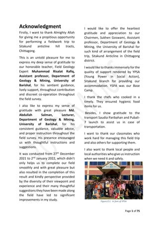
  • 1. Page 1 of 75 Figure 0.1: In font of YPSA Acknowledgment Firstly, I want to thank Almighty Allah for giving me a propitious opportunity for performing a fieldwork trip to Sitakund anticline hill tracts, Chittagong. This is an untold pleasure for me to express my deep sense of gratitude to our honorable teacher, Field Geology Expert Muhammad Risalat Rafiq, Assistant professor, Department of Geology & Mining, University of Barishal, for his sentient guidance, lively support, throughout contribution and discreet co-operation throughout the field survey. I also like to express my sense of gratitude with great pleasure Md. Abdullah Salman, Lecturer, Department of Geology & Mining, University of Barishal, for his consistent guidance, valuable advice, and proper instruction throughout the field survey. His presence encouraged us with thoughtful instructions and suggestions. It was conducted from 27th December 2021 to 2nd January 2022, which didn’t only helps us to complete our field smoothly and with great pleasure but also resulted in the completion of this result and kindly perspective provided by the diversity of their viewpoint and experience and their many thoughtful suggestions they have been made along the field have led to significant improvements in my study. I would like to offer the heartiest gratitude and appreciation to our Chairmen, Sukhen Goswami, Assistant professor, Department of Geology & Mining, the University of Barishal for such kind of arrangement of the field trip, Sitakund Anticline in Chittagong district. I would like to thanks immensely for the quality of support rendered by YPSA (Young Power in Social Action), Sitakund branch for providing our accommodation. YSPA was our Base Camp. I thank the chefs who cooked in a timely. They ensured hygienic food items for us. Besides, I show gratitude to the transport Saudia Paribahan and Pubali- 7 launch to assist us in case of transportation. I want to thank our classmates who work hard for managing this field trip and also others for supporting them. I also want to thank local people and local authorities who give us instruction when we need it and safely.
  • 2. Page 2 of 75 Executive Summary The field report is based on all the scientific facts and data found during the brief field survey on the Shahasradharara section, Barabkund Hill section, and Chandranath Hill Section in the Sitakund Anticline area in Chittagong District. This field report deals with the physiographic, structural, stratigraphic, and sedimentological. And geomorphic characteristics of Sitakund Anticline along with practical and economic aspects. The Sitakund Anticline is situated in the southeast part of Bangladesh under Chittagong District. It is above 75 km long and 10 km wide and is one of the westernmost structures of Chittagong and the Chittagong Hill Tracts. The Sitakund Anticline range act as a water divide between Halda Valley and Swandwip Channel. Structurally, Sitakund Anticline is one of the prominent structures of the eastern folded belt of the Bengal Basin. The Sitakund Anticline is trending in the NNW-SSE direction. It is an asymmetric fold and the western flank of the anticline is faulted regionally, the alignment of which runs parallel to the NNW-SSE trending regional strike. The Sitakund Anticline is completely composed of sedimentary rock which was deposited during the tertiary age in the marginal marine environment. The sedimentary beds are mainly composed of sandstone and shale but at some places, mudstone, and siltstone are also found. So, the overall lithology of the area can be described as the alteration of sandstone and shale with a minor presence of mudstone and siltstone at different sites. In our investigation, we got some geomorphic features such as stream, pool, riffle, rapid, waterfall, slump, pothole, etc. The report gives us the study of rock samples collected from three consecutive sections. They are the Shahasradharara section, the Barabkund Hill Section, and the Chandranath Hill section. There are some economical aspects and importance of this area. It is anticipated that there is a reservoir of gas and petroleum in this area. Several gases seepage that we have found in our investigation are provides strong evidence of it. Besides many hard rocks are supplied from this area for industrial and construction projects. These areas also have the importance of religious views.
  • 3. Page 3 of 75 Table of Content Content Page No. Acknowledgment 01 Executive Summary 02 List of figures 05 List of tables 07 List of Maps 08 Chapter 01: Introduction 09-14 1.1 Background 10 1.2 Scope of Study 10 1.3 Objectives 11 1.4 Previous work 12 1.5 Study area 13 Chapter 02: Physiography 15-20 2.1 Topography 16 2.2 Drainage pattern 18 2.3 Climatology 19 2.4 Population & Culture 20 Chapter 03: Geological Setup 21-26 3.1 Tectonics 22 3.2 Geomorphology 23 3.3 Structural Geology 25 3.4 Petrology 26 Chapter 04: Methodology 27-29 4.1 Method of Study 28 4.2 Lab Investigation 29 4.3 Equipment 29 Chapter 05: Description of Individual Section 30-58 5.1 Shahasradhara Section 31-39  Measuring the height of the waterfall 34 5.2 Barabkund Hill Section 40-50  Gas Seepage 41 5.3 Chandranath Hill Section 51-58 Chapter 06: Structure 59-64 6.1 Introduction 60 6.2 Fold 61 6.3 Fault 62 6.4 Joint 63 6.5 Unconformity 64
  • 4. Page 4 of 75 Chapter 07: Co-relation 65-68 7.1 Lithological Description 66 7.2 Previous Study 67 7.3 Co-relation 68 Chapter 08: Discussion & Conclusion 69-71 8.1 Discussion 70 8.2 Conclusion 71 Reference 72 Geological Map of Sitakund Anticline 73
  • 5. Page 5 of 75 List of Figure Figure No. Topics Page No. 0.1 In font of YPSA 01 2.1 Climate graph of Sitakund Anticline in 2020 19 2.2 Local People 20 2.3 Local Cultivation (Bean) 20 3.1 Stream 24 3.2 Gully 24 3.3 Gorge 24 3.4 Waterfall & Plunge pool 24 3.5 Pothole 24 3.6 Rapid 24 3.7 Pool & Riffle 24 3.8 Ridge & Valley 24 3.9 Reverse Fault 25 3.10 Joint 25 4.1 Measuring Attitude of Beds 28 4.2 Taking Photograph 28 4.3 Data Plotting on the Map 28 4.4 Collecting Sample 28 4.5 GPS (Global Positioning System) 29 4.6 Grain Size Comparator 29 4.7 Compass Clinometer 29 4.8 Measuring Tape 29 4.9 Hands Lens 29 4.10 Hammer 29 4.11 Field Notebook 29 4.12 Base Map 29 5.1.1 At the shahasradhara waterfall section 31 5.1.2 Geometrical Configuration of Waterfall 34 5.1.3 Shahasradhara Waterfall and Plunge pool 35 5.1.4 Stream 35 5.1.5 Rapid 35 5.1.6 Ridge & Valley 36 5.1.7 Landslide 36 5.1.8 Bedding 37 5.1.9 Lamination 37 5.1.10 Bioturbation 37 5.1.11 Sandstone 38 5.1.12 Shale 38 5.1.13 Silty Shale 38
  • 6. Page 6 of 75 5.1.14 Lithological Succession of Shahasradhara Section 39 5.2.1 In font of Agnikand Temple 40 5.2.2 Gas Seepage 41 5.2.3 Stream 45 5.2.4 Pothole 45 5.2.5 Pool & Riffle 46 5.2.6 Point Bar 46 5.2.7 Ridge 46 5.2.8 Gully 46 5.2.9 Gorge 46 5.2.10 Bedding 48 5.2.11 Groove Cast 48 5.2.12 Lenticular Bedding 48 5.2.13 Mud Cast 48 5.2.14 Nodular 48 5.2.15 Lamination 48 5.2.16 Bioturbation 48 5.2.17 Baroz 48 5.2.18 Sandstone 49 5.2.19 Shale 49 5.2.20 Silty Shale 49 5.2.21 Lithological Succession of Barabkund Section 50 5.3.1 Start Point of Chandranath Hill 51 5.3.2 Ridge 55 5.3.3 Y-shaped Valley 55 5.3.4 Bedding 56 5.3.5 Nodular 56 5.3.6 Lamination 56 5.3.7 Silty Shale 57 5.3.8 Sandstone 57 5.3.9 Silty Sandstone 57 5.3.10 Lithological Succession of Chandranath Hill Section 58 6.1 Fold 61 6.2 Anticline of Fold 61 6.3 Fault in Shahasradhara waterfall 62 6.4 Reverse Fault 62 6.5 Joint in Chandranath Hill Section 63 6.6 Joint in Barabkund Section 63 6.7 Local Unconformity 64
  • 7. Page 7 of 75 List of Table Table No. Topics Page No. 1.1 Previous work in Sitakund Anticline 12 5.1 Attitude of Bed (Shahasradhara Section) 32 5.2 Attitude of Bed (Barabkund Section) 42 5.3 Attitude of Bed (Chandranath Hill Section) 52 7.1 Correlation 68
  • 8. Page 8 of 75 List of Map Map No. Topics Page No. 1.1 Satellite image of Sitakund Anticline 13 1.2 Location map of Sitakund Anticline 14 1.3 Sitakund Anticline In Chittagong District Map 14 2.1 Topographic map of Sitakund Anticline 16 2.2 Physiographic map of Sitakund Anticline 17 2.3 Drainage pattern of Sitakund 18 2.4 River system of Chittagong 18 3.1 Geological Setup of Sitakund Anticline 22 3.2 Sitakund Anticline Fold 25 3.3 Petrological Map of Sitakund Anticline 26
  • 9. Page 9 of 75 Chapter One INTRODUCTION 1.1 Background 1.2 Scope of Study 1.3 Objectives 1.4 Previous work 1.5 Study area
  • 10. Page 10 of 75 1.1 Background Geology is the study of visual earth science. Field Studies offer several unique advantages in solving geological problems. A purpose may be economic or scientific. Our purpose was scientific. Field mapping is fundamental to all geologic knowledge. Geological fieldwork usually involves the study and interpretation of rocks, topographic forms, etc. Geologic Field Work is a compulsory course of the Geology and Mining Department, which supplements practical knowledge. The chief purpose of the fieldwork is to get aquatinted with different geologic field problems and interpret them properly. The geologic fieldwork deals with the study and explanation of the rocks, drainage patterns, and structural features such as fold, fault, joint, unconformity, and plotting this geologic data on the base map. For this reason, the Geology and Mining Department of the University of Barishal arranges annual field trips for students. The department of Geology and Mining arranged scheduled fieldwork in Sitakund Hill Range under the district of Chittagong. Course Name: Field Geology I Course Code: GMF 114 Course Credit Hours: 2 Credit We are fifty-four students of the 1st year B.S. (Hon’s) Session 2019-2020 made a field tour for six days. Our investigation was based on the traverse method. We were divided into nine groups consisting of six members. 1.2 Scope of Study In Sitakund Anticline, exposures that are found along the waterfall area, hill slopes, river valleys, anticlinal folded structures, and rock types offer huge scopes for geological investigations. Through exposures, we can study its attitude and lithology and observed different morphological features and the change in natural processes. We prove that it is a clear anticline by defining the axial plane.
  • 11. Page 11 of 75 1.3 Objectives Important Objectives of field report are:  To use maps (topographic and geologic) to estimate distances, visualize landforms and identify geographic and geologic features.  To identify common minerals in hand samples and in-field exposures of rock using visual clues and to identify the common form of sedimentary rock in hand samples and in-field exposures using observations of mineral composition and texture.  To identify common structures and bed features in sedimentary strata. Using a variety of tools and instrumentation, students will describe and quantify the mineral, paleontological composition, grain distribution, textural properties, bedforms, and structures of earth materials and strata.  To know how to collect data process and analyze and represent the collected data.  To know how to make a field report and for realizing about completing the fieldwork.  To know how to make a field report and for realizing about completing the fieldwork.  Using observations and measurements of lithological, paleontological, and geochemical properties, to interpret the history and environment of the formation of rock samples and strata.  To integrate data from fieldwork, laboratory measurements, library research, and the course work to formulate or evaluate a hypothesis and to produce and present oral reports based on posters or digital media (e.g. PowerPoint) that clearly and accurately describe and illustrate the backgrounds, methods, data, and interpretation relevant to a particular project.  To demonstrate proficiency using digital photography and image processing or drafting software to generate scientific illustrations, maps, diagrams, or graphs. After all, and to will apply critical thinking skills such as inductive, deductive, and mathematical reasoning to solve geological problems using the scientific method.
  • 12. Page 12 of 75 1.4 Previous Work S.N Geologists/Organization Work Time 01 The Indian Petroleum Prospecting Company Drilled three wells 1910-1914 02 The Burma oil company (BUC) Drilled a shallow well 1914 03 The oil and gas development corporation (OGDC) Conducted a geological investigation of the area 1963-1964 04 Professor M.A. Latif and M.T. Hossain. Mapped the area Geologically 1963-1965 (winter season only) 05 Professor M.A. Latif and M.T. Hossain Published analytic writings on this hill range. 1968 06 Momin Ullah Published analytic writings on this hill range. 1978 07 Dr. K.M. Hossain, and Dr. S.H. Akhter Published analytic writings on this hill range. 1983 08 Petrobangla Drilled a well 1983 Table 1.1: Previous work in Sitakund Anticline Also, the Geological Survey of Bangladesh, Petrobangla took several projects in this hill range. Moreover, students and teachers of the Department of Geology & Mining of the University of Barishal, Department of Geology of the University of Dhaka, Department of Geology & Mining of Rajshahi University, and Jahangirnagar University, and many geologists study every year.
  • 13. Page 13 of 75 Map 1.1: Satellite image of Sitakund Anticline 1.5 Study Area Sitakund is one of the most familiar hill ranges in Bangladesh. Sitakund is an upazila under the Chittagong District. It is situated in the northwestern part of the Chittagong District. The investigated area lies within the latitude of 22°30ʼ N to 22°45ʼ N and the longitudes of 91°35ʼ E to 91°50ʼ E and is included in the survey of Bangladesh topo sheet No. 79 N/10. The distance between Sitakund and Chittagong is 40 km whereas it is 185 km southeast of Dhaka City, the capital of Bangladesh. It stands beside the Dhaka Chittagong Highway and Dhaka-Chittagong Railway line. The Sitakund Anticline is about 68 km long and 12-16 km wide and covers about 840 sq. km. Sitakund Anticline extends from Feni River to Karnaphuli River whereas Swandip Channel is on the western side and Halda Valley is on the eastern side of the hill range. We went to three sections. Shahasradhara section is situated on the eastern side, Barabkund Section is situated southern side, and Chandranath Hill Section is situated on the north-eastern side of Sitakund Upazila.
  • 14. Page 14 of 75 Map 1.2 : Location map of Sitakund Anticline Map 1.3: Sitakund Anticline In Chittagong District Map
  • 15. Page 15 of 75 Chapter Two Physiography 2.1 Topography 2.2 Drainage pattern 2.3 Climatology 2.4 Population and Culture
  • 16. Page 16 of 75 Map 2.1 : Topographic map of Sitakund Anticline 2.1 Topography The topographic expression of the area is the abrupt rise of the hill on the eastern flank whereas the western flank’s hills are buried under the alluvial plain. (fig) The Sitakund hill range is trending NNW-SSE direction caused by folding. (fig) The eastern flank of the hill gradually merges with Halda Valley and the western flank is abruptly distributed by a major fault. The average height of the Sitakund hill range is 700 feet from sea level. The height of the highest elevated area is 1156 feet from sea level. Based on the general topography, the whole hill range is divided into three major physiographic zones. They are as follows: The Western Zone: This portion is mainly covered with shallow depth of alluvium that’s why it is also named “A Zone of Buried Hill”. This zone extends from the sea coast to the western margins of the hills. Since the sediments are encountered at a shallow depth of alluvial cover. The Middle Zone: The middle portion of the hill range constitutes a strip of landmasses, that make up the foothills of the main range. The average elevation is 100 to 250 feet. Due to differential weathering, the zone shows an inversion of topography and results in a long escarpment. As a result, this zone is named “The Zone of Topographic Inversion”. The Eastern Zone: The eastern portion represents the maximum elevation. The highest peak of this zone is 1156 feet at the Chandranath Temple. The area is still in its early geomorphic youth and the work of sub areal denudation is conspicuous. As a result, the features like cliffs spur rapid waterfalls, plunge pools, etc. are present.
  • 17. Page 17 of 75 Map 2.2 : Physiographic map of Sitakund Anticline
  • 18. Page 18 of 75 Map 2.3: Drainage pattern of Sitakund Map 2.4 : River system of Chittagong 2.2 Drainage Pattern There are numerous valleys and streams along and across the Anticline. The steams are locally known as ‘Chara”. Most of the valleys and streams of Sitakund are in the youth stage. Some streams are perennial and had a very narrow flowage. Two major types of drainage patterns are seen. One is the ‘Dendritic’ pattern. There are no streams that are straight for a hundred meters. All are curved and dendritic. Generally found southern and eastern part and the second is ‘Trellised’ drainage pattern in the north and North-West part of this area. But the drainage of this area is mostly dendritic which indicates that the underlying bedrock is uniform. In these dendritic patterned streams or charas, we found many geomorphic features such as waterfalls, rapids, etc. The general characteristics of those streams in the area are demonstrated and controlled by the geomorphic feature available here like waterfalls, rapids, potholes, gorge, V-shaped valley, etc.
  • 19. Page 19 of 75 Figure 2.1 : Climate graph of Sitakund Anticline in 2020 2.3 Climatology The weather on our observation days was colder to warmer, with a sunny day, no humidity, no rainfall, and temperature is 16°C to 21°C. It was a good time in December we visited Sitakund. There are three distinct seasons in the Sitakund area. They are described below- The summer: Begins in March continues up to May with moderate precipitation. As this mountainous area has a huge amount of plantations so summer heat is not so unbearable. The monsoon: Starts in June and lasts till October. During monsoon, the sky is often overcast with dark clouds, and it rains heavily accomplished by gusty wind and occasionally with a cyclonic storm. The winter: It begins in November and continues up to February, with cool, calm, and pleasant weather.
  • 20. Page 20 of 75 Figure 2.2 : Local People Figure 2.3 : Local Cultivation (Bean) 2.4 Population and Culture According to the census of 2001, Sitakundhad a population of 298,528 distributed to55,837 units of households (average household size 5.3), including 163,561 men and 134,967 women, or a gender ratio of121:100. The average population of component administrative units of the Upazila is 4,072 for wards, 1,666 for mahallas, 29,853 for unions, 5,060 for mulas(revenue villages), and 5,060 for villages reported by the census. Out of the 69 mauzas here, 8 have less than 50 households, while 27 have more than 600 households. Of the villages, 8 have a population of less than 250, while 29 have more than 2,500. As of 2001, the population density of Sitakund was 692 inhabitants per square kilometer (1,792/square mile). Apart from the Bengali majority, there are several small communities of ethnic minorities in the area. Many of the resident Rakhine people are believed to have settled here during the Arakanese rule of Chittagong (1459-1666), though the event is not historically traceable. The Rakhine population in Khagrachari District migrated from the surrounding area and built up their permanent abode at Ramgarhin in the 19th century. Other ethnic groups include the recently migrated Tripuri people. In the District of Chittagong which includes Sitakund, the population ratio by religion in 2001 wasMuslim83.92%, Hindu13.76%, Buddhist2.01%, and Christian 0.12%, with 0.19% following other religions. In 1981, it was Muslim 82.79%, Hindu14.6%, Buddhist 2.23%, and Christian0.21%, with 0.19% following other religions. Chittagonian, a derivative of Bengali spoken by 14 million people mainly in the Chittagong district, is the dominant language. In plain lands most of the people are farmers. But there are also working people like woodcutters, businessmen or porters. There are many temples in the Sitakund region such as Chandranath, and Barabkund temples. An enormous number of people come here every year to meet on religious occasions.
  • 21. Page 21 of 75 Chapter Three Geological Setup 3.1 Tectonics 3.2 Geomorphology 3.3 Structural Geology 3.4 Petrology
  • 22. Page 22 of 75 Map 3.1 : Geological Setup of Sitakund Anticline 3.1 Tectonics Sitakund anticline is a result of the collision between the Burma plate in the east and the Indian plate in the west. It is situated in the northwestern part of the Chittagong district, between 22'34' N and 22'43' N latitude and 91'38' E and 91'41' E longitude. It is delimited in the north by the Fini River, in the south by the Karnaphuli, in the east by the Halda River, and the west by the Swandwip Channel. In a broader sense, the Sitakund hill range acts as a water divider between the Halda valley on the east and the Swandwip channel on the west. The structure is about 70 km long and 10-km wide.
  • 23. Page 23 of 75 3.2 Geomorphology We found various types of geomorphic features in different sections of our field trip. A short description is given below: Stream: A body of running water or any other moving liquid under the influence of gravity to lower levels in a narrow, clearly defined natural channel is called a stream. It has three important roles in the formation of a landscape: It erodes the channels in which it flows, it transports materials provided by weathering and slope processes, and it produces a wide variety of erosional and depositional landforms. It was seen in all Sections(Shahasradhara Section, Barabkund Section, Chandarnarh Hill Section). Waterfall: A steep to vertical descent of a stream course where it drops over the edge of a plateau or where erosion has worn away overhanging softer rock. It was seen in Shahasradhara Section. Because of the force of the water, all waterfalls must necessarily be relatively ephemeral features. Pothole: A pothole is a bowl-shaped, circular, or cylindrical hole formed by the grinding action of a stone in the rock bed of a river of the stream. It was seen in Barabkund Section. Potholes are created by the abrasive action of particles swirling in fast- moving eddies. The rotational motion of the sand and pebbles act like a drill to bore the holes. Plunge Pool: The water occupying a deep hollow scoured in the bed of a stream at the foot of a waterfall is called a plunge pool. It was seen in Shasradhara Section. Ridge & Valley: A ridge is a geological feature consisting of a chain of mountains or hills that form a continuous sharp elevated crest for some distance. Ridges are usually termed hills or mountains as well, depending on size. A valley is a low area between hills, often with a river running through it. In geology, a valley or dale is a depression that is longer than it is wide. We had seen the ridge & valley from the top of Chandranath Hill Section and Shahasradhara Section. In the Sitakund hill range, we found mainly shale and sandstone. Since sandstone is more resistant, it undergoes less weathering than shale. Therefore it makes the ridge. In other cases, shale undergoes more weathering and forms a valley. Gully: A gully is a landform created by running water, eroding sharply into soil, typically on a hillside. Gullies resemble large ditches or small valleys but are meters to tens of meters in depth and width. When the gully formation is in process, the water flow rate can be substantial, which causes a significant deep cutting action into the soil. Gully was seen in the Barabkund Section.
  • 24. Page 24 of 75 Figure 3.1 : Stream Figure 3.2 : Gully Figure 3.3 : Gorge Figure 3.4 : Waterfall & Plunge pool Figure 3.5 : Pothole Figure 3.6 : Rapid Figure 3.7 : Pool & Riffle Figure 3.8 : Ridge & Valley Gorge: Gorge is a narrow passage between mountains or the wall of the canyon, especially one with steep and rocky walls. Most gorges were formed by a process of long-time erosion from a plateau or table-land level. The cliffs form because harder rock strata that are resistant to erosion and weathering remain exposed on the valley walls. We’ve seen Gorge at Balukhali Section and Chandranath Hill Section. Rapid: A rapid is a part of the river where the current is very fast because of the relatively steep gradient of the river bed at that place causing an increase in water flow and turbulence. It was seen in the Sahasdhara Section. Pool and Riffle: Pool and riffle are the deep and shallow portions of an undulating stream bed. Pools are most easily seen in a meandering stream where the outer edge of each meander loop is deep and undercut; riffles form in the shallow water of the short, straight, wide reaches between adjacent loops. The pools and riffles form sequences spaced at a repeating distance of about five to seven widths of the channel and often appear in- stream development long before the stream produces visible meanders. It was seen in Barabkund Section.
  • 25. Page 25 of 75 Map 3.2 : Sitakund Anticline Fold Figure 3.9: Reverse Fault Figure 3.10: Joint 3.3 Structural Geology Sitakund is mainly a Fold. The Sitakund fold is an elongated, asymmetrical, box-type doubly plunging anticline. The axis of the fold is running in the NNW-SSE direction, parallel to the general trend of the regional strike. Both the flanks of the anticline merge into the alluvial plain of the Feni River in the north and the Karnaphuli in the south due to its doubly plunging nature. For a lack of infrastructure in Bangladesh, this anticline is one of the few regularly surveyed structures in the country. The syncline from Sitakund separates the eastern end of the Feni structure located in the folded flank of the Bengal foredeep. In Sitakund, we also found many structural features. They are: Fault: A fault is a planar fracture or discontinuity in a volume of rock across which there has been significant displacement as a result of rock-mass movements. It was seen in Shahasradhara Section. Joint: Joints are brittle-fracture surfaces in rocks along which little or no displacement has occurred. It was seen in Barabkund Section and Chandranath Hill Section. Unconformity: An unconformity is a surface of erosion or non-deposition that generally separates younger strata from older ones. Fault Line
  • 26. Page 26 of 75 Map 3.3 : Petrological Map of Sitakund Anticline 3.4 Petrology The Upper Bhuban Member in the Sitakund anticline is constituted by the light gray, light yellow, and greenish-gray sandstone and siltstone with dark gray, bluish-black and black finely laminated silty shale to shale. The lithofacies of massive sandstone(Sm), turbidite sandstone (ST), flat bedded sandstone-siltstone (Sh), ripple cross-laminated sandstone-siltstone (Sr), laminated sandstone-siltstone (Sl), lenticular laminated sandstone-siltstone-shale (Sll), wavy laminated silty shale to shale (Fw), laminated shale (Fl) with sub-facies black shale (Flbk) and blue shale (Flb) and mudstone (Fm) have been delineated in this member.
  • 27. Page 27 of 75 Chapter Four Methodology 4.1 Method of Study 4.2 Lab Investigation 4.3 Equipment
  • 28. Page 28 of 75 Figure 4.1: Measuring Attitude of Beds Figure 4.2: Taking Photographs Figure 4.3 : Data plotting on the map Figure 4.4: Collecting Sample 4.1 Method of Study Our investigation was based on the traverse method. The area has been surveyed along the roads and streams where the bedrocks were exposed and outcrops were found. We were divided into nine groups consisting of six members guided by honorable teachers. The following methods were used during the fieldwork- Measuring Attitude of Beds: While the investigation of exposure was taken, the strike direction, dip direction, and amount of dip of the bed were measured with the help of Clinometers and then written in the field notebook. Describing lithology: The lithology of the exposures was described and inscribed on the notebook. Collecting samples: We collected some rock samples and some significant sedimentary structures from the explored areas. Identify Mineral Constituents: The constituent minerals and grain size of rock specimens were identified with the help of a lens. Data plotting on the supplied map: During our investigation, we found some data on the attitude of beds and we tried to understand the lithology of the beds.1 cm on the map represents 200 meters on the ground. Taking Photographs: Photographs of well-exposed geomorphic features, vegetation structures, and topography were taken in each section.
  • 29. Page 29 of 75 Figure 4.5: GPS Figure 4.6: Size comparator Figure 4.7:Compass clinometer Figure 4.8: Measuring tape Figure 4.9: Hand lens Figure 4.10: Hammer Figure 4.11: Field Notebook Figure 4.12: Base Map 4.2 Lab Investigations The rock specimens and samples collected during the field survey were investigated in the Barishal University mineralogy Lab. So, we can able to determine the fabric or other optical properties of rock and mineral. 4.3 Equipment GPS Navigation Device: To measure the position (latitude and longitude) of the station’s location. Compass clinometer: Used in measuring the attitude of beds, that is the dip direction, the amount of dip, and the strike direction of the beds. Hammer & Scrapper: To collect samples and find out proper beds. Acid bottle and dropper: Used for identifying rock nature whether it is calcareous or not. Measuring tape: To measure distance. Hand Lens: To see grain size. Grain Size Comparator: To define grain size. Base Map: To plot rocks data and lithology. First Aid Box: For First aid, if needed. Also, we took a field notebook(6”×4”), pen, pencil(also color), Marker pen, Eraser, Diagonal scale, Set square, writing paper, Graph paper, Tracing paper, Pocket knife, Sample bag, Camera, Flash Light, Water Bottle, and enough cloth, Toiletries kit, and necessary equipment according to our needs.
  • 30. Page 30 of 75 Chapter Five Description of Individual Section  Sections 5.1 Shahasradhara Section 5.2 Barabkund Section 5.3 Chandranath Hill Section  Topics to be described  Introduction  Attitude of Bed  Geomorphic features  Sedimentary Structure  Petrology  Lithological Succession
  • 31. Page 31 of 75 Figure 5.1.1: With our honorable teachers at shahasradhara waterfall section 5.1 Shahasradhara Section 5.1.1 Introduction Our 1st day of fieldwork was in Shahasradhara Section. There was a waterfall called Shahasradhara Waterfall. Shahasradhara Waterfall is in the evergreen forest of Chandranath Reserve Forest block of Sitakund Upazilla of Chittagong. The Shahasradhara eco-park is 35 km from Chittagong city, located on the east side of the Dhaka-Chittagong Highway and railway in the north. During the year other than the monsoon, this fountain is less water. The fountain is found 7 km away from the main gate of the eco- park, with a brick path. There is a stairway from the top of the park to the waterfall. So, one just needs to do a relaxing walk to reach the waterfall. But beware, you’d have to do some hard work during your return. The shahasradhara waterfall is a narrow waterfall with only a single drop. The flow of water is not that heavy and it doesn’t produce much noise either. This waterfall is the upper stream of the Suptadhara Waterfall. There is a small pool at the base of the waterfall. Since this is easy to access, that’s why a lot of people visit it, and sometimes they are careless about littering. When we went there during the summer we didn’t see any water in the waterfall. The waterfall can be seen from the top of the eco-park(if anyone does not wish to climb down and up). Also, we didn’t find any path that would lead us to the top of the waterfall. For sure there is a path which local people might know. But as tourists, we couldn’t find it. I’d love to see the photo of the top of this waterfall (if anyone has done it). Date: 29 December 2021(Wednesday) Start Time: 7:15 AM Weather: Cloudy Temperature: 17°C Start Point: Base Camp (YPSA) GPS of Start Point: 22°36’28” N 91°39’49” E End Point: Base Camp (YPSA) GPS of End Point: 22°36’28” N 91°39’49” E
  • 32. Page 32 of 75 5.1.2 Attitude of Bed Station Location Lithology Attitude of Bed Rock Name S.D D.D A.D 01 22°36’90” N 91°40’42” E Alteration of yellowish-brown incline bedded shale and Reddish-brown Siltstone. Grain Size: 0.025mm-2mm N46°E N44°W 50° Silty shale 02 22°36’80” N 91°40’41” E Fine-grain yellowish-brown color Sandstone. It is porous and permeability is high. Grain Size: < 1/16 mm N70°W N160°W 30° Sandstone 03 22°36’57” N 91°41’36” E Brownish Gray- colored Silty Shale. It Shows lamination. Grain Size: 0.004 mm- 0.063 mm N105°E N15°E 15° Silty Shale 04 22°36’50” N 91°41’32” E Brownish Gray- colored Sandstone. It shows the sedimentary structure found in the valley and channel. Lamination is found. Grain Size: 0.125 mm – 0.25 mm N78°E N168°E 20° Sandstone
  • 33. Page 33 of 75 05 22°36’51” N 91°41’34” E It is sandstone- dominated. Light gray color sandstone(highly compacted). Fissile shale is visible. N20°W N70°E 20° Sandstone (some shale) 06 22°36’23” N 91°41’10” E Sandstone is mica silt. It is one kind of fossil, plant root. N18°W N72°E 2° Sandstone 07 22°36’23” N 91°41’10” E Sandstone is found that contains mica, quartz, sand, and iron. N166°E N76°E 30° Sandstone 08 22°36’70” N 91°41’30” E Yellow-colored pure sandstone. Grain size: 0.125 mm – 0.25 mm N64°E N26°W 32° Pure Sandstone Table 5.1: Attitude of Bed(Shahasradhara Section)
  • 34. Page 34 of 75 Figure 5.1.2: Geometrical Configuration of Waterfall 5.1.3 Geomorphic Feature We found many geomorphic features in the Shahasradhara Section. The main geomorphic features are being described below- Waterfall: A steep to vertical descent of a stream course where it drops over the edge of a plateau or where erosion has worn away overhanging softer rock. Because of the force of the water, all waterfalls must necessarily be relatively ephemeral features. We found a waterfall in this section called “Shahasradhara Waterfall”. Its GPS location is 22°36’51” N and 91°41’34” E. The height of the observed waterfall in the Shahasradhara section was 36.013 meters. We measured its height by using a compass clinometer and the help of basic trigonometry. Measuring the height of waterfall Here, The height of the person is, BE = CD = 1.3716 m Distance between person and waterfall is, BC = ED = 20 m We measure the angle by the clinometer, <ABC = 60° Now, The height of the waterfall is, AD = ? Calculation : Waterfall height, AD = AC + CD Person height, CD = 1.3716 m AC = BC × tan <ABC = 20 m × tan 60° = 34.64 m AD = AC + CD = 34.64 m + 1.3716 m = 36.013 m So, The height of the waterfall is, 36.013 m
  • 35. Page 35 of 75 Figure 5.1.3: Shahasradhara Waterfall and Plunge pool Figure 5.1.4: Stream Figure 5.1.5: Rapid Plunge Pool: The water occupying a deep hollow scoured in the bed of a stream at the foot of a waterfall is called a plunge pool. Stream: A body of running water or any other moving liquid under the influence of gravity to lower levels in a narrow, clearly defined natural channel is called a stream. It has three important roles in the formation of a landscape: It erodes the channels in which it flows, it transports materials provided by weathering and slope processes, and it produces a wide variety of erosional and depositional landforms. Rapid: A rapid is a part of the river where the current is very fast because of the relatively steep gradient of the river bed at that place causing an increase in water flow and turbulence. Ridge & Valley: A ridge is a geological feature consisting of a chain of mountains or hills that form a
  • 36. Page 36 of 75 Figure 5.1.6: Ridge and Valley Figure 5.1.7: Landslide continuous sharp elevated crest for some distance. Ridges are usually termed hills or mountains as well, depending on size. A valley is a low area between hills, often with a river running through it. In geology, a valley or dale is a depression that is longer than it is wide. Landslide: A landslide is defined as the movement of a mass of rock, debris, or earth down a slope. Landslides are a type of "mass wasting," which denotes any down-slope movement of soil and rock under the direct influence of gravity.
  • 37. Page 37 of 75 Figure 5.1.8: Bedding Figure 5.1.9: Lamination Figure 5.1.10: Bioturbation 5.1.4 Sedimentary Structure The sedimentary structures, observed here are given below: Bedding: Bedding is a term used for a structure occurring in granite and similar massive rocks that allow them to split into well-defined planes horizontally or parallel to the land surface, thickness more than 1cm. Lamination: Lamination is a small-scale sequence of fine layers that occurs in sedimentary rocks. Laminations are normally smaller and less pronounced than bedding. Thickness is less than 1 cm. Bioturbation Structure: Bioturbation is defined as the reworking of soils and sediments by animals or plants. These include burrowing, ingestion, and defecation of sediment grains. Bioturbating activities have a profound effect on the environment and are thought to be a primary driver of biodiversity.
  • 38. Page 38 of 75 Figure 5.1.11: Sandstone Figure 5.1.12: Shale Figure 5.1.13: Silty Shale 5.1.5 Petrology The lithology of this area includes sandstone, shale, and silty shale. Sandstone: the rock is composed of yellowish-brown colored, fine to medium-grained, very thinly to thickly bedded, loose compacted sand-size particles. Shale: The rock is composed of bluish- gray colored, thinly to thickly laminated, clay-sized particles. Silty shale: the rock is composed of bluish gray-colored, thinly to thickly laminated, medium to fine-grained silt, and clay size particles.
  • 39. Page 39 of 75 5.1.6 Lithological Succession The lithological succession of the Shahasradhara Section is given below: 5m 10m 15m 20m 25m 30m Thickness Clay(Shale) Silt Sand fine Medium Coarse Grain Size 0m Figure 5.1.14: Lithological Succession of Shahasradhara Section Ex-01 Ex-02 Ex-03 Ex-04 Ex-05 Ex-06 Silt Clay Sand
  • 40. Page 40 of 75 Figure 5.2.1: In font of Agnikund Temple 5.2 Babarkund Section 5.2.1 Introduction Our 2nd day of fieldwork was in Barabkund Section. There was a gas seepage. The elevation of this area is 200 feet- 600 feet from sea level. It is located on the east side of the Dhaka- Chittagong Highway and Railway. In this area, most of the rock that we found is Shale. Siltstone, Sandstone, and other sedimentary rock are also found. This area is an evergreen forest area. Calcareous Sandstone is also found in this area. There is a temple name Agnikund Temple and its age is more than hundreds of years ago. On the path, there will be a huge piece of hilly soil. The soil has softened due to the wetness of the rain. But without the rainy season, it is purely hard. The most interesting thing in the Barabkund Section is Gas Seepage. The Agnikund Temple is located beside this gas seepage. Date: 30 December 2021(Thuesday) Start Time: 8:07 AM Weather: Hazy Temperature: 17°C Start Point: Base Camp (YPSA) GPS of Start Point: 22°36’28” N 91°39’49” E End Point: Base Camp (YPSA) GPS of End Point: 22°36’28” N 91°39’49” E
  • 41. Page 41 of 75 Figure 5.2.2: Gas Seepage  Gas Seepage Gas is a very important economic resource. Natural gas is an energy source often used for heating, cooking, and electricity generation. It is also used as fuel for vehicles and as a chemical feedstock in the manufacture of plastics and other commercially important organic chemicals. Various Gas Seepages were found almost all over Sitakund. One of the Gas Seepages was at Barabkund Temple in Barabkund, which was investigated. There we found an amount of very little gas at the temple, which helps to light up the fire beside that. Mainly most of the temples are built centering gas seepage. Gas is formed by organic matter in sedimentary rocks. At first plant or animal, fossils are cooked beneath the surface and the source rock is transformed into kerozin. By getting heated this kerozin releases gas. This gas is then trapped in a reservoir. A layer of shale acts as a seal in the Sitakund gas reservoir. Without the seal, gas cannot be trapped in the reservoir. The seal must be non-porous. It helps the rock to be preserved. The stronger the seal is, the more gas will be deposited. When the Seal cracks, gas started to leak from the Reservoir. This is what we find at the top of the hill as “Gas Seepage”.
  • 42. Page 42 of 75 5.2.2 Attitude of Bed Station Location Lithology Attitude of Bed Rock Name S.D D.D A.D 01 22°34’53” N 91°41’22” E Bluish gray Shale dominated and also yellowish brown sandstone. Planer lamination, inclined bedding, Lenticular bedding, and Bioturbation are found. N10°E N80°W 26° Sandy Shale 02 22°34’54” N 91°41’24” E Yellowish-brown Shale and a minor amount of sandstone. Wavy bedding due to turbidite. N178°E N92°W 8° Sandy Shale 03 22°34’54” N 91°41’28” E Bluish gray- colored shale dominated. Concretion and Reverse graded bedding are found. N185°E N85°W 5° Shale 04 22°34’51” N 91°41’30” E Light bluish-gray colored Shale. Upper bedding shows light color due to oxidation. Flaser bedding (Sandstone) and concretion are found. N150°E N120°W 20° Shale(some sandstone) 05 22°34’51” N 91°41’30” E Light greenish gray colored Shale. N160°E N70°E 38° Shale
  • 43. Page 43 of 75 06 22°34’50” N 91°41’32” E Yellowish-brown colored sandstone. Iron concretion is found. N180°E (True Dip) N90°E 38° Sandstone 07 22°34’50” N 91°41’36” E Pure Shale is found. Color: Dark Bluish Gary Pure Shale 08 22°34’50” N 91°41’35” E Greenish brown colored Shale. A minor amount of sandstone and siltstone. Ripple and potholes are found. N165°E N105°W 42° Silty Shale (Some sandstone also) 09 22°34’51” N 91°41’38” E Light brown colored loose shale and a minor amount of compacted sandstone. N145°E N55°E 60° Sandy Shale 10 22°34’52” N 91°41’40” E Medium-light gray-colored shale and a minor amount of siltstone and sandstone. Nodular structure and Joint are found. N158°E N112°w 78° Silty Shale(some sandstone also) 11 22°34’52” N 91°41’39” E Gray-colored siltstone and Fleasure bedding of Sandstone. Baroz is found. N165°E N105°W 50° Sandy Siltstone 12 22°34’52” N 91°41’40” 1. Light gray colored shale and Fleasure bedding are found. N175°E N85°E 42° Shale
  • 44. Page 44 of 75 2. Medium- light gray- colored shale and Fleasure bedding are found. 3. Gray- colored shale and Lenticular bedding are found. 13 22°34’53” N 91°41’42” E Dark brown colored shale. Fleasure bedding, Contain Iron and lamination are found. N148°E N122°W 40° Shale 14 22°34’54” N 91°41’55” E Brown colored loose shale N70°W N20°E 20° Shale 15 22°34’58” N 91°41’58” E Greenish brown colored shale. Nodular structure is found. N130°E N40°E 10° Shale Table 5.2: Attitude of Bed (Barabkund Section)
  • 45. Page 45 of 75 Figure 5.2.3: Stream Figure 5.2.4: Pothole 5.2.3 Geomorphic Feature The main geomorphic features are described below. Stream: There were a lot of streams that were not so deep in water as it was a dry season. A body of running water or any other moving liquid under the influence of gravity to lower levels in a narrow, clearly defined natural channel. Pothole: we also found some bowl- shaped, circular, or cylindrical holes formed by the action of moving water in the rocky bed of a stream and creating a pot-shaped hole Which is known as a pot whole. Pool and Riffle: A pool is characterized by a water surface profile less than the mean stream gradient and finer bed materials, whereas a rifle has a water surface slope steeper than the mean stream gradient and is composed of coarser bed materials. Point bar: We observed that the streams had a significant characteristic that they had water quantity and velocity variation. A point bar is a depositional feature made of alluvium that accumulates on the inside bends of streams and rivers below the slip-off slope. Point bars are found in abundance in mature or meandering streams. Ridge: A general term for a long narrow, usually sharp-crested, and with steep sides, e.g. an extended upland between valleys. It was seen in this section. Gorge: Gorge is a narrow passage between mountains or the wall of the canyon, especially one with steep and rocky walls. Most gorges were formed by a process of long-time erosion from a plateau or table-land level. The cliffs form because harder rock strata that are resistant to erosion and weathering remain exposed on the valley walls. Gully: A gully is a landform created by running water, eroding sharply into soil, typically on a hillside. Gullies resemble large ditches or small valleys but are meters to tens of meters in depth and width. When the gully formation is in process, the water flow rate can be substantial, which causes a significant deep cutting action into the soil.
  • 46. Page 46 of 75 Figure 5.2.5: Pool & Riffle Figure 5.2.6: Point Bar Figure 5.2.7: Ridge Figure 5.2.8: Gully Figure 5.2.9: Gorge Point Bar
  • 47. Page 47 of 75 5.2.4 Sedimentary Structure We observed many sedimentary structures. They are bellowed: Bedding: On our whole field survey we found a lot of bedding that was expressed by work unit of granular tabular or lenticular form. Generally, a bed or structure is an individual layer of rocks more than 1cm thick. Lenticular Bedding: Lenticular bedding is a sedimentary bedding pattern displaying alternating layers of mud and sand. Formed during periods of slack water, mud suspended in the water is deposited on top of small formations of sand once the water's velocity has reached zero. Wavy Bedding: Wavy bedding occurs when mud is deposited over the whole area of a bed of rippled and/or cross stratified sand. Lamination: We also found some structures that were likely to be bedding but not so thick as bedding. We identified those as lamination which is a small-scale sequence of fine layers that occurs in sedimentary rocks. Laminations are normally smaller and less pronounced than bedding. Groove cast: We got a sedimentary structure that was curved outwards which was named groove casts and they are sedimentary structures found on the bases of certain strata that indicate small-scale grooves or irregularities. Generally, older strata are curved inward. Nodular structure: As much as we became closer to the axis we found some structures that were moderately hard bodies of rock similar to concretions. Nodules may also form by the selective precipitation of dissolved minerals that completely replace the original Sediments. Mud cracks: Mud Cracks are polygonal cracks formed as the mud dried. Mud Cracks indicate shallow water. They are used to show which way up. Bioturbation Structure: Bioturbation is defined as the reworking of soils and sediments by animals or plants. These include burrowing, ingestion, and defecation of sediment grains. Bioturbating activities have a profound effect on the environment and are thought to be a primary driver of biodiversity. We can identify the Bioturbation by observing Baroz. Baroz is faeces of organism.
  • 48. Page 48 of 75 Figure 5.2.10: Bedding Figure 5.2.11: Groove Cast Figure 5.2.12: Lenticular Bedding Figure 5.2.13: Mud Cast Figure 5.2.14: Nodular Figure 5.2.15: Lamination Figure 5.2.16: Bioturbation Figure 5.2.17: Baroz
  • 49. Page 49 of 75 Figure 5.2.18: Sandstone Figure 5.2.19: Shale Figure 5.2.20: Silty Shale 5.2.5 Petrology The lithology of this area includes sandstone, shale, and silty shale. Sandstone: This rock sample was yellowish-brown in color, fine to coarse-grained, very thinly to thickly bedded, moderately to well-sorted, loose compact sandstone composed of interbeds of silt size particles. The cement materials are Arrhenius and ferruginous. The rock was yellowish- brown, thickly laminated, medium to fine-grained silty shale. The cementing materials are Arrhenius. Shale: The rock sample was bluish-gray, thinly to thickly laminated, very fine- grained silt to sand-sized. Some thin beds are calcareous fine-grained sandstone to claystone. Silty shale: Silty Shale: The rock is composed of bluish gray-colored, thinly to thickly laminated, medium to fine-grained silt, and clay size particles.
  • 50. Page 50 of 75 5.2.6 Lithological Succession The lithological succession of the Barabkund Section is given below: 05 m 0 m 10 m 15 m 20 m Thickness Clay (Shale) Silt Sand Grain Size Fine Medium Coarse Silt Sand Clay Figure 5.2.21: Lithological Succession of Barabkund Section
  • 51. Page 51 of 75 Figure 5.3.1: Start point of Chandranath Hill 5.3 Chandranath Hill Section 5.3.1 Introduction Chandranath Hill is the eastern part of the Himalayas separated from the Himalayas. This hill goes south and southeast of the Himalayas and crosses the Feni River through Assam and Tripura states of India and joins Chittagong, Bangladesh. From the Feni river to the Chittagong city, it is about 70 kilometers long. Sitakunda Eco Park is built on the foothills of this. The Chandranath Temple, which is located on the east side of Sitakunda city, is about 1152 feet (around) high and is the highest place in the Chattogram district. The height of the Rajbari hummock is 889 feet and the height of the Sajidhala is 801 feet. The hill height has come down very near the city of Chittagong. Chandranath hill is one of the great places for those trekkers who likes trekking. These hills are located in Sitakunda which is a land of outstanding natural beauty. From Sitakunda it is around 4.5km far. Chandranath has small hill groups. On the way to the hill, tourists will see some religious places Hindu religion. This hill area has various kinds of trees. Here tourists can see the gardens of fruits like Guava, Mango, Coconut, etc. It is easy from other trekking to climbing up and down on the hilly way by the stairs. This area has some people called Tipra and they have a village. The hills look very marvelous during the rainy season, because of the rainfall on the trees and the hills look very awesome. But as well, it is very dangerous to climb this hill. Date: 31 December 2021(Friday) Start Time: 8:10 AM Weather: Hazy Temperature: 18°C Start Point: Base Camp (YPSA) GPS of Start Point: 22°36’28” N 91°39’49” E End Point: Base Camp (YPSA) GPS of End Point: 22°36’28” N 91°39’49” E
  • 52. Page 52 of 75 5.3.2 Attitude of Bed Station No GPS Lithology S.D D.D A.D 01 22⁰34’51” N 91⁰41’53” E Silty shale; its color light gray, grain size less than 0.004mm shale dominated 02 22⁰37’47” N 91⁰40’40” E Silty shale; its color light gray, shale dominated, it has silt also, silt is gray color and color of silt is yellowish- brown, moderately faulted, not highly compacted, iron concretion, the thickness of bed 7.2cm 03 22⁰37’50” N 91⁰40’47” E Silty shale; shale dominated. Minor shale, shale color is gray and silt color is yellowish- brown, moderately N93⁰W N5⁰E 5⁰
  • 53. Page 53 of 75 faulted, not highly compacted, iron concretion 04 22⁰37’44” N 91⁰40’47” E Calcareous shale; sand shale alteration, its color is light gray, shale dominated, pure shale in lower but upper in silt and shale alteration, nodular find in shale, shale is not found because it’s color is yellow color not dark brown, highly compacted shale 96⁰NW 20⁰NE 20⁰ 05 22⁰37’54” N 91⁰40’49” E Nodular structure; fissile shale, flauser bedding, color is yellowish- brown N140⁰W N20⁰E 20⁰ 06 22⁰37’54” N 91⁰40’52” E Gray to yellowish- brown color, S64⁰W N26⁰E 26⁰
  • 54. Page 54 of 75 upper portion sandstone, middle portion sandstone, lower portion shale, highly compacted 07 22⁰37’54” N 91⁰40’52” E Silty shale; fissile shale. Yellowish- brown color, split into a thin layer N20⁰W N6⁰E 6⁰ 08 22⁰38’01” N 91⁰41’02” E Pure sandstone, yellowish- brown color, bioturbation, fine to medium grain size(.06-.25) N20⁰W N5⁰E 5⁰ 09 22⁰38’2” N 91⁰41’2” E The color olive green contains Cl Table 5.3: Attitude of Bed (Chandranath Section)
  • 55. Page 55 of 75 Figure 5.3.2: Ridge Figure 5.3.3: V-Shaped Valley 5.3.3 Geomorphic Feature Many Geomorphic features are observed in this section. They are: Talus: Talus is the triangular-shaped structure where soil creep accumulated at the bottom of the mountain. Regolith: Regolith is a layer of loose, heterogeneous superficial material covering solid rock, including dust, soil, broken rock, and other related materials present on the earth. V-shaped valley: Rivers flow through V- shaped valleys in their upper course. They are usually found in mountains and hills. They are so-called because they often have steps. Ridge: A general term for a long narrow, usually sharp-crested and with steep sides, e.g. an extended upland between valleys. It was seen in this section.
  • 56. Page 56 of 75 Figure 5.3.4: Bedding Figure 5.3.5: Nodular Figure 5.3.6: Lamination 5.3.4 Sedimentary Structure Bedding: Bedding (also called stratification) is one of the most prominent features of sedimentary rocks, which are usually made up of ‘piles’ of layers (called ‘strata‘) of sediments deposited one on top of another. Every stratum is characterized by its lithology (composition), sedimentary structures, grain size, and fossil content that make it unique and different from the strata that lie above and below it. Every layer represents an event, a moment in the geological time when chemical, biological, and physical conditions led to the deposition of a specific rock layer. An event in the sedimentary record could have lasted thousands of years to a few minutes. In any case, when looking at a sequence of strata, we are looking through the sequence of events that occurred in a sedimentary basin over the geologic time. Lamination: In geology, lamination is a small-scale sequence of fine layers (laminae; singular: lamina) that occurs in sedimentary rocks. Laminae are normally smaller and less pronounced than bedding. Lamination is often regarded as planar structures one centimeter or less in thickness, whereas bedding layers are greater than one centimeter. However, structures from several millimeters to many centimeters have been described as laminae. A single sedimentary rock can have both laminae and beds. Nodular structure: As much as we became closer to the axis we found some structures that were moderately hard bodies of rock similar to concretions. Nodules may also form by the selective precipitation of dissolved minerals that completely replace the original Sediments.
  • 57. Page 57 of 75 Figure 5.3.7: Silty Shale Figure 5.3.8: Sandstone Figure 5.3.9: Silty Sandstone 5.3.5 Petrology Silty shale: It is shale-dominated. It has minor silt. Shale is a laminated or fissile clastic sedimentary rock that is composed of a predominance of silt and clay and other minerals, especially quartz and calcite. Characteristic properties of shale are breaks along thin laminae or parallel layering or bedding called fissility. It is the most abundant sedimentary rock. The composition (silt and clay) of shale is in a category of sedimentary rocks known as mudstone. The difference between shale to mudstone is fissile and laminated seen. Shale rock readily into thin pieces along the laminations. Sandstone: Sandstone is a sedimentary rock composed of sand-size grains of mineral, rock, or organic material. It also contains a cementing material that binds the sand grains together and may contain a matrix of silt- or clay-size particles that occupy the spaces between the sand grains. Silty sandstone: It is sandstone- dominated. Its color is yellowish- brown. It is split into a thin layer.
  • 58. Page 58 of 75 5.3.6 Lithological Succession The lithological succession of Chandranath hill section is given below: Clay Sand Silt Medium Fine Coarse Sand Grain Size 50 m 40 m 30 m 10 m 20 m 0 m Figure 5.3.10: Lithological Succession of Chandranath Hill Section
  • 59. Page 59 of 75 Chapter Six Structure 6.1 Introduction 6.2 Fold 6.3 Fault 6.4 Joint 6.5 Unconformity
  • 60. Page 60 of 75 6.1 Introduction Structure is a spatial and geometrical configuration of rock components. Sitakund is a hilly region which is the south-eastern part of Bangladesh. There is a macroscopic anticline in this area which tends NNW-SSE direction. It is a single anticline and doubly plunging asymmetrical fold. Its western flank is suffered by a major faulting and its strike is almost parallel to the main structure. We found joints, micro faults, fractures, etc. major structures, and some significant sedimentary structures in different sections while investigating the region. In this area, we found macroscopic and mesoscopic structures. Macroscopic Structure: Macroscopic structures are large-scale structures beyond the vision which is measured by the satellite or drone camera. The macroscopic structural features are-  Fold  Fault Mesoscopic Structure: Mesoscopic structures are medium-scale structures within the vision which orientations are measurable in individual outcrops. The mesoscopic structural features are-  Joint  Unconformity  Small scale fault
  • 61. Page 61 of 75 Figure 6.1: Fold Figure 6.2: Anticline of Fold 6.2 Fold Folds are wavy undulations in the stratified rocks of the earth’s crust. One of the most significant structures of the investigated area is folding. Sitakund anticline represents a large anticline that lies in the western flank of Bengal’s foredeep. The hill range is an asymmetrical structure. The axis of the fold is running in the NNW-SSE direction parallel to the general trend of the regional strike old axis of Bangladesh. Criteria for folding: From the measurement of the area, we found rock beds dip in opposite directions along an imaginary line, which is called “Fold axis”. It is observed that the westernmost outcrops show overturning of bed, probably due to the drag along the fault plane. Shale is the oldest rock unit in the axial region. So it forms the core of the fold. Bed in the unit in opposite direction with the low amount of dip (between 30-5) at the place. It is an indication of an anticline axis running through the unit. Older rock is deep towards the east and exposed at the western part of the fold. The western flank is steeper and shorter than the eastern flank and the attitude of the beds of those flanks is not uniform. The broad and early flat crustal part and high dip of flanks are an indication of box- like anticline fold Sitakund.
  • 62. Page 62 of 75 Figure 6.4: Reverse Fault Figure 6.3: Fault in Shahasradhara Waterfall 6.3 Fault A fault is a break in the rocks that make up the Earth's crust, along which rocks on either side have moved past each other. Major faulting lies in the eastern flank of the anticline and has been recognized based on abrupt changes in topography, lithology, and structural irregularity. These indicate a major fault occurs in the eastern flank of the anticline. By this, we can say that the Sitakund hill range fault runs NNW-SSE which is roughly parallel to the axis of the anticline. Total Sitakund hill range acted as a hanging wall and the western flank acted as a footwall. This footwall is covered by an alluvial plain. But well-exposed joints are found in the Sahasradhara section. We found a prominent fault line which is an indicator of fault. That was found in the western flank of the anticline. Criteria for Faulting: In Sitakund hill ranges some observations ensure us to be the presence of a fault and the criteria are given here- There some discontinuity in structure in the Sitakund anticline and an abrupt change in attitude suggests that a fault line may have located there. With having a high amount of dip the Hill range starts from the western alluvial plain suddenly. This sudden traction indicates faulting and a comparatively high amount of dip in a short distance near the alluvial plain and hill range may also suggest the faulting. Although there is no repetition of strata is founded, several missions of strata indicate the presence of a fault. The western flank contains the Silty shale unit but the eastern flank does not. Besides the discontinuity of Massive sandstone and Sandy shale unit between two flanks can give the confirmation of displacement of the rock strata which indicates a major fault. Fault Line
  • 63. Page 63 of 75 Figure 6.5: Joint in Chandranath Hill Section Figure 6.6: Joint in Barabkund Section 6.4 Joints Joints are brittle-fracture surfaces in rocks along which little or no displacement has occurred. Joints are observed in more resistant sandstone and shale of the Bhuban Formation. Joints are the most common and abundant structure on the surface of the earth. Sitakund hill range is a highly jointed surface. Most of these joints have been originated at the time of folding. Between our investigated areas numerous joints are seen. Those are the mesoscopic structural features. We found joints in the Barabkund Section and Chandranath Hill Section.
  • 64. Page 64 of 75 Figure 6.7: Local Unconformity 6.5 Unconformity An unconformity is a surface of erosion or non-deposition that generally separates younger strata from older ones. Unconformities represent gaps in the geologic record; periods that are not represented by any rocks. It is regarded as a planar structure. Unconformity is Three types: 1. Angular Unconformity 2. Non-Conformity 3. Dis-Conformity Also, there is a type of conformity called Local Unconformity. Local conformity remains in many sedimentary rocks. Maybe in Barabkund Section and Shahasradhara Section, there are many local conformities that are made with sandstone, Shale, and Siltstone. But, Unfortunately, we could not see it. Local Unconformity
  • 65. Page 65 of 75 Chapter Seven Correlation 7.1 Lithological Description 7.2 Previous Work 7.3 Correlation
  • 66. Page 66 of 75 7.1 Lithological Description Sitakunda Structure is one of the westernmost structures of the Chittagong and Chittagong hill tracts. It is situated in the northwestern part of the Chittagong district, between 22°34’N and 22°43' N latitude and 91°38' E and 91°41' E longitude. It is delimited in the north by the Feni river, in the south by the Karnafuli, in the east by the Halda river, and in the west by the Sandwip channel. In a broader sense, the Sitakunda Hill Range acts as a water divider between the Halda valley on the east and the Sandwip channel on the west. The structure is about 70 km long and 10-km wide and is situated at about 270-km southeast of Dhaka. The Sitakunda fold is an elongated, asymmetrical, box-type doubly plunging anticline. The axis of the fold is running in the NNW-SSE direction, parallel to the general trend of the regional strike. Both the flanks of the anticline merge into the alluvial plain of the Feni River in the north and the Karnafuli in the south due to its doubly plunging nature. The structure has a gently dipping eastern flank and steeper western flank, which is suddenly truncated by the alluvial plain. This truncation is a result of major faulting that runs parallel to the general strike of the anticline. The exposed sedimentary rock sequences of the structure, except limestone, provide no difference in overall lithology from that of other structures of Chittagong and the Chittagong Hill Tracts. The Sitakunda structure contains a thick sedimentary sequence of sandstone, shale, and siltstone. The total thickness of the exposed sediments is about 6,500m.
  • 67. Page 67 of 75 7.2 previous study The Upper Bhuban Member in the Sitakunda anticline, Chittagong, Southeastern Bangladesh is constituted by the light gray, light yellow, and greenish-gray sandstone and siltstone with dark gray, bluish-black, and black finely laminated silty shale to shale. The lithofacies of massive sandstone(Sm), turbidite sandstone (ST), flat bedded sandstone-siltstone (Sh), ripple cross- laminated sandstone-siltstone (Sr), laminated sandstone-siltstone (Sl), lenticular laminated sandstone- siltstone-shale (Sll), wavy laminated silty shale to shale (Fw), laminated shale (Fl) with sub-facies black shale (Flbk) and blue shale (Flb) and mudstone (Fm) have been delineated in this member. Based on genetic aspects the facies are grouped into (1) turbidity generated - and (2) deep marine basin plain facies association. The medium to fine-grained facies Sm and ST with or without Sh, Sr, Sl Sll Fw, and Fm facies constitute the turbidity generated facie association. The deep marine basin plain facies association is characterized by the monotonous hemipelagic bluish- black shale (surfaces Flb) and pelagic black shale (surfaces Flbk) with rare to scare silty stringers of facies Sh, Sr, Sl, Sll, and Fw. The facies Sm is a turbidity channel in the inner part of the medial fan and the complete ST sequence indicates channelized forms, while incomplete ones have been identified as the channel or interchannel deposits in the medial to the distal fan. The facies Flb and Flbk denote deep marine environments above and below the carbonate compensation depth, where the lithofacies facies Sh, Sr, Sl, Sll, and Fw were deposited as distal turbidites. The facies sequence of medial to distal fan and deep marine basin plain were repeated and randomly juxtaposed one upon other due to instability of basin probably by faulting along Dauki and adjoining area accompanied by sea- level change. The paleo flow pattern indicates that the dominant source of detritus was the Shillong plateau along with a minor contribution from the Himalayas and Arakan Yoma Folded Belt. Keywords: Turbidites; Upper Bhuban Member; Sitakunda anticline; SE Bangladesh. DOI: 10.3329/jles.v2i2.7491 J. Life Earth Sci., Vol. 2(2) 1-16, 2007.
  • 68. Page 68 of 75 7.3 Correlation Age Group Formation Alam et al Roy et al Our study Thickness(m) Miocene Surma group Boka bil sst+silt (shale) Gray to light gray fine- grained well- sorted sandstone with sandy shale and siltstone. Lenticular bedding, micro cross lamination, ripple marks, and concretion are present. Upper Middle Lower 1200 Bhuban Upper Sst+silt (shali) Alteration of sandstone silty shale and shale. Flat bedding, ripple lamination. Blue to black laminated and exfoliated wealth red shale with massive mudstone Upper Middle lower 3000+ Table 7.1: Previous work
  • 69. Page 69 of 75 Chapter Eight Discussion & Conclusion 8.1 Discussion 8.2 Conclusion
  • 70. Page 70 of 75 8.1 Discussion Geologically the Sitakund anticline is an elongated, asymmetrical, box-type double plunging anticline; which is the most prominent structure of Bengal Basin. It is situated in the Bengal Foredeep portion of the Bengal Basin, located in the northwest part of the Chittagong district. The Sitakund anticline has a position in the western sub-zone of the Folded Flank, which is considered to be the most continuation of the Chittagong –Tripura folded belt. It originated from the deformation by the relative movement of the Indian plate and Burmese subplate, the Sitakund anticline is trending in the NNW-SSE direction. The western flank has been affected by a major fault which is indicated not only by the abrupt change of the topography but also by some major irregularities. The field study included the determination of strike, dip, and amount of dip. The location of the station was found and marked with the corresponding lithology on the base map. The sedimentary rocks were mostly alterations of Shale, Sandstone, and Silty Shale and were exposed by the road cutting and erosion by streams. Based on lithological criteria, there are two units- 1. Upper sandstone unit 2. Lower shale unit We found different types of sedimentary structures like primary structure; bedding, lamination, secondary structure; load cast, groove cast, nodular shale, etc. There was variation in the thickness of bedding and lamination, this possibly indicates different stages of channel activity. We found many thinly to thickly laminated shale and silty shale which can be indicated as a product of deposition and suspension cloud due to a decrease in turbulence in current velocity. We also found a sand lens that represents the rock in the Surma group formation. This may also represent a varied depositional environment like the fluvial environment. In some stations, we found massive sandstone, which may indicate the rapid deposition of a large amount of sand from the fluidized flow. The overall analysis of lithologic variation of the Sitakund anticline indicates that the area is deposited under a shallow marine environment in the upper tertiary(Miocene) period. After all, we observed three days in different sections, and by plotting the attitude of beds and lithology we found the axis on the geological Map. Although we could not survey many areas of Sitakund due to our time limitations, we also couldn’t recognize some structures due to the weathering and erosion structures.
  • 71. Page 71 of 75 8.2 Conclusion This whole report is prepared with a systematic study of some particular spots in Sitakund Upazila. The total area that we studied covers about 124-125square kilometers. To interpret the geologic condition of any region one has to be sure about the lithology as well as the structural features of the certain area. Sitakund anticline is a huge anticlinorium containing 4 parallel sets of fault lines along the NNW-SSE direction. The structure is likely related to Himalayan orogeny. The total area contains regular alteration of sandstone and shale with a minor proportion of other special sedimentary rocks. The main geomorphic features that we have observed are the waterfalls, streams, valleys, cliffs, pools, riffles, etc. It is predicted that the area is also a reservoir of petroleum and gas. We have got evidence by observing the gas seepage. The first field tour is essential and effective for a geology student, which helps him change his outlook. The first field tour also helps to think about mother nature and its processes acting on the earth. The Sitakund anticline has various economic values. There is a significant possibility of getting gas and oil after hundreds of years. Because the sediments and bedding have not yet been so compacted to drill and mining constructions. It has been tested by some foreign oil companies. This field trip was also very important for our career as a geologist and we have also enjoyed it greatly it inspires us to do better and teaches us to keep our eyes open to see the history of many billions of years of our planet, the earth.
  • 72. Page 72 of 75 Reference  https://www.researchgate.net/publication/305048908_2D_Structural_Mo delling_and_Hydrocarbon_Potentiality_of_the_Sitakund_Structure_Chittago ng_Tripura_Fold_Belt_Bengal_Basin_Bangladesh  https://www.researchgate.net/publication/273267295_Turbidities_in_th e_Upper_Bhuban_Member_of_the_Sitakund_anticline_Chittagong_Southeste rn_Bangladesh  https://www.wikipedia.org/  https://tcktcktck.org/  A Text Book of Geology by G.B. Mahapatra  BILLINGS, M.P., 1974: Structural Geology  Thornbury,W.D. Principles of Geomorphology  Data from Notebook.  Google Map  Bangla pedia
  • 73. Page 73 of 75 Geological Map of Sitakund Anticline