Analysis of Monthly Rainfall Trend over the Mahanadi Basin in Kesinga Station

Climatic changes is uncertain in nature and other changes are not expected to be uniform, rather there may be dramatic regional differences. Considerable effort should be given to understand change in climate at the regional level. Here we had conducted the study to establish the rainfall trends in the Tel river of Kesinga and also to provide the evidence of climate change by analyzing available rainfall record for 11years period from 2003 to 2013. Records of monthly rainfall were obtained from the CWC station at Kesinga for analysis. Graphs were constructed to illustrate the changing trends within the months of the study area. From the graphs the highest and lowest amount of rainfall was obtainedand the variation in rainfall was studied. The mean, median, standard deviation, variance of rainfall data of each month was obtained to know the variation in 11 years of data. Trend analysis is parametric type, i.e. linear regression analysis revealed positive and negative trend in some months.

Recommended
Recommended
More Related Content
What's hot
What's hot (20)
Similar to Analysis of Monthly Rainfall Trend over the Mahanadi Basin in Kesinga Station
Similar to Analysis of Monthly Rainfall Trend over the Mahanadi Basin in Kesinga Station (20)
More from IJLT EMAS
More from IJLT EMAS (20)
Recently uploaded
Recently uploaded (20)
Analysis of Monthly Rainfall Trend over the Mahanadi Basin in Kesinga Station
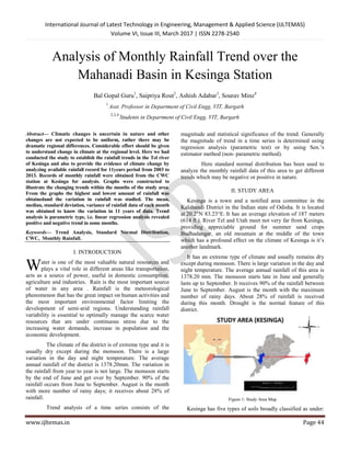
- 1. International Journal of Latest Technology in Engineering, Management & Applied Science (IJLTEMAS) Volume VI, Issue III, March 2017 | ISSN 2278-2540 www.ijltemas.in Page 44 Analysis of Monthly Rainfall Trend over the Mahanadi Basin in Kesinga Station Bal Gopal Guru1 , Saipriya Rout2 , Ashish Adabar3 , Sourav Minz4 1 Asst. Professor in Department of Civil Engg, VIT, Bargarh 2,3,4 Students in Department of Civil Engg, VIT, Bargarh Abstract— Climatic changes is uncertain in nature and other changes are not expected to be uniform, rather there may be dramatic regional differences. Considerable effort should be given to understand change in climate at the regional level. Here we had conducted the study to establish the rainfall trends in the Tel river of Kesinga and also to provide the evidence of climate change by analyzing available rainfall record for 11years period from 2003 to 2013. Records of monthly rainfall were obtained from the CWC station at Kesinga for analysis. Graphs were constructed to illustrate the changing trends within the months of the study area. From the graphs the highest and lowest amount of rainfall was obtainedand the variation in rainfall was studied. The mean, median, standard deviation, variance of rainfall data of each month was obtained to know the variation in 11 years of data. Trend analysis is parametric type, i.e. linear regression analysis revealed positive and negative trend in some months. Keywords— Trend Analysis, Standard Normal Distribution, CWC, Monthly Rainfall. I. INTRODUCTION ater is one of the most valuable natural resources and plays a vital role in different areas like transportation, acts as a source of power, useful in domestic consumption, agriculture and industries. Rain is the most important source of water in any area . Rainfall is the meteorological phenomenon that has the great impact on human activities and the most important environmental factor limiting the development of semi-arid regions. Understanding rainfall variability is essential to optimally manage the scarce water resources that are under continuous stress due to the increasing water demands, increase in population and the economic development. The climate of the district is of extreme type and it is usually dry except during the monsoon. There is a large variation in the day and night temperature. The average annual rainfall of the district is 1378.20mm. The variation in the rainfall from year to year is not large. The monsoon starts by the end of June and get over by September. 90% of the rainfall occurs from June to September. August is the month with more number of rainy days; it receives about 28% of rainfall. Trend analysis of a time series consists of the magnitude and statistical significance of the trend. Generally the magnitude of trend in a time series is determined using regression analysis (parametric test) or by using Sen.’s estimator method (non- parametric method). Here standard normal distribution has been used to analyze the monthly rainfall data of this area to get different trends which may be negative or positive in nature. II. STUDY AREA Kesinga is a town and a notified area committee in the Kalahandi District in the Indian state of Odisha. It is located at 20.2°N 83.23°E. It has an average elevation of 187 meters (614 ft.). River Tel and Utah meet not very far from Kesinga, providing appreciable ground for summer sand crops Budhadangar, an old mountain at the middle of the town which has a profound effect on the climate of Kesinga is it’s another landmark. It has an extreme type of climate and usually remains dry except during monsoon. There is large variation in the day and night temperature. The average annual rainfall of this area is 1378.20 mm. The monsoon starts late in June and generally lasts up to September. It receives 90% of the rainfall between June to September. August is the month with the maximum number of rainy days. About 28% of rainfall is received during this month. Drought is the normal feature of this district. Figure 1: Study Area Map Kesinga has five types of soils broadly classified as under: W
- 2. International Journal of Latest Technology in Engineering, Management & Applied Science (IJLTEMAS) Volume VI, Issue III, March 2017 | ISSN 2278-2540 www.ijltemas.in Page 45 The red laterite soil which is rich in Potassium and Nitrogen but poor in Phosphorus is mostly found in Bhawanipatna and Dharmgarh Tehsil. Sandy loam soil is seen in Lanjigarh and in the Bhawani PatnaTehsil. The area on the river bank of Udanti, Utei and Sagada are alluvial sandy and sandy loam spills. The fertility of soil in Dharmgarh and Jaipatna Tehsil areas is high. The red soil, black clay, clay & sandy loam and yellow soils occur in 31.68%, 13.90%, 54.44% in the district respectively. Nearly half of the total Geographical area of Kalahandi District 4,962 Sq.Kms was covered with forest. In the recent times there has been a considerable shrinkage in forest areas due to denudation. Kalahandi district has an area of 8,364.89 sq.km and ranks 7th among the 30 districts of Orissa. Forest occupies 4,964sq.km of the total geographical area of this district. Uncultivated area of the District in the year 1993 is 375752 hectares.In the same year, 11,602 hectares were left as fallow lands or cultivable waste land. II. METHODOLOGY The daily rainfall data were collected from CWC station Kesinga having its headquarter at Bhubaneswar .The daily rainfall data of each month were taken and their average value was recorded as monthly rainfall data. In this way all the monthly data were analyzed. Trend analysis of a time series consists of the magnitude of trend and its statistical significance. It is determined by Regression Analysis. The significance of trend analysis is to ascertain the presence of statically significant trend in hydrologic climatic variables such as temperature and precipitation with reference to climate change. In our experiment, we have analyzed the rainfall trend monthly wise in the study area on the basis of Mean, Median , Variance and Standard Deviation. First of all the mean of all the observations of each month was calculated by dividing the sum of the observations by the number of observations. Then the median of the observations of each month was found out which separates out the higher half from the lower half. The formula used here is : ( ) if number of observation is even and if the number of observations is odd. After that Variance , which is a measure to find out how far a number in a set is from the mean, was determined by dividing the sum of square of the difference between the mean and each observation by number of observations. It is given by; σ²= ( ) The slope or gradient of a line which is the number that describes both the direction and steepness of a line or selection of line was calculated by finding the ratio of vertical change to horizontal change between two distinct points in a line. Standard Normal Distribution: The standard normal distribution method is used to represent the real values random variables whose distribution are not known. It is calculated by using the formula. Zc= Where, X=The value that is being standardized. U=The mean of distribution. σ=Standard deviation of the distribution The result obtained is negative than the values of Zc is obtained the from the formula Zc= √ ( ) If the result obtained is positive than the following formula is used Zc= √ ( ) If the values obtained is equal to zero than the following formula is used that is Zc=0. If the value of Zc is less than zero than it is negative trend. If the value of Zc is greater than zero then it is called positive trend. The standard normal distribution was used to analyze the observations/event and result. III. RESULT AND DISCUSSION The following varying graph patterns have been obtained from the collection of monthly rainfall data from 2003 to 2013. Graph 1: Yearly rainfall graph for the month of January 0 0.5 1 1.5 2 JANUARY
- 3. International Journal of Latest Technology in Engineering, Management & Applied Science (IJLTEMAS) Volume VI, Issue III, March 2017 | ISSN 2278-2540 www.ijltemas.in Page 46 In the above plot for the month of January, it has been seen that only few years have considerable rainfall. Among the years having considerable rainfall i.e., 2004, 2005,2008,2010,2012 the minimum rainfall has been seen in the year 2004 and the maximum in 2008. Graph 2: Yearly rainfall graph for the month of February Among all the 11 years only 2004, 2005, 2007, 2008, 2011, 2012, 2013 have received considerable amount of rainfall out of which 2011 has received the minimum whereas 2012 the maximum. Graph 3: Yearly rainfall graph for the month of March From the graph of March, 2006 was observed to have the peak value followed by 2004 which has received considerably less amount of rainfall than 2006. The minimum rainfall was observed to have been received in 2005. Graph 4: Yearly rainfall graph for the month of April In the month of April most of the years have received sufficient amount of rainfall except 2003 and 2009. The peak value has been obtained by the year 2013 followed by 2004 and 2012 respectively. 2010 has received the minimum amount of rainfall. Graph 5: Yearly rainfall graph for the month of May Month of May has shown considerably highest amount of rainfall in the year 2010 ranging from 3 to 3.5 followed by 2006 which received rainfall within the range from 2.5 to 3.The least amount of rainfall was observed in the year 2012 with a range in between 0-0.5 which is quite less as compared to the peak value. Graph 6: Yearly rainfall graph for the month of June Being the month of monsoon, June has received considerable amount of rainfall in almost all the years. It has been observed that maximum rainfall was received in the year 2004 ranging from 16 to 18; whereas minimum was received in the year 2010 ranging from 0 to 2. 0 0.5 1 1.5 2003 2004 2005 2006 2007 2008 2009 2010 2011 2012 2013 FEBRUARY 0 0.5 1 1.5 2 2003 2004 2005 2006 2007 2008 2009 2010 2011 2012 2013 MARCH march 0 1 2 APRIL 0 2 4 2003 2004 2005 2006 2007 2008 2009 2010 2011 2012 2013 MAY may 0 10 20 2003 2004 2005 2006 2007 2008 2009 2010 2011 2012 2013 JUNE june 0 10 20 30 40 2003 2004 2005 2006 2007 2008 2009 2010 2011 2012 2013 JULY july
- 4. International Journal of Latest Technology in Engineering, Management & Applied Science (IJLTEMAS) Volume VI, Issue III, March 2017 | ISSN 2278-2540 www.ijltemas.in Page 47 Graph 7: Yearly rainfall graph for the month of July As July lies in the season of monsoon , most of the years have received considerable amount of rainfall having the peak value in the year 2009 ranging from 30 to 35 and the lowest value i.e., 5 in the year 2011. Graph 8: Yearly rainfall graph for the month of August Coming under the season of monsoon August has also received sufficient amount of rainfall in most of the years.it has been found that 2003 has received the maximum amount of rainfall having a range between 25 to 30 whereas 2005 has received the minimum amount of rainfall having a range between 0 to 5. The years like 2006, 2008 and 2011 have nearly equal values. Graph 9: Yearly rainfall graph for the month of September September also comes during the season of monsoon and hence all the years have received sufficient amount of rainfall. It has been observed that 2008 has the peak value ranging from 16 to 18 and 2005 has the minimum value ranging from 4 to 6.l. Graph 10: Yearly rainfall graph for the month of October Observations related to the month of October shows that 2005, 2009 and 2010 have nearly equally varying values .The peak value was observed to have been received in the year 2003 ranging from 3.5-4 followed by 2004 with almost same range whereas 2011 has received the minimum amount of rainfall ranging from 0 to 0.5.which is nearly equal to the year 2008. Graph 11: Yearly rainfall graph for the month of November Much rainfall has not occurred in the month of November as it comes in the winter season. It has been observed that the peak value was obtained in the year 2009 with a range in between 1 to1.2 and the minimum value in 2006 with a range in between 0.4-0.6. The rest of the years i.e2003, 2004, 2007, 2008,2010,2011,2013 have received no rainfall. Graph 12: Yearly rainfall graph for the month of December In the above graph for the month of December considerable amount of rainfall was observed to have occurred in the year 2003 with a range in between 1.6-1.8 which is nearer to the amount of rainfall received in the year 2010 ranging from 1.4-1.6. Standard normal distribution: 0 10 20 30 2003 2004 2005 2006 2007 2008 2009 2010 2011 2012 2013 AUGUST august 0 10 20 2003 2004 2005 2006 2007 2008 2009 2010 2011 2012 2013 SEPTEMBER september 0 2 4 2003 2004 2005 2006 2007 2008 2009 2010 2011 2012 2013 OCTOBER october 0 0.5 1 1.5 2003 2004 2005 2006 2007 2008 2009 2010 2011 2012 2013 NOVEMBER november 0 0.5 1 1.5 2 2003 2004 2005 2006 2007 2008 2009 2010 2011 2012 2013 DECEMBER december
- 5. International Journal of Latest Technology in Engineering, Management & Applied Science (IJLTEMAS) Volume VI, Issue III, March 2017 | ISSN 2278-2540 www.ijltemas.in Page 48 Graph 13: ZC value of all the months From the above table it has been found that July has obtained the peak value of mean, highest value of variance and also the maximum value of standard deviation i.e., 14.877417, 121.35235and 121.35235 respectively. On the other hand, November has obtained the least value of mean, lowest value of variance and the minimum value of standard deviation i.e. 0.240606182, 0.137844115 and 0.371273639 respectively. Table 1: Values of mean, median, variance, standard deviation, slope and ZC monthly wise. SL. NO. MONTH MEAN VARIENCE STANDARD DEVIATION MEDIAN SLOPE ZC 01. JANUARY 0.375 0.424 0.651 0.006 0.018 -0.886 02. FEBRUARY 0.332 0.310 0.379 0.310 0.170 -0.839 03. MARCH 0.385 0.328 0.573 0.187 0.124 -0.878 04. APRIL 0.699 0.415 0.644 0.687 0.106 0.830 05. MAY 1.307 1.222 1.105 1.258 0 0.121 06. JUNE 6.264 25.520 5.052 4.627 0.116 -0.230 07. JULY 14.877 121.352 11.016 14.374 0.201 -0.931 08. AUGUST 12.010 58.587 7.654 8.684 0.197 -0.501 09. SEPTEMBER 7.720 19.675 4.436 7.8 0.026 -1.691 10. OCTOBER 1.653 1.985 1.409 1.445 0.523 0.065 11. NOVEMBER 0.241 0.138 0.371 0 0.005 0 12. DECEMBER 0.278 0.384 0.620 0 0.063 -0.720 IV. CONCLUSION Here in this project we have obtained a varying rainfall pattern of respective months, but didn’t find any uniform pattern as they occur non periodically in different months. We also obtained the value of Zc which gives both positive as well as negative trend. The positive trend means that there is rise in the rainfall and the negative trend means there is fall in the rainfall. REFERENCES [1]. A.opere and W.Basewers “Statistical and trend analysis of rainfall and river discharge” [2]. A.Ramanchandra Rao, Prof. Emenitus, Shih-chich Kao, Anirban Mukhopadhyeg “ Statistical analysis of Indian rainfall data “ [3]. Antonia Longbardi and Paolo Villari “Trend analysis of annual and seasonal rainfall time series in the Mediterranean area” [4]. Gopal Krishna, Surendra Chandniha and Anil kumar Iohan “Rainfall trend analysis of Punjab, India using statistical Non-Parametric test” [5]. Igwenagu chinelo mercy “Trend analysis of rainfall pattern in Enaye state, Nigeria” [6]. Kanzhang and Donald H. Burn, P. Ling “ Analysis of trends in extreme rainfall” [7]. M.Nyatuame, V.Owusu-Gyimah and F.Ampiaw”Statistical analysis of rainfall trend for volta region in Ghana” [8]. Nityanand Singh, Neelima A.Sontakke,H. Narendra Singh & Amit Kumar Pandey “Recent trend in spatiotemporal variation of rainfall over India – an investigation into basin scale rainfall fluctuations” -3 -2 -1 0 1 2 3 ZcVALUE MONTHS