Autonomous Wireless Sensor Networks: from development to long term implementation
•
1 like•106 views

Presented by Arturo Sanchez-Azofeifa at the 2nd ICOS Science Conference in Helsinki, Finland, 27-29 Sep 2016.

Recommended
Recommended
More Related Content
What's hot
What's hot (19)
Viewers also liked
Viewers also liked (13)
Similar to Autonomous Wireless Sensor Networks: from development to long term implementation
Similar to Autonomous Wireless Sensor Networks: from development to long term implementation (20)
More from Integrated Carbon Observation System (ICOS)
More from Integrated Carbon Observation System (ICOS) (20)
Recently uploaded
Recently uploaded (20)
Autonomous Wireless Sensor Networks: from development to long term implementation
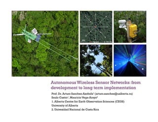
- 1. + Autonomous Wireless Sensor Networks: from development to long term implementation Prof. Dr. Arturo Sanchez-Azofeifa1 (arturo.sanchez@ualberta.ca) Saulo Castro1, Mauricio Vega-Araya2 1. Alberta Centre for Earth Observation Sciences (CEOS) University of Alberta 2. Univesidad Nacional de Costa Rica
- 2. +
- 4. + Applications of some WSN in the literature Application Location #,sensor,nodes Institution Year Duration Variables Links,between,weather,&, hydrology:,catchment? scale,monitoring Hawaii not,given U,Hawaii 2008 7,months water:,pH,,temp,, conductivity,,pO2,, turbidity,,water,level Soil,water,content Almkerk,, Netherlands 18 Twente,&, Wageningen 2009 6,months soil,moisture, (Decagon) Climate,,broadly Amazon UNAMA 2006 Petrel,nesting Maine 32 Intel,&,UC, Berkeley 2002 7,months light,,temp,,IR,,RH,, barometric,pressure Sediment Kansas 2 Kansas,State 2008 8,months opacity Center?pivot,irrigation Texas 17 USDA 2008 1,month IR,thermometer,for, canopy,temp,,air, temp,,RH,,solar, radiation,,windspeed,, rainfall Traveling,irrigation Montana 5 USDA 2008 4,months temp,,RH,,wind, speed,,wind,direction After MacGregor et al. 2013
- 5. + • Measurements at many spatial and temporal scales • Changing data needs (usually sparse) • Increased spatial coverage in heterogeneous environments. • Synchronized sampling across sensors. • Real-time data retrieval capabilities. • Landscape scale remote sensing validation of biophysical products. • Reduced human effort with increased information output. • Non-intrusive! Advantages ofWSN in monitoring
- 6. + Network Topologies and spatial design
- 7. + Sensor Network Cyberinfrastructure n Near real-time data management for Wireless Sensor Networks n Simplified data/trend visualization n Data mining: web data/metadata for cross- discipline social network research cooperation and analysis
- 8. +
- 9. + Santa Rosa Environmental Monitoring Super Site, Costa Rica
- 10. Santa Rosa National Park, Environmental Monitoring Super Site, Guanacaste, Costa Rica: • 10 billion data points/year • CO2/H20 fluxes (vegetation and soil) • Hyperspectral canopy observations • Wireless Sensor Networks • On-line/Real time communication via satellite technology • Drone research • Micro-Satellite testing site (AlbertaSat) • Atmospheric Sounding calibration site • NASA Calibration/Validation site • Airborne and ground-based LiDAR
- 11. +Santa Rosa Environmental Monitoring Super Site: NEE and APAR from WSNs. 0 0.2 0.4 0.6 0.8 1 1.2 2013-161 2013-185 2013-209 2013-233 2013-257 2013-281 2013-305 2013-329 2013-353 2014-09 2014-33 2014-57 2014-81 2014-105 2014-129 2014-153 2014-177 2014-201 2014-225 2014-249 2014-273 2014-297 2014-321 2014-345 2015-01 2015-25 2015-49 2015-73 2015-97 2015-121 2015-145 2015-169 2015-193 2015-217 2015-241 2015-265 2015-289 2015-313 2015-337 2015-361 2016-017 2016-041 2016-065 2016-089 FPAR Terra MODIS v Environet FPAR Raw MODIS FPAR Raw Environet FPAR Score
- 12. + 0.00 0.10 0.20 0.30 0.40 0.50 0.60 0.70 0.80 0.90 1.00 0 0.2 0.4 0.6 0.8 1 EnviroNetFPARWSNEstimate MODIS FPAR Estimate Santa Rosa Environmental Monitoring Super Site: FPAR MODIS Comparison 0 0.1 0.2 0.3 0.4 0.5 0.6 0.7 0.8 0.9 1 0 0.2 0.4 0.6 0.8 1 EnvironetFPARWSNEstimate MODIS FPAR Estimate MODIS TERRA MODIS AQUA
- 13. +Santa Rosa Environmental Monitoring Super Site: NEE and APAR from WSNs.
- 14. + Long term deployment of a WSN: Brazil, 10 –years (2006-2016). Temperature/RH Photosynthetic Active Radiation (PAR)
- 15. + Final remarks: Challenges with Environmental WSNs n Standardization n Durability of Hardware n Power Management n Data Management!!!
- 16. +Final Remarks: Changes on the environmental monitoring paradigm
- 17. + Current fact finding Analyze data in motion – before it is stored Low latency paradigm, push model Data driven – bring the data to the query Historical fact finding Find and analyze information stored on disk Batch paradigm, pull model Query-driven: submits queries to static data Traditional Computing Stream Computing Query Data Results Data Query Results Stream computing – Analyzing data in motion
- 18. + Thank You!