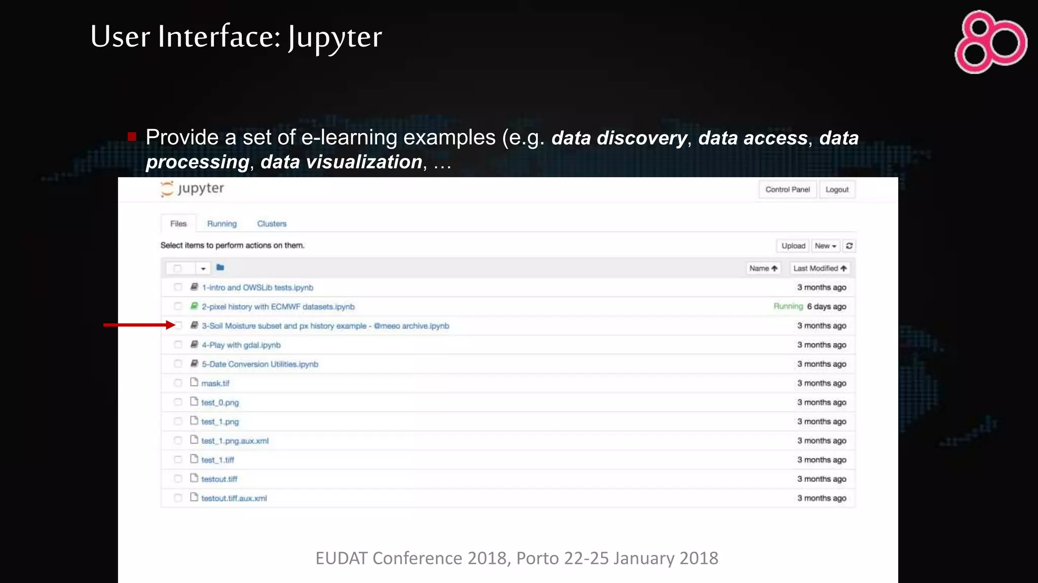
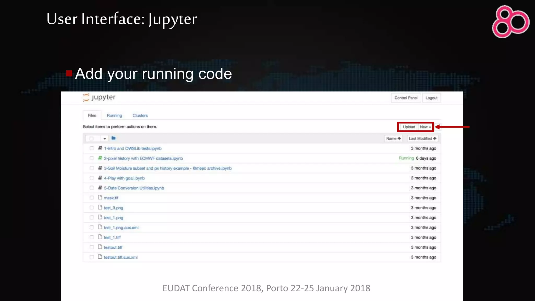
Download to read offline
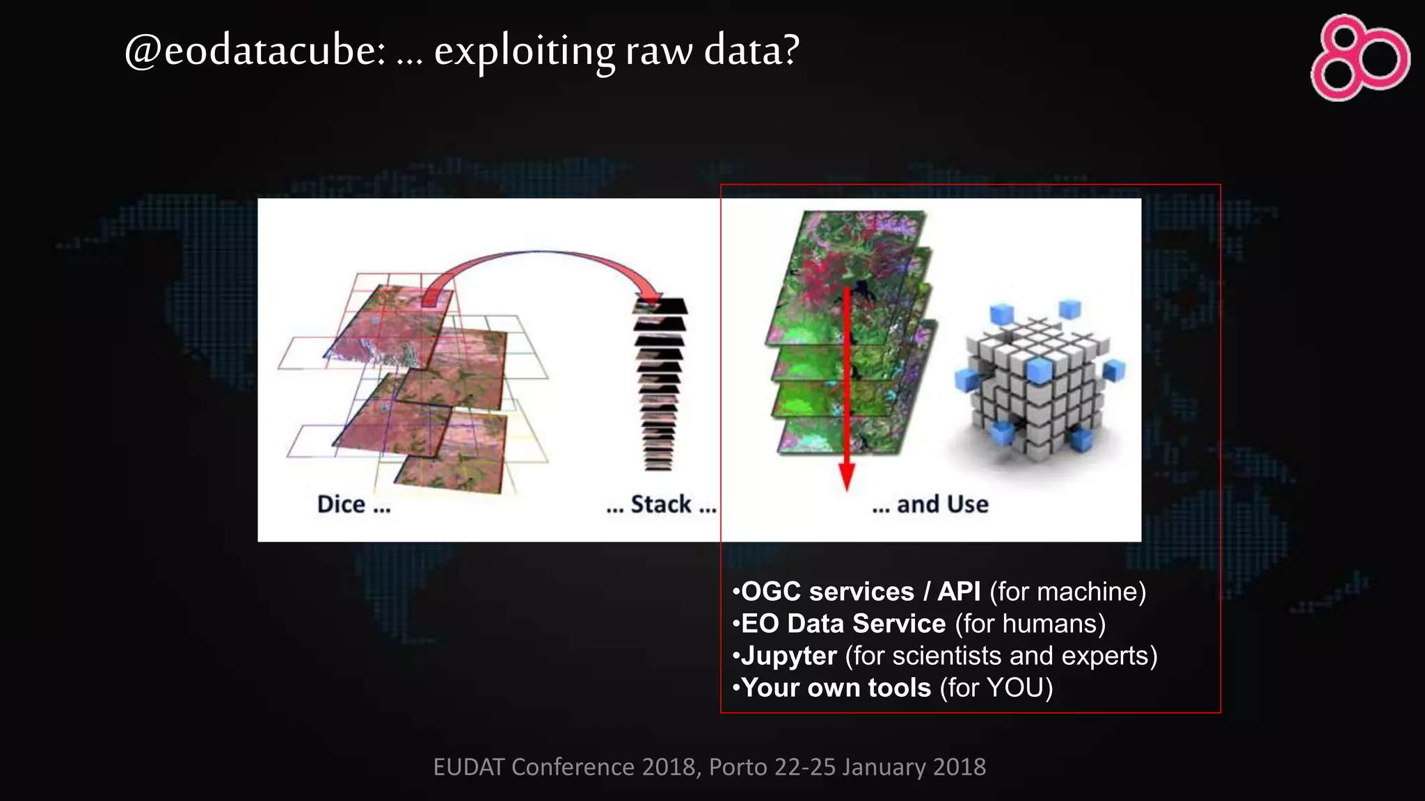
![•[Data collection]
•[re-projection]
•[format conversion]
•filesystem / array database
•OGC services / API (for machine)
•EO Data Service (for humans)
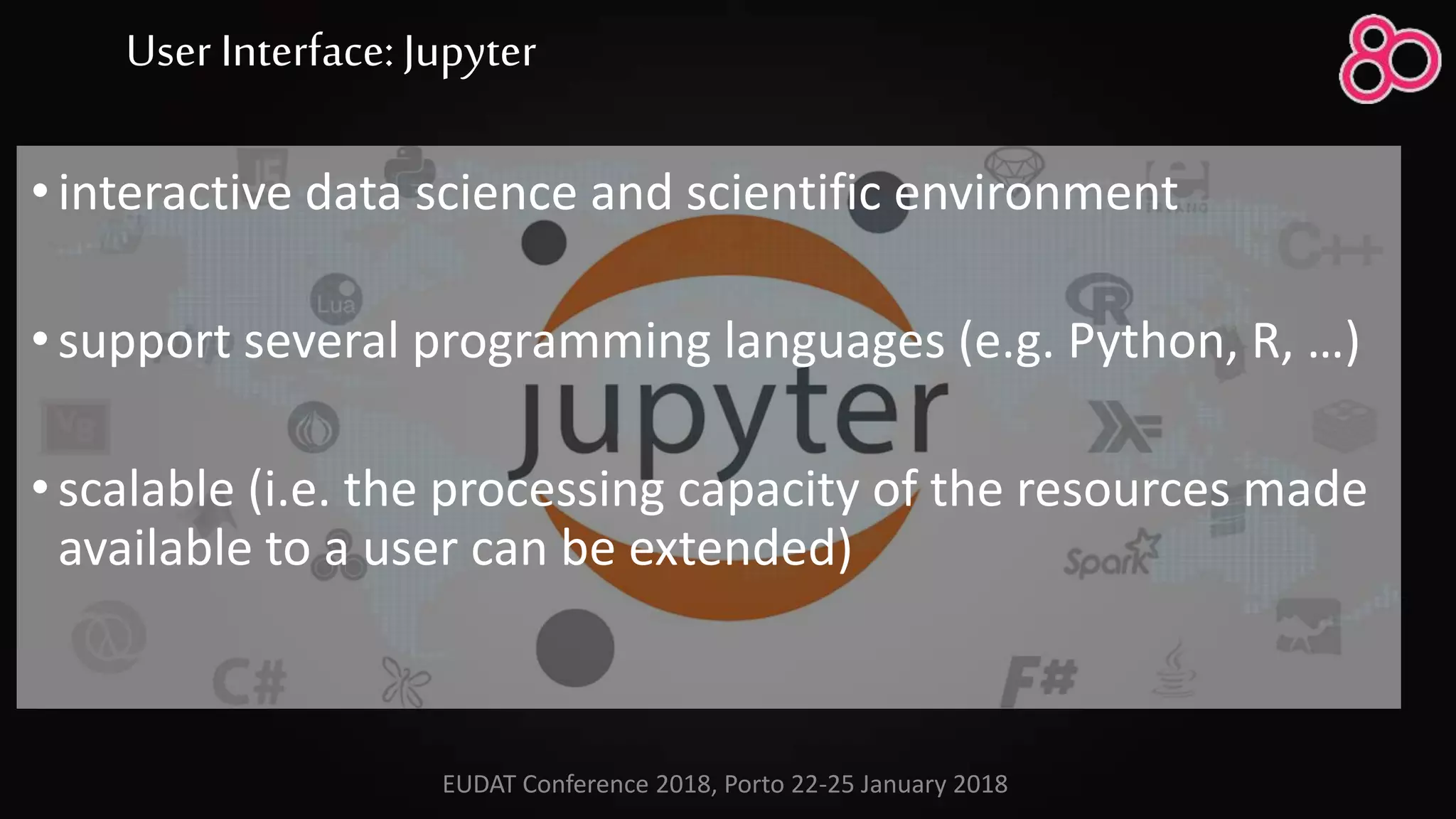
•Jupyter (for scientists and experts)
•Your own tools (for YOU)
@eodatacube: buildingthe ARD? or …
EUDAT Conference 2018, Porto 22-25 January 2018](https://image.slidesharecdn.com/20180122simone-180131090850/75/EODATASERVICE-ORG-Digital-Earth-Platform-to-enable-Muti-disciplinary-Geospatial-Applications-9-2048.jpg)
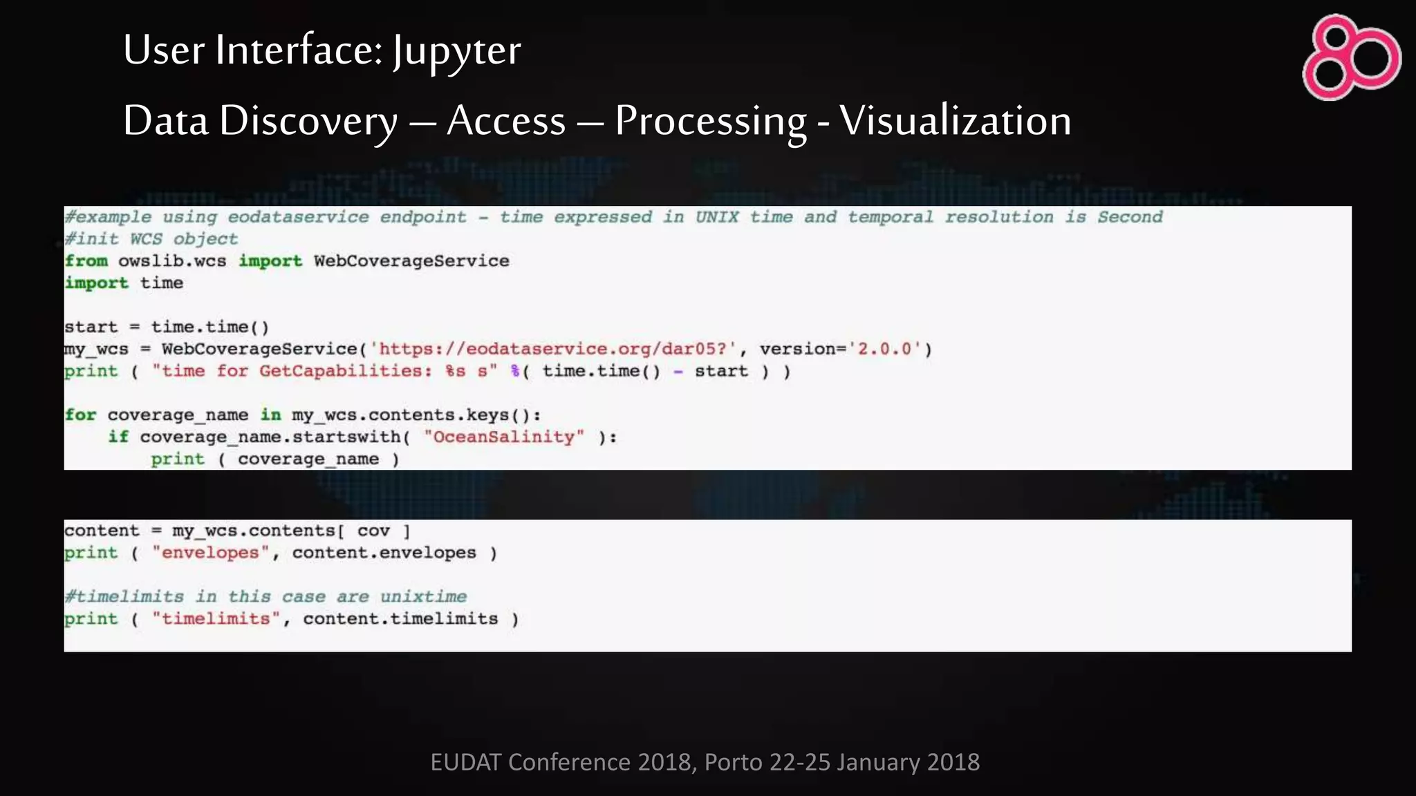

![User Interface: OGC services
http://<endpoint>/opensearch?
&service=CSW
&version=2.0.2
&request=GetRecords
&elementsetname=full
&typenames=csw:Record
&resulttype=results
&q=<ID>
&bbox=<UL,LR>
&time=<t1,t2>
for c in
(MOD_OPTDEPLOMEAN_4326_1)
return
encode ( {
red: (char)( c > 0.1 ) * 255 + (char)( c
>= 0.07 and c <= 0.1 ) * 255 ;
green: (char)( c < 0.07 and c > 0) * 255
+ (char)( c >= 0.07 and c <= 0.1 ) * 255 ;
blue: (char)( c * 0 )
}
[t(150248)]
,"png")
WCPS
OpenSearch
http://<endpoint>/wcs2?
service=WCS&Request=GetCoverage
&version=2.0.0
&CoverageID=<ID>
&SubsetX=x(x1, x2)
&SubsetY=y(y1,x2)
&SubsetT=t(t1, t2)
&format=image/png
WCS
EUDAT Conference 2018, Porto 22-25 January 2018](https://image.slidesharecdn.com/20180122simone-180131090850/75/EODATASERVICE-ORG-Digital-Earth-Platform-to-enable-Muti-disciplinary-Geospatial-Applications-22-2048.jpg)


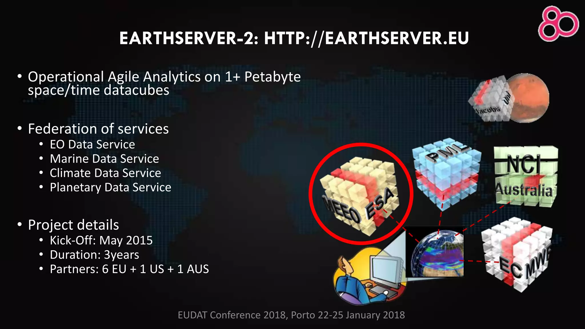
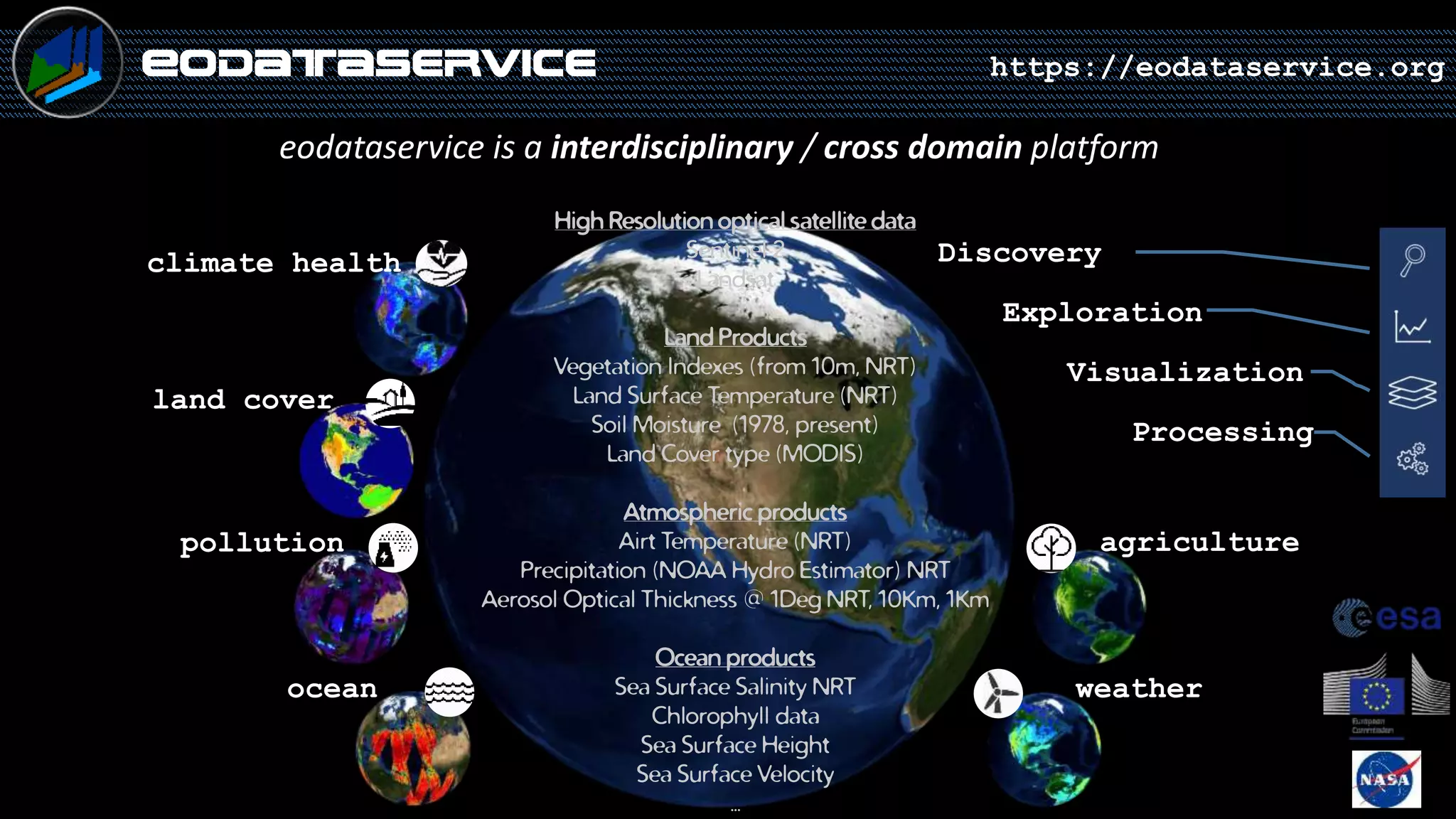
This document discusses the EarthServer-2 project, which aims to create a digital Earth platform for multi-disciplinary geospatial applications. The platform includes several data services that provide access to Earth observation data through standardized interfaces like OGC services. It allows users to access, visualize, subset, combine and process vast amounts of geospatial data simultaneously from multiple data sources. The platform is demonstrated through examples of using vegetation, precipitation and soil moisture data to study drought in Eastern Africa. It also discusses lessons learned from implementing the cube technology and providing access to data through various user interfaces tailored for different user groups.


