SlideShare a Scribd company logo
1 of 65
Download to read offline
COORDINATE SYSTEMS &
PROJECTIONS:
John Hunter, PLS
Colorado NGS Geomatics Coordinator
Grid v. Ground
Interview of Dave Doyle, Chief Geodetic Surveyor, NGS, Ret. North Carolina Professional Land Surveyors Society (2014)
• Coordinate System Basics
• Ellipsoids
• Projection Basics
• Distortion
• Horizontal Datums
• Heights & Scale Factors
• Localized Ground Projection
• Grid v. Ground
• SPCS 2022
The Stuff We Are Going To Learn About
9/25/20183
COORDINATE SYSTEMS
9/25/20184
Geocentric Geodetic Plane
Types of Coordinates Systems
9/25/20185
Types of Coordinates Systems
9/25/20186
Tertiary
Positions
Secondary
Positions
Primary
Positions
Geocentric
Geodetic
Projected
Types of Coordinates
and Respective Coordinate System
9/25/20187
Coordinate Type Coordinate System Note
Earth Centered, Earth Fixed
P(x,y,z)
Geocentric GPS/GNSS Points
Traditional Cartesian
Earth-Centered-Earth-Fixed Coordinates are the most
common Geocentric.
Geocentric coordinates can be thought of as a 3 dimensional
Cartesian with X, Y, and Z axis.
The X axis:
From the origin extending, horizontally, through the
intersection of the Prime Meridian, and the Equator forming a
90° angle with the Z axis in the vertical plane.
The Y axis:
From the origin extending, horizontally, through the Equator
forming a 90° angle with the X axis in the horizontal plane,
and a 90° angle with the Z axis in the vertical plane.
The Z axis:
From the origin (center of the ellipsoid, or center of the earth)
extending straight through the north pole is the Z axis (not the
same as elevation).
GNSS/GPS surveyors are very familiar with these types of
coordinates as these are the results of raw GNSS/GPS
observations (our controllers take those and display them
into something we want to look at such as N, E, El).
GNSS/GPS ECEF are not influenced by ellipsoids, geoids,
projections, scale factors, or anything of the like, other than
the center point of the earth.
Geocentric Coordinate Systems
9/25/20188
ge·o·cen·tric
Geocentric:
Having or representing the earth as the center, as in former
astronomical systems.
Astronomy
Measured from or considered in relation to the center of the earth.
9/25/20189
Geocentric Coordinate Systems
Z
X
Y
P(X,Y,Z)
 Foundational or
Fundamental Positions.
 3D Cartesian Coordinates.
 Uses the center of the
earth as the origin (0,0,0)
of the coordinate system.
 Positions are not affected
by the size or shape of the
earth other than the earth
center of mass.
Types of Coordinates
and Respective Coordinate System
9/25/201810
Coordinate Type Coordinate System Note
Latitude & Longitude
DD°MM’SS.SSSS”N, DDD°MMM’SS.SSSS”W
Geodetic Differs with Ellipsoid
GRS80 Vs. Clarks
Traditional World Coordinate Systems
Considering the same Cartesian system with X, Y, and
Z axis, the Geodetic coordinates utilize a measure of
angles to compute positions.
Latitude (geodetic) is the angle of measurement from
the equator to the point being observed, THAT IS
PERPENDICULAR TO THE ELLIPSOID. This line
does not extend through the origin except at the poles
and along the equatorial plane. As in not geocentric.
Because the constraining factor in latitude is that it is
perpendicular to the size and shape of the earth,
makes it geodetic.
Longitude is the angle measured AROUND the Z axis,
from the Prime Meridian to the point of observation.
This angle is measured counter clock-wise
The common misconception among GNSS/GPS
surveyors are that these are the coordinates of
GNSS/GPS and have become synonymous with
WGS84 coordinates. GRS80 and WGS84 are
essentially the same.
The truth is that geodetic coordinates such as Lat Long
are calculated by the GNSS/GPS controller from ECEF
coordinates.
Because these points are on the ELLIPSOIDAL
surface, the issue of heights, and elevations must be
accounted for.
Geodetic Coordinate Systems
9/25/201811
ge·o·det·ic
Of or relating to geodesy, especially as applied to land
surveying.
ge·od·e·sy
The science dealing with the shape and size of the earth
or large portions of it.
9/25/201812
Geodetic Coordinate Systems
b
a
a
P(L,L,h)
 Secondary Positions.
 Angular Coordinates.
 Uses the same X,Y,Z
geocentric reference frame
for the origin.
 Positions are dependent
upon the size or shape of the
earth.
 Positions are based upon the
mathematical approximation
of the earth.
Greenwich
b
Northing and Easting Coordinates are useful for
representing geospatial information on a flat surface.
Commonly used in most Surveying and Engineering
applications.
2D cartesian system with X, and Y axis, the Plane
coordinates are expressed in ordered pair format
representing distances from the origin.
Northing (Latitude) is the northerly or southerly distance
perpendicular to the X (Easting) axis.
Easting (Departure) Easterly or westerly distance
perpendicular to the Y (Northing) axis.
The State Plane Coordinates are a common example of
the plane coordinate system. However, local ground
based coordinate systems are commonly used by
surveyors to ensure the mitigation of linear distortion.
Plane Coordinate Systems
9/25/201813
Plān:
a flat surface on which a straight line joining any two
points on it would wholly lie.
Types of Coordinates
and Respective Coordinate System
9/25/201814
Coordinate Type Coordinate System Note
State Plane Coordinates
N:1697814.29 E: 3157197.06
Plane Round Surface Projected to
Flat Surface.
Coordinates ≠ Ground
Distances
9/25/201815
Projected (Plane) Coordinate Systems
P(N,E,El)
 Tertiary Positions.
 Ordered Pairs on a flat plane.
 Not Geodetic or Geocentric.
 Plane is attached to one or
more points of the ellipsoid.
 Positions “projected” onto a
flat surface from the
ellipsoidal surface.
 Distortion WILL occur.
9/25/201816
Types of Coordinate Systems
Geocentric
ECEF Positions
Geodetic
Latitude Longitude Positions
Plane
Projected Positions
Types of Coordinates
and Their Coordinate Systems
9/25/201817
Coordinate Type Coordinate System Note
Modified State Plane
N:697814.29 E: 157197.06 CSF: 1.00026
Sometimes more modifications are made
Plane Truncate Coordinates &
Apply a Scale Factor.
Coordinates = Ground
Distances
Types of Coordinates
and Their Coordinate Systems
9/25/201818
Coordinate Type Coordinate System Note
Earth Centered, Earth Fixed
P(x,y,z)
Geocentric GPS/GNSS Points
Traditional Cartesian
Latitude & Longitude
DD°MM’SS.SSSS”N, DDD°MMM’SS.SSSS”W
Geodetic Differs with Ellipsoid
GRS80 Vs. Clarks
State Plane Coordinates
N:1697814.29 E: 3157197.06
Plane Round Surface Projected to
Flat Surface.
Coordinates ≠ Ground
Distances
Modified State Plane
N:697814.29 E: 157197.06 CSF: 1.00026
Plane Truncate Coordinates &
Apply a Scale Factor.
Coordinates = Ground
Distances
ELLIPSOIDS
9/25/201819
9/25/201820
Neil Degrasse Tyson
Shape of the Earth
Neil Degrasse Tyson. Seth Rogan Podcast (2018)
9/25/201821
Kansas Really Is Flatter Than a Pancake
…Sort of
Mark Fonstad, William Pugatch and Brandon Vogt. Improbable Research (2003).
The Ellipsoid
9/25/201822
• Biaxial ellipsoid has dimensions a,
and b
• Mathematical approximation of the
shape and size of the earth.
• Defined by two dimensions; a Semi-
Major axis, (a), and a Semi-minor
axis, (b).
• The flattening ratio, (ƒ) of an
ellipsoid.
• ƒ = (a-b)/a
• The eccentricity, (e) is how much
the ellipsoid deviates from a circle.
• e = √(2 ƒ - ƒ 2).
• Typical notation: A precise
calculation of the ellipsoid can be
performed with the Semi-major
dimension, (a), and the flattening
ratio, ƒ.
THE GEOID
9/25/201823
The GEOID
9/25/201824
• Attaches to the X,Y,Z
Geocentric Reference
Frame.
• Model of the earths
gravitational surface.
• Used to obtain more
accurate elevations
• Geoid models must be
paired with the correct
horizontal datum.
Example: GEOID 12B should
be utilized in the NAD83
(2011) datum.
The GEOID and Ellipsoid
Deflection of the Vertical
9/25/201825
What is the LaPlace
Correction, anyway?
Ellipsoid
Geoid
PROJECTIONS
9/25/201826
Cylindrical Conical Planar
Types of Projections
9/25/201827
9/25/201828
Projection Orientations
Cylindrical
Conical
(or Cylindrical)
9/25/201829
SOME… Classical Projections
9/25/201830
SOME…. Polyhedral Projections
However….
 All projections will result in
some sort of distortion.
 Even a conformal projection
will distort angles over a
large enough area.
The Secant Lambert Conformal
Conic (SLCC) projection is one of
many types of projection
methodologies. This conformal
conic projection preserves the
integrity of angles. However linear
distortion will be present within the
design area of the projected
coordinate system.
Conformal Projection
9/25/201831
Conformal Projection:
In Cartography.
A map projection in which angles formed by lines are
preserved: a map made using this projection preserves
the shape of any small area.
Secant: Projection Plane Intersects the ellipsoidal surface in 2
locations, hence 2 standard parallels.
Tangent: Projection Plane intersects the ellipsoidal surface in
exactly 1 location, hence 1 standard parallel.
Non-intersecting: Projection Plane does not intersect the
ellipsoidal surface at all.
9/25/201832
The Conformal Lambert Conical
Secant Projection
9/25/201833
The Conformal Lambert Conical
Secant Projection
This is our projection area
that will become our
coordinate system
9/25/201834
The Conformal Lambert Conical
Secant Projection
Projections
Lambert Conformal Conic (SLCC) projection
9/25/201835
Standard Parallels are the only points (lines) in this projection
with a scale of 1. Standard parallels are important in a projection
because they essentially function as the boundaries.
The Origin is the anchor point for the projection. It is the point
from which Northing and Eastings are derived.
The Central Meridian. (in a coordinate systems) A line of
longitude that defines the center of a projected coordinate
system. In planar rectangular coordinate systems of limited
extent, such as state plane, grid north coincides with true north
at the central meridian.
The False Northing (map projections) The linear value added to
all y-coordinates of a map projection so that none of the values
in the geographic region being mapped are negative.
The False Easting (map projections) The linear value added to
all x-coordinates of a map projection so that none of the values
in the geographic region being mapped are negative.
The false northing and easting is often used to ensure that there are no negative coordinate
values within the projection.
Linear Distortion
9/25/201836
HORIZONTAL DATUM
9/25/201837
Horizontal Datum
Orientation & Initial Point
9/25/201838
• Attaches the ellipsoid to a physical
point on the earth’s surface, known
as an initial point.
• Points chosen were best suited for
a particular region.
• Historically observatories were
used.
• Five Parameters:
1. Semi-Major (a)
2. Semi-Minor (b)
3. Latitude
4. Longitude
5. Azimuth to reference point
• Makes geodetic datums possible.
• NAD 1927 fixed at Meade’s Ranch
in Kansas and uses Clarke 1866
Spheroid.
Horizontal Datum
Geocentric Datums
9/25/201839
• Attaches the ellipsoid to a theoretical point at the
center of the earth, known as a geocentric
system.
• NAD 1983 used new technologies to take
measurements.
• Satellite Laser Ranging (SLR)
• Lunar Laser Ranging (LLR)
• Very Long Baseline Interferometry (VLBI)
• Doppler Orbitography (DORIS)
• Some (relatively few) GPS
• Realizations are needed to become useful in
Land Surveying.
• Realization can be thought of as a snapshot in
time. The center of the earth is a fixed point,
whereas the surface is constantly moving and
changing.
• Readjusted to incorporate additional “survey
measurements & observations”.
• Classical survey measurements
• EDM-measured baselines
• A lot of GPS observations
• Other
• NAD 1983 is fixed at, and attached to the center
of the earth, uses the GRS80 Spheroid, and
requires realizations.
Horizontal Datum
9/25/201840
A horizontal datum forms the
basis for computations of
horizontal positions which may be
defined at an origin point of an
ellipsoid such that the center of the
ellipsoid coincides with the earth’s
center, or actual fixed points on the
earth’s surface. A proper
horizontal datum will define:
• The dimensions of the
reference ellipsoid.
• The orientation of the
coordinate system.
• The location of the origin of the
coordinate system.
So really… A datum essentially
defines the coordinate system.
o NAD27
o NAD83
o NAD83 (2011)
o NAD83 (CORS96)
o 2022 Modernization
HEIGHTS (……AND GEOIDS)
9/25/201841
Heights
Ellipsoidal Height
9/25/201842
The Ellipsoidal Heights is the distance from the ellipsoid to a corresponding
point on the surface of the Earth. The height is measured along a line
perpendicular to the ellipsoid. This distance is known by more than one name. It
is called the ellipsoidal height and is also called the geodetic height, and it is
usually symbolized by h.
Note: Not all h values are the same, and the horizontal datum CAN impact h.
Heights
What is a Geoid and what is a Geoid Height
9/25/201843
The Geoid is an equipotential surface that best fits mean sea level. Meaning
that, across the geoid, the potential of gravity is always the same. The geoid and
mean sea level could be the same if the oceans of the world could be utterly still,
completely free of currents, tides, friction, variations in temperature, and all
other physical forces, except gravity.
A Geoid Height is the ellipsoidal height
from an ellipsoidal datum to a geoid.
That means that geoid height models are
directly tied to the geoid and ellipsoid that
define them. In other words, geoid height
models are not interchangeable.
Note that the geoid is a vertical datum surface.
Heights
Putting it together
9/25/201844
Orthometric Height (H) = h-N
Ellipsoidal Height (h) = H+N
Geoid Height (N) = h-H
Keep this in mind: An elevation that was established by differential leveling
should not be used to determine an Ellipsoidal Height because the level is
based upon gravity. However, this is negligible in most cases but reinforces the
need to ensure geoids are properly paired with the correct horizontal datum.
GRID V. GROUND
9/25/201845
Scale Factor
9/25/201846
An Elevation Factor (EF) is determined by the ratio of the ground distance (DGND) to the corresponding geodetic
distance (DGDC): EF = DGND / DGDC.
The Scale Factor (SF) is determined by the ratio of the geodetic distance (DGDC) to the corresponding grid distance
(DGRD): SF = DGDC / DGRD.
A Combined Scale Factor (CSF) is perhaps the most useful, and is determined by the ratio of the ground distance
(DGND) and the grid distance (DGRD): CSF = DGND / DGRD.
Scale Factor
Grid to Ground and Ground to Grid
9/25/201847
Combined Scale Factor (CSF) = 1.00046
Grid to Ground
Ground Distance = Grid Distance x CSF
Ground to Grid
Grid Distance = Grid Distance/CSF
The horizontal distance between two section corners is measured on the surface
with a GPS unit, and has a ground distance of 5,280’. To convert the distance to
grid we take the ground distance (5280’) and divide it by the CSF (1.00046), which
gives us 5277.57’.
The horizontal distance between two section corners is measured on the surface
with a GPS unit, and has a grid distance of 5,280’. To convert the distance to grid
we take the ground distance (5280) and multiply it by the CSF (1.00046), which
gives us 5282.43’.
Modified Projection
9/25/201848
The Modified Projection is a method commonly used to
mitigate the adverse effects that elevation has on distances
such that ground distances are more accurately
represented. A correctly modified projection must be
defined in such a way that the coordinate values are easily
distinguishable between modified coordinate values and
non-modified coordinate values. This is typically
accomplished by a standard truncation of the Northing and
Easting coordinate values. The Modified System also
requires a combined scale factor, (CSF).
The Denver Water custom grids are a modification of the
Colorado State Plane coordinate system.
Modified Projection
9/25/201849
Denver Water Modified State Plane Coordinate Systems
State Plane to DW Grid DW Grid to State Plane
𝑆𝑆𝑆𝑆𝑁𝑁 − 𝑇𝑇𝑇𝑇𝑁𝑁 ∗ 𝐶𝐶𝐶𝐶𝐶𝐶 = 𝐷𝐷𝐷𝐷𝑁𝑁 (𝐷𝐷𝐷𝐷𝑁𝑁/𝐶𝐶𝐶𝐶𝐶𝐶) + 𝑇𝑇𝑇𝑇𝑁𝑁 = 𝑆𝑆𝑆𝑆𝑁𝑁
𝑆𝑆𝑆𝑆𝐸𝐸 − 𝑇𝑇𝑇𝑇𝐸𝐸 ∗ 𝐶𝐶𝐶𝐶 = 𝐷𝐷𝐷𝐷𝐸𝐸 (𝐷𝐷𝐷𝐷𝐸𝐸/𝐶𝐶𝐶𝐶𝐶𝐶) + 𝑇𝑇𝑇𝑇𝐸𝐸 = 𝑆𝑆𝑆𝑆𝐸𝐸
CSF: Combined Scale Factor
DW: Denver Water Coordinate
N=Northing E=Easting
SP: State Plane Coordinate
N=Northing E=Easting
Tr: Coordinate Truncation
N=Northing E=Easting
Create a Ground Based
Projection for your GIS Project…
9/25/201850
1. Work with your surveyor
2. Request the projection definition from the surveyor
3. Find a Combined Scale Factor
4. Create a Projection
5. Modify and rename
6. Test the Projection
7. Create a prj to utilize in the future or share data
Request The Projection
Definition From The Surveyor
9/25/201851
Important Parameters to
Request
 Units
 Projection Type
 False N and E
 Central Meridian
 Scale Factor
 Latitude of Origin
 Geographic coordinate
System (Geodetic
Coordinate System)
Denver Water Projection Definition
How to Determine a Combined
Scale Factor
9/25/201852
Scale Factor Resources
 Surveyors
 NGS Datasheets published
by the National Geodetic
Survey – NGS
https://www.ngs.noaa.gov/
datasheets/
 Published Data on ArcGIS
Online – All Portal (Just be
mindful of the person or
organization publishing the
data)
 https://www.ngs.noaa.gov/datasheets/
A Shapefile from NGS – You
Must Keep It Up To Date.
There is no data service for
this.
How to Determine a Combined
Scale Factor
9/25/201853
NGS Data Explorer
 Launch Map
 Zoom to Project Area
 Map Layers
 Select the Mark Types of
Interest and “Find Marks”
 Pay Close Attention to
“Control Types” to make
sure you utilize good data.
 https://www.ngs.noaa.gov/datasheets/
How to Determine a Combined
Scale Factor
9/25/201854
Find the Datasheet
 Examine the Basic
Information to
determine if it is what
you are looking for.
 Launch “Datasheet”
 https://www.ngs.noaa.gov/datasheets/
How to Determine a Combined
Scale Factor
9/25/201855
https://www.ngs.noaa.gov/datasheets/
Combined Scale Factor
0.99993765 sFT
Colorado Central SP
Select the appropriate scale factor.
In this case Colorado State Plane
Central Zone in Survey Feet.
How to Determine a Combined
Scale Factor
9/25/201856
https://www.ngs.noaa.gov/datasheets/
Select Several Horizontal
Controls around the
Project Area and average the CSF
Calculate Average
0.99993765
0.99993614
0.99993739
Avg: 0.99993706
1/x: 1.00006294
Note:
1/x is the inverse.
1/0.99993706 = 1.00006294
Most software asks for the
inverse input.
How to Build a Ground Based
Projection
9/25/201857
“Copy and Modify” the
projected Coordinate System
that you want to start with.
In this case we are going to
modify Colorado Central Zone
State Plane.
How to Build a Ground Based
Projection
9/25/201858
Entering Parameters
Change the name of the
projection to something
meaningful.
Enter the previously
computed scale factor.
Don’t forget to add to your
favorites.
Note:
By utilizing this method, the
coordinate values will look
very similar to plain State
plane coordinates.
Examine Grid V. Ground
9/25/201859
Grid v. Ground
Set the map Coordinate
System to the modified
projection.
Import field measured points.
At this point, you should have
“ground” information
resulting in ground distances.
Examine Ground V. Grid
9/25/201860
Ground v. Grid
Set the map Coordinate
System back to State Plane.
Leave the field measured
point feature in the map.
At this point, you should have
“ground” information
resulting in grid distances.
From the north end of the
dam to the south end of the
dam:
Modified Projection = 4111.53
SP Projection = 4111.27
Examine Grid V. Ground
9/25/201861
Grid v. Ground
Set the map Coordinate
System to the modified
projection.
Import field measured points.
At this point, you should have
“ground” information
resulting in ground distances.
Examine Ground V. Grid
9/25/201862
Ground v. Grid
Set the map Coordinate
System back to State Plane.
Leave the field measured
point feature in the map.
At this point, you should have
“ground” information
resulting in grid distances.
From the north end of the
dam to the south end of the
dam:
Mod. Projection = 7,834,490
SP Projection = 7,833,504
Future of the NSRS
9/25/201863
 Modernization of the NSRS – 2022
- Horizontal Displacement of apx. 3.6 ft.
- Vertical Displacement of apx. 2.9 ft.
 SPCS 2022
- NGS currently designing
- Potential for LDP designs
 Contemporary
- Future could see time dependent positioning
- Largely driven by technology
NATRF 2022 Approximate Horizontal Displacement NATRF 2022 Approximate Vertical Displacement
Good Geodetic Resources
9/25/201864
National Geodetic Survey
https://geodesy.noaa.gov/#
Michael Dennis – Geodetic Analysis
https://geodeticanalysis.com/resources/
Dave Doyle – Base9 Geodetic Consulting Services
https://www.base9geodesy.com/publications
Jan Van Sickle – Basic GIS Coordinates
Available on Amazon
B. John Hunter, PLS
Geodetic Surveyor
Denver Water
Colorado NGS Geomatics Coordinator
CoCoordinator@plsc.net
john.hunter@denverwater.org
720.883.6508

More Related Content

What's hot

Accuracy assessment of Remote Sensing Data
Accuracy assessment of Remote Sensing DataAccuracy assessment of Remote Sensing Data
Accuracy assessment of Remote Sensing DataMuhammad Zubair
 
Application of GIS
Application of GISApplication of GIS
Application of GISRohit Pant
 
"Why LiDAR?" Presentation
"Why LiDAR?" Presentation"Why LiDAR?" Presentation
"Why LiDAR?" PresentationLidar Blog
 
Google Earth Engine: Health Applications of Google’s Cloud Platform for Big E...
Google Earth Engine: Health Applications of Google’s Cloud Platform for Big E...Google Earth Engine: Health Applications of Google’s Cloud Platform for Big E...
Google Earth Engine: Health Applications of Google’s Cloud Platform for Big E...MEASURE Evaluation
 
GNSS - GPS Surveying
GNSS - GPS SurveyingGNSS - GPS Surveying
GNSS - GPS SurveyingOpenmaps
 
Data Models - GIS I
Data Models - GIS IData Models - GIS I
Data Models - GIS IJohn Reiser
 
Remote sensing by priyanshu kumar,9608684800
Remote sensing by priyanshu kumar,9608684800Remote sensing by priyanshu kumar,9608684800
Remote sensing by priyanshu kumar,9608684800PRIYANSHU KUMAR
 
Network analysis in gis
Network analysis in gisNetwork analysis in gis
Network analysis in gisstudent
 
Lecture for landsat
Lecture for landsatLecture for landsat
Lecture for landsatGeoMedeelel
 
The active remote sensing equation
The active remote sensing equationThe active remote sensing equation
The active remote sensing equationtobiasotto
 
2013 PLSC Track, How to describe Accuracy, and Why does it matter? by Jon Pr...
2013 PLSC Track, How to describe Accuracy, and Why does it matter?  by Jon Pr...2013 PLSC Track, How to describe Accuracy, and Why does it matter?  by Jon Pr...
2013 PLSC Track, How to describe Accuracy, and Why does it matter? by Jon Pr...GIS in the Rockies
 
An introduction to geographic information systems (gis) m goulbourne 2007
An introduction to geographic information systems (gis)   m goulbourne 2007An introduction to geographic information systems (gis)   m goulbourne 2007
An introduction to geographic information systems (gis) m goulbourne 2007Michelle Goulbourne @ DiaMind Health
 
Remote sensing satellites with sensors
Remote sensing satellites with sensorsRemote sensing satellites with sensors
Remote sensing satellites with sensorsAnchit Garg
 

What's hot (20)

Accuracy assessment of Remote Sensing Data
Accuracy assessment of Remote Sensing DataAccuracy assessment of Remote Sensing Data
Accuracy assessment of Remote Sensing Data
 
Coordinate systems
Coordinate systemsCoordinate systems
Coordinate systems
 
Application of GIS
Application of GISApplication of GIS
Application of GIS
 
Ethiopia geodetic network
Ethiopia geodetic network Ethiopia geodetic network
Ethiopia geodetic network
 
"Why LiDAR?" Presentation
"Why LiDAR?" Presentation"Why LiDAR?" Presentation
"Why LiDAR?" Presentation
 
Google Earth Engine: Health Applications of Google’s Cloud Platform for Big E...
Google Earth Engine: Health Applications of Google’s Cloud Platform for Big E...Google Earth Engine: Health Applications of Google’s Cloud Platform for Big E...
Google Earth Engine: Health Applications of Google’s Cloud Platform for Big E...
 
GNSS - GPS Surveying
GNSS - GPS SurveyingGNSS - GPS Surveying
GNSS - GPS Surveying
 
Data Models - GIS I
Data Models - GIS IData Models - GIS I
Data Models - GIS I
 
Maps and GIS
Maps and GISMaps and GIS
Maps and GIS
 
Geographical Information System (GIS)
Geographical Information System (GIS)Geographical Information System (GIS)
Geographical Information System (GIS)
 
Remote sensing by priyanshu kumar,9608684800
Remote sensing by priyanshu kumar,9608684800Remote sensing by priyanshu kumar,9608684800
Remote sensing by priyanshu kumar,9608684800
 
Network analysis in gis
Network analysis in gisNetwork analysis in gis
Network analysis in gis
 
Lecture for landsat
Lecture for landsatLecture for landsat
Lecture for landsat
 
Historical Development of Photogrammetry
Historical Development of PhotogrammetryHistorical Development of Photogrammetry
Historical Development of Photogrammetry
 
Shapefile
ShapefileShapefile
Shapefile
 
The active remote sensing equation
The active remote sensing equationThe active remote sensing equation
The active remote sensing equation
 
2013 PLSC Track, How to describe Accuracy, and Why does it matter? by Jon Pr...
2013 PLSC Track, How to describe Accuracy, and Why does it matter?  by Jon Pr...2013 PLSC Track, How to describe Accuracy, and Why does it matter?  by Jon Pr...
2013 PLSC Track, How to describe Accuracy, and Why does it matter? by Jon Pr...
 
An introduction to geographic information systems (gis) m goulbourne 2007
An introduction to geographic information systems (gis)   m goulbourne 2007An introduction to geographic information systems (gis)   m goulbourne 2007
An introduction to geographic information systems (gis) m goulbourne 2007
 
Remote sensing satellites with sensors
Remote sensing satellites with sensorsRemote sensing satellites with sensors
Remote sensing satellites with sensors
 
GIS Map Projection
GIS Map ProjectionGIS Map Projection
GIS Map Projection
 

Similar to 2018 GIS in the Rockies Workshop: Coordinate Systems and Projections

2017 PLSC Track: Fundamentals of Coordinate Systems
2017 PLSC Track: Fundamentals of Coordinate Systems2017 PLSC Track: Fundamentals of Coordinate Systems
2017 PLSC Track: Fundamentals of Coordinate SystemsGIS in the Rockies
 
CARTOGRAPHY – yesterday, today and tomorrow
CARTOGRAPHY – yesterday, today and tomorrowCARTOGRAPHY – yesterday, today and tomorrow
CARTOGRAPHY – yesterday, today and tomorrowProf Ashis Sarkar
 
Projections and coordinate system
Projections and coordinate systemProjections and coordinate system
Projections and coordinate systemMohsin Siddique
 
TYBSC IT PGIS Unit III Chapter I Spatial Referencing and Positioning
TYBSC IT PGIS Unit III Chapter I Spatial Referencing and PositioningTYBSC IT PGIS Unit III Chapter I Spatial Referencing and Positioning
TYBSC IT PGIS Unit III Chapter I Spatial Referencing and PositioningArti Parab Academics
 
Understandingprojectionsforarcgis 12794889760059-phpapp01
Understandingprojectionsforarcgis 12794889760059-phpapp01Understandingprojectionsforarcgis 12794889760059-phpapp01
Understandingprojectionsforarcgis 12794889760059-phpapp01Manisha Tomar
 
coordinate systems map projections and graphical and atoms ppt group (B).pptx
coordinate systems map projections and graphical and atoms ppt group (B).pptxcoordinate systems map projections and graphical and atoms ppt group (B).pptx
coordinate systems map projections and graphical and atoms ppt group (B).pptxBakhtAli10
 
Understanding Coordinate Systems and Projections for ArcGIS
Understanding Coordinate Systems and Projections for ArcGISUnderstanding Coordinate Systems and Projections for ArcGIS
Understanding Coordinate Systems and Projections for ArcGISJohn Schaeffer
 
coordinate systems map Projections and Atoms ppt - - Copy.pptx
coordinate systems map Projections  and Atoms ppt -  - Copy.pptxcoordinate systems map Projections  and Atoms ppt -  - Copy.pptx
coordinate systems map Projections and Atoms ppt - - Copy.pptxBakhtAli10
 
7 8.math projection (2)
7 8.math projection (2)7 8.math projection (2)
7 8.math projection (2)Riya Gupta
 
Earth Coordinate Systems
Earth Coordinate Systems Earth Coordinate Systems
Earth Coordinate Systems Sheikh Maryam
 
Coordinate systems, datum & map projections
Coordinate systems, datum & map projectionsCoordinate systems, datum & map projections
Coordinate systems, datum & map projectionsKU Leuven
 
Coordinate system used in Satellite Navigation.pptx
Coordinate system used in Satellite Navigation.pptxCoordinate system used in Satellite Navigation.pptx
Coordinate system used in Satellite Navigation.pptxQuotesBox
 
Distortion preservation on conformal mapping
Distortion preservation on conformal mappingDistortion preservation on conformal mapping
Distortion preservation on conformal mappingDraemmraj
 

Similar to 2018 GIS in the Rockies Workshop: Coordinate Systems and Projections (20)

2017 PLSC Track: Fundamentals of Coordinate Systems
2017 PLSC Track: Fundamentals of Coordinate Systems2017 PLSC Track: Fundamentals of Coordinate Systems
2017 PLSC Track: Fundamentals of Coordinate Systems
 
CARTOGRAPHY – yesterday, today and tomorrow
CARTOGRAPHY – yesterday, today and tomorrowCARTOGRAPHY – yesterday, today and tomorrow
CARTOGRAPHY – yesterday, today and tomorrow
 
Projections and coordinate system
Projections and coordinate systemProjections and coordinate system
Projections and coordinate system
 
TYBSC IT PGIS Unit III Chapter I Spatial Referencing and Positioning
TYBSC IT PGIS Unit III Chapter I Spatial Referencing and PositioningTYBSC IT PGIS Unit III Chapter I Spatial Referencing and Positioning
TYBSC IT PGIS Unit III Chapter I Spatial Referencing and Positioning
 
Understandingprojectionsforarcgis 12794889760059-phpapp01
Understandingprojectionsforarcgis 12794889760059-phpapp01Understandingprojectionsforarcgis 12794889760059-phpapp01
Understandingprojectionsforarcgis 12794889760059-phpapp01
 
coordinate systems map projections and graphical and atoms ppt group (B).pptx
coordinate systems map projections and graphical and atoms ppt group (B).pptxcoordinate systems map projections and graphical and atoms ppt group (B).pptx
coordinate systems map projections and graphical and atoms ppt group (B).pptx
 
Understanding Coordinate Systems and Projections for ArcGIS
Understanding Coordinate Systems and Projections for ArcGISUnderstanding Coordinate Systems and Projections for ArcGIS
Understanding Coordinate Systems and Projections for ArcGIS
 
coordinate systems map Projections and Atoms ppt - - Copy.pptx
coordinate systems map Projections  and Atoms ppt -  - Copy.pptxcoordinate systems map Projections  and Atoms ppt -  - Copy.pptx
coordinate systems map Projections and Atoms ppt - - Copy.pptx
 
Gis georeference
Gis georeferenceGis georeference
Gis georeference
 
projection.pptx
projection.pptxprojection.pptx
projection.pptx
 
7 8.math projection (2)
7 8.math projection (2)7 8.math projection (2)
7 8.math projection (2)
 
Earth Coordinate Systems
Earth Coordinate Systems Earth Coordinate Systems
Earth Coordinate Systems
 
Gis Concepts 3/5
Gis Concepts 3/5Gis Concepts 3/5
Gis Concepts 3/5
 
Coordinate systems, datum & map projections
Coordinate systems, datum & map projectionsCoordinate systems, datum & map projections
Coordinate systems, datum & map projections
 
inroduction to geodesy
inroduction to geodesyinroduction to geodesy
inroduction to geodesy
 
Coordinate system used in Satellite Navigation.pptx
Coordinate system used in Satellite Navigation.pptxCoordinate system used in Satellite Navigation.pptx
Coordinate system used in Satellite Navigation.pptx
 
GIS.pptx
GIS.pptxGIS.pptx
GIS.pptx
 
Distortion preservation on conformal mapping
Distortion preservation on conformal mappingDistortion preservation on conformal mapping
Distortion preservation on conformal mapping
 
datum
datumdatum
datum
 
GIS
GISGIS
GIS
 

More from GIS in the Rockies

GISCO Fall 2018: Bike Network Equity: A GIS and Qualitative Analysis of Ameri...
GISCO Fall 2018: Bike Network Equity: A GIS and Qualitative Analysis of Ameri...GISCO Fall 2018: Bike Network Equity: A GIS and Qualitative Analysis of Ameri...
GISCO Fall 2018: Bike Network Equity: A GIS and Qualitative Analysis of Ameri...GIS in the Rockies
 
GISCO Fall 2018: Colorado 811: Changes and Challenges – Brian Collison
GISCO Fall 2018: Colorado 811: Changes and Challenges – Brian CollisonGISCO Fall 2018: Colorado 811: Changes and Challenges – Brian Collison
GISCO Fall 2018: Colorado 811: Changes and Challenges – Brian CollisonGIS in the Rockies
 
GISCO Fall 2018: Senate Bill 18-167 and GIS – Dave Murray
GISCO Fall 2018: Senate Bill 18-167 and GIS – Dave MurrayGISCO Fall 2018: Senate Bill 18-167 and GIS – Dave Murray
GISCO Fall 2018: Senate Bill 18-167 and GIS – Dave MurrayGIS in the Rockies
 
2018 GIS in Emergency Management: Denver Office of Emergency Management Overview
2018 GIS in Emergency Management: Denver Office of Emergency Management Overview2018 GIS in Emergency Management: Denver Office of Emergency Management Overview
2018 GIS in Emergency Management: Denver Office of Emergency Management OverviewGIS in the Rockies
 
2018 GIS in the Rockies Vendor Showcase (Th): The Data Driven Government
2018 GIS in the Rockies Vendor Showcase (Th): The Data Driven Government2018 GIS in the Rockies Vendor Showcase (Th): The Data Driven Government
2018 GIS in the Rockies Vendor Showcase (Th): The Data Driven GovernmentGIS in the Rockies
 
2018 GIS in the Rockies Vendor Showcase (Th): Solving Real World Issues With ...
2018 GIS in the Rockies Vendor Showcase (Th): Solving Real World Issues With ...2018 GIS in the Rockies Vendor Showcase (Th): Solving Real World Issues With ...
2018 GIS in the Rockies Vendor Showcase (Th): Solving Real World Issues With ...GIS in the Rockies
 
2018 GIS in the Rockies Vendor Showcase (Th): ERDAS Imagine What's New and Ti...
2018 GIS in the Rockies Vendor Showcase (Th): ERDAS Imagine What's New and Ti...2018 GIS in the Rockies Vendor Showcase (Th): ERDAS Imagine What's New and Ti...
2018 GIS in the Rockies Vendor Showcase (Th): ERDAS Imagine What's New and Ti...GIS in the Rockies
 
2018 GIS in the Rockies Vendor Showcase (Th): Building High Performance Gover...
2018 GIS in the Rockies Vendor Showcase (Th): Building High Performance Gover...2018 GIS in the Rockies Vendor Showcase (Th): Building High Performance Gover...
2018 GIS in the Rockies Vendor Showcase (Th): Building High Performance Gover...GIS in the Rockies
 
2018 GIS in Recreation: The Making of a Trail
2018 GIS in Recreation: The Making of a Trail2018 GIS in Recreation: The Making of a Trail
2018 GIS in Recreation: The Making of a TrailGIS in the Rockies
 
2018 GIS in Recreation: The Latest Trail Technology Crowdsourcing Maps and Apps
2018 GIS in Recreation: The Latest Trail Technology Crowdsourcing Maps and Apps2018 GIS in Recreation: The Latest Trail Technology Crowdsourcing Maps and Apps
2018 GIS in Recreation: The Latest Trail Technology Crowdsourcing Maps and AppsGIS in the Rockies
 
2018 GIS in the Rockies: Riparian Shrub Assessment of the Mancos River Canyon...
2018 GIS in the Rockies: Riparian Shrub Assessment of the Mancos River Canyon...2018 GIS in the Rockies: Riparian Shrub Assessment of the Mancos River Canyon...
2018 GIS in the Rockies: Riparian Shrub Assessment of the Mancos River Canyon...GIS in the Rockies
 
2018 GIS in Development: Partnerships Lead to Additional Recreational Content...
2018 GIS in Development: Partnerships Lead to Additional Recreational Content...2018 GIS in Development: Partnerships Lead to Additional Recreational Content...
2018 GIS in Development: Partnerships Lead to Additional Recreational Content...GIS in the Rockies
 
2018 GIS in Recreation: Adding Value to Colorado the Beautiful Initiative carr
2018 GIS in Recreation: Adding Value to Colorado the Beautiful Initiative carr2018 GIS in Recreation: Adding Value to Colorado the Beautiful Initiative carr
2018 GIS in Recreation: Adding Value to Colorado the Beautiful Initiative carrGIS in the Rockies
 
2018 GIS in Recreation: A Creek Runs Through It
2018 GIS in Recreation: A Creek Runs Through It2018 GIS in Recreation: A Creek Runs Through It
2018 GIS in Recreation: A Creek Runs Through ItGIS in the Rockies
 
2018 GIS in Recreation: Virtually Touring the National Trails
2018 GIS in Recreation: Virtually Touring the National Trails2018 GIS in Recreation: Virtually Touring the National Trails
2018 GIS in Recreation: Virtually Touring the National TrailsGIS in the Rockies
 
2018 GIS in the Rockies PLSC Track: Turning Towards the Future
2018 GIS in the Rockies PLSC Track: Turning Towards the Future2018 GIS in the Rockies PLSC Track: Turning Towards the Future
2018 GIS in the Rockies PLSC Track: Turning Towards the FutureGIS in the Rockies
 
2018 GIS in the Rockies PLSC: Intro to PLSS
2018 GIS in the Rockies PLSC: Intro to PLSS2018 GIS in the Rockies PLSC: Intro to PLSS
2018 GIS in the Rockies PLSC: Intro to PLSSGIS in the Rockies
 
2018 GIS in the Rockies PLSC Track: Grid to Ground NATRF2022
2018 GIS in the Rockies PLSC Track: Grid to Ground NATRF20222018 GIS in the Rockies PLSC Track: Grid to Ground NATRF2022
2018 GIS in the Rockies PLSC Track: Grid to Ground NATRF2022GIS in the Rockies
 
2018 GIS in Development: USGS and Citizen Science Success and Enhancements fo...
2018 GIS in Development: USGS and Citizen Science Success and Enhancements fo...2018 GIS in Development: USGS and Citizen Science Success and Enhancements fo...
2018 GIS in Development: USGS and Citizen Science Success and Enhancements fo...GIS in the Rockies
 
2018 GIS in Development: Semantic Web
2018 GIS in Development: Semantic Web2018 GIS in Development: Semantic Web
2018 GIS in Development: Semantic WebGIS in the Rockies
 

More from GIS in the Rockies (20)

GISCO Fall 2018: Bike Network Equity: A GIS and Qualitative Analysis of Ameri...
GISCO Fall 2018: Bike Network Equity: A GIS and Qualitative Analysis of Ameri...GISCO Fall 2018: Bike Network Equity: A GIS and Qualitative Analysis of Ameri...
GISCO Fall 2018: Bike Network Equity: A GIS and Qualitative Analysis of Ameri...
 
GISCO Fall 2018: Colorado 811: Changes and Challenges – Brian Collison
GISCO Fall 2018: Colorado 811: Changes and Challenges – Brian CollisonGISCO Fall 2018: Colorado 811: Changes and Challenges – Brian Collison
GISCO Fall 2018: Colorado 811: Changes and Challenges – Brian Collison
 
GISCO Fall 2018: Senate Bill 18-167 and GIS – Dave Murray
GISCO Fall 2018: Senate Bill 18-167 and GIS – Dave MurrayGISCO Fall 2018: Senate Bill 18-167 and GIS – Dave Murray
GISCO Fall 2018: Senate Bill 18-167 and GIS – Dave Murray
 
2018 GIS in Emergency Management: Denver Office of Emergency Management Overview
2018 GIS in Emergency Management: Denver Office of Emergency Management Overview2018 GIS in Emergency Management: Denver Office of Emergency Management Overview
2018 GIS in Emergency Management: Denver Office of Emergency Management Overview
 
2018 GIS in the Rockies Vendor Showcase (Th): The Data Driven Government
2018 GIS in the Rockies Vendor Showcase (Th): The Data Driven Government2018 GIS in the Rockies Vendor Showcase (Th): The Data Driven Government
2018 GIS in the Rockies Vendor Showcase (Th): The Data Driven Government
 
2018 GIS in the Rockies Vendor Showcase (Th): Solving Real World Issues With ...
2018 GIS in the Rockies Vendor Showcase (Th): Solving Real World Issues With ...2018 GIS in the Rockies Vendor Showcase (Th): Solving Real World Issues With ...
2018 GIS in the Rockies Vendor Showcase (Th): Solving Real World Issues With ...
 
2018 GIS in the Rockies Vendor Showcase (Th): ERDAS Imagine What's New and Ti...
2018 GIS in the Rockies Vendor Showcase (Th): ERDAS Imagine What's New and Ti...2018 GIS in the Rockies Vendor Showcase (Th): ERDAS Imagine What's New and Ti...
2018 GIS in the Rockies Vendor Showcase (Th): ERDAS Imagine What's New and Ti...
 
2018 GIS in the Rockies Vendor Showcase (Th): Building High Performance Gover...
2018 GIS in the Rockies Vendor Showcase (Th): Building High Performance Gover...2018 GIS in the Rockies Vendor Showcase (Th): Building High Performance Gover...
2018 GIS in the Rockies Vendor Showcase (Th): Building High Performance Gover...
 
2018 GIS in Recreation: The Making of a Trail
2018 GIS in Recreation: The Making of a Trail2018 GIS in Recreation: The Making of a Trail
2018 GIS in Recreation: The Making of a Trail
 
2018 GIS in Recreation: The Latest Trail Technology Crowdsourcing Maps and Apps
2018 GIS in Recreation: The Latest Trail Technology Crowdsourcing Maps and Apps2018 GIS in Recreation: The Latest Trail Technology Crowdsourcing Maps and Apps
2018 GIS in Recreation: The Latest Trail Technology Crowdsourcing Maps and Apps
 
2018 GIS in the Rockies: Riparian Shrub Assessment of the Mancos River Canyon...
2018 GIS in the Rockies: Riparian Shrub Assessment of the Mancos River Canyon...2018 GIS in the Rockies: Riparian Shrub Assessment of the Mancos River Canyon...
2018 GIS in the Rockies: Riparian Shrub Assessment of the Mancos River Canyon...
 
2018 GIS in Development: Partnerships Lead to Additional Recreational Content...
2018 GIS in Development: Partnerships Lead to Additional Recreational Content...2018 GIS in Development: Partnerships Lead to Additional Recreational Content...
2018 GIS in Development: Partnerships Lead to Additional Recreational Content...
 
2018 GIS in Recreation: Adding Value to Colorado the Beautiful Initiative carr
2018 GIS in Recreation: Adding Value to Colorado the Beautiful Initiative carr2018 GIS in Recreation: Adding Value to Colorado the Beautiful Initiative carr
2018 GIS in Recreation: Adding Value to Colorado the Beautiful Initiative carr
 
2018 GIS in Recreation: A Creek Runs Through It
2018 GIS in Recreation: A Creek Runs Through It2018 GIS in Recreation: A Creek Runs Through It
2018 GIS in Recreation: A Creek Runs Through It
 
2018 GIS in Recreation: Virtually Touring the National Trails
2018 GIS in Recreation: Virtually Touring the National Trails2018 GIS in Recreation: Virtually Touring the National Trails
2018 GIS in Recreation: Virtually Touring the National Trails
 
2018 GIS in the Rockies PLSC Track: Turning Towards the Future
2018 GIS in the Rockies PLSC Track: Turning Towards the Future2018 GIS in the Rockies PLSC Track: Turning Towards the Future
2018 GIS in the Rockies PLSC Track: Turning Towards the Future
 
2018 GIS in the Rockies PLSC: Intro to PLSS
2018 GIS in the Rockies PLSC: Intro to PLSS2018 GIS in the Rockies PLSC: Intro to PLSS
2018 GIS in the Rockies PLSC: Intro to PLSS
 
2018 GIS in the Rockies PLSC Track: Grid to Ground NATRF2022
2018 GIS in the Rockies PLSC Track: Grid to Ground NATRF20222018 GIS in the Rockies PLSC Track: Grid to Ground NATRF2022
2018 GIS in the Rockies PLSC Track: Grid to Ground NATRF2022
 
2018 GIS in Development: USGS and Citizen Science Success and Enhancements fo...
2018 GIS in Development: USGS and Citizen Science Success and Enhancements fo...2018 GIS in Development: USGS and Citizen Science Success and Enhancements fo...
2018 GIS in Development: USGS and Citizen Science Success and Enhancements fo...
 
2018 GIS in Development: Semantic Web
2018 GIS in Development: Semantic Web2018 GIS in Development: Semantic Web
2018 GIS in Development: Semantic Web
 

Recently uploaded

APIForce Zurich 5 April Automation LPDG
APIForce Zurich 5 April  Automation LPDGAPIForce Zurich 5 April  Automation LPDG
APIForce Zurich 5 April Automation LPDGMarianaLemus7
 
WordPress Websites for Engineers: Elevate Your Brand
WordPress Websites for Engineers: Elevate Your BrandWordPress Websites for Engineers: Elevate Your Brand
WordPress Websites for Engineers: Elevate Your Brandgvaughan
 
"Federated learning: out of reach no matter how close",Oleksandr Lapshyn
"Federated learning: out of reach no matter how close",Oleksandr Lapshyn"Federated learning: out of reach no matter how close",Oleksandr Lapshyn
"Federated learning: out of reach no matter how close",Oleksandr LapshynFwdays
 
New from BookNet Canada for 2024: BNC CataList - Tech Forum 2024
New from BookNet Canada for 2024: BNC CataList - Tech Forum 2024New from BookNet Canada for 2024: BNC CataList - Tech Forum 2024
New from BookNet Canada for 2024: BNC CataList - Tech Forum 2024BookNet Canada
 
Scanning the Internet for External Cloud Exposures via SSL Certs
Scanning the Internet for External Cloud Exposures via SSL CertsScanning the Internet for External Cloud Exposures via SSL Certs
Scanning the Internet for External Cloud Exposures via SSL CertsRizwan Syed
 
Pigging Solutions in Pet Food Manufacturing
Pigging Solutions in Pet Food ManufacturingPigging Solutions in Pet Food Manufacturing
Pigging Solutions in Pet Food ManufacturingPigging Solutions
 
Unraveling Multimodality with Large Language Models.pdf
Unraveling Multimodality with Large Language Models.pdfUnraveling Multimodality with Large Language Models.pdf
Unraveling Multimodality with Large Language Models.pdfAlex Barbosa Coqueiro
 
"ML in Production",Oleksandr Bagan
"ML in Production",Oleksandr Bagan"ML in Production",Oleksandr Bagan
"ML in Production",Oleksandr BaganFwdays
 
Beyond Boundaries: Leveraging No-Code Solutions for Industry Innovation
Beyond Boundaries: Leveraging No-Code Solutions for Industry InnovationBeyond Boundaries: Leveraging No-Code Solutions for Industry Innovation
Beyond Boundaries: Leveraging No-Code Solutions for Industry InnovationSafe Software
 
SIP trunking in Janus @ Kamailio World 2024
SIP trunking in Janus @ Kamailio World 2024SIP trunking in Janus @ Kamailio World 2024
SIP trunking in Janus @ Kamailio World 2024Lorenzo Miniero
 
Install Stable Diffusion in windows machine
Install Stable Diffusion in windows machineInstall Stable Diffusion in windows machine
Install Stable Diffusion in windows machinePadma Pradeep
 
"Debugging python applications inside k8s environment", Andrii Soldatenko
"Debugging python applications inside k8s environment", Andrii Soldatenko"Debugging python applications inside k8s environment", Andrii Soldatenko
"Debugging python applications inside k8s environment", Andrii SoldatenkoFwdays
 
Tampa BSides - Chef's Tour of Microsoft Security Adoption Framework (SAF)
Tampa BSides - Chef's Tour of Microsoft Security Adoption Framework (SAF)Tampa BSides - Chef's Tour of Microsoft Security Adoption Framework (SAF)
Tampa BSides - Chef's Tour of Microsoft Security Adoption Framework (SAF)Mark Simos
 
Artificial intelligence in cctv survelliance.pptx
Artificial intelligence in cctv survelliance.pptxArtificial intelligence in cctv survelliance.pptx
Artificial intelligence in cctv survelliance.pptxhariprasad279825
 
Connect Wave/ connectwave Pitch Deck Presentation
Connect Wave/ connectwave Pitch Deck PresentationConnect Wave/ connectwave Pitch Deck Presentation
Connect Wave/ connectwave Pitch Deck PresentationSlibray Presentation
 
Gen AI in Business - Global Trends Report 2024.pdf
Gen AI in Business - Global Trends Report 2024.pdfGen AI in Business - Global Trends Report 2024.pdf
Gen AI in Business - Global Trends Report 2024.pdfAddepto
 
Nell’iperspazio con Rocket: il Framework Web di Rust!
Nell’iperspazio con Rocket: il Framework Web di Rust!Nell’iperspazio con Rocket: il Framework Web di Rust!
Nell’iperspazio con Rocket: il Framework Web di Rust!Commit University
 
My Hashitalk Indonesia April 2024 Presentation
My Hashitalk Indonesia April 2024 PresentationMy Hashitalk Indonesia April 2024 Presentation
My Hashitalk Indonesia April 2024 PresentationRidwan Fadjar
 

Recently uploaded (20)

APIForce Zurich 5 April Automation LPDG
APIForce Zurich 5 April  Automation LPDGAPIForce Zurich 5 April  Automation LPDG
APIForce Zurich 5 April Automation LPDG
 
WordPress Websites for Engineers: Elevate Your Brand
WordPress Websites for Engineers: Elevate Your BrandWordPress Websites for Engineers: Elevate Your Brand
WordPress Websites for Engineers: Elevate Your Brand
 
"Federated learning: out of reach no matter how close",Oleksandr Lapshyn
"Federated learning: out of reach no matter how close",Oleksandr Lapshyn"Federated learning: out of reach no matter how close",Oleksandr Lapshyn
"Federated learning: out of reach no matter how close",Oleksandr Lapshyn
 
DMCC Future of Trade Web3 - Special Edition
DMCC Future of Trade Web3 - Special EditionDMCC Future of Trade Web3 - Special Edition
DMCC Future of Trade Web3 - Special Edition
 
New from BookNet Canada for 2024: BNC CataList - Tech Forum 2024
New from BookNet Canada for 2024: BNC CataList - Tech Forum 2024New from BookNet Canada for 2024: BNC CataList - Tech Forum 2024
New from BookNet Canada for 2024: BNC CataList - Tech Forum 2024
 
Scanning the Internet for External Cloud Exposures via SSL Certs
Scanning the Internet for External Cloud Exposures via SSL CertsScanning the Internet for External Cloud Exposures via SSL Certs
Scanning the Internet for External Cloud Exposures via SSL Certs
 
Pigging Solutions in Pet Food Manufacturing
Pigging Solutions in Pet Food ManufacturingPigging Solutions in Pet Food Manufacturing
Pigging Solutions in Pet Food Manufacturing
 
Unraveling Multimodality with Large Language Models.pdf
Unraveling Multimodality with Large Language Models.pdfUnraveling Multimodality with Large Language Models.pdf
Unraveling Multimodality with Large Language Models.pdf
 
"ML in Production",Oleksandr Bagan
"ML in Production",Oleksandr Bagan"ML in Production",Oleksandr Bagan
"ML in Production",Oleksandr Bagan
 
Beyond Boundaries: Leveraging No-Code Solutions for Industry Innovation
Beyond Boundaries: Leveraging No-Code Solutions for Industry InnovationBeyond Boundaries: Leveraging No-Code Solutions for Industry Innovation
Beyond Boundaries: Leveraging No-Code Solutions for Industry Innovation
 
SIP trunking in Janus @ Kamailio World 2024
SIP trunking in Janus @ Kamailio World 2024SIP trunking in Janus @ Kamailio World 2024
SIP trunking in Janus @ Kamailio World 2024
 
Install Stable Diffusion in windows machine
Install Stable Diffusion in windows machineInstall Stable Diffusion in windows machine
Install Stable Diffusion in windows machine
 
"Debugging python applications inside k8s environment", Andrii Soldatenko
"Debugging python applications inside k8s environment", Andrii Soldatenko"Debugging python applications inside k8s environment", Andrii Soldatenko
"Debugging python applications inside k8s environment", Andrii Soldatenko
 
Tampa BSides - Chef's Tour of Microsoft Security Adoption Framework (SAF)
Tampa BSides - Chef's Tour of Microsoft Security Adoption Framework (SAF)Tampa BSides - Chef's Tour of Microsoft Security Adoption Framework (SAF)
Tampa BSides - Chef's Tour of Microsoft Security Adoption Framework (SAF)
 
Artificial intelligence in cctv survelliance.pptx
Artificial intelligence in cctv survelliance.pptxArtificial intelligence in cctv survelliance.pptx
Artificial intelligence in cctv survelliance.pptx
 
Connect Wave/ connectwave Pitch Deck Presentation
Connect Wave/ connectwave Pitch Deck PresentationConnect Wave/ connectwave Pitch Deck Presentation
Connect Wave/ connectwave Pitch Deck Presentation
 
Gen AI in Business - Global Trends Report 2024.pdf
Gen AI in Business - Global Trends Report 2024.pdfGen AI in Business - Global Trends Report 2024.pdf
Gen AI in Business - Global Trends Report 2024.pdf
 
Nell’iperspazio con Rocket: il Framework Web di Rust!
Nell’iperspazio con Rocket: il Framework Web di Rust!Nell’iperspazio con Rocket: il Framework Web di Rust!
Nell’iperspazio con Rocket: il Framework Web di Rust!
 
Hot Sexy call girls in Panjabi Bagh 🔝 9953056974 🔝 Delhi escort Service
Hot Sexy call girls in Panjabi Bagh 🔝 9953056974 🔝 Delhi escort ServiceHot Sexy call girls in Panjabi Bagh 🔝 9953056974 🔝 Delhi escort Service
Hot Sexy call girls in Panjabi Bagh 🔝 9953056974 🔝 Delhi escort Service
 
My Hashitalk Indonesia April 2024 Presentation
My Hashitalk Indonesia April 2024 PresentationMy Hashitalk Indonesia April 2024 Presentation
My Hashitalk Indonesia April 2024 Presentation
 

2018 GIS in the Rockies Workshop: Coordinate Systems and Projections

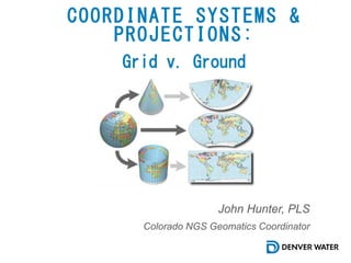
  • 1. COORDINATE SYSTEMS & PROJECTIONS: John Hunter, PLS Colorado NGS Geomatics Coordinator Grid v. Ground
  • 2. Interview of Dave Doyle, Chief Geodetic Surveyor, NGS, Ret. North Carolina Professional Land Surveyors Society (2014)
  • 3. • Coordinate System Basics • Ellipsoids • Projection Basics • Distortion • Horizontal Datums • Heights & Scale Factors • Localized Ground Projection • Grid v. Ground • SPCS 2022 The Stuff We Are Going To Learn About 9/25/20183
  • 5. Geocentric Geodetic Plane Types of Coordinates Systems 9/25/20185
  • 6. Types of Coordinates Systems 9/25/20186 Tertiary Positions Secondary Positions Primary Positions Geocentric Geodetic Projected
  • 7. Types of Coordinates and Respective Coordinate System 9/25/20187 Coordinate Type Coordinate System Note Earth Centered, Earth Fixed P(x,y,z) Geocentric GPS/GNSS Points Traditional Cartesian
  • 8. Earth-Centered-Earth-Fixed Coordinates are the most common Geocentric. Geocentric coordinates can be thought of as a 3 dimensional Cartesian with X, Y, and Z axis. The X axis: From the origin extending, horizontally, through the intersection of the Prime Meridian, and the Equator forming a 90° angle with the Z axis in the vertical plane. The Y axis: From the origin extending, horizontally, through the Equator forming a 90° angle with the X axis in the horizontal plane, and a 90° angle with the Z axis in the vertical plane. The Z axis: From the origin (center of the ellipsoid, or center of the earth) extending straight through the north pole is the Z axis (not the same as elevation). GNSS/GPS surveyors are very familiar with these types of coordinates as these are the results of raw GNSS/GPS observations (our controllers take those and display them into something we want to look at such as N, E, El). GNSS/GPS ECEF are not influenced by ellipsoids, geoids, projections, scale factors, or anything of the like, other than the center point of the earth. Geocentric Coordinate Systems 9/25/20188 ge·o·cen·tric Geocentric: Having or representing the earth as the center, as in former astronomical systems. Astronomy Measured from or considered in relation to the center of the earth.
  • 9. 9/25/20189 Geocentric Coordinate Systems Z X Y P(X,Y,Z)  Foundational or Fundamental Positions.  3D Cartesian Coordinates.  Uses the center of the earth as the origin (0,0,0) of the coordinate system.  Positions are not affected by the size or shape of the earth other than the earth center of mass.
  • 10. Types of Coordinates and Respective Coordinate System 9/25/201810 Coordinate Type Coordinate System Note Latitude & Longitude DD°MM’SS.SSSS”N, DDD°MMM’SS.SSSS”W Geodetic Differs with Ellipsoid GRS80 Vs. Clarks
  • 11. Traditional World Coordinate Systems Considering the same Cartesian system with X, Y, and Z axis, the Geodetic coordinates utilize a measure of angles to compute positions. Latitude (geodetic) is the angle of measurement from the equator to the point being observed, THAT IS PERPENDICULAR TO THE ELLIPSOID. This line does not extend through the origin except at the poles and along the equatorial plane. As in not geocentric. Because the constraining factor in latitude is that it is perpendicular to the size and shape of the earth, makes it geodetic. Longitude is the angle measured AROUND the Z axis, from the Prime Meridian to the point of observation. This angle is measured counter clock-wise The common misconception among GNSS/GPS surveyors are that these are the coordinates of GNSS/GPS and have become synonymous with WGS84 coordinates. GRS80 and WGS84 are essentially the same. The truth is that geodetic coordinates such as Lat Long are calculated by the GNSS/GPS controller from ECEF coordinates. Because these points are on the ELLIPSOIDAL surface, the issue of heights, and elevations must be accounted for. Geodetic Coordinate Systems 9/25/201811 ge·o·det·ic Of or relating to geodesy, especially as applied to land surveying. ge·od·e·sy The science dealing with the shape and size of the earth or large portions of it.
  • 12. 9/25/201812 Geodetic Coordinate Systems b a a P(L,L,h)  Secondary Positions.  Angular Coordinates.  Uses the same X,Y,Z geocentric reference frame for the origin.  Positions are dependent upon the size or shape of the earth.  Positions are based upon the mathematical approximation of the earth. Greenwich b
  • 13. Northing and Easting Coordinates are useful for representing geospatial information on a flat surface. Commonly used in most Surveying and Engineering applications. 2D cartesian system with X, and Y axis, the Plane coordinates are expressed in ordered pair format representing distances from the origin. Northing (Latitude) is the northerly or southerly distance perpendicular to the X (Easting) axis. Easting (Departure) Easterly or westerly distance perpendicular to the Y (Northing) axis. The State Plane Coordinates are a common example of the plane coordinate system. However, local ground based coordinate systems are commonly used by surveyors to ensure the mitigation of linear distortion. Plane Coordinate Systems 9/25/201813 Plān: a flat surface on which a straight line joining any two points on it would wholly lie.
  • 14. Types of Coordinates and Respective Coordinate System 9/25/201814 Coordinate Type Coordinate System Note State Plane Coordinates N:1697814.29 E: 3157197.06 Plane Round Surface Projected to Flat Surface. Coordinates ≠ Ground Distances
  • 15. 9/25/201815 Projected (Plane) Coordinate Systems P(N,E,El)  Tertiary Positions.  Ordered Pairs on a flat plane.  Not Geodetic or Geocentric.  Plane is attached to one or more points of the ellipsoid.  Positions “projected” onto a flat surface from the ellipsoidal surface.  Distortion WILL occur.
  • 16. 9/25/201816 Types of Coordinate Systems Geocentric ECEF Positions Geodetic Latitude Longitude Positions Plane Projected Positions
  • 17. Types of Coordinates and Their Coordinate Systems 9/25/201817 Coordinate Type Coordinate System Note Modified State Plane N:697814.29 E: 157197.06 CSF: 1.00026 Sometimes more modifications are made Plane Truncate Coordinates & Apply a Scale Factor. Coordinates = Ground Distances
  • 18. Types of Coordinates and Their Coordinate Systems 9/25/201818 Coordinate Type Coordinate System Note Earth Centered, Earth Fixed P(x,y,z) Geocentric GPS/GNSS Points Traditional Cartesian Latitude & Longitude DD°MM’SS.SSSS”N, DDD°MMM’SS.SSSS”W Geodetic Differs with Ellipsoid GRS80 Vs. Clarks State Plane Coordinates N:1697814.29 E: 3157197.06 Plane Round Surface Projected to Flat Surface. Coordinates ≠ Ground Distances Modified State Plane N:697814.29 E: 157197.06 CSF: 1.00026 Plane Truncate Coordinates & Apply a Scale Factor. Coordinates = Ground Distances
  • 20. 9/25/201820 Neil Degrasse Tyson Shape of the Earth Neil Degrasse Tyson. Seth Rogan Podcast (2018)
  • 21. 9/25/201821 Kansas Really Is Flatter Than a Pancake …Sort of Mark Fonstad, William Pugatch and Brandon Vogt. Improbable Research (2003).
  • 22. The Ellipsoid 9/25/201822 • Biaxial ellipsoid has dimensions a, and b • Mathematical approximation of the shape and size of the earth. • Defined by two dimensions; a Semi- Major axis, (a), and a Semi-minor axis, (b). • The flattening ratio, (ƒ) of an ellipsoid. • ƒ = (a-b)/a • The eccentricity, (e) is how much the ellipsoid deviates from a circle. • e = √(2 ƒ - ƒ 2). • Typical notation: A precise calculation of the ellipsoid can be performed with the Semi-major dimension, (a), and the flattening ratio, ƒ.
  • 24. The GEOID 9/25/201824 • Attaches to the X,Y,Z Geocentric Reference Frame. • Model of the earths gravitational surface. • Used to obtain more accurate elevations • Geoid models must be paired with the correct horizontal datum. Example: GEOID 12B should be utilized in the NAD83 (2011) datum.
  • 25. The GEOID and Ellipsoid Deflection of the Vertical 9/25/201825 What is the LaPlace Correction, anyway? Ellipsoid Geoid
  • 27. Cylindrical Conical Planar Types of Projections 9/25/201827
  • 31. However….  All projections will result in some sort of distortion.  Even a conformal projection will distort angles over a large enough area. The Secant Lambert Conformal Conic (SLCC) projection is one of many types of projection methodologies. This conformal conic projection preserves the integrity of angles. However linear distortion will be present within the design area of the projected coordinate system. Conformal Projection 9/25/201831 Conformal Projection: In Cartography. A map projection in which angles formed by lines are preserved: a map made using this projection preserves the shape of any small area. Secant: Projection Plane Intersects the ellipsoidal surface in 2 locations, hence 2 standard parallels. Tangent: Projection Plane intersects the ellipsoidal surface in exactly 1 location, hence 1 standard parallel. Non-intersecting: Projection Plane does not intersect the ellipsoidal surface at all.
  • 32. 9/25/201832 The Conformal Lambert Conical Secant Projection
  • 33. 9/25/201833 The Conformal Lambert Conical Secant Projection This is our projection area that will become our coordinate system
  • 34. 9/25/201834 The Conformal Lambert Conical Secant Projection
  • 35. Projections Lambert Conformal Conic (SLCC) projection 9/25/201835 Standard Parallels are the only points (lines) in this projection with a scale of 1. Standard parallels are important in a projection because they essentially function as the boundaries. The Origin is the anchor point for the projection. It is the point from which Northing and Eastings are derived. The Central Meridian. (in a coordinate systems) A line of longitude that defines the center of a projected coordinate system. In planar rectangular coordinate systems of limited extent, such as state plane, grid north coincides with true north at the central meridian. The False Northing (map projections) The linear value added to all y-coordinates of a map projection so that none of the values in the geographic region being mapped are negative. The False Easting (map projections) The linear value added to all x-coordinates of a map projection so that none of the values in the geographic region being mapped are negative. The false northing and easting is often used to ensure that there are no negative coordinate values within the projection.
  • 38. Horizontal Datum Orientation & Initial Point 9/25/201838 • Attaches the ellipsoid to a physical point on the earth’s surface, known as an initial point. • Points chosen were best suited for a particular region. • Historically observatories were used. • Five Parameters: 1. Semi-Major (a) 2. Semi-Minor (b) 3. Latitude 4. Longitude 5. Azimuth to reference point • Makes geodetic datums possible. • NAD 1927 fixed at Meade’s Ranch in Kansas and uses Clarke 1866 Spheroid.
  • 39. Horizontal Datum Geocentric Datums 9/25/201839 • Attaches the ellipsoid to a theoretical point at the center of the earth, known as a geocentric system. • NAD 1983 used new technologies to take measurements. • Satellite Laser Ranging (SLR) • Lunar Laser Ranging (LLR) • Very Long Baseline Interferometry (VLBI) • Doppler Orbitography (DORIS) • Some (relatively few) GPS • Realizations are needed to become useful in Land Surveying. • Realization can be thought of as a snapshot in time. The center of the earth is a fixed point, whereas the surface is constantly moving and changing. • Readjusted to incorporate additional “survey measurements & observations”. • Classical survey measurements • EDM-measured baselines • A lot of GPS observations • Other • NAD 1983 is fixed at, and attached to the center of the earth, uses the GRS80 Spheroid, and requires realizations.
  • 40. Horizontal Datum 9/25/201840 A horizontal datum forms the basis for computations of horizontal positions which may be defined at an origin point of an ellipsoid such that the center of the ellipsoid coincides with the earth’s center, or actual fixed points on the earth’s surface. A proper horizontal datum will define: • The dimensions of the reference ellipsoid. • The orientation of the coordinate system. • The location of the origin of the coordinate system. So really… A datum essentially defines the coordinate system. o NAD27 o NAD83 o NAD83 (2011) o NAD83 (CORS96) o 2022 Modernization
  • 42. Heights Ellipsoidal Height 9/25/201842 The Ellipsoidal Heights is the distance from the ellipsoid to a corresponding point on the surface of the Earth. The height is measured along a line perpendicular to the ellipsoid. This distance is known by more than one name. It is called the ellipsoidal height and is also called the geodetic height, and it is usually symbolized by h. Note: Not all h values are the same, and the horizontal datum CAN impact h.
  • 43. Heights What is a Geoid and what is a Geoid Height 9/25/201843 The Geoid is an equipotential surface that best fits mean sea level. Meaning that, across the geoid, the potential of gravity is always the same. The geoid and mean sea level could be the same if the oceans of the world could be utterly still, completely free of currents, tides, friction, variations in temperature, and all other physical forces, except gravity. A Geoid Height is the ellipsoidal height from an ellipsoidal datum to a geoid. That means that geoid height models are directly tied to the geoid and ellipsoid that define them. In other words, geoid height models are not interchangeable. Note that the geoid is a vertical datum surface.
  • 44. Heights Putting it together 9/25/201844 Orthometric Height (H) = h-N Ellipsoidal Height (h) = H+N Geoid Height (N) = h-H Keep this in mind: An elevation that was established by differential leveling should not be used to determine an Ellipsoidal Height because the level is based upon gravity. However, this is negligible in most cases but reinforces the need to ensure geoids are properly paired with the correct horizontal datum.
  • 46. Scale Factor 9/25/201846 An Elevation Factor (EF) is determined by the ratio of the ground distance (DGND) to the corresponding geodetic distance (DGDC): EF = DGND / DGDC. The Scale Factor (SF) is determined by the ratio of the geodetic distance (DGDC) to the corresponding grid distance (DGRD): SF = DGDC / DGRD. A Combined Scale Factor (CSF) is perhaps the most useful, and is determined by the ratio of the ground distance (DGND) and the grid distance (DGRD): CSF = DGND / DGRD.
  • 47. Scale Factor Grid to Ground and Ground to Grid 9/25/201847 Combined Scale Factor (CSF) = 1.00046 Grid to Ground Ground Distance = Grid Distance x CSF Ground to Grid Grid Distance = Grid Distance/CSF The horizontal distance between two section corners is measured on the surface with a GPS unit, and has a ground distance of 5,280’. To convert the distance to grid we take the ground distance (5280’) and divide it by the CSF (1.00046), which gives us 5277.57’. The horizontal distance between two section corners is measured on the surface with a GPS unit, and has a grid distance of 5,280’. To convert the distance to grid we take the ground distance (5280) and multiply it by the CSF (1.00046), which gives us 5282.43’.
  • 48. Modified Projection 9/25/201848 The Modified Projection is a method commonly used to mitigate the adverse effects that elevation has on distances such that ground distances are more accurately represented. A correctly modified projection must be defined in such a way that the coordinate values are easily distinguishable between modified coordinate values and non-modified coordinate values. This is typically accomplished by a standard truncation of the Northing and Easting coordinate values. The Modified System also requires a combined scale factor, (CSF). The Denver Water custom grids are a modification of the Colorado State Plane coordinate system.
  • 49. Modified Projection 9/25/201849 Denver Water Modified State Plane Coordinate Systems State Plane to DW Grid DW Grid to State Plane 𝑆𝑆𝑆𝑆𝑁𝑁 − 𝑇𝑇𝑇𝑇𝑁𝑁 ∗ 𝐶𝐶𝐶𝐶𝐶𝐶 = 𝐷𝐷𝐷𝐷𝑁𝑁 (𝐷𝐷𝐷𝐷𝑁𝑁/𝐶𝐶𝐶𝐶𝐶𝐶) + 𝑇𝑇𝑇𝑇𝑁𝑁 = 𝑆𝑆𝑆𝑆𝑁𝑁 𝑆𝑆𝑆𝑆𝐸𝐸 − 𝑇𝑇𝑇𝑇𝐸𝐸 ∗ 𝐶𝐶𝐶𝐶 = 𝐷𝐷𝐷𝐷𝐸𝐸 (𝐷𝐷𝐷𝐷𝐸𝐸/𝐶𝐶𝐶𝐶𝐶𝐶) + 𝑇𝑇𝑇𝑇𝐸𝐸 = 𝑆𝑆𝑆𝑆𝐸𝐸 CSF: Combined Scale Factor DW: Denver Water Coordinate N=Northing E=Easting SP: State Plane Coordinate N=Northing E=Easting Tr: Coordinate Truncation N=Northing E=Easting
  • 50. Create a Ground Based Projection for your GIS Project… 9/25/201850 1. Work with your surveyor 2. Request the projection definition from the surveyor 3. Find a Combined Scale Factor 4. Create a Projection 5. Modify and rename 6. Test the Projection 7. Create a prj to utilize in the future or share data
  • 51. Request The Projection Definition From The Surveyor 9/25/201851 Important Parameters to Request  Units  Projection Type  False N and E  Central Meridian  Scale Factor  Latitude of Origin  Geographic coordinate System (Geodetic Coordinate System) Denver Water Projection Definition
  • 52. How to Determine a Combined Scale Factor 9/25/201852 Scale Factor Resources  Surveyors  NGS Datasheets published by the National Geodetic Survey – NGS https://www.ngs.noaa.gov/ datasheets/  Published Data on ArcGIS Online – All Portal (Just be mindful of the person or organization publishing the data)  https://www.ngs.noaa.gov/datasheets/ A Shapefile from NGS – You Must Keep It Up To Date. There is no data service for this.
  • 53. How to Determine a Combined Scale Factor 9/25/201853 NGS Data Explorer  Launch Map  Zoom to Project Area  Map Layers  Select the Mark Types of Interest and “Find Marks”  Pay Close Attention to “Control Types” to make sure you utilize good data.  https://www.ngs.noaa.gov/datasheets/
  • 54. How to Determine a Combined Scale Factor 9/25/201854 Find the Datasheet  Examine the Basic Information to determine if it is what you are looking for.  Launch “Datasheet”  https://www.ngs.noaa.gov/datasheets/
  • 55. How to Determine a Combined Scale Factor 9/25/201855 https://www.ngs.noaa.gov/datasheets/ Combined Scale Factor 0.99993765 sFT Colorado Central SP Select the appropriate scale factor. In this case Colorado State Plane Central Zone in Survey Feet.
  • 56. How to Determine a Combined Scale Factor 9/25/201856 https://www.ngs.noaa.gov/datasheets/ Select Several Horizontal Controls around the Project Area and average the CSF Calculate Average 0.99993765 0.99993614 0.99993739 Avg: 0.99993706 1/x: 1.00006294 Note: 1/x is the inverse. 1/0.99993706 = 1.00006294 Most software asks for the inverse input.
  • 57. How to Build a Ground Based Projection 9/25/201857 “Copy and Modify” the projected Coordinate System that you want to start with. In this case we are going to modify Colorado Central Zone State Plane.
  • 58. How to Build a Ground Based Projection 9/25/201858 Entering Parameters Change the name of the projection to something meaningful. Enter the previously computed scale factor. Don’t forget to add to your favorites. Note: By utilizing this method, the coordinate values will look very similar to plain State plane coordinates.
  • 59. Examine Grid V. Ground 9/25/201859 Grid v. Ground Set the map Coordinate System to the modified projection. Import field measured points. At this point, you should have “ground” information resulting in ground distances.
  • 60. Examine Ground V. Grid 9/25/201860 Ground v. Grid Set the map Coordinate System back to State Plane. Leave the field measured point feature in the map. At this point, you should have “ground” information resulting in grid distances. From the north end of the dam to the south end of the dam: Modified Projection = 4111.53 SP Projection = 4111.27
  • 61. Examine Grid V. Ground 9/25/201861 Grid v. Ground Set the map Coordinate System to the modified projection. Import field measured points. At this point, you should have “ground” information resulting in ground distances.
  • 62. Examine Ground V. Grid 9/25/201862 Ground v. Grid Set the map Coordinate System back to State Plane. Leave the field measured point feature in the map. At this point, you should have “ground” information resulting in grid distances. From the north end of the dam to the south end of the dam: Mod. Projection = 7,834,490 SP Projection = 7,833,504
  • 63. Future of the NSRS 9/25/201863  Modernization of the NSRS – 2022 - Horizontal Displacement of apx. 3.6 ft. - Vertical Displacement of apx. 2.9 ft.  SPCS 2022 - NGS currently designing - Potential for LDP designs  Contemporary - Future could see time dependent positioning - Largely driven by technology NATRF 2022 Approximate Horizontal Displacement NATRF 2022 Approximate Vertical Displacement
  • 64. Good Geodetic Resources 9/25/201864 National Geodetic Survey https://geodesy.noaa.gov/# Michael Dennis – Geodetic Analysis https://geodeticanalysis.com/resources/ Dave Doyle – Base9 Geodetic Consulting Services https://www.base9geodesy.com/publications Jan Van Sickle – Basic GIS Coordinates Available on Amazon
  • 65. B. John Hunter, PLS Geodetic Surveyor Denver Water Colorado NGS Geomatics Coordinator CoCoordinator@plsc.net john.hunter@denverwater.org 720.883.6508