SlideShare a Scribd company logo
1 of 40
Will this law impact your
GIS?
SB 18-167
Dave Murray, GISP
GIS Coordinator
City of Westminster
GISCO Quarterly Meeting – October 19, 2018
Exogenous
3
2b: introduced from or produced
outside the organism or system
specifically : not synthesized within the
organism or system
Exogenous GIS Events
 Telecom 5G
– Small Cell Sites
 Senate Bill 18-167 –
Utility Locates
 Liquor Licenses
 Marijuana Licenses
 2022
 Others… 4
Exogenous GIS Events
 Google maps
5
Exogenous GIS Events
 HTTPS:
6
Works Just fine on
another computer->
7
8
9
GIS Responds
10
What?
Current Excavation Damage
Prevention Law
 Before conducting an excavation
Contact Colorado 811 (Utility
Notification Center of Colorado)
 They contact the owners of the
underground facilities based on tier
type
 Violations enforced through civil
actions by damaged parties
11
Why?
Enforcement is Inadequate
 According to the United States
Department of Transportation's
Pipeline and Hazardous Materials
(PHMSA) 2016 report
 Which may eventually result in the
WITHOLDING OF FEDERAL FUNDS FROM
COLORADO
12
This is your
presentation title
Senate Bill 18-167
Underground Damage Prevention
Safety Commission
 Rule-making and enforcement authority
 Colorado 811 is required to provide
administrative support – Central
resource
 A review committee determines if a
violation has been committed
 Commission determines action on
violation
15
Senate bill 18-167
Follow the Money
 Fines credited to damage prevention
fund
 Educational programming
 Grants to improve the worker and
public safety
16
Which Tier?
Currently
 Tier 2 members - Local governments,
special districts, cable and small
telecom providers
- Contacted directly by excavator
 Tier 1 members – all the rest
- Colorado 811 contacted directly
17
Who?
Now it gets interesting
 Current law – Only the excavator can
submit a location request to 811
 SB 18-167 allows a licensed
professional engineer to submit a
location request
 Engineer is required to ensure plans
meet ASCE accuracy of underground
facility standards.
18
Tier No More
Effective January 1, 2021
 All underground facility owners and
operators are full members
 Colorado 811 will be contacted
 ALL NEW UNDERGROUND FACILITIES
INSTALLED AFTER JANUARY 1, 2020 MUST
BE ELECTRONICALLY LOCATABLE WHEN
INSTALLED.
 Home rule local governments must
adopt safety program or create their
own.
19
GIS Community Impact?
Our Data is a starting point
 Currently used as a starting point
 Future – Source with on-the-ground
updates
 Closely linked to GPS
 Used in ways we have not imagined
20
Caution
22
 You do not want to accept liability
base on GIS coordinates that have
not been verified
 Where does your GIS come from?
 How do you verify locations?
 How is the GIS data used?
 Do you have solid disclaimers?
 Do you have metadata?
The line is a bit foggy
23
24
This guideline is a protocol for engineers to use in
rendering a professional opinion about the quality and
reliability of utility information depicted on excavation
plans.
By following the process spelled out in ASCE 38-02, an
engineer can quantify the quality of the utility information
in terms that a lay person or non-engineer can
understand.
ASCE 38-02 defines four distinct levels of quality with
respect to utility information. The quality of the utility
information is ranked from the most reliable, Quality
Level A, to the least reliable, Quality Level D.
http://www2.apwa.net/documents/About/TechSvcs/ROW/Products/Locating_private_utilities_i
n_the_pub_ROW-9-06.pdf
ASCE 38-02
25
Standard Guideline for the Collection
and Depiction of Existing Subsurface
Utility Data
CI/ASCE 38-02
26
 Quality Level D
Information derived from existing records
or oral recollections.
-> GIS and those that are in the know
https://www.etsy.com/listing/99913462/pirate-ship-and-buried-treasure-
map?gpla=1&gao=1&utm_campaign=shopping_us_danadecals_sfc_osa&utm_medium=cpc&utm_source=google&utm_custom1=0&utm_content=6668580&gclid=EAIaIQobChMIvMDv4o-
O3gIVChhpCh37Sg15EAQYASABEgIbpPD_BwE
27
 Quality Level C
Information obtained by surveying and plotting
visible above-ground utility features and by using
professional judgment in correlating this
information to quality level D information.
-> GIS and survey grade GPS
https://www.google.com/search?biw=2048&bih=723&tbm=isch&sa=1&ei=zYHHW5OaAaXYjwSa_bioDA&q=gis+survey+map&oq=gis+survey+map&gs_l=img.3..0i24.157841.160807..161190...0.0
..0.70.787.14......0....1..gws-wiz-img.......0j0i67j0i5i30j0i8i30j0i10i24j0i30.0M-LT83-FK0#imgrc=vpnwusmbqDYujM:
28
 Quality Level B
Information obtained through the
application of appropriate surface
geophysical methods to determine the
existence and approximate horizontal
position of subsurface utilities.
Quality level B data should be
reproducible by surface geophysics at
any point of their depiction. This
information is surveyed to applicable
tolerances defined by the project and
reduced onto plan documents.
https://www.google.com/search?biw=2048&bih=723&tbm=isch&s
a=1&ei=zYHHW5OaAaXYjwSa_bioDA&q=ground+penetrating+r
adar&oq=ground+penetrating+r&gs_l=img.1.0.0l10.2337.6881..1
0198...0.0..0.74.1086.20......0....1..gws-wiz-
img.......0i67.ZpLix7foMCY#imgrc=VtSiwId4HixsQM:
29
 Quality Level B
30
 Quality Level A
Precise horizontal and vertical location of utilities
obtained by the actual exposure (or verification of
previously exposed and surveyed utilities) and
subsequent measurement of subsurface utilities, usually
at a specific point. Minimally intrusive excavation
equipment is typically used to minimize the potential for
utility damage.
A precise horizontal and vertical location, as well as
other utility attributes, is shown on plan documents.
Accuracy is typically set to 15-mm vertical and to
applicable horizontal survey and mapping accuracy as
defined or expected by the project owner.
31
 Quality Level A
32
https://www.google.com/search?biw=2048&bih=723&tbm=isch&sa=1&ei=zoXHW9SeKce_jwSdqJqoCQ&q=underground+utility+verification&oq=underground+utility+verification&gs_l=im
g.3...24654.31065..31652...0.0..0.55.606.12......0....1..gws-wiz-img.rydVkVLndhM#imgdii=pqTe3arwiGtb4M:&imgrc=cQeQOoUTaFUNeM:
33
 COST SAVINGS
Current GIS Impacts
34
GIS
Engineering
Plans
Field
Operations
Future GIS Impacts
35
Engineering
Plans
Field
Operations
GIS
36
What are the Next Steps
Review your Data
Know how your Data was Collected
Know how to represent your Data
Last but not least:
https://www.google.com/search?tbm=isch&source=hp&biw=1288&bih=670&ei=bBjGW-
3INITTjwSg5YbAAw&q=metadata&oq=metadata&gs_l=img.3.0.0l10.1287.3260..3538...0.0..0.371.2365.2-5j3......0....1..gws-wiz-img.......0i10.9S6zuW6Yrq0#imgrc=o_TfFtBUoVUM4M:
Thoughts?
37
2022
Thank you
40
www.slidescarnival.com/
https://www.cml.org/
https://www.asce.org/templates/publications-
book-detail.aspx?id=8162 -
SOFT COVER — IN STOCK
$51.00 List / $38.25 ASCE Member
City of Westminster GIS

More Related Content

What's hot

Smallworld and Google: the best of both worlds
Smallworld and Google: the best of both worldsSmallworld and Google: the best of both worlds
Smallworld and Google: the best of both worldsPeter Batty
 
From Google to Transport for London: How to personalize public services. Andr...
From Google to Transport for London: How to personalize public services. Andr...From Google to Transport for London: How to personalize public services. Andr...
From Google to Transport for London: How to personalize public services. Andr...Data Driven Innovation
 
Big Data for Smart Mobility. Fabio Pressi, Infoblu
Big Data for Smart Mobility. Fabio Pressi, InfobluBig Data for Smart Mobility. Fabio Pressi, Infoblu
Big Data for Smart Mobility. Fabio Pressi, InfobluData Driven Innovation
 
Bristol smart city report
Bristol smart city reportBristol smart city report
Bristol smart city reportBristol Futures
 
INOV360_From Smart Metering to Smart Cities and Internet of Things
INOV360_From Smart Metering to Smart Cities and Internet of Things INOV360_From Smart Metering to Smart Cities and Internet of Things
INOV360_From Smart Metering to Smart Cities and Internet of Things INOV360
 
Impact Assessment for Climate-Smart Cities
Impact Assessment for Climate-Smart CitiesImpact Assessment for Climate-Smart Cities
Impact Assessment for Climate-Smart CitiesDirk Ahlers
 
Energy and Smart Building technologies 2014
Energy and Smart Building technologies 2014Energy and Smart Building technologies 2014
Energy and Smart Building technologies 2014BSRIA
 
O futuro do software
O futuro do softwareO futuro do software
O futuro do softwareRamon Durães
 
Smart Cities 2019: What kind of smart city do you want to build?
Smart Cities 2019: What kind of smart city do you want to build?Smart Cities 2019: What kind of smart city do you want to build?
Smart Cities 2019: What kind of smart city do you want to build?Sarah Barns
 
Sébastien Soriano, Session 2
Sébastien Soriano, Session 2Sébastien Soriano, Session 2
Sébastien Soriano, Session 2OECD Governance
 
Smart city and e government
Smart city and e governmentSmart city and e government
Smart city and e governmentPukarSharma2
 
An overview of interconnection, facilities leasing and number administration ...
An overview of interconnection, facilities leasing and number administration ...An overview of interconnection, facilities leasing and number administration ...
An overview of interconnection, facilities leasing and number administration ...VoiceSA
 
Greenr - Better parks for better living
Greenr - Better parks for better livingGreenr - Better parks for better living
Greenr - Better parks for better livingLoris Bottello
 

What's hot (20)

Smallworld and Google: the best of both worlds
Smallworld and Google: the best of both worldsSmallworld and Google: the best of both worlds
Smallworld and Google: the best of both worlds
 
From Google to Transport for London: How to personalize public services. Andr...
From Google to Transport for London: How to personalize public services. Andr...From Google to Transport for London: How to personalize public services. Andr...
From Google to Transport for London: How to personalize public services. Andr...
 
Digital City Bristol
Digital City BristolDigital City Bristol
Digital City Bristol
 
Taking 3D to the next Level with 3D Streaming Maps
Taking 3D to the next Level with 3D Streaming MapsTaking 3D to the next Level with 3D Streaming Maps
Taking 3D to the next Level with 3D Streaming Maps
 
Big Data for Smart Mobility. Fabio Pressi, Infoblu
Big Data for Smart Mobility. Fabio Pressi, InfobluBig Data for Smart Mobility. Fabio Pressi, Infoblu
Big Data for Smart Mobility. Fabio Pressi, Infoblu
 
Paolo Rigato, Here Technologies
Paolo Rigato, Here TechnologiesPaolo Rigato, Here Technologies
Paolo Rigato, Here Technologies
 
Bristol smart city report
Bristol smart city reportBristol smart city report
Bristol smart city report
 
INOV360_From Smart Metering to Smart Cities and Internet of Things
INOV360_From Smart Metering to Smart Cities and Internet of Things INOV360_From Smart Metering to Smart Cities and Internet of Things
INOV360_From Smart Metering to Smart Cities and Internet of Things
 
Smart cities
Smart citiesSmart cities
Smart cities
 
Impact Assessment for Climate-Smart Cities
Impact Assessment for Climate-Smart CitiesImpact Assessment for Climate-Smart Cities
Impact Assessment for Climate-Smart Cities
 
Energy and Smart Building technologies 2014
Energy and Smart Building technologies 2014Energy and Smart Building technologies 2014
Energy and Smart Building technologies 2014
 
Robert Mitchell
Robert MitchellRobert Mitchell
Robert Mitchell
 
O futuro do software
O futuro do softwareO futuro do software
O futuro do software
 
Smart Cities 2019: What kind of smart city do you want to build?
Smart Cities 2019: What kind of smart city do you want to build?Smart Cities 2019: What kind of smart city do you want to build?
Smart Cities 2019: What kind of smart city do you want to build?
 
Sébastien Soriano, Session 2
Sébastien Soriano, Session 2Sébastien Soriano, Session 2
Sébastien Soriano, Session 2
 
Smart city and e government
Smart city and e governmentSmart city and e government
Smart city and e government
 
An overview of interconnection, facilities leasing and number administration ...
An overview of interconnection, facilities leasing and number administration ...An overview of interconnection, facilities leasing and number administration ...
An overview of interconnection, facilities leasing and number administration ...
 
Digital twins
Digital twinsDigital twins
Digital twins
 
Greenr - Better parks for better living
Greenr - Better parks for better livingGreenr - Better parks for better living
Greenr - Better parks for better living
 
Edge Technology
Edge TechnologyEdge Technology
Edge Technology
 

Similar to GISCO Fall 2018: Senate Bill 18-167 and GIS – Dave Murray

World Pipelines - Better Together - SCADA and GIS
World Pipelines - Better Together - SCADA and GISWorld Pipelines - Better Together - SCADA and GIS
World Pipelines - Better Together - SCADA and GISsmrobb
 
Vehicle Tracking System for School Bus by Arduino
Vehicle Tracking System for School Bus by ArduinoVehicle Tracking System for School Bus by Arduino
Vehicle Tracking System for School Bus by ArduinoIRJET Journal
 
Capgemini ses - smart grid operational services - gis pov (gr)
Capgemini   ses - smart grid operational services - gis pov (gr)Capgemini   ses - smart grid operational services - gis pov (gr)
Capgemini ses - smart grid operational services - gis pov (gr)Gord Reynolds
 
IRJET- Trafficop Android Application for Management of Traffic Violations
IRJET-  	  Trafficop Android Application for Management of Traffic ViolationsIRJET-  	  Trafficop Android Application for Management of Traffic Violations
IRJET- Trafficop Android Application for Management of Traffic ViolationsIRJET Journal
 
CD December 2015 Le Geosystems Cable Detection presentation
CD December 2015 Le Geosystems Cable Detection presentationCD December 2015 Le Geosystems Cable Detection presentation
CD December 2015 Le Geosystems Cable Detection presentationComit Projects Ltd
 
IRJET - Road Condition Improvement in Smart Cities using IoT
IRJET - Road Condition Improvement in Smart Cities using IoTIRJET - Road Condition Improvement in Smart Cities using IoT
IRJET - Road Condition Improvement in Smart Cities using IoTIRJET Journal
 
IoT & Data Analytics Sharing Session - Telkomsigma
IoT & Data Analytics Sharing Session - TelkomsigmaIoT & Data Analytics Sharing Session - Telkomsigma
IoT & Data Analytics Sharing Session - TelkomsigmaTogi Nababan
 
Smart vehicle tracking using GPS
Smart vehicle tracking using GPSSmart vehicle tracking using GPS
Smart vehicle tracking using GPSIRJET Journal
 
TNT TECHNOLOGIES PRIVATE L
TNT TECHNOLOGIES PRIVATE LTNT TECHNOLOGIES PRIVATE L
TNT TECHNOLOGIES PRIVATE LTakishaPeck109
 
IRJET - Accident Monitoring and Rescue System
IRJET - Accident Monitoring and Rescue SystemIRJET - Accident Monitoring and Rescue System
IRJET - Accident Monitoring and Rescue SystemIRJET Journal
 
AutoCon 0 Day Two Keynote: Kireeti Kompella
AutoCon 0 Day Two Keynote: Kireeti KompellaAutoCon 0 Day Two Keynote: Kireeti Kompella
AutoCon 0 Day Two Keynote: Kireeti KompellaNetwork Automation Forum
 
IRJET- On Board Diagnostics (OBD)3 for Vehicular Management
IRJET- On Board Diagnostics (OBD)3 for Vehicular ManagementIRJET- On Board Diagnostics (OBD)3 for Vehicular Management
IRJET- On Board Diagnostics (OBD)3 for Vehicular ManagementIRJET Journal
 
IRJET- Speed Limit Alerting Device
IRJET- Speed Limit Alerting DeviceIRJET- Speed Limit Alerting Device
IRJET- Speed Limit Alerting DeviceIRJET Journal
 
Joep Luijten.pdf
Joep Luijten.pdfJoep Luijten.pdf
Joep Luijten.pdfGokhul2
 
IRJET- Intelligent Car Parking System commanded by Android Application
IRJET- Intelligent Car Parking System commanded by Android ApplicationIRJET- Intelligent Car Parking System commanded by Android Application
IRJET- Intelligent Car Parking System commanded by Android ApplicationIRJET Journal
 
January 2013 world Pipeline magazine Article
January  2013 world Pipeline magazine ArticleJanuary  2013 world Pipeline magazine Article
January 2013 world Pipeline magazine ArticleLayne Tucker
 
IRJET- IoT based Smart Garbage Monitioring System using Esp8266 with GPS ...
IRJET-  	  IoT based Smart Garbage Monitioring System using Esp8266 with GPS ...IRJET-  	  IoT based Smart Garbage Monitioring System using Esp8266 with GPS ...
IRJET- IoT based Smart Garbage Monitioring System using Esp8266 with GPS ...IRJET Journal
 
MDPD GIS Application Review and Recommendations for Implementation
MDPD GIS Application Review and Recommendations for ImplementationMDPD GIS Application Review and Recommendations for Implementation
MDPD GIS Application Review and Recommendations for ImplementationJuan Tobar
 

Similar to GISCO Fall 2018: Senate Bill 18-167 and GIS – Dave Murray (20)

World Pipelines - Better Together - SCADA and GIS
World Pipelines - Better Together - SCADA and GISWorld Pipelines - Better Together - SCADA and GIS
World Pipelines - Better Together - SCADA and GIS
 
Vehicle Tracking System for School Bus by Arduino
Vehicle Tracking System for School Bus by ArduinoVehicle Tracking System for School Bus by Arduino
Vehicle Tracking System for School Bus by Arduino
 
Capgemini ses - smart grid operational services - gis pov (gr)
Capgemini   ses - smart grid operational services - gis pov (gr)Capgemini   ses - smart grid operational services - gis pov (gr)
Capgemini ses - smart grid operational services - gis pov (gr)
 
IRJET- Trafficop Android Application for Management of Traffic Violations
IRJET-  	  Trafficop Android Application for Management of Traffic ViolationsIRJET-  	  Trafficop Android Application for Management of Traffic Violations
IRJET- Trafficop Android Application for Management of Traffic Violations
 
CD December 2015 Le Geosystems Cable Detection presentation
CD December 2015 Le Geosystems Cable Detection presentationCD December 2015 Le Geosystems Cable Detection presentation
CD December 2015 Le Geosystems Cable Detection presentation
 
Introduction to IoT unit II
Introduction to IoT  unit IIIntroduction to IoT  unit II
Introduction to IoT unit II
 
IRJET - Road Condition Improvement in Smart Cities using IoT
IRJET - Road Condition Improvement in Smart Cities using IoTIRJET - Road Condition Improvement in Smart Cities using IoT
IRJET - Road Condition Improvement in Smart Cities using IoT
 
IoT & Data Analytics Sharing Session - Telkomsigma
IoT & Data Analytics Sharing Session - TelkomsigmaIoT & Data Analytics Sharing Session - Telkomsigma
IoT & Data Analytics Sharing Session - Telkomsigma
 
Smart vehicle tracking using GPS
Smart vehicle tracking using GPSSmart vehicle tracking using GPS
Smart vehicle tracking using GPS
 
TNT TECHNOLOGIES PRIVATE L
TNT TECHNOLOGIES PRIVATE LTNT TECHNOLOGIES PRIVATE L
TNT TECHNOLOGIES PRIVATE L
 
IRJET - Accident Monitoring and Rescue System
IRJET - Accident Monitoring and Rescue SystemIRJET - Accident Monitoring and Rescue System
IRJET - Accident Monitoring and Rescue System
 
AutoCon 0 Day Two Keynote: Kireeti Kompella
AutoCon 0 Day Two Keynote: Kireeti KompellaAutoCon 0 Day Two Keynote: Kireeti Kompella
AutoCon 0 Day Two Keynote: Kireeti Kompella
 
GPS Tracking
GPS TrackingGPS Tracking
GPS Tracking
 
IRJET- On Board Diagnostics (OBD)3 for Vehicular Management
IRJET- On Board Diagnostics (OBD)3 for Vehicular ManagementIRJET- On Board Diagnostics (OBD)3 for Vehicular Management
IRJET- On Board Diagnostics (OBD)3 for Vehicular Management
 
IRJET- Speed Limit Alerting Device
IRJET- Speed Limit Alerting DeviceIRJET- Speed Limit Alerting Device
IRJET- Speed Limit Alerting Device
 
Joep Luijten.pdf
Joep Luijten.pdfJoep Luijten.pdf
Joep Luijten.pdf
 
IRJET- Intelligent Car Parking System commanded by Android Application
IRJET- Intelligent Car Parking System commanded by Android ApplicationIRJET- Intelligent Car Parking System commanded by Android Application
IRJET- Intelligent Car Parking System commanded by Android Application
 
January 2013 world Pipeline magazine Article
January  2013 world Pipeline magazine ArticleJanuary  2013 world Pipeline magazine Article
January 2013 world Pipeline magazine Article
 
IRJET- IoT based Smart Garbage Monitioring System using Esp8266 with GPS ...
IRJET-  	  IoT based Smart Garbage Monitioring System using Esp8266 with GPS ...IRJET-  	  IoT based Smart Garbage Monitioring System using Esp8266 with GPS ...
IRJET- IoT based Smart Garbage Monitioring System using Esp8266 with GPS ...
 
MDPD GIS Application Review and Recommendations for Implementation
MDPD GIS Application Review and Recommendations for ImplementationMDPD GIS Application Review and Recommendations for Implementation
MDPD GIS Application Review and Recommendations for Implementation
 

More from GIS in the Rockies

GISCO Fall 2018: Bike Network Equity: A GIS and Qualitative Analysis of Ameri...
GISCO Fall 2018: Bike Network Equity: A GIS and Qualitative Analysis of Ameri...GISCO Fall 2018: Bike Network Equity: A GIS and Qualitative Analysis of Ameri...
GISCO Fall 2018: Bike Network Equity: A GIS and Qualitative Analysis of Ameri...GIS in the Rockies
 
2018 GIS in the Rockies Workshop: Coordinate Systems and Projections
2018 GIS in the Rockies Workshop: Coordinate Systems and Projections 2018 GIS in the Rockies Workshop: Coordinate Systems and Projections
2018 GIS in the Rockies Workshop: Coordinate Systems and Projections GIS in the Rockies
 
2018 GIS in Emergency Management: Denver Office of Emergency Management Overview
2018 GIS in Emergency Management: Denver Office of Emergency Management Overview2018 GIS in Emergency Management: Denver Office of Emergency Management Overview
2018 GIS in Emergency Management: Denver Office of Emergency Management OverviewGIS in the Rockies
 
2018 GIS in the Rockies Vendor Showcase (Th): The Data Driven Government
2018 GIS in the Rockies Vendor Showcase (Th): The Data Driven Government2018 GIS in the Rockies Vendor Showcase (Th): The Data Driven Government
2018 GIS in the Rockies Vendor Showcase (Th): The Data Driven GovernmentGIS in the Rockies
 
2018 GIS in the Rockies Vendor Showcase (Th): Solving Real World Issues With ...
2018 GIS in the Rockies Vendor Showcase (Th): Solving Real World Issues With ...2018 GIS in the Rockies Vendor Showcase (Th): Solving Real World Issues With ...
2018 GIS in the Rockies Vendor Showcase (Th): Solving Real World Issues With ...GIS in the Rockies
 
2018 GIS in the Rockies Vendor Showcase (Th): ERDAS Imagine What's New and Ti...
2018 GIS in the Rockies Vendor Showcase (Th): ERDAS Imagine What's New and Ti...2018 GIS in the Rockies Vendor Showcase (Th): ERDAS Imagine What's New and Ti...
2018 GIS in the Rockies Vendor Showcase (Th): ERDAS Imagine What's New and Ti...GIS in the Rockies
 
2018 GIS in the Rockies Vendor Showcase (Th): Building High Performance Gover...
2018 GIS in the Rockies Vendor Showcase (Th): Building High Performance Gover...2018 GIS in the Rockies Vendor Showcase (Th): Building High Performance Gover...
2018 GIS in the Rockies Vendor Showcase (Th): Building High Performance Gover...GIS in the Rockies
 
2018 GIS in Recreation: The Making of a Trail
2018 GIS in Recreation: The Making of a Trail2018 GIS in Recreation: The Making of a Trail
2018 GIS in Recreation: The Making of a TrailGIS in the Rockies
 
2018 GIS in Recreation: The Latest Trail Technology Crowdsourcing Maps and Apps
2018 GIS in Recreation: The Latest Trail Technology Crowdsourcing Maps and Apps2018 GIS in Recreation: The Latest Trail Technology Crowdsourcing Maps and Apps
2018 GIS in Recreation: The Latest Trail Technology Crowdsourcing Maps and AppsGIS in the Rockies
 
2018 GIS in the Rockies: Riparian Shrub Assessment of the Mancos River Canyon...
2018 GIS in the Rockies: Riparian Shrub Assessment of the Mancos River Canyon...2018 GIS in the Rockies: Riparian Shrub Assessment of the Mancos River Canyon...
2018 GIS in the Rockies: Riparian Shrub Assessment of the Mancos River Canyon...GIS in the Rockies
 
2018 GIS in Development: Partnerships Lead to Additional Recreational Content...
2018 GIS in Development: Partnerships Lead to Additional Recreational Content...2018 GIS in Development: Partnerships Lead to Additional Recreational Content...
2018 GIS in Development: Partnerships Lead to Additional Recreational Content...GIS in the Rockies
 
2018 GIS in Recreation: Adding Value to Colorado the Beautiful Initiative carr
2018 GIS in Recreation: Adding Value to Colorado the Beautiful Initiative carr2018 GIS in Recreation: Adding Value to Colorado the Beautiful Initiative carr
2018 GIS in Recreation: Adding Value to Colorado the Beautiful Initiative carrGIS in the Rockies
 
2018 GIS in Recreation: A Creek Runs Through It
2018 GIS in Recreation: A Creek Runs Through It2018 GIS in Recreation: A Creek Runs Through It
2018 GIS in Recreation: A Creek Runs Through ItGIS in the Rockies
 
2018 GIS in Recreation: Virtually Touring the National Trails
2018 GIS in Recreation: Virtually Touring the National Trails2018 GIS in Recreation: Virtually Touring the National Trails
2018 GIS in Recreation: Virtually Touring the National TrailsGIS in the Rockies
 
2018 GIS in the Rockies PLSC Track: Turning Towards the Future
2018 GIS in the Rockies PLSC Track: Turning Towards the Future2018 GIS in the Rockies PLSC Track: Turning Towards the Future
2018 GIS in the Rockies PLSC Track: Turning Towards the FutureGIS in the Rockies
 
2018 GIS in the Rockies PLSC: Intro to PLSS
2018 GIS in the Rockies PLSC: Intro to PLSS2018 GIS in the Rockies PLSC: Intro to PLSS
2018 GIS in the Rockies PLSC: Intro to PLSSGIS in the Rockies
 
2018 GIS in the Rockies PLSC Track: Grid to Ground NATRF2022
2018 GIS in the Rockies PLSC Track: Grid to Ground NATRF20222018 GIS in the Rockies PLSC Track: Grid to Ground NATRF2022
2018 GIS in the Rockies PLSC Track: Grid to Ground NATRF2022GIS in the Rockies
 
2018 GIS in Development: USGS and Citizen Science Success and Enhancements fo...
2018 GIS in Development: USGS and Citizen Science Success and Enhancements fo...2018 GIS in Development: USGS and Citizen Science Success and Enhancements fo...
2018 GIS in Development: USGS and Citizen Science Success and Enhancements fo...GIS in the Rockies
 
2018 GIS in Development: Semantic Web
2018 GIS in Development: Semantic Web2018 GIS in Development: Semantic Web
2018 GIS in Development: Semantic WebGIS in the Rockies
 
2018 GIS in Development: Look Ma, No Server and Big Data Using Serverless Fun...
2018 GIS in Development: Look Ma, No Server and Big Data Using Serverless Fun...2018 GIS in Development: Look Ma, No Server and Big Data Using Serverless Fun...
2018 GIS in Development: Look Ma, No Server and Big Data Using Serverless Fun...GIS in the Rockies
 

More from GIS in the Rockies (20)

GISCO Fall 2018: Bike Network Equity: A GIS and Qualitative Analysis of Ameri...
GISCO Fall 2018: Bike Network Equity: A GIS and Qualitative Analysis of Ameri...GISCO Fall 2018: Bike Network Equity: A GIS and Qualitative Analysis of Ameri...
GISCO Fall 2018: Bike Network Equity: A GIS and Qualitative Analysis of Ameri...
 
2018 GIS in the Rockies Workshop: Coordinate Systems and Projections
2018 GIS in the Rockies Workshop: Coordinate Systems and Projections 2018 GIS in the Rockies Workshop: Coordinate Systems and Projections
2018 GIS in the Rockies Workshop: Coordinate Systems and Projections
 
2018 GIS in Emergency Management: Denver Office of Emergency Management Overview
2018 GIS in Emergency Management: Denver Office of Emergency Management Overview2018 GIS in Emergency Management: Denver Office of Emergency Management Overview
2018 GIS in Emergency Management: Denver Office of Emergency Management Overview
 
2018 GIS in the Rockies Vendor Showcase (Th): The Data Driven Government
2018 GIS in the Rockies Vendor Showcase (Th): The Data Driven Government2018 GIS in the Rockies Vendor Showcase (Th): The Data Driven Government
2018 GIS in the Rockies Vendor Showcase (Th): The Data Driven Government
 
2018 GIS in the Rockies Vendor Showcase (Th): Solving Real World Issues With ...
2018 GIS in the Rockies Vendor Showcase (Th): Solving Real World Issues With ...2018 GIS in the Rockies Vendor Showcase (Th): Solving Real World Issues With ...
2018 GIS in the Rockies Vendor Showcase (Th): Solving Real World Issues With ...
 
2018 GIS in the Rockies Vendor Showcase (Th): ERDAS Imagine What's New and Ti...
2018 GIS in the Rockies Vendor Showcase (Th): ERDAS Imagine What's New and Ti...2018 GIS in the Rockies Vendor Showcase (Th): ERDAS Imagine What's New and Ti...
2018 GIS in the Rockies Vendor Showcase (Th): ERDAS Imagine What's New and Ti...
 
2018 GIS in the Rockies Vendor Showcase (Th): Building High Performance Gover...
2018 GIS in the Rockies Vendor Showcase (Th): Building High Performance Gover...2018 GIS in the Rockies Vendor Showcase (Th): Building High Performance Gover...
2018 GIS in the Rockies Vendor Showcase (Th): Building High Performance Gover...
 
2018 GIS in Recreation: The Making of a Trail
2018 GIS in Recreation: The Making of a Trail2018 GIS in Recreation: The Making of a Trail
2018 GIS in Recreation: The Making of a Trail
 
2018 GIS in Recreation: The Latest Trail Technology Crowdsourcing Maps and Apps
2018 GIS in Recreation: The Latest Trail Technology Crowdsourcing Maps and Apps2018 GIS in Recreation: The Latest Trail Technology Crowdsourcing Maps and Apps
2018 GIS in Recreation: The Latest Trail Technology Crowdsourcing Maps and Apps
 
2018 GIS in the Rockies: Riparian Shrub Assessment of the Mancos River Canyon...
2018 GIS in the Rockies: Riparian Shrub Assessment of the Mancos River Canyon...2018 GIS in the Rockies: Riparian Shrub Assessment of the Mancos River Canyon...
2018 GIS in the Rockies: Riparian Shrub Assessment of the Mancos River Canyon...
 
2018 GIS in Development: Partnerships Lead to Additional Recreational Content...
2018 GIS in Development: Partnerships Lead to Additional Recreational Content...2018 GIS in Development: Partnerships Lead to Additional Recreational Content...
2018 GIS in Development: Partnerships Lead to Additional Recreational Content...
 
2018 GIS in Recreation: Adding Value to Colorado the Beautiful Initiative carr
2018 GIS in Recreation: Adding Value to Colorado the Beautiful Initiative carr2018 GIS in Recreation: Adding Value to Colorado the Beautiful Initiative carr
2018 GIS in Recreation: Adding Value to Colorado the Beautiful Initiative carr
 
2018 GIS in Recreation: A Creek Runs Through It
2018 GIS in Recreation: A Creek Runs Through It2018 GIS in Recreation: A Creek Runs Through It
2018 GIS in Recreation: A Creek Runs Through It
 
2018 GIS in Recreation: Virtually Touring the National Trails
2018 GIS in Recreation: Virtually Touring the National Trails2018 GIS in Recreation: Virtually Touring the National Trails
2018 GIS in Recreation: Virtually Touring the National Trails
 
2018 GIS in the Rockies PLSC Track: Turning Towards the Future
2018 GIS in the Rockies PLSC Track: Turning Towards the Future2018 GIS in the Rockies PLSC Track: Turning Towards the Future
2018 GIS in the Rockies PLSC Track: Turning Towards the Future
 
2018 GIS in the Rockies PLSC: Intro to PLSS
2018 GIS in the Rockies PLSC: Intro to PLSS2018 GIS in the Rockies PLSC: Intro to PLSS
2018 GIS in the Rockies PLSC: Intro to PLSS
 
2018 GIS in the Rockies PLSC Track: Grid to Ground NATRF2022
2018 GIS in the Rockies PLSC Track: Grid to Ground NATRF20222018 GIS in the Rockies PLSC Track: Grid to Ground NATRF2022
2018 GIS in the Rockies PLSC Track: Grid to Ground NATRF2022
 
2018 GIS in Development: USGS and Citizen Science Success and Enhancements fo...
2018 GIS in Development: USGS and Citizen Science Success and Enhancements fo...2018 GIS in Development: USGS and Citizen Science Success and Enhancements fo...
2018 GIS in Development: USGS and Citizen Science Success and Enhancements fo...
 
2018 GIS in Development: Semantic Web
2018 GIS in Development: Semantic Web2018 GIS in Development: Semantic Web
2018 GIS in Development: Semantic Web
 
2018 GIS in Development: Look Ma, No Server and Big Data Using Serverless Fun...
2018 GIS in Development: Look Ma, No Server and Big Data Using Serverless Fun...2018 GIS in Development: Look Ma, No Server and Big Data Using Serverless Fun...
2018 GIS in Development: Look Ma, No Server and Big Data Using Serverless Fun...
 

Recently uploaded

Nell’iperspazio con Rocket: il Framework Web di Rust!
Nell’iperspazio con Rocket: il Framework Web di Rust!Nell’iperspazio con Rocket: il Framework Web di Rust!
Nell’iperspazio con Rocket: il Framework Web di Rust!Commit University
 
Artificial intelligence in cctv survelliance.pptx
Artificial intelligence in cctv survelliance.pptxArtificial intelligence in cctv survelliance.pptx
Artificial intelligence in cctv survelliance.pptxhariprasad279825
 
DSPy a system for AI to Write Prompts and Do Fine Tuning
DSPy a system for AI to Write Prompts and Do Fine TuningDSPy a system for AI to Write Prompts and Do Fine Tuning
DSPy a system for AI to Write Prompts and Do Fine TuningLars Bell
 
DevEX - reference for building teams, processes, and platforms
DevEX - reference for building teams, processes, and platformsDevEX - reference for building teams, processes, and platforms
DevEX - reference for building teams, processes, and platformsSergiu Bodiu
 
Story boards and shot lists for my a level piece
Story boards and shot lists for my a level pieceStory boards and shot lists for my a level piece
Story boards and shot lists for my a level piececharlottematthew16
 
SIP trunking in Janus @ Kamailio World 2024
SIP trunking in Janus @ Kamailio World 2024SIP trunking in Janus @ Kamailio World 2024
SIP trunking in Janus @ Kamailio World 2024Lorenzo Miniero
 
Vertex AI Gemini Prompt Engineering Tips
Vertex AI Gemini Prompt Engineering TipsVertex AI Gemini Prompt Engineering Tips
Vertex AI Gemini Prompt Engineering TipsMiki Katsuragi
 
What's New in Teams Calling, Meetings and Devices March 2024
What's New in Teams Calling, Meetings and Devices March 2024What's New in Teams Calling, Meetings and Devices March 2024
What's New in Teams Calling, Meetings and Devices March 2024Stephanie Beckett
 
Developer Data Modeling Mistakes: From Postgres to NoSQL
Developer Data Modeling Mistakes: From Postgres to NoSQLDeveloper Data Modeling Mistakes: From Postgres to NoSQL
Developer Data Modeling Mistakes: From Postgres to NoSQLScyllaDB
 
Search Engine Optimization SEO PDF for 2024.pdf
Search Engine Optimization SEO PDF for 2024.pdfSearch Engine Optimization SEO PDF for 2024.pdf
Search Engine Optimization SEO PDF for 2024.pdfRankYa
 
Advanced Test Driven-Development @ php[tek] 2024
Advanced Test Driven-Development @ php[tek] 2024Advanced Test Driven-Development @ php[tek] 2024
Advanced Test Driven-Development @ php[tek] 2024Scott Keck-Warren
 
"Debugging python applications inside k8s environment", Andrii Soldatenko
"Debugging python applications inside k8s environment", Andrii Soldatenko"Debugging python applications inside k8s environment", Andrii Soldatenko
"Debugging python applications inside k8s environment", Andrii SoldatenkoFwdays
 
Take control of your SAP testing with UiPath Test Suite
Take control of your SAP testing with UiPath Test SuiteTake control of your SAP testing with UiPath Test Suite
Take control of your SAP testing with UiPath Test SuiteDianaGray10
 
Tampa BSides - Chef's Tour of Microsoft Security Adoption Framework (SAF)
Tampa BSides - Chef's Tour of Microsoft Security Adoption Framework (SAF)Tampa BSides - Chef's Tour of Microsoft Security Adoption Framework (SAF)
Tampa BSides - Chef's Tour of Microsoft Security Adoption Framework (SAF)Mark Simos
 
"LLMs for Python Engineers: Advanced Data Analysis and Semantic Kernel",Oleks...
"LLMs for Python Engineers: Advanced Data Analysis and Semantic Kernel",Oleks..."LLMs for Python Engineers: Advanced Data Analysis and Semantic Kernel",Oleks...
"LLMs for Python Engineers: Advanced Data Analysis and Semantic Kernel",Oleks...Fwdays
 
The Ultimate Guide to Choosing WordPress Pros and Cons
The Ultimate Guide to Choosing WordPress Pros and ConsThe Ultimate Guide to Choosing WordPress Pros and Cons
The Ultimate Guide to Choosing WordPress Pros and ConsPixlogix Infotech
 
"Subclassing and Composition – A Pythonic Tour of Trade-Offs", Hynek Schlawack
"Subclassing and Composition – A Pythonic Tour of Trade-Offs", Hynek Schlawack"Subclassing and Composition – A Pythonic Tour of Trade-Offs", Hynek Schlawack
"Subclassing and Composition – A Pythonic Tour of Trade-Offs", Hynek SchlawackFwdays
 
CloudStudio User manual (basic edition):
CloudStudio User manual (basic edition):CloudStudio User manual (basic edition):
CloudStudio User manual (basic edition):comworks
 
How AI, OpenAI, and ChatGPT impact business and software.
How AI, OpenAI, and ChatGPT impact business and software.How AI, OpenAI, and ChatGPT impact business and software.
How AI, OpenAI, and ChatGPT impact business and software.Curtis Poe
 

Recently uploaded (20)

Nell’iperspazio con Rocket: il Framework Web di Rust!
Nell’iperspazio con Rocket: il Framework Web di Rust!Nell’iperspazio con Rocket: il Framework Web di Rust!
Nell’iperspazio con Rocket: il Framework Web di Rust!
 
DMCC Future of Trade Web3 - Special Edition
DMCC Future of Trade Web3 - Special EditionDMCC Future of Trade Web3 - Special Edition
DMCC Future of Trade Web3 - Special Edition
 
Artificial intelligence in cctv survelliance.pptx
Artificial intelligence in cctv survelliance.pptxArtificial intelligence in cctv survelliance.pptx
Artificial intelligence in cctv survelliance.pptx
 
DSPy a system for AI to Write Prompts and Do Fine Tuning
DSPy a system for AI to Write Prompts and Do Fine TuningDSPy a system for AI to Write Prompts and Do Fine Tuning
DSPy a system for AI to Write Prompts and Do Fine Tuning
 
DevEX - reference for building teams, processes, and platforms
DevEX - reference for building teams, processes, and platformsDevEX - reference for building teams, processes, and platforms
DevEX - reference for building teams, processes, and platforms
 
Story boards and shot lists for my a level piece
Story boards and shot lists for my a level pieceStory boards and shot lists for my a level piece
Story boards and shot lists for my a level piece
 
SIP trunking in Janus @ Kamailio World 2024
SIP trunking in Janus @ Kamailio World 2024SIP trunking in Janus @ Kamailio World 2024
SIP trunking in Janus @ Kamailio World 2024
 
Vertex AI Gemini Prompt Engineering Tips
Vertex AI Gemini Prompt Engineering TipsVertex AI Gemini Prompt Engineering Tips
Vertex AI Gemini Prompt Engineering Tips
 
What's New in Teams Calling, Meetings and Devices March 2024
What's New in Teams Calling, Meetings and Devices March 2024What's New in Teams Calling, Meetings and Devices March 2024
What's New in Teams Calling, Meetings and Devices March 2024
 
Developer Data Modeling Mistakes: From Postgres to NoSQL
Developer Data Modeling Mistakes: From Postgres to NoSQLDeveloper Data Modeling Mistakes: From Postgres to NoSQL
Developer Data Modeling Mistakes: From Postgres to NoSQL
 
Search Engine Optimization SEO PDF for 2024.pdf
Search Engine Optimization SEO PDF for 2024.pdfSearch Engine Optimization SEO PDF for 2024.pdf
Search Engine Optimization SEO PDF for 2024.pdf
 
Advanced Test Driven-Development @ php[tek] 2024
Advanced Test Driven-Development @ php[tek] 2024Advanced Test Driven-Development @ php[tek] 2024
Advanced Test Driven-Development @ php[tek] 2024
 
"Debugging python applications inside k8s environment", Andrii Soldatenko
"Debugging python applications inside k8s environment", Andrii Soldatenko"Debugging python applications inside k8s environment", Andrii Soldatenko
"Debugging python applications inside k8s environment", Andrii Soldatenko
 
Take control of your SAP testing with UiPath Test Suite
Take control of your SAP testing with UiPath Test SuiteTake control of your SAP testing with UiPath Test Suite
Take control of your SAP testing with UiPath Test Suite
 
Tampa BSides - Chef's Tour of Microsoft Security Adoption Framework (SAF)
Tampa BSides - Chef's Tour of Microsoft Security Adoption Framework (SAF)Tampa BSides - Chef's Tour of Microsoft Security Adoption Framework (SAF)
Tampa BSides - Chef's Tour of Microsoft Security Adoption Framework (SAF)
 
"LLMs for Python Engineers: Advanced Data Analysis and Semantic Kernel",Oleks...
"LLMs for Python Engineers: Advanced Data Analysis and Semantic Kernel",Oleks..."LLMs for Python Engineers: Advanced Data Analysis and Semantic Kernel",Oleks...
"LLMs for Python Engineers: Advanced Data Analysis and Semantic Kernel",Oleks...
 
The Ultimate Guide to Choosing WordPress Pros and Cons
The Ultimate Guide to Choosing WordPress Pros and ConsThe Ultimate Guide to Choosing WordPress Pros and Cons
The Ultimate Guide to Choosing WordPress Pros and Cons
 
"Subclassing and Composition – A Pythonic Tour of Trade-Offs", Hynek Schlawack
"Subclassing and Composition – A Pythonic Tour of Trade-Offs", Hynek Schlawack"Subclassing and Composition – A Pythonic Tour of Trade-Offs", Hynek Schlawack
"Subclassing and Composition – A Pythonic Tour of Trade-Offs", Hynek Schlawack
 
CloudStudio User manual (basic edition):
CloudStudio User manual (basic edition):CloudStudio User manual (basic edition):
CloudStudio User manual (basic edition):
 
How AI, OpenAI, and ChatGPT impact business and software.
How AI, OpenAI, and ChatGPT impact business and software.How AI, OpenAI, and ChatGPT impact business and software.
How AI, OpenAI, and ChatGPT impact business and software.
 

GISCO Fall 2018: Senate Bill 18-167 and GIS – Dave Murray

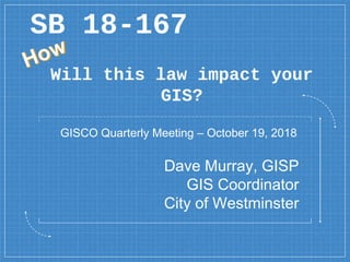
  • 1. Will this law impact your GIS? SB 18-167 Dave Murray, GISP GIS Coordinator City of Westminster GISCO Quarterly Meeting – October 19, 2018
  • 3. 3 2b: introduced from or produced outside the organism or system specifically : not synthesized within the organism or system
  • 4. Exogenous GIS Events  Telecom 5G – Small Cell Sites  Senate Bill 18-167 – Utility Locates  Liquor Licenses  Marijuana Licenses  2022  Others… 4
  • 5. Exogenous GIS Events  Google maps 5
  • 6. Exogenous GIS Events  HTTPS: 6 Works Just fine on another computer->
  • 7. 7
  • 8. 8
  • 10. 10
  • 11. What? Current Excavation Damage Prevention Law  Before conducting an excavation Contact Colorado 811 (Utility Notification Center of Colorado)  They contact the owners of the underground facilities based on tier type  Violations enforced through civil actions by damaged parties 11
  • 12. Why? Enforcement is Inadequate  According to the United States Department of Transportation's Pipeline and Hazardous Materials (PHMSA) 2016 report  Which may eventually result in the WITHOLDING OF FEDERAL FUNDS FROM COLORADO 12
  • 13.
  • 15. Senate Bill 18-167 Underground Damage Prevention Safety Commission  Rule-making and enforcement authority  Colorado 811 is required to provide administrative support – Central resource  A review committee determines if a violation has been committed  Commission determines action on violation 15
  • 16. Senate bill 18-167 Follow the Money  Fines credited to damage prevention fund  Educational programming  Grants to improve the worker and public safety 16
  • 17. Which Tier? Currently  Tier 2 members - Local governments, special districts, cable and small telecom providers - Contacted directly by excavator  Tier 1 members – all the rest - Colorado 811 contacted directly 17
  • 18. Who? Now it gets interesting  Current law – Only the excavator can submit a location request to 811  SB 18-167 allows a licensed professional engineer to submit a location request  Engineer is required to ensure plans meet ASCE accuracy of underground facility standards. 18
  • 19. Tier No More Effective January 1, 2021  All underground facility owners and operators are full members  Colorado 811 will be contacted  ALL NEW UNDERGROUND FACILITIES INSTALLED AFTER JANUARY 1, 2020 MUST BE ELECTRONICALLY LOCATABLE WHEN INSTALLED.  Home rule local governments must adopt safety program or create their own. 19
  • 20. GIS Community Impact? Our Data is a starting point  Currently used as a starting point  Future – Source with on-the-ground updates  Closely linked to GPS  Used in ways we have not imagined 20
  • 22. 22  You do not want to accept liability base on GIS coordinates that have not been verified  Where does your GIS come from?  How do you verify locations?  How is the GIS data used?  Do you have solid disclaimers?  Do you have metadata?
  • 23. The line is a bit foggy 23
  • 24. 24 This guideline is a protocol for engineers to use in rendering a professional opinion about the quality and reliability of utility information depicted on excavation plans. By following the process spelled out in ASCE 38-02, an engineer can quantify the quality of the utility information in terms that a lay person or non-engineer can understand. ASCE 38-02 defines four distinct levels of quality with respect to utility information. The quality of the utility information is ranked from the most reliable, Quality Level A, to the least reliable, Quality Level D. http://www2.apwa.net/documents/About/TechSvcs/ROW/Products/Locating_private_utilities_i n_the_pub_ROW-9-06.pdf ASCE 38-02
  • 25. 25 Standard Guideline for the Collection and Depiction of Existing Subsurface Utility Data CI/ASCE 38-02
  • 26. 26  Quality Level D Information derived from existing records or oral recollections. -> GIS and those that are in the know https://www.etsy.com/listing/99913462/pirate-ship-and-buried-treasure- map?gpla=1&gao=1&utm_campaign=shopping_us_danadecals_sfc_osa&utm_medium=cpc&utm_source=google&utm_custom1=0&utm_content=6668580&gclid=EAIaIQobChMIvMDv4o- O3gIVChhpCh37Sg15EAQYASABEgIbpPD_BwE
  • 27. 27  Quality Level C Information obtained by surveying and plotting visible above-ground utility features and by using professional judgment in correlating this information to quality level D information. -> GIS and survey grade GPS https://www.google.com/search?biw=2048&bih=723&tbm=isch&sa=1&ei=zYHHW5OaAaXYjwSa_bioDA&q=gis+survey+map&oq=gis+survey+map&gs_l=img.3..0i24.157841.160807..161190...0.0 ..0.70.787.14......0....1..gws-wiz-img.......0j0i67j0i5i30j0i8i30j0i10i24j0i30.0M-LT83-FK0#imgrc=vpnwusmbqDYujM:
  • 28. 28  Quality Level B Information obtained through the application of appropriate surface geophysical methods to determine the existence and approximate horizontal position of subsurface utilities. Quality level B data should be reproducible by surface geophysics at any point of their depiction. This information is surveyed to applicable tolerances defined by the project and reduced onto plan documents. https://www.google.com/search?biw=2048&bih=723&tbm=isch&s a=1&ei=zYHHW5OaAaXYjwSa_bioDA&q=ground+penetrating+r adar&oq=ground+penetrating+r&gs_l=img.1.0.0l10.2337.6881..1 0198...0.0..0.74.1086.20......0....1..gws-wiz- img.......0i67.ZpLix7foMCY#imgrc=VtSiwId4HixsQM:
  • 30. 30  Quality Level A Precise horizontal and vertical location of utilities obtained by the actual exposure (or verification of previously exposed and surveyed utilities) and subsequent measurement of subsurface utilities, usually at a specific point. Minimally intrusive excavation equipment is typically used to minimize the potential for utility damage. A precise horizontal and vertical location, as well as other utility attributes, is shown on plan documents. Accuracy is typically set to 15-mm vertical and to applicable horizontal survey and mapping accuracy as defined or expected by the project owner.
  • 36. 36 What are the Next Steps Review your Data Know how your Data was Collected Know how to represent your Data Last but not least: https://www.google.com/search?tbm=isch&source=hp&biw=1288&bih=670&ei=bBjGW- 3INITTjwSg5YbAAw&q=metadata&oq=metadata&gs_l=img.3.0.0l10.1287.3260..3538...0.0..0.371.2365.2-5j3......0....1..gws-wiz-img.......0i10.9S6zuW6Yrq0#imgrc=o_TfFtBUoVUM4M:
  • 38. 2022