SlideShare a Scribd company logo
1 of 40
Download to read offline
+ 1
+
Date 9/20/2018
Elizabeth McCartney
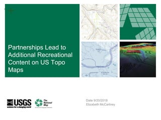
Partnerships Lead to
Additional Recreational
Content on US Topo
Maps
+ 2
+ 2
Introduction
● US Topo content over time
● Protected lands
● Partners
● Trails
● Recreational Points of Interest
● Data access
● Future Steps
+ 3
+ 3
US Topo Map
https://viewer.nationalmap.gov/basic
/?basemap=b1&category=histtopo,u
stopo&title=Map%20View
US Topo
+ 4
US Topo Content Over Time
2009, 2010, 2011, 2012, 2013, 2014, 2015, 2016,
2017, 2018, 2019
▪ Ortho-rectified Aerial Imagery
▪ Roads (Commercial Source)
▪ Names
▪ Elevation Contours
▪ Hydrography
▪ State/County/USFS Boundaries
▪ Runways, Woodlands
▪ Railroads
▪ Public Land Survey System
▪ Fire Stations, Hospitals, Schools
▪ USFS Roads
▪ Military Boundaries
▪ Cemeteries, Post Offices
▪ State Capito
▪ Shaded Relief
▪ USFS Trails
▪ FWS Boundaries
▪ State Capital Buildings
▪ Police Stations
▪ Correctional Facilities
▪ Alaska State Park Trails
▪ IMBA Trails
▪ National Scenic Trails
▪ Additional state trails
▪ Recreational features pilot (trailheads,
visitor centers, campgrounds)
▪ Additional state trails
▪ Trailheads, visitor centers,
campgrounds
▪ Historic Sites, Memorials, Monuments
▪ Headquarters, Ranger stations,
Cabins
▪ FWS Wetlands (Freshwater Emergent
and Freshwater Forested/Shrub
+ 5
+ 5
USGS Products Over Time
2011 2013 2016
Eldorado Springs Quad in Colorado - Colorado Department of Natural Resources, Eldorado
Canyon State Park.
+ 6
+ 6
Protected Areas Database of United States
(PAD-US)
+ 7
+ 7Trail Collaboration Efforts - Partners
U.S. Forest Service
109,264 miles of trails
+ 8
+ 8Uncompahgre
National
Forest
+ 9
+ 9Trail Collaboration Efforts - Partners
Fish and Wildlife Service
3,980 miles of trails
+ 10
+ 10Tamarac National
Wildlife Refuge
+ 11
+ 11Trail Collaboration Efforts - Partners
National Park Service
13,167 miles of trails
+ 12
+ 12Yellowstone
National
Park
+ 13
+ 13Trail Collaboration Efforts - Partners
Bureau of Land Management
479 miles of trails
+ 14
+ 14Trail Collaboration Efforts - Partners
National Scenic Trail System
Combined 12,685 miles of trails
+ 15
+ 15Trail Collaboration Efforts - Partners
Appalachian National
Scenic Trail
Appalachian Trail
Conservancy (NPS)
2,125 miles of trails
+ 16
+ 16Trail Collaboration Efforts - Partners
North Country National Scenic Trail
North County Trail Organization (NPS) 2,223 miles of trails
+ 17
+ 17
Trail Collaboration
Efforts - Partners
Continental Divide
National
Scenic Trail
Continental Divide Trail Coalition
(USFS)
2,170 miles of trails
+ 18
+ 18
Trail Collaboration
Efforts - Partners
New England National
Scenic Trail
Appalachian Mountain Club and
Connecticut Forest & Park
Association (NPS)
226 miles of trails
+ 19
+ 19Trail Collaboration Efforts - Partners
Arizona National Scenic Trail
Arizona Trail
Association (USFS)
785 miles of trails
+ 20
+ 20Trail Collaboration Efforts - Partners
Pacific Northwest Scenic Trail
USFS Region 6 1,204 miles of trails
+ 21
+ 21
Trail Collaboration
Efforts - Partners
Pacific Crest National
Scenic Trail
US Forest Service
2,570 miles of trails
+ 22
+ 22
Trail Collaboration Efforts - Partners
Florida National Scenic Trail
US Forest Service 1,130 miles of trails
+ 23
+ 23Trail Collaboration Efforts - Partners
Ice Age National Scenic Trail
Ice Age Trail Alliance (NPS) 668 miles of trails
+ 24
+ 24Trail Collaboration Efforts - Partners
States
Combined 12,847 mi
+ 25
+ 25Trail Collaboration Efforts - Partners
Alaska
Alaska Department of Natural Resources 716 miles of trails
+ 26
+ 26Trail Collaboration Efforts - Partners
Alaska DNR 716 mi
West Virginia
West Virginia GIS Technical Center 2,491 miles of trails
+ 27
+ 27Trail Collaboration Efforts - Partners
Michigan
Michigan Department of Natural Resources 9,027 miles of trails
+ 28
+ 28Trail Collaboration Efforts - Partners
Colorado
Colorado Department of Natural Resources 621 miles of trails
+ 29
+ 29Trail Collaboration Efforts - Partners
Adventure Projects / International Mountain Bike
Association
22,222 miles of trails
+ 30
+ 30Colorado Front Range
+ 31
+ 31Trail Collaboration Efforts - Partners
Aggregated Trails - USGS
~200,000 mi
+ 32
+ 32
Recreational Points of Interest
Features
+ 34
+ 34Data Access - USGS Products & Services
The National Map Viewer
https://viewer.nationalmap.gov/advanced-viewer/
+ 35
+ 35
Data Download - The National Map Viewer / FTP
ftp://rockyftp.cr.usgs.gov/vdelivery/Datasets/Staged/
https://viewer.nationalmap.gov/basic/
Data Access - USGS Products & Services
+ 36
+ 36
Services - REST, WMS, ArcGIS, ArcMap
US Topo Map
https://viewer.nationalmap.gov/services/
Data Access - USGS Products & Services
+ 37
+ 37
Future Steps
The USGS is the only aggregated source of public
domain trails and recreation data over
public/protected lands
● Increase partnerships
● Streamline data integration
● Leverage Crowdsourcing
○ TNMCorps
○ Other Partners
+ 38
+ 38
The End
Questions / Comments / Ideas
Elizabeth McCartney
emccartney@USGS.GOV
Greg Matthews
gdmatthews@usgs.gov
+ 39
+ 39
Recreational Points of Interest
Examples
In the following comparison, you can see the addition of six trailhead symbols, two picnic areas,
several new trail systems, and the Little River Gorge Road. The map looks much more complete
thanks to the addition of the new National Park Service features.
+ 40
+ 40
Recreational Points of Interest
Examples
In the following comparison, you can see the addition of four recreational symbols, including a
picnic area, campground, trailhead and observation tower. The Great Smoky Mountain National
Park boundary is now bounding the Foothills Parkway road.
+ 41
+ 41
Recreational Points of Interest
Examples
In the following comparison, you can see the addition of a campground along the newly
acquired Cane Creek Trail. Also, the park boundary is now present along with the new title of
Great Smoky Mountains National Park.

More Related Content

Similar to 2018 GIS in Development: Partnerships Lead to Additional Recreational Content On US Topo Maps

Economic Benefits of Bicycling
Economic Benefits of BicyclingEconomic Benefits of Bicycling
Economic Benefits of BicyclingJocelyn Bergh
 
20101101 general implementation usbrs
20101101 general implementation usbrs20101101 general implementation usbrs
20101101 general implementation usbrsWinona Bateman
 
Sharp presentation
Sharp presentationSharp presentation
Sharp presentationRPO America
 
Regional Planning Partnerships
Regional Planning PartnershipsRegional Planning Partnerships
Regional Planning PartnershipsRPO America
 
Champ can trail action plan ppt
Champ can trail action plan pptChamp can trail action plan ppt
Champ can trail action plan pptNelson Ronsvalle
 
Planning for Bicycling and Pedestrian Accommodations
Planning for Bicycling and Pedestrian AccommodationsPlanning for Bicycling and Pedestrian Accommodations
Planning for Bicycling and Pedestrian AccommodationsRPO America
 
Lost Creek Blvd.: Security and Safety
Lost Creek Blvd.: Security and SafetyLost Creek Blvd.: Security and Safety
Lost Creek Blvd.: Security and SafetyPaul Schumann
 
2017 GIS in Conservation Track: Using Python and Selenium to Make Geographica...
2017 GIS in Conservation Track: Using Python and Selenium to Make Geographica...2017 GIS in Conservation Track: Using Python and Selenium to Make Geographica...
2017 GIS in Conservation Track: Using Python and Selenium to Make Geographica...GIS in the Rockies
 
Trans-sierra Transportation Coalition
Trans-sierra Transportation CoalitionTrans-sierra Transportation Coalition
Trans-sierra Transportation CoalitionRPO America
 
Springfield District 2018 Paving and Restriping: Public Information Meeting A...
Springfield District 2018 Paving and Restriping: Public Information Meeting A...Springfield District 2018 Paving and Restriping: Public Information Meeting A...
Springfield District 2018 Paving and Restriping: Public Information Meeting A...Fairfax County
 
Pennsylvania Land and Water Trail Network Strategic Plan
Pennsylvania Land and Water Trail Network Strategic PlanPennsylvania Land and Water Trail Network Strategic Plan
Pennsylvania Land and Water Trail Network Strategic PlanHannah Greenberg
 
Planning Partnerships in No. Arizona
Planning Partnerships in No. ArizonaPlanning Partnerships in No. Arizona
Planning Partnerships in No. ArizonaRPO America
 
2018 GIS in Recreation: Virtually Touring the National Trails
2018 GIS in Recreation: Virtually Touring the National Trails2018 GIS in Recreation: Virtually Touring the National Trails
2018 GIS in Recreation: Virtually Touring the National TrailsGIS in the Rockies
 
Champlain Canal Trail Planning
Champlain Canal Trail PlanningChamplain Canal Trail Planning
Champlain Canal Trail PlanningNelson Ronsvalle
 
Champlain Canalway Trail Plan
Champlain Canalway Trail PlanChamplain Canalway Trail Plan
Champlain Canalway Trail PlanNelson Ronsvalle
 
The Minneapolis Bicycle Story David Peterson
The Minneapolis Bicycle Story David PetersonThe Minneapolis Bicycle Story David Peterson
The Minneapolis Bicycle Story David PetersonTrailnet
 
GIS in the Miami Valley Region
GIS in the Miami Valley RegionGIS in the Miami Valley Region
GIS in the Miami Valley RegionMVRPC
 

Similar to 2018 GIS in Development: Partnerships Lead to Additional Recreational Content On US Topo Maps (20)

Economic Benefits of Bicycling
Economic Benefits of BicyclingEconomic Benefits of Bicycling
Economic Benefits of Bicycling
 
20101101 general implementation usbrs
20101101 general implementation usbrs20101101 general implementation usbrs
20101101 general implementation usbrs
 
Sharp presentation
Sharp presentationSharp presentation
Sharp presentation
 
Regional Planning Partnerships
Regional Planning PartnershipsRegional Planning Partnerships
Regional Planning Partnerships
 
Complete Freeways: Evaluation of Florida's Bicycles on Limited Access Facilit...
Complete Freeways: Evaluation of Florida's Bicycles on Limited Access Facilit...Complete Freeways: Evaluation of Florida's Bicycles on Limited Access Facilit...
Complete Freeways: Evaluation of Florida's Bicycles on Limited Access Facilit...
 
Champ can trail action plan ppt
Champ can trail action plan pptChamp can trail action plan ppt
Champ can trail action plan ppt
 
Planning for Bicycling and Pedestrian Accommodations
Planning for Bicycling and Pedestrian AccommodationsPlanning for Bicycling and Pedestrian Accommodations
Planning for Bicycling and Pedestrian Accommodations
 
Lost Creek Blvd.: Security and Safety
Lost Creek Blvd.: Security and SafetyLost Creek Blvd.: Security and Safety
Lost Creek Blvd.: Security and Safety
 
2017 GIS in Conservation Track: Using Python and Selenium to Make Geographica...
2017 GIS in Conservation Track: Using Python and Selenium to Make Geographica...2017 GIS in Conservation Track: Using Python and Selenium to Make Geographica...
2017 GIS in Conservation Track: Using Python and Selenium to Make Geographica...
 
Trans-sierra Transportation Coalition
Trans-sierra Transportation CoalitionTrans-sierra Transportation Coalition
Trans-sierra Transportation Coalition
 
Springfield District 2018 Paving and Restriping: Public Information Meeting A...
Springfield District 2018 Paving and Restriping: Public Information Meeting A...Springfield District 2018 Paving and Restriping: Public Information Meeting A...
Springfield District 2018 Paving and Restriping: Public Information Meeting A...
 
ASCE OC Luncheon - Sustainability in Transportation Part 2
ASCE OC Luncheon - Sustainability in Transportation Part 2ASCE OC Luncheon - Sustainability in Transportation Part 2
ASCE OC Luncheon - Sustainability in Transportation Part 2
 
Pennsylvania Land and Water Trail Network Strategic Plan
Pennsylvania Land and Water Trail Network Strategic PlanPennsylvania Land and Water Trail Network Strategic Plan
Pennsylvania Land and Water Trail Network Strategic Plan
 
Planning Partnerships in No. Arizona
Planning Partnerships in No. ArizonaPlanning Partnerships in No. Arizona
Planning Partnerships in No. Arizona
 
2018 GIS in Recreation: Virtually Touring the National Trails
2018 GIS in Recreation: Virtually Touring the National Trails2018 GIS in Recreation: Virtually Touring the National Trails
2018 GIS in Recreation: Virtually Touring the National Trails
 
Champlain Canal Trail Planning
Champlain Canal Trail PlanningChamplain Canal Trail Planning
Champlain Canal Trail Planning
 
Champlain Canalway Trail Plan
Champlain Canalway Trail PlanChamplain Canalway Trail Plan
Champlain Canalway Trail Plan
 
The Minneapolis Bicycle Story David Peterson
The Minneapolis Bicycle Story David PetersonThe Minneapolis Bicycle Story David Peterson
The Minneapolis Bicycle Story David Peterson
 
TeamTX Austin 2015 Presentations
TeamTX Austin 2015 PresentationsTeamTX Austin 2015 Presentations
TeamTX Austin 2015 Presentations
 
GIS in the Miami Valley Region
GIS in the Miami Valley RegionGIS in the Miami Valley Region
GIS in the Miami Valley Region
 

More from GIS in the Rockies

GISCO Fall 2018: Bike Network Equity: A GIS and Qualitative Analysis of Ameri...
GISCO Fall 2018: Bike Network Equity: A GIS and Qualitative Analysis of Ameri...GISCO Fall 2018: Bike Network Equity: A GIS and Qualitative Analysis of Ameri...
GISCO Fall 2018: Bike Network Equity: A GIS and Qualitative Analysis of Ameri...GIS in the Rockies
 
GISCO Fall 2018: Colorado 811: Changes and Challenges – Brian Collison
GISCO Fall 2018: Colorado 811: Changes and Challenges – Brian CollisonGISCO Fall 2018: Colorado 811: Changes and Challenges – Brian Collison
GISCO Fall 2018: Colorado 811: Changes and Challenges – Brian CollisonGIS in the Rockies
 
GISCO Fall 2018: Senate Bill 18-167 and GIS – Dave Murray
GISCO Fall 2018: Senate Bill 18-167 and GIS – Dave MurrayGISCO Fall 2018: Senate Bill 18-167 and GIS – Dave Murray
GISCO Fall 2018: Senate Bill 18-167 and GIS – Dave MurrayGIS in the Rockies
 
2018 GIS in the Rockies Workshop: Coordinate Systems and Projections
2018 GIS in the Rockies Workshop: Coordinate Systems and Projections 2018 GIS in the Rockies Workshop: Coordinate Systems and Projections
2018 GIS in the Rockies Workshop: Coordinate Systems and Projections GIS in the Rockies
 
2018 GIS in Emergency Management: Denver Office of Emergency Management Overview
2018 GIS in Emergency Management: Denver Office of Emergency Management Overview2018 GIS in Emergency Management: Denver Office of Emergency Management Overview
2018 GIS in Emergency Management: Denver Office of Emergency Management OverviewGIS in the Rockies
 
2018 GIS in the Rockies Vendor Showcase (Th): The Data Driven Government
2018 GIS in the Rockies Vendor Showcase (Th): The Data Driven Government2018 GIS in the Rockies Vendor Showcase (Th): The Data Driven Government
2018 GIS in the Rockies Vendor Showcase (Th): The Data Driven GovernmentGIS in the Rockies
 
2018 GIS in the Rockies Vendor Showcase (Th): Solving Real World Issues With ...
2018 GIS in the Rockies Vendor Showcase (Th): Solving Real World Issues With ...2018 GIS in the Rockies Vendor Showcase (Th): Solving Real World Issues With ...
2018 GIS in the Rockies Vendor Showcase (Th): Solving Real World Issues With ...GIS in the Rockies
 
2018 GIS in the Rockies Vendor Showcase (Th): ERDAS Imagine What's New and Ti...
2018 GIS in the Rockies Vendor Showcase (Th): ERDAS Imagine What's New and Ti...2018 GIS in the Rockies Vendor Showcase (Th): ERDAS Imagine What's New and Ti...
2018 GIS in the Rockies Vendor Showcase (Th): ERDAS Imagine What's New and Ti...GIS in the Rockies
 
2018 GIS in the Rockies Vendor Showcase (Th): Building High Performance Gover...
2018 GIS in the Rockies Vendor Showcase (Th): Building High Performance Gover...2018 GIS in the Rockies Vendor Showcase (Th): Building High Performance Gover...
2018 GIS in the Rockies Vendor Showcase (Th): Building High Performance Gover...GIS in the Rockies
 
2018 GIS in Recreation: The Making of a Trail
2018 GIS in Recreation: The Making of a Trail2018 GIS in Recreation: The Making of a Trail
2018 GIS in Recreation: The Making of a TrailGIS in the Rockies
 
2018 GIS in Recreation: The Latest Trail Technology Crowdsourcing Maps and Apps
2018 GIS in Recreation: The Latest Trail Technology Crowdsourcing Maps and Apps2018 GIS in Recreation: The Latest Trail Technology Crowdsourcing Maps and Apps
2018 GIS in Recreation: The Latest Trail Technology Crowdsourcing Maps and AppsGIS in the Rockies
 
2018 GIS in the Rockies: Riparian Shrub Assessment of the Mancos River Canyon...
2018 GIS in the Rockies: Riparian Shrub Assessment of the Mancos River Canyon...2018 GIS in the Rockies: Riparian Shrub Assessment of the Mancos River Canyon...
2018 GIS in the Rockies: Riparian Shrub Assessment of the Mancos River Canyon...GIS in the Rockies
 
2018 GIS in Recreation: Adding Value to Colorado the Beautiful Initiative carr
2018 GIS in Recreation: Adding Value to Colorado the Beautiful Initiative carr2018 GIS in Recreation: Adding Value to Colorado the Beautiful Initiative carr
2018 GIS in Recreation: Adding Value to Colorado the Beautiful Initiative carrGIS in the Rockies
 
2018 GIS in Recreation: A Creek Runs Through It
2018 GIS in Recreation: A Creek Runs Through It2018 GIS in Recreation: A Creek Runs Through It
2018 GIS in Recreation: A Creek Runs Through ItGIS in the Rockies
 
2018 GIS in the Rockies PLSC Track: Turning Towards the Future
2018 GIS in the Rockies PLSC Track: Turning Towards the Future2018 GIS in the Rockies PLSC Track: Turning Towards the Future
2018 GIS in the Rockies PLSC Track: Turning Towards the FutureGIS in the Rockies
 
2018 GIS in the Rockies PLSC: Intro to PLSS
2018 GIS in the Rockies PLSC: Intro to PLSS2018 GIS in the Rockies PLSC: Intro to PLSS
2018 GIS in the Rockies PLSC: Intro to PLSSGIS in the Rockies
 
2018 GIS in the Rockies PLSC Track: Grid to Ground NATRF2022
2018 GIS in the Rockies PLSC Track: Grid to Ground NATRF20222018 GIS in the Rockies PLSC Track: Grid to Ground NATRF2022
2018 GIS in the Rockies PLSC Track: Grid to Ground NATRF2022GIS in the Rockies
 
2018 GIS in Development: USGS and Citizen Science Success and Enhancements fo...
2018 GIS in Development: USGS and Citizen Science Success and Enhancements fo...2018 GIS in Development: USGS and Citizen Science Success and Enhancements fo...
2018 GIS in Development: USGS and Citizen Science Success and Enhancements fo...GIS in the Rockies
 
2018 GIS in Development: Semantic Web
2018 GIS in Development: Semantic Web2018 GIS in Development: Semantic Web
2018 GIS in Development: Semantic WebGIS in the Rockies
 
2018 GIS in Development: Look Ma, No Server and Big Data Using Serverless Fun...
2018 GIS in Development: Look Ma, No Server and Big Data Using Serverless Fun...2018 GIS in Development: Look Ma, No Server and Big Data Using Serverless Fun...
2018 GIS in Development: Look Ma, No Server and Big Data Using Serverless Fun...GIS in the Rockies
 

More from GIS in the Rockies (20)

GISCO Fall 2018: Bike Network Equity: A GIS and Qualitative Analysis of Ameri...
GISCO Fall 2018: Bike Network Equity: A GIS and Qualitative Analysis of Ameri...GISCO Fall 2018: Bike Network Equity: A GIS and Qualitative Analysis of Ameri...
GISCO Fall 2018: Bike Network Equity: A GIS and Qualitative Analysis of Ameri...
 
GISCO Fall 2018: Colorado 811: Changes and Challenges – Brian Collison
GISCO Fall 2018: Colorado 811: Changes and Challenges – Brian CollisonGISCO Fall 2018: Colorado 811: Changes and Challenges – Brian Collison
GISCO Fall 2018: Colorado 811: Changes and Challenges – Brian Collison
 
GISCO Fall 2018: Senate Bill 18-167 and GIS – Dave Murray
GISCO Fall 2018: Senate Bill 18-167 and GIS – Dave MurrayGISCO Fall 2018: Senate Bill 18-167 and GIS – Dave Murray
GISCO Fall 2018: Senate Bill 18-167 and GIS – Dave Murray
 
2018 GIS in the Rockies Workshop: Coordinate Systems and Projections
2018 GIS in the Rockies Workshop: Coordinate Systems and Projections 2018 GIS in the Rockies Workshop: Coordinate Systems and Projections
2018 GIS in the Rockies Workshop: Coordinate Systems and Projections
 
2018 GIS in Emergency Management: Denver Office of Emergency Management Overview
2018 GIS in Emergency Management: Denver Office of Emergency Management Overview2018 GIS in Emergency Management: Denver Office of Emergency Management Overview
2018 GIS in Emergency Management: Denver Office of Emergency Management Overview
 
2018 GIS in the Rockies Vendor Showcase (Th): The Data Driven Government
2018 GIS in the Rockies Vendor Showcase (Th): The Data Driven Government2018 GIS in the Rockies Vendor Showcase (Th): The Data Driven Government
2018 GIS in the Rockies Vendor Showcase (Th): The Data Driven Government
 
2018 GIS in the Rockies Vendor Showcase (Th): Solving Real World Issues With ...
2018 GIS in the Rockies Vendor Showcase (Th): Solving Real World Issues With ...2018 GIS in the Rockies Vendor Showcase (Th): Solving Real World Issues With ...
2018 GIS in the Rockies Vendor Showcase (Th): Solving Real World Issues With ...
 
2018 GIS in the Rockies Vendor Showcase (Th): ERDAS Imagine What's New and Ti...
2018 GIS in the Rockies Vendor Showcase (Th): ERDAS Imagine What's New and Ti...2018 GIS in the Rockies Vendor Showcase (Th): ERDAS Imagine What's New and Ti...
2018 GIS in the Rockies Vendor Showcase (Th): ERDAS Imagine What's New and Ti...
 
2018 GIS in the Rockies Vendor Showcase (Th): Building High Performance Gover...
2018 GIS in the Rockies Vendor Showcase (Th): Building High Performance Gover...2018 GIS in the Rockies Vendor Showcase (Th): Building High Performance Gover...
2018 GIS in the Rockies Vendor Showcase (Th): Building High Performance Gover...
 
2018 GIS in Recreation: The Making of a Trail
2018 GIS in Recreation: The Making of a Trail2018 GIS in Recreation: The Making of a Trail
2018 GIS in Recreation: The Making of a Trail
 
2018 GIS in Recreation: The Latest Trail Technology Crowdsourcing Maps and Apps
2018 GIS in Recreation: The Latest Trail Technology Crowdsourcing Maps and Apps2018 GIS in Recreation: The Latest Trail Technology Crowdsourcing Maps and Apps
2018 GIS in Recreation: The Latest Trail Technology Crowdsourcing Maps and Apps
 
2018 GIS in the Rockies: Riparian Shrub Assessment of the Mancos River Canyon...
2018 GIS in the Rockies: Riparian Shrub Assessment of the Mancos River Canyon...2018 GIS in the Rockies: Riparian Shrub Assessment of the Mancos River Canyon...
2018 GIS in the Rockies: Riparian Shrub Assessment of the Mancos River Canyon...
 
2018 GIS in Recreation: Adding Value to Colorado the Beautiful Initiative carr
2018 GIS in Recreation: Adding Value to Colorado the Beautiful Initiative carr2018 GIS in Recreation: Adding Value to Colorado the Beautiful Initiative carr
2018 GIS in Recreation: Adding Value to Colorado the Beautiful Initiative carr
 
2018 GIS in Recreation: A Creek Runs Through It
2018 GIS in Recreation: A Creek Runs Through It2018 GIS in Recreation: A Creek Runs Through It
2018 GIS in Recreation: A Creek Runs Through It
 
2018 GIS in the Rockies PLSC Track: Turning Towards the Future
2018 GIS in the Rockies PLSC Track: Turning Towards the Future2018 GIS in the Rockies PLSC Track: Turning Towards the Future
2018 GIS in the Rockies PLSC Track: Turning Towards the Future
 
2018 GIS in the Rockies PLSC: Intro to PLSS
2018 GIS in the Rockies PLSC: Intro to PLSS2018 GIS in the Rockies PLSC: Intro to PLSS
2018 GIS in the Rockies PLSC: Intro to PLSS
 
2018 GIS in the Rockies PLSC Track: Grid to Ground NATRF2022
2018 GIS in the Rockies PLSC Track: Grid to Ground NATRF20222018 GIS in the Rockies PLSC Track: Grid to Ground NATRF2022
2018 GIS in the Rockies PLSC Track: Grid to Ground NATRF2022
 
2018 GIS in Development: USGS and Citizen Science Success and Enhancements fo...
2018 GIS in Development: USGS and Citizen Science Success and Enhancements fo...2018 GIS in Development: USGS and Citizen Science Success and Enhancements fo...
2018 GIS in Development: USGS and Citizen Science Success and Enhancements fo...
 
2018 GIS in Development: Semantic Web
2018 GIS in Development: Semantic Web2018 GIS in Development: Semantic Web
2018 GIS in Development: Semantic Web
 
2018 GIS in Development: Look Ma, No Server and Big Data Using Serverless Fun...
2018 GIS in Development: Look Ma, No Server and Big Data Using Serverless Fun...2018 GIS in Development: Look Ma, No Server and Big Data Using Serverless Fun...
2018 GIS in Development: Look Ma, No Server and Big Data Using Serverless Fun...
 

Recently uploaded

Unraveling Multimodality with Large Language Models.pdf
Unraveling Multimodality with Large Language Models.pdfUnraveling Multimodality with Large Language Models.pdf
Unraveling Multimodality with Large Language Models.pdfAlex Barbosa Coqueiro
 
My Hashitalk Indonesia April 2024 Presentation
My Hashitalk Indonesia April 2024 PresentationMy Hashitalk Indonesia April 2024 Presentation
My Hashitalk Indonesia April 2024 PresentationRidwan Fadjar
 
New from BookNet Canada for 2024: BNC CataList - Tech Forum 2024
New from BookNet Canada for 2024: BNC CataList - Tech Forum 2024New from BookNet Canada for 2024: BNC CataList - Tech Forum 2024
New from BookNet Canada for 2024: BNC CataList - Tech Forum 2024BookNet Canada
 
Artificial intelligence in cctv survelliance.pptx
Artificial intelligence in cctv survelliance.pptxArtificial intelligence in cctv survelliance.pptx
Artificial intelligence in cctv survelliance.pptxhariprasad279825
 
Tech-Forward - Achieving Business Readiness For Copilot in Microsoft 365
Tech-Forward - Achieving Business Readiness For Copilot in Microsoft 365Tech-Forward - Achieving Business Readiness For Copilot in Microsoft 365
Tech-Forward - Achieving Business Readiness For Copilot in Microsoft 3652toLead Limited
 
Powerpoint exploring the locations used in television show Time Clash
Powerpoint exploring the locations used in television show Time ClashPowerpoint exploring the locations used in television show Time Clash
Powerpoint exploring the locations used in television show Time Clashcharlottematthew16
 
WordPress Websites for Engineers: Elevate Your Brand
WordPress Websites for Engineers: Elevate Your BrandWordPress Websites for Engineers: Elevate Your Brand
WordPress Websites for Engineers: Elevate Your Brandgvaughan
 
Understanding the Laravel MVC Architecture
Understanding the Laravel MVC ArchitectureUnderstanding the Laravel MVC Architecture
Understanding the Laravel MVC ArchitecturePixlogix Infotech
 
Advanced Test Driven-Development @ php[tek] 2024
Advanced Test Driven-Development @ php[tek] 2024Advanced Test Driven-Development @ php[tek] 2024
Advanced Test Driven-Development @ php[tek] 2024Scott Keck-Warren
 
"Federated learning: out of reach no matter how close",Oleksandr Lapshyn
"Federated learning: out of reach no matter how close",Oleksandr Lapshyn"Federated learning: out of reach no matter how close",Oleksandr Lapshyn
"Federated learning: out of reach no matter how close",Oleksandr LapshynFwdays
 
Scanning the Internet for External Cloud Exposures via SSL Certs
Scanning the Internet for External Cloud Exposures via SSL CertsScanning the Internet for External Cloud Exposures via SSL Certs
Scanning the Internet for External Cloud Exposures via SSL CertsRizwan Syed
 
"Debugging python applications inside k8s environment", Andrii Soldatenko
"Debugging python applications inside k8s environment", Andrii Soldatenko"Debugging python applications inside k8s environment", Andrii Soldatenko
"Debugging python applications inside k8s environment", Andrii SoldatenkoFwdays
 
Tampa BSides - Chef's Tour of Microsoft Security Adoption Framework (SAF)
Tampa BSides - Chef's Tour of Microsoft Security Adoption Framework (SAF)Tampa BSides - Chef's Tour of Microsoft Security Adoption Framework (SAF)
Tampa BSides - Chef's Tour of Microsoft Security Adoption Framework (SAF)Mark Simos
 
Developer Data Modeling Mistakes: From Postgres to NoSQL
Developer Data Modeling Mistakes: From Postgres to NoSQLDeveloper Data Modeling Mistakes: From Postgres to NoSQL
Developer Data Modeling Mistakes: From Postgres to NoSQLScyllaDB
 
costume and set research powerpoint presentation
costume and set research powerpoint presentationcostume and set research powerpoint presentation
costume and set research powerpoint presentationphoebematthew05
 
Kotlin Multiplatform & Compose Multiplatform - Starter kit for pragmatics
Kotlin Multiplatform & Compose Multiplatform - Starter kit for pragmaticsKotlin Multiplatform & Compose Multiplatform - Starter kit for pragmatics
Kotlin Multiplatform & Compose Multiplatform - Starter kit for pragmaticscarlostorres15106
 
Ensuring Technical Readiness For Copilot in Microsoft 365
Ensuring Technical Readiness For Copilot in Microsoft 365Ensuring Technical Readiness For Copilot in Microsoft 365
Ensuring Technical Readiness For Copilot in Microsoft 3652toLead Limited
 
Nell’iperspazio con Rocket: il Framework Web di Rust!
Nell’iperspazio con Rocket: il Framework Web di Rust!Nell’iperspazio con Rocket: il Framework Web di Rust!
Nell’iperspazio con Rocket: il Framework Web di Rust!Commit University
 
Vertex AI Gemini Prompt Engineering Tips
Vertex AI Gemini Prompt Engineering TipsVertex AI Gemini Prompt Engineering Tips
Vertex AI Gemini Prompt Engineering TipsMiki Katsuragi
 
Designing IA for AI - Information Architecture Conference 2024
Designing IA for AI - Information Architecture Conference 2024Designing IA for AI - Information Architecture Conference 2024
Designing IA for AI - Information Architecture Conference 2024Enterprise Knowledge
 

Recently uploaded (20)

Unraveling Multimodality with Large Language Models.pdf
Unraveling Multimodality with Large Language Models.pdfUnraveling Multimodality with Large Language Models.pdf
Unraveling Multimodality with Large Language Models.pdf
 
My Hashitalk Indonesia April 2024 Presentation
My Hashitalk Indonesia April 2024 PresentationMy Hashitalk Indonesia April 2024 Presentation
My Hashitalk Indonesia April 2024 Presentation
 
New from BookNet Canada for 2024: BNC CataList - Tech Forum 2024
New from BookNet Canada for 2024: BNC CataList - Tech Forum 2024New from BookNet Canada for 2024: BNC CataList - Tech Forum 2024
New from BookNet Canada for 2024: BNC CataList - Tech Forum 2024
 
Artificial intelligence in cctv survelliance.pptx
Artificial intelligence in cctv survelliance.pptxArtificial intelligence in cctv survelliance.pptx
Artificial intelligence in cctv survelliance.pptx
 
Tech-Forward - Achieving Business Readiness For Copilot in Microsoft 365
Tech-Forward - Achieving Business Readiness For Copilot in Microsoft 365Tech-Forward - Achieving Business Readiness For Copilot in Microsoft 365
Tech-Forward - Achieving Business Readiness For Copilot in Microsoft 365
 
Powerpoint exploring the locations used in television show Time Clash
Powerpoint exploring the locations used in television show Time ClashPowerpoint exploring the locations used in television show Time Clash
Powerpoint exploring the locations used in television show Time Clash
 
WordPress Websites for Engineers: Elevate Your Brand
WordPress Websites for Engineers: Elevate Your BrandWordPress Websites for Engineers: Elevate Your Brand
WordPress Websites for Engineers: Elevate Your Brand
 
Understanding the Laravel MVC Architecture
Understanding the Laravel MVC ArchitectureUnderstanding the Laravel MVC Architecture
Understanding the Laravel MVC Architecture
 
Advanced Test Driven-Development @ php[tek] 2024
Advanced Test Driven-Development @ php[tek] 2024Advanced Test Driven-Development @ php[tek] 2024
Advanced Test Driven-Development @ php[tek] 2024
 
"Federated learning: out of reach no matter how close",Oleksandr Lapshyn
"Federated learning: out of reach no matter how close",Oleksandr Lapshyn"Federated learning: out of reach no matter how close",Oleksandr Lapshyn
"Federated learning: out of reach no matter how close",Oleksandr Lapshyn
 
Scanning the Internet for External Cloud Exposures via SSL Certs
Scanning the Internet for External Cloud Exposures via SSL CertsScanning the Internet for External Cloud Exposures via SSL Certs
Scanning the Internet for External Cloud Exposures via SSL Certs
 
"Debugging python applications inside k8s environment", Andrii Soldatenko
"Debugging python applications inside k8s environment", Andrii Soldatenko"Debugging python applications inside k8s environment", Andrii Soldatenko
"Debugging python applications inside k8s environment", Andrii Soldatenko
 
Tampa BSides - Chef's Tour of Microsoft Security Adoption Framework (SAF)
Tampa BSides - Chef's Tour of Microsoft Security Adoption Framework (SAF)Tampa BSides - Chef's Tour of Microsoft Security Adoption Framework (SAF)
Tampa BSides - Chef's Tour of Microsoft Security Adoption Framework (SAF)
 
Developer Data Modeling Mistakes: From Postgres to NoSQL
Developer Data Modeling Mistakes: From Postgres to NoSQLDeveloper Data Modeling Mistakes: From Postgres to NoSQL
Developer Data Modeling Mistakes: From Postgres to NoSQL
 
costume and set research powerpoint presentation
costume and set research powerpoint presentationcostume and set research powerpoint presentation
costume and set research powerpoint presentation
 
Kotlin Multiplatform & Compose Multiplatform - Starter kit for pragmatics
Kotlin Multiplatform & Compose Multiplatform - Starter kit for pragmaticsKotlin Multiplatform & Compose Multiplatform - Starter kit for pragmatics
Kotlin Multiplatform & Compose Multiplatform - Starter kit for pragmatics
 
Ensuring Technical Readiness For Copilot in Microsoft 365
Ensuring Technical Readiness For Copilot in Microsoft 365Ensuring Technical Readiness For Copilot in Microsoft 365
Ensuring Technical Readiness For Copilot in Microsoft 365
 
Nell’iperspazio con Rocket: il Framework Web di Rust!
Nell’iperspazio con Rocket: il Framework Web di Rust!Nell’iperspazio con Rocket: il Framework Web di Rust!
Nell’iperspazio con Rocket: il Framework Web di Rust!
 
Vertex AI Gemini Prompt Engineering Tips
Vertex AI Gemini Prompt Engineering TipsVertex AI Gemini Prompt Engineering Tips
Vertex AI Gemini Prompt Engineering Tips
 
Designing IA for AI - Information Architecture Conference 2024
Designing IA for AI - Information Architecture Conference 2024Designing IA for AI - Information Architecture Conference 2024
Designing IA for AI - Information Architecture Conference 2024
 

2018 GIS in Development: Partnerships Lead to Additional Recreational Content On US Topo Maps

  • 1. + 1 + Date 9/20/2018 Elizabeth McCartney Partnerships Lead to Additional Recreational Content on US Topo Maps
  • 2. + 2 + 2 Introduction ● US Topo content over time ● Protected lands ● Partners ● Trails ● Recreational Points of Interest ● Data access ● Future Steps
  • 3. + 3 + 3 US Topo Map https://viewer.nationalmap.gov/basic /?basemap=b1&category=histtopo,u stopo&title=Map%20View US Topo
  • 4. + 4 US Topo Content Over Time 2009, 2010, 2011, 2012, 2013, 2014, 2015, 2016, 2017, 2018, 2019 ▪ Ortho-rectified Aerial Imagery ▪ Roads (Commercial Source) ▪ Names ▪ Elevation Contours ▪ Hydrography ▪ State/County/USFS Boundaries ▪ Runways, Woodlands ▪ Railroads ▪ Public Land Survey System ▪ Fire Stations, Hospitals, Schools ▪ USFS Roads ▪ Military Boundaries ▪ Cemeteries, Post Offices ▪ State Capito ▪ Shaded Relief ▪ USFS Trails ▪ FWS Boundaries ▪ State Capital Buildings ▪ Police Stations ▪ Correctional Facilities ▪ Alaska State Park Trails ▪ IMBA Trails ▪ National Scenic Trails ▪ Additional state trails ▪ Recreational features pilot (trailheads, visitor centers, campgrounds) ▪ Additional state trails ▪ Trailheads, visitor centers, campgrounds ▪ Historic Sites, Memorials, Monuments ▪ Headquarters, Ranger stations, Cabins ▪ FWS Wetlands (Freshwater Emergent and Freshwater Forested/Shrub
  • 5. + 5 + 5 USGS Products Over Time 2011 2013 2016 Eldorado Springs Quad in Colorado - Colorado Department of Natural Resources, Eldorado Canyon State Park.
  • 6. + 6 + 6 Protected Areas Database of United States (PAD-US)
  • 7. + 7 + 7Trail Collaboration Efforts - Partners U.S. Forest Service 109,264 miles of trails
  • 9. + 9 + 9Trail Collaboration Efforts - Partners Fish and Wildlife Service 3,980 miles of trails
  • 10. + 10 + 10Tamarac National Wildlife Refuge
  • 11. + 11 + 11Trail Collaboration Efforts - Partners National Park Service 13,167 miles of trails
  • 13. + 13 + 13Trail Collaboration Efforts - Partners Bureau of Land Management 479 miles of trails
  • 14. + 14 + 14Trail Collaboration Efforts - Partners National Scenic Trail System Combined 12,685 miles of trails
  • 15. + 15 + 15Trail Collaboration Efforts - Partners Appalachian National Scenic Trail Appalachian Trail Conservancy (NPS) 2,125 miles of trails
  • 16. + 16 + 16Trail Collaboration Efforts - Partners North Country National Scenic Trail North County Trail Organization (NPS) 2,223 miles of trails
  • 17. + 17 + 17 Trail Collaboration Efforts - Partners Continental Divide National Scenic Trail Continental Divide Trail Coalition (USFS) 2,170 miles of trails
  • 18. + 18 + 18 Trail Collaboration Efforts - Partners New England National Scenic Trail Appalachian Mountain Club and Connecticut Forest & Park Association (NPS) 226 miles of trails
  • 19. + 19 + 19Trail Collaboration Efforts - Partners Arizona National Scenic Trail Arizona Trail Association (USFS) 785 miles of trails
  • 20. + 20 + 20Trail Collaboration Efforts - Partners Pacific Northwest Scenic Trail USFS Region 6 1,204 miles of trails
  • 21. + 21 + 21 Trail Collaboration Efforts - Partners Pacific Crest National Scenic Trail US Forest Service 2,570 miles of trails
  • 22. + 22 + 22 Trail Collaboration Efforts - Partners Florida National Scenic Trail US Forest Service 1,130 miles of trails
  • 23. + 23 + 23Trail Collaboration Efforts - Partners Ice Age National Scenic Trail Ice Age Trail Alliance (NPS) 668 miles of trails
  • 24. + 24 + 24Trail Collaboration Efforts - Partners States Combined 12,847 mi
  • 25. + 25 + 25Trail Collaboration Efforts - Partners Alaska Alaska Department of Natural Resources 716 miles of trails
  • 26. + 26 + 26Trail Collaboration Efforts - Partners Alaska DNR 716 mi West Virginia West Virginia GIS Technical Center 2,491 miles of trails
  • 27. + 27 + 27Trail Collaboration Efforts - Partners Michigan Michigan Department of Natural Resources 9,027 miles of trails
  • 28. + 28 + 28Trail Collaboration Efforts - Partners Colorado Colorado Department of Natural Resources 621 miles of trails
  • 29. + 29 + 29Trail Collaboration Efforts - Partners Adventure Projects / International Mountain Bike Association 22,222 miles of trails
  • 30. + 30 + 30Colorado Front Range
  • 31. + 31 + 31Trail Collaboration Efforts - Partners Aggregated Trails - USGS ~200,000 mi
  • 32. + 32 + 32 Recreational Points of Interest Features
  • 33. + 34 + 34Data Access - USGS Products & Services The National Map Viewer https://viewer.nationalmap.gov/advanced-viewer/
  • 34. + 35 + 35 Data Download - The National Map Viewer / FTP ftp://rockyftp.cr.usgs.gov/vdelivery/Datasets/Staged/ https://viewer.nationalmap.gov/basic/ Data Access - USGS Products & Services
  • 35. + 36 + 36 Services - REST, WMS, ArcGIS, ArcMap US Topo Map https://viewer.nationalmap.gov/services/ Data Access - USGS Products & Services
  • 36. + 37 + 37 Future Steps The USGS is the only aggregated source of public domain trails and recreation data over public/protected lands ● Increase partnerships ● Streamline data integration ● Leverage Crowdsourcing ○ TNMCorps ○ Other Partners
  • 37. + 38 + 38 The End Questions / Comments / Ideas Elizabeth McCartney emccartney@USGS.GOV Greg Matthews gdmatthews@usgs.gov
  • 38. + 39 + 39 Recreational Points of Interest Examples In the following comparison, you can see the addition of six trailhead symbols, two picnic areas, several new trail systems, and the Little River Gorge Road. The map looks much more complete thanks to the addition of the new National Park Service features.
  • 39. + 40 + 40 Recreational Points of Interest Examples In the following comparison, you can see the addition of four recreational symbols, including a picnic area, campground, trailhead and observation tower. The Great Smoky Mountain National Park boundary is now bounding the Foothills Parkway road.
  • 40. + 41 + 41 Recreational Points of Interest Examples In the following comparison, you can see the addition of a campground along the newly acquired Cane Creek Trail. Also, the park boundary is now present along with the new title of Great Smoky Mountains National Park.