SlideShare a Scribd company logo
1 of 107
Download to read offline
Former countries in
Europe after 1815 (105 states)
49 states to day
By Alexander Altenhof - Own
work. Source of
Information:Historical atlases–
Map "1815 - L'Europe apès le
Congrès de Vienne" (Author
unknown)(Link)– Ramsay Muir,
George Philip (ed.): Philip's New
School Atlas of Universal
History, George Philip & Son,
Ltd., London 1928– Dr. Walter
Leisering (ed.): Putzger
Historischer Weltatlas,
Cornelsen Verlag, Berlin 1992,
ISBN 3-464-00176-8–
Bayerischer Schulbuch-Verlag
(ed.): Großer Historischer
Weltatlas, Dritter Teil, Neuzeit,
Bayerischer Schulbuch-Verlag,
München 1981, ISBN 3-7627-
6021-7.– Prof. Dr. Hans-Erich
Stier, Prof. Dr. Ernst Kirsten a. o.
(ed.): Großer Atlas zur
Weltgeschichte, Orbis Verlag,
München 1990, ISBN 3-7627-
6021-7Other publications–
Reinhard Stauber: Der Wiener
Kongress, Böhlau Verlag,
Wien/Köln/Weimar 2014, ISBN
978-3-8252-4095-0– Thierry
Lentz: 1815. Der Wiener
Kongress und die Neugründung
Europas, Siedler Verlag,
München 2014, ISBN 978-3-
8275-0027-4, CC BY-SA 4.0,
https://commons.wikimedia.org
/w/index.php?curid=50255845
East Prussian
Regierungsbezirk Allenstein
(red), established in 1905
Allenstein
Regierungsbezirk Allenstein was a Regierungsbezirk, or government region, of the
Prussian province of East Prussia from 1905 until 1945. The regional capital was
Allenstein (present-day Olsztyn). The territory today is part of the Polish Warmian-
Masurian Voivodeship.
The government region was created on 1 November 1905 as the third East Prussian
Regierungsbezirk out of the southern districts of the two original administrative
regions Gumbinnen and Königsberg, which had been established in 1815. It comprised
the south of the former Duchy of Prussia; the lands of the Allenstein and Rößel
districts had belonged to the Prince-Bishopric of Warmia, annexed by Prussia in 1772.
In 1920 East Prussian plebiscite 1920 all the Allenstein Region plus the District of
Oletzko (de) was part of the Allenstein Plebiscite precinct, with the electorate voting
for remaining with Germany by more than 97%.
In 1945 following World War II, Regierungsbezirk Allenstein was dissolved when East
Prussia was partitioned between the Republic of Poland and the Soviet Union
(Kaliningrad Oblast) according to the resolutions at the Potsdam Conference.
Almost a country 1920
By Shadowxfox - Own work based on: File:Deutsches Reich (Karte) Anhalt.svg, CC
BY-SA 3.0, https://commons.wikimedia.org/w/index.php?curid=35265347
https://commons.wikimedia.org/wiki/File:Duchy_of_Anhalt_1863-1918_en.svg
Duchy of Anhalt
Herzogtum Anhalt
1806–1918
By Yerevanci - Own work, CC BY-SA 3.0, https://commons.wikimedia.org/w/index.php?curid=27929331
Republic of
Armenia
Հայաստանի
Հանրապետութիւն
1918–1920
By TRAJAN 117This vector image was created with Inkscape. - Own workThis vector image
includes elements that have been taken or adapted from this: Blank map of Europe
1815.svg (by Alphathon)., CC BY-SA 3.0,
https://commons.wikimedia.org/w/index.php?curid=27673116
Austrian Empire
1804–1867
By Spiridon Ion Cepleanu - Own work, CC BY-SA 3.0,
https://commons.wikimedia.org/w/index.php?curid=18152140
Government Absolute monarchy
Emperor
• 1804–1835 Francis I
• 1835–1848 Ferdinand I
• 1848–1867 Franz Joseph I
By TRAJAN 117This vector image was created with Inkscape. - Own workThis vector
image includes elements that have been taken or adapted from this: German Empire
1914.svg (by Alphathon)., CC BY-SA 3.0,
https://commons.wikimedia.org/w/index.php?curid=18627049
Austria-Hungary↓
1867–1918
By Andrein - Transferred from en.wikipedia, Public Domain,
https://commons.wikimedia.org/w/index.php?curid=5867649
https://commons.wikimedia.org/wiki/File:Dissolution_of_Austria-Hungary.png
Kingdoms and countries of Austria-
Hungary:
Cisleithania (Empire of Austria[6]): 1.
Bohemia, 2. Bukovina, 3. Carinthia, 4.
Carniola, 5. Dalmatia, 6. Galicia, 7.
Küstenland, 8. Lower Austria, 9. Moravia,
10. Salzburg, 11. Silesia, 12. Styria, 13. Tyrol,
14. Upper Austria, 15. Vorarlberg;
Transleithania (Kingdom of Hungary[6]):
16. Hungary proper 17. Croatia-Slavonia; 18.
Bosnia and Herzegovina (Austro-Hungarian
condominium)
Avar Khanate
Khanate
Early 13th century–1864
By Emin Bashirov - Own work, CC BY-SA 3.0, https://commons.wikimedia.org/w/index.php?curid=6323251
Azerbaijan Democratic
Republic
‫جومهوریتی‬ ‫خلق‬ ‫آذربایجان‬
Azərbaycan Demokratik
Respublikası
1918–1920
By Melikov Memmed - Own work, CC0,
https://commons.wikimedia.org/w/index.php?curi
d=14951900
By Elevatorrailfan - This vector image includes elements that have been taken or
adapted from this: Blank map of Europe 1815.svg., CC BY-SA 4.0,
https://commons.wikimedia.org/w/index.php?curid=42274670
By Unknown - Karten- und Luftbildstelle der DB Mainz, Public Domain,
https://commons.wikimedia.org/w/index.php?curid=5922808
Grand Duchy of
Baden
Großherzogtum Baden
State of the Confederation of the Rhine (1806–
1813)
State of the German Confederation (1815–1866)
Federal State of the German Empire (1871–1918)
1806–1918
https://commons.wikimedia.org/wiki/File:German_Empire_-_Bavaria_(1871).svg
Kingdom of Bavaria
Königreich Bayern
Electorate of the Holy Roman Empire
(1805–1806)
State of the Confederation of the Rhine
(1806–13)
State of the German Confederation
(1815–66)
Federal State of the German Empire
(1871–1918)
1805–1918
Kingdom of Bavaria
By NordNordWest - Own work, usingUnited States National Imagery and Mapping Agency
dataWorld Data Base II data, CC BY-SA 3.0,
https://commons.wikimedia.org/w/index.php?curid=7773875
Batumi (Georgian: ბათუმი [bɑtʰumi]) is the second-largest
city of Georgia, located on the coast of the Black Sea in the
country's southwest.[2] Situated in a subtropical zone near the
foot of the Lesser Caucasus Mountains, Batumi is a popular
tourist destination known for its varying weather–it is a
bustling seaside resort during warm seasons, but it can get
entirely covered in snow during winter. Much of Batumi's
economy revolves around tourism and gambling, but the city
is also an important sea port and includes industries like
shipbuilding, food processing and light manufacturing. Since
2010, Batumi has been transformed by the construction of
modern high-rise buildings, as well as the restoration of
classical 19th-century edifices lining its historic Old Town
Year 1918 – 1920
British goverment
Batumi
Belarusian People's
Republic
Partially recognized
Government in exile since 1919
Russian rule (1795–1918)
Belarusian People's Republic
(from 1918)
Byelorussian Soviet Republic
(1919–91)
West Belarus (1919–39)
Modern Belarus (from 1991)
By Ulamm (talk) 23:44, 29 December 2013 (UTC) - Own work, CC BY-SA 3.0,
https://commons.wikimedia.org/w/index.php?curid=30394605
Free Hanseatic City of Bremen
At the unwinding of the Holy Roman Empire in 1806 the Free Imperial City
of Bremen (as of 1646, after earlier privileges of autonomy of 1186) was not
mediatised but became a sovereign state officially titled Free Hanseatic City
of Bremen. Its currency was the Bremen thaler (until 1873). In 1811 the First
French Empire annexed the city-state. Upon the first, albeit only
preliminary, defeat of Napoléon Bonaparte, Bremen resumed its pre-1811
status as city-state in 1813.
The Vienna Congress of 1815 confirmed Bremen's—as well as Frankfurt's,
Hamburg's, and Lübeck's—independence after pressuring by Bremen's
emissary, and later burgomaster, Johann Smidt. Bremen became one of 39
sovereign states of the German Confederation. In 1827 the state of Bremen
bought the tract of land from the Kingdom of Hanover, where future
Bremerhaven would be established. Bremen became part of the North
German Confederation in 1867 and became an autonomous component
state of the new-founded German Empire in 1871
By Shadowxfox - Own work based on: File:Deutsches Reich (Karte) Braunschweig.svg, CC BY-SA
3.0, https://commons.wikimedia.org/w/index.php?curid=35265353
Duchy of Brunswick
Herzogtum Braunschweig (German)
Part of the German Confederation, the North German
Confederation, and the German Empire
1815–1918
Carpatho-Ukraine
Unrecognized state
1939
Carpatho-Ukraine (Ukrainian: Карпа́тська
Украї́на, Karpats’ka Ukrayina, pronounced
[kɐrˈpɑtsʲkɐ ukrɐˈjinɐ]) was an autonomous
region within Czechoslovakia from late 1938 to
March 15, 1939. It was declared an independent
republic by Avgustyn Voloshyn on March 15,
1939. Voloshyn named himself the president
and asked Adolf Hitler to support him. Hitler
did not reply and the historical part of Hungary
was annexed by Hungary between March 15 and
March 16, 1939, remaining under Hungarian
control until the end of World War II, when it
was ceded to the Soviet Union. The territory is
now administered as Zakarpattia Oblast in
Ukraine.
By No machine-readable author provided. Decius assumed (based on copyright
claims). - No machine-readable source provided. Own work assumed (based on
copyright claims)., CC BY 2.5,
https://commons.wikimedia.org/w/index.php?curid=994390
Carnaro and Fiume year 1918 – 1920
The Italian Regency of Carnaro (Italian: Reggenza Italiana del
Carnaro) was a self-proclaimed state in the city of Fiume (now
Rijeka, Croatia) led by Gabriele d'Annunzio between 1919 and
1920. It is also known by its lyrical name in Italian: Fiume
Endeavour (Impresa di Fiume).
During World War I (1914–1918), Italy made a pact with the Allies, the Treaty of London (1915), in which it was promised all of the
Austrian Littoral, but not the city of Fiume. After the war, at the Paris Peace Conference, 1919, this delineation of territory was confirmed,
with Fiume remaining outside of Italian borders, instead joined with adjacent Croatian territories into the Kingdom of Serbs, Croats and
Slovenes.
Gabriele d'Annunzio was angered by what he considered to be handing over of the city of Fiume. On September 12, 1919, he led around
2,600 troops from the Royal Italian Army (the Granatieri di Sardegna), Italian nationalists and irredentists, into a seizure of the city,
forcing the withdrawal of the inter-Allied (American, British and French) occupying forces. Their march from Ronchi dei Legionari to
Fiume became known as the Impresa di Fiume ("Fiume Endeavour").
Gabriele d'Annunzio (in the middle with the stick) with some legionaries (components of the Arditi's department of the Italian Royal
Army) in Fiume in 1919. To the right of d'Annunzio, facing him, Lt. Arturo Avolio (commander of the Ardit's department of Bologna
Brigade).
On the same day, d'Annunzio announced that he had annexed the territory to the Kingdom of Italy. He was enthusiastically welcomed by
the Italian population of Fiume. This move was opposed by the Italian government and d'Annunzio tried to resist pressure from Italy.
The plotters sought to have Italy annex Fiume, but were denied. Instead, Italy initiated a blockade of Fiume while demanding that the
plotters surrender. During his time in Fiume in September 1919, Filippo Tommaso Marinetti called the leaders of the Exploit "advance-
guard deserters" (disertori in avanti).
By Aotearoa - Own work, CC BY-SA 3.0,
https://commons.wikimedia.org/w/index.php?curid=3885255
Channel Islands year
1940 - 1945
Year 1940, 92 000 people living in the islands.
From aprox 1200 + , United Kingdom.
Germany 1940 – 1945.
Sark liberated as late as 10 may 1945.
List of islands
The permanently inhabited islands of the Channel Islands
and their population and area are:
Jersey 100,080 (118 km2)
Guernsey 63,026 (65 km2)
Alderney 2,000 (8 km2)
Sark 600 (5 km2)
Herm 60 (2 km2)
Jethou 3 (0.2 km2)
Brecqhou (Brechou) (0.3 km2)
The islands were the only British territory to be occupied
by the German Army during World War II.
Cospaia Republic
Repubblica di Cospaia
Microstate
1440–1826
The Republic of Cospaia was a small state in Italy, located
in northern Umbria, independent from 1440 to 1826. It
was located in what is now the hamlet (frazione) of
Cospaia in the comune of San Giustino in the Province of
Perugia
Couto Misto
Microstate
10th century–1868
Couto Misto (Portuguese: Couto Misto
[ˈko(w)tu ˈmiʃtu], Galician: Couto Mixto,
Spanish: Coto Mixto) was an independent
microstate on the border between Spain
and Portugal. It was composed of the
villages of Santiago de Rubiás, Rubiás
(now in the Spanish municipality of Calvos
de Randín), and Meaus (now in the
Spanish municipality of Baltar), all in the
Salas Valley, Ourense, Galicia. The
territory of the Couto Misto also included
a small uninhabited strip now part of the
Portuguese municipality of Montalegre.
Cretan State
The Cretan State (Greek: Κρητική Πολιτεία, Kritiki Politia; Ottoman Turkish:
‫دولتى‬ ‫كرید‬ ,Girit Devleti), was established in 1898, following the intervention by
the Great Powers (Britain, France, Italy, Austria-Hungary, and Russia) on the
island of Crete. In 1897, an insurrection in Crete led the Ottoman Empire to
declare war on Greece, which led Great Britain, France, Italy and Russia to
intervene on the grounds that the Ottoman Empire could no longer maintain
control. It was the prelude of the island's final annexation to the Kingdom of
Greece, which occurred de facto in 1908 and de jure in 1913.
History
• Proclamation 9 December 1898
• Theriso revolt 10 March 1905
• Unilateral union with Greece 24
September 1908
• Treaty of London 30 May 1913
• Union with Greece 1 December 1913
By Crossswords -
https://upload.wikimedia.org/wikipedia/commons/archive/3/33/20150102092908%
21Crimea_crisis_map.PNG, CC BY-SA 3.0,
https://commons.wikimedia.org/w/index.php?curid=37635280
Crimeawas annexed by the Russian Federation in early 2014 and the peninsula, Ukrainian territory since
1954, is now administered as two Russian federal subjects—the Republic of Crimea and the federal city of
Sevastopol. Until 2016 these new subjects were grouped in the Crimean Federal District. The annexation was
accompanied by a military intervention by Russia in Crimea that took place in the aftermath of the 2014
Ukrainian revolution and was part of wider unrest across southern and eastern Ukraine.
By DIREKTOR - Own work, CC BY-SA 4.0,
https://commons.wikimedia.org/w/index.php?curid=37973302
Independent State of Croatia
Nezavisna Država Hrvatska
Puppet state of Germany (1941–45)
Protectorate of Italy (1941–43)
1941–1945
The Independent State of Croatia (Croatian: Nezavisna Država
Hrvatska, NDH; German: Unabhängiger Staat Kroatien; Italian: Stato
Indipendente di Croazia) was a World War II fascist puppet state of
Germany and Italy. It was established in parts of occupied Yugoslavia
on 10 April 1941, after the invasion by the Axis powers. Its territory
consisted of most of modern-day Croatia and Bosnia and Herzegovina,
as well as some parts of modern-day Serbia and Slovenia, but also
excluded many Croat-populated areas in Dalmatia (until late 1943),
Istria, and Međimurje regions (which today are part of Croatia).
In 1942, Germany suggested Italy take military control of all of Croatia
out of a desire to redirect German troops from Croatia to the Eastern
Front. Italy however rejected the offer as it did not believe that it could
handle the unstable situation in the Balkans alone.[22] After the ousting
of Mussolini and the Kingdom of Italy's armistice with the Allies, the
NDH on 10 September 1943 declared that the Treaties of Rome were
null and void and annexed the portion of Dalmatia that had been ceded
to Italy. The NDH attempted to annex Zara, which had been a
recognized territory of Italy since 1919 but long an object of Croatian
irredentism, but Germany did not allow it
By Blank_map_of_Europe.svg: maix¿?derivative work: Alphathon /'æɫfə.θɒn/ (talk) -
Blank_map_of_Europe.svg, CC BY-SA 3.0,
https://commons.wikimedia.org/w/index.php?curid=17172982
Czechoslovakia
Československo
Česko-Slovensko
1918–1992
1939–1945: Government-in-exile
Czechoslovakia, or Czecho-Slovakia; Czech and Slovak:
Československo, Česko-Slovensko, was a sovereign state in Central Europe
that existed from October 1918, when it declared its independence from the
Austro-Hungarian Empire, until its peaceful dissolution into the Czech
Republic and Slovakia on 1 January 1993.
From 1939 to 1945, following its forced division and partial incorporation
into Nazi Germany, the state did not de facto exist but its government-in-
exile continued to operate.
From 1948 to 1990, Czechoslovakia was part of the Soviet bloc with a
command economy. Its economic status was formalized in membership of
Comecon from 1949 and its defense status in the Warsaw Pact of May 1955.
A period of political liberalization in 1968, known as the Prague Spring, was
forcibly ended when the Soviet Union, assisted by several other Warsaw
Pact countries, invaded. In 1989, as Marxist–Leninist governments and
communism were ending all over Europe, Czechoslovaks peacefully
deposed their government in the Velvet Revolution; state price controls
were removed after a period of preparation. In 1993, Czechoslovakia split
into the two sovereign states of the Czech Republic and Slovakia.
By Gdansk_Bay_Borderlines_1939_English.png: Masturbiusderivative work: Justass (talk) -
Gdansk_Bay_Borderlines_1939_English.png, CC BY-SA 3.0, https://commons.wikimedia.org/w/index.php?curid=8516865
Free City of Danzig
Freie Stadt Danzig (German)
Wolne Miasto Gdańsk (Polish)
Free City under League of Nations protection
1920–1939
The Free City of Danzig (German: Freie Stadt Danzig;
Polish: Wolne Miasto Gdańsk) was a semi-autonomous
city-state that existed between 1920 and 1939, consisting
of the Baltic Sea port of Danzig (now Gdańsk, Poland) and
nearly 200 towns and villages in the surrounding areas. It
was created on 15 November 1920 in accordance with the
terms of Article 100 (Section XI of Part III) of the 1919
Treaty of Versailles after the end of World War I.
The Free City included the city of Danzig and other nearby
towns, villages, and settlements that had been primarily
inhabited by Germans. As the Treaty stated, the region
was to remain separated from post-World War I Germany
(the Weimar Republic) and from the newly independent
nation of the Second Polish Republic ("interwar Poland"),
but it was not an independent state. The Free City was
under League of Nations protection and put into a binding
customs union with Poland.
Historical era Interwar period
• Established 15 November 1920
• Invasion of Poland 1 September 1939
• Annexed by Germany 2 September 1939
East Karelia and West Karelia with
borders of 1939 and 1940/1947. They
are also known as Russian Karelia
and Finnish Karelia respectively.
East Karelia (Finnish: Itä-Karjala, Karelian: Idä-Karjala), also rendered as Eastern Karelia or
Russian Karelia, is a name for the part of Karelia that since the Treaty of Stolbova in 1617 has
remained Eastern Orthodox under Russian supremacy. It is separated from the western part of
Karelia, called Finnish Karelia or historically Swedish Karelia (before 1808). Most of East Karelia is
now part of the Republic of Karelia within the Russian Federation. It consists mainly of old historical
regions of Viena and Aunus.
19th century ethnic nationalist Fennomans saw East Karelia as the ancient home of Finnic culture,
"un-contaminated" by both Scandinavians and Slavs. In the sparsely populated East Karelian
backwoods, mainly in White Karelia, Elias Lönnrot collected the folk tales that ultimately would
become Finland's national epic, the Kalevala.
The idea of annexing East Karelia to Finland ("Greater Finland") was widely supported in newly
independent Finland. It was especially popular during the Continuation War when it seemed
possible through German assistance. Most of East Karelia was occupied by Finnish forces 1941–
1944. The war was accompanied by hardship for the local ethnic Russian civilians, including forced
labour and internment in prison camps as enemy aliens. After the Continuation War, calls for
annexation of East Karelia have virtually disappeared.
After Karelia was divided between Finland and Russia in 1918, the Finnic peoples that made up most
of the population of East Karelia were promised far-reaching cultural rights. However, these rights
were never realised and under Stalin ethnic Finns were persecuted and an intensive Russification
programme began. Since the fall of communism, there has been a revival in Finnic culture in East
Karelia.
East Karelia year 1922
Republic of Guria
გურიის რესპუბლიკა
1905–1906
The Republic of Guria or the Gurian Peasant Republic was
an insurrection that took place in the western Georgian
province Guria, against Imperial Russia, prior to and
during the Russian Revolution of 1905.
After the beginning of the 1905 Revolution, however, the
revolt began spreading throughout Georgia and the
Gurian revolution proceeded even in a more radical way.
The peasants sent away all the authorities, and,
nominating their own judges, they organized independent
village communities and armed red detachments also
known as forest brothers, embodying a whole territory.
The Gurian peasant women at village meetings adopted
resolutions demanding political equality with men. The
revolutionaries largely used terrorism against the Tsarist
officers and loyal landlords. By February the whole of
Guria was in the power of the revolutionaries, perhaps the
world’s first Marxist national-liberation movement.
On January 10, 1906 Colonel Krilov’s strong
reinforcements of all arms attacked the province and
ruthlessly crushed the insurrection putting an end to the
“Gurian Republic”.
German Democratic
Republic
Deutsche Demokratische Republik (German)
Member of the Warsaw Pact (1955–1989)
1949–1990
East Germany, officially the German Democratic Republic (GDR;
German: Deutsche Demokratische Republik pronounced [ˈdɔʏtʃə
demoˈkʀaːtɪʃə ʀepuˈbliːk], DDR), was a communist state in central-
western Europe, during the Cold War period. It described itself as a
socialist "workers' and peasants' state." From 1949 to 1990, it
administered the portion of Germany that had been occupied by
Soviet forces at the end of World War II—the Soviet Occupation
Zone of the Potsdam Agreement, bounded on the east by the Oder–
Neisse line. The Soviet zone surrounded West Berlin, but did not
include it; as a result, West Berlin remained outside the jurisdiction
of the GDR.
The East German population declined by three million people
throughout its forty-one year history, from 19 million in 1948 to 16
million in 1990; of the 1948 population, some 4 million were
deported from the lands east of the Oder-Neisse line. This was a
stark contrast from Poland, which increased during that time; from
24 million in 1950 (a little more than East Germany) to 38 million
(more than twice of East Germany's population). This was primarily
a result of emigration—about one quarter of East Germans left the
country before the Berlin Wall was completed in 1961,[55] and after
that time, East Germany had very low birth rates,[56] except for a
recovery in the 1980s when the birth rate in East Germany was
considerably higher than in West Germany
By Jniemenmaa - Own work, CC BY-SA 3.0,
https://commons.wikimedia.org/w/index.php?curid=6017493
Finnish Democratic Republic
Suomen kansanvaltainen tasavalta
Demokratiska Republiken Finland
Puppet state of the Soviet Union
1939–1940
The Finnish Democratic Republic (Finnish: Suomen kansanvaltainen
tasavalta, also Finnish: Suomen kansantasavalta, Swedish:
Demokratiska Republiken Finland, Russian: Финляндская
Демократическая Республика) was a short-lived puppet government
created and recognised only by the Soviet Union. Headed by Finnish-
born politician Otto Ville Kuusinen, the Finnish Democratic Republic
was Joseph Stalin's planned means to conquer Finland.It nominally
operated in the parts of Finnish Karelia that were occupied by the
Soviet Union during the Winter War.
The Soviet Union argued that it was the only rightful government for
all of Finland that was capable of ending the Winter War and restoring
peace; however, before the end of the war, the Soviets gave up this
interpretation to make peace with the preexisting government of
Finland, which was still recognized by the rest of the world.
Free City of Frankfurt
Freie Stadt Frankfurt
State of the Holy Roman Empire
State of the German Confederation
1372–1806
1806–1815: Grand Duchy
1816–1866
Frankfurt was a major city of the Holy Roman Empire, being
the seat of imperial elections since 885 and the city for
imperial coronations from 1562 (previously in Free Imperial
City of Aachen) until 1792. Frankfurt was declared an
Imperial Free City (Reichsstadt) in 1372, making the city an
entity of Imperial immediacy, meaning immediately
subordinate to the Holy Roman Emperor and not to a
regional ruler or a local nobleman.
Due to its imperial significance, Frankfurt survived
mediatisation in 1803. Following the collapse of the Holy
Roman Empire in 1806, Frankfurt fell to the rule of
Napoleon I, who granted the city to Karl Theodor Anton
Maria von Dalberg; the city became known as the
Principality of Frankfurt. The Catholic clergy Dalberg
emancipated the Catholics living with the city boundary. In
1810 Dalberg merged Frankfurt with the Principality of
Aschaffenburg, the County of Wetzlar, Fulda, and Hanau to
form the Grand Duchy of Frankfurt. After the defeat of
Napoleon and the collapse of the Confederation of the Rhine,
Frankfurt was returned to its pre-Napoleonic constitution
via the Congress of Vienna of 1815 and became a sovereign
city-state and a member of the German Confederation.
By Goran tek-en - Own workThis file was derived from:Carte de la Georgie, 1920.jpgKingdom of
Georgia after dissolution as a unified state, 1490 AD.svg, CC BY-SA 3.0,
https://commons.wikimedia.org/w/index.php?curid=30984750
Democratic Republic of Georgia
საქართველოს დემოკრატიული
რესპუბლიკა (Georgian)
1918–1921
The Democratic Republic of Georgia (DRG; Georgian:
საქართველოს დემოკრატიული რესპუბლიკა sak’art’velos
demokratiuli respublika) existed from May 1918 to February 1921
and was the first modern establishment of a Republic of Georgia.
The DRG was created after the collapse of the Russian Empire that
began with the Russian Revolution of 1917. Its established borders
were with the Kuban People's Republic and the Mountainous
Republic of the Northern Caucasus in the north, the Ottoman
Empire and the First Republic of Armenia in the south, and the
Azerbaijan Democratic Republic in the southeast. It had a total land
area of roughly 107,600 km2 (by comparison, the total area of
today's Georgia is 69,700 km2), and a population of 2.5 million.
The republic's capital was Tbilisi, and its state language was
Georgian. Proclaimed on May 26, 1918, on the break-up of the
Transcaucasian Federation, it was led by the Georgian Social
Democratic Party (also known as the Georgian Menshevik Party).
Facing permanent internal and external problems, the young state
was unable to withstand invasion by the Russian SFSR Red Armies,
and collapsed between February and March 1921 to become a Soviet
republic.
By TRAJAN 117This vector image was created with Inkscape. - Own workThis
vector image includes elements that have been taken or adapted from this: Blank
map of Europe 1956-1990.svg (by Alphathon)., CC BY-SA 3.0,
https://commons.wikimedia.org/w/index.php?curid=19225662
Kingdom of Greece
Βασίλειον τῆς Ἑλλάδος
1832–1924
1935–1973
The Kingdom of Greece (Greek: Βασίλειον τῆς Ἑλλάδος, [vaˈsiliɔn ˈtis
ɛˈlaðɔs]) was a state established in 1832 at the Convention of London by
the Great Powers (the United Kingdom, Kingdom of France and the
Russian Empire). It was internationally recognised by the Treaty of
Constantinople, where it also secured full independence from the
Ottoman Empire. This event also marked the birth of the first fully
independent Greek state since the fall of the Byzantine Empire to the
Ottomans in the mid-15th century.
The Kingdom succeeded from the Greek provisional governments after
the Greek War of Independence, and lasted until 1924. In 1924 the
monarchy was abolished, and the Second Hellenic Republic was
established, after Greece's defeat by Turkey in the Asia Minor Campaign.
It lasted until 1935, when it was overthrown by a military coup d'état
which restored the monarchy. The restored Kingdom of Greece lasted
from 1935 to 1973. The Kingdom was again dissolved in the aftermath of
the seven-year military dictatorship (1967–1974), and the Third Republic,
the current Greek state, came to be, after a popular referendum.
Historical eraModern
• London Protocol 30 August 1832
• Constitution granted 3 September 1843
• Second Republic 25 March 1924
• Monarchy restored 3 November 1935
• Axis occupation April 1941–October 1944
• Admitted to the United Nations 25 October 1945
• Military Junta 21 April 1967
• Abolishment by Papadopoulos 1 July 1973
Hamburg ca. 1600
Free and Hanseatic City of Hamburg
The city was member in the medieval Hanseatic trading
league and a free imperial city of the Holy Roman Empire.
From 1815 until 1866 Hamburg was an independent and
sovereign state of the German Confederation, then the
North German Confederation (1866–71), the German
Empire (1871–1918) and during the period of the Weimar
Republic (1918–33). In Nazi Germany Hamburg was a
city-state and a Gau from 1934 until 1945. After the
Second World War Hamburg was in the British Zone of
Occupation and became a state in the western part of
Germany in the Federal Republic of Germany (Since
1949).
By kgberger - own drawing/Source of Information: Putzger – Historischer Weltatlas, 89.
Auflage, 1965, CC BY 2.5, https://commons.wikimedia.org/w/index.php?curid=1483888
Kingdom of Hanover
1814–1866
History
• Congress of Vienna 12 October 1814
• Revolution of 1848 13 March 1848
• Austro-Prussian War 14 June 1866
• Peace of Prague 23 August 1866
• Annexed by Prussia 20 September 1866
By Hohum - Own work, CC BY-SA 3.0, https://commons.wikimedia.org/w/index.php?curid=11273470
Heligoland
Named after Heligoland, it was the location of World War I naval
battles in 1914 and 1917. In 1939 it also had a World War II aerial
battle named after it.
In the Heligoland Basin (Helgoländer Becken), a basin lying directly
southwest of Heligoland, the bight is up to 56 metres deep.
One of the busiest shipping lanes in the world, from Hamburg and
the mouth of the Elbe to the Straits of Dover and the English
Channel, runs through the Heligoland Bight. The area also includes
nature reserves such as the Heligoland Felssockel and the protected
Wadden Sea, in which the Wadden Sea National Parks of Schleswig-
Holstein (East), Hamburg (southeast) and Lower Saxony (south)
are located.
Year 1821 ( 2 200 people) when the Englishmen left the island.
Year 1952 the islands was incorporated in Germany.
https://commons.wikimedia.org/wiki/File:Helgoland_Vogelperspektive_sx.jpg
Grand Duchy of Hesse and by Rhine
Großherzogtum Hessen und bei Rhein
State of the Confederation of the Rhine (1806–1813)
State of the German Confederation (1815–1866)
State of the North German Confederation (1867–1871)
Federal State of the German Empire (1871–1918)
1806–1918
1806–1918
The Grand Duchy of Hesse and by Rhine (German:
Großherzogtum Hessen und bei Rhein), or the Grand Duchy
of Hesse (German: Großherzogtum Hessen) between 1806
and 1816, was an independent country and member state of
the Confederation of the Rhine as of 1806, when the
Landgraviate of Hesse-Darmstadt was elevated to a Grand
Duchy which it remained until 1918, when the monarchy was
overthrown. Hesse lost its independence when it joined the
German Empire in 1871. Before 1866, its northern neighbour
was its former sister Landgraviate, since 1803 an Electorate,
of Hesse-Kassel – for this reason, this state was sometimes
colloquially known as Hesse-Darmstadt.
By Ziegelbrenner - own drawing/Source of Information: Putzger – Historischer Weltatlas, 89. Auflage, 1965 & de: Jean Joseph
Tranchot / de: Karl von Müffling, CC BY-SA 3.0, https://commons.wikimedia.org/w/index.php?curid=959591
Landgraviate of Hesse-Homburg
Landgrafschaft Hessen-Homburg
1622–1866
Hesse-Homburg was formed into a separate landgraviate in
1622 by the landgrave of Hesse-Darmstadt; it was to be ruled
by his son, although it did not become independent of Hesse-
Darmstadt until 1668.
It was briefly divided into Hesse-Homburg and Hesse-
Homburg-Bingenheim; but these parts were reunited in 1681.
In 1806, Hesse-Homburg was incorporated with Hesse-
Darmstadt; but in 1815, by the Congress of Vienna, the latter
state was compelled to recognize the independence of Hesse-
Homburg, which was increased by the addition of
Meisenheim.
The landgraviate of Hesse-Homburg consisted of two parts,
the district of Homburg on the right side of the Rhine, and the
district of Meisenheim, added in 1815, on the left side of the
same river.
In 1866, Hesse-Homburg was inherited by the grand-duke of
Hesse-Darmstadt, while Meisenheim fell to Prussia. Later
that same year, these territories were taken from Hesse-
Darmstadt again, and the former landgraviate was combined
with the Electorate of Hesse-Kassel, duchy of Nassau, and the
free city of Frankfurt to form the Prussian province of Hesse-
Nassau.
Today, it forms a part of the German state of Hesse.
By ziegelbrenner - own drawing/Source of Information:
Putzger – Historischer Weltatlas, 89. Auflage, 1965;
Westermanns Großer Atlas zuur Weltgeschichte, 1969;
Haacks geographischer Atlas. VEB Hermann Haack
Geographisch-Kartographische Anstalt, Gotha/Leipzig, 1.
Auflage, 1979., CC BY 2.5,
https://commons.wikimedia.org/w/index.php?curid=1511111
6
Electorate of Hesse
Kurfürstentum Hessen
State of the Holy Roman Empire
State of the German Confederation
1803–1807
1814–1866
The Electorate of Hesse (also known as Hesse-Kassel) was
a state elevated by Napoleon in 1803 from the
Landgraviate of Hesse-Kassel. When the Holy Roman
Empire was abolished in 1806, the Prince-Elector of Hesse
chose to remain an Elector, even though there was no
longer an Emperor to elect. In 1807, with the Treaties of
Tilsit the area was annexed to the Kingdom of Westphalia,
but in 1814 the Congress of Vienna restored the electorate.
The state—last of its kind—consisted of several detached
territories to the north of Frankfurt which survived until
1866 with the name of an electorate within the German
Confederation. It comprised a total land area of 3,699
square miles (9,580 km2), and its population in 1864 was
745,063.
By Känsterle from nl, CC BY-SA 3.0, https://commons.wikimedia.org/w/index.php?curid=9667587
Hohenzollern-Hechingen
State of the Holy Roman Empire (until 1806)
1576–1850
Hohenzollern-Hechingen was a small principality in
southwestern Germany. Its rulers belonged to the
Swabian branch of the Hohenzollern dynasty.
The County of Hohenzollern-Hechingen was created in 1576, upon the partition of the
County of Hohenzollern, a fief of the Holy Roman Empire. When the last count of
Hohenzollern, Charles I of Hohenzollern (1512–1579) died, the territory was to be
divided up between his three sons:
Eitel Frederick IV of Hohenzollern-Hechingen (1545–1605)
Charles II of Hohenzollern-Sigmaringen (1547–1606)
Christopher of Hohenzollern-Haigerloch (1552–1592)
Unlike the Hohenzollerns of Brandenburg and Prussia, the Hohenzollerns of southwest
Germany remained Roman Catholic. The County was raised to a principality in 1623.
The principality joined the Confederation of the Rhine in 1806 and was a member state
of the German Confederation between 1815 and 1850. The democratic Revolution of
1848 was relatively successful in Hohenzollern, and on 16 May 1848, the Prince was
forced to accept the establishment of a constitution. However, the conflict between
monarch and democrats continued, and on 6 August, Hohenzollern was occupied by
Prussian forces. On 7 December 1849, Prince Friedrich Wilhelm Konstantin sold the
country to his relative, King Frederick William IV of Prussia. On 12 March 1850,
Hohenzollern-Hechingen officially became part of Prussia, and formed together with
Hohenzollern-Sigmaringen the Province of Hohenzollern.
By XrysD - Own work, CC BY-SA 4.0, https://commons.wikimedia.org/w/index.php?curid=63249495
Italian Social Republic
Repubblica Sociale Italiana
Puppet state of Germany
1943–1945
On 24 July 1943, after the Allied landings in Sicily on a motion by
Dino Grandi the Grand Fascist Council voted a motion of no
confidence in Mussolini. Mussolini's position had been undermined
by a series of military defeats from the start of Italy's entry into the
war in June 1940, including the bombing of Rome, the loss of the
African colonies and the Allied invasions of Sicily and the southern
Italian Peninsula.
The new Italian government had moved Mussolini from place to
place while he was in captivity in an attempt to foil any attempts at
rescue. Despite this, the Germans eventually pinpointed Mussolini
at the Campo Imperatore Hotel at Gran Sasso. On 12 September,
Mussolini was liberated by the Germans in Operation Eiche in the
mountains of Abruzzo, while the Italian carabinieri were allegedly
placed under orders to not fire their weapons at the raiders,
rendering them defenseless. After being liberated, Mussolini was
flown to Bavaria. Gathering what support he still had among the
Italian population, his liberation made it possible for a new
German-dependent Fascist Italian state to be created.
By Rob984 - Derived from:File:Blank map of Europe (polar stereographic projection)
cropped.svg, CC BY-SA 4.0,
https://commons.wikimedia.org/w/index.php?curid=41107766
Irish Republic
Poblacht na hÉireann
(Saorstát Éireann)
Revolutionary state
1919–1922
Disputed with the United Kingdom
Historical era Interwar period
• Proclamation of the Irish Republic 24 April 1916
• Independence declared 21 January 1919
• Anglo-Irish Treaty adopted 7 January
1922
• Irish Free State established 6 December
1922
The Irish Republic (Irish: Poblacht na hÉireann or Saorstát Éireann) was a revolutionary state that declared its
independence from the United Kingdom of Great Britain and Ireland in January 1919. The Republic claimed
jurisdiction over the whole island of Ireland, but by 1920 its functional control was limited to only 21 of Ireland's
32 counties, and British state forces maintained presence across much of the north-east, as well as Cork, Dublin
and other major towns.
By Blank_map_of_Europe.svg: maix¿?derivative work: Alphathon /'æɫfə.θɒn/ (talk) -
This file was derived from Blank map of Europe.svg:, CC BY-SA 3.0,
https://commons.wikimedia.org/w/index.php?curid=27668323
Free, Independent, and Strictly Neutral City of Cracow
with its Territory
Wolne, Niepodległe i Ściśle Neutralne Miasto Kraków z
Okręgiem
Protectorate of Austria, Prussia and Russia
1815–1846
History
• Established 3 May 1815
• November Uprising 29 November 1830
• Kraków Uprising 16 November 1846
The Free, Independent, and Strictly Neutral City of Cracow with its Territory (Polish:
Wolne, Niepodległe i Ściśle Neutralne Miasto Kraków z Okręgiem), more commonly
known as either the Free City of Cracow or Republic of Cracow (Polish:
Rzeczpospolita Krakowska, German: Republik Krakau), was a city republic created
by the Congress of Vienna in 1815, which included the city of Kraków and its
surrounding areas. It was controlled by its three neighbours (Russia, Prussia, and
Austria). It was a center of agitation for an independent Poland. In 1846, in the
aftermath of the unsuccessful Kraków Uprising, it was annexed by the Austrian
Empire. It was a remnant of the Duchy of Warsaw, which was partitioned between
the three states in 1815. It was an overwhelmingly Polish-speaking city-state; of its
population 85% were Catholics, 14% were Jews while other religions comprised less
than 1%. The city of Kraków itself had a Jewish population reaching nearly 40%,
while the rest were almost exclusively Polish-speaking Catholics.
Kuban People's Republic
1918–1920
The Kuban People's Republic (Russian:
Кубанская Народная Республика Kubanskaya
Narodnaya Respublika; Ukrainian: Кубанська
Народна Республiка Kubans'ka Narodna
Respublika) was an anti-Bolshevik state during
the Russian Civil War, comprising the territory of
the modern-day Kuban region in Russia.
The republic was proclaimed by the Kuban Rada
on 28 January 1918, and declared its
independence on 16 February. It would include all
territory of the former Kuban Oblast of the
Russian Empire. During its brief independence, it
sought union with the Ukrainian People's
Republic until the latter was occupied by Soviet
forces. The Kuban People's Republic was crushed
7 November 1919, having existed for 21 months.
By The original uploader was Störfix at German Wikipedia(Original text: de:Benutzer:Störfix) - Transferred from
de.wikipedia to Commons.(Original text: selbst gezeichnet), CC BY-SA 2.0 de,
https://commons.wikimedia.org/w/index.php?curid=1855620
Principality of Lichtenberg
Fürstentum Lichtenberg
1815–1834
History
• Congress of Vienna 1815
• sold to Prussia 1834
The Principality of Lichtenberg (German:
Fürstentum Lichtenberg) on the Nahe River
was an exclave of the Duchy of Saxe-
Coburg-Saalfeld from 1816 to 1826 and the
Duchy of Saxe-Coburg and Gotha from
1826 to 1834, when it was sold to the
Kingdom of Prussia. Today the area lies in
two States of Germany – Saarland in the
District of St. Wendel and Rhineland-
Palatinate in the District of Birkenfeld.
Principality of Lippe
Fürstentum Lippe
State of the Holy Roman Empire
(1123–1806)
State of the Confederation of the Rhine
(1806–1813)
State of the German Confederation
(1815–1866)
State of the North German Confederation
(1867–1871)
Federal State of the German Empire
(1871–1918)
1123–1918
Lippe (later Lippe-Detmold and then again Lippe)
was a historical state in Germany, ruled by the
House of Lippe. It was located between the Weser
River and the southeast part of the Teutoburg forest.
Free and Hanseatic City of Lübeck
Freie und Hansestadt Lübeck
Free imperial city of the Holy Roman Empire
Member of the German Confederation
Member of the North German Confederation
State of the German Empire
State of the Weimar Republic
1226–1811
1815–1937
History
• Gained Imp. immediacy
from Emp. Frederick II 1226
• Annexed by French Empire 1811
• Regained sovereignty under
Congress of Vienna 1815
• Abolished by the
Greater Hamburg Act
1 April 1937
The Free and Hanseatic City of Lübeck was a city-state from 1226 to
1937, in what is now the German states of Schleswig-Holstein and
Mecklenburg-Vorpommern.
By Gabagool - Own work, CC BY 3.0, https://commons.wikimedia.org/w/index.php?curid=7162695
Duchy of Lucca
Ducato di Lucca
1815–1847
History
• Congress of Vienna 9 June 1815
• Annexed by Tuscany 17 December 1847
The Duchy of Lucca was a small Italian state existing from 1815
to 1847. It was centered on the city of Lucca. By the Congress of
Vienna of 1815 the Duchy was to revert to Tuscany on the end of
its Bourbon line of rulers, which happened in 1847. Tuscany was
annexed by the Kingdom of Sardinia (Piedmont) in 1860.
The Duchy was formed in 1815 by the Congress of Vienna,[1] out
of the former Republic of Lucca and the Principality of Lucca and
Piombino, which had been ruled by Elisa Bonaparte.[2] It was
created to compensate the House of Bourbon-Parma for the loss
of the Duchy of Parma, which had been given to Marie Louise of
Austria.
Duchy of Massa and Carrara
Ducato di Massa e Carrara
1473–1829
Historical era Italian Renaissance
• Established 22 February 1473
• French rule 1796-1814
• Disestablished 14 November 1829
The Duchy of Massa and Carrara
was the duchy that controlled
the towns of Massa di Carrara
and Carrara; the area is now
part of unified Italy, but retains
its local identity as the province
of Massa-Carrara.
By Shadowxfox - Own work based on: File:Deutsches Reich (Karte) Mecklenburg-Schwerin.svg, CC BY-SA 3.0,
https://commons.wikimedia.org/w/index.php?curid=35265362
Grand Duchy of
Mecklenburg-Schwerin
Großherzogtum Mecklenburg-Schwerin
State of the German Confederation (1815–48, 1850–66)
State of the North German Confederation (1867–71)
Federal State of the German Empire (1871–1918)
1815–1918
History
• Congress of Vienna 14 June 1815
• German Revolution 14 November 1918
The Grand Duchy of Mecklenburg-Schwerin was a
territory in Northern Germany held by the House of
Mecklenburg residing at Schwerin. It was a sovereign
member state of the German Confederation and became a
federated state of the North German Confederation and
finally of the German Empire in 1871.
In the early years of the French Revolutionary Wars Duke
Frederick Francis I of Mecklenburg-Schwerin had
remained neutral, and in 1803 he regained Wismar, which
was pawned to him from Sweden. After Napoleon's victory
at the Battle of Austerlitz and the final dissolution of the
Holy Roman Empire in 1806, he joined the Confederation
of the Rhine by a treaty of 22 March 1808. Napoleon, in
preparation for the French invasion of Russia in 1812,
disregarded this alliance; he offered the duchy to the
Swedish heir apparent Jean Bernadotte for his support.
By de:Benutzer:Störfix - selbst gezeichnet, de:Benutzer:Störfix, Public Domain,
https://commons.wikimedia.org/w/index.php?curid=699237
Grand Duchy of
Mecklenburg-Strelitz
Großherzogtum Mecklenburg-Strelitz
State of the German Confederation, the North
German Confederation, and the German Empire
1815–1918
The Grand Duchy of Mecklenburg-Strelitz was a
territory in Northern Germany, held by the younger
line of the House of Mecklenburg residing in
Neustrelitz. Like the neighbouring Grand Duchy of
Mecklenburg-Schwerin, it was a sovereign member
state of the German Confederation and became a
federated state of the North German Confederation
and finally of the German Empire upon the
unification of 1871. After World War I and the
German Revolution of 1918–19 it was succeeded by
the Free State of Mecklenburg-Strelitz.
The Duchy of Mecklenburg-Strelitz, established according to the dynastic Treaty of Hamburg in 1701, adopted the corporative
constitution of the sister Duchy of Mecklenburg-Schwerin by an act of September 1755. During the Napoleonic Wars it was spared
the infliction of a French occupation through the good offices of King Maximilian I Joseph of Bavaria and his minister Maximilian
von Montgelas; Duke Charles II of Mecklenburg-Strelitz declared neutrality in 1806 and joined the Confederation of the Rhine in
1808, however, he withdrew in 1813 on the eve of the German campaign in favor of an alliance against Napoleon. He joined the
German Confederation established after the 1815 Congress of Vienna to succeed the dissolved Holy Roman Empire; he and his
cousin Frederick Francis I of Mecklenburg-Schwerin both assumed the title of grand duke (Großherzog von
By Bukkia - Own work, CC BY-SA 4.0,
https://commons.wikimedia.org/w/index.php?curid=51890180
Duchy of Modena and Reggio
Former Italian State
1452–1796
1814–1859
Historical era Early modern era
• Created 1452
• Conquered by France 1796
• Re-established 1814
• Merged to form the United Provinces of Central
Italy 1859
The Duchy of Modena and Reggio (Italian: Ducato di
Modena e Reggio, Latin: Ducatus Mutinae et Regii) was a
small northwestern Italian state that existed from 1452 to
1859, with a break during the Napoleonic Wars (1796–1814)
when Emperor Napoleon I reorganized the states and
republics of renaissance-era Italy, then under the
domination of his French Empire. It was ruled from 1814 by
the noble House of Este, of Austria-Este.
Moldavian Democratic Republic
1917–1918
The Moldavian Democratic Republic (Romanian: Republica
Democratică Moldovenească), also known as the Moldavian
Republic, was a state proclaimed on December 15 [O.S. December
2] 1917 by the Sfatul Țării (National Council) of Bessarabia,
elected in October–November 1917 following the February
Revolution and the start of the disintegration of the Russian
Empire.
The Sfatul Țării was its legislative body, while the "Council of
Directors General", renamed the "Council of Ministers" after the
Declaration of Independence, was its government.
By TRAJAN 117This vector image was created with Inkscape. - Own workThis vector image
includes elements that have been taken or adapted from this: Blank map of Europe
1914.svg (by Alphathon)., CC BY-SA 3.0,
https://commons.wikimedia.org/w/index.php?curid=19992782
Kingdom of Montenegro
Kraljevina Crna Gora
1910–1916
1916-1922: Government-in-exile
Historical era World War I
• Proclamation 28 August 1910
• Balkan Wars 1912–1913
• Treaty of London 30 May 1913
• Balkans Campaign 1914–1918
• Corfu Declaration 20 July 1917
• Unification with Serbia 28 November 1916
1916-1922: Government-in-exile
• Creation of Yugoslavia 1 December 1918
The Kingdom of Montenegro (Serbian: Краљевина Црнa Горa / Kraljevina Crna Gora), was a monarchy in
southeastern Europe, present day Montenegro, during the tumultuous years on the Balkan Peninsula leading up to
and during World War I. Legally it was a constitutional monarchy, but absolutist in practice. On 28 November 1918,
following the end of World War I, with Montenegrin government still in exile, the Podgorica Assembly proclaimed
unification with the Kingdom of Serbia which itself was merged into the Kingdom of Serbs, Croats and Slovenes three
days later, on 1 December 1918.
https://commons.wikimedia.org/wiki/File:ApproxPositionsWWI-1919.png
Mountainous Republic of the Northern Caucasus
1917–1920
The Mountainous Republic of the Northern Caucasus (MRNC; also
known as the Mountain Republic or the Republic of the Mountaineers;
Russian: Республика Союза Горцев Северного Кавказа, tr. Respublika
Soyuza Gortsev Severnogo Kavkaza) was a short-lived state situated in
the Northern Caucasus that existed from 1917 until 1920. It broke away
from the Russian Empire during the February Revolution, shortly before
the start of the Russian Civil War.
MRNC included most of the territory of the former Terek Oblast and
Dagestan Oblast of the Russian Empire, which now form the republics of
Chechnya, Ingushetia, North Ossetia–Alania, Kabardino-Balkaria,
Dagestan and part of Stavropol Krai of the Russian Federation. The total
land area was about 260,000 square kilometers (100,000 sq mi), with a
population of about 6.5 million. Its capital was initially at Vladikavkaz,
then Nazran, and finally Temir-Khan-Shura.
The state was captured by Soviet Russian forces in 1920, who
transformed it into the Mountain Autonomous Soviet Socialist Republic.
By ZH2000 - self-made, using the the map from Image:Map-DB-Hanover.svg., CC BY-SA 2.5,
https://commons.wikimedia.org/w/index.php?curid=15064121
Duchy of Nassau
Herzogtum Nassau (de)
State of the Confederation of the Rhine
(1806–1813)
State of the German Confederation
(1815–1866)
1806–1866
The Duchy of Nassau (German: Herzogtum Nassau), or simply
Nassau, was an independent state between 1806 and 1866, located in
what is now the German states of Rhineland-Palatinate and Hesse. It
was a member of the Confederation of the Rhine and later of the
German Confederation. Its ruling dynasty, now extinct, was the
House of Nassau. The duchy was named for its historical core city,
Nassau, although Wiesbaden, not Nassau, was its capital. In 1865, it
had 465,636 inhabitants. After being occupied and annexed into the
Kingdom of Prussia in 1866, it was succeeded by the Province of
Hesse-Nassau. The area today is a geographical and historical region,
Nassau, and Nassau is also the name of the Nassau Nature Park
within the borders of the former duchy.
Today, the Grand Duke of Luxembourg still uses "Duke of Nassau" as
his secondary title (of pretense), and "Prince" or "Princess of Nassau"
is used as a title of pretense by other members of the grand ducal
family. Nassau is also part of the name of the Dutch Royal Family,
which styles itself Orange-Nassau.
By User:52 Pickup - Based on map data of the IEG-Maps project (Andreas Kunz, B. Johnen and Joachim
Robert Moeschl: University of Mainz) - http://www.ieg-maps.uni-mainz.de, CC BY-SA 2.5,
https://commons.wikimedia.org/w/index.php?curid=2450998
North German Confederation
1867–1871
The North German Confederation (red). The southern
German states that joined in 1870 to form the German
Empire are in orange. Alsace-Lorraine, the territory
annexed following the Franco-Prussian War of 1871, is
in tan. The red territory in the South marks the
original princedom of the House of Hohenzollern,
rulers of the Kingdom of Prussia.
Historical era New Imperialism
• Confederation Treaty 18 August 1866
• Constitution adopted 16 April 1867
• Franco-Prussian War 19 July 1870
• Unification of Germany 18 January 1871
The North German Confederation (German: Norddeutscher
Bund)[1] was the German federal state which existed from July
1867 to December 1870. Some historians also use the name for
the alliance of 22 German states formed on 18 August 1866
(Augustbündnis). In 1870–1871, the south German states of
Baden, Hesse-Darmstadt, Württemberg and Bavaria joined the
country. On 1 January 1871, the country adopted a new
constitution, which was written under the title of a new
"German Confederation" but already gave it the name "German
Empire" in the preamble and article 11. As the state system
largely remained the same in the German Empire, the North
German Confederation continues as the German nation state
which still exists today.
By Shadowxfox - Own work based on: File:Deutsches Reich (Karte) Oldenburg.svg, CC BY-SA 3.0,
https://commons.wikimedia.org/w/index.php?curid=35265366
Grand Duchy of Oldenburg
State of the German Confederation, the North German
Confederation, and the German Empire
1815–1918
The Grand Duchy of Oldenburg (German: Großherzogtum
Oldenburg) (also known as Holstein-Oldenburg) was a
Grand Duchy within the German Confederation, North
German Confederation, and German Empire, which
consisted of three widely separated territories: Oldenburg,
Eutin and Birkenfeld. It ranked tenth among the German
states and had one vote in the Bundesrat of Germany and
three members in the Reichstag.
Its ruling family, the House of Oldenburg, also came to rule
in Denmark, Norway, Sweden, Greece and Russia. The
heirs of a junior line of the Greek branch are, through
Prince Philip, Duke of Edinburgh, in the line of succession
to the thrones of the United Kingdom and the other
Commonwealth realms after Queen Elizabeth II.
As common for German houses, the ruling branch of
Oldenburg, which ruled as Dukes and later Grand Dukes,
holds the headship by primogeniture of the entire House of
Holstein-Oldenburg with all its cadet branches.
By Chamboz - Own work, CC BY-SA 4.0, https://en.wikipedia.org/w/index.php?curid=52259059
Ottoman Empire
History
• Founded c. 1299
• Interregnum 1402–1414
• Transformation to empire 1453
• 1st Constitutional 1876–1878
• 2nd Constitutional 1908–1920
• Raid on the Sublime Porte 23 January 1913
• Sultanate abolished 1 November 1922
• Republic of Turkey established 29 October 1923
• Caliphate abolished 3 March 1924
The Ottoman Empire (/ˈɒtəmən/; Devlet-i ʿAlīye-i
ʿOsmānīye, also historically known in Western Europe
as the Turkish Empire or simply Turkey, was a state
that controlled much of southeastern Europe, western
Asia and northern Africa between the 14th and early
20th centuries. It was founded at the end of the 13th
century in northwestern Anatolia in the town of Söğüt
(modern-day Bilecik Province) by the Oghuz Turkish
tribal leader Osman. After 1354, the Ottomans crossed
into Europe, and with the conquest of the Balkans, the
Ottoman Beylik was transformed into a
transcontinental empire. The Ottomans ended the
Byzantine Empire with the 1453 conquest of
Constantinople by Mehmed the Conqueror.
The Empire's defeat and the occupation of part of its
territory by the Allied Powers in the aftermath of World
War I resulted in its partitioning and the loss of its
Middle Eastern territories.
By Gabagool - Own work, CC BY 3.0, https://commons.wikimedia.org/w/index.php?curid=7131365
State of the Church
Stato della Chiesa
Status Ecclesiae
754–1870
Interregna (1798–1799,
1809–1814 and 1849)
By Capmo - Own work, CC
BY-SA 3.0,
https://commons.wikimedi
a.org/w/index.php?curid=1
284504
History of the papacy
Duchy of Rome 533–751
Donation of Pepin 750s
Papal States 754–1870
Capture of Rome 1870
"Prisoner in the Vatican" 1870–1929
Lateran Treaty 1929
Vatican City 1929–present
For its first 300 years the Catholic Church was persecuted and unrecognized, unable to hold or transfer
property. Early congregations met in rooms set aside for that purpose in the homes of well-to-do individuals,
and a number of early churches, known as titular churches and located on the outskirts of Ancient Rome, were
held as property by individuals, rather than by the Church itself. Nonetheless, the properties held nominally or
actually by individual members of the Roman churches would usually be considered as a common patrimony
handed over successively to the legitimate "heir" of that property, often its senior deacons, who were, in turn,
assistants to the local bishop. This common patrimony attached to the churches at Rome, and thus under its
ruling bishop, became quite considerable, including as it did not only houses etc. in Rome or nearby but
landed estates, whole or in part, across Italy and beyond. This system began to change during the reign of the
emperor Constantine I, who made Christianity legal within the Roman Empire, and restoring to it any
properties that had been confiscated (in the larger cities of the empire this would have been quite
considerable, and the Roman patrimony not least among them). The Lateran Palace was the first significant
new donation to the Church, most probably a gift from Constantine himself.
By Gabagool - Own work, CC BY 3.0, https://commons.wikimedia.org/w/index.php?curid=7162078
Duchy of Parma
State of the Holy Roman Empire
(until 1806) 1545–1802 (1808)
1814–1859
History
• Imperial Diploma16 September 1545
• Treaty of Aix-la-Chapelle 24 April 1748
• French administration 1 November 1802
• Formal annexation by France 1808
• Restored11 April 1814
• Italian unification 3 December 1859
The Duchy of Parma was created in 1545 from that part
of the Duchy of Milan south of the Po River, which was
conquered by the Papal States in 1512. These
territories, centered on the city of Parma, were given as
a fief for Pope Paul III's illegitimate son, Pier Luigi
Farnese.
In 1556, the second Duke, Ottavio Farnese, was given
the city of Piacenza, becoming thus also Duke of
Piacenza, and so the state was thereafter properly
known as the Duchy of Parma and Piacenza (Italian:
Ducato di Parma e Piacenza).
The Farnese family continued to rule until their
extinction in 1731, when the duchy was inherited by the
young son of the King of Spain, Don Charles, whose
mother Elizabeth Farnese was the Farnese heiress. He
ruled until 1735 during the War of the Polish
Succession, when Parma was ceded to Emperor
Charles VI in exchange for the Two Sicilies.
By Shadowxfox - Own work based on: File:Deutsches Reich (Karte) Preußen.svg, CC BY-SA 3.0,
https://commons.wikimedia.org/w/index.php?curid=35265381
Kingdom of Prussia
State of the German Confederation
(partly, 1815–1866)
State of the North German Confederation
(1867–1871)
Federal State of the German Empire
(1871–1918)
1701–1918
Historical era
New Imperialism
World War I
• Coronation of Frederick I 18 January 1701
• Battle of Jena–Auerstedt 14 October 1806
• Congress of Vienna 9 June 1815
• Constitution adopted 5 December 1848
• Germany unified 18 January 1871
• William II abdicatedb 28 November 1918
• Treaty of Versailles 28 June 1919
The Kingdom of Prussia (German: Königreich Preußen) was a German kingdom that constituted the state of Prussia between 1701 and 1918 and
included parts of present-day Germany, Poland, Russia, Lithuania, Denmark, Belgium and the Czech Republic. It was the driving force behind the
unification of Germany in 1871 and was the leading state of the German Empire until its dissolution in 1918. Although it took its name from the region
called Prussia, it was based in the Margraviate of Brandenburg, where its capital was Berlin.
By Shadowxfox - Own work based on: File:Deutsches Reich (Karte) Reuß jüngere Linie.svg, CC
BY-SA 3.0, https://commons.wikimedia.org/w/index.php?curid=35265384
Principality of Reuss-Gera
1806–1918
The Principality of Reuss-Gera
(German: Fürstentum Reuß-Gera),
called the Principality of the Reuss
Junior Line (German: Fürstentum Reuß
jüngerer Linie) after 1848, was a
sovereign state in modern Germany,
ruled by members of the House of
Reuss. The Counts Reuss of Gera, of
Schleiz, of Lobenstein, of Köstritz and of
Ebersdorf, each became princes in 1806,
and they and their reigning successors
bore the title of Prince of Reuss-Gera.
One may also refer to them using their
branch names (for example: Prince
Reuss of Köstriz).
By Shadowxfox - Own work based on: File:Deutsches Reich (Karte) Reuß ältere Linie.svg, CC BY-SA 3.0,
https://commons.wikimedia.org/w/index.php?curid=35265383
Principality of
Reuss-Greiz
1778–1918
The Principality of Reuss-Greiz (German: Fürstentum Reuß-
Greiz), called the Principality of the Reuss Elder Line
(German: Fürstentum Reuß älterer Linie) after 1848, was a
sovereign state in modern Germany, ruled by members of the
House of Reuss. The Counts Reuss of Greiz, Lower-Greiz and
Upper-Greiz (German: Reuß zu Greiz, Untergreiz und
Obergreiz) were elevated to princely status in 1778 and
thereafter bore the title of Prince Reuss, Elder Line, or Prince
Reuss of Greiz.
Similarly to the more numerous Reuss Junior Line, the male
members of this house were all named "Heinrich", in honour
of Emperor Heinrich VI, who had benefited the family. They
were numbered sequentially by birth, rather than by reign,
with the last series beginning with Heinrich I (born 1693) and
ending with Heinrich XXIV (1878–1927).
Av Underlying lk - Eget arbete, CC BY-SA 3.0, https://commons.wikimedia.org/w/index.php?curid=16430365
Rumelia (Ottoman Turkish: ‫ایلى‬ ‫روم‬ ,
Rūm-ėli; Turkish: Rumeli), also
known as Turkey in Europe, was a
historical term describing the area
in southeastern Europe that was
administered by the Ottoman
Empire, mainly the Balkan
Peninsula.
Rumelia included the provinces of Thrace, Macedonia
and Moesia, today's Bulgaria and Turkish Thrace,
bounded to the north by the rivers Sava and Danube,
west by the Adriatic coast, and south by the Morea. The
name Rumelia was ultimately applied to a province
composed of central Albania and north-western
Macedonia, with Bitola for its chief town.
Owing to administrative changes effected between
1870 and 1875, the name ceased to correspond to any
political division. Eastern Rumelia was constituted as
an autonomous province of the Ottoman Empire by the
Treaty of Berlin, 1878, but on September 6, 1885, after
a bloodless revolution, it was united with Bulgaria. The
Kosovo Vilayet was created in 1877.
Rumelia 1878 - 1908
Eastern Rumelia was constituted an autonomous
province of the Turkish empire by the Berlin treaty of
1878; but on the 18th of September 1885, after a
bloodless revolution, it was united with Bulgaria
(q.v.).
By Shadowxfox - Own work, CC BY-SA 3.0,
https://commons.wikimedia.org/w/index.php?curid=25609772
Russian Soviet Federative Socialist Republic
Independent state (1917–1922, 12–25 December 1991)
Union Republic of the USSR (1922–1990)
Union Republic with priority of Russian legislation (1990–1991)
1917–1991
Historical era 20th century
• October Revolution 7 November 1917
• Soviet Republic proclaimed 9 November 1917
• Admitted to the USSR 30 December 1922
• Priority of Russian laws declared, partial cancellation of the
Soviet form of government 12 June 1990
• Agreement to dissolve the USSR was ratified (de-facto
Russia's independence declared) 12 December 1991
• Russian SFSR renamed into the
Russian Federation 25 December 1991
• Self-dissolution of the USSR
(de-facto Russia's independence recognized) 26 December 1991
The East Slavs emerged as a recognizable group in Europe between the 3rd and 8th centuries AD. Founded and
ruled by a Varangian warrior elite and their descendants, the medieval state of Rus arose in the 9th century. In 988
it adopted Orthodox Christianity from the Byzantine Empire, beginning the synthesis of Byzantine and Slavic
cultures that defined Russian culture for the next millennium. Rus' ultimately disintegrated into a number of
smaller states; most of the Rus' lands were overrun by the Mongol invasion
By Original uploader was User:Splee at en.wikipedia - Transferred from
en.wikipedia to Commons., CC BY-SA 3.0,
https://commons.wikimedia.org/w/index.php?curid=2054355
Territory of the Saar Basin
Territory under League of Nations protection
1920–1935
The Territory of the Saar Basin (German: Saarbeckengebiet, Saarterritorium;
French: Le Territoire du Bassin de la Sarre) was a region of Germany
occupied and governed by the United Kingdom and France from 1920 to 1935
under a League of Nations mandate. It had its own flag (adopted on July 28,
1920): a blue, white, and black horizontal tricolour. The blue and white stood
for Bavaria, and white and black for Prussia, out of whose lands the Saar
Territory was formed. Initially, the occupation was under the auspices of the
Treaty of Versailles. Its population in 1933 was 812,000, and its capital was
Saarbrücken. The territory closely corresponds with the modern German state
of Saarland, but was slightly smaller in area. After a plebiscite was held in
1935, it was restored to Germany.
On 17 January 1935, the territory's reunion with Germany was approved by the League Council. On 1 March,
Germany re-integrated the region into the German Reich, appointing Josef Bürckel as Reichskommissar für die
Rückgliederung des Saarlandes, "Reich Commissioner for the reincorporation of the Saarland."
Many opponents of Nazism who had taken refuge in the territory and former politicians and office holders of the
Saar who had collaborated with the occupation were imprisoned.
By WikiNight2 (talk) - Own work, based on:Germany location map labeled 8 Jun 1947 - 22 Apr
1949.svgFlag of France.svgFlag of the Soviet Union (1923-1955).svgUS flag 48 stars.svgGovernment
Ensign of the United Kingdom.svg, GFDL,
https://commons.wikimedia.org/w/index.php?curid=10252531
Saar Protectorate
Historical era Cold War
• Established 15 December 1947
• WEU referendum 23 October 1955
• Saar Treaty 27 October 1956
• Joined Germany 1 January 1957
The Saar Protectorate (German: Saarprotektorat; French: Protectorat
de Sarre) was a short-lived protectorate (1947–56) partitioned from
Germany after its defeat in World War II; it was administered by the
French Fourth Republic. On rejoining West Germany in 1957, it
became the smallest "area state" (Flächenland), the Saarland, not
counting the "city states" (Stadtstaaten) of Berlin, Hamburg and
Bremen. It is named after the Saar River.
The region around the Saar River and its tributary valleys is a
geographically folded, mineral-rich, ethnically German, economically
important, heavily industrialized area. It has well-developed
transportation infrastructure that was one of the centres of the
Industrial Revolution in Germany and around 1900 formed the third-
largest area of coal, iron, and steel industry in Germany (after the
Ruhr Area and the Upper Silesian Coal Basin). From 1920 to 1935, as
a result of World War I, the region was under the control of the
League of Nations as the Territory of the Saar Basin. Near the end of
World War II it was heavily bombed by the Allies as part of their
strategic bombing campaigns.
Republic of San Marco
1848–1849
Historical era Revolutions of 1848
• Napoleon cedes Venice to Habsburg Austria
17 October 1797
• Insurrection against Habsburg rule
17 March 1848
• Independence declared 22 March 1848
• Joined by cities of Venetia
March – April 1848
• Joined Piedmont-Sardinia
5–13 August 1848
• Battle of Novara 23 March 1849
• Manin negotiates surrender to Austria
27 August 1849
• Habsburgs cede Venetia to Italy (via France) 12 October 1866
The Republic of San Marco (Italian:
Repubblica di San Marco), an Italian
revolutionary state, existed for 17
months in 1848–1849. Based on the
Venetian Lagoon, it extended into most
of Venetia, or the Terraferma territory
of the Venetian Republic, suppressed 51
years earlier in the French
Revolutionary Wars. After declaring
independence from the Habsburg
Austrian Empire, the republic later
joined the Kingdom of Sardinia
By Blank_map_of_Europe.svg: maix¿?derivative work:
Alphathon /'æɫfə.θɒn/ (talk) - This file was derived from Blank
map of Europe.svg:, CC BY-SA 3.0,
https://commons.wikimedia.org/w/index.php?curid=27669016
Kingdom of Sardinia, in
1815: Mainland Piedmont
with Savoy, Nice, and
Sardinia in the inset.
Sardinia was a component of the
Crown of Aragon in the 15th
century
Kingdom of Sardinia 1324–1861
History
• Papal investiture 1297
• Actual establishment 1324
• Kingdom to Habsburg 1714
• Kingdom to Savoy 1720
• Perfect Fusion 1848
• Loss of Savoy and Nice 1860
• Becomes the new Kingdom of Italy 1861
The Kingdom of Sardinia was a state in Southern Europe which existed from the early
14th until the mid-19th century. It was the predecessor state of the Kingdom of Italy.
When it was acquired by the Duke of Savoy in 1720, it was a small state with weak
institutions. However, the Savoyards united it with their possessions on the Italian
mainland and, by the time of the Crimean War in 1853, had built the resulting
kingdom into a strong power. The composite state under the rule of Savoy in this
period may be called Savoy-Sardinia or Piedmont-Sardinia, or even the Kingdom of
Piedmont to emphasise that the island of Sardinia was of secondary importance to the
monarchy. The formal name of the entire Savoyard state was the "States of His
Majesty the King of Sardinia". Its final capital was Turin, the capital of Savoy since the
Middle Ages.
https://commons.wikimedia.org/wiki/File:German_Empire_-
_Saxe_Altenburg_(1871).svg
Ernestine duchies after
1825, showing Saxe-
Altenburg in orange
Duchy of Saxe-Altenburg (1602–1918)
Free State of Saxe-Altenburg (1918–20)
Freistaat Saxe-Altenburg
1602–1672
1826–1920
History
• Saxe-Weimar partitioned 7 July 1602
• Personal union with Saxe-Gotha* 1672–1825
• Ernestine duchies rearranged, duchy restored 12 November 1826
• German Revolution November 1918
• Merger of Thuringia‡ 1920
Saxe-Altenburg (German: Sachsen-Altenburg) was one of the Saxon
duchies held by the Ernestine branch of the House of Wettin in present-
day Thuringia. It was one of the smallest of the German states with an area
of 1323 square kilometers and a population of 207,000 (1905) of whom
about one fifth resided in the capital, Altenburg. The territory of the duchy
consisted of two non-contiguous territories separated by land belonging to
the Principality of Reuss. Its economy was based on agriculture, forestry,
and small industry. The state had a constitutional monarchical form of
government with a parliament composed of thirty members chosen by
male taxpayers over 25 years of age.
By Mihai mad - Own work, CC BY-SA 3.0,
https://commons.wikimedia.org/w/index.php?curid=19192672
Sazan year 1914 - 1944
Italy occupied Sazan on 30 October 1914, and established a military
commander on the island, which is called Saseno in Italian. This was later
ratified on 26 April 1915 by the secret Treaty of London. After World War I,
Albania formally ceded the island to Italy on 2 September 1920 as part of
the Albano-Italian protocol. The island was part of Italy from 1920 until
World War II: it was administratively part of Lagosta, inside the Italian
Province of Zara. In those years the Italian authorities built a lighthouse and
some naval fortifications, and populated the island with a few families of
fishermen relocated from Apulia. The island was united to the Italian
Governatorate of Dalmatia in 1941 during World War II and ceded to
Albania on 10 February 1947, under the postwar peace treaty with Italy.
By Shadowxfox - Own work based on: File:Deutsches Reich
(Karte) Sachsen-Coburg und Gotha.svg, CC BY-SA 3.0,
https://commons.wikimedia.org/w/index.php?curid=3526539
5
Duchy of Saxe-Coburg and Gotha 1826–1918
Saxe-Coburg and Gotha (German: Sachsen-Coburg und Gotha), or
Saxe-Coburg-Gotha, was an Ernestine duchy ruled by a branch of the
House of Wettin, consisting of territories in the present-day states of
Bavaria and Thuringia in Germany. It lasted from 1826 to 1918. In
November 1918, Charles Edward, Duke of Saxe-Coburg and Gotha
was forced to abdicate. Saxe (Gotha) was subsequently merged into
Thuringia whereas Coburg merged into Bavaria.
The name Saxe-Coburg-Gotha also refers to the family of the ruling
House of Saxe-Coburg and Gotha, which played many varied roles in
the dynastic and political history of Europe in the 19th and 20th
centuries. In the early part of the 20th century, before the First World
War, it was the family of the sovereigns of the United Kingdom,
Belgium, Portugal, Bulgaria, and Saxe-Coburg-Gotha. In 1910, the
Portuguese king was deposed, and the same thing occurred in Saxe-
Coburg-Gotha in 1918 and in Bulgaria in 1946. As of 2016, branches
of the family still reign in Belgium, the United Kingdom, and the
other Commonwealth realms. The former Tsar of Bulgaria, Simeon II
(reigned 1943–46), kept his surname while serving as the Prime
Minister of Bulgaria from 2001 to 2005.
Royal Standard of the Duke of
Saxe-Coburg and Gotha
By Känsterle from nl, CC BY-SA 3.0,
https://commons.wikimedia.org/w/index.php?curid=3163838
Duchy of Saxe-Coburg-Saalfeld 1699–1825
Historical era Middle Ages
• Division of Erfurt 1572
• Coburg and Saalfeld
united August 6, 1699
• Renamed on Imperial decision
of Ernestine succession 1735
• Lost Saalfeld, gained Gotha, renamed
February 11, 1825
Saxe-Coburg-Saalfeld (German: Sachsen-Coburg-Saalfeld) was one of the Saxon Duchies held by the Ernestine line
of the Wettin Dynasty. Established in 1699, the Saxe-Coburg-Saalfield line lasted until the reshuffle of the
Ernestine territories that occurred following the extinction of the Saxe-Gotha line in 1825, in which the Saxe-
Coburg-Saalfeld line received Gotha, but lost Saalfeld to Saxe-Meiningen.
After the Duke of Saxe-Gotha, Ernest the Pious, died on 26 March 1675 in Gotha, the Principality was divided on
24 February 1680 among his seven surviving sons.
After the death of John Ernest IV in 1729, his sons Christian Ernest II and Francis Josias ruled the country,
consisting of two distinct and separate areas, together
The new duchy of Saxe-Coburg and Gotha was born as a personal union of the two duchies of Saxe-Coburg and
Saxe-Gotha. Ernest III, the last Duke of Saxe-Coburg-Saalfeld, then became Ernest I, the first Duke of Saxe-Coburg
and Gotha.
Duchy of Saxe-Gotha-Altenburg
Herzogtum Sachsen-Gotha-Altenburg
1680–1826
Historical era Early modern Europe
• Union of Saxe-Gotha and Saxe-Altenburg 1672
• Duchy established 1680
• Partitioned between Saxe-Coburg-Saalfeld and Saxe-
Hildburghausen 1826
Saxe-Gotha-Altenburg was a duchy ruled by the
Ernestine branch of the House of Wettin in today's Thuringia,
Germany. The extinction of the line in 1825 led to a major re-
organisation of the Thuringian states.
In 1640 the sons of the late Ernestine duke John II of Saxe-
Weimar divided their paternal heritage (Ernestinische
Teilung) whereby Duke Ernest the Pious, a younger son,
received the newly established Duchy of Saxe-Gotha.
After the abolition of German monarchies in the course of the
German Revolution of 1918–1919, all former duchies became
part of the newly created state of Thuringia in 1920.
By Shadowxfox - Own work based on: File:Deutsches Reich (Karte) Sachsen-Meiningen.svg, CC
BY-SA 3.0, https://commons.wikimedia.org/w/index.php?curid=35265389
Duchy of Saxe-Meiningen (1680–1918)
Herzogtum Sachsen-Meiningen
Free State of Saxe-Meiningen (1918–20)
Freistaat Sachsen-Meiningen
1680–1920
Historical era Early modern period
• Partitioned from Saxe-Gotha 1680
• Acquired Saxe-Hildburghausen 1826
• Duchy abolished 1918
• Merged into Thuringia 1920
Saxe-Meiningen was one of the Saxon duchies held by the
Ernestine line of the Wettin dynasty, located in the southwest of
the present-day German state of Thuringia.
Established in 1681, by partition of the Ernestine duchy of Saxe-
Gotha among the seven sons of deceased Duke Ernst der Fromme
(Ernest the Pious), the Saxe-Meiningen line of the House of
Wettin lasted until the end of the German monarchies in 1918.
By Shadowxfox - Own work based on: File:Deutsches Reich (Karte) Sachsen-
Weimar-Eisenach.svg, CC BY-SA 3.0,
https://commons.wikimedia.org/w/index.php?curid=35265396
(Grand) Duchy of Saxe-Weimar-Eisenach (1809–1903)
Grand Duchy of Saxony (1903–1918)
Großherzogtum Sachsen
Free State of Saxe-Weimar-Eisenach (1918–20)
Freistaat Sachsen-Weimar-Eisenach
1809–1920
Historical era Middle Ages
• Saxe-Eisenach and Saxe-Weimar held in personal union
1741
• Merger of Eisenach and Weimar 1809
• Raised to grand duchy 1815
• German Revolution 1918
• Joined Thuringia 1920
Saxe-Weimar-Eisenach (German: Sachsen-Weimar-Eisenach) was created as a duchy
in 1809 by the merger of the Ernestine duchies of Saxe-Weimar and Saxe-Eisenach. It
was raised to a Grand duchy in 1815 by resolution of the Vienna Congress. In 1903, it
officially changed its name to the Grand Duchy of Saxony (German: Großherzogtum
Sachsen), but this name was rarely used. The Grand Duchy came to an end in the
German Revolution of 1918–19 with the other monarchies of the German Empire. It
was succeeded by the Free State of Saxe-Weimar-Eisenach, which was merged into the
new state of Thuringia two years later.
South Russia year 1919 - 1920
Leader General Anton I. Denikin.
Anton Ivanovich Denikin 16 December [O.S. 4
December] 1872 – 8 August 1947) was a Lieutenant General
in the Imperial Russian Army (1916) and afterwards a
leading general of the White movement in the Russian Civil
War.
Following the October Revolution both Denikin and
Kornilov escaped to Novocherkassk in the Northern
Caucasus and, with other Tsarist officers, formed the anti-
Bolshevik Volunteer Army, initially commanded by
Alekseev. Kornilov was killed in April 1918 near
Ekaterinodar and the Volunteer Army came under Denikin's
command. There was some sentiment to place Grand Duke
Nicholas in overall command but Denikin was not interested
in sharing power. In the face of a Communist counter-
offensive he withdrew his forces back towards the Don area
in what came to be known as the Ice March. Denikin led one
final assault of the southern White forces in their final push
to capture Moscow in the summer of 1919. For a time, it
appeared that the White Army would succeed in its drive
By Shadowxfox - Own work based on: File:Deutsches Reich (Karte) Sachsen.svg, CC
BY-SA 3.0, https://commons.wikimedia.org/w/index.php?curid=35265399
Kingdom of Saxony
Königreich Sachsen (German)
State of the Confederation of the Rhine
(1806–1813)
State of the German Confederation
(1815–1866)
State of the North German Confederation
(1867–1871)
Federal state of the German Empire
(1871–1918)
1806–1918
Historical era Napoleonic Wars / WWI
• Established 20 December 1806
• Disestablished 13 November 1918
The Kingdom of Saxony (German: Königreich Sachsen), lasting between 1806
and 1918, was an independent member of a number of historical
confederacies in Napoleonic through post-Napoleonic Germany. The kingdom
was formed from the Electorate of Saxony. From 1871 it was part of the
German Empire. It became a Free state in the era of Weimar Republic in 1918
after the end of World War I and the abdication of King Frederick Augustus
III of Saxony. Its capital was the city of Dresden, and its modern successor
state is the Free State of Saxony.
By Shadowxfox - Own work based on: File:Deutsches Reich (Karte) Schaumburg-Lippe.svg,
CC BY-SA 3.0, https://commons.wikimedia.org/w/index.php?curid=35265400
County (Principality) of Schaumburg-Lippe
1647–1918
Historical era Early modern Europe
• Partitioned from
Schaumburg 1647
• Inherited
Lippe-Alverdissen 1777
• Raised to principality 1807
• German Revolution 1918
• Merged into
Lower Saxony 1946
Schaumburg-Lippe was created as a county in 1647, became a principality in 1807, a
free state in 1918, and was until 1946 a small state in Germany, located in the present
day state of Lower Saxony, with its capital at Bückeburg.
1918, when it became a free state as the Free State of Schaumburg-Lippe. In
November 1918, Prince Adolf was the second last reigning German monarch to
abdicate.
https://commons.wikimedia.org/wiki/File:DuchySchleswi
gSlesvig.png
Duchy of Schleswig 1058–1866
The Duchy of Schleswig (Danish: Hertugdømmet Slesvig; German:
Herzogtum Schleswig; Low German: Sleswig; North Frisian: Slaswik) was
a duchy in Southern Jutland (Sønderjylland) covering the area between
about 60 km north and 70 km south of the current border between
Germany and Denmark. The territory has been divided between the two
countries since 1920, with Northern Schleswig in Denmark and Southern
Schleswig in Germany. The region is also called Sleswick in English.
The area's traditional significance lies in the transfer of goods between
the North Sea and the Baltic Sea, connecting the trade route through
Russia with the trade routes along the Rhine and the Atlantic coast (see
also Kiel Canal). By AdmiSusa - Own work, CC BY-SA 4.0, https://commons.wikimedia.org/w/index.php?curid=49406195
In the Copenhagen-Bonn declaration of 1955, West Germany (later
Germany as a whole) and Denmark promised to uphold the rights of each
other's minority population. Today, both parts co-operate as a
Euroregion, despite a national border dividing the former duchy. As
Denmark and Germany are both part of the Schengen Area, there are no
controls at the border.
https://commons.wikimedia.org/wiki/File:German_Empire_-
_Schwarzburg_Rudolstadt_(1871).svg
https://commons.wikimedia.org/wiki/File:SBRU.png
County (Principality) of Schwarzburg-Rudolstadt 1599–1918
Historical era Early modern period
• Emerged from
Schwarzburg 1599
• Raised to Principality 1711
• German Revolution 1918
• Merged into Thuringia 1920
Schwarzburg-Rudolstadt was a small historic state in present-day Thuringia,
Germany, with its capital at Rudolstadt.
Schwarzburg-Rudolstadt was established in 1599 in the course of a
resettlement of Schwarzburg dynasty lands. Since the 11th century, the
ancestral seat of the comital family had been at Schwarzburg Castle, though
after 1340, for most of its existence as a polity had the capital at the larger
town of Rudolstadt. In 1583 Count Günther XLI of Schwarzburg, the eldest
son of Günther XL the Rich and ruler over the united Schwarzburg lands,
had died without issue. He was succeeded by his younger brothers, whereby
Albert VII received the territory around Rudolstadt. After their brother
Count William of Schwarzburg-Frankenhausen had died in 1597, the
surviving brothers Albert VII and John Günther I established the two
counties of Schwarzburg-Rudolstadt and Schwarzburg-Sondershausen by
the 1599 Treaty of Stadtilm.
https://commons.wikimedia.org/wiki/File:German_Empire_-
_Schwarzburg_Sondershausen_(1871).svg
County (Principality) of Schwarzburg-Sondershausen 1599–1918
Historical era Middle Ages
• Partitioned from
Schwarzburg 1599
• Raised to Principality 1697
• German Revolution 1918
• Merged into Thuringia 1920
Schwarzburg-Sondershausen was a small principality in Germany, in
the present day state of Thuringia, with its capital at Sondershausen.
Schwarzburg-Sondershausen was a county until 1697. In that year, it
became a principality, which lasted until the fall of the German
monarchies in 1918, during the German Revolution of 1918–1919.
After the German Revolution, it became a republic.
In 1920, it joined with other small states in the area to form the new
state of Thuringia. Schwarzburg-Sondershausen had an area of 862
km² and a population of 85,000 (1905). Towns placed in the state
were: Arnstadt, Sondershausen, Gehren, Langewiesen,
Großbreitenbach, Ebeleben, Großenehrich, Greußen and Plaue.
Kingdom of Serbia
1882–1918
The Kingdom of Serbia (Serbian: Краљевина Србија/Kraljevina
Srbija), often rendered as Servia in English sources during the time of
its existence, was created when Prince Milan I of Serbia, ruler of the
Principality of Serbia, was proclaimed king in 1882.
Since 1817, the Principality was ruled by the Obrenović dynasty
(replaced by the Karađorđević dynasty for a short time). The
Principality, suzerainty of the Ottoman Empire, de facto achieved full
independence when the last Ottoman troops left Belgrade in 1867. The
Congress of Berlin in 1878 recognized the formal independence of the
Principality of Serbia, and in its composition Nišava, Pirot, Toplica and
Vranje districts entered the South part of Serbia.
In 1882, King Milan I proclaimed the Kingdom of Serbia and
maintained a foreign policy friendly to Austria-Hungary.
Between 1912 and 1913, Serbia greatly enlarged its territory through
engagement in the First and Second Balkan Wars—Sandžak-Raška,
Kosovo Vilayet and Vardar Macedonia were annexed. As outcome of
the World War I in 1918 it united with Vojvodina and Kingdom of
Montenegro. Towards the end of 1918, Serbia joined with the newly
created State of Slovenes, Croats and Serbs to form the new Kingdom
of Serbs, Croats and Slovenes (later known as Kingdom of Yugoslavia)
under the continued rule of the Serbian Karađorđević dynasty.
By Pakko, CC BY-SA 3.0, https://commons.wikimedia.org/w/index.php?curid=3823189
Principality of Serbia 1815–1882
The Principality of Serbia (Serbian: Кнежевина Србија)
was a semi-independent state in the Balkans that came into
existence as a result of the Serbian Revolution which lasted
between 1804 and 1817. Its creation was negotiated first
through an unwritten agreement between Miloš Obrenović,
leader of the Second Serbian Uprising and Ottoman official
Marashli Pasha. It was followed by the series of legal
documents published by the Porte in 1828, 1829 and finally,
1830 — the Hatt-i Sharif. Its de facto independence ensued
in 1867, following the expulsion of all Ottoman troops from
the country; Treaty of Berlin (1878) recognized its
independence internationally. By 1882 the country was
elevated to Kingdom of Serbia.
Septinsular Republic 1800–1815
The Septinsular Republic (Greek: Ἑπτάνησος Πολιτεία, Italian:
Repubblica Settinsulare, Ottoman Turkish: ‫موجتميا‬ ‫صباى‬ ‫جزایيرى‬
‫جومهورو‬ Cezayir-i Seb'a-i Müctemia Cumhuru) was an island
republic that existed from 1800 to 1807 under nominal Russian
and Ottoman sovereignty in the Ionian Islands. It succeeded the
previous French departments of Greece. It was the first time
Greeks had been granted even limited self-government since the
fall of the last remnants of the Byzantine Empire to the Ottomans
in 1460. In 1807, the republic was ceded to Napoleon's First
French Empire, but the islands were not annexed by France,
keeping their institutions of government (known in French as
République Septinsulaire or République des Sept-Îles). The
British gradually took control of the islands, and following the
Treaty of Paris, the islands were formally organised into the
United States of the Ionian Islands under British protection.
By TRAJAN 117 - Own workThis vector image includes elements that have been taken or
adapted from this: Europe 1942.svg (by Alphathon)., CC BY-SA 3.0,
https://commons.wikimedia.org/w/index.php?curid=27152020
Slovak Republic 1939–1945
The (First) Slovak Republic (Slovak: [prvá] Slovenská republika)
otherwise known as the Slovak State (Slovak: Slovenský štát) was
a client state of Nazi Germany which existed between 14 March
1939 and 4 April 1945. It controlled the majority of the territory of
present-day Slovakia, but without its current southern and
eastern parts, which had been ceded to Hungary in 1938. The
Republic bordered Germany, the Protectorate of Bohemia and
Moravia, Poland – and subsequently the General Government
(German-occupied remnant of Poland) – and Hungary.
Germany recognized the Slovak State, as did several other states,
including the Provisional Government of the Republic of China,
Croatian State, Serbian State, El Salvador, Estonia, Italy,
Hungary, Japan, Lithuania, Manchukuo, Mengjiang, Romania,
the Soviet Union, Spain, Switzerland, and the Vatican City. The
majority of the Allies of World War II never recognized the
existence of Slovak state. The only exception was Soviet Union
who nullified its recognition after Slovakia joined the invasion of
the USSR in 1941.
By Source material : Alphathon, Thewanderer. Cutting : Flappiefh - Blank map of Europe 1914.svg,
Blank map of Europe 1929-1938.svg, CC BY-SA 3.0,
https://commons.wikimedia.org/w/index.php?curid=27662247
State of Slovenes, Croats and Serbs 1918
The State of Slovenes, Croats and Serbs (Serbo-
Croatian: Država Slovenaca, Hrvata i
Srba/Држава Словенаца, Хрвата и Срба;
Slovene: Država Slovencev, Hrvatov in Srbov) was
a short-lived entity formed at the end of World
War I by Slovenes, Croats and Serbs residing in
what were the southernmost parts of the Austro-
Hungarian Empire. Although internationally
unrecognized, this was the first incarnation of a
Yugoslav state and had been founded on the Pan-
Slavic ideology behind the initiative. A month after
it was proclaimed, the State joined the Kingdom of
Serbia to form the Kingdom of Serbs, Croats and
Slovenes.
Transcaucasian Democratic 1918
The Transcaucasian Democratic Federative
Republic (TDFR; Закавказская
демократическая Федеративная
Республика (ЗКДФР); Zakavkazskaya
Demokraticheskaya Federativnaya
Respublika (ZKDFR); 22 April – 28 May
1918), also known as the Transcaucasian
Federation, was a short-lived South
Caucasian state extending across what are
now the modern-day countries of Armenia,
Azerbaijan, and Georgia, plus parts of
Eastern Turkey as well as Russian border
areas.
Historical era World War I
• Federation proclaimed April 22, 1918
• Georgia declares independence May 26, 1918
•Armenia and Azerbaijan declare independence May 28, 1918
• Federation dissolved May 28, 1918
https://commons.wikimedia.org/wiki/File:Ter
ritorio_libero_di_Trieste_carta.png
Free Territory of Trieste 1947–1954
The Free Territory of Trieste (Italian: Territorio libero di Trieste, Slovene:
Svobodno tržaško ozemlje; Serbo-Croatian: Slobodni teritorij Trsta) was an
independent territory situated in Central Europe between northern Italy and
Yugoslavia, facing the north part of the Adriatic Sea, under direct
responsibility of the United Nations Security Council in the aftermath of
World War II.
Map of the territory, showing the two zones
The Free Territory was established on 10 February 1947 by a protocol of the
Treaty of Peace with Italy in order to accommodate an ethnically and
culturally mixed population in a neutral independent country. The intention
was also to cool down territorial claims between Italy and Yugoslavia, due to
its strategic importance for trade with Central Europe. It came into existence
on 15 September 1947. Its administration was divided into two areas: one
being the port city of Trieste with a narrow coastal strip to the north west
(Zone A); the other, larger (Zone B) was formed by a small portion of the
north-western part of the Istrian peninsula.
The Free Territory was de facto taken over by its two neighbours in 1954 and
this was formalized much later by the bilateral Treaty of Osimo of 1975,
ratified in 1977.
By Europe_1789.svg: *Blank_map_of_Europe.svg: maix¿?derivative work:
Alphathonderivative work: Alphathon - This file was derived from Europe 1789.svg:, CC
BY-SA 3.0, https://commons.wikimedia.org/w/index.php?curid=25588016
Grand Duchy of Tuscany
1569–1801
1815–1859
The Grand Duchy of Tuscany (Italian: Granducato di Toscana, Latin: Magnus
Ducatus Etruriae) was a central Italian monarchy that existed, with
interruptions, from 1569 to 1859, replacing the Duchy of Florence. The grand
duchy's capital was Florence. Tuscany was nominally a state of the Holy Roman
Empire until the Treaty of Campo Formio in 1797.
Initially, Tuscany was ruled by the House of Medici until the extinction of its
senior branch in 1737. While not as internationally renowned as the old republic,
the grand duchy thrived under the Medici and it bore witness to unprecedented
economic and military success under Cosimo I and his sons, until the reign of
Ferdinando II, which saw the beginning of the state's long economic decline. It
peaked under Cosimo III. The Medicis' only advancement in the latter days of
their existence was their elevation to royalty, by the Holy Roman Emperor, in
1691.
Francis Stephen of Lorraine, a cognatic descendant of the Medici, succeeded the
family and ascended the throne of his Medicean ancestors. Tuscany was
governed by a viceroy, Marc de Beauvau-Craon, for his entire rule. His
descendants ruled, and resided in, the grand duchy until 1859, barring one
interruption, when Napoleon Bonaparte gave Tuscany to the House of Bourbon-
Parma. Following the collapse of the Napoleonic system in 1814, the grand duchy
was restored. The United Provinces of Central Italy, a client state of the Kingdom
of Sardinia-Piedmont, annexed Tuscany in 1859. Tuscany was formally annexed
to Sardinia in 1860, following a landslide referendum, in which 95% of voters
approved.
By Elevatorrailfan - This vector image includes elements that have been taken or adapted
from this: Blank map of Europe 1839.svg., CC BY-SA 4.0,
https://commons.wikimedia.org/w/index.php?curid=41879035
Kingdom of the Two Sicilies 1816–1861
The Kingdom of the Two Sicilies (Neapolitan: Regno dê Doje
Sicilie, Sicilian: Regnu dî Dui Sicili, Italian: Regno delle Due
Sicilie) was the largest of the states of Italy before the Italian
unification. It was formed as a union of the Kingdom of Sicily
and the Kingdom of Naples, which collectively had long been
called the "Two Sicilies" (Utraque Sicilia, literally "both Sicilies").
The Kingdom of the Two Sicilies lasted from 1815 until 1860,
when it was annexed by the Kingdom of Sardinia to form the
Kingdom of Italy in 1861. The capitals of the Two Sicilies were in
Naples and in Palermo. The kingdom extended over the
Mezzogiorno (the southern part of mainland Italy) and the island
of Sicily. Jordan Lancaster notes that the integration of the
Kingdom of the Two Sicilies into the Kingdom of Italy changed
the status of Naples forever: "Abject poverty meant that,
throughout Naples and Southern Italy, thousands decided to
leave in search of a better future." Many went to the United
States, Australia and Argentina. The kingdom was heavily
agricultural, like the other Italian states the church owned 50–
65% of the land by 1750.
By Alex Tora - Own work, based on Українська держава, утворення Директорії та відновлення
УНР (травень - листопад 1918 р) // Атлас історії України. 10 клас, CC BY-SA 2.1 jp,
https://commons.wikimedia.org/w/index.php?curid=13236588
Ukrainian People's Republic
1917–1921
Historical era World War I
• Republic founded 7 November 1917
• Independence 22 January 1918
• Sack of Kiev 9 February 1918
• Ukrainian State 29 April 1918
• Directorate 13 November 1918
• Soviet invasion 16 January 1919
• Peace of Riga 18 March 1921
The Ukrainian People's Republic or Ukrainian National Republic
(Украінська Народня Республіка, in modern orthography
Ukrainian: Українська Народна Республіка, Ukrajinśka Narodna
Respublika; abbreviated УНР, UNR) was a predecessor of modern
Ukraine declared on 10 June 1917 following the Russian
Revolution. It was initially part of the Russian Republic but
proclaimed its independence on 25 January 1918.[1] During its
short existence, the republic went through several political
transformations from the socialist-leaning republic headed by the
Central council with its general secretariat to the national republic,
led by the Directorate and by Symon Petlyura. Between April and
December 1918, the Ukrainian People's Republic did not function,
having been overthrown by the Ukrainian State of Pavlo
Skoropadsky. From autumn 1919, the UNR operated as an ally of
the Second Polish Republic,[1] but by then, the state de facto no
longer existed. The 18 March 1921 Treaty of Riga between the
Second Polish Republic, Soviet Russia (acting also on behalf of
Soviet Belarus) and Soviet Ukraine sealed the fate of the Ukrainian
People's Republic.
Länder i Europa före 1815

More Related Content

What's hot

Romania interbelica
Romania interbelicaRomania interbelica
Romania interbelicaanother64
 
Ferdinand1engleza
Ferdinand1englezaFerdinand1engleza
Ferdinand1englezaana mitrea
 
European History Part I: French Revolution and Napoleonic period
European History Part I: French Revolution and Napoleonic periodEuropean History Part I: French Revolution and Napoleonic period
European History Part I: French Revolution and Napoleonic periodEmmy Y's (Emine Yuseinova)
 
Geschiedenis imperial germany
Geschiedenis   imperial germanyGeschiedenis   imperial germany
Geschiedenis imperial germanyJurgen Marechal
 
Unification of germany
Unification of germanyUnification of germany
Unification of germanyAlmiro4ka
 
Reasons for the growth of German nationalism military
Reasons for the growth of German nationalism   militaryReasons for the growth of German nationalism   military
Reasons for the growth of German nationalism militarymrmarr
 
Absolutely Austria And Prussia!
Absolutely Austria And Prussia!Absolutely Austria And Prussia!
Absolutely Austria And Prussia!grieffel
 
Higher history revision notes - germany 1815-1939
Higher history revision notes - germany 1815-1939Higher history revision notes - germany 1815-1939
Higher history revision notes - germany 1815-1939mrmarr
 
German Unification powerpoint
German Unification powerpointGerman Unification powerpoint
German Unification powerpointtmeyer1026
 
Unification of germany ppt
Unification of germany pptUnification of germany ppt
Unification of germany pptAmeeta Singh
 
New παρουσίαση του microsoft office power point
New παρουσίαση του microsoft office power pointNew παρουσίαση του microsoft office power point
New παρουσίαση του microsoft office power pointAnaxagoreio
 

What's hot (19)

Mc Kay Ch25 Sections 1 & 2
Mc Kay Ch25 Sections 1 & 2Mc Kay Ch25 Sections 1 & 2
Mc Kay Ch25 Sections 1 & 2
 
Romania interbelica
Romania interbelicaRomania interbelica
Romania interbelica
 
European History: Part III
European History: Part IIIEuropean History: Part III
European History: Part III
 
European History: Part II
European History: Part IIEuropean History: Part II
European History: Part II
 
Ferdinand1engleza
Ferdinand1englezaFerdinand1engleza
Ferdinand1engleza
 
European History Part I: French Revolution and Napoleonic period
European History Part I: French Revolution and Napoleonic periodEuropean History Part I: French Revolution and Napoleonic period
European History Part I: French Revolution and Napoleonic period
 
German unification
German unificationGerman unification
German unification
 
Geschiedenis imperial germany
Geschiedenis   imperial germanyGeschiedenis   imperial germany
Geschiedenis imperial germany
 
Ferdinand I of Romania
Ferdinand I of RomaniaFerdinand I of Romania
Ferdinand I of Romania
 
Unification of germany
Unification of germanyUnification of germany
Unification of germany
 
Reasons for the growth of German nationalism military
Reasons for the growth of German nationalism   militaryReasons for the growth of German nationalism   military
Reasons for the growth of German nationalism military
 
Absolutely Austria And Prussia!
Absolutely Austria And Prussia!Absolutely Austria And Prussia!
Absolutely Austria And Prussia!
 
Weimar Crisis
Weimar CrisisWeimar Crisis
Weimar Crisis
 
Higher history revision notes - germany 1815-1939
Higher history revision notes - germany 1815-1939Higher history revision notes - germany 1815-1939
Higher history revision notes - germany 1815-1939
 
German Unification powerpoint
German Unification powerpointGerman Unification powerpoint
German Unification powerpoint
 
Unification of germany ppt
Unification of germany pptUnification of germany ppt
Unification of germany ppt
 
Marea unire 1918
Marea unire 1918 Marea unire 1918
Marea unire 1918
 
Berlin
BerlinBerlin
Berlin
 
New παρουσίαση του microsoft office power point
New παρουσίαση του microsoft office power pointNew παρουσίαση του microsoft office power point
New παρουσίαση του microsoft office power point
 

Similar to Länder i Europa före 1815

Revolutions and State Formation in Europe, 4th lecture: State formation after...
Revolutions and State Formation in Europe, 4th lecture: State formation after...Revolutions and State Formation in Europe, 4th lecture: State formation after...
Revolutions and State Formation in Europe, 4th lecture: State formation after...ChrisAliprantis2
 
Ww i approaches (1 of 5)
Ww i approaches (1 of 5)Ww i approaches (1 of 5)
Ww i approaches (1 of 5)11hoosier11
 
Unifications of Italy and Germany
Unifications of Italy and GermanyUnifications of Italy and Germany
Unifications of Italy and Germanypapefons Fons
 
Thinkers or Junkers? Germans in England 1860-1920 & Beyond by Anne Hill Fernie
Thinkers or Junkers? Germans in England 1860-1920 & Beyond by Anne Hill FernieThinkers or Junkers? Germans in England 1860-1920 & Beyond by Anne Hill Fernie
Thinkers or Junkers? Germans in England 1860-1920 & Beyond by Anne Hill FernieAlex Dunedin
 
Unit 8 the first world war and the russian revolution
Unit 8 the first world war and the russian revolutionUnit 8 the first world war and the russian revolution
Unit 8 the first world war and the russian revolutionalmusociales
 
Germany 1918 45; The Rise N Fall Of Hitler
Germany 1918 45; The Rise N Fall Of HitlerGermany 1918 45; The Rise N Fall Of Hitler
Germany 1918 45; The Rise N Fall Of HitlerKatie B
 
Berlin
BerlinBerlin
BerlinHobby
 
Berlin and its history
Berlin and its historyBerlin and its history
Berlin and its historyHobby
 
Europe in the second half of the 19th century
Europe in the second half of the 19th centuryEurope in the second half of the 19th century
Europe in the second half of the 19th centurypapefons Fons
 
Unit 6 nationalism and liberalism
Unit 6 nationalism and liberalismUnit 6 nationalism and liberalism
Unit 6 nationalism and liberalismalmusociales
 

Similar to Länder i Europa före 1815 (20)

Revolutions and State Formation in Europe, 4th lecture: State formation after...
Revolutions and State Formation in Europe, 4th lecture: State formation after...Revolutions and State Formation in Europe, 4th lecture: State formation after...
Revolutions and State Formation in Europe, 4th lecture: State formation after...
 
Germany 2016
Germany 2016Germany 2016
Germany 2016
 
A brief history of Germany
A brief history of Germany A brief history of Germany
A brief history of Germany
 
German culture powerpoint
German culture powerpointGerman culture powerpoint
German culture powerpoint
 
Appendix for Dissertation
Appendix for DissertationAppendix for Dissertation
Appendix for Dissertation
 
Ww i approaches (1 of 5)
Ww i approaches (1 of 5)Ww i approaches (1 of 5)
Ww i approaches (1 of 5)
 
Weimar Republic
Weimar RepublicWeimar Republic
Weimar Republic
 
Unifications of Italy and Germany
Unifications of Italy and GermanyUnifications of Italy and Germany
Unifications of Italy and Germany
 
Thinkers or Junkers? Germans in England 1860-1920 & Beyond by Anne Hill Fernie
Thinkers or Junkers? Germans in England 1860-1920 & Beyond by Anne Hill FernieThinkers or Junkers? Germans in England 1860-1920 & Beyond by Anne Hill Fernie
Thinkers or Junkers? Germans in England 1860-1920 & Beyond by Anne Hill Fernie
 
Unit 8 the first world war and the russian revolution
Unit 8 the first world war and the russian revolutionUnit 8 the first world war and the russian revolution
Unit 8 the first world war and the russian revolution
 
Germany 1918 45; The Rise N Fall Of Hitler
Germany 1918 45; The Rise N Fall Of HitlerGermany 1918 45; The Rise N Fall Of Hitler
Germany 1918 45; The Rise N Fall Of Hitler
 
Berlin
BerlinBerlin
Berlin
 
Berlin and its history
Berlin and its historyBerlin and its history
Berlin and its history
 
Ch_16-section2
Ch_16-section2Ch_16-section2
Ch_16-section2
 
Germany - InfoBarrel
Germany - InfoBarrelGermany - InfoBarrel
Germany - InfoBarrel
 
Europe in the second half of the 19th century
Europe in the second half of the 19th centuryEurope in the second half of the 19th century
Europe in the second half of the 19th century
 
Berlin
BerlinBerlin
Berlin
 
Unit 6 nationalism and liberalism
Unit 6 nationalism and liberalismUnit 6 nationalism and liberalism
Unit 6 nationalism and liberalism
 
A F T E R M A T H
A F T E R M A T HA F T E R M A T H
A F T E R M A T H
 
102610 wh prussia 100m
102610 wh prussia 100m102610 wh prussia 100m
102610 wh prussia 100m
 

More from ADVICEDERNBACK

More from ADVICEDERNBACK (20)

Bengt b 1
Bengt b 1Bengt b 1
Bengt b 1
 
Rysshärjningarna
RysshärjningarnaRysshärjningarna
Rysshärjningarna
 
Norrlands historia
Norrlands historia Norrlands historia
Norrlands historia
 
Ranavalona III
Ranavalona IIIRanavalona III
Ranavalona III
 
If Hitler lived in Stratford Canada
If Hitler lived in Stratford CanadaIf Hitler lived in Stratford Canada
If Hitler lived in Stratford Canada
 
A boring book about Napoleon
A boring book about NapoleonA boring book about Napoleon
A boring book about Napoleon
 
Eskilstuna history
Eskilstuna history Eskilstuna history
Eskilstuna history
 
Preparing for a Dictatorship
Preparing for a DictatorshipPreparing for a Dictatorship
Preparing for a Dictatorship
 
German elections 1930 to 1938
German elections 1930 to 1938German elections 1930 to 1938
German elections 1930 to 1938
 
German economy in 1930s
German economy in 1930sGerman economy in 1930s
German economy in 1930s
 
10 tallest persons
10 tallest persons10 tallest persons
10 tallest persons
 
Poland and freedom of press
Poland and freedom of pressPoland and freedom of press
Poland and freedom of press
 
Peter Driben
Peter DribenPeter Driben
Peter Driben
 
Mallorca
MallorcaMallorca
Mallorca
 
Zeppelin 1900
Zeppelin 1900Zeppelin 1900
Zeppelin 1900
 
Louise XIV of France
Louise XIV of FranceLouise XIV of France
Louise XIV of France
 
Kushite 25 th Egypt Dynasty
Kushite 25 th Egypt DynastyKushite 25 th Egypt Dynasty
Kushite 25 th Egypt Dynasty
 
Millitary of the Swedish Empire
Millitary of the Swedish EmpireMillitary of the Swedish Empire
Millitary of the Swedish Empire
 
Skånska krig 1658 1710
Skånska krig 1658 1710Skånska krig 1658 1710
Skånska krig 1658 1710
 
Skråväsen avskaffat
Skråväsen avskaffatSkråväsen avskaffat
Skråväsen avskaffat
 

Recently uploaded

How to Manage Notification Preferences in the Odoo 17
How to Manage Notification Preferences in the Odoo 17How to Manage Notification Preferences in the Odoo 17
How to Manage Notification Preferences in the Odoo 17Celine George
 
Basic_QTL_Marker-assisted_Selection_Sourabh.ppt
Basic_QTL_Marker-assisted_Selection_Sourabh.pptBasic_QTL_Marker-assisted_Selection_Sourabh.ppt
Basic_QTL_Marker-assisted_Selection_Sourabh.pptSourabh Kumar
 
Open Educational Resources Primer PowerPoint
Open Educational Resources Primer PowerPointOpen Educational Resources Primer PowerPoint
Open Educational Resources Primer PowerPointELaRue0
 
Danh sách HSG Bộ môn cấp trường - Cấp THPT.pdf
Danh sách HSG Bộ môn cấp trường - Cấp THPT.pdfDanh sách HSG Bộ môn cấp trường - Cấp THPT.pdf
Danh sách HSG Bộ môn cấp trường - Cấp THPT.pdfQucHHunhnh
 
factors influencing drug absorption-final-2.pptx
factors influencing drug absorption-final-2.pptxfactors influencing drug absorption-final-2.pptx
factors influencing drug absorption-final-2.pptxSanjay Shekar
 
Removal Strategy _ FEFO _ Working with Perishable Products in Odoo 17
Removal Strategy _ FEFO _ Working with Perishable Products in Odoo 17Removal Strategy _ FEFO _ Working with Perishable Products in Odoo 17
Removal Strategy _ FEFO _ Working with Perishable Products in Odoo 17Celine George
 
Telling Your Story_ Simple Steps to Build Your Nonprofit's Brand Webinar.pdf
Telling Your Story_ Simple Steps to Build Your Nonprofit's Brand Webinar.pdfTelling Your Story_ Simple Steps to Build Your Nonprofit's Brand Webinar.pdf
Telling Your Story_ Simple Steps to Build Your Nonprofit's Brand Webinar.pdfTechSoup
 
Pragya Champions Chalice 2024 Prelims & Finals Q/A set, General Quiz
Pragya Champions Chalice 2024 Prelims & Finals Q/A set, General QuizPragya Champions Chalice 2024 Prelims & Finals Q/A set, General Quiz
Pragya Champions Chalice 2024 Prelims & Finals Q/A set, General QuizPragya - UEM Kolkata Quiz Club
 
Features of Video Calls in the Discuss Module in Odoo 17
Features of Video Calls in the Discuss Module in Odoo 17Features of Video Calls in the Discuss Module in Odoo 17
Features of Video Calls in the Discuss Module in Odoo 17Celine George
 
MichaelStarkes_UncutGemsProjectSummary.pdf
MichaelStarkes_UncutGemsProjectSummary.pdfMichaelStarkes_UncutGemsProjectSummary.pdf
MichaelStarkes_UncutGemsProjectSummary.pdfmstarkes24
 
The Benefits and Challenges of Open Educational Resources
The Benefits and Challenges of Open Educational ResourcesThe Benefits and Challenges of Open Educational Resources
The Benefits and Challenges of Open Educational Resourcesaileywriter
 
Application of Matrices in real life. Presentation on application of matrices
Application of Matrices in real life. Presentation on application of matricesApplication of Matrices in real life. Presentation on application of matrices
Application of Matrices in real life. Presentation on application of matricesRased Khan
 
2024_Student Session 2_ Set Plan Preparation.pptx
2024_Student Session 2_ Set Plan Preparation.pptx2024_Student Session 2_ Set Plan Preparation.pptx
2024_Student Session 2_ Set Plan Preparation.pptxmansk2
 
會考英文會考英文會考英文會考英文會考英文會考英文會考英文會考英文會考英文會考英文會考英文
會考英文會考英文會考英文會考英文會考英文會考英文會考英文會考英文會考英文會考英文會考英文會考英文會考英文會考英文會考英文會考英文會考英文會考英文會考英文會考英文會考英文會考英文
會考英文會考英文會考英文會考英文會考英文會考英文會考英文會考英文會考英文會考英文會考英文中 央社
 
50 ĐỀ LUYỆN THI IOE LỚP 9 - NĂM HỌC 2022-2023 (CÓ LINK HÌNH, FILE AUDIO VÀ ĐÁ...
50 ĐỀ LUYỆN THI IOE LỚP 9 - NĂM HỌC 2022-2023 (CÓ LINK HÌNH, FILE AUDIO VÀ ĐÁ...50 ĐỀ LUYỆN THI IOE LỚP 9 - NĂM HỌC 2022-2023 (CÓ LINK HÌNH, FILE AUDIO VÀ ĐÁ...
50 ĐỀ LUYỆN THI IOE LỚP 9 - NĂM HỌC 2022-2023 (CÓ LINK HÌNH, FILE AUDIO VÀ ĐÁ...Nguyen Thanh Tu Collection
 
ppt your views.ppt your views of your college in your eyes
ppt your views.ppt your views of your college in your eyesppt your views.ppt your views of your college in your eyes
ppt your views.ppt your views of your college in your eyesashishpaul799
 
size separation d pharm 1st year pharmaceutics
size separation d pharm 1st year pharmaceuticssize separation d pharm 1st year pharmaceutics
size separation d pharm 1st year pharmaceuticspragatimahajan3
 
Matatag-Curriculum and the 21st Century Skills Presentation.pptx
Matatag-Curriculum and the 21st Century Skills Presentation.pptxMatatag-Curriculum and the 21st Century Skills Presentation.pptx
Matatag-Curriculum and the 21st Century Skills Presentation.pptxJenilouCasareno
 
How to the fix Attribute Error in odoo 17
How to the fix Attribute Error in odoo 17How to the fix Attribute Error in odoo 17
How to the fix Attribute Error in odoo 17Celine George
 
Gyanartha SciBizTech Quiz slideshare.pptx
Gyanartha SciBizTech Quiz slideshare.pptxGyanartha SciBizTech Quiz slideshare.pptx
Gyanartha SciBizTech Quiz slideshare.pptxShibin Azad
 

Recently uploaded (20)

How to Manage Notification Preferences in the Odoo 17
How to Manage Notification Preferences in the Odoo 17How to Manage Notification Preferences in the Odoo 17
How to Manage Notification Preferences in the Odoo 17
 
Basic_QTL_Marker-assisted_Selection_Sourabh.ppt
Basic_QTL_Marker-assisted_Selection_Sourabh.pptBasic_QTL_Marker-assisted_Selection_Sourabh.ppt
Basic_QTL_Marker-assisted_Selection_Sourabh.ppt
 
Open Educational Resources Primer PowerPoint
Open Educational Resources Primer PowerPointOpen Educational Resources Primer PowerPoint
Open Educational Resources Primer PowerPoint
 
Danh sách HSG Bộ môn cấp trường - Cấp THPT.pdf
Danh sách HSG Bộ môn cấp trường - Cấp THPT.pdfDanh sách HSG Bộ môn cấp trường - Cấp THPT.pdf
Danh sách HSG Bộ môn cấp trường - Cấp THPT.pdf
 
factors influencing drug absorption-final-2.pptx
factors influencing drug absorption-final-2.pptxfactors influencing drug absorption-final-2.pptx
factors influencing drug absorption-final-2.pptx
 
Removal Strategy _ FEFO _ Working with Perishable Products in Odoo 17
Removal Strategy _ FEFO _ Working with Perishable Products in Odoo 17Removal Strategy _ FEFO _ Working with Perishable Products in Odoo 17
Removal Strategy _ FEFO _ Working with Perishable Products in Odoo 17
 
Telling Your Story_ Simple Steps to Build Your Nonprofit's Brand Webinar.pdf
Telling Your Story_ Simple Steps to Build Your Nonprofit's Brand Webinar.pdfTelling Your Story_ Simple Steps to Build Your Nonprofit's Brand Webinar.pdf
Telling Your Story_ Simple Steps to Build Your Nonprofit's Brand Webinar.pdf
 
Pragya Champions Chalice 2024 Prelims & Finals Q/A set, General Quiz
Pragya Champions Chalice 2024 Prelims & Finals Q/A set, General QuizPragya Champions Chalice 2024 Prelims & Finals Q/A set, General Quiz
Pragya Champions Chalice 2024 Prelims & Finals Q/A set, General Quiz
 
Features of Video Calls in the Discuss Module in Odoo 17
Features of Video Calls in the Discuss Module in Odoo 17Features of Video Calls in the Discuss Module in Odoo 17
Features of Video Calls in the Discuss Module in Odoo 17
 
MichaelStarkes_UncutGemsProjectSummary.pdf
MichaelStarkes_UncutGemsProjectSummary.pdfMichaelStarkes_UncutGemsProjectSummary.pdf
MichaelStarkes_UncutGemsProjectSummary.pdf
 
The Benefits and Challenges of Open Educational Resources
The Benefits and Challenges of Open Educational ResourcesThe Benefits and Challenges of Open Educational Resources
The Benefits and Challenges of Open Educational Resources
 
Application of Matrices in real life. Presentation on application of matrices
Application of Matrices in real life. Presentation on application of matricesApplication of Matrices in real life. Presentation on application of matrices
Application of Matrices in real life. Presentation on application of matrices
 
2024_Student Session 2_ Set Plan Preparation.pptx
2024_Student Session 2_ Set Plan Preparation.pptx2024_Student Session 2_ Set Plan Preparation.pptx
2024_Student Session 2_ Set Plan Preparation.pptx
 
會考英文會考英文會考英文會考英文會考英文會考英文會考英文會考英文會考英文會考英文會考英文
會考英文會考英文會考英文會考英文會考英文會考英文會考英文會考英文會考英文會考英文會考英文會考英文會考英文會考英文會考英文會考英文會考英文會考英文會考英文會考英文會考英文會考英文
會考英文會考英文會考英文會考英文會考英文會考英文會考英文會考英文會考英文會考英文會考英文
 
50 ĐỀ LUYỆN THI IOE LỚP 9 - NĂM HỌC 2022-2023 (CÓ LINK HÌNH, FILE AUDIO VÀ ĐÁ...
50 ĐỀ LUYỆN THI IOE LỚP 9 - NĂM HỌC 2022-2023 (CÓ LINK HÌNH, FILE AUDIO VÀ ĐÁ...50 ĐỀ LUYỆN THI IOE LỚP 9 - NĂM HỌC 2022-2023 (CÓ LINK HÌNH, FILE AUDIO VÀ ĐÁ...
50 ĐỀ LUYỆN THI IOE LỚP 9 - NĂM HỌC 2022-2023 (CÓ LINK HÌNH, FILE AUDIO VÀ ĐÁ...
 
ppt your views.ppt your views of your college in your eyes
ppt your views.ppt your views of your college in your eyesppt your views.ppt your views of your college in your eyes
ppt your views.ppt your views of your college in your eyes
 
size separation d pharm 1st year pharmaceutics
size separation d pharm 1st year pharmaceuticssize separation d pharm 1st year pharmaceutics
size separation d pharm 1st year pharmaceutics
 
Matatag-Curriculum and the 21st Century Skills Presentation.pptx
Matatag-Curriculum and the 21st Century Skills Presentation.pptxMatatag-Curriculum and the 21st Century Skills Presentation.pptx
Matatag-Curriculum and the 21st Century Skills Presentation.pptx
 
How to the fix Attribute Error in odoo 17
How to the fix Attribute Error in odoo 17How to the fix Attribute Error in odoo 17
How to the fix Attribute Error in odoo 17
 
Gyanartha SciBizTech Quiz slideshare.pptx
Gyanartha SciBizTech Quiz slideshare.pptxGyanartha SciBizTech Quiz slideshare.pptx
Gyanartha SciBizTech Quiz slideshare.pptx
 

Länder i Europa före 1815

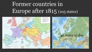
  • 1. Former countries in Europe after 1815 (105 states) 49 states to day
  • 2. By Alexander Altenhof - Own work. Source of Information:Historical atlases– Map "1815 - L'Europe apès le Congrès de Vienne" (Author unknown)(Link)– Ramsay Muir, George Philip (ed.): Philip's New School Atlas of Universal History, George Philip & Son, Ltd., London 1928– Dr. Walter Leisering (ed.): Putzger Historischer Weltatlas, Cornelsen Verlag, Berlin 1992, ISBN 3-464-00176-8– Bayerischer Schulbuch-Verlag (ed.): Großer Historischer Weltatlas, Dritter Teil, Neuzeit, Bayerischer Schulbuch-Verlag, München 1981, ISBN 3-7627- 6021-7.– Prof. Dr. Hans-Erich Stier, Prof. Dr. Ernst Kirsten a. o. (ed.): Großer Atlas zur Weltgeschichte, Orbis Verlag, München 1990, ISBN 3-7627- 6021-7Other publications– Reinhard Stauber: Der Wiener Kongress, Böhlau Verlag, Wien/Köln/Weimar 2014, ISBN 978-3-8252-4095-0– Thierry Lentz: 1815. Der Wiener Kongress und die Neugründung Europas, Siedler Verlag, München 2014, ISBN 978-3- 8275-0027-4, CC BY-SA 4.0, https://commons.wikimedia.org /w/index.php?curid=50255845
  • 3. East Prussian Regierungsbezirk Allenstein (red), established in 1905 Allenstein Regierungsbezirk Allenstein was a Regierungsbezirk, or government region, of the Prussian province of East Prussia from 1905 until 1945. The regional capital was Allenstein (present-day Olsztyn). The territory today is part of the Polish Warmian- Masurian Voivodeship. The government region was created on 1 November 1905 as the third East Prussian Regierungsbezirk out of the southern districts of the two original administrative regions Gumbinnen and Königsberg, which had been established in 1815. It comprised the south of the former Duchy of Prussia; the lands of the Allenstein and Rößel districts had belonged to the Prince-Bishopric of Warmia, annexed by Prussia in 1772. In 1920 East Prussian plebiscite 1920 all the Allenstein Region plus the District of Oletzko (de) was part of the Allenstein Plebiscite precinct, with the electorate voting for remaining with Germany by more than 97%. In 1945 following World War II, Regierungsbezirk Allenstein was dissolved when East Prussia was partitioned between the Republic of Poland and the Soviet Union (Kaliningrad Oblast) according to the resolutions at the Potsdam Conference. Almost a country 1920
  • 4. By Shadowxfox - Own work based on: File:Deutsches Reich (Karte) Anhalt.svg, CC BY-SA 3.0, https://commons.wikimedia.org/w/index.php?curid=35265347 https://commons.wikimedia.org/wiki/File:Duchy_of_Anhalt_1863-1918_en.svg Duchy of Anhalt Herzogtum Anhalt 1806–1918
  • 5. By Yerevanci - Own work, CC BY-SA 3.0, https://commons.wikimedia.org/w/index.php?curid=27929331 Republic of Armenia Հայաստանի Հանրապետութիւն 1918–1920
  • 6. By TRAJAN 117This vector image was created with Inkscape. - Own workThis vector image includes elements that have been taken or adapted from this: Blank map of Europe 1815.svg (by Alphathon)., CC BY-SA 3.0, https://commons.wikimedia.org/w/index.php?curid=27673116 Austrian Empire 1804–1867 By Spiridon Ion Cepleanu - Own work, CC BY-SA 3.0, https://commons.wikimedia.org/w/index.php?curid=18152140 Government Absolute monarchy Emperor • 1804–1835 Francis I • 1835–1848 Ferdinand I • 1848–1867 Franz Joseph I
  • 7. By TRAJAN 117This vector image was created with Inkscape. - Own workThis vector image includes elements that have been taken or adapted from this: German Empire 1914.svg (by Alphathon)., CC BY-SA 3.0, https://commons.wikimedia.org/w/index.php?curid=18627049 Austria-Hungary↓ 1867–1918 By Andrein - Transferred from en.wikipedia, Public Domain, https://commons.wikimedia.org/w/index.php?curid=5867649 https://commons.wikimedia.org/wiki/File:Dissolution_of_Austria-Hungary.png Kingdoms and countries of Austria- Hungary: Cisleithania (Empire of Austria[6]): 1. Bohemia, 2. Bukovina, 3. Carinthia, 4. Carniola, 5. Dalmatia, 6. Galicia, 7. Küstenland, 8. Lower Austria, 9. Moravia, 10. Salzburg, 11. Silesia, 12. Styria, 13. Tyrol, 14. Upper Austria, 15. Vorarlberg; Transleithania (Kingdom of Hungary[6]): 16. Hungary proper 17. Croatia-Slavonia; 18. Bosnia and Herzegovina (Austro-Hungarian condominium)
  • 9. By Emin Bashirov - Own work, CC BY-SA 3.0, https://commons.wikimedia.org/w/index.php?curid=6323251 Azerbaijan Democratic Republic ‫جومهوریتی‬ ‫خلق‬ ‫آذربایجان‬ Azərbaycan Demokratik Respublikası 1918–1920 By Melikov Memmed - Own work, CC0, https://commons.wikimedia.org/w/index.php?curi d=14951900
  • 10. By Elevatorrailfan - This vector image includes elements that have been taken or adapted from this: Blank map of Europe 1815.svg., CC BY-SA 4.0, https://commons.wikimedia.org/w/index.php?curid=42274670 By Unknown - Karten- und Luftbildstelle der DB Mainz, Public Domain, https://commons.wikimedia.org/w/index.php?curid=5922808 Grand Duchy of Baden Großherzogtum Baden State of the Confederation of the Rhine (1806– 1813) State of the German Confederation (1815–1866) Federal State of the German Empire (1871–1918) 1806–1918
  • 11. https://commons.wikimedia.org/wiki/File:German_Empire_-_Bavaria_(1871).svg Kingdom of Bavaria Königreich Bayern Electorate of the Holy Roman Empire (1805–1806) State of the Confederation of the Rhine (1806–13) State of the German Confederation (1815–66) Federal State of the German Empire (1871–1918) 1805–1918 Kingdom of Bavaria
  • 12. By NordNordWest - Own work, usingUnited States National Imagery and Mapping Agency dataWorld Data Base II data, CC BY-SA 3.0, https://commons.wikimedia.org/w/index.php?curid=7773875 Batumi (Georgian: ბათუმი [bɑtʰumi]) is the second-largest city of Georgia, located on the coast of the Black Sea in the country's southwest.[2] Situated in a subtropical zone near the foot of the Lesser Caucasus Mountains, Batumi is a popular tourist destination known for its varying weather–it is a bustling seaside resort during warm seasons, but it can get entirely covered in snow during winter. Much of Batumi's economy revolves around tourism and gambling, but the city is also an important sea port and includes industries like shipbuilding, food processing and light manufacturing. Since 2010, Batumi has been transformed by the construction of modern high-rise buildings, as well as the restoration of classical 19th-century edifices lining its historic Old Town Year 1918 – 1920 British goverment Batumi
  • 13. Belarusian People's Republic Partially recognized Government in exile since 1919 Russian rule (1795–1918) Belarusian People's Republic (from 1918) Byelorussian Soviet Republic (1919–91) West Belarus (1919–39) Modern Belarus (from 1991)
  • 14. By Ulamm (talk) 23:44, 29 December 2013 (UTC) - Own work, CC BY-SA 3.0, https://commons.wikimedia.org/w/index.php?curid=30394605 Free Hanseatic City of Bremen At the unwinding of the Holy Roman Empire in 1806 the Free Imperial City of Bremen (as of 1646, after earlier privileges of autonomy of 1186) was not mediatised but became a sovereign state officially titled Free Hanseatic City of Bremen. Its currency was the Bremen thaler (until 1873). In 1811 the First French Empire annexed the city-state. Upon the first, albeit only preliminary, defeat of Napoléon Bonaparte, Bremen resumed its pre-1811 status as city-state in 1813. The Vienna Congress of 1815 confirmed Bremen's—as well as Frankfurt's, Hamburg's, and Lübeck's—independence after pressuring by Bremen's emissary, and later burgomaster, Johann Smidt. Bremen became one of 39 sovereign states of the German Confederation. In 1827 the state of Bremen bought the tract of land from the Kingdom of Hanover, where future Bremerhaven would be established. Bremen became part of the North German Confederation in 1867 and became an autonomous component state of the new-founded German Empire in 1871
  • 15. By Shadowxfox - Own work based on: File:Deutsches Reich (Karte) Braunschweig.svg, CC BY-SA 3.0, https://commons.wikimedia.org/w/index.php?curid=35265353 Duchy of Brunswick Herzogtum Braunschweig (German) Part of the German Confederation, the North German Confederation, and the German Empire 1815–1918
  • 16. Carpatho-Ukraine Unrecognized state 1939 Carpatho-Ukraine (Ukrainian: Карпа́тська Украї́на, Karpats’ka Ukrayina, pronounced [kɐrˈpɑtsʲkɐ ukrɐˈjinɐ]) was an autonomous region within Czechoslovakia from late 1938 to March 15, 1939. It was declared an independent republic by Avgustyn Voloshyn on March 15, 1939. Voloshyn named himself the president and asked Adolf Hitler to support him. Hitler did not reply and the historical part of Hungary was annexed by Hungary between March 15 and March 16, 1939, remaining under Hungarian control until the end of World War II, when it was ceded to the Soviet Union. The territory is now administered as Zakarpattia Oblast in Ukraine.
  • 17. By No machine-readable author provided. Decius assumed (based on copyright claims). - No machine-readable source provided. Own work assumed (based on copyright claims)., CC BY 2.5, https://commons.wikimedia.org/w/index.php?curid=994390 Carnaro and Fiume year 1918 – 1920 The Italian Regency of Carnaro (Italian: Reggenza Italiana del Carnaro) was a self-proclaimed state in the city of Fiume (now Rijeka, Croatia) led by Gabriele d'Annunzio between 1919 and 1920. It is also known by its lyrical name in Italian: Fiume Endeavour (Impresa di Fiume). During World War I (1914–1918), Italy made a pact with the Allies, the Treaty of London (1915), in which it was promised all of the Austrian Littoral, but not the city of Fiume. After the war, at the Paris Peace Conference, 1919, this delineation of territory was confirmed, with Fiume remaining outside of Italian borders, instead joined with adjacent Croatian territories into the Kingdom of Serbs, Croats and Slovenes. Gabriele d'Annunzio was angered by what he considered to be handing over of the city of Fiume. On September 12, 1919, he led around 2,600 troops from the Royal Italian Army (the Granatieri di Sardegna), Italian nationalists and irredentists, into a seizure of the city, forcing the withdrawal of the inter-Allied (American, British and French) occupying forces. Their march from Ronchi dei Legionari to Fiume became known as the Impresa di Fiume ("Fiume Endeavour"). Gabriele d'Annunzio (in the middle with the stick) with some legionaries (components of the Arditi's department of the Italian Royal Army) in Fiume in 1919. To the right of d'Annunzio, facing him, Lt. Arturo Avolio (commander of the Ardit's department of Bologna Brigade). On the same day, d'Annunzio announced that he had annexed the territory to the Kingdom of Italy. He was enthusiastically welcomed by the Italian population of Fiume. This move was opposed by the Italian government and d'Annunzio tried to resist pressure from Italy. The plotters sought to have Italy annex Fiume, but were denied. Instead, Italy initiated a blockade of Fiume while demanding that the plotters surrender. During his time in Fiume in September 1919, Filippo Tommaso Marinetti called the leaders of the Exploit "advance- guard deserters" (disertori in avanti).
  • 18. By Aotearoa - Own work, CC BY-SA 3.0, https://commons.wikimedia.org/w/index.php?curid=3885255 Channel Islands year 1940 - 1945 Year 1940, 92 000 people living in the islands. From aprox 1200 + , United Kingdom. Germany 1940 – 1945. Sark liberated as late as 10 may 1945. List of islands The permanently inhabited islands of the Channel Islands and their population and area are: Jersey 100,080 (118 km2) Guernsey 63,026 (65 km2) Alderney 2,000 (8 km2) Sark 600 (5 km2) Herm 60 (2 km2) Jethou 3 (0.2 km2) Brecqhou (Brechou) (0.3 km2) The islands were the only British territory to be occupied by the German Army during World War II.
  • 19. Cospaia Republic Repubblica di Cospaia Microstate 1440–1826 The Republic of Cospaia was a small state in Italy, located in northern Umbria, independent from 1440 to 1826. It was located in what is now the hamlet (frazione) of Cospaia in the comune of San Giustino in the Province of Perugia
  • 20. Couto Misto Microstate 10th century–1868 Couto Misto (Portuguese: Couto Misto [ˈko(w)tu ˈmiʃtu], Galician: Couto Mixto, Spanish: Coto Mixto) was an independent microstate on the border between Spain and Portugal. It was composed of the villages of Santiago de Rubiás, Rubiás (now in the Spanish municipality of Calvos de Randín), and Meaus (now in the Spanish municipality of Baltar), all in the Salas Valley, Ourense, Galicia. The territory of the Couto Misto also included a small uninhabited strip now part of the Portuguese municipality of Montalegre.
  • 21. Cretan State The Cretan State (Greek: Κρητική Πολιτεία, Kritiki Politia; Ottoman Turkish: ‫دولتى‬ ‫كرید‬ ,Girit Devleti), was established in 1898, following the intervention by the Great Powers (Britain, France, Italy, Austria-Hungary, and Russia) on the island of Crete. In 1897, an insurrection in Crete led the Ottoman Empire to declare war on Greece, which led Great Britain, France, Italy and Russia to intervene on the grounds that the Ottoman Empire could no longer maintain control. It was the prelude of the island's final annexation to the Kingdom of Greece, which occurred de facto in 1908 and de jure in 1913. History • Proclamation 9 December 1898 • Theriso revolt 10 March 1905 • Unilateral union with Greece 24 September 1908 • Treaty of London 30 May 1913 • Union with Greece 1 December 1913
  • 22. By Crossswords - https://upload.wikimedia.org/wikipedia/commons/archive/3/33/20150102092908% 21Crimea_crisis_map.PNG, CC BY-SA 3.0, https://commons.wikimedia.org/w/index.php?curid=37635280 Crimeawas annexed by the Russian Federation in early 2014 and the peninsula, Ukrainian territory since 1954, is now administered as two Russian federal subjects—the Republic of Crimea and the federal city of Sevastopol. Until 2016 these new subjects were grouped in the Crimean Federal District. The annexation was accompanied by a military intervention by Russia in Crimea that took place in the aftermath of the 2014 Ukrainian revolution and was part of wider unrest across southern and eastern Ukraine.
  • 23. By DIREKTOR - Own work, CC BY-SA 4.0, https://commons.wikimedia.org/w/index.php?curid=37973302 Independent State of Croatia Nezavisna Država Hrvatska Puppet state of Germany (1941–45) Protectorate of Italy (1941–43) 1941–1945 The Independent State of Croatia (Croatian: Nezavisna Država Hrvatska, NDH; German: Unabhängiger Staat Kroatien; Italian: Stato Indipendente di Croazia) was a World War II fascist puppet state of Germany and Italy. It was established in parts of occupied Yugoslavia on 10 April 1941, after the invasion by the Axis powers. Its territory consisted of most of modern-day Croatia and Bosnia and Herzegovina, as well as some parts of modern-day Serbia and Slovenia, but also excluded many Croat-populated areas in Dalmatia (until late 1943), Istria, and Međimurje regions (which today are part of Croatia). In 1942, Germany suggested Italy take military control of all of Croatia out of a desire to redirect German troops from Croatia to the Eastern Front. Italy however rejected the offer as it did not believe that it could handle the unstable situation in the Balkans alone.[22] After the ousting of Mussolini and the Kingdom of Italy's armistice with the Allies, the NDH on 10 September 1943 declared that the Treaties of Rome were null and void and annexed the portion of Dalmatia that had been ceded to Italy. The NDH attempted to annex Zara, which had been a recognized territory of Italy since 1919 but long an object of Croatian irredentism, but Germany did not allow it
  • 24. By Blank_map_of_Europe.svg: maix¿?derivative work: Alphathon /'æɫfə.θɒn/ (talk) - Blank_map_of_Europe.svg, CC BY-SA 3.0, https://commons.wikimedia.org/w/index.php?curid=17172982 Czechoslovakia Československo Česko-Slovensko 1918–1992 1939–1945: Government-in-exile Czechoslovakia, or Czecho-Slovakia; Czech and Slovak: Československo, Česko-Slovensko, was a sovereign state in Central Europe that existed from October 1918, when it declared its independence from the Austro-Hungarian Empire, until its peaceful dissolution into the Czech Republic and Slovakia on 1 January 1993. From 1939 to 1945, following its forced division and partial incorporation into Nazi Germany, the state did not de facto exist but its government-in- exile continued to operate. From 1948 to 1990, Czechoslovakia was part of the Soviet bloc with a command economy. Its economic status was formalized in membership of Comecon from 1949 and its defense status in the Warsaw Pact of May 1955. A period of political liberalization in 1968, known as the Prague Spring, was forcibly ended when the Soviet Union, assisted by several other Warsaw Pact countries, invaded. In 1989, as Marxist–Leninist governments and communism were ending all over Europe, Czechoslovaks peacefully deposed their government in the Velvet Revolution; state price controls were removed after a period of preparation. In 1993, Czechoslovakia split into the two sovereign states of the Czech Republic and Slovakia.
  • 25. By Gdansk_Bay_Borderlines_1939_English.png: Masturbiusderivative work: Justass (talk) - Gdansk_Bay_Borderlines_1939_English.png, CC BY-SA 3.0, https://commons.wikimedia.org/w/index.php?curid=8516865 Free City of Danzig Freie Stadt Danzig (German) Wolne Miasto Gdańsk (Polish) Free City under League of Nations protection 1920–1939 The Free City of Danzig (German: Freie Stadt Danzig; Polish: Wolne Miasto Gdańsk) was a semi-autonomous city-state that existed between 1920 and 1939, consisting of the Baltic Sea port of Danzig (now Gdańsk, Poland) and nearly 200 towns and villages in the surrounding areas. It was created on 15 November 1920 in accordance with the terms of Article 100 (Section XI of Part III) of the 1919 Treaty of Versailles after the end of World War I. The Free City included the city of Danzig and other nearby towns, villages, and settlements that had been primarily inhabited by Germans. As the Treaty stated, the region was to remain separated from post-World War I Germany (the Weimar Republic) and from the newly independent nation of the Second Polish Republic ("interwar Poland"), but it was not an independent state. The Free City was under League of Nations protection and put into a binding customs union with Poland. Historical era Interwar period • Established 15 November 1920 • Invasion of Poland 1 September 1939 • Annexed by Germany 2 September 1939
  • 26. East Karelia and West Karelia with borders of 1939 and 1940/1947. They are also known as Russian Karelia and Finnish Karelia respectively. East Karelia (Finnish: Itä-Karjala, Karelian: Idä-Karjala), also rendered as Eastern Karelia or Russian Karelia, is a name for the part of Karelia that since the Treaty of Stolbova in 1617 has remained Eastern Orthodox under Russian supremacy. It is separated from the western part of Karelia, called Finnish Karelia or historically Swedish Karelia (before 1808). Most of East Karelia is now part of the Republic of Karelia within the Russian Federation. It consists mainly of old historical regions of Viena and Aunus. 19th century ethnic nationalist Fennomans saw East Karelia as the ancient home of Finnic culture, "un-contaminated" by both Scandinavians and Slavs. In the sparsely populated East Karelian backwoods, mainly in White Karelia, Elias Lönnrot collected the folk tales that ultimately would become Finland's national epic, the Kalevala. The idea of annexing East Karelia to Finland ("Greater Finland") was widely supported in newly independent Finland. It was especially popular during the Continuation War when it seemed possible through German assistance. Most of East Karelia was occupied by Finnish forces 1941– 1944. The war was accompanied by hardship for the local ethnic Russian civilians, including forced labour and internment in prison camps as enemy aliens. After the Continuation War, calls for annexation of East Karelia have virtually disappeared. After Karelia was divided between Finland and Russia in 1918, the Finnic peoples that made up most of the population of East Karelia were promised far-reaching cultural rights. However, these rights were never realised and under Stalin ethnic Finns were persecuted and an intensive Russification programme began. Since the fall of communism, there has been a revival in Finnic culture in East Karelia. East Karelia year 1922
  • 27. Republic of Guria გურიის რესპუბლიკა 1905–1906 The Republic of Guria or the Gurian Peasant Republic was an insurrection that took place in the western Georgian province Guria, against Imperial Russia, prior to and during the Russian Revolution of 1905. After the beginning of the 1905 Revolution, however, the revolt began spreading throughout Georgia and the Gurian revolution proceeded even in a more radical way. The peasants sent away all the authorities, and, nominating their own judges, they organized independent village communities and armed red detachments also known as forest brothers, embodying a whole territory. The Gurian peasant women at village meetings adopted resolutions demanding political equality with men. The revolutionaries largely used terrorism against the Tsarist officers and loyal landlords. By February the whole of Guria was in the power of the revolutionaries, perhaps the world’s first Marxist national-liberation movement. On January 10, 1906 Colonel Krilov’s strong reinforcements of all arms attacked the province and ruthlessly crushed the insurrection putting an end to the “Gurian Republic”.
  • 28. German Democratic Republic Deutsche Demokratische Republik (German) Member of the Warsaw Pact (1955–1989) 1949–1990 East Germany, officially the German Democratic Republic (GDR; German: Deutsche Demokratische Republik pronounced [ˈdɔʏtʃə demoˈkʀaːtɪʃə ʀepuˈbliːk], DDR), was a communist state in central- western Europe, during the Cold War period. It described itself as a socialist "workers' and peasants' state." From 1949 to 1990, it administered the portion of Germany that had been occupied by Soviet forces at the end of World War II—the Soviet Occupation Zone of the Potsdam Agreement, bounded on the east by the Oder– Neisse line. The Soviet zone surrounded West Berlin, but did not include it; as a result, West Berlin remained outside the jurisdiction of the GDR. The East German population declined by three million people throughout its forty-one year history, from 19 million in 1948 to 16 million in 1990; of the 1948 population, some 4 million were deported from the lands east of the Oder-Neisse line. This was a stark contrast from Poland, which increased during that time; from 24 million in 1950 (a little more than East Germany) to 38 million (more than twice of East Germany's population). This was primarily a result of emigration—about one quarter of East Germans left the country before the Berlin Wall was completed in 1961,[55] and after that time, East Germany had very low birth rates,[56] except for a recovery in the 1980s when the birth rate in East Germany was considerably higher than in West Germany
  • 29. By Jniemenmaa - Own work, CC BY-SA 3.0, https://commons.wikimedia.org/w/index.php?curid=6017493 Finnish Democratic Republic Suomen kansanvaltainen tasavalta Demokratiska Republiken Finland Puppet state of the Soviet Union 1939–1940 The Finnish Democratic Republic (Finnish: Suomen kansanvaltainen tasavalta, also Finnish: Suomen kansantasavalta, Swedish: Demokratiska Republiken Finland, Russian: Финляндская Демократическая Республика) was a short-lived puppet government created and recognised only by the Soviet Union. Headed by Finnish- born politician Otto Ville Kuusinen, the Finnish Democratic Republic was Joseph Stalin's planned means to conquer Finland.It nominally operated in the parts of Finnish Karelia that were occupied by the Soviet Union during the Winter War. The Soviet Union argued that it was the only rightful government for all of Finland that was capable of ending the Winter War and restoring peace; however, before the end of the war, the Soviets gave up this interpretation to make peace with the preexisting government of Finland, which was still recognized by the rest of the world.
  • 30. Free City of Frankfurt Freie Stadt Frankfurt State of the Holy Roman Empire State of the German Confederation 1372–1806 1806–1815: Grand Duchy 1816–1866 Frankfurt was a major city of the Holy Roman Empire, being the seat of imperial elections since 885 and the city for imperial coronations from 1562 (previously in Free Imperial City of Aachen) until 1792. Frankfurt was declared an Imperial Free City (Reichsstadt) in 1372, making the city an entity of Imperial immediacy, meaning immediately subordinate to the Holy Roman Emperor and not to a regional ruler or a local nobleman. Due to its imperial significance, Frankfurt survived mediatisation in 1803. Following the collapse of the Holy Roman Empire in 1806, Frankfurt fell to the rule of Napoleon I, who granted the city to Karl Theodor Anton Maria von Dalberg; the city became known as the Principality of Frankfurt. The Catholic clergy Dalberg emancipated the Catholics living with the city boundary. In 1810 Dalberg merged Frankfurt with the Principality of Aschaffenburg, the County of Wetzlar, Fulda, and Hanau to form the Grand Duchy of Frankfurt. After the defeat of Napoleon and the collapse of the Confederation of the Rhine, Frankfurt was returned to its pre-Napoleonic constitution via the Congress of Vienna of 1815 and became a sovereign city-state and a member of the German Confederation.
  • 31. By Goran tek-en - Own workThis file was derived from:Carte de la Georgie, 1920.jpgKingdom of Georgia after dissolution as a unified state, 1490 AD.svg, CC BY-SA 3.0, https://commons.wikimedia.org/w/index.php?curid=30984750 Democratic Republic of Georgia საქართველოს დემოკრატიული რესპუბლიკა (Georgian) 1918–1921 The Democratic Republic of Georgia (DRG; Georgian: საქართველოს დემოკრატიული რესპუბლიკა sak’art’velos demokratiuli respublika) existed from May 1918 to February 1921 and was the first modern establishment of a Republic of Georgia. The DRG was created after the collapse of the Russian Empire that began with the Russian Revolution of 1917. Its established borders were with the Kuban People's Republic and the Mountainous Republic of the Northern Caucasus in the north, the Ottoman Empire and the First Republic of Armenia in the south, and the Azerbaijan Democratic Republic in the southeast. It had a total land area of roughly 107,600 km2 (by comparison, the total area of today's Georgia is 69,700 km2), and a population of 2.5 million. The republic's capital was Tbilisi, and its state language was Georgian. Proclaimed on May 26, 1918, on the break-up of the Transcaucasian Federation, it was led by the Georgian Social Democratic Party (also known as the Georgian Menshevik Party). Facing permanent internal and external problems, the young state was unable to withstand invasion by the Russian SFSR Red Armies, and collapsed between February and March 1921 to become a Soviet republic.
  • 32. By TRAJAN 117This vector image was created with Inkscape. - Own workThis vector image includes elements that have been taken or adapted from this: Blank map of Europe 1956-1990.svg (by Alphathon)., CC BY-SA 3.0, https://commons.wikimedia.org/w/index.php?curid=19225662 Kingdom of Greece Βασίλειον τῆς Ἑλλάδος 1832–1924 1935–1973 The Kingdom of Greece (Greek: Βασίλειον τῆς Ἑλλάδος, [vaˈsiliɔn ˈtis ɛˈlaðɔs]) was a state established in 1832 at the Convention of London by the Great Powers (the United Kingdom, Kingdom of France and the Russian Empire). It was internationally recognised by the Treaty of Constantinople, where it also secured full independence from the Ottoman Empire. This event also marked the birth of the first fully independent Greek state since the fall of the Byzantine Empire to the Ottomans in the mid-15th century. The Kingdom succeeded from the Greek provisional governments after the Greek War of Independence, and lasted until 1924. In 1924 the monarchy was abolished, and the Second Hellenic Republic was established, after Greece's defeat by Turkey in the Asia Minor Campaign. It lasted until 1935, when it was overthrown by a military coup d'état which restored the monarchy. The restored Kingdom of Greece lasted from 1935 to 1973. The Kingdom was again dissolved in the aftermath of the seven-year military dictatorship (1967–1974), and the Third Republic, the current Greek state, came to be, after a popular referendum. Historical eraModern • London Protocol 30 August 1832 • Constitution granted 3 September 1843 • Second Republic 25 March 1924 • Monarchy restored 3 November 1935 • Axis occupation April 1941–October 1944 • Admitted to the United Nations 25 October 1945 • Military Junta 21 April 1967 • Abolishment by Papadopoulos 1 July 1973
  • 33. Hamburg ca. 1600 Free and Hanseatic City of Hamburg The city was member in the medieval Hanseatic trading league and a free imperial city of the Holy Roman Empire. From 1815 until 1866 Hamburg was an independent and sovereign state of the German Confederation, then the North German Confederation (1866–71), the German Empire (1871–1918) and during the period of the Weimar Republic (1918–33). In Nazi Germany Hamburg was a city-state and a Gau from 1934 until 1945. After the Second World War Hamburg was in the British Zone of Occupation and became a state in the western part of Germany in the Federal Republic of Germany (Since 1949).
  • 34. By kgberger - own drawing/Source of Information: Putzger – Historischer Weltatlas, 89. Auflage, 1965, CC BY 2.5, https://commons.wikimedia.org/w/index.php?curid=1483888 Kingdom of Hanover 1814–1866 History • Congress of Vienna 12 October 1814 • Revolution of 1848 13 March 1848 • Austro-Prussian War 14 June 1866 • Peace of Prague 23 August 1866 • Annexed by Prussia 20 September 1866
  • 35. By Hohum - Own work, CC BY-SA 3.0, https://commons.wikimedia.org/w/index.php?curid=11273470 Heligoland Named after Heligoland, it was the location of World War I naval battles in 1914 and 1917. In 1939 it also had a World War II aerial battle named after it. In the Heligoland Basin (Helgoländer Becken), a basin lying directly southwest of Heligoland, the bight is up to 56 metres deep. One of the busiest shipping lanes in the world, from Hamburg and the mouth of the Elbe to the Straits of Dover and the English Channel, runs through the Heligoland Bight. The area also includes nature reserves such as the Heligoland Felssockel and the protected Wadden Sea, in which the Wadden Sea National Parks of Schleswig- Holstein (East), Hamburg (southeast) and Lower Saxony (south) are located. Year 1821 ( 2 200 people) when the Englishmen left the island. Year 1952 the islands was incorporated in Germany. https://commons.wikimedia.org/wiki/File:Helgoland_Vogelperspektive_sx.jpg
  • 36. Grand Duchy of Hesse and by Rhine Großherzogtum Hessen und bei Rhein State of the Confederation of the Rhine (1806–1813) State of the German Confederation (1815–1866) State of the North German Confederation (1867–1871) Federal State of the German Empire (1871–1918) 1806–1918 1806–1918 The Grand Duchy of Hesse and by Rhine (German: Großherzogtum Hessen und bei Rhein), or the Grand Duchy of Hesse (German: Großherzogtum Hessen) between 1806 and 1816, was an independent country and member state of the Confederation of the Rhine as of 1806, when the Landgraviate of Hesse-Darmstadt was elevated to a Grand Duchy which it remained until 1918, when the monarchy was overthrown. Hesse lost its independence when it joined the German Empire in 1871. Before 1866, its northern neighbour was its former sister Landgraviate, since 1803 an Electorate, of Hesse-Kassel – for this reason, this state was sometimes colloquially known as Hesse-Darmstadt.
  • 37. By Ziegelbrenner - own drawing/Source of Information: Putzger – Historischer Weltatlas, 89. Auflage, 1965 & de: Jean Joseph Tranchot / de: Karl von Müffling, CC BY-SA 3.0, https://commons.wikimedia.org/w/index.php?curid=959591 Landgraviate of Hesse-Homburg Landgrafschaft Hessen-Homburg 1622–1866 Hesse-Homburg was formed into a separate landgraviate in 1622 by the landgrave of Hesse-Darmstadt; it was to be ruled by his son, although it did not become independent of Hesse- Darmstadt until 1668. It was briefly divided into Hesse-Homburg and Hesse- Homburg-Bingenheim; but these parts were reunited in 1681. In 1806, Hesse-Homburg was incorporated with Hesse- Darmstadt; but in 1815, by the Congress of Vienna, the latter state was compelled to recognize the independence of Hesse- Homburg, which was increased by the addition of Meisenheim. The landgraviate of Hesse-Homburg consisted of two parts, the district of Homburg on the right side of the Rhine, and the district of Meisenheim, added in 1815, on the left side of the same river. In 1866, Hesse-Homburg was inherited by the grand-duke of Hesse-Darmstadt, while Meisenheim fell to Prussia. Later that same year, these territories were taken from Hesse- Darmstadt again, and the former landgraviate was combined with the Electorate of Hesse-Kassel, duchy of Nassau, and the free city of Frankfurt to form the Prussian province of Hesse- Nassau. Today, it forms a part of the German state of Hesse.
  • 38. By ziegelbrenner - own drawing/Source of Information: Putzger – Historischer Weltatlas, 89. Auflage, 1965; Westermanns Großer Atlas zuur Weltgeschichte, 1969; Haacks geographischer Atlas. VEB Hermann Haack Geographisch-Kartographische Anstalt, Gotha/Leipzig, 1. Auflage, 1979., CC BY 2.5, https://commons.wikimedia.org/w/index.php?curid=1511111 6 Electorate of Hesse Kurfürstentum Hessen State of the Holy Roman Empire State of the German Confederation 1803–1807 1814–1866 The Electorate of Hesse (also known as Hesse-Kassel) was a state elevated by Napoleon in 1803 from the Landgraviate of Hesse-Kassel. When the Holy Roman Empire was abolished in 1806, the Prince-Elector of Hesse chose to remain an Elector, even though there was no longer an Emperor to elect. In 1807, with the Treaties of Tilsit the area was annexed to the Kingdom of Westphalia, but in 1814 the Congress of Vienna restored the electorate. The state—last of its kind—consisted of several detached territories to the north of Frankfurt which survived until 1866 with the name of an electorate within the German Confederation. It comprised a total land area of 3,699 square miles (9,580 km2), and its population in 1864 was 745,063.
  • 39. By Känsterle from nl, CC BY-SA 3.0, https://commons.wikimedia.org/w/index.php?curid=9667587 Hohenzollern-Hechingen State of the Holy Roman Empire (until 1806) 1576–1850 Hohenzollern-Hechingen was a small principality in southwestern Germany. Its rulers belonged to the Swabian branch of the Hohenzollern dynasty. The County of Hohenzollern-Hechingen was created in 1576, upon the partition of the County of Hohenzollern, a fief of the Holy Roman Empire. When the last count of Hohenzollern, Charles I of Hohenzollern (1512–1579) died, the territory was to be divided up between his three sons: Eitel Frederick IV of Hohenzollern-Hechingen (1545–1605) Charles II of Hohenzollern-Sigmaringen (1547–1606) Christopher of Hohenzollern-Haigerloch (1552–1592) Unlike the Hohenzollerns of Brandenburg and Prussia, the Hohenzollerns of southwest Germany remained Roman Catholic. The County was raised to a principality in 1623. The principality joined the Confederation of the Rhine in 1806 and was a member state of the German Confederation between 1815 and 1850. The democratic Revolution of 1848 was relatively successful in Hohenzollern, and on 16 May 1848, the Prince was forced to accept the establishment of a constitution. However, the conflict between monarch and democrats continued, and on 6 August, Hohenzollern was occupied by Prussian forces. On 7 December 1849, Prince Friedrich Wilhelm Konstantin sold the country to his relative, King Frederick William IV of Prussia. On 12 March 1850, Hohenzollern-Hechingen officially became part of Prussia, and formed together with Hohenzollern-Sigmaringen the Province of Hohenzollern.
  • 40. By XrysD - Own work, CC BY-SA 4.0, https://commons.wikimedia.org/w/index.php?curid=63249495 Italian Social Republic Repubblica Sociale Italiana Puppet state of Germany 1943–1945 On 24 July 1943, after the Allied landings in Sicily on a motion by Dino Grandi the Grand Fascist Council voted a motion of no confidence in Mussolini. Mussolini's position had been undermined by a series of military defeats from the start of Italy's entry into the war in June 1940, including the bombing of Rome, the loss of the African colonies and the Allied invasions of Sicily and the southern Italian Peninsula. The new Italian government had moved Mussolini from place to place while he was in captivity in an attempt to foil any attempts at rescue. Despite this, the Germans eventually pinpointed Mussolini at the Campo Imperatore Hotel at Gran Sasso. On 12 September, Mussolini was liberated by the Germans in Operation Eiche in the mountains of Abruzzo, while the Italian carabinieri were allegedly placed under orders to not fire their weapons at the raiders, rendering them defenseless. After being liberated, Mussolini was flown to Bavaria. Gathering what support he still had among the Italian population, his liberation made it possible for a new German-dependent Fascist Italian state to be created.
  • 41. By Rob984 - Derived from:File:Blank map of Europe (polar stereographic projection) cropped.svg, CC BY-SA 4.0, https://commons.wikimedia.org/w/index.php?curid=41107766 Irish Republic Poblacht na hÉireann (Saorstát Éireann) Revolutionary state 1919–1922 Disputed with the United Kingdom Historical era Interwar period • Proclamation of the Irish Republic 24 April 1916 • Independence declared 21 January 1919 • Anglo-Irish Treaty adopted 7 January 1922 • Irish Free State established 6 December 1922 The Irish Republic (Irish: Poblacht na hÉireann or Saorstát Éireann) was a revolutionary state that declared its independence from the United Kingdom of Great Britain and Ireland in January 1919. The Republic claimed jurisdiction over the whole island of Ireland, but by 1920 its functional control was limited to only 21 of Ireland's 32 counties, and British state forces maintained presence across much of the north-east, as well as Cork, Dublin and other major towns.
  • 42. By Blank_map_of_Europe.svg: maix¿?derivative work: Alphathon /'æɫfə.θɒn/ (talk) - This file was derived from Blank map of Europe.svg:, CC BY-SA 3.0, https://commons.wikimedia.org/w/index.php?curid=27668323 Free, Independent, and Strictly Neutral City of Cracow with its Territory Wolne, Niepodległe i Ściśle Neutralne Miasto Kraków z Okręgiem Protectorate of Austria, Prussia and Russia 1815–1846 History • Established 3 May 1815 • November Uprising 29 November 1830 • Kraków Uprising 16 November 1846 The Free, Independent, and Strictly Neutral City of Cracow with its Territory (Polish: Wolne, Niepodległe i Ściśle Neutralne Miasto Kraków z Okręgiem), more commonly known as either the Free City of Cracow or Republic of Cracow (Polish: Rzeczpospolita Krakowska, German: Republik Krakau), was a city republic created by the Congress of Vienna in 1815, which included the city of Kraków and its surrounding areas. It was controlled by its three neighbours (Russia, Prussia, and Austria). It was a center of agitation for an independent Poland. In 1846, in the aftermath of the unsuccessful Kraków Uprising, it was annexed by the Austrian Empire. It was a remnant of the Duchy of Warsaw, which was partitioned between the three states in 1815. It was an overwhelmingly Polish-speaking city-state; of its population 85% were Catholics, 14% were Jews while other religions comprised less than 1%. The city of Kraków itself had a Jewish population reaching nearly 40%, while the rest were almost exclusively Polish-speaking Catholics.
  • 43. Kuban People's Republic 1918–1920 The Kuban People's Republic (Russian: Кубанская Народная Республика Kubanskaya Narodnaya Respublika; Ukrainian: Кубанська Народна Республiка Kubans'ka Narodna Respublika) was an anti-Bolshevik state during the Russian Civil War, comprising the territory of the modern-day Kuban region in Russia. The republic was proclaimed by the Kuban Rada on 28 January 1918, and declared its independence on 16 February. It would include all territory of the former Kuban Oblast of the Russian Empire. During its brief independence, it sought union with the Ukrainian People's Republic until the latter was occupied by Soviet forces. The Kuban People's Republic was crushed 7 November 1919, having existed for 21 months.
  • 44. By The original uploader was Störfix at German Wikipedia(Original text: de:Benutzer:Störfix) - Transferred from de.wikipedia to Commons.(Original text: selbst gezeichnet), CC BY-SA 2.0 de, https://commons.wikimedia.org/w/index.php?curid=1855620 Principality of Lichtenberg Fürstentum Lichtenberg 1815–1834 History • Congress of Vienna 1815 • sold to Prussia 1834 The Principality of Lichtenberg (German: Fürstentum Lichtenberg) on the Nahe River was an exclave of the Duchy of Saxe- Coburg-Saalfeld from 1816 to 1826 and the Duchy of Saxe-Coburg and Gotha from 1826 to 1834, when it was sold to the Kingdom of Prussia. Today the area lies in two States of Germany – Saarland in the District of St. Wendel and Rhineland- Palatinate in the District of Birkenfeld.
  • 45. Principality of Lippe Fürstentum Lippe State of the Holy Roman Empire (1123–1806) State of the Confederation of the Rhine (1806–1813) State of the German Confederation (1815–1866) State of the North German Confederation (1867–1871) Federal State of the German Empire (1871–1918) 1123–1918 Lippe (later Lippe-Detmold and then again Lippe) was a historical state in Germany, ruled by the House of Lippe. It was located between the Weser River and the southeast part of the Teutoburg forest.
  • 46. Free and Hanseatic City of Lübeck Freie und Hansestadt Lübeck Free imperial city of the Holy Roman Empire Member of the German Confederation Member of the North German Confederation State of the German Empire State of the Weimar Republic 1226–1811 1815–1937 History • Gained Imp. immediacy from Emp. Frederick II 1226 • Annexed by French Empire 1811 • Regained sovereignty under Congress of Vienna 1815 • Abolished by the Greater Hamburg Act 1 April 1937 The Free and Hanseatic City of Lübeck was a city-state from 1226 to 1937, in what is now the German states of Schleswig-Holstein and Mecklenburg-Vorpommern.
  • 47. By Gabagool - Own work, CC BY 3.0, https://commons.wikimedia.org/w/index.php?curid=7162695 Duchy of Lucca Ducato di Lucca 1815–1847 History • Congress of Vienna 9 June 1815 • Annexed by Tuscany 17 December 1847 The Duchy of Lucca was a small Italian state existing from 1815 to 1847. It was centered on the city of Lucca. By the Congress of Vienna of 1815 the Duchy was to revert to Tuscany on the end of its Bourbon line of rulers, which happened in 1847. Tuscany was annexed by the Kingdom of Sardinia (Piedmont) in 1860. The Duchy was formed in 1815 by the Congress of Vienna,[1] out of the former Republic of Lucca and the Principality of Lucca and Piombino, which had been ruled by Elisa Bonaparte.[2] It was created to compensate the House of Bourbon-Parma for the loss of the Duchy of Parma, which had been given to Marie Louise of Austria.
  • 48. Duchy of Massa and Carrara Ducato di Massa e Carrara 1473–1829 Historical era Italian Renaissance • Established 22 February 1473 • French rule 1796-1814 • Disestablished 14 November 1829 The Duchy of Massa and Carrara was the duchy that controlled the towns of Massa di Carrara and Carrara; the area is now part of unified Italy, but retains its local identity as the province of Massa-Carrara.
  • 49. By Shadowxfox - Own work based on: File:Deutsches Reich (Karte) Mecklenburg-Schwerin.svg, CC BY-SA 3.0, https://commons.wikimedia.org/w/index.php?curid=35265362 Grand Duchy of Mecklenburg-Schwerin Großherzogtum Mecklenburg-Schwerin State of the German Confederation (1815–48, 1850–66) State of the North German Confederation (1867–71) Federal State of the German Empire (1871–1918) 1815–1918 History • Congress of Vienna 14 June 1815 • German Revolution 14 November 1918 The Grand Duchy of Mecklenburg-Schwerin was a territory in Northern Germany held by the House of Mecklenburg residing at Schwerin. It was a sovereign member state of the German Confederation and became a federated state of the North German Confederation and finally of the German Empire in 1871. In the early years of the French Revolutionary Wars Duke Frederick Francis I of Mecklenburg-Schwerin had remained neutral, and in 1803 he regained Wismar, which was pawned to him from Sweden. After Napoleon's victory at the Battle of Austerlitz and the final dissolution of the Holy Roman Empire in 1806, he joined the Confederation of the Rhine by a treaty of 22 March 1808. Napoleon, in preparation for the French invasion of Russia in 1812, disregarded this alliance; he offered the duchy to the Swedish heir apparent Jean Bernadotte for his support.
  • 50. By de:Benutzer:Störfix - selbst gezeichnet, de:Benutzer:Störfix, Public Domain, https://commons.wikimedia.org/w/index.php?curid=699237 Grand Duchy of Mecklenburg-Strelitz Großherzogtum Mecklenburg-Strelitz State of the German Confederation, the North German Confederation, and the German Empire 1815–1918 The Grand Duchy of Mecklenburg-Strelitz was a territory in Northern Germany, held by the younger line of the House of Mecklenburg residing in Neustrelitz. Like the neighbouring Grand Duchy of Mecklenburg-Schwerin, it was a sovereign member state of the German Confederation and became a federated state of the North German Confederation and finally of the German Empire upon the unification of 1871. After World War I and the German Revolution of 1918–19 it was succeeded by the Free State of Mecklenburg-Strelitz. The Duchy of Mecklenburg-Strelitz, established according to the dynastic Treaty of Hamburg in 1701, adopted the corporative constitution of the sister Duchy of Mecklenburg-Schwerin by an act of September 1755. During the Napoleonic Wars it was spared the infliction of a French occupation through the good offices of King Maximilian I Joseph of Bavaria and his minister Maximilian von Montgelas; Duke Charles II of Mecklenburg-Strelitz declared neutrality in 1806 and joined the Confederation of the Rhine in 1808, however, he withdrew in 1813 on the eve of the German campaign in favor of an alliance against Napoleon. He joined the German Confederation established after the 1815 Congress of Vienna to succeed the dissolved Holy Roman Empire; he and his cousin Frederick Francis I of Mecklenburg-Schwerin both assumed the title of grand duke (Großherzog von
  • 51. By Bukkia - Own work, CC BY-SA 4.0, https://commons.wikimedia.org/w/index.php?curid=51890180 Duchy of Modena and Reggio Former Italian State 1452–1796 1814–1859 Historical era Early modern era • Created 1452 • Conquered by France 1796 • Re-established 1814 • Merged to form the United Provinces of Central Italy 1859 The Duchy of Modena and Reggio (Italian: Ducato di Modena e Reggio, Latin: Ducatus Mutinae et Regii) was a small northwestern Italian state that existed from 1452 to 1859, with a break during the Napoleonic Wars (1796–1814) when Emperor Napoleon I reorganized the states and republics of renaissance-era Italy, then under the domination of his French Empire. It was ruled from 1814 by the noble House of Este, of Austria-Este.
  • 52. Moldavian Democratic Republic 1917–1918 The Moldavian Democratic Republic (Romanian: Republica Democratică Moldovenească), also known as the Moldavian Republic, was a state proclaimed on December 15 [O.S. December 2] 1917 by the Sfatul Țării (National Council) of Bessarabia, elected in October–November 1917 following the February Revolution and the start of the disintegration of the Russian Empire. The Sfatul Țării was its legislative body, while the "Council of Directors General", renamed the "Council of Ministers" after the Declaration of Independence, was its government.
  • 53. By TRAJAN 117This vector image was created with Inkscape. - Own workThis vector image includes elements that have been taken or adapted from this: Blank map of Europe 1914.svg (by Alphathon)., CC BY-SA 3.0, https://commons.wikimedia.org/w/index.php?curid=19992782 Kingdom of Montenegro Kraljevina Crna Gora 1910–1916 1916-1922: Government-in-exile Historical era World War I • Proclamation 28 August 1910 • Balkan Wars 1912–1913 • Treaty of London 30 May 1913 • Balkans Campaign 1914–1918 • Corfu Declaration 20 July 1917 • Unification with Serbia 28 November 1916 1916-1922: Government-in-exile • Creation of Yugoslavia 1 December 1918 The Kingdom of Montenegro (Serbian: Краљевина Црнa Горa / Kraljevina Crna Gora), was a monarchy in southeastern Europe, present day Montenegro, during the tumultuous years on the Balkan Peninsula leading up to and during World War I. Legally it was a constitutional monarchy, but absolutist in practice. On 28 November 1918, following the end of World War I, with Montenegrin government still in exile, the Podgorica Assembly proclaimed unification with the Kingdom of Serbia which itself was merged into the Kingdom of Serbs, Croats and Slovenes three days later, on 1 December 1918.
  • 54. https://commons.wikimedia.org/wiki/File:ApproxPositionsWWI-1919.png Mountainous Republic of the Northern Caucasus 1917–1920 The Mountainous Republic of the Northern Caucasus (MRNC; also known as the Mountain Republic or the Republic of the Mountaineers; Russian: Республика Союза Горцев Северного Кавказа, tr. Respublika Soyuza Gortsev Severnogo Kavkaza) was a short-lived state situated in the Northern Caucasus that existed from 1917 until 1920. It broke away from the Russian Empire during the February Revolution, shortly before the start of the Russian Civil War. MRNC included most of the territory of the former Terek Oblast and Dagestan Oblast of the Russian Empire, which now form the republics of Chechnya, Ingushetia, North Ossetia–Alania, Kabardino-Balkaria, Dagestan and part of Stavropol Krai of the Russian Federation. The total land area was about 260,000 square kilometers (100,000 sq mi), with a population of about 6.5 million. Its capital was initially at Vladikavkaz, then Nazran, and finally Temir-Khan-Shura. The state was captured by Soviet Russian forces in 1920, who transformed it into the Mountain Autonomous Soviet Socialist Republic.
  • 55. By ZH2000 - self-made, using the the map from Image:Map-DB-Hanover.svg., CC BY-SA 2.5, https://commons.wikimedia.org/w/index.php?curid=15064121 Duchy of Nassau Herzogtum Nassau (de) State of the Confederation of the Rhine (1806–1813) State of the German Confederation (1815–1866) 1806–1866 The Duchy of Nassau (German: Herzogtum Nassau), or simply Nassau, was an independent state between 1806 and 1866, located in what is now the German states of Rhineland-Palatinate and Hesse. It was a member of the Confederation of the Rhine and later of the German Confederation. Its ruling dynasty, now extinct, was the House of Nassau. The duchy was named for its historical core city, Nassau, although Wiesbaden, not Nassau, was its capital. In 1865, it had 465,636 inhabitants. After being occupied and annexed into the Kingdom of Prussia in 1866, it was succeeded by the Province of Hesse-Nassau. The area today is a geographical and historical region, Nassau, and Nassau is also the name of the Nassau Nature Park within the borders of the former duchy. Today, the Grand Duke of Luxembourg still uses "Duke of Nassau" as his secondary title (of pretense), and "Prince" or "Princess of Nassau" is used as a title of pretense by other members of the grand ducal family. Nassau is also part of the name of the Dutch Royal Family, which styles itself Orange-Nassau.
  • 56. By User:52 Pickup - Based on map data of the IEG-Maps project (Andreas Kunz, B. Johnen and Joachim Robert Moeschl: University of Mainz) - http://www.ieg-maps.uni-mainz.de, CC BY-SA 2.5, https://commons.wikimedia.org/w/index.php?curid=2450998 North German Confederation 1867–1871 The North German Confederation (red). The southern German states that joined in 1870 to form the German Empire are in orange. Alsace-Lorraine, the territory annexed following the Franco-Prussian War of 1871, is in tan. The red territory in the South marks the original princedom of the House of Hohenzollern, rulers of the Kingdom of Prussia. Historical era New Imperialism • Confederation Treaty 18 August 1866 • Constitution adopted 16 April 1867 • Franco-Prussian War 19 July 1870 • Unification of Germany 18 January 1871 The North German Confederation (German: Norddeutscher Bund)[1] was the German federal state which existed from July 1867 to December 1870. Some historians also use the name for the alliance of 22 German states formed on 18 August 1866 (Augustbündnis). In 1870–1871, the south German states of Baden, Hesse-Darmstadt, Württemberg and Bavaria joined the country. On 1 January 1871, the country adopted a new constitution, which was written under the title of a new "German Confederation" but already gave it the name "German Empire" in the preamble and article 11. As the state system largely remained the same in the German Empire, the North German Confederation continues as the German nation state which still exists today.
  • 57. By Shadowxfox - Own work based on: File:Deutsches Reich (Karte) Oldenburg.svg, CC BY-SA 3.0, https://commons.wikimedia.org/w/index.php?curid=35265366 Grand Duchy of Oldenburg State of the German Confederation, the North German Confederation, and the German Empire 1815–1918 The Grand Duchy of Oldenburg (German: Großherzogtum Oldenburg) (also known as Holstein-Oldenburg) was a Grand Duchy within the German Confederation, North German Confederation, and German Empire, which consisted of three widely separated territories: Oldenburg, Eutin and Birkenfeld. It ranked tenth among the German states and had one vote in the Bundesrat of Germany and three members in the Reichstag. Its ruling family, the House of Oldenburg, also came to rule in Denmark, Norway, Sweden, Greece and Russia. The heirs of a junior line of the Greek branch are, through Prince Philip, Duke of Edinburgh, in the line of succession to the thrones of the United Kingdom and the other Commonwealth realms after Queen Elizabeth II. As common for German houses, the ruling branch of Oldenburg, which ruled as Dukes and later Grand Dukes, holds the headship by primogeniture of the entire House of Holstein-Oldenburg with all its cadet branches.
  • 58. By Chamboz - Own work, CC BY-SA 4.0, https://en.wikipedia.org/w/index.php?curid=52259059 Ottoman Empire History • Founded c. 1299 • Interregnum 1402–1414 • Transformation to empire 1453 • 1st Constitutional 1876–1878 • 2nd Constitutional 1908–1920 • Raid on the Sublime Porte 23 January 1913 • Sultanate abolished 1 November 1922 • Republic of Turkey established 29 October 1923 • Caliphate abolished 3 March 1924 The Ottoman Empire (/ˈɒtəmən/; Devlet-i ʿAlīye-i ʿOsmānīye, also historically known in Western Europe as the Turkish Empire or simply Turkey, was a state that controlled much of southeastern Europe, western Asia and northern Africa between the 14th and early 20th centuries. It was founded at the end of the 13th century in northwestern Anatolia in the town of Söğüt (modern-day Bilecik Province) by the Oghuz Turkish tribal leader Osman. After 1354, the Ottomans crossed into Europe, and with the conquest of the Balkans, the Ottoman Beylik was transformed into a transcontinental empire. The Ottomans ended the Byzantine Empire with the 1453 conquest of Constantinople by Mehmed the Conqueror. The Empire's defeat and the occupation of part of its territory by the Allied Powers in the aftermath of World War I resulted in its partitioning and the loss of its Middle Eastern territories.
  • 59. By Gabagool - Own work, CC BY 3.0, https://commons.wikimedia.org/w/index.php?curid=7131365 State of the Church Stato della Chiesa Status Ecclesiae 754–1870 Interregna (1798–1799, 1809–1814 and 1849) By Capmo - Own work, CC BY-SA 3.0, https://commons.wikimedi a.org/w/index.php?curid=1 284504 History of the papacy Duchy of Rome 533–751 Donation of Pepin 750s Papal States 754–1870 Capture of Rome 1870 "Prisoner in the Vatican" 1870–1929 Lateran Treaty 1929 Vatican City 1929–present For its first 300 years the Catholic Church was persecuted and unrecognized, unable to hold or transfer property. Early congregations met in rooms set aside for that purpose in the homes of well-to-do individuals, and a number of early churches, known as titular churches and located on the outskirts of Ancient Rome, were held as property by individuals, rather than by the Church itself. Nonetheless, the properties held nominally or actually by individual members of the Roman churches would usually be considered as a common patrimony handed over successively to the legitimate "heir" of that property, often its senior deacons, who were, in turn, assistants to the local bishop. This common patrimony attached to the churches at Rome, and thus under its ruling bishop, became quite considerable, including as it did not only houses etc. in Rome or nearby but landed estates, whole or in part, across Italy and beyond. This system began to change during the reign of the emperor Constantine I, who made Christianity legal within the Roman Empire, and restoring to it any properties that had been confiscated (in the larger cities of the empire this would have been quite considerable, and the Roman patrimony not least among them). The Lateran Palace was the first significant new donation to the Church, most probably a gift from Constantine himself.
  • 60. By Gabagool - Own work, CC BY 3.0, https://commons.wikimedia.org/w/index.php?curid=7162078 Duchy of Parma State of the Holy Roman Empire (until 1806) 1545–1802 (1808) 1814–1859 History • Imperial Diploma16 September 1545 • Treaty of Aix-la-Chapelle 24 April 1748 • French administration 1 November 1802 • Formal annexation by France 1808 • Restored11 April 1814 • Italian unification 3 December 1859 The Duchy of Parma was created in 1545 from that part of the Duchy of Milan south of the Po River, which was conquered by the Papal States in 1512. These territories, centered on the city of Parma, were given as a fief for Pope Paul III's illegitimate son, Pier Luigi Farnese. In 1556, the second Duke, Ottavio Farnese, was given the city of Piacenza, becoming thus also Duke of Piacenza, and so the state was thereafter properly known as the Duchy of Parma and Piacenza (Italian: Ducato di Parma e Piacenza). The Farnese family continued to rule until their extinction in 1731, when the duchy was inherited by the young son of the King of Spain, Don Charles, whose mother Elizabeth Farnese was the Farnese heiress. He ruled until 1735 during the War of the Polish Succession, when Parma was ceded to Emperor Charles VI in exchange for the Two Sicilies.
  • 61. By Shadowxfox - Own work based on: File:Deutsches Reich (Karte) Preußen.svg, CC BY-SA 3.0, https://commons.wikimedia.org/w/index.php?curid=35265381 Kingdom of Prussia State of the German Confederation (partly, 1815–1866) State of the North German Confederation (1867–1871) Federal State of the German Empire (1871–1918) 1701–1918 Historical era New Imperialism World War I • Coronation of Frederick I 18 January 1701 • Battle of Jena–Auerstedt 14 October 1806 • Congress of Vienna 9 June 1815 • Constitution adopted 5 December 1848 • Germany unified 18 January 1871 • William II abdicatedb 28 November 1918 • Treaty of Versailles 28 June 1919 The Kingdom of Prussia (German: Königreich Preußen) was a German kingdom that constituted the state of Prussia between 1701 and 1918 and included parts of present-day Germany, Poland, Russia, Lithuania, Denmark, Belgium and the Czech Republic. It was the driving force behind the unification of Germany in 1871 and was the leading state of the German Empire until its dissolution in 1918. Although it took its name from the region called Prussia, it was based in the Margraviate of Brandenburg, where its capital was Berlin.
  • 62. By Shadowxfox - Own work based on: File:Deutsches Reich (Karte) Reuß jüngere Linie.svg, CC BY-SA 3.0, https://commons.wikimedia.org/w/index.php?curid=35265384 Principality of Reuss-Gera 1806–1918 The Principality of Reuss-Gera (German: Fürstentum Reuß-Gera), called the Principality of the Reuss Junior Line (German: Fürstentum Reuß jüngerer Linie) after 1848, was a sovereign state in modern Germany, ruled by members of the House of Reuss. The Counts Reuss of Gera, of Schleiz, of Lobenstein, of Köstritz and of Ebersdorf, each became princes in 1806, and they and their reigning successors bore the title of Prince of Reuss-Gera. One may also refer to them using their branch names (for example: Prince Reuss of Köstriz).
  • 63. By Shadowxfox - Own work based on: File:Deutsches Reich (Karte) Reuß ältere Linie.svg, CC BY-SA 3.0, https://commons.wikimedia.org/w/index.php?curid=35265383 Principality of Reuss-Greiz 1778–1918 The Principality of Reuss-Greiz (German: Fürstentum Reuß- Greiz), called the Principality of the Reuss Elder Line (German: Fürstentum Reuß älterer Linie) after 1848, was a sovereign state in modern Germany, ruled by members of the House of Reuss. The Counts Reuss of Greiz, Lower-Greiz and Upper-Greiz (German: Reuß zu Greiz, Untergreiz und Obergreiz) were elevated to princely status in 1778 and thereafter bore the title of Prince Reuss, Elder Line, or Prince Reuss of Greiz. Similarly to the more numerous Reuss Junior Line, the male members of this house were all named "Heinrich", in honour of Emperor Heinrich VI, who had benefited the family. They were numbered sequentially by birth, rather than by reign, with the last series beginning with Heinrich I (born 1693) and ending with Heinrich XXIV (1878–1927).
  • 64. Av Underlying lk - Eget arbete, CC BY-SA 3.0, https://commons.wikimedia.org/w/index.php?curid=16430365 Rumelia (Ottoman Turkish: ‫ایلى‬ ‫روم‬ , Rūm-ėli; Turkish: Rumeli), also known as Turkey in Europe, was a historical term describing the area in southeastern Europe that was administered by the Ottoman Empire, mainly the Balkan Peninsula. Rumelia included the provinces of Thrace, Macedonia and Moesia, today's Bulgaria and Turkish Thrace, bounded to the north by the rivers Sava and Danube, west by the Adriatic coast, and south by the Morea. The name Rumelia was ultimately applied to a province composed of central Albania and north-western Macedonia, with Bitola for its chief town. Owing to administrative changes effected between 1870 and 1875, the name ceased to correspond to any political division. Eastern Rumelia was constituted as an autonomous province of the Ottoman Empire by the Treaty of Berlin, 1878, but on September 6, 1885, after a bloodless revolution, it was united with Bulgaria. The Kosovo Vilayet was created in 1877. Rumelia 1878 - 1908 Eastern Rumelia was constituted an autonomous province of the Turkish empire by the Berlin treaty of 1878; but on the 18th of September 1885, after a bloodless revolution, it was united with Bulgaria (q.v.).
  • 65. By Shadowxfox - Own work, CC BY-SA 3.0, https://commons.wikimedia.org/w/index.php?curid=25609772 Russian Soviet Federative Socialist Republic Independent state (1917–1922, 12–25 December 1991) Union Republic of the USSR (1922–1990) Union Republic with priority of Russian legislation (1990–1991) 1917–1991 Historical era 20th century • October Revolution 7 November 1917 • Soviet Republic proclaimed 9 November 1917 • Admitted to the USSR 30 December 1922 • Priority of Russian laws declared, partial cancellation of the Soviet form of government 12 June 1990 • Agreement to dissolve the USSR was ratified (de-facto Russia's independence declared) 12 December 1991 • Russian SFSR renamed into the Russian Federation 25 December 1991 • Self-dissolution of the USSR (de-facto Russia's independence recognized) 26 December 1991 The East Slavs emerged as a recognizable group in Europe between the 3rd and 8th centuries AD. Founded and ruled by a Varangian warrior elite and their descendants, the medieval state of Rus arose in the 9th century. In 988 it adopted Orthodox Christianity from the Byzantine Empire, beginning the synthesis of Byzantine and Slavic cultures that defined Russian culture for the next millennium. Rus' ultimately disintegrated into a number of smaller states; most of the Rus' lands were overrun by the Mongol invasion
  • 66. By Original uploader was User:Splee at en.wikipedia - Transferred from en.wikipedia to Commons., CC BY-SA 3.0, https://commons.wikimedia.org/w/index.php?curid=2054355 Territory of the Saar Basin Territory under League of Nations protection 1920–1935 The Territory of the Saar Basin (German: Saarbeckengebiet, Saarterritorium; French: Le Territoire du Bassin de la Sarre) was a region of Germany occupied and governed by the United Kingdom and France from 1920 to 1935 under a League of Nations mandate. It had its own flag (adopted on July 28, 1920): a blue, white, and black horizontal tricolour. The blue and white stood for Bavaria, and white and black for Prussia, out of whose lands the Saar Territory was formed. Initially, the occupation was under the auspices of the Treaty of Versailles. Its population in 1933 was 812,000, and its capital was Saarbrücken. The territory closely corresponds with the modern German state of Saarland, but was slightly smaller in area. After a plebiscite was held in 1935, it was restored to Germany. On 17 January 1935, the territory's reunion with Germany was approved by the League Council. On 1 March, Germany re-integrated the region into the German Reich, appointing Josef Bürckel as Reichskommissar für die Rückgliederung des Saarlandes, "Reich Commissioner for the reincorporation of the Saarland." Many opponents of Nazism who had taken refuge in the territory and former politicians and office holders of the Saar who had collaborated with the occupation were imprisoned.
  • 67. By WikiNight2 (talk) - Own work, based on:Germany location map labeled 8 Jun 1947 - 22 Apr 1949.svgFlag of France.svgFlag of the Soviet Union (1923-1955).svgUS flag 48 stars.svgGovernment Ensign of the United Kingdom.svg, GFDL, https://commons.wikimedia.org/w/index.php?curid=10252531 Saar Protectorate Historical era Cold War • Established 15 December 1947 • WEU referendum 23 October 1955 • Saar Treaty 27 October 1956 • Joined Germany 1 January 1957 The Saar Protectorate (German: Saarprotektorat; French: Protectorat de Sarre) was a short-lived protectorate (1947–56) partitioned from Germany after its defeat in World War II; it was administered by the French Fourth Republic. On rejoining West Germany in 1957, it became the smallest "area state" (Flächenland), the Saarland, not counting the "city states" (Stadtstaaten) of Berlin, Hamburg and Bremen. It is named after the Saar River. The region around the Saar River and its tributary valleys is a geographically folded, mineral-rich, ethnically German, economically important, heavily industrialized area. It has well-developed transportation infrastructure that was one of the centres of the Industrial Revolution in Germany and around 1900 formed the third- largest area of coal, iron, and steel industry in Germany (after the Ruhr Area and the Upper Silesian Coal Basin). From 1920 to 1935, as a result of World War I, the region was under the control of the League of Nations as the Territory of the Saar Basin. Near the end of World War II it was heavily bombed by the Allies as part of their strategic bombing campaigns.
  • 68. Republic of San Marco 1848–1849 Historical era Revolutions of 1848 • Napoleon cedes Venice to Habsburg Austria 17 October 1797 • Insurrection against Habsburg rule 17 March 1848 • Independence declared 22 March 1848 • Joined by cities of Venetia March – April 1848 • Joined Piedmont-Sardinia 5–13 August 1848 • Battle of Novara 23 March 1849 • Manin negotiates surrender to Austria 27 August 1849 • Habsburgs cede Venetia to Italy (via France) 12 October 1866 The Republic of San Marco (Italian: Repubblica di San Marco), an Italian revolutionary state, existed for 17 months in 1848–1849. Based on the Venetian Lagoon, it extended into most of Venetia, or the Terraferma territory of the Venetian Republic, suppressed 51 years earlier in the French Revolutionary Wars. After declaring independence from the Habsburg Austrian Empire, the republic later joined the Kingdom of Sardinia
  • 69. By Blank_map_of_Europe.svg: maix¿?derivative work: Alphathon /'æɫfə.θɒn/ (talk) - This file was derived from Blank map of Europe.svg:, CC BY-SA 3.0, https://commons.wikimedia.org/w/index.php?curid=27669016 Kingdom of Sardinia, in 1815: Mainland Piedmont with Savoy, Nice, and Sardinia in the inset. Sardinia was a component of the Crown of Aragon in the 15th century Kingdom of Sardinia 1324–1861 History • Papal investiture 1297 • Actual establishment 1324 • Kingdom to Habsburg 1714 • Kingdom to Savoy 1720 • Perfect Fusion 1848 • Loss of Savoy and Nice 1860 • Becomes the new Kingdom of Italy 1861 The Kingdom of Sardinia was a state in Southern Europe which existed from the early 14th until the mid-19th century. It was the predecessor state of the Kingdom of Italy. When it was acquired by the Duke of Savoy in 1720, it was a small state with weak institutions. However, the Savoyards united it with their possessions on the Italian mainland and, by the time of the Crimean War in 1853, had built the resulting kingdom into a strong power. The composite state under the rule of Savoy in this period may be called Savoy-Sardinia or Piedmont-Sardinia, or even the Kingdom of Piedmont to emphasise that the island of Sardinia was of secondary importance to the monarchy. The formal name of the entire Savoyard state was the "States of His Majesty the King of Sardinia". Its final capital was Turin, the capital of Savoy since the Middle Ages.
  • 70. https://commons.wikimedia.org/wiki/File:German_Empire_- _Saxe_Altenburg_(1871).svg Ernestine duchies after 1825, showing Saxe- Altenburg in orange Duchy of Saxe-Altenburg (1602–1918) Free State of Saxe-Altenburg (1918–20) Freistaat Saxe-Altenburg 1602–1672 1826–1920 History • Saxe-Weimar partitioned 7 July 1602 • Personal union with Saxe-Gotha* 1672–1825 • Ernestine duchies rearranged, duchy restored 12 November 1826 • German Revolution November 1918 • Merger of Thuringia‡ 1920 Saxe-Altenburg (German: Sachsen-Altenburg) was one of the Saxon duchies held by the Ernestine branch of the House of Wettin in present- day Thuringia. It was one of the smallest of the German states with an area of 1323 square kilometers and a population of 207,000 (1905) of whom about one fifth resided in the capital, Altenburg. The territory of the duchy consisted of two non-contiguous territories separated by land belonging to the Principality of Reuss. Its economy was based on agriculture, forestry, and small industry. The state had a constitutional monarchical form of government with a parliament composed of thirty members chosen by male taxpayers over 25 years of age.
  • 71. By Mihai mad - Own work, CC BY-SA 3.0, https://commons.wikimedia.org/w/index.php?curid=19192672 Sazan year 1914 - 1944 Italy occupied Sazan on 30 October 1914, and established a military commander on the island, which is called Saseno in Italian. This was later ratified on 26 April 1915 by the secret Treaty of London. After World War I, Albania formally ceded the island to Italy on 2 September 1920 as part of the Albano-Italian protocol. The island was part of Italy from 1920 until World War II: it was administratively part of Lagosta, inside the Italian Province of Zara. In those years the Italian authorities built a lighthouse and some naval fortifications, and populated the island with a few families of fishermen relocated from Apulia. The island was united to the Italian Governatorate of Dalmatia in 1941 during World War II and ceded to Albania on 10 February 1947, under the postwar peace treaty with Italy.
  • 72. By Shadowxfox - Own work based on: File:Deutsches Reich (Karte) Sachsen-Coburg und Gotha.svg, CC BY-SA 3.0, https://commons.wikimedia.org/w/index.php?curid=3526539 5 Duchy of Saxe-Coburg and Gotha 1826–1918 Saxe-Coburg and Gotha (German: Sachsen-Coburg und Gotha), or Saxe-Coburg-Gotha, was an Ernestine duchy ruled by a branch of the House of Wettin, consisting of territories in the present-day states of Bavaria and Thuringia in Germany. It lasted from 1826 to 1918. In November 1918, Charles Edward, Duke of Saxe-Coburg and Gotha was forced to abdicate. Saxe (Gotha) was subsequently merged into Thuringia whereas Coburg merged into Bavaria. The name Saxe-Coburg-Gotha also refers to the family of the ruling House of Saxe-Coburg and Gotha, which played many varied roles in the dynastic and political history of Europe in the 19th and 20th centuries. In the early part of the 20th century, before the First World War, it was the family of the sovereigns of the United Kingdom, Belgium, Portugal, Bulgaria, and Saxe-Coburg-Gotha. In 1910, the Portuguese king was deposed, and the same thing occurred in Saxe- Coburg-Gotha in 1918 and in Bulgaria in 1946. As of 2016, branches of the family still reign in Belgium, the United Kingdom, and the other Commonwealth realms. The former Tsar of Bulgaria, Simeon II (reigned 1943–46), kept his surname while serving as the Prime Minister of Bulgaria from 2001 to 2005. Royal Standard of the Duke of Saxe-Coburg and Gotha
  • 73. By Känsterle from nl, CC BY-SA 3.0, https://commons.wikimedia.org/w/index.php?curid=3163838 Duchy of Saxe-Coburg-Saalfeld 1699–1825 Historical era Middle Ages • Division of Erfurt 1572 • Coburg and Saalfeld united August 6, 1699 • Renamed on Imperial decision of Ernestine succession 1735 • Lost Saalfeld, gained Gotha, renamed February 11, 1825 Saxe-Coburg-Saalfeld (German: Sachsen-Coburg-Saalfeld) was one of the Saxon Duchies held by the Ernestine line of the Wettin Dynasty. Established in 1699, the Saxe-Coburg-Saalfield line lasted until the reshuffle of the Ernestine territories that occurred following the extinction of the Saxe-Gotha line in 1825, in which the Saxe- Coburg-Saalfeld line received Gotha, but lost Saalfeld to Saxe-Meiningen. After the Duke of Saxe-Gotha, Ernest the Pious, died on 26 March 1675 in Gotha, the Principality was divided on 24 February 1680 among his seven surviving sons. After the death of John Ernest IV in 1729, his sons Christian Ernest II and Francis Josias ruled the country, consisting of two distinct and separate areas, together The new duchy of Saxe-Coburg and Gotha was born as a personal union of the two duchies of Saxe-Coburg and Saxe-Gotha. Ernest III, the last Duke of Saxe-Coburg-Saalfeld, then became Ernest I, the first Duke of Saxe-Coburg and Gotha.
  • 74. Duchy of Saxe-Gotha-Altenburg Herzogtum Sachsen-Gotha-Altenburg 1680–1826 Historical era Early modern Europe • Union of Saxe-Gotha and Saxe-Altenburg 1672 • Duchy established 1680 • Partitioned between Saxe-Coburg-Saalfeld and Saxe- Hildburghausen 1826 Saxe-Gotha-Altenburg was a duchy ruled by the Ernestine branch of the House of Wettin in today's Thuringia, Germany. The extinction of the line in 1825 led to a major re- organisation of the Thuringian states. In 1640 the sons of the late Ernestine duke John II of Saxe- Weimar divided their paternal heritage (Ernestinische Teilung) whereby Duke Ernest the Pious, a younger son, received the newly established Duchy of Saxe-Gotha. After the abolition of German monarchies in the course of the German Revolution of 1918–1919, all former duchies became part of the newly created state of Thuringia in 1920.
  • 75. By Shadowxfox - Own work based on: File:Deutsches Reich (Karte) Sachsen-Meiningen.svg, CC BY-SA 3.0, https://commons.wikimedia.org/w/index.php?curid=35265389 Duchy of Saxe-Meiningen (1680–1918) Herzogtum Sachsen-Meiningen Free State of Saxe-Meiningen (1918–20) Freistaat Sachsen-Meiningen 1680–1920 Historical era Early modern period • Partitioned from Saxe-Gotha 1680 • Acquired Saxe-Hildburghausen 1826 • Duchy abolished 1918 • Merged into Thuringia 1920 Saxe-Meiningen was one of the Saxon duchies held by the Ernestine line of the Wettin dynasty, located in the southwest of the present-day German state of Thuringia. Established in 1681, by partition of the Ernestine duchy of Saxe- Gotha among the seven sons of deceased Duke Ernst der Fromme (Ernest the Pious), the Saxe-Meiningen line of the House of Wettin lasted until the end of the German monarchies in 1918.
  • 76. By Shadowxfox - Own work based on: File:Deutsches Reich (Karte) Sachsen- Weimar-Eisenach.svg, CC BY-SA 3.0, https://commons.wikimedia.org/w/index.php?curid=35265396 (Grand) Duchy of Saxe-Weimar-Eisenach (1809–1903) Grand Duchy of Saxony (1903–1918) Großherzogtum Sachsen Free State of Saxe-Weimar-Eisenach (1918–20) Freistaat Sachsen-Weimar-Eisenach 1809–1920 Historical era Middle Ages • Saxe-Eisenach and Saxe-Weimar held in personal union 1741 • Merger of Eisenach and Weimar 1809 • Raised to grand duchy 1815 • German Revolution 1918 • Joined Thuringia 1920 Saxe-Weimar-Eisenach (German: Sachsen-Weimar-Eisenach) was created as a duchy in 1809 by the merger of the Ernestine duchies of Saxe-Weimar and Saxe-Eisenach. It was raised to a Grand duchy in 1815 by resolution of the Vienna Congress. In 1903, it officially changed its name to the Grand Duchy of Saxony (German: Großherzogtum Sachsen), but this name was rarely used. The Grand Duchy came to an end in the German Revolution of 1918–19 with the other monarchies of the German Empire. It was succeeded by the Free State of Saxe-Weimar-Eisenach, which was merged into the new state of Thuringia two years later.
  • 77. South Russia year 1919 - 1920 Leader General Anton I. Denikin. Anton Ivanovich Denikin 16 December [O.S. 4 December] 1872 – 8 August 1947) was a Lieutenant General in the Imperial Russian Army (1916) and afterwards a leading general of the White movement in the Russian Civil War. Following the October Revolution both Denikin and Kornilov escaped to Novocherkassk in the Northern Caucasus and, with other Tsarist officers, formed the anti- Bolshevik Volunteer Army, initially commanded by Alekseev. Kornilov was killed in April 1918 near Ekaterinodar and the Volunteer Army came under Denikin's command. There was some sentiment to place Grand Duke Nicholas in overall command but Denikin was not interested in sharing power. In the face of a Communist counter- offensive he withdrew his forces back towards the Don area in what came to be known as the Ice March. Denikin led one final assault of the southern White forces in their final push to capture Moscow in the summer of 1919. For a time, it appeared that the White Army would succeed in its drive
  • 78. By Shadowxfox - Own work based on: File:Deutsches Reich (Karte) Sachsen.svg, CC BY-SA 3.0, https://commons.wikimedia.org/w/index.php?curid=35265399 Kingdom of Saxony Königreich Sachsen (German) State of the Confederation of the Rhine (1806–1813) State of the German Confederation (1815–1866) State of the North German Confederation (1867–1871) Federal state of the German Empire (1871–1918) 1806–1918 Historical era Napoleonic Wars / WWI • Established 20 December 1806 • Disestablished 13 November 1918 The Kingdom of Saxony (German: Königreich Sachsen), lasting between 1806 and 1918, was an independent member of a number of historical confederacies in Napoleonic through post-Napoleonic Germany. The kingdom was formed from the Electorate of Saxony. From 1871 it was part of the German Empire. It became a Free state in the era of Weimar Republic in 1918 after the end of World War I and the abdication of King Frederick Augustus III of Saxony. Its capital was the city of Dresden, and its modern successor state is the Free State of Saxony.
  • 79. By Shadowxfox - Own work based on: File:Deutsches Reich (Karte) Schaumburg-Lippe.svg, CC BY-SA 3.0, https://commons.wikimedia.org/w/index.php?curid=35265400 County (Principality) of Schaumburg-Lippe 1647–1918 Historical era Early modern Europe • Partitioned from Schaumburg 1647 • Inherited Lippe-Alverdissen 1777 • Raised to principality 1807 • German Revolution 1918 • Merged into Lower Saxony 1946 Schaumburg-Lippe was created as a county in 1647, became a principality in 1807, a free state in 1918, and was until 1946 a small state in Germany, located in the present day state of Lower Saxony, with its capital at Bückeburg. 1918, when it became a free state as the Free State of Schaumburg-Lippe. In November 1918, Prince Adolf was the second last reigning German monarch to abdicate.
  • 80. https://commons.wikimedia.org/wiki/File:DuchySchleswi gSlesvig.png Duchy of Schleswig 1058–1866 The Duchy of Schleswig (Danish: Hertugdømmet Slesvig; German: Herzogtum Schleswig; Low German: Sleswig; North Frisian: Slaswik) was a duchy in Southern Jutland (Sønderjylland) covering the area between about 60 km north and 70 km south of the current border between Germany and Denmark. The territory has been divided between the two countries since 1920, with Northern Schleswig in Denmark and Southern Schleswig in Germany. The region is also called Sleswick in English. The area's traditional significance lies in the transfer of goods between the North Sea and the Baltic Sea, connecting the trade route through Russia with the trade routes along the Rhine and the Atlantic coast (see also Kiel Canal). By AdmiSusa - Own work, CC BY-SA 4.0, https://commons.wikimedia.org/w/index.php?curid=49406195 In the Copenhagen-Bonn declaration of 1955, West Germany (later Germany as a whole) and Denmark promised to uphold the rights of each other's minority population. Today, both parts co-operate as a Euroregion, despite a national border dividing the former duchy. As Denmark and Germany are both part of the Schengen Area, there are no controls at the border.
  • 81. https://commons.wikimedia.org/wiki/File:German_Empire_- _Schwarzburg_Rudolstadt_(1871).svg https://commons.wikimedia.org/wiki/File:SBRU.png County (Principality) of Schwarzburg-Rudolstadt 1599–1918 Historical era Early modern period • Emerged from Schwarzburg 1599 • Raised to Principality 1711 • German Revolution 1918 • Merged into Thuringia 1920 Schwarzburg-Rudolstadt was a small historic state in present-day Thuringia, Germany, with its capital at Rudolstadt. Schwarzburg-Rudolstadt was established in 1599 in the course of a resettlement of Schwarzburg dynasty lands. Since the 11th century, the ancestral seat of the comital family had been at Schwarzburg Castle, though after 1340, for most of its existence as a polity had the capital at the larger town of Rudolstadt. In 1583 Count Günther XLI of Schwarzburg, the eldest son of Günther XL the Rich and ruler over the united Schwarzburg lands, had died without issue. He was succeeded by his younger brothers, whereby Albert VII received the territory around Rudolstadt. After their brother Count William of Schwarzburg-Frankenhausen had died in 1597, the surviving brothers Albert VII and John Günther I established the two counties of Schwarzburg-Rudolstadt and Schwarzburg-Sondershausen by the 1599 Treaty of Stadtilm.
  • 82. https://commons.wikimedia.org/wiki/File:German_Empire_- _Schwarzburg_Sondershausen_(1871).svg County (Principality) of Schwarzburg-Sondershausen 1599–1918 Historical era Middle Ages • Partitioned from Schwarzburg 1599 • Raised to Principality 1697 • German Revolution 1918 • Merged into Thuringia 1920 Schwarzburg-Sondershausen was a small principality in Germany, in the present day state of Thuringia, with its capital at Sondershausen. Schwarzburg-Sondershausen was a county until 1697. In that year, it became a principality, which lasted until the fall of the German monarchies in 1918, during the German Revolution of 1918–1919. After the German Revolution, it became a republic. In 1920, it joined with other small states in the area to form the new state of Thuringia. Schwarzburg-Sondershausen had an area of 862 km² and a population of 85,000 (1905). Towns placed in the state were: Arnstadt, Sondershausen, Gehren, Langewiesen, Großbreitenbach, Ebeleben, Großenehrich, Greußen and Plaue.
  • 83. Kingdom of Serbia 1882–1918 The Kingdom of Serbia (Serbian: Краљевина Србија/Kraljevina Srbija), often rendered as Servia in English sources during the time of its existence, was created when Prince Milan I of Serbia, ruler of the Principality of Serbia, was proclaimed king in 1882. Since 1817, the Principality was ruled by the Obrenović dynasty (replaced by the Karađorđević dynasty for a short time). The Principality, suzerainty of the Ottoman Empire, de facto achieved full independence when the last Ottoman troops left Belgrade in 1867. The Congress of Berlin in 1878 recognized the formal independence of the Principality of Serbia, and in its composition Nišava, Pirot, Toplica and Vranje districts entered the South part of Serbia. In 1882, King Milan I proclaimed the Kingdom of Serbia and maintained a foreign policy friendly to Austria-Hungary. Between 1912 and 1913, Serbia greatly enlarged its territory through engagement in the First and Second Balkan Wars—Sandžak-Raška, Kosovo Vilayet and Vardar Macedonia were annexed. As outcome of the World War I in 1918 it united with Vojvodina and Kingdom of Montenegro. Towards the end of 1918, Serbia joined with the newly created State of Slovenes, Croats and Serbs to form the new Kingdom of Serbs, Croats and Slovenes (later known as Kingdom of Yugoslavia) under the continued rule of the Serbian Karađorđević dynasty.
  • 84. By Pakko, CC BY-SA 3.0, https://commons.wikimedia.org/w/index.php?curid=3823189 Principality of Serbia 1815–1882 The Principality of Serbia (Serbian: Кнежевина Србија) was a semi-independent state in the Balkans that came into existence as a result of the Serbian Revolution which lasted between 1804 and 1817. Its creation was negotiated first through an unwritten agreement between Miloš Obrenović, leader of the Second Serbian Uprising and Ottoman official Marashli Pasha. It was followed by the series of legal documents published by the Porte in 1828, 1829 and finally, 1830 — the Hatt-i Sharif. Its de facto independence ensued in 1867, following the expulsion of all Ottoman troops from the country; Treaty of Berlin (1878) recognized its independence internationally. By 1882 the country was elevated to Kingdom of Serbia.
  • 85. Septinsular Republic 1800–1815 The Septinsular Republic (Greek: Ἑπτάνησος Πολιτεία, Italian: Repubblica Settinsulare, Ottoman Turkish: ‫موجتميا‬ ‫صباى‬ ‫جزایيرى‬ ‫جومهورو‬ Cezayir-i Seb'a-i Müctemia Cumhuru) was an island republic that existed from 1800 to 1807 under nominal Russian and Ottoman sovereignty in the Ionian Islands. It succeeded the previous French departments of Greece. It was the first time Greeks had been granted even limited self-government since the fall of the last remnants of the Byzantine Empire to the Ottomans in 1460. In 1807, the republic was ceded to Napoleon's First French Empire, but the islands were not annexed by France, keeping their institutions of government (known in French as République Septinsulaire or République des Sept-Îles). The British gradually took control of the islands, and following the Treaty of Paris, the islands were formally organised into the United States of the Ionian Islands under British protection.
  • 86. By TRAJAN 117 - Own workThis vector image includes elements that have been taken or adapted from this: Europe 1942.svg (by Alphathon)., CC BY-SA 3.0, https://commons.wikimedia.org/w/index.php?curid=27152020 Slovak Republic 1939–1945 The (First) Slovak Republic (Slovak: [prvá] Slovenská republika) otherwise known as the Slovak State (Slovak: Slovenský štát) was a client state of Nazi Germany which existed between 14 March 1939 and 4 April 1945. It controlled the majority of the territory of present-day Slovakia, but without its current southern and eastern parts, which had been ceded to Hungary in 1938. The Republic bordered Germany, the Protectorate of Bohemia and Moravia, Poland – and subsequently the General Government (German-occupied remnant of Poland) – and Hungary. Germany recognized the Slovak State, as did several other states, including the Provisional Government of the Republic of China, Croatian State, Serbian State, El Salvador, Estonia, Italy, Hungary, Japan, Lithuania, Manchukuo, Mengjiang, Romania, the Soviet Union, Spain, Switzerland, and the Vatican City. The majority of the Allies of World War II never recognized the existence of Slovak state. The only exception was Soviet Union who nullified its recognition after Slovakia joined the invasion of the USSR in 1941.
  • 87. By Source material : Alphathon, Thewanderer. Cutting : Flappiefh - Blank map of Europe 1914.svg, Blank map of Europe 1929-1938.svg, CC BY-SA 3.0, https://commons.wikimedia.org/w/index.php?curid=27662247 State of Slovenes, Croats and Serbs 1918 The State of Slovenes, Croats and Serbs (Serbo- Croatian: Država Slovenaca, Hrvata i Srba/Држава Словенаца, Хрвата и Срба; Slovene: Država Slovencev, Hrvatov in Srbov) was a short-lived entity formed at the end of World War I by Slovenes, Croats and Serbs residing in what were the southernmost parts of the Austro- Hungarian Empire. Although internationally unrecognized, this was the first incarnation of a Yugoslav state and had been founded on the Pan- Slavic ideology behind the initiative. A month after it was proclaimed, the State joined the Kingdom of Serbia to form the Kingdom of Serbs, Croats and Slovenes.
  • 88. Transcaucasian Democratic 1918 The Transcaucasian Democratic Federative Republic (TDFR; Закавказская демократическая Федеративная Республика (ЗКДФР); Zakavkazskaya Demokraticheskaya Federativnaya Respublika (ZKDFR); 22 April – 28 May 1918), also known as the Transcaucasian Federation, was a short-lived South Caucasian state extending across what are now the modern-day countries of Armenia, Azerbaijan, and Georgia, plus parts of Eastern Turkey as well as Russian border areas. Historical era World War I • Federation proclaimed April 22, 1918 • Georgia declares independence May 26, 1918 •Armenia and Azerbaijan declare independence May 28, 1918 • Federation dissolved May 28, 1918
  • 89. https://commons.wikimedia.org/wiki/File:Ter ritorio_libero_di_Trieste_carta.png Free Territory of Trieste 1947–1954 The Free Territory of Trieste (Italian: Territorio libero di Trieste, Slovene: Svobodno tržaško ozemlje; Serbo-Croatian: Slobodni teritorij Trsta) was an independent territory situated in Central Europe between northern Italy and Yugoslavia, facing the north part of the Adriatic Sea, under direct responsibility of the United Nations Security Council in the aftermath of World War II. Map of the territory, showing the two zones The Free Territory was established on 10 February 1947 by a protocol of the Treaty of Peace with Italy in order to accommodate an ethnically and culturally mixed population in a neutral independent country. The intention was also to cool down territorial claims between Italy and Yugoslavia, due to its strategic importance for trade with Central Europe. It came into existence on 15 September 1947. Its administration was divided into two areas: one being the port city of Trieste with a narrow coastal strip to the north west (Zone A); the other, larger (Zone B) was formed by a small portion of the north-western part of the Istrian peninsula. The Free Territory was de facto taken over by its two neighbours in 1954 and this was formalized much later by the bilateral Treaty of Osimo of 1975, ratified in 1977.
  • 90. By Europe_1789.svg: *Blank_map_of_Europe.svg: maix¿?derivative work: Alphathonderivative work: Alphathon - This file was derived from Europe 1789.svg:, CC BY-SA 3.0, https://commons.wikimedia.org/w/index.php?curid=25588016 Grand Duchy of Tuscany 1569–1801 1815–1859 The Grand Duchy of Tuscany (Italian: Granducato di Toscana, Latin: Magnus Ducatus Etruriae) was a central Italian monarchy that existed, with interruptions, from 1569 to 1859, replacing the Duchy of Florence. The grand duchy's capital was Florence. Tuscany was nominally a state of the Holy Roman Empire until the Treaty of Campo Formio in 1797. Initially, Tuscany was ruled by the House of Medici until the extinction of its senior branch in 1737. While not as internationally renowned as the old republic, the grand duchy thrived under the Medici and it bore witness to unprecedented economic and military success under Cosimo I and his sons, until the reign of Ferdinando II, which saw the beginning of the state's long economic decline. It peaked under Cosimo III. The Medicis' only advancement in the latter days of their existence was their elevation to royalty, by the Holy Roman Emperor, in 1691. Francis Stephen of Lorraine, a cognatic descendant of the Medici, succeeded the family and ascended the throne of his Medicean ancestors. Tuscany was governed by a viceroy, Marc de Beauvau-Craon, for his entire rule. His descendants ruled, and resided in, the grand duchy until 1859, barring one interruption, when Napoleon Bonaparte gave Tuscany to the House of Bourbon- Parma. Following the collapse of the Napoleonic system in 1814, the grand duchy was restored. The United Provinces of Central Italy, a client state of the Kingdom of Sardinia-Piedmont, annexed Tuscany in 1859. Tuscany was formally annexed to Sardinia in 1860, following a landslide referendum, in which 95% of voters approved.
  • 91. By Elevatorrailfan - This vector image includes elements that have been taken or adapted from this: Blank map of Europe 1839.svg., CC BY-SA 4.0, https://commons.wikimedia.org/w/index.php?curid=41879035 Kingdom of the Two Sicilies 1816–1861 The Kingdom of the Two Sicilies (Neapolitan: Regno dê Doje Sicilie, Sicilian: Regnu dî Dui Sicili, Italian: Regno delle Due Sicilie) was the largest of the states of Italy before the Italian unification. It was formed as a union of the Kingdom of Sicily and the Kingdom of Naples, which collectively had long been called the "Two Sicilies" (Utraque Sicilia, literally "both Sicilies"). The Kingdom of the Two Sicilies lasted from 1815 until 1860, when it was annexed by the Kingdom of Sardinia to form the Kingdom of Italy in 1861. The capitals of the Two Sicilies were in Naples and in Palermo. The kingdom extended over the Mezzogiorno (the southern part of mainland Italy) and the island of Sicily. Jordan Lancaster notes that the integration of the Kingdom of the Two Sicilies into the Kingdom of Italy changed the status of Naples forever: "Abject poverty meant that, throughout Naples and Southern Italy, thousands decided to leave in search of a better future." Many went to the United States, Australia and Argentina. The kingdom was heavily agricultural, like the other Italian states the church owned 50– 65% of the land by 1750.
  • 92. By Alex Tora - Own work, based on Українська держава, утворення Директорії та відновлення УНР (травень - листопад 1918 р) // Атлас історії України. 10 клас, CC BY-SA 2.1 jp, https://commons.wikimedia.org/w/index.php?curid=13236588 Ukrainian People's Republic 1917–1921 Historical era World War I • Republic founded 7 November 1917 • Independence 22 January 1918 • Sack of Kiev 9 February 1918 • Ukrainian State 29 April 1918 • Directorate 13 November 1918 • Soviet invasion 16 January 1919 • Peace of Riga 18 March 1921 The Ukrainian People's Republic or Ukrainian National Republic (Украінська Народня Республіка, in modern orthography Ukrainian: Українська Народна Республіка, Ukrajinśka Narodna Respublika; abbreviated УНР, UNR) was a predecessor of modern Ukraine declared on 10 June 1917 following the Russian Revolution. It was initially part of the Russian Republic but proclaimed its independence on 25 January 1918.[1] During its short existence, the republic went through several political transformations from the socialist-leaning republic headed by the Central council with its general secretariat to the national republic, led by the Directorate and by Symon Petlyura. Between April and December 1918, the Ukrainian People's Republic did not function, having been overthrown by the Ukrainian State of Pavlo Skoropadsky. From autumn 1919, the UNR operated as an ally of the Second Polish Republic,[1] but by then, the state de facto no longer existed. The 18 March 1921 Treaty of Riga between the Second Polish Republic, Soviet Russia (acting also on behalf of Soviet Belarus) and Soviet Ukraine sealed the fate of the Ukrainian People's Republic.