Download as PDF, PPTX
![Why merge BI and geospatial software?
●
Because “About 80% of all data stored in corporate databases has a
spatial component” [Franklin 1992]
● Enable the exploration of spatial relations between data
− To definitely take into account all aspects (spatial, temporal, desc.) of data
− And then take more informed decisions
●
Some phenomena can only be effectively observed and interpreted
by representing them on a map!
− Spatial distribution,
− Spatiotemporal evolution,
− etc.
●
But we need to go beyond simple push-pins on a Google Maps!
– Need for complex spatial analysis and transformations
– Advanced and cool thematic map representations
– Extend the query language with geospatial capabilities
– Easy navigation via drill-down and roll-up operators applied to maps](https://image.slidesharecdn.com/spatialytics-geobi-pentahogps2011-110206104949-phpapp01/75/Spatially-enabled-open-source-BI-GeoBI-with-GeoKettle-GeoMondrian-SOLAPLayers-3-2048.jpg)
![Spatially enabled MDX
●
Goal: bring to Mondrian and MDX what SQL spatial
extensions do for relational DBMS (i.e. Simple Features for
SQL and implementations such as PostGIS).
●
Example query: filter spatial dimension members based on
distance from a feature
− SELECT
{[Measures].[Population]} on columns,
Filter(
{[Unite geographique].[Region economique].members},
ST_Distance([Unitegeographique].CurrentMember.Properties("geom"),
[Unite geographique].[Province].[Ontario].Properties("geom")) < 2.0
) on rows
FROM [Recensements]
WHERE [Temps].[Rencensement 2001 (2001-2003)].[2001]](https://image.slidesharecdn.com/spatialytics-geobi-pentahogps2011-110206104949-phpapp01/75/Spatially-enabled-open-source-BI-GeoBI-with-GeoKettle-GeoMondrian-SOLAPLayers-16-2048.jpg)
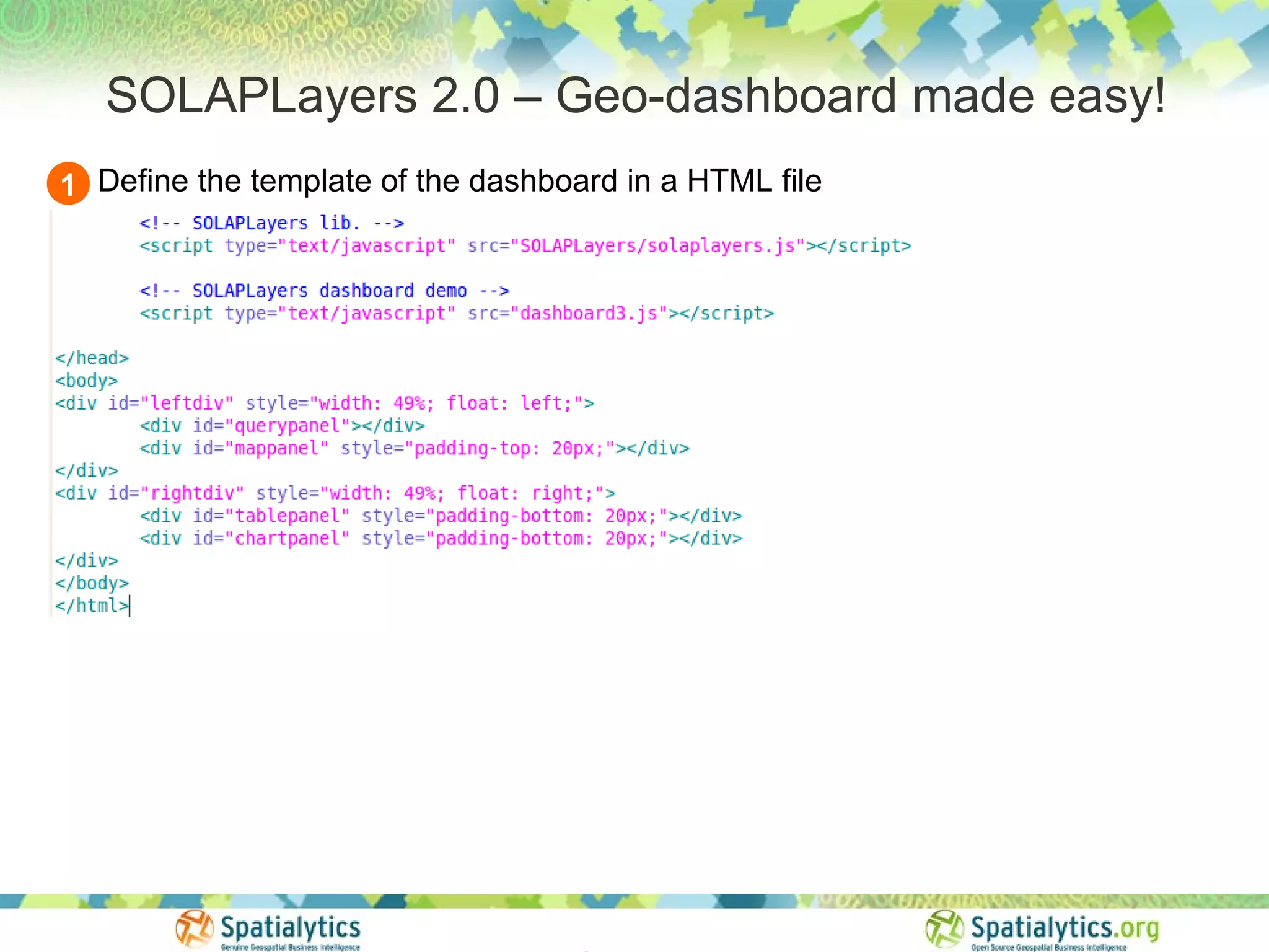
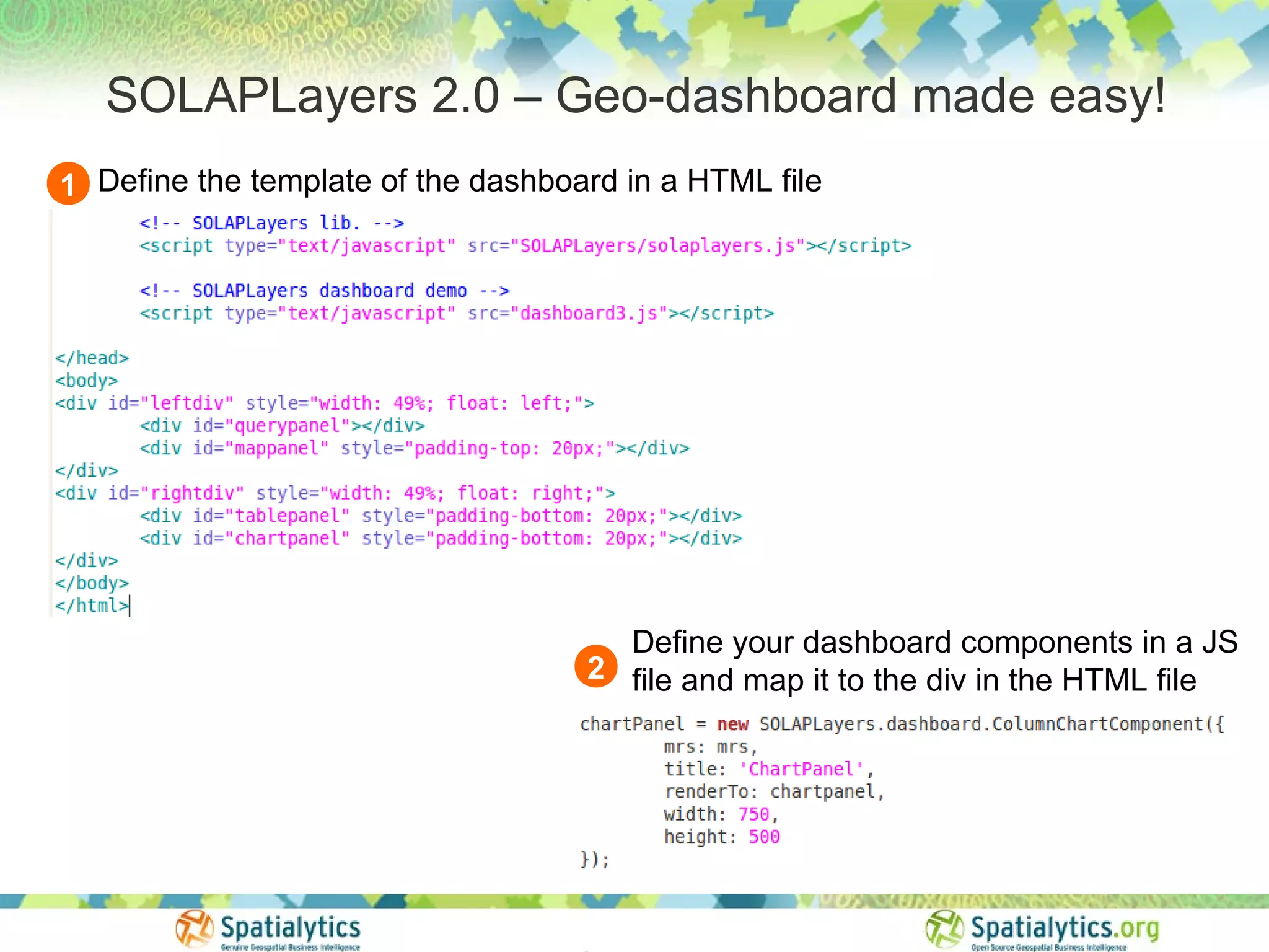

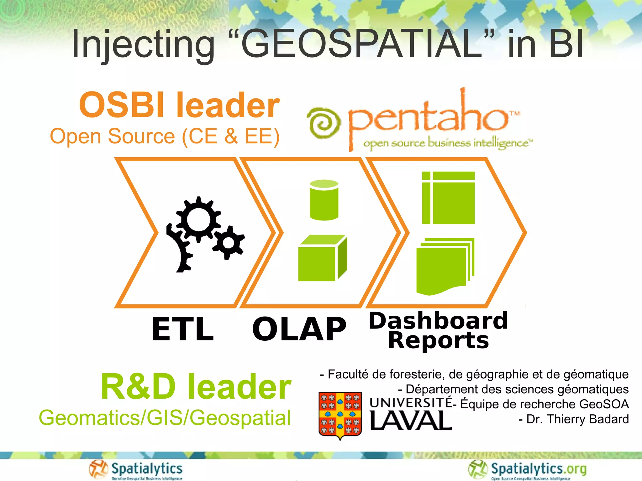
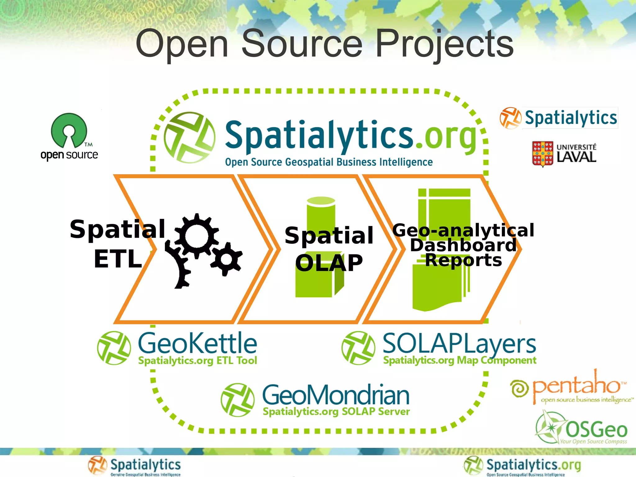
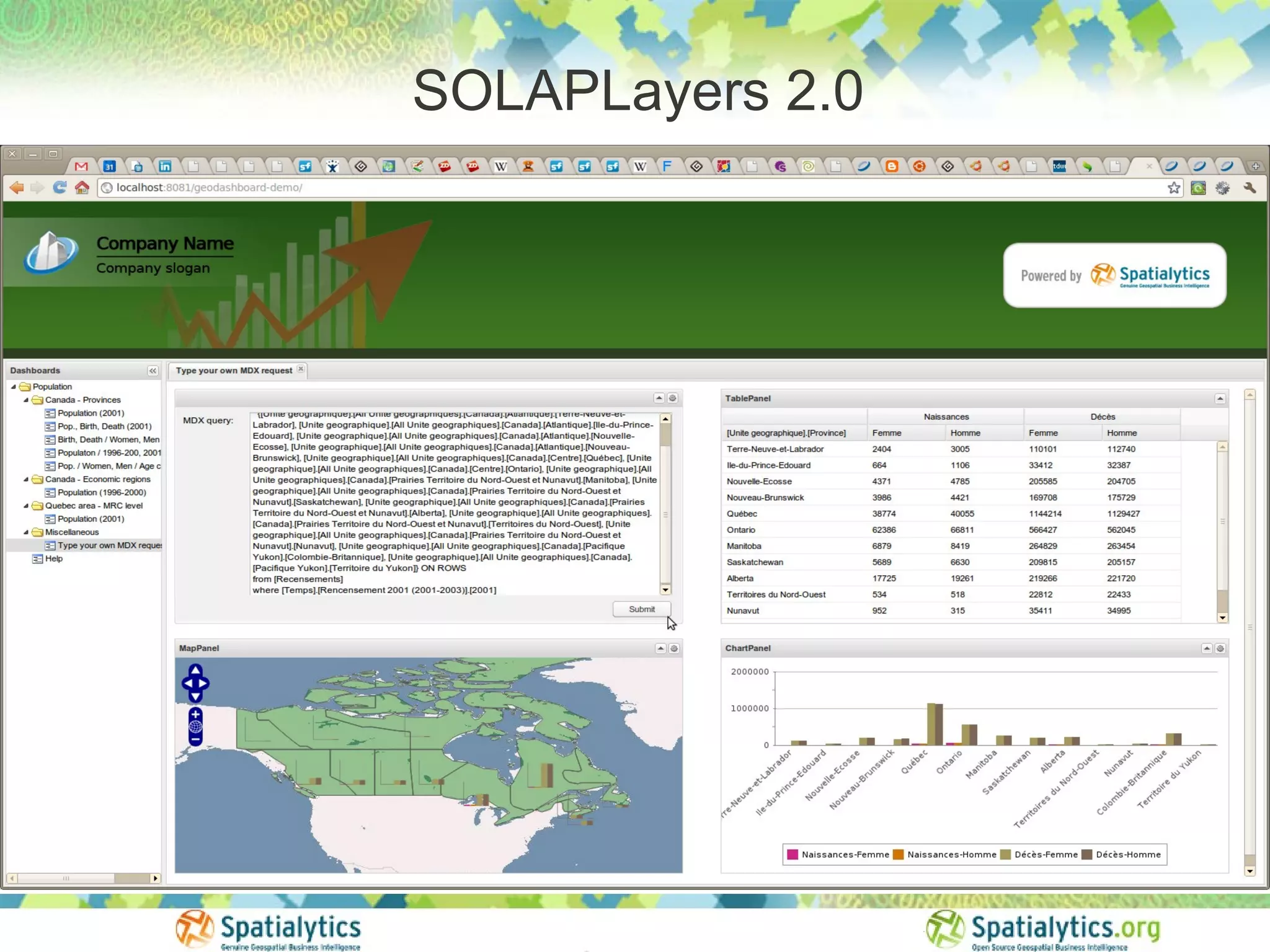
This document discusses spatially enabled open source business intelligence (GeoBI) tools including GeoKettle, GeoMondrian, and SOLAPLayers. GeoKettle adds spatial capabilities to Pentaho Data Integration. GeoMondrian does the same for Pentaho Analysis Services (Mondrian) by integrating spatial objects into OLAP data cubes. SOLAPLayers provides a lightweight framework for building interactive geospatial dashboards using these tools. The document demonstrates the capabilities and architecture of these projects.


![Vibe Coding vs. Spec-Driven Development [Free Meetup]](https://cdn.slidesharecdn.com/ss_thumbnails/vibecodingvsspecdrivendevelopment-251209105622-43f455e7-thumbnail.jpg?width=640&height=640&fit=bounds)


