SlideShare a Scribd company logo
1 of 7
OMAK ROCK (I)
(Okanogan County, Washington, c.1900 BC)
Dr. R.M. de Jonge ©, drsrmdejonge@hotmail.com
Oktober, 2013
Summary
Omak Rock is generally considered as a geological anomality. However, it appears the Rock
was placed into position by men in antiquity. The monument tells the story of the Egyptian
discovery of America via the Bering Sea by king Menkaure of the Fourth Dynasty (c.2570
BC). The four Atlantic crossings were subsequently discovered by three kings of the Fifth Dynasty. It appears the monument dates from the Twelfth Dynasty (c.1900 BC).
Introduction
Omak Rock is located at the south-east end of Omak Lake in the Colville Indian Reservation,
Okanogan County, Washington. It is situated at a distance of 25 km south-east of the town of
Omak, having 5,000 residents. The Rock has an estimated volume of 16 m 3, and a mass of about 40 tons. However, the granite Boulder sits on top of a medium height knoll, and balances
on a narrow support with a diameter of only c.40 cm, more than half a meter above the ground
(Fig.1). For that reason it is also called “Balanced Rock”. (Ref.1)
Megalithic Monument
There are reasons to believe Omak Rock is not a natural phenomenon, but a monument of the
Megalithic Culture of Western Europe. The Rock is situated at a distance of c.440 meters, or
4.0 millimoiras from the shore of Omak Lake (1 Egyptian moira= 1° of latitude= 111 km).
Omac Lake has a length of c.11 km, or 0.10 moira, and an average width of c.1.1 km, or 0.010
moira. The Boulder is located c.22 km, or 0.20 moiras above of the Columbia River, and at a
distance of c.220 km, or 2.0 moiras from the West Coast, at Port Susan, Puget Sound, near the
Strait of Juan de Fuca. (Ref.2)
Fig.1 Omak Rock in north Washington, with Omak Lake in the background.
(c.1900 BC, courtesy: Ref.1)
Discovery of America
King Menkaure
Omak Rock is located at a latitude of 48.2°N and a longitude of 119.4°W. Latitudes were already known c.4800 BC, as shown in the monument of Barnénez, Brittany, France. The meridian, or north-south line, of Omak Rock hits Pyramid Lake, Nevada, at 40°N. It refers to the
discovery of America in the Fourth Dynasty of Egypt. The Rock is situated at a distance of
440 meters, or 4.0 millimoiras from the shore of Omak Lake, confirming it.
It happened at the southern Aleutian islands, at the south side of the Bering Sea, at the complementary latitude of 90-40= c.50°N. In antiquity the use of complementary latitudes was very common. The discovery was accomplished by the 5th king Menkaure (Mycerinos, c.25802562 BC) of this dynasty. The 40th latitude line extends from coast to coast across 50° of longitude, confirming it.
The meridian runs along Lake Tahoe, at the border of Nevada and California, at 39°N. It refers to the exact latitude of the discovery at the southern Aleutian islands, at the complementary latitude of 90-39= 50+1= 51°N. – The holy Arctic Circle, at 67°N, is the northernmost line the Sun still shines at midwinter day (Sun religion). So, king Menkaure returned via the
crossing of the Bering Strait, 1° below it, at 67-1= 66°N. So, he also discovered this crossing,
66-51= 15° of latitude above the southern Aleutian islands. Omak Rock is located 150° west
of the Nile Delta, confirming it. (Refs.3-6)
Atlantic Crossings
King Sahure
The southern Cape Verde islands, off shore West Africa, are situated at 15°N (see above). The
Nile Delta, at 30°N, encodes the sailing direction of the Southern Crossing of the Atlantic,
with the wind and the current, 30° SSW. The 50th latitude line near the southern Aleutians en-
codes the point of arrival, Cape São Rock (the Holy Rock), Brazil, at 5°S, as well as the Fifth
Dynasty. The sailing distance of 2 Moiras, or 20°, encodes the 2nd king Sahure (c.2510-2498
BC), who discovered it. Omak Rock is located at a distance of 220 km, or 2.0 moiras from
Port Susan, at the West Coast, confirming it.
This King had to return. The meridian of Omak Rock hits Moses Lake, at 48-1= 47°N. It
shows he returned from Cape Race, the SE Cape of Newfoundland, at this latitude. The initial sailing direction, with the wind and the current, is 20° ESE, and the sailing distance is 2
Moiras, or 20°, to the two islands of the West Azores. It illustrates this Crossing was discovered by this 2nd king, as well. Omak Rock is located 0.2° and 48-46= 2° above the Columbia River, confirming it, twice.
The West Azores are located at the latitude of Lake Tahoe, at 39°N. The five islands of the
Central Azores, at 38°N, confirm it happened in the Fifth Dynasty. Its complementary latitude
of 90-38= 50+2= 52°N confirms the two southern crossings of the Ocean were discovered by
the 2nd king Sahure of this dynasty. The meridian of Omak Rock hits Okanagan Lake, Columbia, Canada, 2° above the Site, at 48+2= 50°N, confirming it.
The meridian of Omak Rock hits Tulare Lake, California, at 36°N. It refers to the circumference of the planet Earth of 36 Moiras, or 360° (1 Egyptian Moira= 10 moiras= 10°). It shows
the 2nd king Sahure (c.2510-2498 BC) was the first king who circumnavigated the planet
Earth. Tulare Lake is located 48-36= 12° below Omak Rock, confirming his 12 years of reign.
(Refs.7-11)
King Neferirkare
The Nile Delta is located at 30°N. It encodes the Northern Crossing of the Ocean from the
Shetland Islands, via the South Cape of Greenland, to Cape Chidley, Canada, at the complementary latitude of 90-30= 60°N. It was discovered by the 3rd king Neferirkare (c.2498-2478
BC). So, the third crossing of the Ocean was discovered by this 3rd king. Omak Rock is located at a distance of 220 km, or 2.0 moiras from Port Susan, at the West Coast, confirming his
20 years of reign.
King Unas
The last discovered crossing starts at Abaco Island, northern Bahama’s, 3° below the Mississippi Delta, at 30-3= 27°N. The 2nd king Sahure (c.2510-2498 BC) reigned for 12 years. It
shows the sailing distance to Bermuda, at 30+2= 32°N, was 12 moiras, or 12°. This island is
located 9° above the holy Tropic of Cancer, at 23+9= 32°N. At midsummer day the Sun is
there at right angles above (Sun religion).
It shows the Crossing from Bermuda to the nine islands of the Azores was discovered by the
9th and last king Unas (c.2403-2370 BC) of this dynasty. The three island groups of the Azores (the East, Central, and West Azores) encode the long sailing distance, with the wind and
the current: 3 Moiras, or 30°.
The 2nd king Sahure of the Fifth Dynasty sailed from the five islands of the Central Azores to
the two islands of Madeira, at 38-5= 33°N. Their latitude encodes the 33 years of reign of
king Unas (c.2403-2370 BC). The meridian of Omak Rock hits San Nicolas Island, California, at 33°N, confirming it. The latitude line of the Rock hits the east coast of Lake Superior,
33° of longitude to the east, confirming it, again. He was the last king of the Fifth Dynasty! -
He discovered the island of Bermuda, 50-32= 18° below the 50th latitude line, confirming the
18 years of reign of king Menkaure (c.2580-2562 BC), who discovered America.
The 40th latitude line plays an important role, because it honors the four Egyptian Kings who
were involved in the discovery of America. However, it also celebrates the four discovered
crossings of the Atlantic Ocean. (Refs.12-17)

Fig.2 The 5th king Menkaure (c.2580-2562 BC) of the Fourth Dynasty, who discovered
America via the Bering Sea. (Boston Museum of Fine Arts)
Religion
The 18 years of reign of king Menkaure refer to the ancient civilization around the south point
of the Gulf of Campeche, Mexico, at 18°N. It was the place where the Olmec civilization started, the holiest place of the America’s. It is the center of the Underworld, “the Realm of the
Dead, at the other side of the waters (the Ocean), in the land where the Sun sets (America).”
It is located at half the latitude of the Strait of Gibraltar, at 36/2= 18°N. It is the center of the
Land of Punt, at a symbolic distance of half the circumference of the planet Earth, 18 Moiras,
or 180° from the Land of the Living (Egypt). The ancient Egyptian “Book of the Dead” contains c.180 Spells for the Afterlife, confirming it. It is the oldest book on Earth. (Refs.18-33)
Date
Omak Rock is usely considered to be a balancing, glacial erratic, a geological anomality.
However, we believe this is not true. It appears in antiquity the Rock was
placed into this po-sition for its aimed function as a monument. - What might
be the date of this supported Rock?
North and South America were colonies of Egypt between c.2500 and 1200 BC. Together,
they formed the empire of Atlantis. It was the time period of the metal trade
from America to the Old World. Copper from Upper Michigan and Isle
Royale, and tin, silver and gold from Bolivia were shipped across the Ocean
to the Mediterranean. Omak Rock dates from this time period.
In an other article we will show Omak Rock also tells the story of the Comet Catastrophe (or
Flood) in the Sixth Dynasty (c.2344 BC). Megalithic monuments of this type were usely constructed in the Twelfth Dynasty. The Site is located 48-36= 12° above the latitude of the Strait
of Gibraltar, encoding a probable date in the Twelfth Dynasty (c.2007-1794 BC) (Middle
Kingdom). So, the estimated date is c.1900 BC. (Refs.34-39)
References
1. Website: http://en.wikipedia.org/wiki/Omak_Rock
2. Molina, Y., FB Group: “Mystery Mountain, West Virginia”
3. De Jonge, R.M., and Wakefield, J.S., How the SunGod Reached America c.2500 BC, A Guide to Megalithic
Sites, 2002 (ISBN 0-917054-19-9). Available: MCS Inc., Box 3392, Kirkland, Wa 98083, also on CD.
Website: www.howthesungod.com
4. Wakefield, J.S., and De Jonge, R.M., Rocks & Rows, Sailing Routes across the Atlantic and the Copper
Trade, MCS Inc, 2010 (ISBN 0-917054-20-2). Available: MCS Inc, Box 3392, Kirkland, Wa USA 98083.
Website: www.rocksandrows.com
5. De Jonge, R.M., Website: www.slideshare.net/rmdejonge
6. Pellech, Chr., Website: www.migration-diffusion.info
7. De Jonge, R.M., “The Discovery of Three Continents (Santo Stefano, North Sardinia, Italy, c.2300 BC)”, Ancient American, Vol.12, No.76, pgs.28-29 (2007), Ref.5.
8. De Jonge, R.M., “Houghton’s Petroglyph (Copper Country, Michigan, 2500-1200 BC)” (2009), Ref.5.
9. De Jonge, R.M., “The Mystic Symbol, mark of the Michigan Mound Builders” (2009), Ref.5.
10. De Jonge, R.M., “A Sword for America (Kirkburn, East Yorkshire, England, c.250 BC)” (2009), Ref.5.
11. De Jonge, R.M., “The Battersea Shield (River Thames, London, c.190 BC)” (2009), Ref.5, to be published.
12. De Jonge, R.M., and Wakefield, J.S., “Discovery of the Islands in the Ocean (Cairn T, Loughcrew, Co.
Meath, Ireland, c.3200 BC)” (2011), Ref.5.
13. De Jonge, R.M., and Wakefield, J.S., "The Passage Grave of Karleby, Encoding the Islands Discovered in the
Ocean, c.2950 BC", Migration & Diffusion, Vol.5, No.18, pgs.64-74 (2004), Ref.6.
14. De Jonge, R.M., and Wakefield, J.S., "The Three Rivers Petroglyph, A Guide-post for River Travel in America", Migration & Diffusion, Vol.3, No.12, pgs.74-100 (2002), Ref.6.
15. De Jonge, R.M., and Wakefield, J.S., “A Nautical Center for Crossing the Ocean, America’s Stonehenge,
New Hampshire, c.2200 BC”, Migration & Diffusion, Vol.4, No.15, pgs.60-100 (2003), Ref.6.
16. De Jonge, R.M., “Stonehenge, Monument for the Discovery of America (Salisbury Plain, South England,
c.2000 BC)” (2011), Refs.5,6.
17. De Jonge, R.M., “Tripod Rock, Pyramid Mountain (Morris County, New Jersey, c.1900 BC)” (2011), Refs.5,6.
18. De Jonge, R.M., “The Comet Catastrophe of c.2345 BC”, (sixteen articles),
Webpage: http://www.barry.warmkessel.com/dejonge.html
19. De Jonge, R.M., “Gold Ring (Grand Canyon, Arizona, c.1450 BC)” (2010), Ref.5.
20. De Jonge, R.M., “Sentinel Rock, Vermont (Discovery of America and Biblical Flood, c.1900 BC) ” (2011),
Refs.5,6.
21. De Jonge, R.M., “Oil City Glyphs (Pennsylvania, c. 2000 BC)” (2012), Ref.5.
22. Rydholm, C.F., Michigan Copper, The Untold Story, Winter Cabin Books, Marquette, 2006 (ISBN 09744679-2-8).
23. De Jonge, R.M., “Megaliths of Arrowhead Region I (Minnesota, c.1900 BC)” (2012), Ref.5.
24. De Jonge, R.M., “Megaliths of Arrowhead Region II (Minnesota, c.1900 and c.770 BC BC)” (2012), Ref.5.
25. De Jonge, R.M., “Grave Creek Mound (I) (Moundville, Marshall County, WV)” (2012), Ref.5.
26. De Jonge, R.M., “Grave Creek Mound (II) (c.720 BC, Moundville, Marshall County, WV)” (2012), Ref.5.
27. De Jonge, R.M., “Copper Spear Tip, (Crow Wing County, MN, c.1500 BC)”, (2013), Ref.5.
28. De Jonge, R.M., “Ancient Stone Balls, (Redwood Co. and Stevens Co., MN, c.1900 BC)”, (2013), Ref.5.
29. De Jonge, R.M., “Circle Cross Symbol, (Copper Harbor, Upper Michigan, c.1900 BC)”, (2013), Ref.5.
30. Faulkner, R.O., The Ancient Egyptian Book of the Dead, British Museum Press (2010) (ISBN 978-0-71411992-2).
31. Robin Mueller, FB Group: “Old Copper Complex and Ancient Waterways America”.
32. Susan English, Yahoo Group of the Ancient Waterways Society.
33. De Jonge, R.M., http://independent.academia.edu/ReinoudDeJonge
34. De Jonge, R.M., “Four Stone Chambers (I), (Crestone, Colorado, c.1900 BC)”, (2013), Refs.5,32,33.
35. De Jonge, R.M., “Four Stone Chambers (II), (Crestone, Colorado, c.1900 BC)”, (2013), Refs.5,32,33.
36. De Jonge, R.M., “Balanced Rock (I), (Buhl, Twin Falls County, Idaho)”, (2013), Refs.5,32,33.
37. De Jonge, R.M., “Balanced Rock (II), (Buhl, Twin Falls County, Idaho)”, (2013), Refs.5,32,33.
38. De Jonge, R.M., “Megalithic Writing (I), (Orkney’s, Scotland, c.2450 BC)”, (2013), Refs.5,32,33.
39. De Jonge, R.M., “Megalithic Writing (II), (Orkney’s, Scotland, c.2370 BC)”, (2013), Refs.5,32,33.

More Related Content

Similar to OMAK ROCK (I), WA

Similar to OMAK ROCK (I), WA (20)

OLD COPPER CULTURE II, MN
OLD COPPER CULTURE II, MNOLD COPPER CULTURE II, MN
OLD COPPER CULTURE II, MN
 
MYSTERY MOUNTAIN (I), WV
MYSTERY MOUNTAIN (I), WVMYSTERY MOUNTAIN (I), WV
MYSTERY MOUNTAIN (I), WV
 
OLD COPPER CULTURE I, MN
OLD COPPER CULTURE I, MNOLD COPPER CULTURE I, MN
OLD COPPER CULTURE I, MN
 
OIL CITY GLYPHS I, PA
OIL CITY GLYPHS I, PAOIL CITY GLYPHS I, PA
OIL CITY GLYPHS I, PA
 
GRAVE CREEK MOUND II, WV
GRAVE CREEK MOUND II, WVGRAVE CREEK MOUND II, WV
GRAVE CREEK MOUND II, WV
 
OMAK ROCK (II), WA
OMAK ROCK (II), WAOMAK ROCK (II), WA
OMAK ROCK (II), WA
 
COPPER SPEAR TIP, MN
COPPER SPEAR TIP, MNCOPPER SPEAR TIP, MN
COPPER SPEAR TIP, MN
 
CIRCLE CROSS CARVING, MI
CIRCLE CROSS CARVING, MICIRCLE CROSS CARVING, MI
CIRCLE CROSS CARVING, MI
 
ANGLO-SAXON ARTIFACTS
ANGLO-SAXON ARTIFACTSANGLO-SAXON ARTIFACTS
ANGLO-SAXON ARTIFACTS
 
INDIAN ROCK HOUSE, ARKANSAS
INDIAN ROCK HOUSE, ARKANSASINDIAN ROCK HOUSE, ARKANSAS
INDIAN ROCK HOUSE, ARKANSAS
 
PREHISTORY OF AZORES (3600-1200 BC)
PREHISTORY OF AZORES (3600-1200 BC)PREHISTORY OF AZORES (3600-1200 BC)
PREHISTORY OF AZORES (3600-1200 BC)
 
DISCOVERY OF THREE CONTINENTS, SARDINIA
DISCOVERY OF THREE CONTINENTS, SARDINIADISCOVERY OF THREE CONTINENTS, SARDINIA
DISCOVERY OF THREE CONTINENTS, SARDINIA
 
SWAN STONE, ILLINOIS
SWAN STONE, ILLINOISSWAN STONE, ILLINOIS
SWAN STONE, ILLINOIS
 
DISCOVERY OF AMERICA
DISCOVERY OF AMERICADISCOVERY OF AMERICA
DISCOVERY OF AMERICA
 
SPHERICAL ROCK, WI
SPHERICAL ROCK, WISPHERICAL ROCK, WI
SPHERICAL ROCK, WI
 
IKOM AND DARDANUS FLOOD
IKOM AND DARDANUS FLOODIKOM AND DARDANUS FLOOD
IKOM AND DARDANUS FLOOD
 
GOLD RING, ARIZONA
GOLD RING, ARIZONAGOLD RING, ARIZONA
GOLD RING, ARIZONA
 
BALANCED ROCK (II), ID
BALANCED ROCK (II), IDBALANCED ROCK (II), ID
BALANCED ROCK (II), ID
 
MEGALITHIC WRITING (II), ORKNEY'S
MEGALITHIC WRITING (II), ORKNEY'SMEGALITHIC WRITING (II), ORKNEY'S
MEGALITHIC WRITING (II), ORKNEY'S
 
MEGALITHS ON ICELAND
MEGALITHS ON ICELANDMEGALITHS ON ICELAND
MEGALITHS ON ICELAND
 

More from INSTITUTE OF MEGALITHIC RESEARCH (10)

LONGYOU CAVES, CHINA
LONGYOU CAVES, CHINALONGYOU CAVES, CHINA
LONGYOU CAVES, CHINA
 
EARLY DISCOVERY OF THE WORLD (II)
EARLY DISCOVERY OF THE WORLD (II)EARLY DISCOVERY OF THE WORLD (II)
EARLY DISCOVERY OF THE WORLD (II)
 
EARLY DISCOVERY OF THE WORLD (I)
EARLY DISCOVERY OF THE WORLD (I)EARLY DISCOVERY OF THE WORLD (I)
EARLY DISCOVERY OF THE WORLD (I)
 
SAILING FROM NEW ZEALAND TO AUSTRALIA
SAILING FROM NEW ZEALAND TO AUSTRALIASAILING FROM NEW ZEALAND TO AUSTRALIA
SAILING FROM NEW ZEALAND TO AUSTRALIA
 
MAN OF BACKA, SWEDEN
MAN OF BACKA, SWEDENMAN OF BACKA, SWEDEN
MAN OF BACKA, SWEDEN
 
MEGALITHIC WRITING (I), ORKNEY'S
MEGALITHIC WRITING (I), ORKNEY'SMEGALITHIC WRITING (I), ORKNEY'S
MEGALITHIC WRITING (I), ORKNEY'S
 
Could it be just a rock?
Could it be just a rock?Could it be just a rock?
Could it be just a rock?
 
RATTLESNAKE DISC (MOUNDVILLE, AL)
RATTLESNAKE DISC (MOUNDVILLE, AL)RATTLESNAKE DISC (MOUNDVILLE, AL)
RATTLESNAKE DISC (MOUNDVILLE, AL)
 
OIL CITY GLYPHS II, PA
OIL CITY GLYPHS II, PAOIL CITY GLYPHS II, PA
OIL CITY GLYPHS II, PA
 
NARRAGANSETT RUNE STONE
NARRAGANSETT RUNE STONENARRAGANSETT RUNE STONE
NARRAGANSETT RUNE STONE
 

Recently uploaded

CARE OF CHILD IN INCUBATOR..........pptx
CARE OF CHILD IN INCUBATOR..........pptxCARE OF CHILD IN INCUBATOR..........pptx
CARE OF CHILD IN INCUBATOR..........pptxGaneshChakor2
 
microwave assisted reaction. General introduction
microwave assisted reaction. General introductionmicrowave assisted reaction. General introduction
microwave assisted reaction. General introductionMaksud Ahmed
 
Nutritional Needs Presentation - HLTH 104
Nutritional Needs Presentation - HLTH 104Nutritional Needs Presentation - HLTH 104
Nutritional Needs Presentation - HLTH 104misteraugie
 
Organic Name Reactions for the students and aspirants of Chemistry12th.pptx
Organic Name Reactions  for the students and aspirants of Chemistry12th.pptxOrganic Name Reactions  for the students and aspirants of Chemistry12th.pptx
Organic Name Reactions for the students and aspirants of Chemistry12th.pptxVS Mahajan Coaching Centre
 
Kisan Call Centre - To harness potential of ICT in Agriculture by answer farm...
Kisan Call Centre - To harness potential of ICT in Agriculture by answer farm...Kisan Call Centre - To harness potential of ICT in Agriculture by answer farm...
Kisan Call Centre - To harness potential of ICT in Agriculture by answer farm...Krashi Coaching
 
social pharmacy d-pharm 1st year by Pragati K. Mahajan
social pharmacy d-pharm 1st year by Pragati K. Mahajansocial pharmacy d-pharm 1st year by Pragati K. Mahajan
social pharmacy d-pharm 1st year by Pragati K. Mahajanpragatimahajan3
 
JAPAN: ORGANISATION OF PMDA, PHARMACEUTICAL LAWS & REGULATIONS, TYPES OF REGI...
JAPAN: ORGANISATION OF PMDA, PHARMACEUTICAL LAWS & REGULATIONS, TYPES OF REGI...JAPAN: ORGANISATION OF PMDA, PHARMACEUTICAL LAWS & REGULATIONS, TYPES OF REGI...
JAPAN: ORGANISATION OF PMDA, PHARMACEUTICAL LAWS & REGULATIONS, TYPES OF REGI...anjaliyadav012327
 
BAG TECHNIQUE Bag technique-a tool making use of public health bag through wh...
BAG TECHNIQUE Bag technique-a tool making use of public health bag through wh...BAG TECHNIQUE Bag technique-a tool making use of public health bag through wh...
BAG TECHNIQUE Bag technique-a tool making use of public health bag through wh...Sapna Thakur
 
SOCIAL AND HISTORICAL CONTEXT - LFTVD.pptx
SOCIAL AND HISTORICAL CONTEXT - LFTVD.pptxSOCIAL AND HISTORICAL CONTEXT - LFTVD.pptx
SOCIAL AND HISTORICAL CONTEXT - LFTVD.pptxiammrhaywood
 
Arihant handbook biology for class 11 .pdf
Arihant handbook biology for class 11 .pdfArihant handbook biology for class 11 .pdf
Arihant handbook biology for class 11 .pdfchloefrazer622
 
Student login on Anyboli platform.helpin
Student login on Anyboli platform.helpinStudent login on Anyboli platform.helpin
Student login on Anyboli platform.helpinRaunakKeshri1
 
Beyond the EU: DORA and NIS 2 Directive's Global Impact
Beyond the EU: DORA and NIS 2 Directive's Global ImpactBeyond the EU: DORA and NIS 2 Directive's Global Impact
Beyond the EU: DORA and NIS 2 Directive's Global ImpactPECB
 
Measures of Central Tendency: Mean, Median and Mode
Measures of Central Tendency: Mean, Median and ModeMeasures of Central Tendency: Mean, Median and Mode
Measures of Central Tendency: Mean, Median and ModeThiyagu K
 
Interactive Powerpoint_How to Master effective communication
Interactive Powerpoint_How to Master effective communicationInteractive Powerpoint_How to Master effective communication
Interactive Powerpoint_How to Master effective communicationnomboosow
 
Q4-W6-Restating Informational Text Grade 3
Q4-W6-Restating Informational Text Grade 3Q4-W6-Restating Informational Text Grade 3
Q4-W6-Restating Informational Text Grade 3JemimahLaneBuaron
 
Call Girls in Dwarka Mor Delhi Contact Us 9654467111
Call Girls in Dwarka Mor Delhi Contact Us 9654467111Call Girls in Dwarka Mor Delhi Contact Us 9654467111
Call Girls in Dwarka Mor Delhi Contact Us 9654467111Sapana Sha
 
Grant Readiness 101 TechSoup and Remy Consulting
Grant Readiness 101 TechSoup and Remy ConsultingGrant Readiness 101 TechSoup and Remy Consulting
Grant Readiness 101 TechSoup and Remy ConsultingTechSoup
 
Sanyam Choudhary Chemistry practical.pdf
Sanyam Choudhary Chemistry practical.pdfSanyam Choudhary Chemistry practical.pdf
Sanyam Choudhary Chemistry practical.pdfsanyamsingh5019
 

Recently uploaded (20)

CARE OF CHILD IN INCUBATOR..........pptx
CARE OF CHILD IN INCUBATOR..........pptxCARE OF CHILD IN INCUBATOR..........pptx
CARE OF CHILD IN INCUBATOR..........pptx
 
microwave assisted reaction. General introduction
microwave assisted reaction. General introductionmicrowave assisted reaction. General introduction
microwave assisted reaction. General introduction
 
Nutritional Needs Presentation - HLTH 104
Nutritional Needs Presentation - HLTH 104Nutritional Needs Presentation - HLTH 104
Nutritional Needs Presentation - HLTH 104
 
Organic Name Reactions for the students and aspirants of Chemistry12th.pptx
Organic Name Reactions  for the students and aspirants of Chemistry12th.pptxOrganic Name Reactions  for the students and aspirants of Chemistry12th.pptx
Organic Name Reactions for the students and aspirants of Chemistry12th.pptx
 
Kisan Call Centre - To harness potential of ICT in Agriculture by answer farm...
Kisan Call Centre - To harness potential of ICT in Agriculture by answer farm...Kisan Call Centre - To harness potential of ICT in Agriculture by answer farm...
Kisan Call Centre - To harness potential of ICT in Agriculture by answer farm...
 
social pharmacy d-pharm 1st year by Pragati K. Mahajan
social pharmacy d-pharm 1st year by Pragati K. Mahajansocial pharmacy d-pharm 1st year by Pragati K. Mahajan
social pharmacy d-pharm 1st year by Pragati K. Mahajan
 
JAPAN: ORGANISATION OF PMDA, PHARMACEUTICAL LAWS & REGULATIONS, TYPES OF REGI...
JAPAN: ORGANISATION OF PMDA, PHARMACEUTICAL LAWS & REGULATIONS, TYPES OF REGI...JAPAN: ORGANISATION OF PMDA, PHARMACEUTICAL LAWS & REGULATIONS, TYPES OF REGI...
JAPAN: ORGANISATION OF PMDA, PHARMACEUTICAL LAWS & REGULATIONS, TYPES OF REGI...
 
BAG TECHNIQUE Bag technique-a tool making use of public health bag through wh...
BAG TECHNIQUE Bag technique-a tool making use of public health bag through wh...BAG TECHNIQUE Bag technique-a tool making use of public health bag through wh...
BAG TECHNIQUE Bag technique-a tool making use of public health bag through wh...
 
SOCIAL AND HISTORICAL CONTEXT - LFTVD.pptx
SOCIAL AND HISTORICAL CONTEXT - LFTVD.pptxSOCIAL AND HISTORICAL CONTEXT - LFTVD.pptx
SOCIAL AND HISTORICAL CONTEXT - LFTVD.pptx
 
Arihant handbook biology for class 11 .pdf
Arihant handbook biology for class 11 .pdfArihant handbook biology for class 11 .pdf
Arihant handbook biology for class 11 .pdf
 
Student login on Anyboli platform.helpin
Student login on Anyboli platform.helpinStudent login on Anyboli platform.helpin
Student login on Anyboli platform.helpin
 
Beyond the EU: DORA and NIS 2 Directive's Global Impact
Beyond the EU: DORA and NIS 2 Directive's Global ImpactBeyond the EU: DORA and NIS 2 Directive's Global Impact
Beyond the EU: DORA and NIS 2 Directive's Global Impact
 
Measures of Central Tendency: Mean, Median and Mode
Measures of Central Tendency: Mean, Median and ModeMeasures of Central Tendency: Mean, Median and Mode
Measures of Central Tendency: Mean, Median and Mode
 
Interactive Powerpoint_How to Master effective communication
Interactive Powerpoint_How to Master effective communicationInteractive Powerpoint_How to Master effective communication
Interactive Powerpoint_How to Master effective communication
 
Q4-W6-Restating Informational Text Grade 3
Q4-W6-Restating Informational Text Grade 3Q4-W6-Restating Informational Text Grade 3
Q4-W6-Restating Informational Text Grade 3
 
Call Girls in Dwarka Mor Delhi Contact Us 9654467111
Call Girls in Dwarka Mor Delhi Contact Us 9654467111Call Girls in Dwarka Mor Delhi Contact Us 9654467111
Call Girls in Dwarka Mor Delhi Contact Us 9654467111
 
INDIA QUIZ 2024 RLAC DELHI UNIVERSITY.pptx
INDIA QUIZ 2024 RLAC DELHI UNIVERSITY.pptxINDIA QUIZ 2024 RLAC DELHI UNIVERSITY.pptx
INDIA QUIZ 2024 RLAC DELHI UNIVERSITY.pptx
 
Grant Readiness 101 TechSoup and Remy Consulting
Grant Readiness 101 TechSoup and Remy ConsultingGrant Readiness 101 TechSoup and Remy Consulting
Grant Readiness 101 TechSoup and Remy Consulting
 
Mattingly "AI & Prompt Design: The Basics of Prompt Design"
Mattingly "AI & Prompt Design: The Basics of Prompt Design"Mattingly "AI & Prompt Design: The Basics of Prompt Design"
Mattingly "AI & Prompt Design: The Basics of Prompt Design"
 
Sanyam Choudhary Chemistry practical.pdf
Sanyam Choudhary Chemistry practical.pdfSanyam Choudhary Chemistry practical.pdf
Sanyam Choudhary Chemistry practical.pdf
 

OMAK ROCK (I), WA

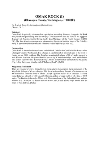
  • 1. OMAK ROCK (I) (Okanogan County, Washington, c.1900 BC) Dr. R.M. de Jonge ©, drsrmdejonge@hotmail.com Oktober, 2013 Summary Omak Rock is generally considered as a geological anomality. However, it appears the Rock was placed into position by men in antiquity. The monument tells the story of the Egyptian discovery of America via the Bering Sea by king Menkaure of the Fourth Dynasty (c.2570 BC). The four Atlantic crossings were subsequently discovered by three kings of the Fifth Dynasty. It appears the monument dates from the Twelfth Dynasty (c.1900 BC). Introduction Omak Rock is located at the south-east end of Omak Lake in the Colville Indian Reservation, Okanogan County, Washington. It is situated at a distance of 25 km south-east of the town of Omak, having 5,000 residents. The Rock has an estimated volume of 16 m 3, and a mass of about 40 tons. However, the granite Boulder sits on top of a medium height knoll, and balances on a narrow support with a diameter of only c.40 cm, more than half a meter above the ground (Fig.1). For that reason it is also called “Balanced Rock”. (Ref.1) Megalithic Monument There are reasons to believe Omak Rock is not a natural phenomenon, but a monument of the Megalithic Culture of Western Europe. The Rock is situated at a distance of c.440 meters, or 4.0 millimoiras from the shore of Omak Lake (1 Egyptian moira= 1° of latitude= 111 km). Omac Lake has a length of c.11 km, or 0.10 moira, and an average width of c.1.1 km, or 0.010 moira. The Boulder is located c.22 km, or 0.20 moiras above of the Columbia River, and at a distance of c.220 km, or 2.0 moiras from the West Coast, at Port Susan, Puget Sound, near the Strait of Juan de Fuca. (Ref.2)
  • 2. Fig.1 Omak Rock in north Washington, with Omak Lake in the background. (c.1900 BC, courtesy: Ref.1) Discovery of America King Menkaure Omak Rock is located at a latitude of 48.2°N and a longitude of 119.4°W. Latitudes were already known c.4800 BC, as shown in the monument of Barnénez, Brittany, France. The meridian, or north-south line, of Omak Rock hits Pyramid Lake, Nevada, at 40°N. It refers to the discovery of America in the Fourth Dynasty of Egypt. The Rock is situated at a distance of 440 meters, or 4.0 millimoiras from the shore of Omak Lake, confirming it. It happened at the southern Aleutian islands, at the south side of the Bering Sea, at the complementary latitude of 90-40= c.50°N. In antiquity the use of complementary latitudes was very common. The discovery was accomplished by the 5th king Menkaure (Mycerinos, c.25802562 BC) of this dynasty. The 40th latitude line extends from coast to coast across 50° of longitude, confirming it. The meridian runs along Lake Tahoe, at the border of Nevada and California, at 39°N. It refers to the exact latitude of the discovery at the southern Aleutian islands, at the complementary latitude of 90-39= 50+1= 51°N. – The holy Arctic Circle, at 67°N, is the northernmost line the Sun still shines at midwinter day (Sun religion). So, king Menkaure returned via the crossing of the Bering Strait, 1° below it, at 67-1= 66°N. So, he also discovered this crossing, 66-51= 15° of latitude above the southern Aleutian islands. Omak Rock is located 150° west of the Nile Delta, confirming it. (Refs.3-6) Atlantic Crossings King Sahure The southern Cape Verde islands, off shore West Africa, are situated at 15°N (see above). The Nile Delta, at 30°N, encodes the sailing direction of the Southern Crossing of the Atlantic, with the wind and the current, 30° SSW. The 50th latitude line near the southern Aleutians en-
  • 3. codes the point of arrival, Cape São Rock (the Holy Rock), Brazil, at 5°S, as well as the Fifth Dynasty. The sailing distance of 2 Moiras, or 20°, encodes the 2nd king Sahure (c.2510-2498 BC), who discovered it. Omak Rock is located at a distance of 220 km, or 2.0 moiras from Port Susan, at the West Coast, confirming it. This King had to return. The meridian of Omak Rock hits Moses Lake, at 48-1= 47°N. It shows he returned from Cape Race, the SE Cape of Newfoundland, at this latitude. The initial sailing direction, with the wind and the current, is 20° ESE, and the sailing distance is 2 Moiras, or 20°, to the two islands of the West Azores. It illustrates this Crossing was discovered by this 2nd king, as well. Omak Rock is located 0.2° and 48-46= 2° above the Columbia River, confirming it, twice. The West Azores are located at the latitude of Lake Tahoe, at 39°N. The five islands of the Central Azores, at 38°N, confirm it happened in the Fifth Dynasty. Its complementary latitude of 90-38= 50+2= 52°N confirms the two southern crossings of the Ocean were discovered by the 2nd king Sahure of this dynasty. The meridian of Omak Rock hits Okanagan Lake, Columbia, Canada, 2° above the Site, at 48+2= 50°N, confirming it. The meridian of Omak Rock hits Tulare Lake, California, at 36°N. It refers to the circumference of the planet Earth of 36 Moiras, or 360° (1 Egyptian Moira= 10 moiras= 10°). It shows the 2nd king Sahure (c.2510-2498 BC) was the first king who circumnavigated the planet Earth. Tulare Lake is located 48-36= 12° below Omak Rock, confirming his 12 years of reign. (Refs.7-11) King Neferirkare The Nile Delta is located at 30°N. It encodes the Northern Crossing of the Ocean from the Shetland Islands, via the South Cape of Greenland, to Cape Chidley, Canada, at the complementary latitude of 90-30= 60°N. It was discovered by the 3rd king Neferirkare (c.2498-2478 BC). So, the third crossing of the Ocean was discovered by this 3rd king. Omak Rock is located at a distance of 220 km, or 2.0 moiras from Port Susan, at the West Coast, confirming his 20 years of reign. King Unas The last discovered crossing starts at Abaco Island, northern Bahama’s, 3° below the Mississippi Delta, at 30-3= 27°N. The 2nd king Sahure (c.2510-2498 BC) reigned for 12 years. It shows the sailing distance to Bermuda, at 30+2= 32°N, was 12 moiras, or 12°. This island is located 9° above the holy Tropic of Cancer, at 23+9= 32°N. At midsummer day the Sun is there at right angles above (Sun religion). It shows the Crossing from Bermuda to the nine islands of the Azores was discovered by the 9th and last king Unas (c.2403-2370 BC) of this dynasty. The three island groups of the Azores (the East, Central, and West Azores) encode the long sailing distance, with the wind and the current: 3 Moiras, or 30°. The 2nd king Sahure of the Fifth Dynasty sailed from the five islands of the Central Azores to the two islands of Madeira, at 38-5= 33°N. Their latitude encodes the 33 years of reign of king Unas (c.2403-2370 BC). The meridian of Omak Rock hits San Nicolas Island, California, at 33°N, confirming it. The latitude line of the Rock hits the east coast of Lake Superior, 33° of longitude to the east, confirming it, again. He was the last king of the Fifth Dynasty! -
  • 4. He discovered the island of Bermuda, 50-32= 18° below the 50th latitude line, confirming the 18 years of reign of king Menkaure (c.2580-2562 BC), who discovered America. The 40th latitude line plays an important role, because it honors the four Egyptian Kings who were involved in the discovery of America. However, it also celebrates the four discovered crossings of the Atlantic Ocean. (Refs.12-17) Fig.2 The 5th king Menkaure (c.2580-2562 BC) of the Fourth Dynasty, who discovered America via the Bering Sea. (Boston Museum of Fine Arts) Religion The 18 years of reign of king Menkaure refer to the ancient civilization around the south point of the Gulf of Campeche, Mexico, at 18°N. It was the place where the Olmec civilization started, the holiest place of the America’s. It is the center of the Underworld, “the Realm of the Dead, at the other side of the waters (the Ocean), in the land where the Sun sets (America).” It is located at half the latitude of the Strait of Gibraltar, at 36/2= 18°N. It is the center of the Land of Punt, at a symbolic distance of half the circumference of the planet Earth, 18 Moiras, or 180° from the Land of the Living (Egypt). The ancient Egyptian “Book of the Dead” contains c.180 Spells for the Afterlife, confirming it. It is the oldest book on Earth. (Refs.18-33)
  • 5. Date Omak Rock is usely considered to be a balancing, glacial erratic, a geological anomality. However, we believe this is not true. It appears in antiquity the Rock was placed into this po-sition for its aimed function as a monument. - What might be the date of this supported Rock? North and South America were colonies of Egypt between c.2500 and 1200 BC. Together, they formed the empire of Atlantis. It was the time period of the metal trade from America to the Old World. Copper from Upper Michigan and Isle Royale, and tin, silver and gold from Bolivia were shipped across the Ocean to the Mediterranean. Omak Rock dates from this time period. In an other article we will show Omak Rock also tells the story of the Comet Catastrophe (or Flood) in the Sixth Dynasty (c.2344 BC). Megalithic monuments of this type were usely constructed in the Twelfth Dynasty. The Site is located 48-36= 12° above the latitude of the Strait of Gibraltar, encoding a probable date in the Twelfth Dynasty (c.2007-1794 BC) (Middle Kingdom). So, the estimated date is c.1900 BC. (Refs.34-39) References 1. Website: http://en.wikipedia.org/wiki/Omak_Rock 2. Molina, Y., FB Group: “Mystery Mountain, West Virginia” 3. De Jonge, R.M., and Wakefield, J.S., How the SunGod Reached America c.2500 BC, A Guide to Megalithic Sites, 2002 (ISBN 0-917054-19-9). Available: MCS Inc., Box 3392, Kirkland, Wa 98083, also on CD. Website: www.howthesungod.com 4. Wakefield, J.S., and De Jonge, R.M., Rocks & Rows, Sailing Routes across the Atlantic and the Copper Trade, MCS Inc, 2010 (ISBN 0-917054-20-2). Available: MCS Inc, Box 3392, Kirkland, Wa USA 98083. Website: www.rocksandrows.com 5. De Jonge, R.M., Website: www.slideshare.net/rmdejonge 6. Pellech, Chr., Website: www.migration-diffusion.info 7. De Jonge, R.M., “The Discovery of Three Continents (Santo Stefano, North Sardinia, Italy, c.2300 BC)”, Ancient American, Vol.12, No.76, pgs.28-29 (2007), Ref.5. 8. De Jonge, R.M., “Houghton’s Petroglyph (Copper Country, Michigan, 2500-1200 BC)” (2009), Ref.5. 9. De Jonge, R.M., “The Mystic Symbol, mark of the Michigan Mound Builders” (2009), Ref.5. 10. De Jonge, R.M., “A Sword for America (Kirkburn, East Yorkshire, England, c.250 BC)” (2009), Ref.5. 11. De Jonge, R.M., “The Battersea Shield (River Thames, London, c.190 BC)” (2009), Ref.5, to be published. 12. De Jonge, R.M., and Wakefield, J.S., “Discovery of the Islands in the Ocean (Cairn T, Loughcrew, Co. Meath, Ireland, c.3200 BC)” (2011), Ref.5. 13. De Jonge, R.M., and Wakefield, J.S., "The Passage Grave of Karleby, Encoding the Islands Discovered in the Ocean, c.2950 BC", Migration & Diffusion, Vol.5, No.18, pgs.64-74 (2004), Ref.6. 14. De Jonge, R.M., and Wakefield, J.S., "The Three Rivers Petroglyph, A Guide-post for River Travel in America", Migration & Diffusion, Vol.3, No.12, pgs.74-100 (2002), Ref.6. 15. De Jonge, R.M., and Wakefield, J.S., “A Nautical Center for Crossing the Ocean, America’s Stonehenge, New Hampshire, c.2200 BC”, Migration & Diffusion, Vol.4, No.15, pgs.60-100 (2003), Ref.6. 16. De Jonge, R.M., “Stonehenge, Monument for the Discovery of America (Salisbury Plain, South England, c.2000 BC)” (2011), Refs.5,6. 17. De Jonge, R.M., “Tripod Rock, Pyramid Mountain (Morris County, New Jersey, c.1900 BC)” (2011), Refs.5,6. 18. De Jonge, R.M., “The Comet Catastrophe of c.2345 BC”, (sixteen articles), Webpage: http://www.barry.warmkessel.com/dejonge.html 19. De Jonge, R.M., “Gold Ring (Grand Canyon, Arizona, c.1450 BC)” (2010), Ref.5. 20. De Jonge, R.M., “Sentinel Rock, Vermont (Discovery of America and Biblical Flood, c.1900 BC) ” (2011), Refs.5,6. 21. De Jonge, R.M., “Oil City Glyphs (Pennsylvania, c. 2000 BC)” (2012), Ref.5. 22. Rydholm, C.F., Michigan Copper, The Untold Story, Winter Cabin Books, Marquette, 2006 (ISBN 09744679-2-8). 23. De Jonge, R.M., “Megaliths of Arrowhead Region I (Minnesota, c.1900 BC)” (2012), Ref.5. 24. De Jonge, R.M., “Megaliths of Arrowhead Region II (Minnesota, c.1900 and c.770 BC BC)” (2012), Ref.5.
  • 6. 25. De Jonge, R.M., “Grave Creek Mound (I) (Moundville, Marshall County, WV)” (2012), Ref.5. 26. De Jonge, R.M., “Grave Creek Mound (II) (c.720 BC, Moundville, Marshall County, WV)” (2012), Ref.5. 27. De Jonge, R.M., “Copper Spear Tip, (Crow Wing County, MN, c.1500 BC)”, (2013), Ref.5. 28. De Jonge, R.M., “Ancient Stone Balls, (Redwood Co. and Stevens Co., MN, c.1900 BC)”, (2013), Ref.5. 29. De Jonge, R.M., “Circle Cross Symbol, (Copper Harbor, Upper Michigan, c.1900 BC)”, (2013), Ref.5. 30. Faulkner, R.O., The Ancient Egyptian Book of the Dead, British Museum Press (2010) (ISBN 978-0-71411992-2). 31. Robin Mueller, FB Group: “Old Copper Complex and Ancient Waterways America”. 32. Susan English, Yahoo Group of the Ancient Waterways Society. 33. De Jonge, R.M., http://independent.academia.edu/ReinoudDeJonge 34. De Jonge, R.M., “Four Stone Chambers (I), (Crestone, Colorado, c.1900 BC)”, (2013), Refs.5,32,33. 35. De Jonge, R.M., “Four Stone Chambers (II), (Crestone, Colorado, c.1900 BC)”, (2013), Refs.5,32,33. 36. De Jonge, R.M., “Balanced Rock (I), (Buhl, Twin Falls County, Idaho)”, (2013), Refs.5,32,33. 37. De Jonge, R.M., “Balanced Rock (II), (Buhl, Twin Falls County, Idaho)”, (2013), Refs.5,32,33. 38. De Jonge, R.M., “Megalithic Writing (I), (Orkney’s, Scotland, c.2450 BC)”, (2013), Refs.5,32,33. 39. De Jonge, R.M., “Megalithic Writing (II), (Orkney’s, Scotland, c.2370 BC)”, (2013), Refs.5,32,33.
  • 7. 25. De Jonge, R.M., “Grave Creek Mound (I) (Moundville, Marshall County, WV)” (2012), Ref.5. 26. De Jonge, R.M., “Grave Creek Mound (II) (c.720 BC, Moundville, Marshall County, WV)” (2012), Ref.5. 27. De Jonge, R.M., “Copper Spear Tip, (Crow Wing County, MN, c.1500 BC)”, (2013), Ref.5. 28. De Jonge, R.M., “Ancient Stone Balls, (Redwood Co. and Stevens Co., MN, c.1900 BC)”, (2013), Ref.5. 29. De Jonge, R.M., “Circle Cross Symbol, (Copper Harbor, Upper Michigan, c.1900 BC)”, (2013), Ref.5. 30. Faulkner, R.O., The Ancient Egyptian Book of the Dead, British Museum Press (2010) (ISBN 978-0-71411992-2). 31. Robin Mueller, FB Group: “Old Copper Complex and Ancient Waterways America”. 32. Susan English, Yahoo Group of the Ancient Waterways Society. 33. De Jonge, R.M., http://independent.academia.edu/ReinoudDeJonge 34. De Jonge, R.M., “Four Stone Chambers (I), (Crestone, Colorado, c.1900 BC)”, (2013), Refs.5,32,33. 35. De Jonge, R.M., “Four Stone Chambers (II), (Crestone, Colorado, c.1900 BC)”, (2013), Refs.5,32,33. 36. De Jonge, R.M., “Balanced Rock (I), (Buhl, Twin Falls County, Idaho)”, (2013), Refs.5,32,33. 37. De Jonge, R.M., “Balanced Rock (II), (Buhl, Twin Falls County, Idaho)”, (2013), Refs.5,32,33. 38. De Jonge, R.M., “Megalithic Writing (I), (Orkney’s, Scotland, c.2450 BC)”, (2013), Refs.5,32,33. 39. De Jonge, R.M., “Megalithic Writing (II), (Orkney’s, Scotland, c.2370 BC)”, (2013), Refs.5,32,33.