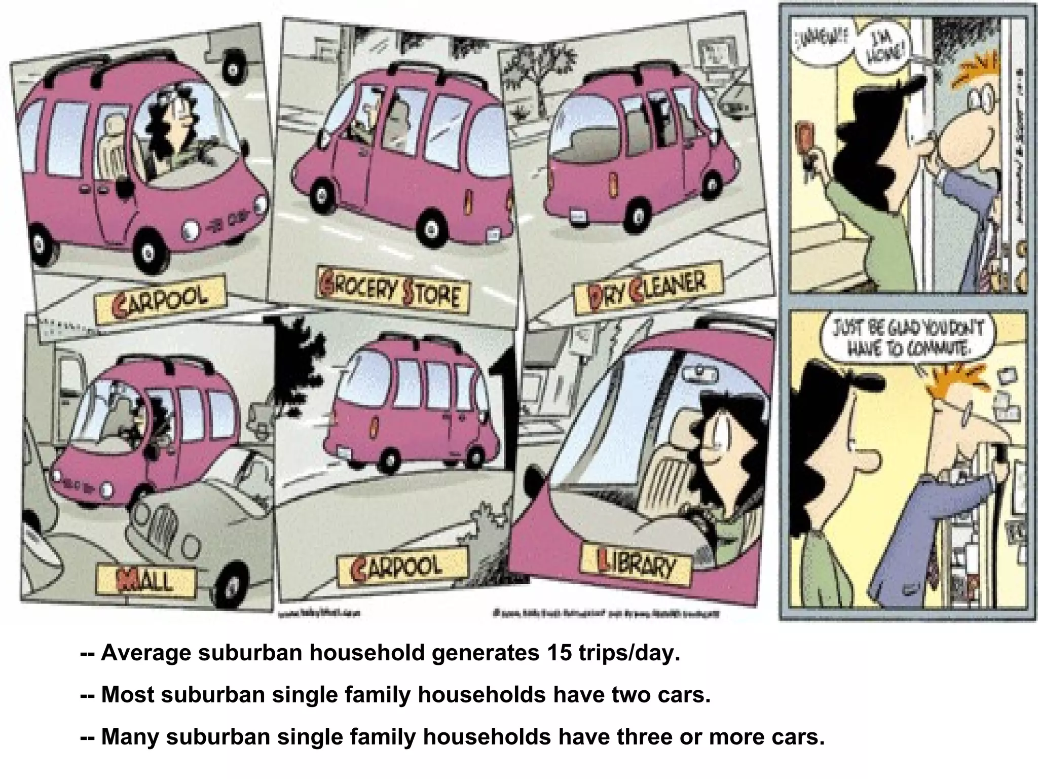
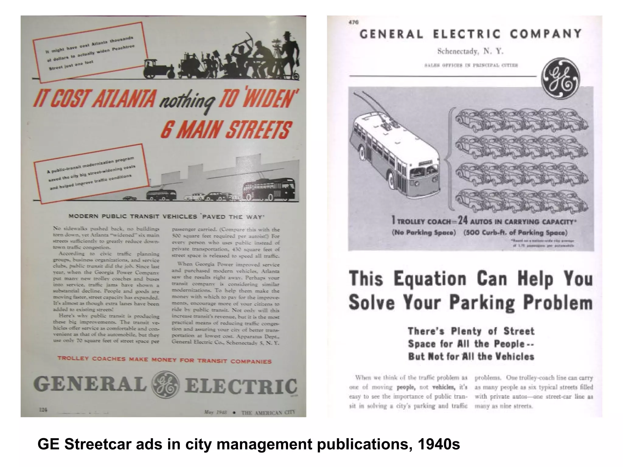
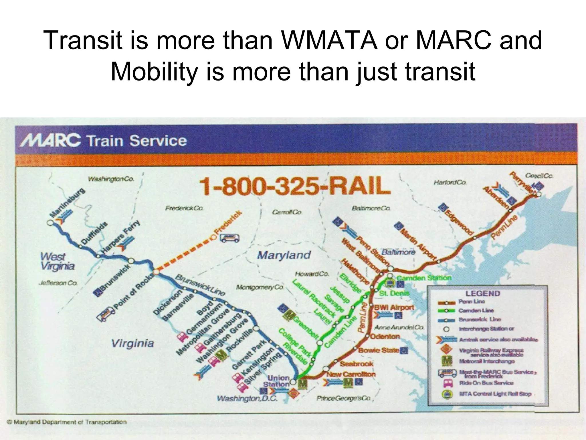
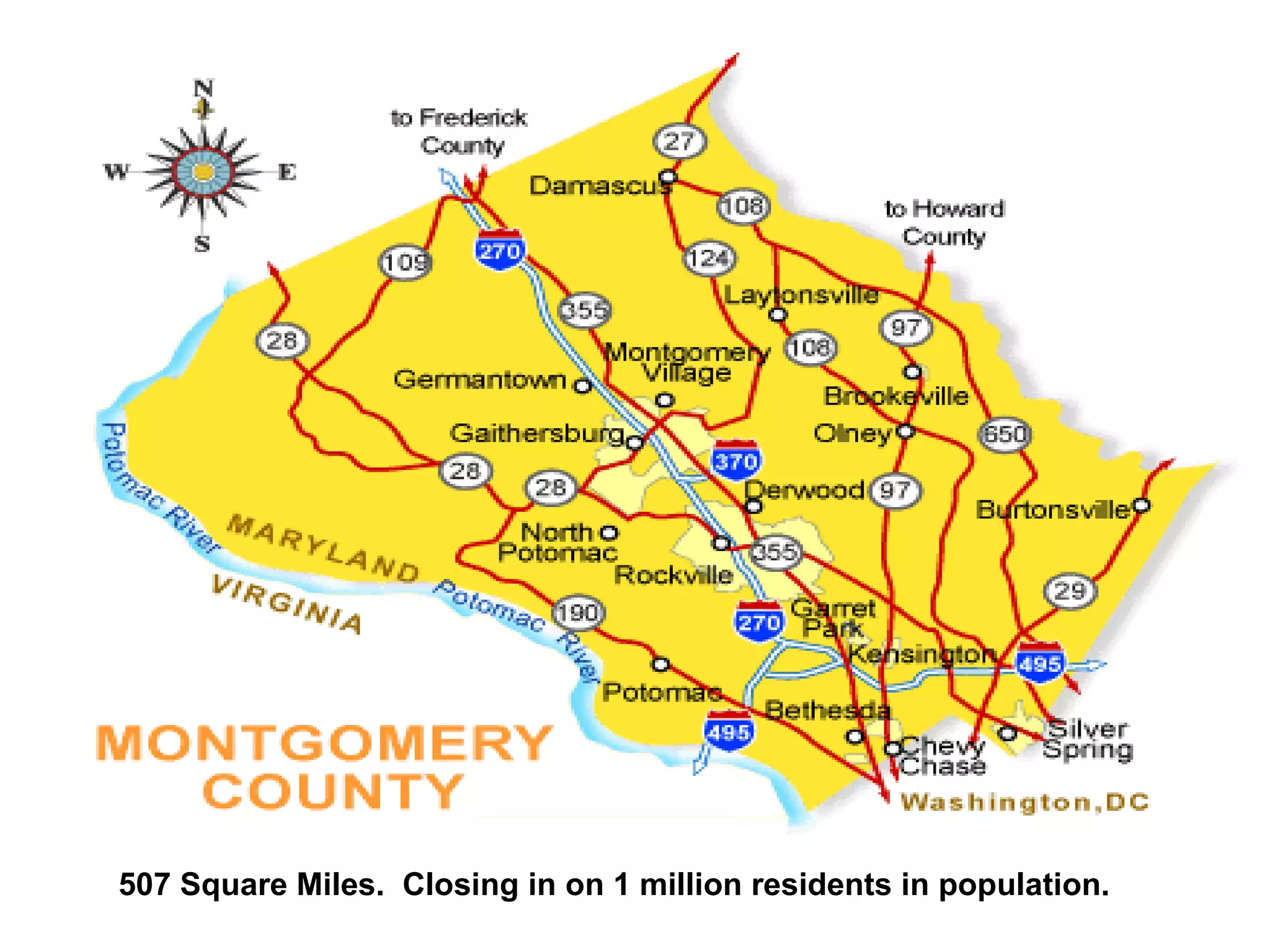
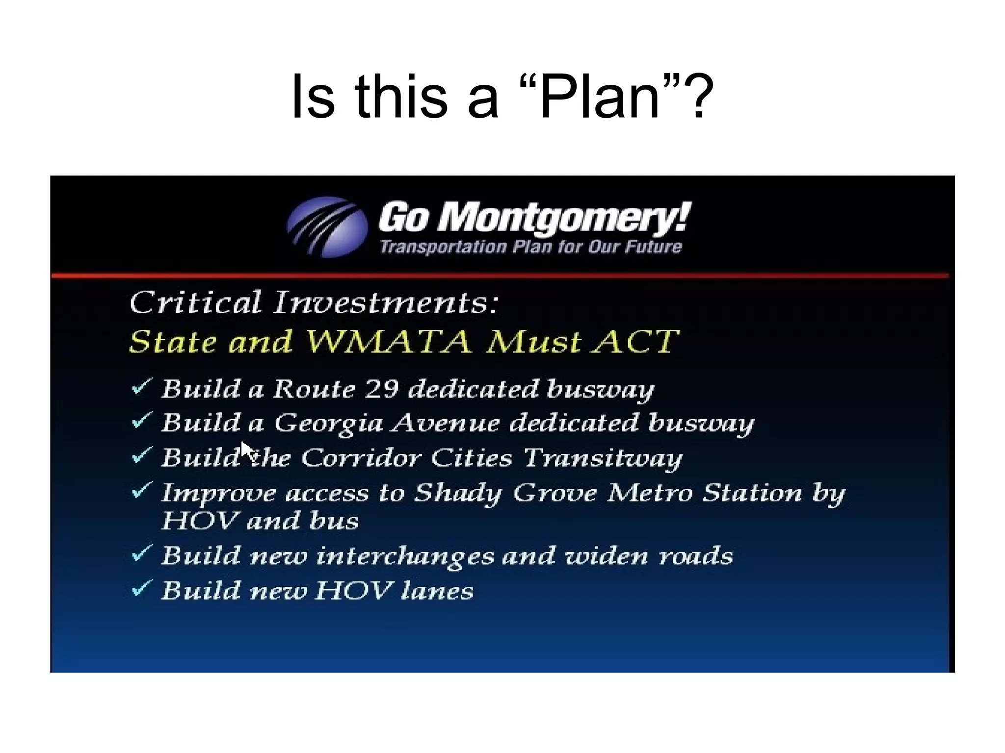
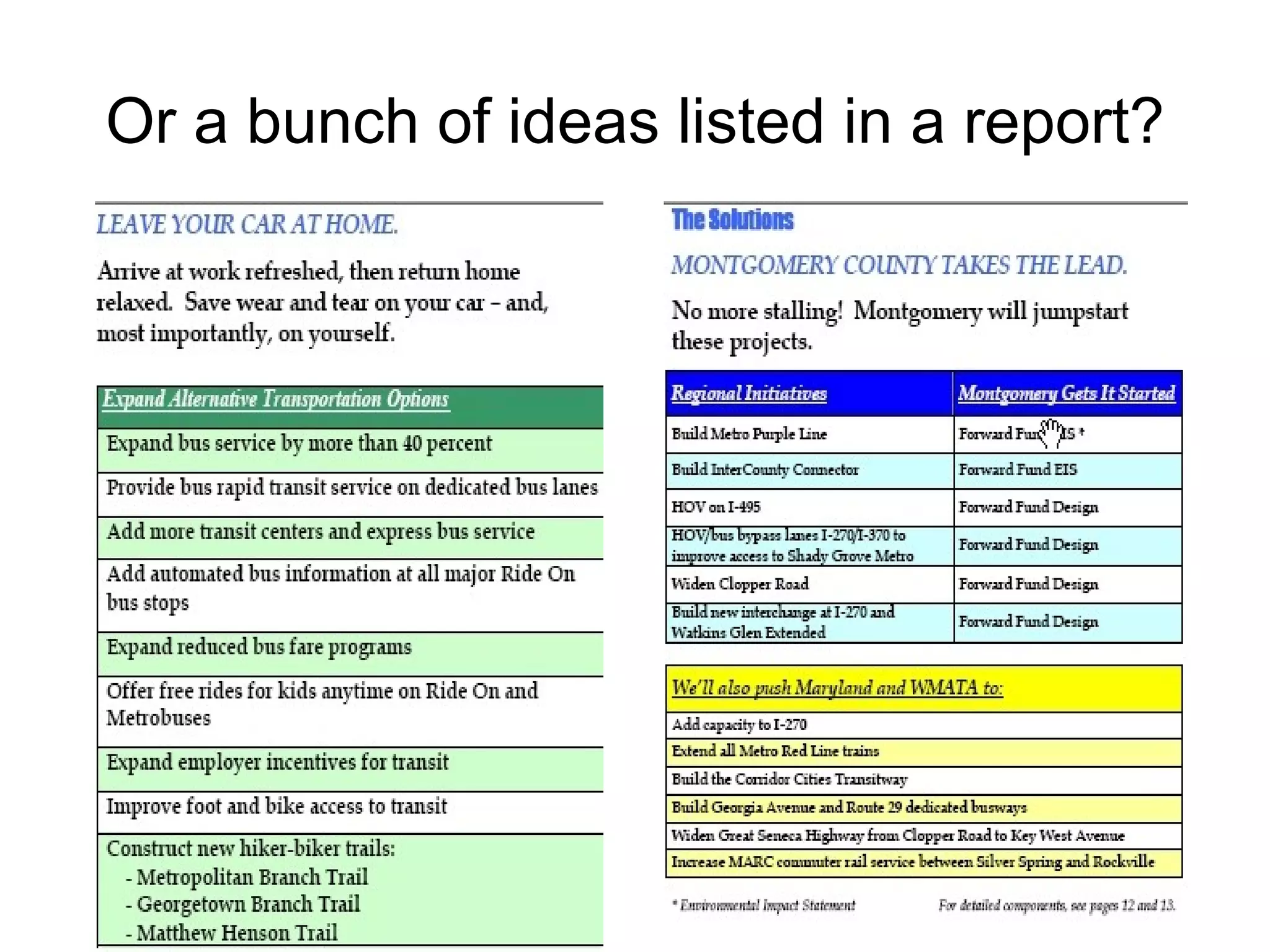
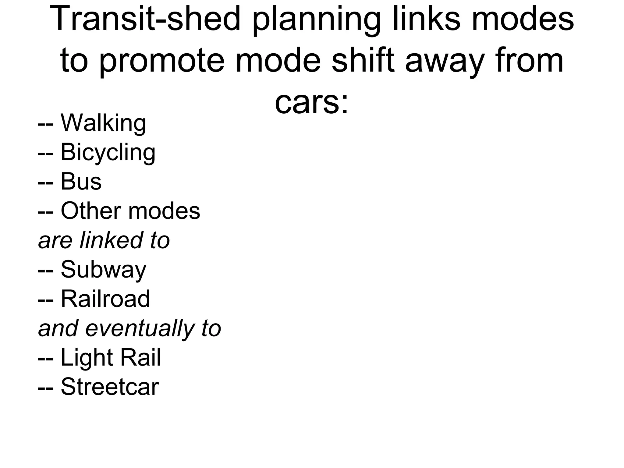
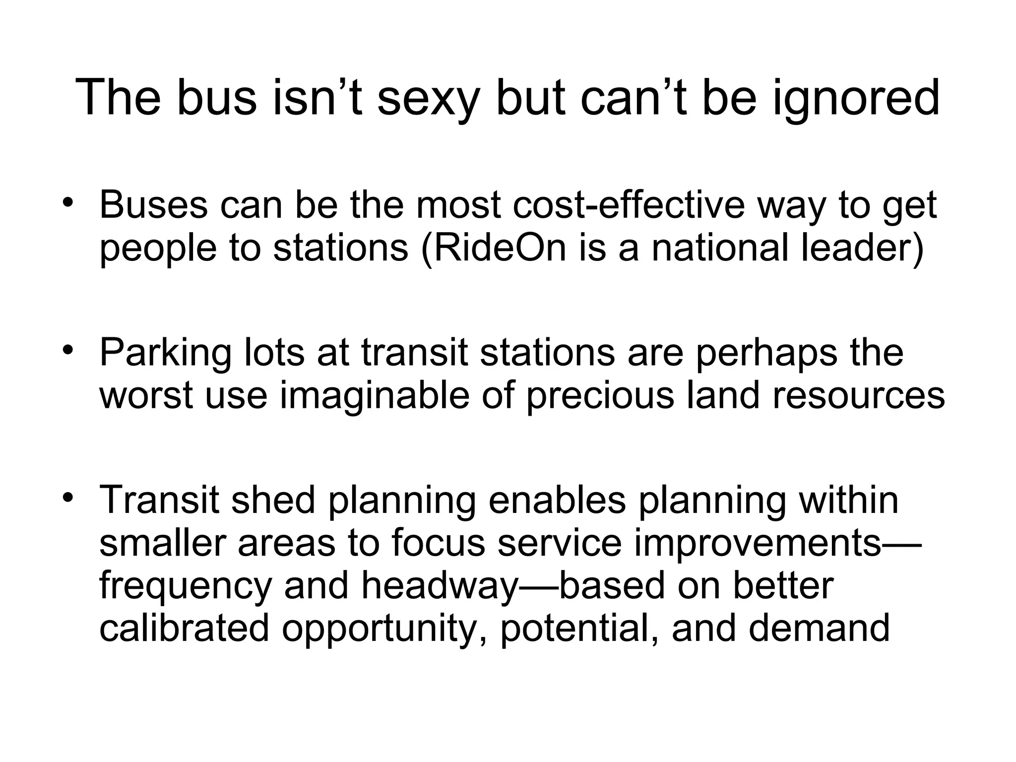
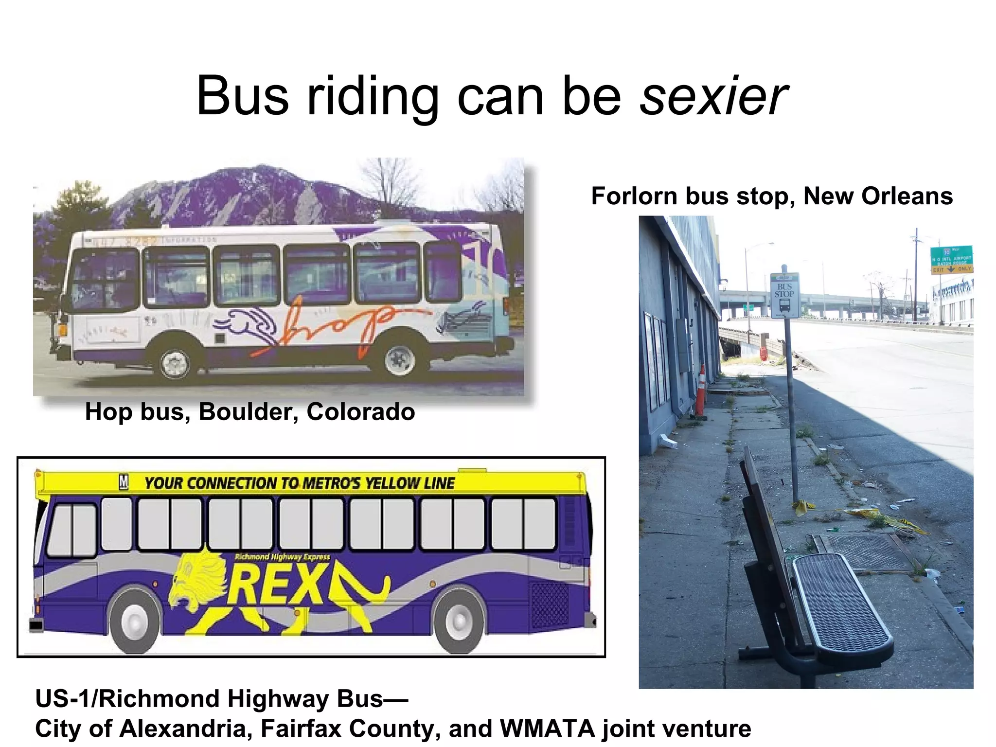
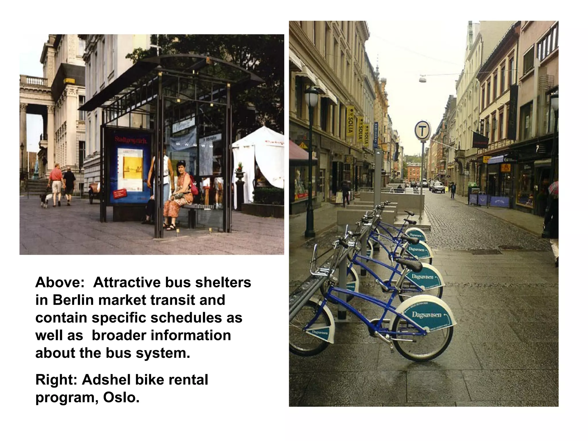
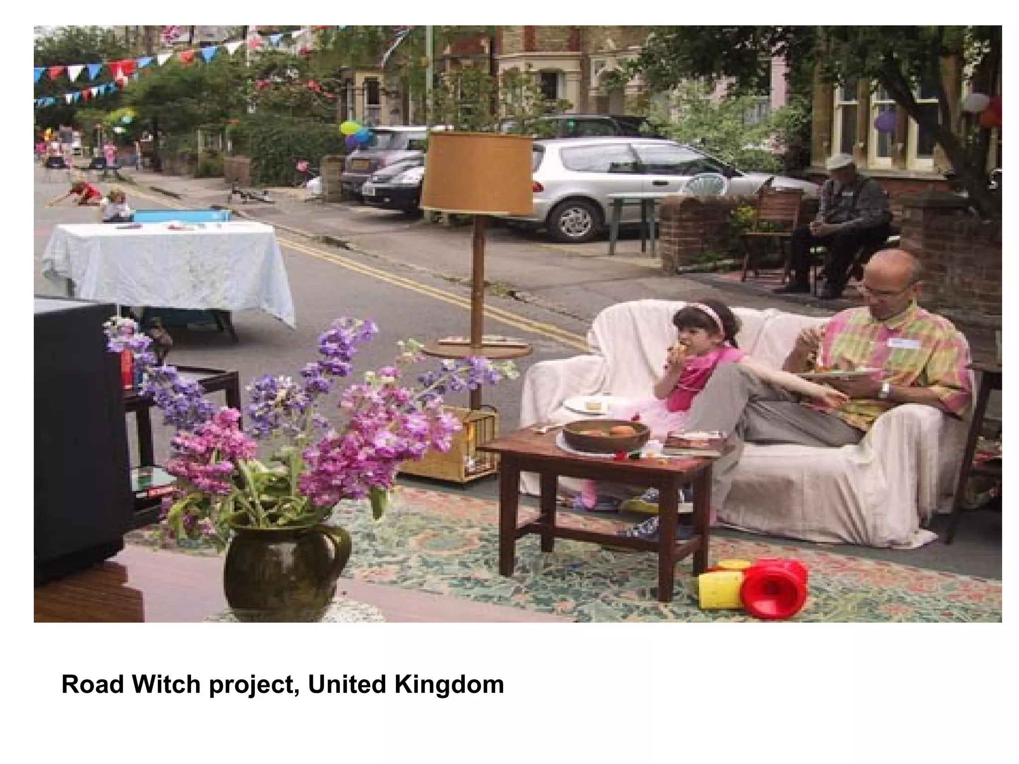
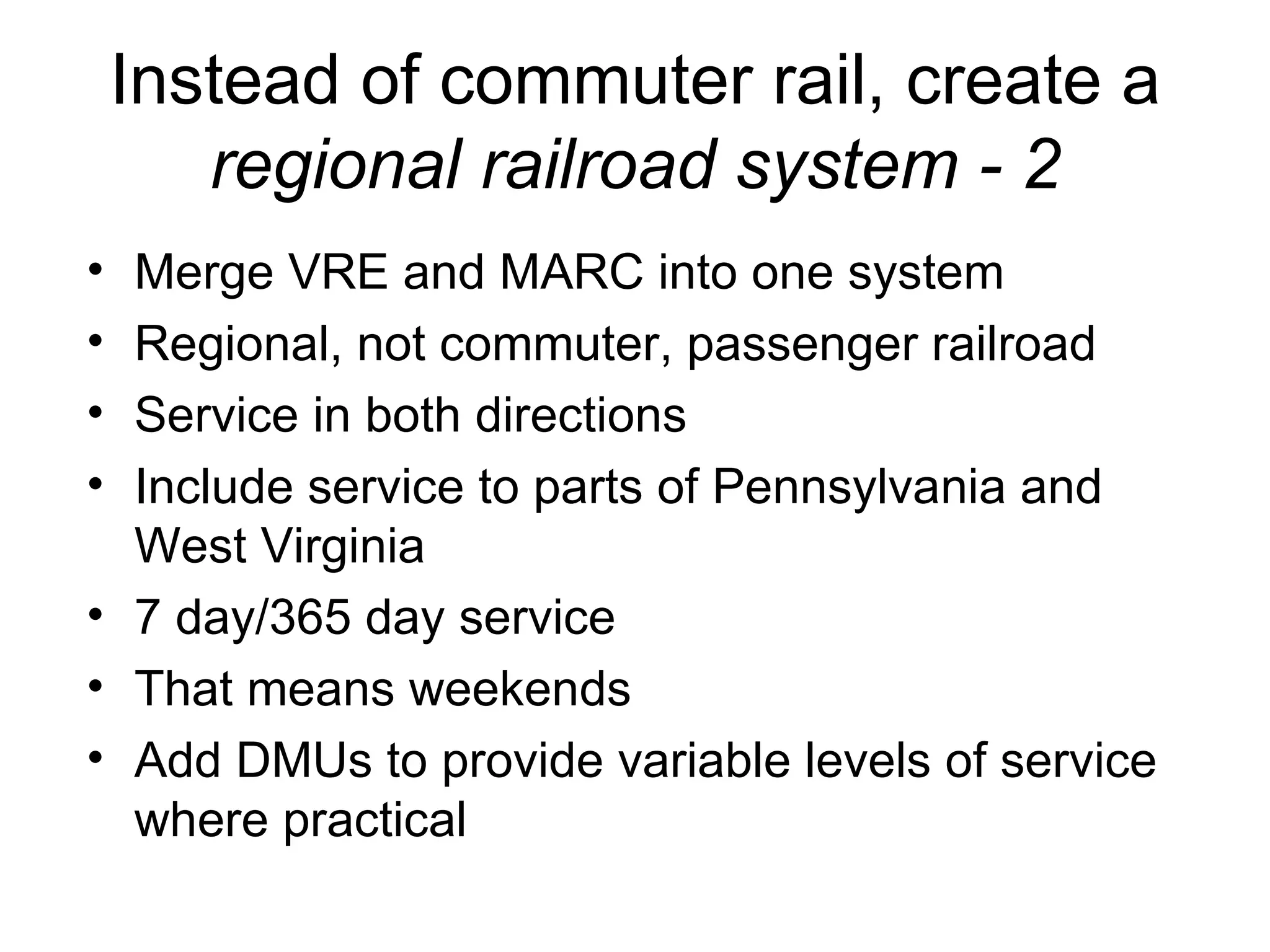
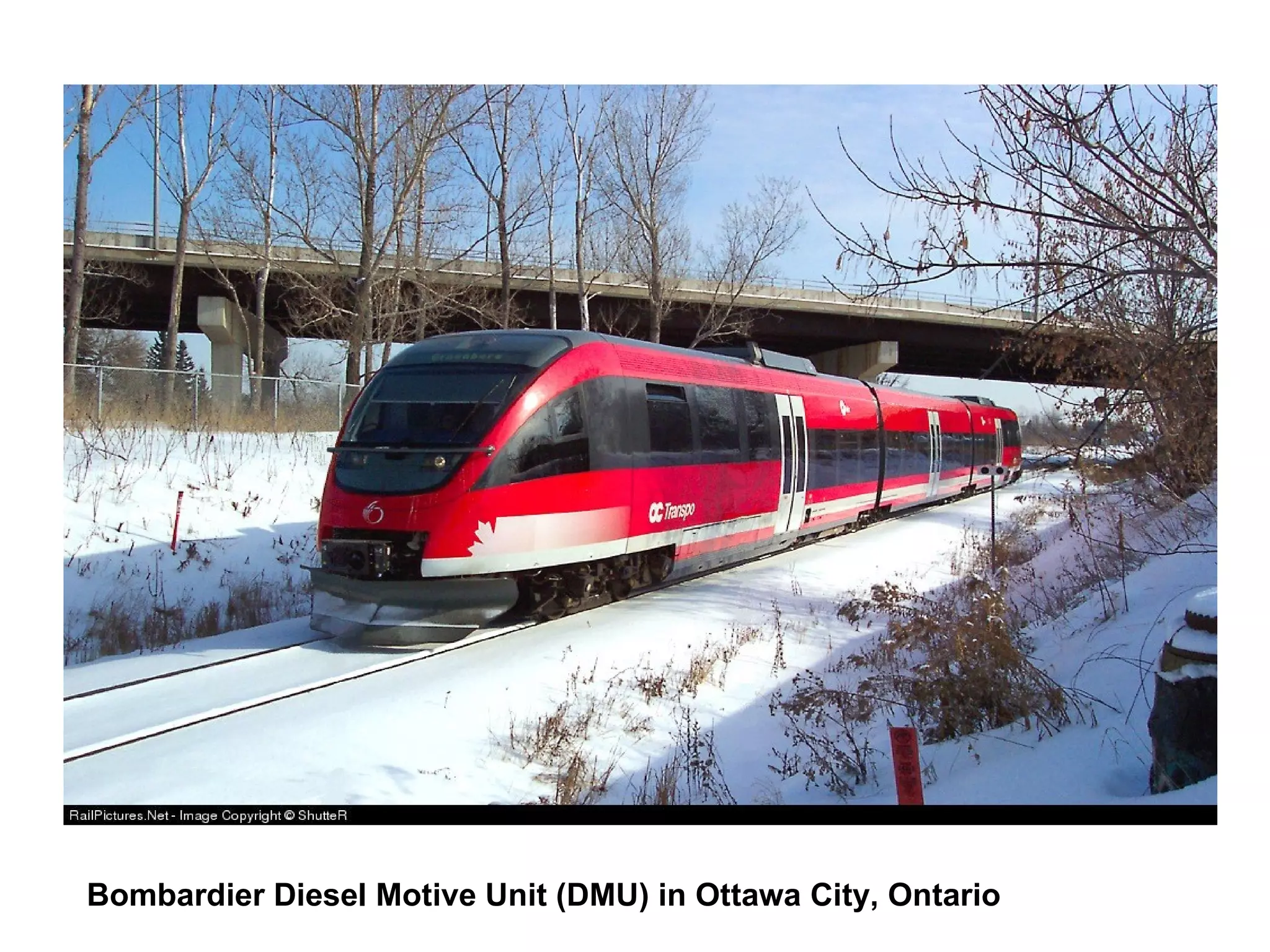
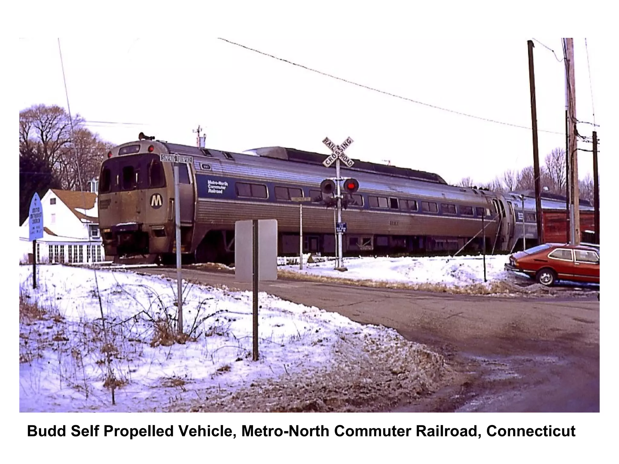
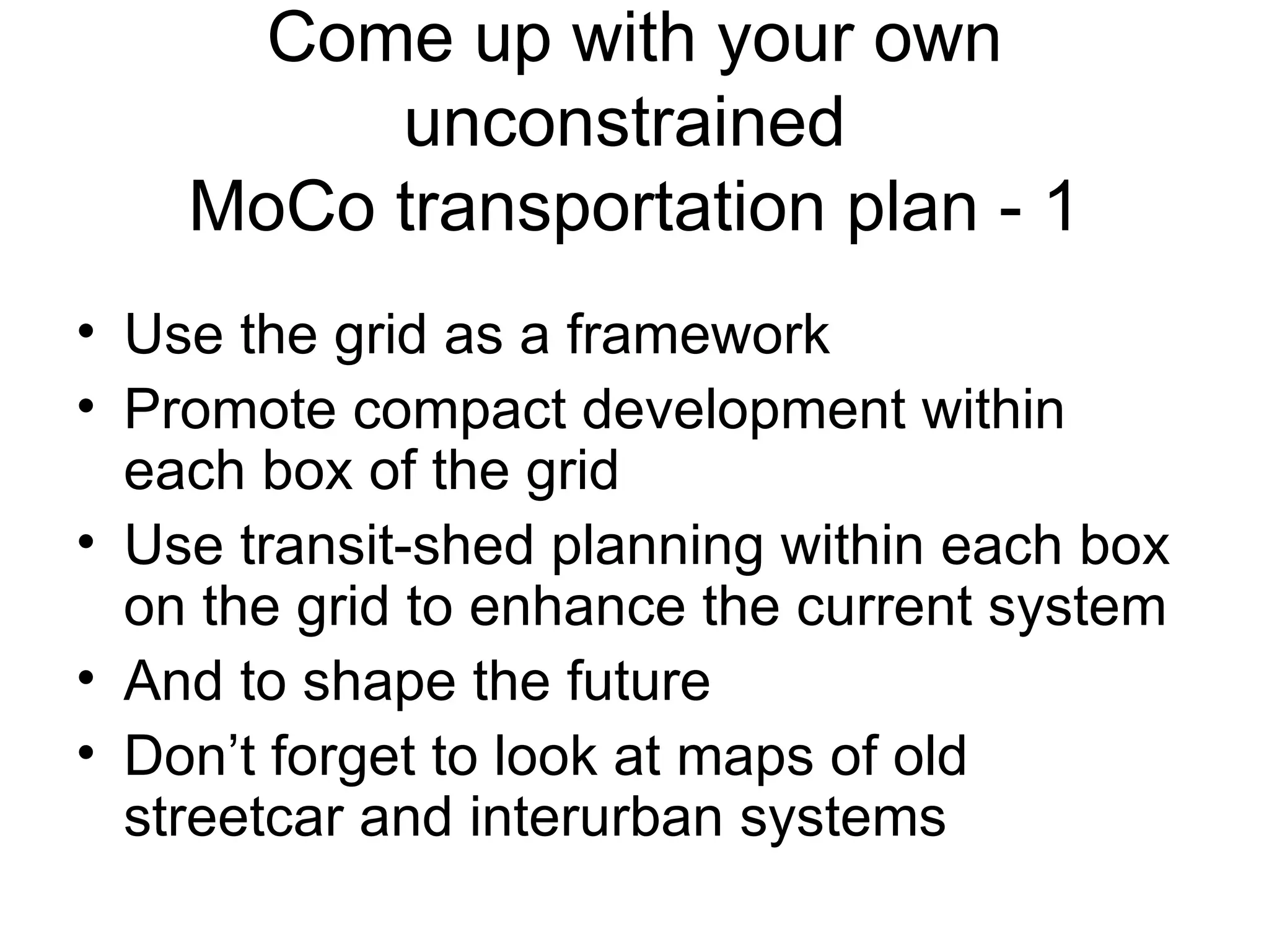
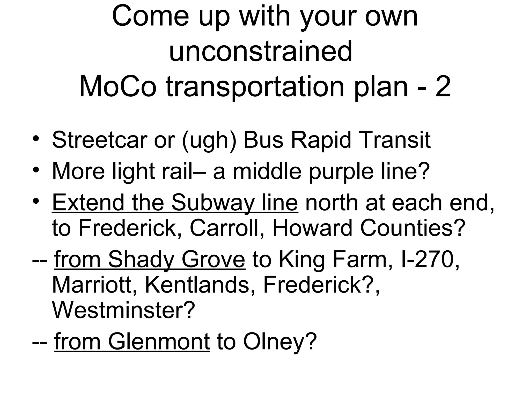
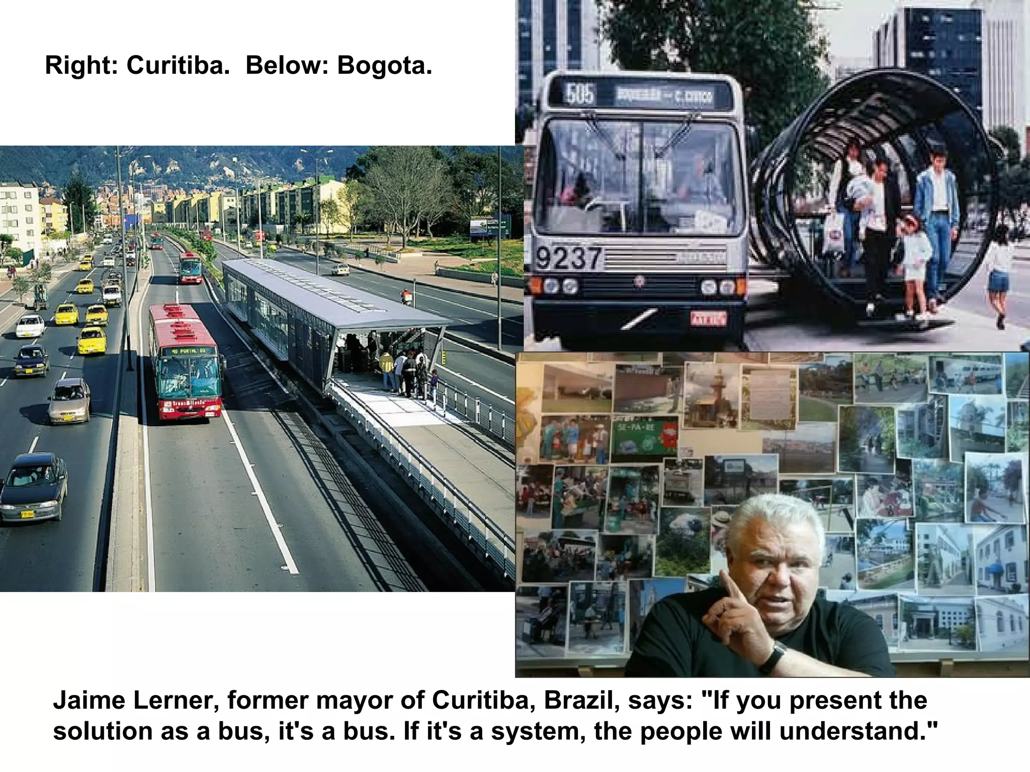
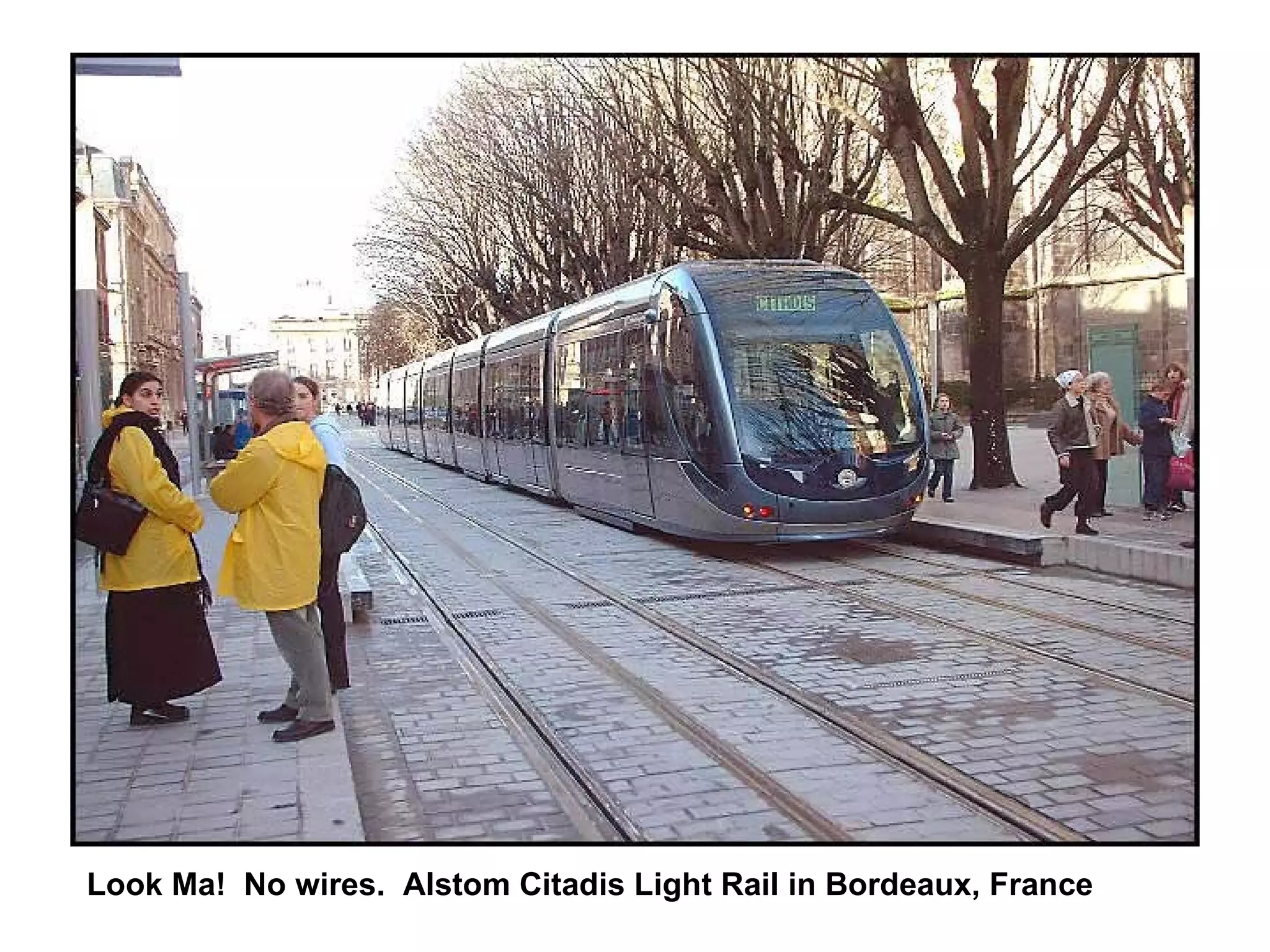
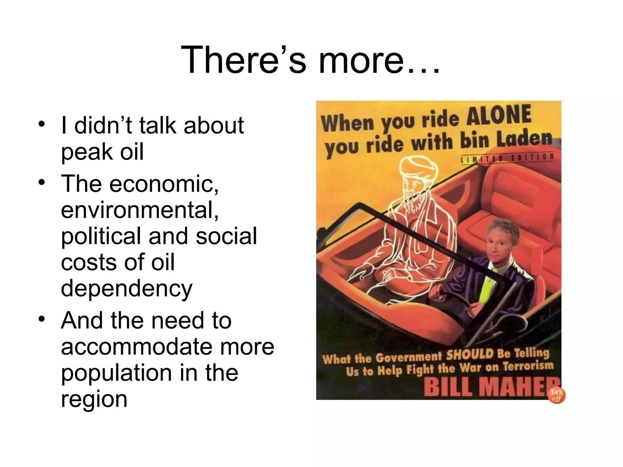
Montgomery County: Transit Beyond the Purple Line ACT: October 2006 Richard Layman Citizens Planning Coalition Washington, DC


-- Average suburban household generates 15 trips/day.  -- Most suburban single family households have two cars. -- Many suburban single family households have three or more cars.
Mobility ‘rithmetic 1,350 cars/hour Urban superblocks Capacity  (per hour) Mode (one lane/mile) 2,200 cars Freeway (car) 1,800 cars/hour/lane Off-ramp (car) 900 cars/hour Urban small blocks 6,250 passengers/hour Regular bus 10,000 passengers/hour Rapid bus 16,000 passengers/hour Light rail 30,000+ passengers/hour Rapid rail transit
DC’s Competitive Advantages: 1.  (Historic) architecture [historic preservation] 2.  Pedestrian-centric urban design [walking city] 3.  History and authenticity 4.  A rich transit infrastructure that allows time- and cost- efficient mobility without being car-dependent. ------------------------------------------------------------------------------ 5.  The fifth competitive advantage is the federal government and its generation of an agglomeration of jobs and businesses, with a significant number of both being located in the core of the center city
What are Montgomery County’s Competitive Advantages? Does transit and mobility rate? If not, why not? If not, should it be strengthened to become a competitive advantage?  (Arlington!) Many employment centers are located within range of subway stations (Silver Spring, Bethesda, Rockville, White Flint, Shady Grove-Gaithersburg)
Seven reasons why people don’t ride transit It doesn't go where they need to go from where they are.  It's not time-efficient.  It's not cost-efficient to take transit compared to driving.  Metro goes where they need to go, and they would ride, if they could get to the station somewhat efficiently. Otherwise, it's easier or faster to drive. (This is related to but subtly different from [2]).  Transit can't be counted on; it is no longer reliable when planning time-sensitive trips, and therefore another mode is chosen.  Transit riding isn't conducive to the requirements of the trip (parent with children, transporting something big and bulky, etc.)  Driving is subsidized in so many ways (cost of roads, cost of military protection of access to oil, land use planning, free parking, etc.) that people don’t pay the real cost of the trip, and it seemingly is cheaper than transit
The auto-centric paradigm
Every parking space is an automobile trip generator
GE Streetcar ads in city management publications, 1940s
More to think about Donald Shoup’s points about car subsidy, that a free public parking space is worth $1,800/year People say transit is subsidized.  It is.  But so are roads to the tune of 50%.  Gasoline taxes come nowhere near to covering road costs. Average fuel cost: $1,500/year. Cost to own and maintain a car: $6,000/year Avg. household spends 20% of income on transportation (automobiles) The less you spend on automobiles, the more there is to spend on housing ownership, other necessary and discretionary spending
Reinserting transit into the paradigm Arlington County Ad in the Arlington-Alexandria Extra,  Washington Post
RideOn is a national best practice example of suburban bus transit But you can’t be content with best practices from the 1980s
Think differently about how to get around
Jurisdictions in the WMATA region  must adopt a “Places First (complete streets)-Transit First”  land use and planning paradigm
“ Transit First” policies Reduce subsidies to the private automobile  through increase in user-based fees such as tolls, gasoline taxes, parking fees, and parking cash-outs. Reward smart land use planning decisions  by making greater regional transportation investments in communities that take real steps to discourage urban sprawl and reinforce city centers. Fund transportation projects based on performance measures or criteria which consistently increase the share of non-automobile trips , improve air quality, and reduce average vehicles miles traveled per capita. Ensure adequate funding for maintenance of the existing transportation system  before spending money on expansion through major capital investments. Maximize funding flexibility at the regional level  so that local jurisdictions are able to program funds where they are most needed.
Transit user demographics Graphic: Washington Post
It’s politically incorrect to say but -- In some respects transportation planning is about getting people who have choices to make better choices -- Sure we want to make a great transit system for everyone -- But transit-dependent people (like me) will ride transit out of necessity -- Mode shifting is directed towards people with choices
The original WMATA system was designed for suburban commuters “ Rail Rapid Transit for the (suburban) Motorist”
Not to promote  compact development
Sprawl/automobility vs. efficiency Polycentric vs. monocentric transit planning  Sprawl land use patterns make transit costly and inefficient, therefore infrequent Priming – road building shapes development patterns Exurban development (people keep moving farther and farther out)
Transit planning needs to be based around the “mobility-shed”
Thinking about the mobility-shed
Mobility-Transportation Modes -- Walking -- Bicycling -- Segways/scooters/Vespas -- Transit -- bus -- rapid bus/streetcar -- streetcar -- light rail -- subway -- Taxi -- Car Sharing -- Motorcycle -- Van pooling -- Railroad -- Personally owned automobile
Transit is more than WMATA or MARC and Mobility is more than just transit
507 Square Miles.  Closing in on 1 million residents in population.
We must focus on connecting modes* Metrorail Metrobus Ride-on Bus System Maryland Commuter Rail Bicycling Walking (?????) Transportation Management Districts *This is called articulation
What’s the County’s plan?
Is this a “Plan”?
Or a bunch of ideas listed in a report?
Auto mobility maybe--not mobility
Montgomery County has a number of distinct transit sheds  13 subway stations (including Takoma) 11 MARC railroad stations Other transit centers (i.e., Langley Park) Major employment centers -- some with subway stations (Bethesda, Silver Spring, White Flint, Rockville, Shady Grove) and some without Other activity centers (shopping centers, Montgomery College, etc.)
Plenty of opportunity for mode shift The mobility-shed (transit-shed) provides a  conceptual framework for planning Mode shift within transit-sheds should be a priority for planning and marketing transit MoCo extant “Transportation Management Districts” and “Mitigation Plans” How effective are Mitigation Plans?  Minimum 20% reduction in automobile trips. The TravelSmart method as a way to implement mobility-shed approaches
Transit-shed planning links modes to promote mode shift away from cars: -- Walking -- Bicycling -- Bus  -- Other modes are linked to   -- Subway  -- Railroad and eventually to -- Light Rail -- Streetcar
The bus isn’t sexy but can’t be ignored Buses can be the most cost-effective way to get people to stations (RideOn is a national leader) Parking lots at transit stations are perhaps the worst use imaginable of precious land resources Transit shed planning enables planning within smaller areas to focus service improvements—frequency and headway—based on better calibrated opportunity, potential, and demand
 
Bus marketing Bus shelters are primary points of contact for marketing transit Quality shelters Signage-Identity systems Bus-based identity systems Schedules Adshel/Decaux – ad-supported shelter program, bike rental
What does this say about how we value transit and the bus system? 4 th  and H Streets NE. DC has contracted with Adshel to improve all extant bus shelters, to add additional shelters, and to launch a related bicycle use program comparable to carsharing. Outside Union Station--the region’s most significant intermodal transit station
Bus riding can be  sexier   Hop bus, Boulder, Colorado Forlorn bus stop, New Orleans US-1/Richmond Highway Bus—  City of Alexandria, Fairfax County, and WMATA joint venture
Above:  Attractive bus shelters in Berlin market transit and contain specific schedules as well as  broader information about the bus system. Right: Adshel bike rental program, Oslo.
Bus shelters can be better integrated into neighborhoods and commercial districts, by incorporating public art, cultural-history signage and wayfinding programs.
Better Marketing and Promotion is Key!
Walking:  Every transit trip starts and ends on foot That’s why you need great places to walk. People walk further when they have interesting, well-maintained, and safe places to walk.  Montgomery County for the most part is safe, but not a nice place to walk.  Above: Bethesda Row.
Bicycling Montgomery County Bicycling Master Plan -- I am not conversant with it Does it propose Bike Stations with showers in each major employment center? (Bethesda, Silver Spring, Rockville, North Bethesda, Gaithersburg, Germantown) Missing link in Purple Line Planning Check out Washcycle.typepad.com
Reduce automobile use and automobile acquisition Carsharing Arlington County’s Master Transportation Plan is focused on reducing single occupancy vehicle trips
MoCo Transportation Planning:  In Flux? Corridor Cities Transit plan? Bus Rapid Transit?  -- few people with choices ride buses willingly State Administration not committed to transit – planned failure, designed to maximize opposition?  (Purple Line) Inter County Connector! Go! Montgomery & Ike Leggett?
One role of advocates is  to push the envelope
Rebar Art Collective: Parking Squat, San Francisco, Sept. 2006
Road Witch project, United Kingdom
Simulation: MARC train in Crystal City, Virginia.  Steve Dunham, Virginia Association of Railway Patrons -- MARC trains could go south from Union Station to L’Enfant Plaza, Crystal City, Alexandria; could stop in Takoma Park (Walter Reed); Brookland (CUA, Washington Hospital Center, Providence Hospital) Extend MARC within DC & Virginia-- or
Instead of commuter rail, create a  regional railroad   system - 1 Concept: Dan Malouff,   www.beyonddc.com
Instead of commuter rail, create a  regional railroad   system - 2 Merge VRE and MARC into one system Regional, not commuter, passenger railroad Service in both directions Include service to parts of Pennsylvania and West Virginia 7 day/365 day service That means weekends Add DMUs to provide variable levels of service where practical
Bombardier Diesel Motive Unit (DMU) in Ottawa City, Ontario
Budd Self Propelled Vehicle, Metro-North Commuter Railroad, Connecticut
Budd RDC Vehicle, MTA, deaccessioned
Think of MoCo as a grid East-West Streets -- Viers Mill Road -- Randolph Road -- University Boulevard -- East-West Highway
Think of MoCo as a grid North-South Streets -- I-270 -- Rockville Pike -- Connecticut Avenue -- Georgia Avenue -- Colesville Road
Come up with your own unconstrained  MoCo transportation plan - 1 Use the grid as a framework Promote compact development within each box of the grid Use transit-shed planning within each box on the grid to enhance the current system And to shape the future Don’t forget to look at maps of old streetcar and interurban systems
Come up with your own unconstrained  MoCo transportation plan - 2 Streetcar or (ugh) Bus Rapid Transit More light rail– a middle purple line? Extend the Subway line  north at each end, to Frederick, Carroll, Howard Counties? --  from Shady Grove  to King Farm, I-270, Marriott, Kentlands, Frederick?, Westminster? --  from Glenmont  to Olney?
Subway extension planning Proposed extended green line to BWI. -- Where is MoCo in all the crazy talk about extending subway lines? -- What about extending the red line north beyond Shady Grove, beyond Glenmont?
Bus Rapid Transit vs. Rail:  DC region is not Bogotá or Curitiba Most people riding transit in those places do so because they are transit dependent.  Buses are their only option The more successful BRT lines in North America have ridership not much higher than highly used Metrobus lines Mode shift must be the first priority
Jaime Lerner, former mayor of Curitiba, Brazil, says: "If you present the solution as a bus, it's a bus. If it's a system, the people will understand."  Right: Curitiba.  Below: Bogota.
Wifi/york York region BRT (Toronto) is testing wi-fi on board as a way to reposition its bus service More systems are considering it
What’s Old is New Again? Trolley at Glen Echo Park
Portland Streetcar, Oregon
Look Ma!  No wires.  Alstom Citadis Light Rail in Bordeaux, France
Citadis Light Rail in Barcelona:  Note grass and adjacent walking-bike path.
Simulation: Skoda/Inekon Streetcar on Charles Street, Baltimore.
Regional Transit Advocates Unite! We need to develop an annual cross-jurisdictional transit advocates conference Develop a consensus, unconstrained agenda (publish-publicize) Alternate meetings annually, between the Baltimore and Washington regions Legislative advocacy conferences each year in Annapolis, Richmond, and DC (DC session to include lobbying Congress)
There’s more… I didn’t talk about peak oil The economic, environmental, political and social costs of oil dependency And the need to accommodate more population in the region
Thank you to Ken Firestone for assistance in preparing this presentation For simplicity, credits are not listed on most photos.  Many are not mine.  Provenance will be provided for any photo on request.
Richard Layman Citizens Planning Coalition Washington, DC 20011 Email:  [email_address] Blog:  http:// urbanplacesandspaces.blogspot.com

Montgomery County And Transit (revised)

  • 1.
    Montgomery County: TransitBeyond the Purple Line ACT: October 2006 Richard Layman Citizens Planning Coalition Washington, DC
  • 2.
  • 3.
  • 4.
  • 5.
    -- Average suburbanhousehold generates 15 trips/day. -- Most suburban single family households have two cars. -- Many suburban single family households have three or more cars.
  • 6.
    Mobility ‘rithmetic 1,350cars/hour Urban superblocks Capacity (per hour) Mode (one lane/mile) 2,200 cars Freeway (car) 1,800 cars/hour/lane Off-ramp (car) 900 cars/hour Urban small blocks 6,250 passengers/hour Regular bus 10,000 passengers/hour Rapid bus 16,000 passengers/hour Light rail 30,000+ passengers/hour Rapid rail transit
  • 7.
    DC’s Competitive Advantages:1.  (Historic) architecture [historic preservation] 2.  Pedestrian-centric urban design [walking city] 3.  History and authenticity 4.  A rich transit infrastructure that allows time- and cost- efficient mobility without being car-dependent. ------------------------------------------------------------------------------ 5. The fifth competitive advantage is the federal government and its generation of an agglomeration of jobs and businesses, with a significant number of both being located in the core of the center city
  • 8.
    What are MontgomeryCounty’s Competitive Advantages? Does transit and mobility rate? If not, why not? If not, should it be strengthened to become a competitive advantage? (Arlington!) Many employment centers are located within range of subway stations (Silver Spring, Bethesda, Rockville, White Flint, Shady Grove-Gaithersburg)
  • 9.
    Seven reasons whypeople don’t ride transit It doesn't go where they need to go from where they are. It's not time-efficient. It's not cost-efficient to take transit compared to driving. Metro goes where they need to go, and they would ride, if they could get to the station somewhat efficiently. Otherwise, it's easier or faster to drive. (This is related to but subtly different from [2]). Transit can't be counted on; it is no longer reliable when planning time-sensitive trips, and therefore another mode is chosen. Transit riding isn't conducive to the requirements of the trip (parent with children, transporting something big and bulky, etc.) Driving is subsidized in so many ways (cost of roads, cost of military protection of access to oil, land use planning, free parking, etc.) that people don’t pay the real cost of the trip, and it seemingly is cheaper than transit
  • 10.
  • 11.
    Every parking spaceis an automobile trip generator
  • 12.
    GE Streetcar adsin city management publications, 1940s
  • 13.
    More to thinkabout Donald Shoup’s points about car subsidy, that a free public parking space is worth $1,800/year People say transit is subsidized. It is. But so are roads to the tune of 50%. Gasoline taxes come nowhere near to covering road costs. Average fuel cost: $1,500/year. Cost to own and maintain a car: $6,000/year Avg. household spends 20% of income on transportation (automobiles) The less you spend on automobiles, the more there is to spend on housing ownership, other necessary and discretionary spending
  • 14.
    Reinserting transit intothe paradigm Arlington County Ad in the Arlington-Alexandria Extra, Washington Post
  • 15.
    RideOn is anational best practice example of suburban bus transit But you can’t be content with best practices from the 1980s
  • 16.
    Think differently abouthow to get around
  • 17.
    Jurisdictions in theWMATA region must adopt a “Places First (complete streets)-Transit First” land use and planning paradigm
  • 18.
    “ Transit First”policies Reduce subsidies to the private automobile through increase in user-based fees such as tolls, gasoline taxes, parking fees, and parking cash-outs. Reward smart land use planning decisions by making greater regional transportation investments in communities that take real steps to discourage urban sprawl and reinforce city centers. Fund transportation projects based on performance measures or criteria which consistently increase the share of non-automobile trips , improve air quality, and reduce average vehicles miles traveled per capita. Ensure adequate funding for maintenance of the existing transportation system before spending money on expansion through major capital investments. Maximize funding flexibility at the regional level so that local jurisdictions are able to program funds where they are most needed.
  • 19.
    Transit user demographicsGraphic: Washington Post
  • 20.
    It’s politically incorrectto say but -- In some respects transportation planning is about getting people who have choices to make better choices -- Sure we want to make a great transit system for everyone -- But transit-dependent people (like me) will ride transit out of necessity -- Mode shifting is directed towards people with choices
  • 21.
    The original WMATAsystem was designed for suburban commuters “ Rail Rapid Transit for the (suburban) Motorist”
  • 22.
    Not to promote compact development
  • 23.
    Sprawl/automobility vs. efficiencyPolycentric vs. monocentric transit planning Sprawl land use patterns make transit costly and inefficient, therefore infrequent Priming – road building shapes development patterns Exurban development (people keep moving farther and farther out)
  • 24.
    Transit planning needsto be based around the “mobility-shed”
  • 25.
    Thinking about themobility-shed
  • 26.
    Mobility-Transportation Modes --Walking -- Bicycling -- Segways/scooters/Vespas -- Transit -- bus -- rapid bus/streetcar -- streetcar -- light rail -- subway -- Taxi -- Car Sharing -- Motorcycle -- Van pooling -- Railroad -- Personally owned automobile
  • 27.
    Transit is morethan WMATA or MARC and Mobility is more than just transit
  • 28.
    507 Square Miles. Closing in on 1 million residents in population.
  • 29.
    We must focuson connecting modes* Metrorail Metrobus Ride-on Bus System Maryland Commuter Rail Bicycling Walking (?????) Transportation Management Districts *This is called articulation
  • 30.
  • 31.
    Is this a“Plan”?
  • 32.
    Or a bunchof ideas listed in a report?
  • 33.
  • 34.
    Montgomery County hasa number of distinct transit sheds 13 subway stations (including Takoma) 11 MARC railroad stations Other transit centers (i.e., Langley Park) Major employment centers -- some with subway stations (Bethesda, Silver Spring, White Flint, Rockville, Shady Grove) and some without Other activity centers (shopping centers, Montgomery College, etc.)
  • 35.
    Plenty of opportunityfor mode shift The mobility-shed (transit-shed) provides a conceptual framework for planning Mode shift within transit-sheds should be a priority for planning and marketing transit MoCo extant “Transportation Management Districts” and “Mitigation Plans” How effective are Mitigation Plans? Minimum 20% reduction in automobile trips. The TravelSmart method as a way to implement mobility-shed approaches
  • 36.
    Transit-shed planning linksmodes to promote mode shift away from cars: -- Walking -- Bicycling -- Bus -- Other modes are linked to -- Subway -- Railroad and eventually to -- Light Rail -- Streetcar
  • 37.
    The bus isn’tsexy but can’t be ignored Buses can be the most cost-effective way to get people to stations (RideOn is a national leader) Parking lots at transit stations are perhaps the worst use imaginable of precious land resources Transit shed planning enables planning within smaller areas to focus service improvements—frequency and headway—based on better calibrated opportunity, potential, and demand
  • 38.
  • 39.
    Bus marketing Busshelters are primary points of contact for marketing transit Quality shelters Signage-Identity systems Bus-based identity systems Schedules Adshel/Decaux – ad-supported shelter program, bike rental
  • 40.
    What does thissay about how we value transit and the bus system? 4 th and H Streets NE. DC has contracted with Adshel to improve all extant bus shelters, to add additional shelters, and to launch a related bicycle use program comparable to carsharing. Outside Union Station--the region’s most significant intermodal transit station
  • 41.
    Bus riding canbe sexier Hop bus, Boulder, Colorado Forlorn bus stop, New Orleans US-1/Richmond Highway Bus— City of Alexandria, Fairfax County, and WMATA joint venture
  • 42.
    Above: Attractivebus shelters in Berlin market transit and contain specific schedules as well as broader information about the bus system. Right: Adshel bike rental program, Oslo.
  • 43.
    Bus shelters canbe better integrated into neighborhoods and commercial districts, by incorporating public art, cultural-history signage and wayfinding programs.
  • 44.
    Better Marketing andPromotion is Key!
  • 45.
    Walking: Everytransit trip starts and ends on foot That’s why you need great places to walk. People walk further when they have interesting, well-maintained, and safe places to walk. Montgomery County for the most part is safe, but not a nice place to walk. Above: Bethesda Row.
  • 46.
    Bicycling Montgomery CountyBicycling Master Plan -- I am not conversant with it Does it propose Bike Stations with showers in each major employment center? (Bethesda, Silver Spring, Rockville, North Bethesda, Gaithersburg, Germantown) Missing link in Purple Line Planning Check out Washcycle.typepad.com
  • 47.
    Reduce automobile useand automobile acquisition Carsharing Arlington County’s Master Transportation Plan is focused on reducing single occupancy vehicle trips
  • 48.
    MoCo Transportation Planning: In Flux? Corridor Cities Transit plan? Bus Rapid Transit? -- few people with choices ride buses willingly State Administration not committed to transit – planned failure, designed to maximize opposition? (Purple Line) Inter County Connector! Go! Montgomery & Ike Leggett?
  • 49.
    One role ofadvocates is to push the envelope
  • 50.
    Rebar Art Collective:Parking Squat, San Francisco, Sept. 2006
  • 51.
    Road Witch project,United Kingdom
  • 52.
    Simulation: MARC trainin Crystal City, Virginia. Steve Dunham, Virginia Association of Railway Patrons -- MARC trains could go south from Union Station to L’Enfant Plaza, Crystal City, Alexandria; could stop in Takoma Park (Walter Reed); Brookland (CUA, Washington Hospital Center, Providence Hospital) Extend MARC within DC & Virginia-- or
  • 53.
    Instead of commuterrail, create a regional railroad system - 1 Concept: Dan Malouff, www.beyonddc.com
  • 54.
    Instead of commuterrail, create a regional railroad system - 2 Merge VRE and MARC into one system Regional, not commuter, passenger railroad Service in both directions Include service to parts of Pennsylvania and West Virginia 7 day/365 day service That means weekends Add DMUs to provide variable levels of service where practical
  • 55.
    Bombardier Diesel MotiveUnit (DMU) in Ottawa City, Ontario
  • 56.
    Budd Self PropelledVehicle, Metro-North Commuter Railroad, Connecticut
  • 57.
    Budd RDC Vehicle,MTA, deaccessioned
  • 58.
    Think of MoCoas a grid East-West Streets -- Viers Mill Road -- Randolph Road -- University Boulevard -- East-West Highway
  • 59.
    Think of MoCoas a grid North-South Streets -- I-270 -- Rockville Pike -- Connecticut Avenue -- Georgia Avenue -- Colesville Road
  • 60.
    Come up withyour own unconstrained MoCo transportation plan - 1 Use the grid as a framework Promote compact development within each box of the grid Use transit-shed planning within each box on the grid to enhance the current system And to shape the future Don’t forget to look at maps of old streetcar and interurban systems
  • 61.
    Come up withyour own unconstrained MoCo transportation plan - 2 Streetcar or (ugh) Bus Rapid Transit More light rail– a middle purple line? Extend the Subway line north at each end, to Frederick, Carroll, Howard Counties? -- from Shady Grove to King Farm, I-270, Marriott, Kentlands, Frederick?, Westminster? -- from Glenmont to Olney?
  • 62.
    Subway extension planningProposed extended green line to BWI. -- Where is MoCo in all the crazy talk about extending subway lines? -- What about extending the red line north beyond Shady Grove, beyond Glenmont?
  • 63.
    Bus Rapid Transitvs. Rail: DC region is not Bogotá or Curitiba Most people riding transit in those places do so because they are transit dependent. Buses are their only option The more successful BRT lines in North America have ridership not much higher than highly used Metrobus lines Mode shift must be the first priority
  • 64.
    Jaime Lerner, formermayor of Curitiba, Brazil, says: "If you present the solution as a bus, it's a bus. If it's a system, the people will understand." Right: Curitiba. Below: Bogota.
  • 65.
    Wifi/york York regionBRT (Toronto) is testing wi-fi on board as a way to reposition its bus service More systems are considering it
  • 66.
    What’s Old isNew Again? Trolley at Glen Echo Park
  • 67.
  • 68.
    Look Ma! No wires. Alstom Citadis Light Rail in Bordeaux, France
  • 69.
    Citadis Light Railin Barcelona: Note grass and adjacent walking-bike path.
  • 70.
    Simulation: Skoda/Inekon Streetcaron Charles Street, Baltimore.
  • 71.
    Regional Transit AdvocatesUnite! We need to develop an annual cross-jurisdictional transit advocates conference Develop a consensus, unconstrained agenda (publish-publicize) Alternate meetings annually, between the Baltimore and Washington regions Legislative advocacy conferences each year in Annapolis, Richmond, and DC (DC session to include lobbying Congress)
  • 72.
    There’s more… Ididn’t talk about peak oil The economic, environmental, political and social costs of oil dependency And the need to accommodate more population in the region
  • 73.
    Thank you toKen Firestone for assistance in preparing this presentation For simplicity, credits are not listed on most photos. Many are not mine. Provenance will be provided for any photo on request.
  • 74.
    Richard Layman CitizensPlanning Coalition Washington, DC 20011 Email: [email_address] Blog: http:// urbanplacesandspaces.blogspot.com