Ortho photo in Ottawa
•
3 likes•581 views

Ortho-Rectified Imagery. What is it? How can it be used? How to create it? How to distribute it?

Recommended
More Related Content
What's hot
What's hot (19)
Similar to Ortho photo in Ottawa
Similar to Ortho photo in Ottawa (20)
Recently uploaded
Recently uploaded (20)
Ortho photo in Ottawa
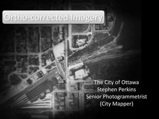
- 1. Ortho-corrected Imagery The City of Ottawa Stephen Perkins stephen.perkins@ottawa.ca Senior Photogrammetrist (City Mapper) Search “ortho photo” in slideshare
- 2. What is ortho-corrected? What products are ortho-corrected? What is Photogrammetry? How is imagery prepared? What corrections are required? Examples of historic imagery 1928 Imagery 3D Point Cloud Data
- 3. http://maps.ottawa.ca/geoOttawa/ or search for ‘geoOttawa’
- 4. A georeferenced, ortho-rectified, mosaicked aerial image
- 5. Ortho-rectified means scale is uniform across product based on / LIBRARY AND ARCHIVES CANADA / C.1-22
- 6. based on / LIBRARY AND ARCHIVES CANADA / C.1-30
- 8. Aerial Imagery from airplane
- 9. Aerial Projects are flown in flight lines, row after row
- 10. Large format digital cameras are used to capture large areas
- 13. Successive images overlap and can be viewed in ‘3D’
- 16. Ortho-images are created by spatially locating each image pixel, draping it on a surface model and dropping it to the datum surface
- 17. Ortho-images are created by spatially locating each image pixel, draping it on a surface model and dropping it to the datum surface
- 18. Notice that only one image is required for the ortho-image, multiple images are required to construct the surface model. The image draping process takes each image and ortho-rectifies it using the elevation model and creates an ortho-corrected image.
- 19. Photoshop can be used to prepare small ortho projects
- 22. The seam line can be cleaned up where the overlap occurs
- 23. The edge can be ‘feathered’ using cut or Alpha channel
- 24. Seamline should be hidden along linear features
- 25. Each successive image contains its own ‘sweet spot’
- 26. Image across scene needs correction for vignetting
- 27. vv
- 28. Some errors can stay, others require fixing
- 29. Back to geoOttawa, a geo-referenced ortho-corrected mosaic
- 32. Now, back to the 1920’s
- 33. N.A.P.L. Roll Nº 1
- 34. N.E.O.D.F. Roll Number A1 Viewing Angle Vertical Spectral Range Black&White Area OTTAWA AREA Roll Date 1928-04-20 Camera Name/Number Lens Name/Number Focal length (mm) 304.8 Camera Filter Film Type Total Frames 77 Scale 6000 Altitude 6000(ft) Negative size 7 x 9 Overlap 60 Season Spring
- 35. Unfortunately, not a systematic set of flight lines
- 37. Large G.S.D. and small colour depth
- 38. Image needs to be related to similar features
- 41. Many older lines exist, potentially can be scanned
- 42. Remember the two-pixel situation? The single 3D pixel can be used as an image point cloud So, from the past, a brief glimpse into the future …
- 55. Also, U.A.V.’s (drones) are becoming increasingly used in aerial acquisition for applications in mapping pits and quarry’s and archaeological sites.
- 56. The City now maps the Landfill using Drones
Editor's Notes
- Ortho-Corrected Imagery
- What is ortho-corrected? What products are ortho-corrected? What is Photogrammetry? How is imagery prepared? What corrections are required? Examples of historic imagery 1928 Imagery 3D Point Cloud Data
- http://maps.ottawa.ca/geoOttawa/ or search for ‘geoOttawa’
- A georeferenced, ortho-rectified, mosaicked aerial image.
- Ortho-rectified means scale is uniform across product. But not vertical information.
- An ortho-plan showing the original street car tracks in Ottawa.
- Some ortho-plans such as survey plans show vertical information as well, but as a orthometric profile view.
- Photogrammetry traditionally uses aerial imagery captured from an airplane.
- Aerial Projects are flown in flight lines, row after row
- Large format digital cameras are used to capture large areas.
- Digital images are now rectangular, not square.
- Overlapping sequential images show overlapping detail.
- Successive images overlap and can be viewed in ‘3D’.
- Image one with no overlap at the bottom.
- Image two showing the overlap.
- Ortho-images are created by spatially locating each image pixel, draping it on a surface model and dropping it to the datum surface. But wait, there are two things wrong with this image, can you see?
- The red lines show the true radial lines dropping to the ortho-plane.
- Notice that only one image is required for the ortho-image, multiple images are required to construct the surface model. The image draping process takes each image and ortho-rectifies it using the elevation model and creates an ortho-corrected image.
- Photoshop can be used to prepare small ortho projects.
- The first image is placed in the frame.
- The second image is placed overtop the first image.
- Note that there is an edge between the two images where the detail doesn’t line up. Image elements above or below the surface model show positional errors.
- The edge can be ‘feathered’ using cut or Alpha channel.
- Seamline should be hidden along linear features but not through images elements that move between frames such as cars and buses.
- Each successive image contains its own ‘sweet spot’.
- Image across scene needs correction for vignetting .
- Some problems cannot be avoided, such as building lean – unless ‘true ortho’ technique is employed.
- Some errors can stay, others require fixing.
- Back to geoOttawa, a geo-referenced ortho-corrected mosaic, this is the 2002 aerial imagery from film camera.
- Same type of camera, but black and white film, in 1958.
- And during Queensway construction in 1965.
- Back in history, the first aerial images were taken [possibly] from a Curtiss HS-2L.
- National Air Photo Library Roll Number 1 over Parliament Hill.
- The National Earth Observation Data Framework Catalogue shows meta data from the first roll of film. Unfortunately, not a calibrated lens or camera.
- Unfortunately, not a systematic set of flight lines.
- Showing the flight line in a little more detail.
- The film shows a large ground sample distance (GSD) of about 30 cm and a very narrow colour depth.
- It was hard to reference the older images using new maps so old maps were geo-referenced to provide similar ground information.
- Surveyed in 1906.
- The Ottawa detail matches the imagery.
- Many older lines exist, potentially can be scanned.
- So, from the past, a brief glimpse into the future. Remember the two-pixel situation? The single 3D pixel can be used as an image point cloud.
- Point cloud 1
- Point cloud 2
- Point cloud 3
- Point cloud 4
- Point cloud 5
- Point cloud 6
- Point cloud 7
- Point cloud 8
- Point cloud 9
- Point cloud 10
- Point cloud 11
- Point cloud 12
- Also, U.A.V.’s (drones) are becoming increasingly used in aerial acquisition for applications in mapping pits and quarry’s and archaeological sites.
- The City now maps the Landfill using Drones.
- Well, that’s all.
- Any questions?