Digital Elevation Models - WUR - Grontmij
•
20 likes•2,455 views

This is the presentation given to a delegation of students from Wageningen University (WUR) on Digital Elevation Models

Recommended
More Related Content
What's hot
What's hot (20)
Viewers also liked
Viewers also liked (20)
Similar to Digital Elevation Models - WUR - Grontmij
Similar to Digital Elevation Models - WUR - Grontmij (20)
More from Xander Bakker
More from Xander Bakker (13)
Recently uploaded
Recently uploaded (20)
Digital Elevation Models - WUR - Grontmij
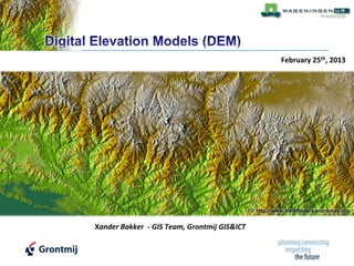
- 1. February 25th, 2013 © http://www.viewfinderpanoramas.org Xander Bakker - GIS Team, Grontmij GIS&ICT
- 2. 2 The digital elevation model represents the bare ground surface without any objects like plants and buildings A digital elevation model (DEM) is a digital representation of ground surface topography or terrain. A digital elevation model (DEM) is defined as "any digital representation of the continuous variation of relief over space,“ Burrough, 1986 Digital Elevation Model (DEM) is a grid where each cell is a value referenced to a common datum (sea level), Aronoff 1989
- 3. 3
- 4. 4 In some definitions a DTM is the same as a DEM DTM is defined as spatial distribution of terrain attributes, a topographic map in digital format, that not only consist of the DEM but also slope, aspect and so on… (Meijerink, A. M. J., De Brouwer, H. A. M., Mannaerts, C. M. & Valenzuela) What’s more important; be aware that there are different definitions!
- 7. 7
- 9. 9
- 10. 10 No break lines Soft break lines Hard break lines Input data Triangulation Surface 3D view © http://www.ian-ko.com
- 11. 11 © Ramon Hanssen, TU Delft
- 12. ght etection nd anging 12
- 13. ght etection nd anging 13
- 14. 14
- 15. 15
- 16. 16 ‘Raw’ AHN2 points(DSM) Filtered AHN2 points ( DEM) Point cloud TIN
- 18. 18
- 19. 19 Buildings not in TOP10 are detected Buildings mainly covered with NoData are depicted as well
- 20. 20
- 21. 21 Digital Surface Model Slope GIS Buildings footprints Aspect Cities
- 23. 23 West East Cundinamarca, Colombia
- 24. 24 3D 2D
- 25. 25 bare earth Soil maps Soil maps GeoTOP GeoTOP
- 26. 26
- 27. 27
- 28. 28 Speed bumps
- 29. 29 6 7 A 2 4 5 8 9 B 3 10 11 1 Center of the dike
- 30. 30 1200 km of dike Evaluate every 0.5 meter Retrieve 11 heights > 26 million queries … from a dataset with 7 billon pixels (30GB) Read each time only the extent of 1 dike into memory. Hours of processing time reduced to minutes!
- 31. 31 height ≥ A B ≤ height < A height< B Insufficient data No Data
- 32. 32 More than 1.5m, AHN2 > A More than 70% NoData AHN2 < B Insufficient data, less than 70% NoData, More than 1.5m, B <= AHN2 < A but no 3 consecutive points with data
- 33. 33 height ≥ A B ≤ height < A B-10cm ≤ height < B B-20cm ≤ height < B-10cm height ≥ A B-30cm ≤ height < B-20cm B ≤ height < A B-40cm ≤ height < B-30cm height < B height < B-40cm Insufficient data Insufficient data No Data No Data
- 34. 34 Sections of 100m DEM Dike center line Cross profile H100min Standard profile 3D dike profile
- 35. 35
- 36. 36 Standard profiel after iteration H100min Standard profile before iteration
- 37. 37 Z X Y First result Second result before correction after correction with better position
- 38. 38
- 39. 39
- 40. 40
- 41. 41 More information about LAStools: https://twitter.com/#!/LAStools http://www.cs.unc.edu/~isenburg/lastools/ http://www.linkedin.com/groups/LAStools-4408378 http://www.facebook.com/LAStools
- 42. 42
- 43. 43
- 44. 44
- 45. http://twitter.com/#!/XanderBakker http://nl.linkedin.com/in/xanderbakker Xander Bakker Senior GIS Advisor Xander [DOT] Bakker [AT] Grontmij [DOT] NL http://software.grontmij.nl Grontmij Netherlands BV :: GIS & ICT – GIS Team :: http://www.Grontmij.com :: +31 30 220 79 11