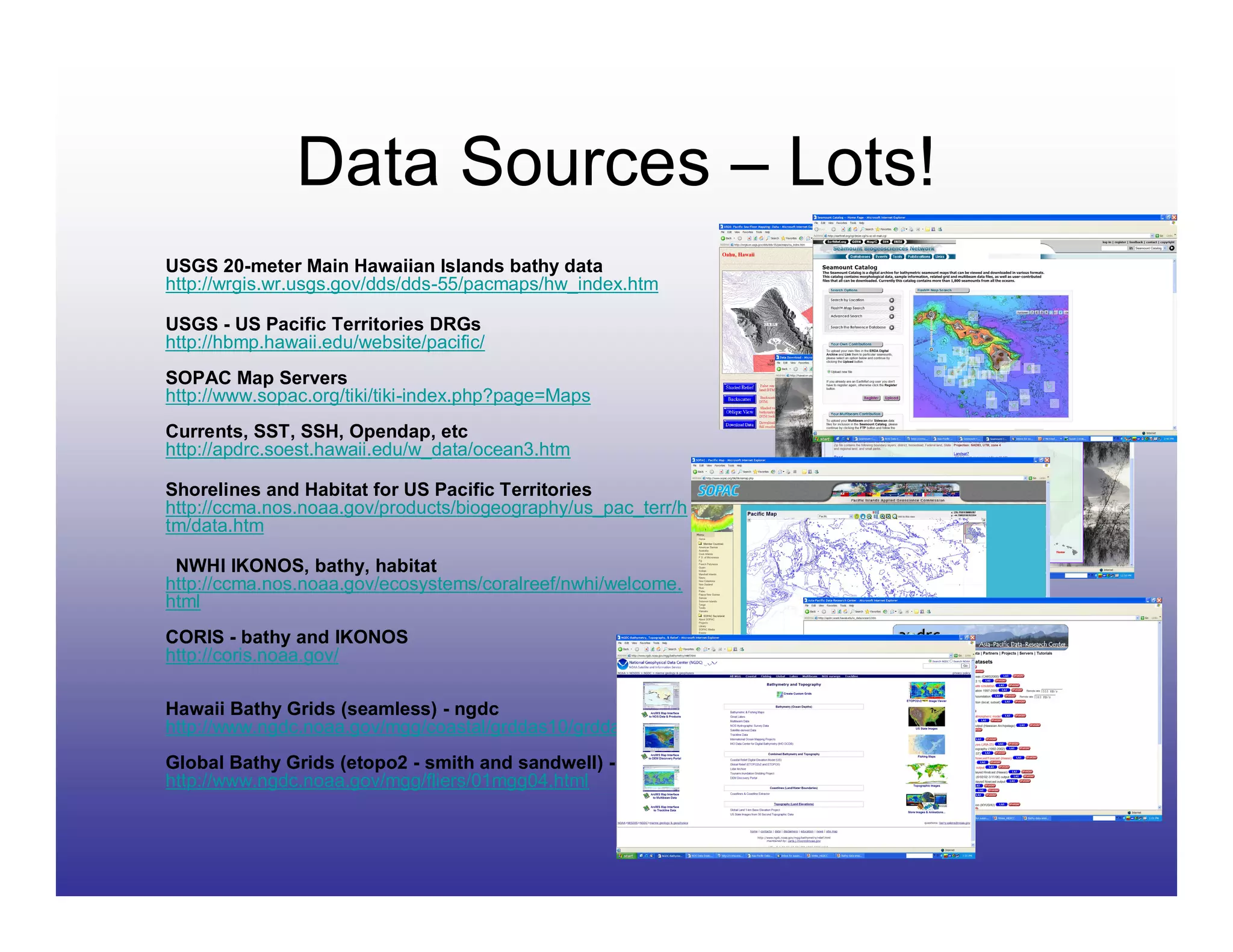
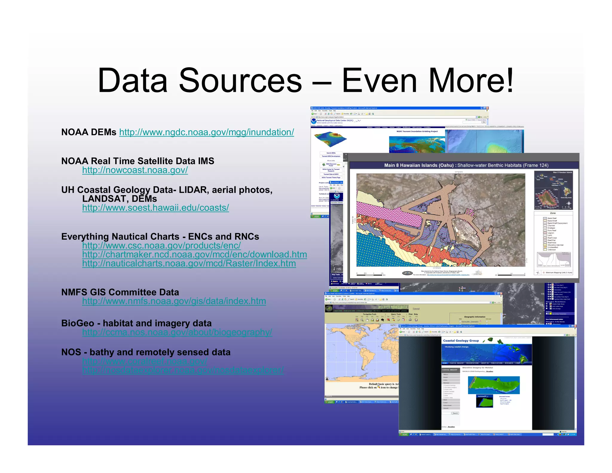
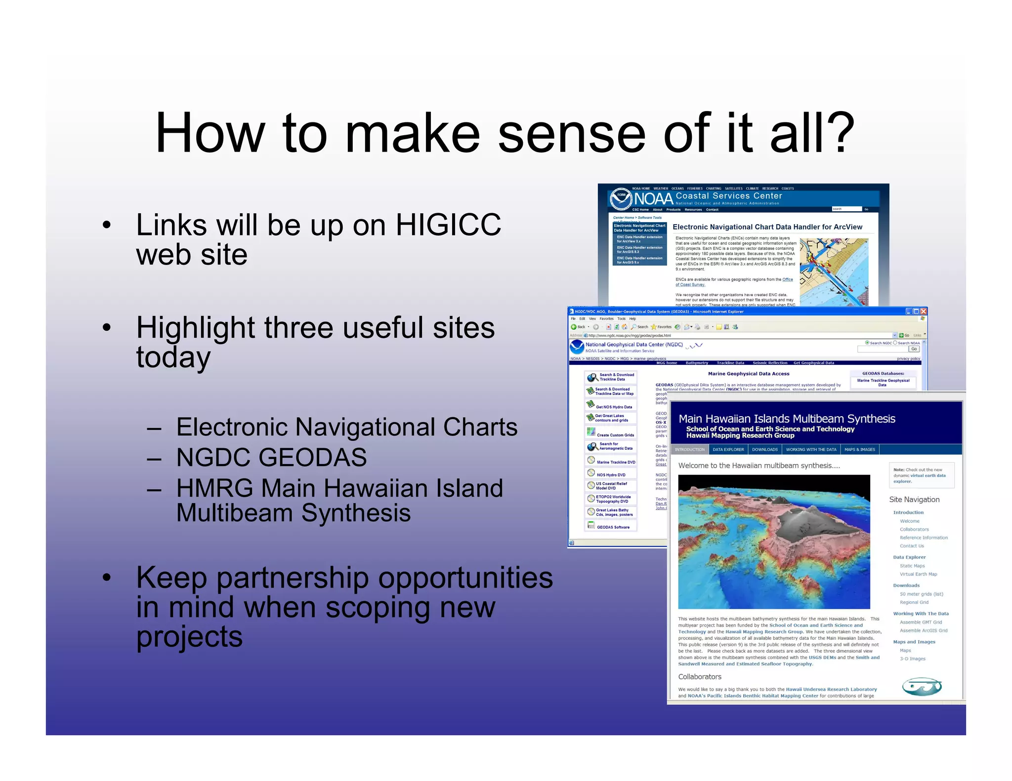
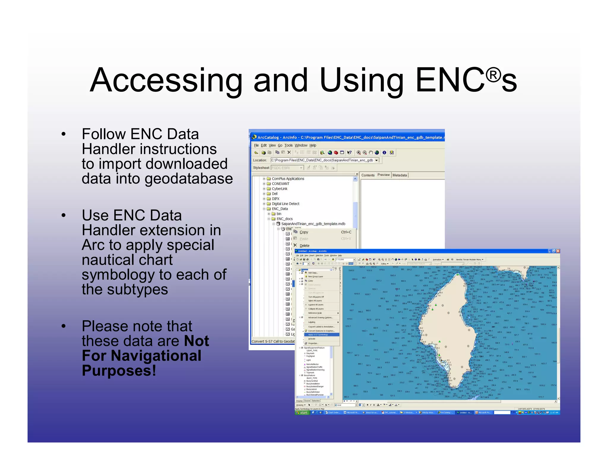
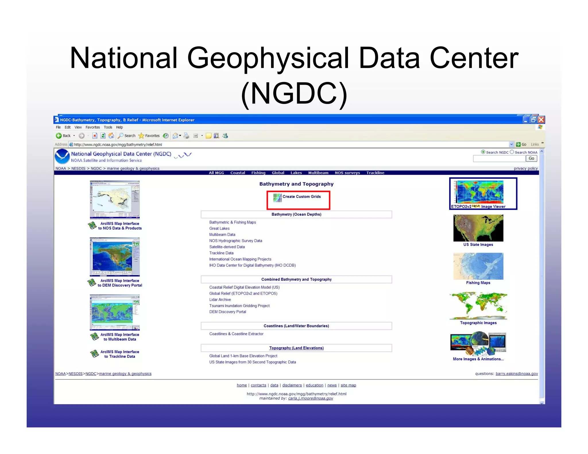
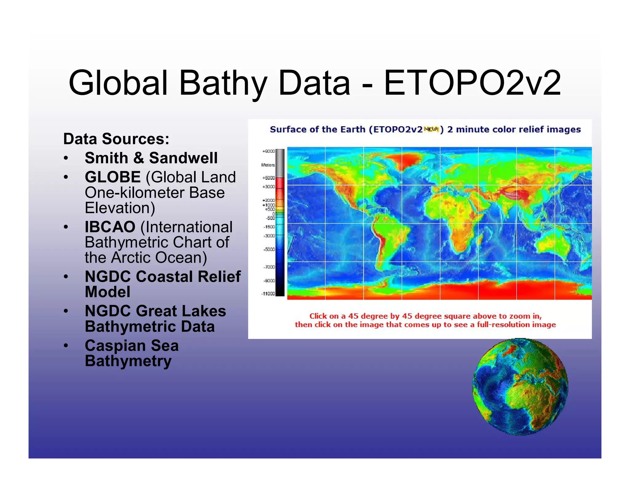
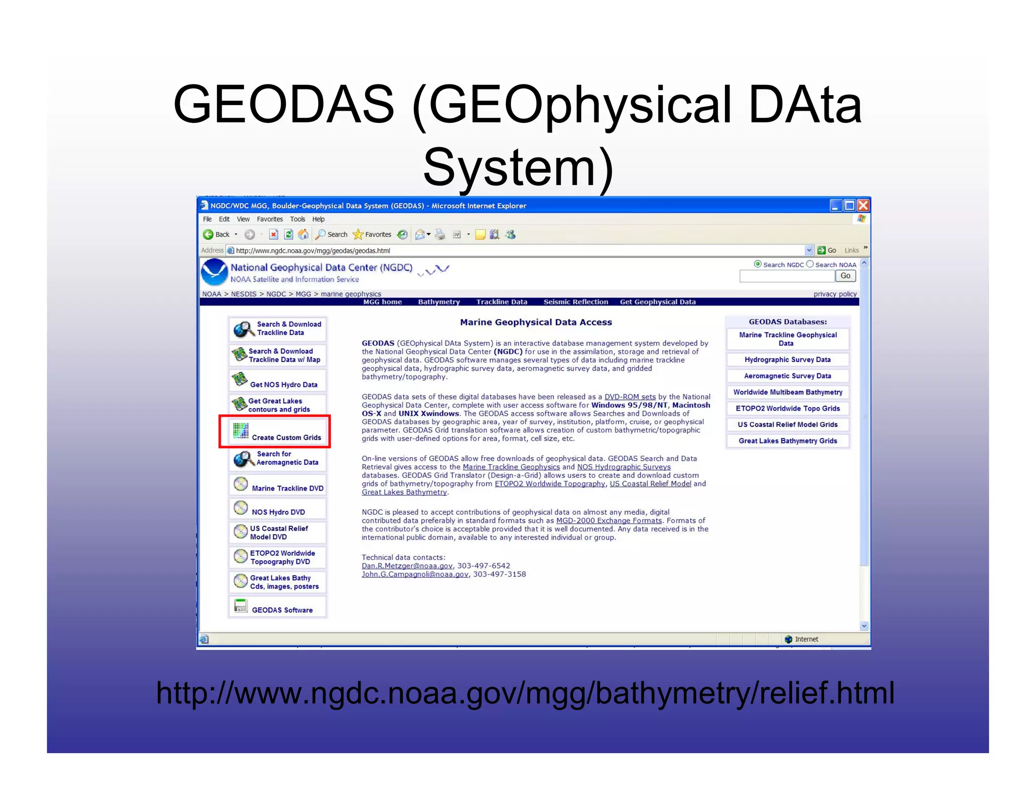
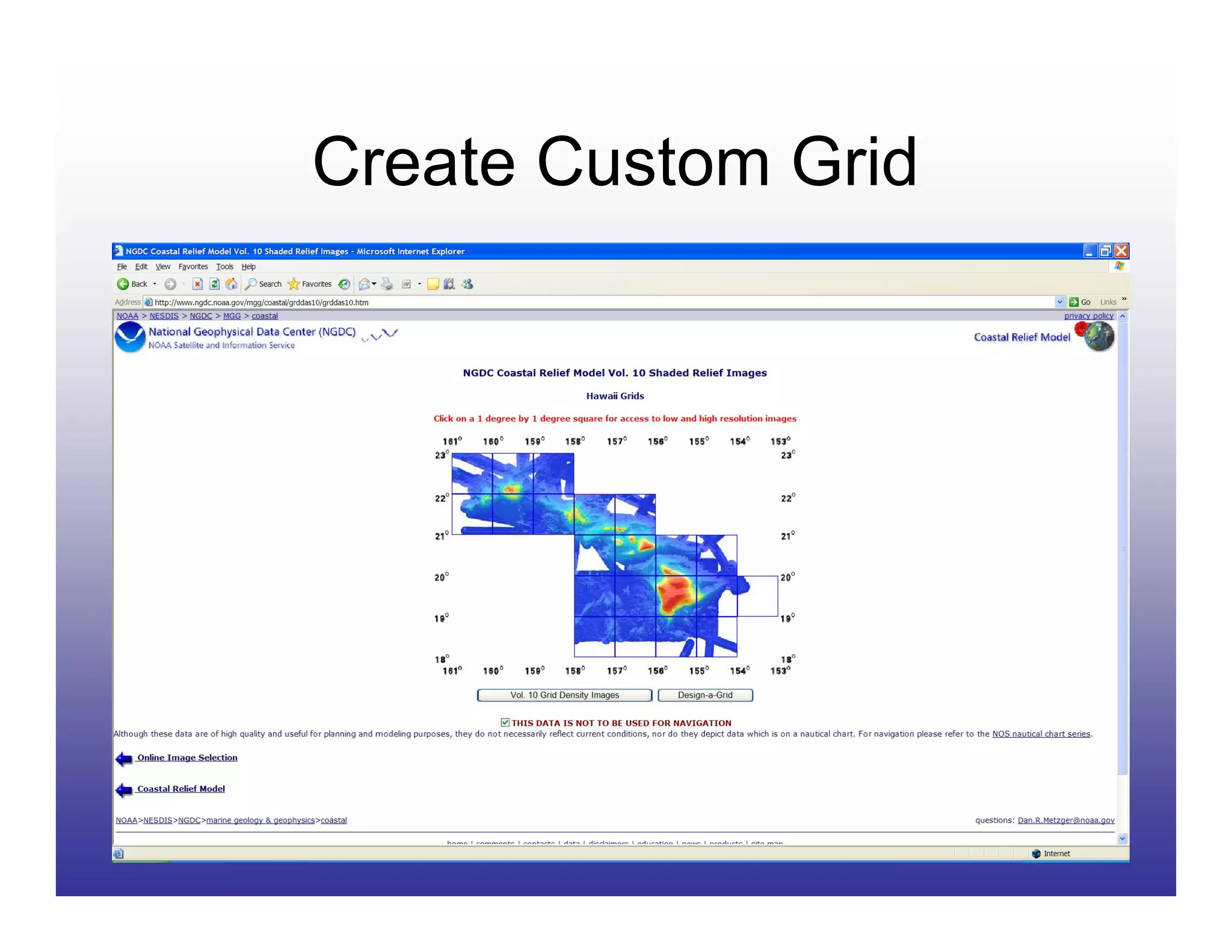
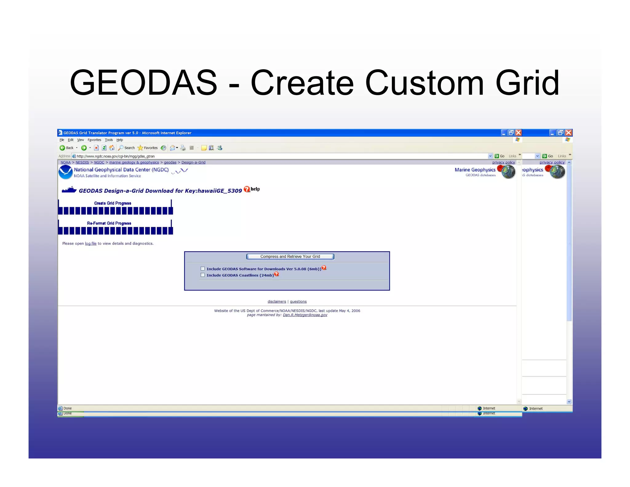
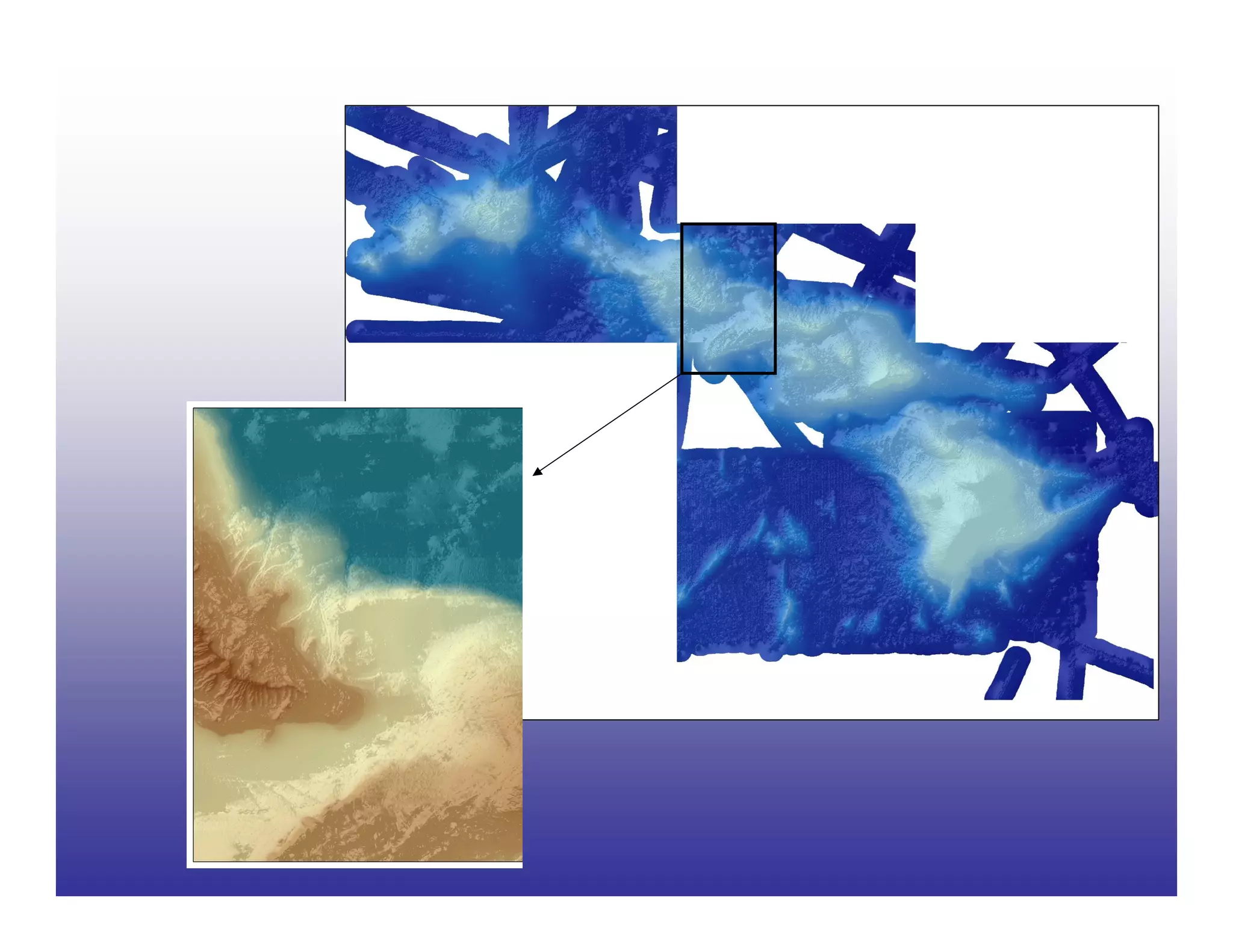
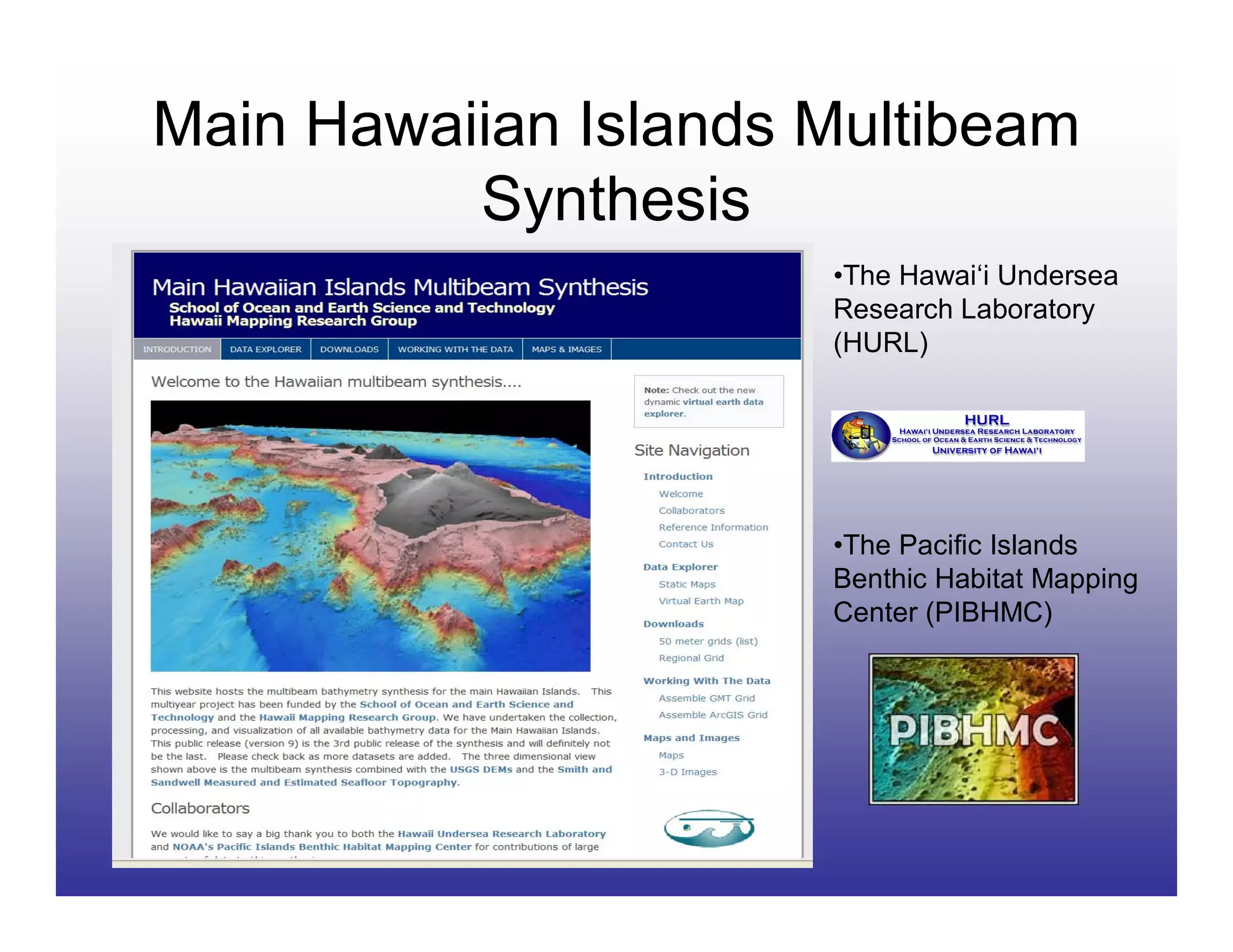
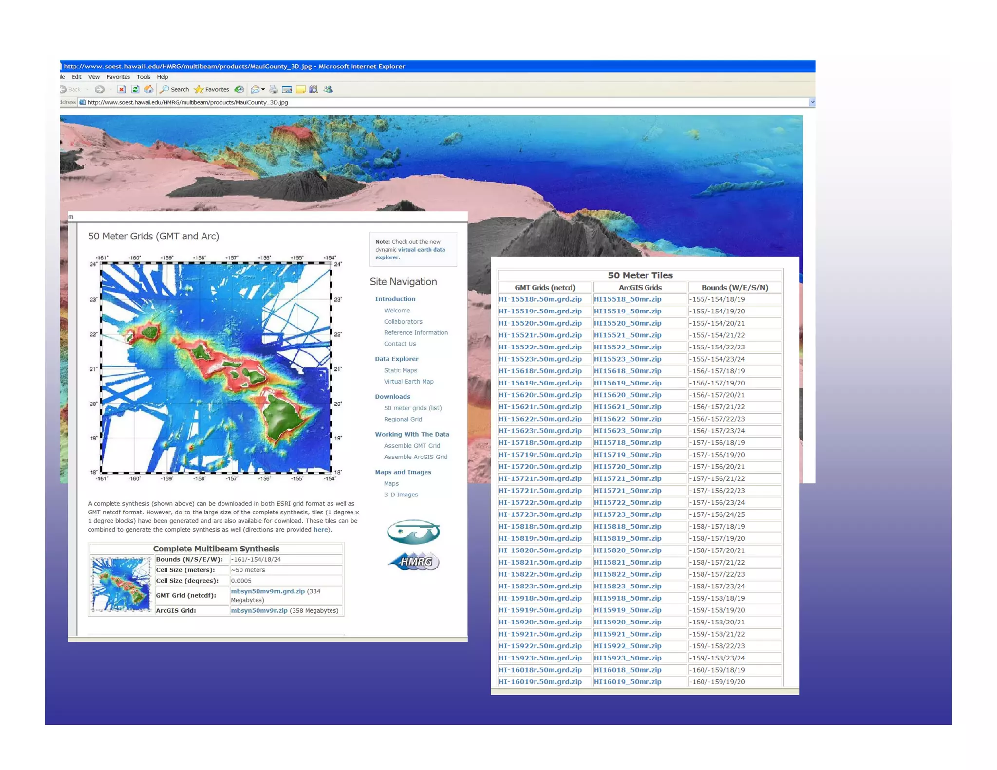
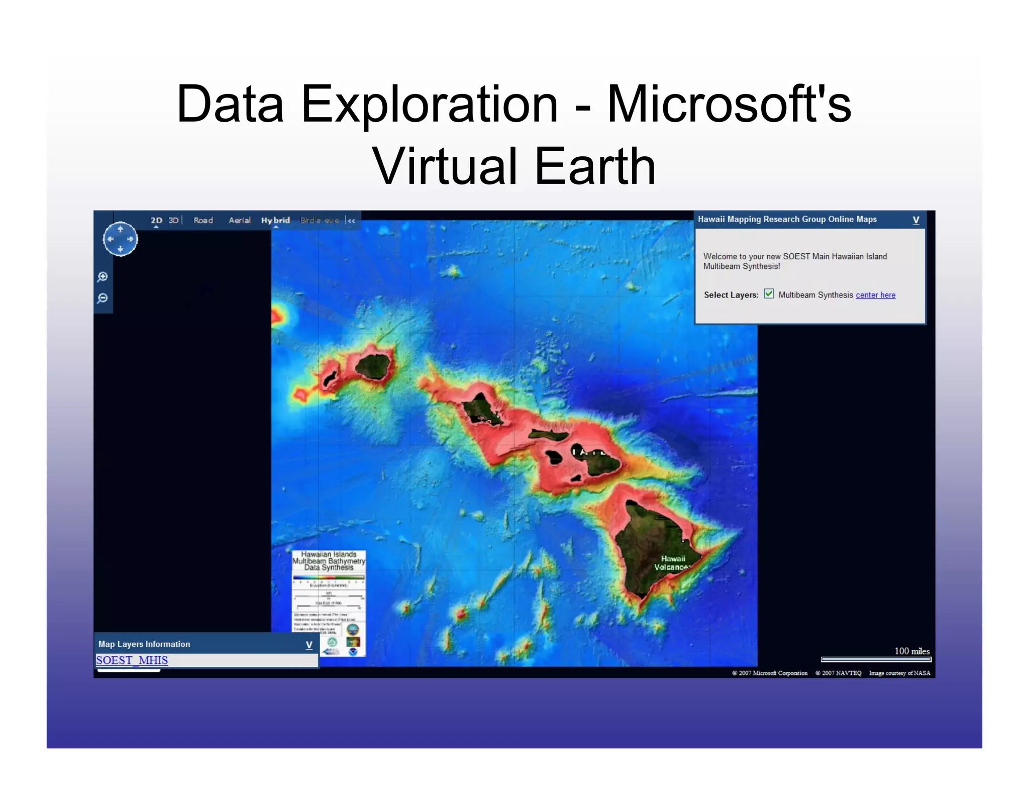
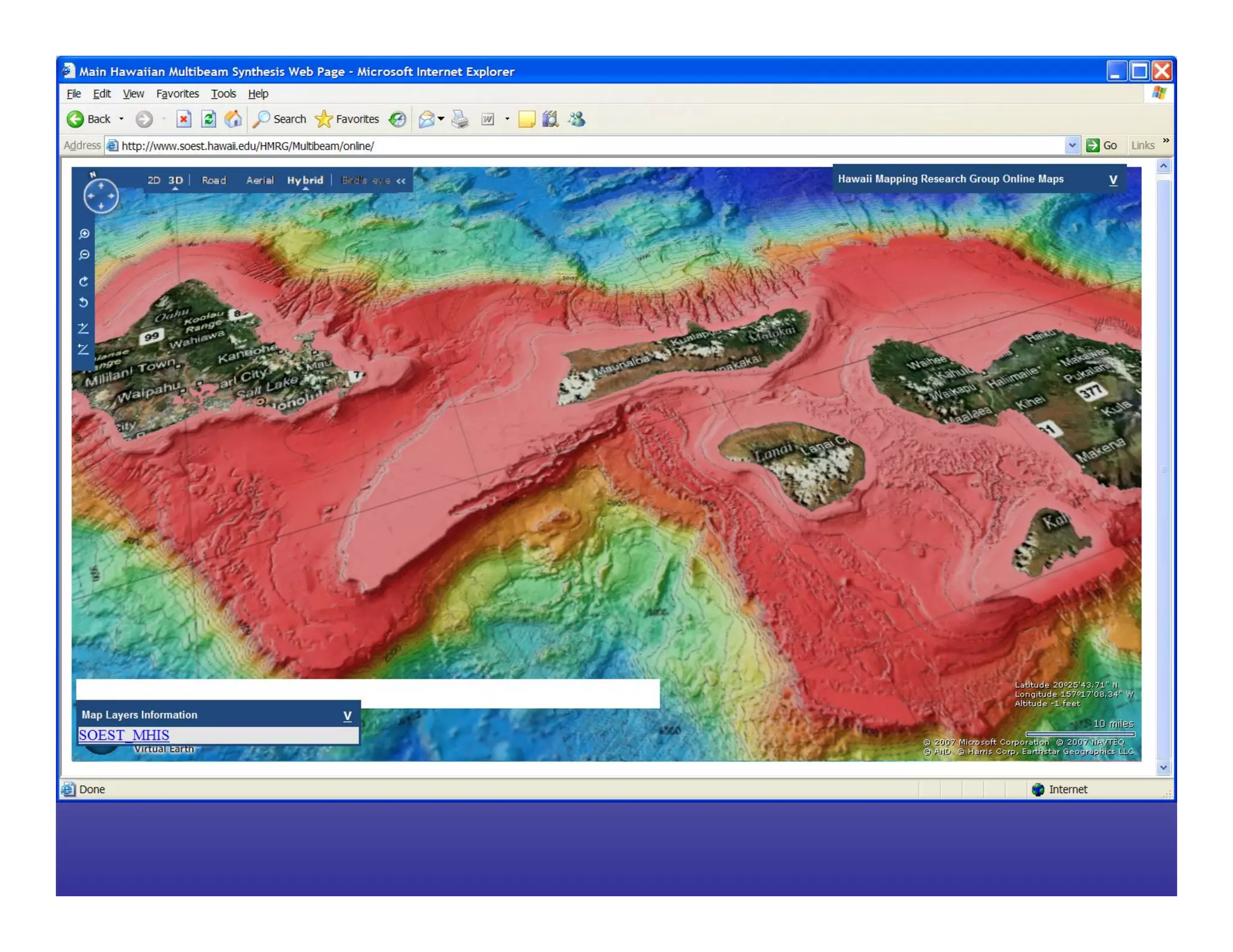
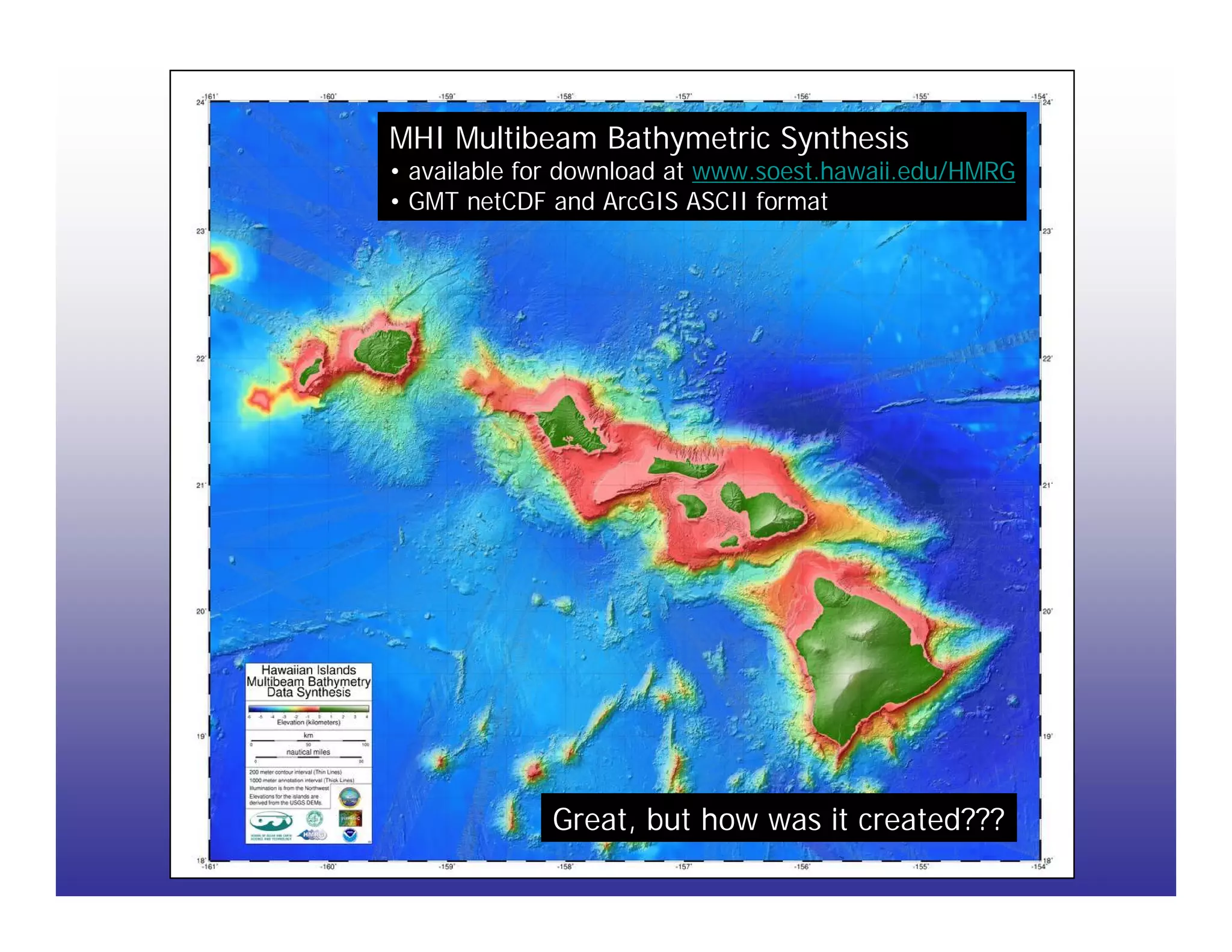
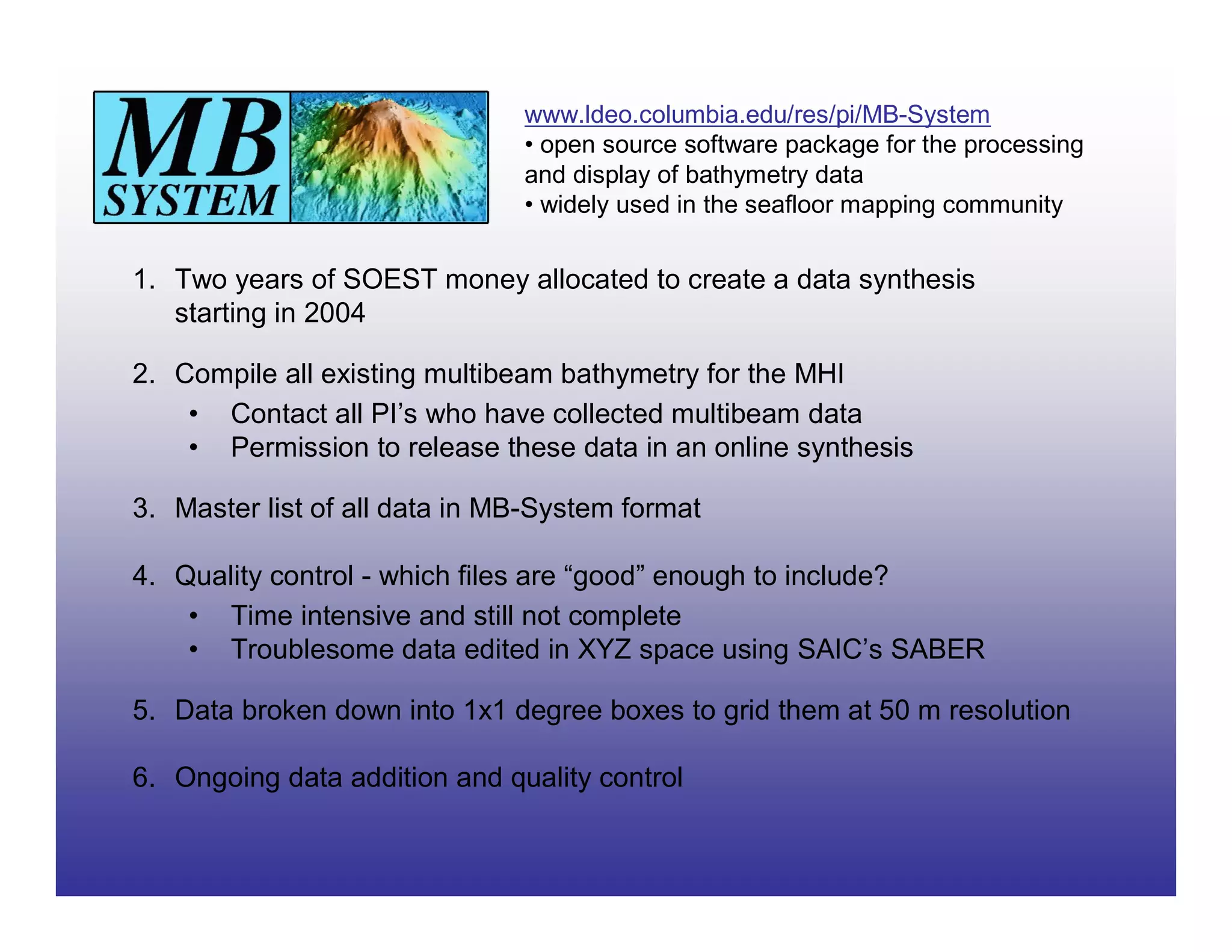
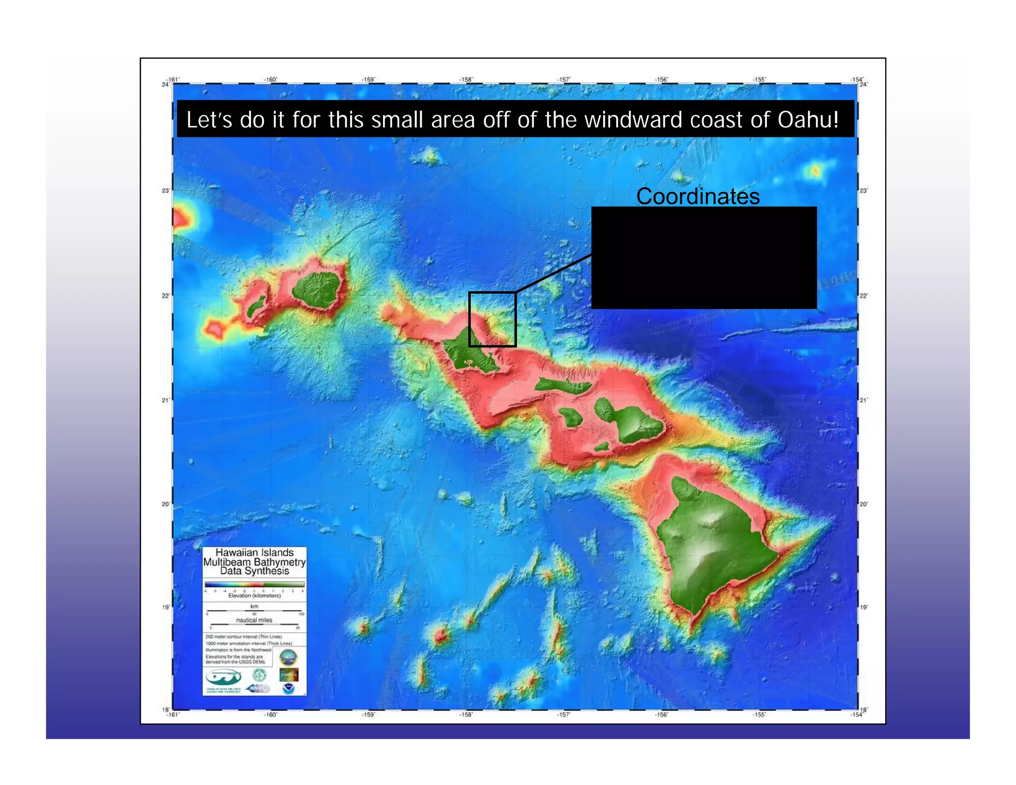
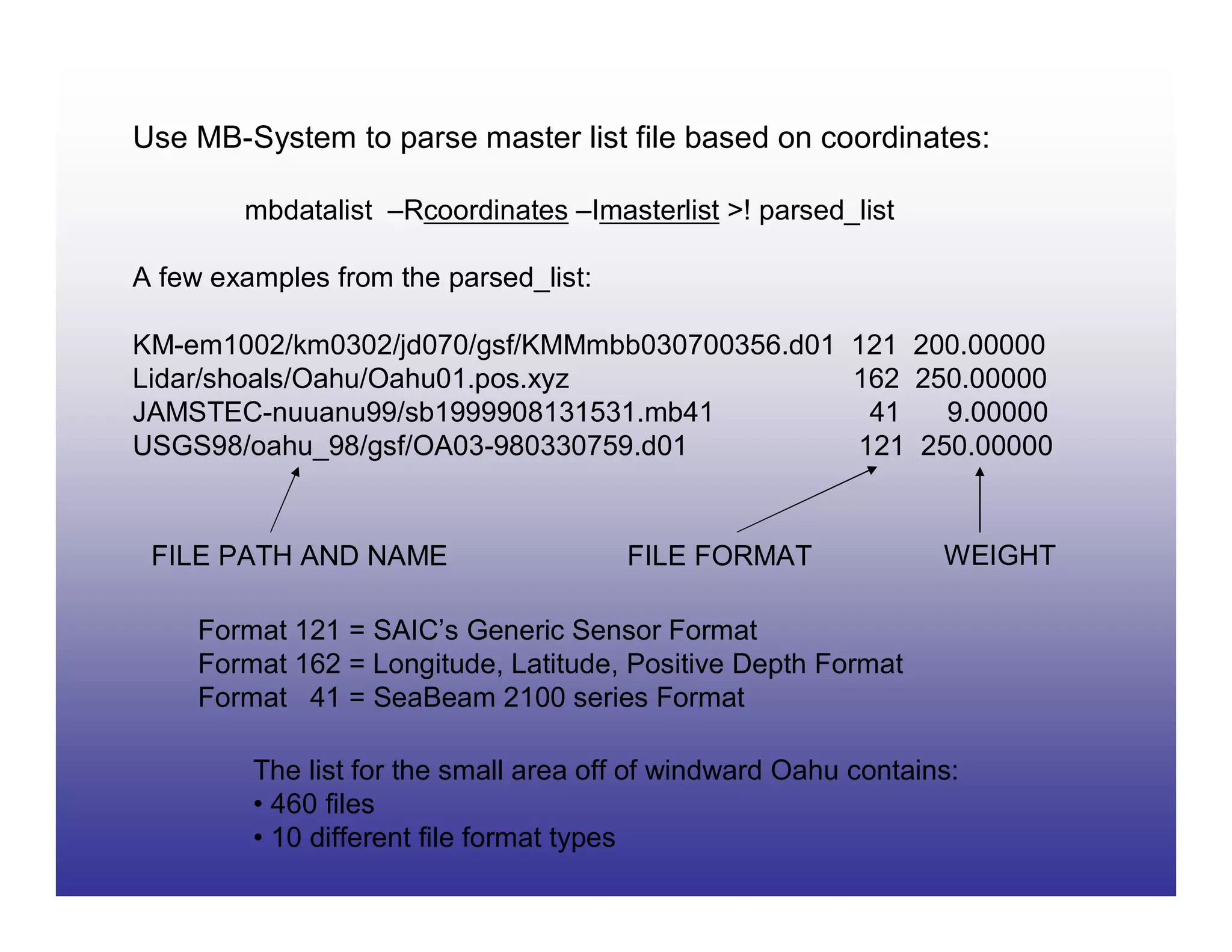
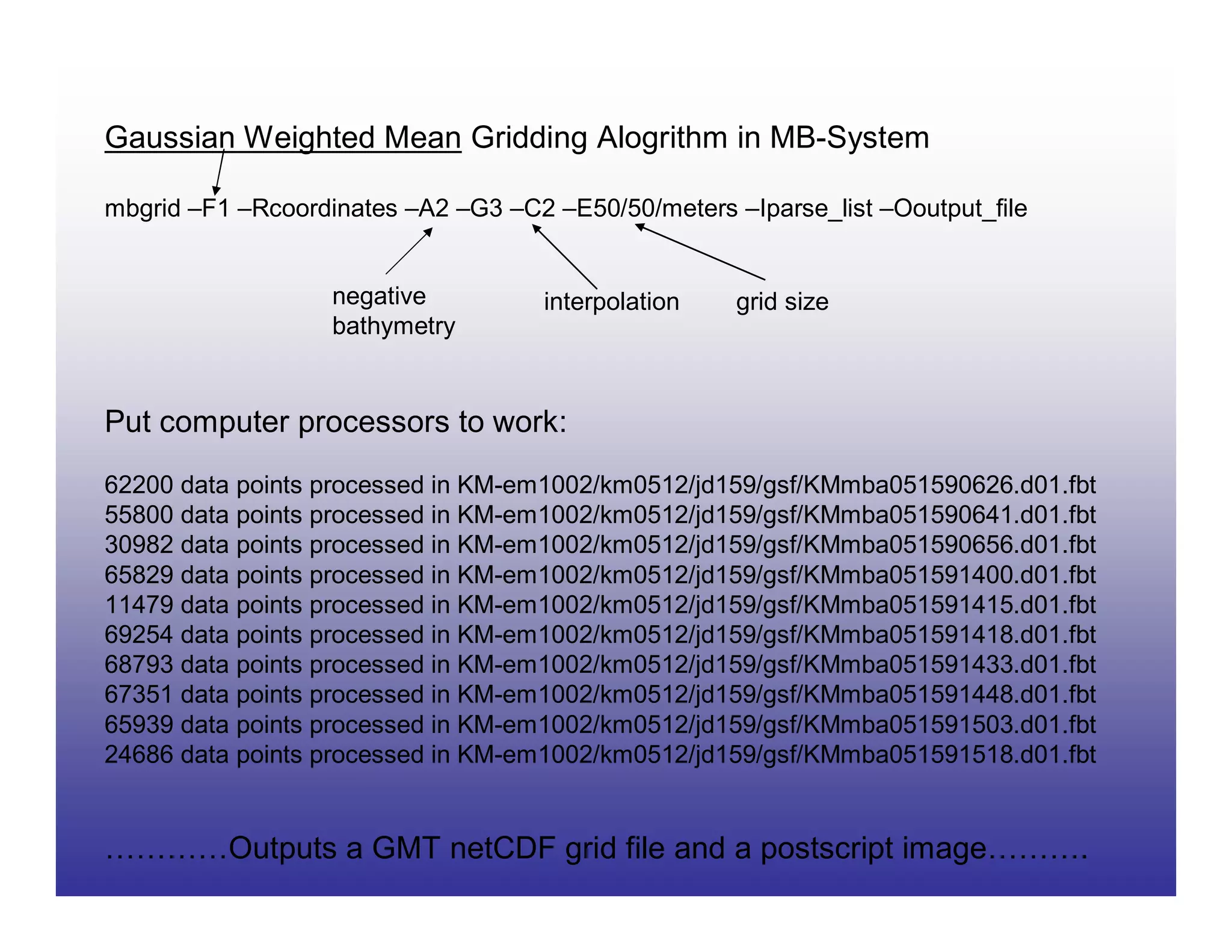
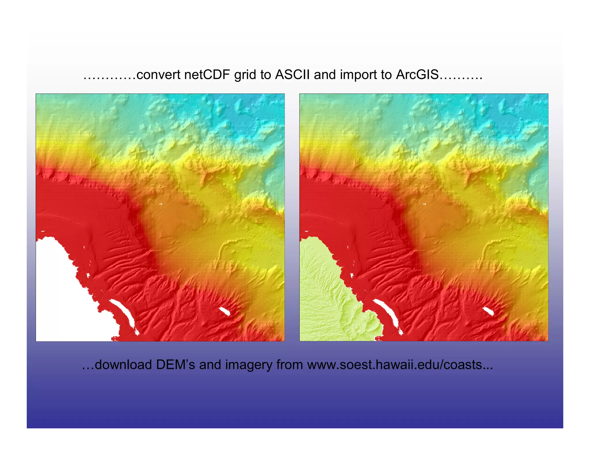
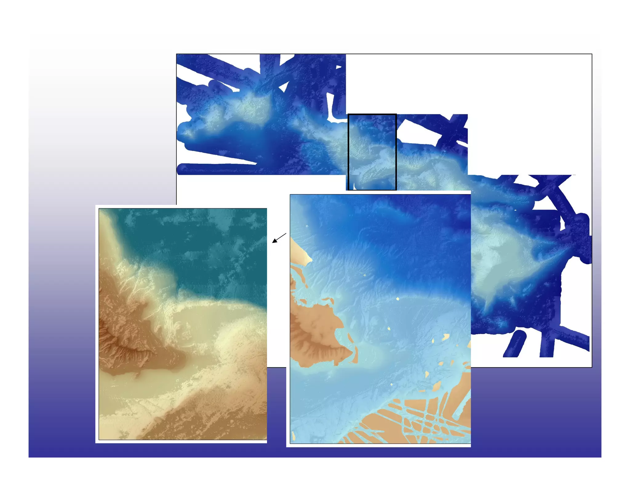
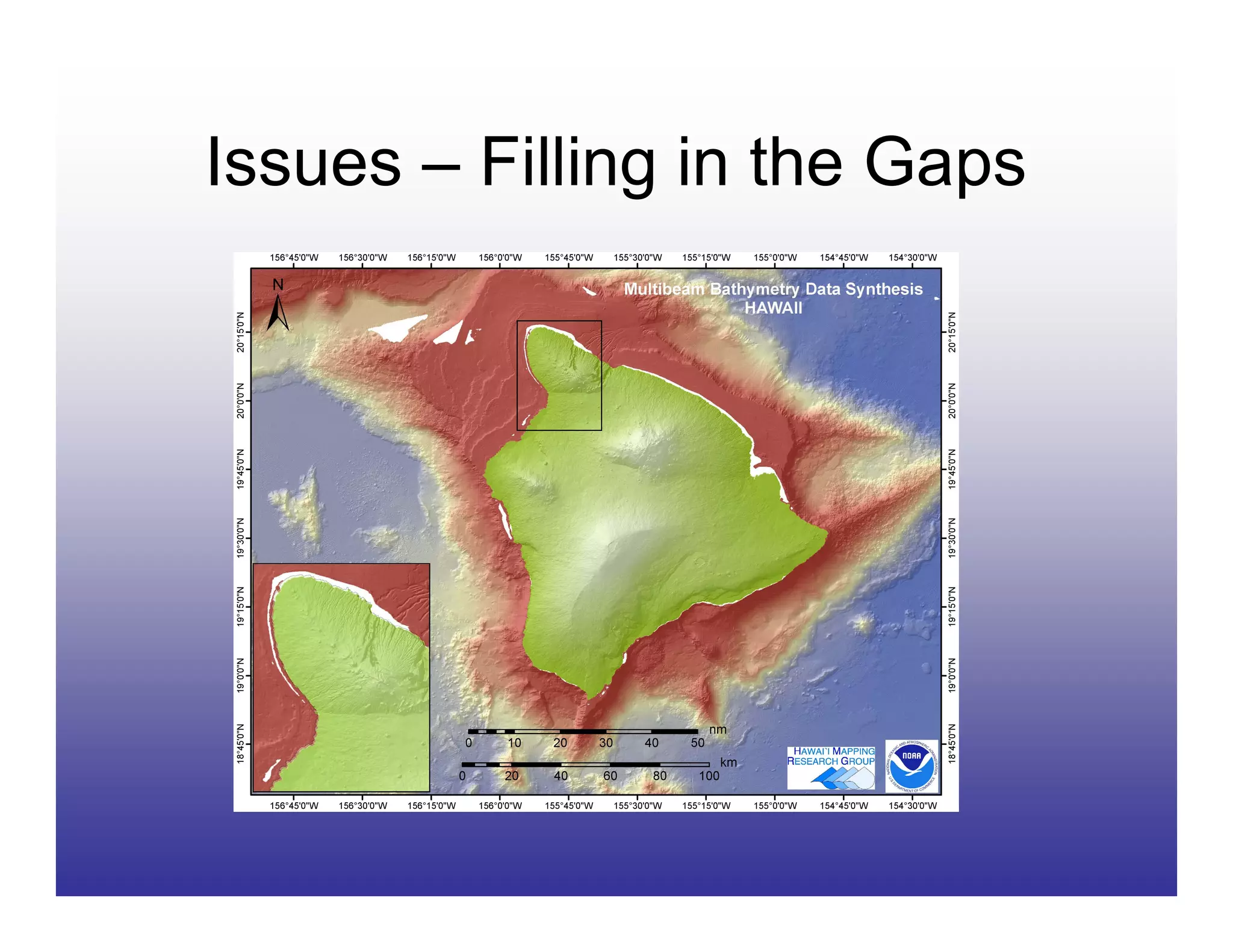
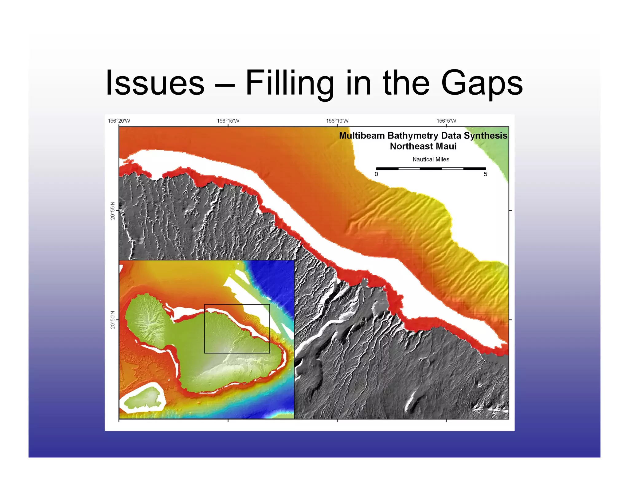
Bathymetric and Related
      Benthic Data
Susan Vogt, GIS Specialist, NOAA Pacific Islands Science Center, Coral Reef
Ecosystem Division

Joyce Miller, Oceanographer, NOAA Pacific Islands Science Center, Coral
Reef Ecosystem Division

Robert O’Conner, Fisheries Information Specialist, NOAA Pacific Islands
Region Office
Data Sources – Lots!
USGS 20-meter Main Hawaiian Islands bathy data
http://wrgis.wr.usgs.gov/dds/dds-55/pacmaps/hw_index.htm

USGS - US Pacific Territories DRGs
http://hbmp.hawaii.edu/website/pacific/
SOPAC Map Servers
http://www.sopac.org/tiki/tiki-index.php?page=Maps
Currents, SST, SSH, Opendap, etc
http://apdrc.soest.hawaii.edu/w_data/ocean3.htm

Shorelines and Habitat for US Pacific Territories
http://ccma.nos.noaa.gov/products/biogeography/us_pac_terr/h
tm/data.htm

 NWHI IKONOS, bathy, habitat
http://ccma.nos.noaa.gov/ecosystems/coralreef/nwhi/welcome.
html
CORIS - bathy and IKONOS
http://coris.noaa.gov/

Hawaii Bathy Grids (seamless) - ngdc
http://www.ngdc.noaa.gov/mgg/coastal/grddas10/grddas10.htm
Global Bathy Grids (etopo2 - smith and sandwell) - ngdc
http://www.ngdc.noaa.gov/mgg/fliers/01mgg04.html
Data Sources – Even More!
NOAA DEMs http://www.ngdc.noaa.gov/mgg/inundation/


NOAA Real Time Satellite Data IMS
   http://nowcoast.noaa.gov/

UH Coastal Geology Data- LIDAR, aerial photos,
    LANDSAT, DEMs
    http://www.soest.hawaii.edu/coasts/


Everything Nautical Charts - ENCs and RNCs
    http://www.csc.noaa.gov/products/enc/
    http://chartmaker.ncd.noaa.gov/mcd/enc/download.htm
    http://nauticalcharts.noaa.gov/mcd/Raster/Index.htm


NMFS GIS Committee Data
   http://www.nmfs.noaa.gov/gis/data/index.htm

BioGeo - habitat and imagery data
    http://ccma.nos.noaa.gov/about/biogeography/

NOS - bathy and remotely sensed data
   http://www.coralreef.noaa.gov/
   http://nosdataexplorer.noaa.gov/nosdataexplorer/
How to make sense of it all?
• Links will be up on HIGICC
  web site

• Highlight three useful sites
  today

   – Electronic Navigational Charts
   – NGDC GEODAS
   – HMRG Main Hawaiian Island
     Multibeam Synthesis

• Keep partnership opportunities
  in mind when scoping new
  projects
Electronic Navigational Charts
               (ENC®s)
• Produced by the
  Office of Coast
  Survey

• IHO S-57
  international
  exchange format
  (non-proprietary,
  publicly available)

• Not the same as a
  raster chart
Accessing and Using ENC®s
        Two step process:

  Select and       Download ENC
download ENC        Data Handler
     data           extension for
                       ArcGIS
Accessing and Using ENC®s
• Download ENCs
  from the Office of
  Coast Survey web
  site:
  http://nauticalcharts.noaa.go
  v/mcd/enc/download.htm


• Select graphically or
  by text

• Place, then collect
  order by
  downloading
Accessing and Using ENC®s
• ENC Data Handler
   extension from Coastal
   Services Center
http://www.csc.noaa.gov/
   products/enc/

• Easy to download

• Comes with easy to
  follow instruction PDF
Accessing and Using ENC®s
•   Follow ENC Data
    Handler instructions
    to import downloaded
    data into geodatabase

•   Use ENC Data
    Handler extension in
    Arc to apply special
    nautical chart
    symbology to each of
    the subtypes

•   Please note that
    these data are Not
    For Navigational
    Purposes!
National Geophysical Data Center
            (NGDC)
Global Bathy Data - ETOPO2v2
Data Sources:
• Smith & Sandwell
• GLOBE (Global Land
  One-kilometer Base
  Elevation)
• IBCAO (International
  Bathymetric Chart of
  the Arctic Ocean)
• NGDC Coastal Relief
  Model
• NGDC Great Lakes
  Bathymetric Data
• Caspian Sea
  Bathymetry
GEODAS (GEOphysical DAta
         System)


http://www.ngdc.noaa.gov/mgg/bathymetry/relief.html
Create Custom Grid
GEODAS - Create Custom Grid
Main Hawaiian Islands Multibeam
          Synthesis
                      •The Hawai‘i Undersea
                      Research Laboratory
                      (HURL)


                      •The Pacific Islands
                      Benthic Habitat Mapping
                      Center (PIBHMC)
Data Exploration - Microsoft's
       Virtual Earth
MHI Multibeam Bathymetric Synthesis
• available for download at www.soest.hawaii.edu/HMRG
• GMT netCDF and ArcGIS ASCII format


             Great, but how was it created???
www.ldeo.columbia.edu/res/pi/MB-System
                               • open source software package for the processing
                               and display of bathymetry data
                               • widely used in the seafloor mapping community


1. Two years of SOEST money allocated to create a data synthesis
   starting in 2004

2. Compile all existing multibeam bathymetry for the MHI
    • Contact all PI’s who have collected multibeam data
    • Permission to release these data in an online synthesis

3. Master list of all data in MB-System format

4. Quality control - which files are “good” enough to include?
    • Time intensive and still not complete
    • Troublesome data edited in XYZ space using SAIC’s SABER

5. Data broken down into 1x1 degree boxes to grid them at 50 m resolution

6. Ongoing data addition and quality control
Let’s do it for this small area off of the windward coast of Oahu!


                                             Coordinates
                                                 22 N
                                         158 W            157.5 W

                                                 21.5 N
Use MB-System to parse master list file based on coordinates:

        mbdatalist –Rcoordinates –Imasterlist >! parsed_list

A few examples from the parsed_list:

KM-em1002/km0302/jd070/gsf/KMMmbb030700356.d01 121 200.00000
Lidar/shoals/Oahu/Oahu01.pos.xyz               162 250.00000
JAMSTEC-nuuanu99/sb1999908131531.mb41           41   9.00000
USGS98/oahu_98/gsf/OA03-980330759.d01          121 250.00000


 FILE PATH AND NAME                    FILE FORMAT               WEIGHT

     Format 121 = SAIC’s Generic Sensor Format
     Format 162 = Longitude, Latitude, Positive Depth Format
     Format 41 = SeaBeam 2100 series Format

         The list for the small area off of windward Oahu contains:
         • 460 files
         • 10 different file format types
Gaussian Weighted Mean Gridding Alogrithm in MB-System

mbgrid –F1 –Rcoordinates –A2 –G3 –C2 –E50/50/meters –Iparse_list –Ooutput_file


                   negative          interpolation   grid size
                   bathymetry


Put computer processors to work:
62200 data points processed in KM-em1002/km0512/jd159/gsf/KMmba051590626.d01.fbt
55800 data points processed in KM-em1002/km0512/jd159/gsf/KMmba051590641.d01.fbt
30982 data points processed in KM-em1002/km0512/jd159/gsf/KMmba051590656.d01.fbt
65829 data points processed in KM-em1002/km0512/jd159/gsf/KMmba051591400.d01.fbt
11479 data points processed in KM-em1002/km0512/jd159/gsf/KMmba051591415.d01.fbt
69254 data points processed in KM-em1002/km0512/jd159/gsf/KMmba051591418.d01.fbt
68793 data points processed in KM-em1002/km0512/jd159/gsf/KMmba051591433.d01.fbt
67351 data points processed in KM-em1002/km0512/jd159/gsf/KMmba051591448.d01.fbt
65939 data points processed in KM-em1002/km0512/jd159/gsf/KMmba051591503.d01.fbt
24686 data points processed in KM-em1002/km0512/jd159/gsf/KMmba051591518.d01.fbt


…………Outputs a GMT netCDF grid file and a postscript image……….
…………convert netCDF grid to ASCII and import to ArcGIS……….


…download DEM’s and imagery from www.soest.hawaii.edu/coasts...
Issues – Filling in the Gaps

Bathymetric and Related Benthic Data

  • 1.
    Bathymetric and Related Benthic Data Susan Vogt, GIS Specialist, NOAA Pacific Islands Science Center, Coral Reef Ecosystem Division Joyce Miller, Oceanographer, NOAA Pacific Islands Science Center, Coral Reef Ecosystem Division Robert O’Conner, Fisheries Information Specialist, NOAA Pacific Islands Region Office
  • 2.
    Data Sources –Lots! USGS 20-meter Main Hawaiian Islands bathy data http://wrgis.wr.usgs.gov/dds/dds-55/pacmaps/hw_index.htm USGS - US Pacific Territories DRGs http://hbmp.hawaii.edu/website/pacific/ SOPAC Map Servers http://www.sopac.org/tiki/tiki-index.php?page=Maps Currents, SST, SSH, Opendap, etc http://apdrc.soest.hawaii.edu/w_data/ocean3.htm Shorelines and Habitat for US Pacific Territories http://ccma.nos.noaa.gov/products/biogeography/us_pac_terr/h tm/data.htm NWHI IKONOS, bathy, habitat http://ccma.nos.noaa.gov/ecosystems/coralreef/nwhi/welcome. html CORIS - bathy and IKONOS http://coris.noaa.gov/ Hawaii Bathy Grids (seamless) - ngdc http://www.ngdc.noaa.gov/mgg/coastal/grddas10/grddas10.htm Global Bathy Grids (etopo2 - smith and sandwell) - ngdc http://www.ngdc.noaa.gov/mgg/fliers/01mgg04.html
  • 3.
    Data Sources –Even More! NOAA DEMs http://www.ngdc.noaa.gov/mgg/inundation/ NOAA Real Time Satellite Data IMS http://nowcoast.noaa.gov/ UH Coastal Geology Data- LIDAR, aerial photos, LANDSAT, DEMs http://www.soest.hawaii.edu/coasts/ Everything Nautical Charts - ENCs and RNCs http://www.csc.noaa.gov/products/enc/ http://chartmaker.ncd.noaa.gov/mcd/enc/download.htm http://nauticalcharts.noaa.gov/mcd/Raster/Index.htm NMFS GIS Committee Data http://www.nmfs.noaa.gov/gis/data/index.htm BioGeo - habitat and imagery data http://ccma.nos.noaa.gov/about/biogeography/ NOS - bathy and remotely sensed data http://www.coralreef.noaa.gov/ http://nosdataexplorer.noaa.gov/nosdataexplorer/
  • 4.
    How to makesense of it all? • Links will be up on HIGICC web site • Highlight three useful sites today – Electronic Navigational Charts – NGDC GEODAS – HMRG Main Hawaiian Island Multibeam Synthesis • Keep partnership opportunities in mind when scoping new projects
  • 5.
    Electronic Navigational Charts (ENC®s) • Produced by the Office of Coast Survey • IHO S-57 international exchange format (non-proprietary, publicly available) • Not the same as a raster chart
  • 6.
    Accessing and UsingENC®s Two step process: Select and Download ENC download ENC Data Handler data extension for ArcGIS
  • 7.
    Accessing and UsingENC®s • Download ENCs from the Office of Coast Survey web site: http://nauticalcharts.noaa.go v/mcd/enc/download.htm • Select graphically or by text • Place, then collect order by downloading
  • 8.
    Accessing and UsingENC®s • ENC Data Handler extension from Coastal Services Center http://www.csc.noaa.gov/ products/enc/ • Easy to download • Comes with easy to follow instruction PDF
  • 9.
    Accessing and UsingENC®s • Follow ENC Data Handler instructions to import downloaded data into geodatabase • Use ENC Data Handler extension in Arc to apply special nautical chart symbology to each of the subtypes • Please note that these data are Not For Navigational Purposes!
  • 10.
  • 11.
    Global Bathy Data- ETOPO2v2 Data Sources: • Smith & Sandwell • GLOBE (Global Land One-kilometer Base Elevation) • IBCAO (International Bathymetric Chart of the Arctic Ocean) • NGDC Coastal Relief Model • NGDC Great Lakes Bathymetric Data • Caspian Sea Bathymetry
  • 12.
    GEODAS (GEOphysical DAta System) http://www.ngdc.noaa.gov/mgg/bathymetry/relief.html
  • 13.
  • 14.
    GEODAS - CreateCustom Grid
  • 16.
    Main Hawaiian IslandsMultibeam Synthesis •The Hawai‘i Undersea Research Laboratory (HURL) •The Pacific Islands Benthic Habitat Mapping Center (PIBHMC)
  • 18.
    Data Exploration -Microsoft's Virtual Earth
  • 21.
    MHI Multibeam BathymetricSynthesis • available for download at www.soest.hawaii.edu/HMRG • GMT netCDF and ArcGIS ASCII format Great, but how was it created???
  • 22.
    www.ldeo.columbia.edu/res/pi/MB-System • open source software package for the processing and display of bathymetry data • widely used in the seafloor mapping community 1. Two years of SOEST money allocated to create a data synthesis starting in 2004 2. Compile all existing multibeam bathymetry for the MHI • Contact all PI’s who have collected multibeam data • Permission to release these data in an online synthesis 3. Master list of all data in MB-System format 4. Quality control - which files are “good” enough to include? • Time intensive and still not complete • Troublesome data edited in XYZ space using SAIC’s SABER 5. Data broken down into 1x1 degree boxes to grid them at 50 m resolution 6. Ongoing data addition and quality control
  • 23.
    Let’s do itfor this small area off of the windward coast of Oahu! Coordinates 22 N 158 W 157.5 W 21.5 N
  • 24.
    Use MB-System toparse master list file based on coordinates: mbdatalist –Rcoordinates –Imasterlist >! parsed_list A few examples from the parsed_list: KM-em1002/km0302/jd070/gsf/KMMmbb030700356.d01 121 200.00000 Lidar/shoals/Oahu/Oahu01.pos.xyz 162 250.00000 JAMSTEC-nuuanu99/sb1999908131531.mb41 41 9.00000 USGS98/oahu_98/gsf/OA03-980330759.d01 121 250.00000 FILE PATH AND NAME FILE FORMAT WEIGHT Format 121 = SAIC’s Generic Sensor Format Format 162 = Longitude, Latitude, Positive Depth Format Format 41 = SeaBeam 2100 series Format The list for the small area off of windward Oahu contains: • 460 files • 10 different file format types
  • 25.
    Gaussian Weighted MeanGridding Alogrithm in MB-System mbgrid –F1 –Rcoordinates –A2 –G3 –C2 –E50/50/meters –Iparse_list –Ooutput_file negative interpolation grid size bathymetry Put computer processors to work: 62200 data points processed in KM-em1002/km0512/jd159/gsf/KMmba051590626.d01.fbt 55800 data points processed in KM-em1002/km0512/jd159/gsf/KMmba051590641.d01.fbt 30982 data points processed in KM-em1002/km0512/jd159/gsf/KMmba051590656.d01.fbt 65829 data points processed in KM-em1002/km0512/jd159/gsf/KMmba051591400.d01.fbt 11479 data points processed in KM-em1002/km0512/jd159/gsf/KMmba051591415.d01.fbt 69254 data points processed in KM-em1002/km0512/jd159/gsf/KMmba051591418.d01.fbt 68793 data points processed in KM-em1002/km0512/jd159/gsf/KMmba051591433.d01.fbt 67351 data points processed in KM-em1002/km0512/jd159/gsf/KMmba051591448.d01.fbt 65939 data points processed in KM-em1002/km0512/jd159/gsf/KMmba051591503.d01.fbt 24686 data points processed in KM-em1002/km0512/jd159/gsf/KMmba051591518.d01.fbt …………Outputs a GMT netCDF grid file and a postscript image……….
  • 26.
    …………convert netCDF gridto ASCII and import to ArcGIS………. …download DEM’s and imagery from www.soest.hawaii.edu/coasts...
  • 28.
    Issues – Fillingin the Gaps
  • 29.
    Issues – Fillingin the Gaps