Downloaded 41 times
![The End Domande? [email_address] FOSS4G-IT 2010, Lugano 11 th February 2010](https://image.slidesharecdn.com/geosolutions-foss4g-it-2010c-100223032123-phpapp01/75/Geosolutions-Foss4g-It-2010-26-2048.jpg)

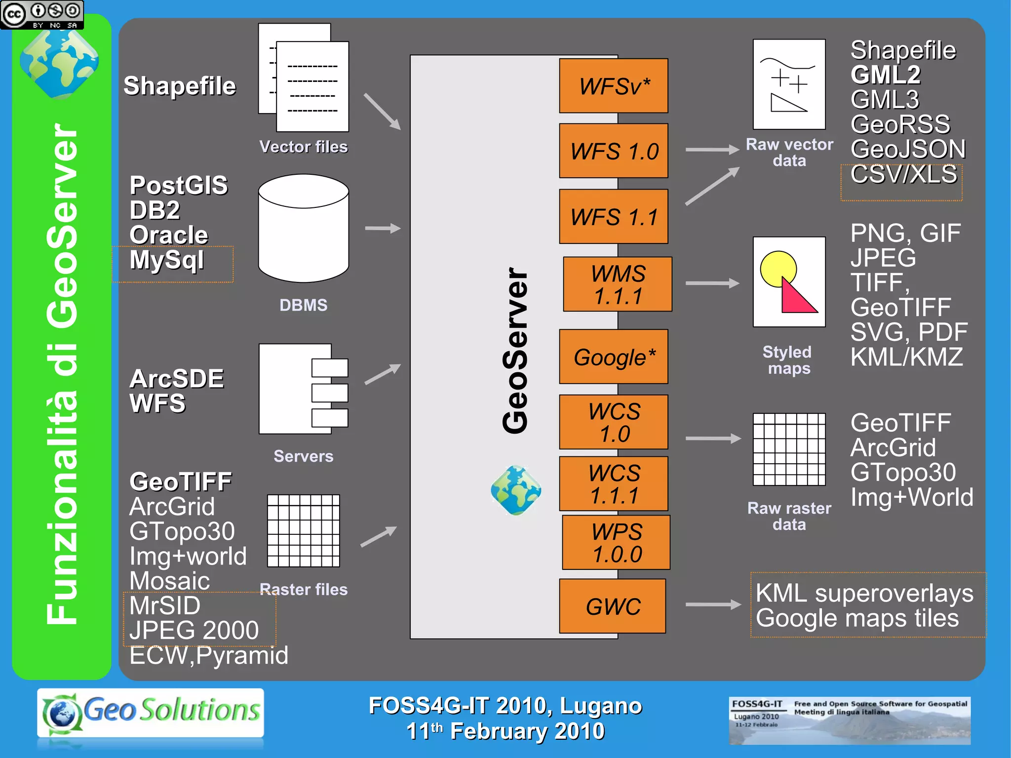
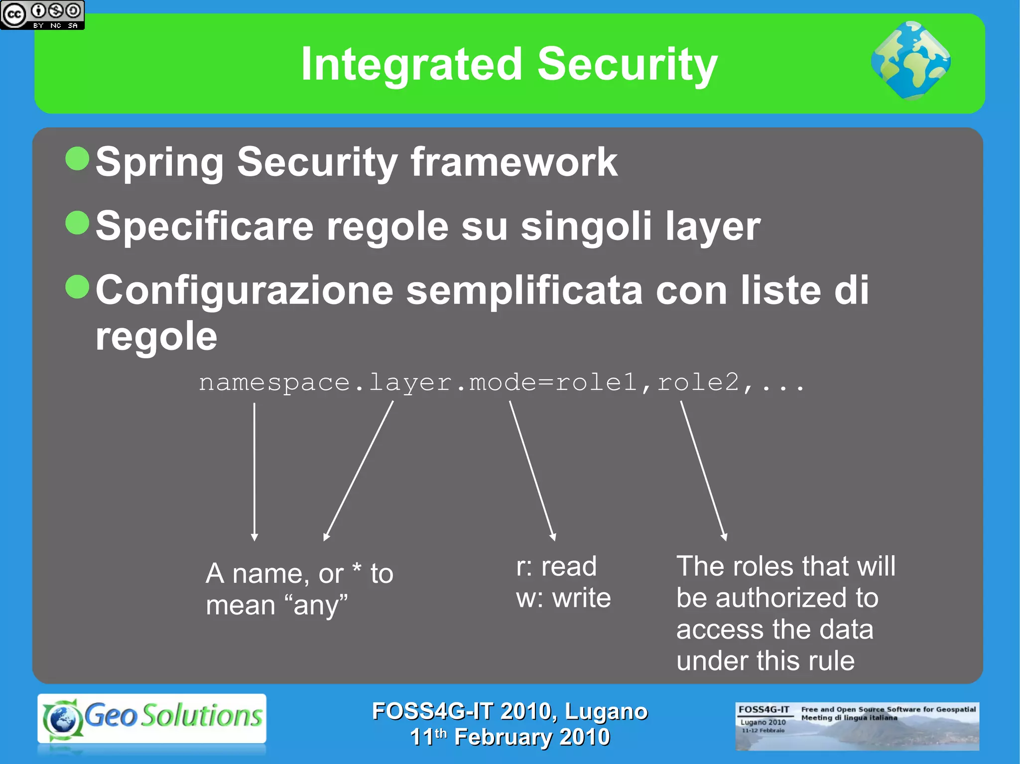
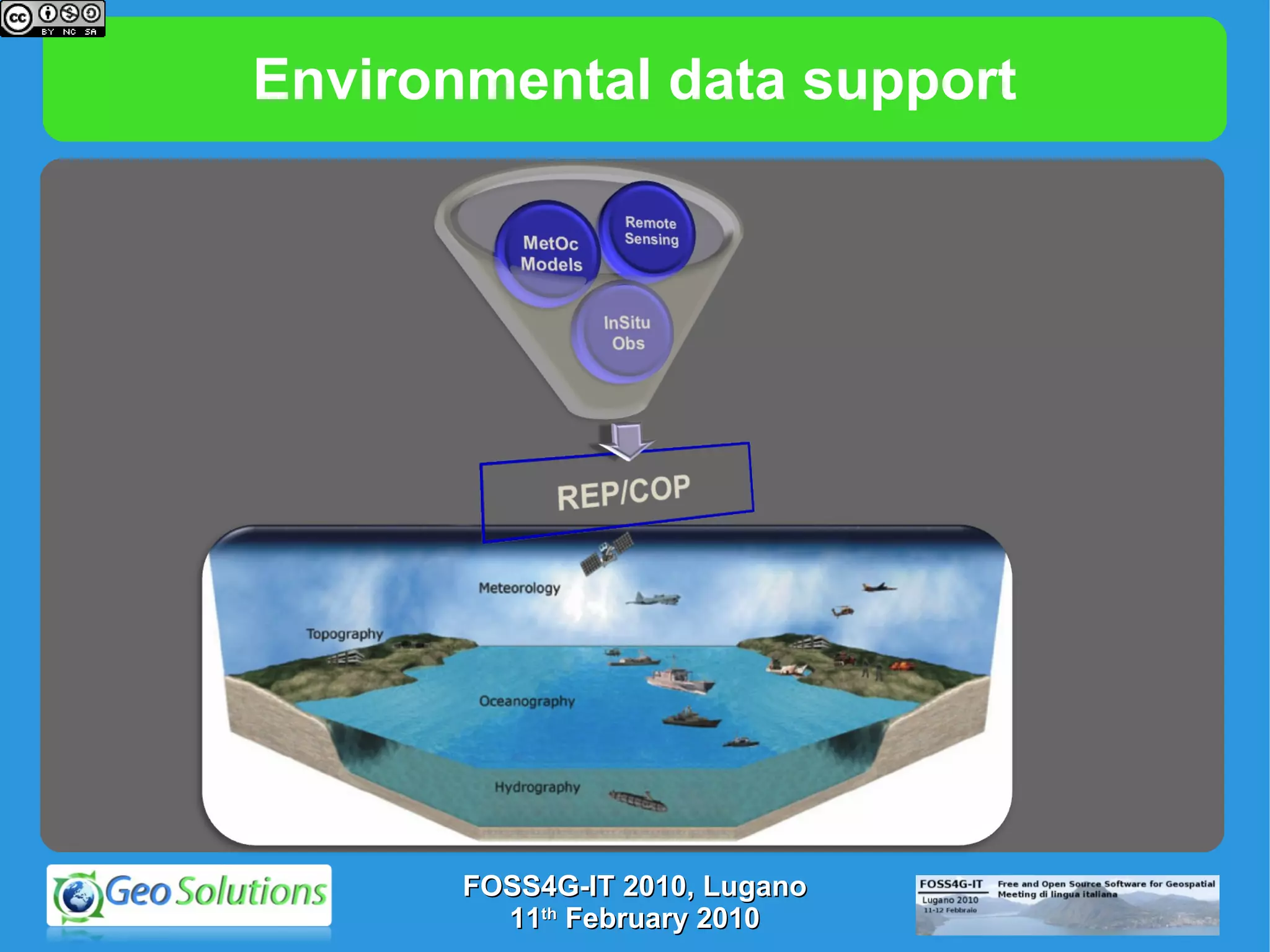
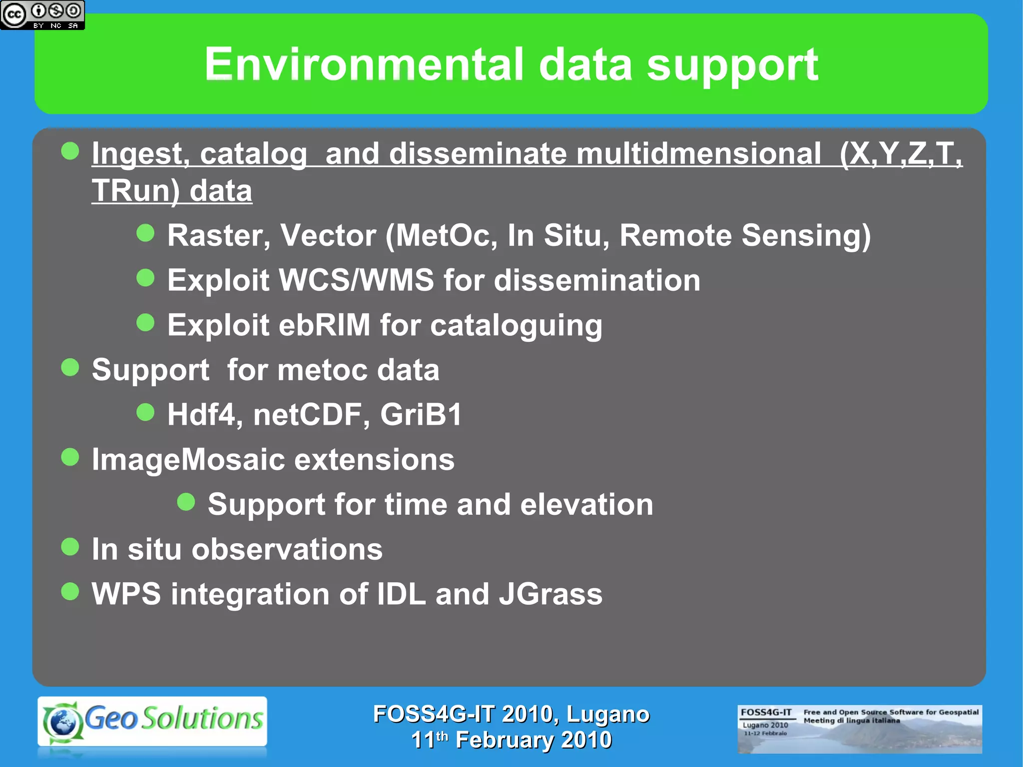
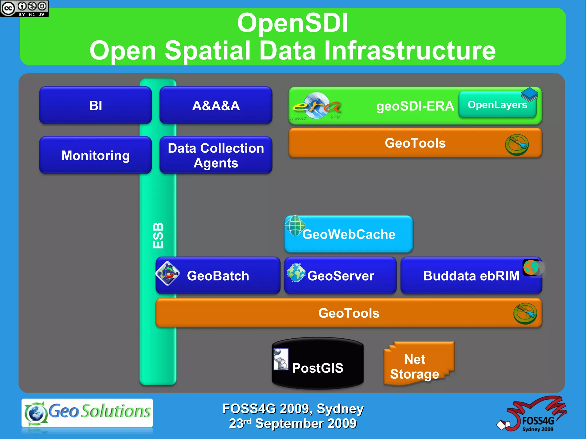
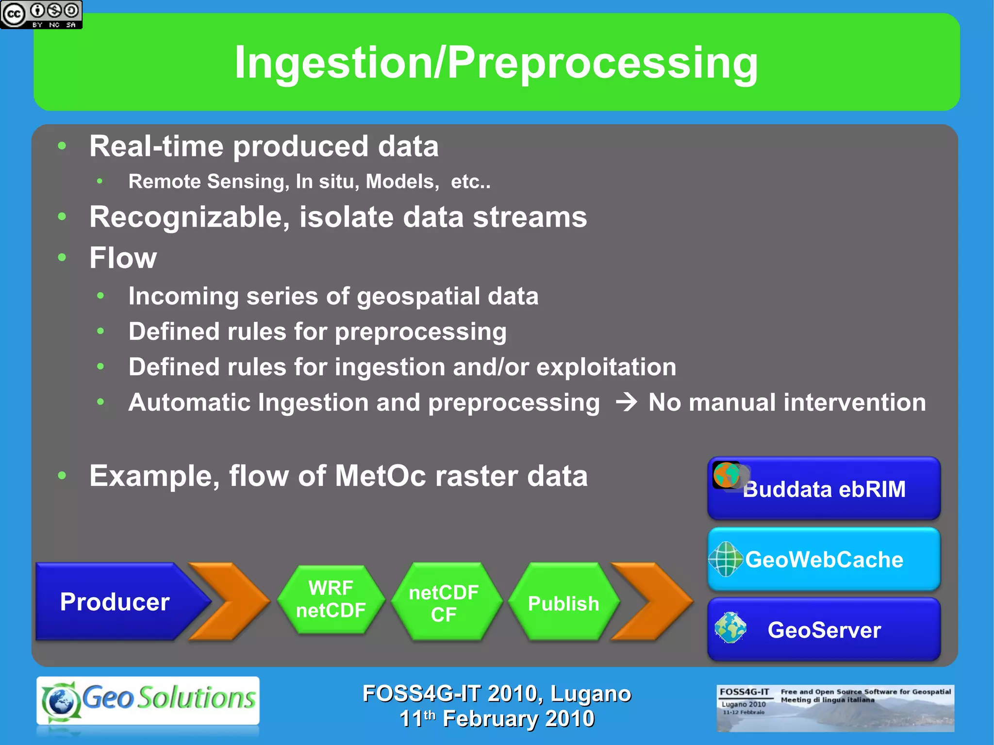
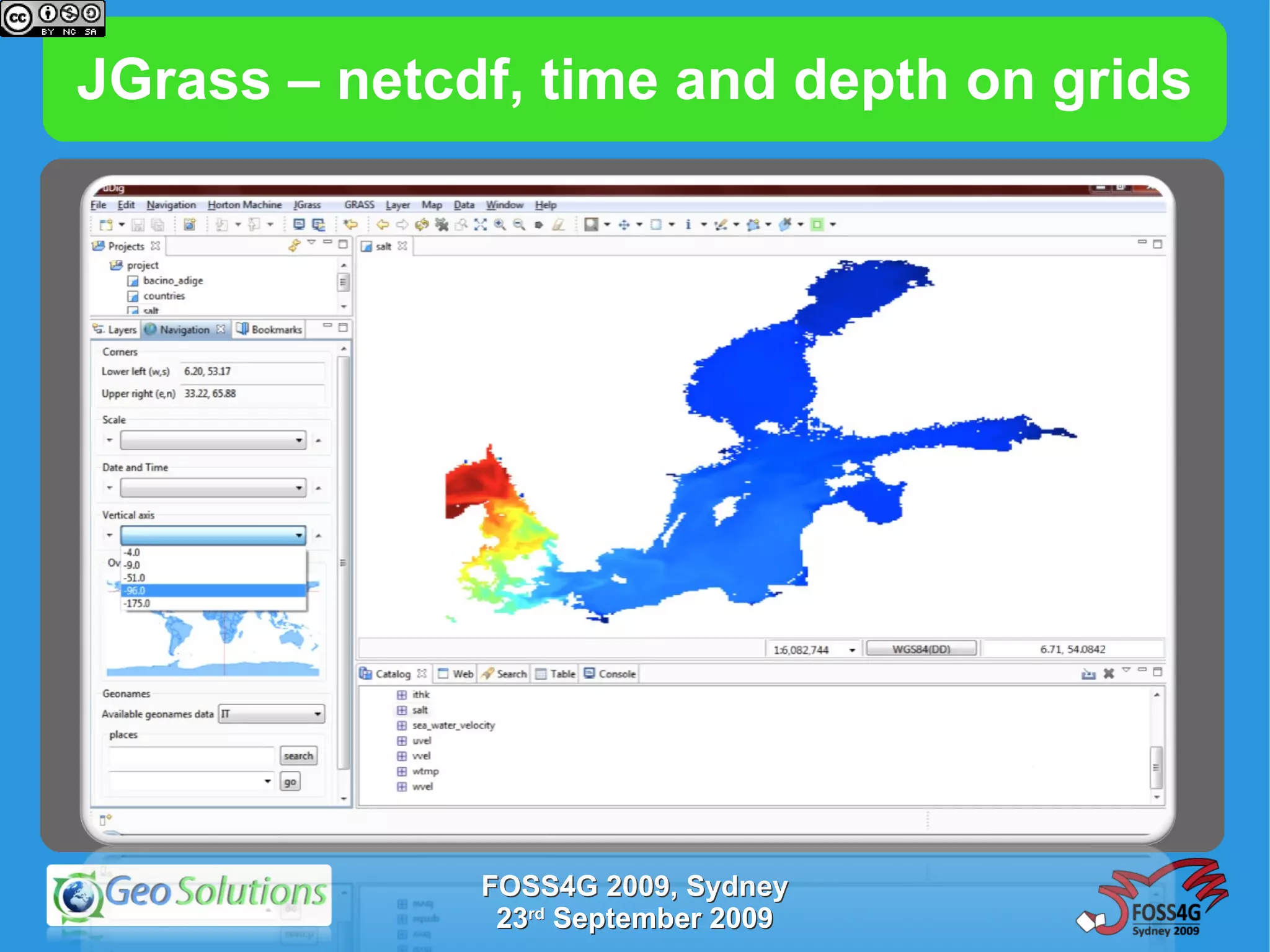
This document discusses ongoing developments for supporting environmental data in GeoServer. It summarizes GeoServer's current functionality, including WMS, WFS, and integrated security. It then outlines developments like improved support for time and elevation parameters in WMS/WCS, exposing time and elevation in WFS, and disseminating netCDF-CF cubes from WCS. The goal is to better handle multidimensional environmental data like meteorological rasters, vectors, and in-situ observations.