9. lvrm ch 13 14 ukraine- erosion control-eb
•Download as PPT, PDF•
0 likes•830 views

erosion control

Recommended
Recommended
More Related Content
What's hot
What's hot (20)
Viewers also liked
Viewers also liked (20)
Similar to 9. lvrm ch 13 14 ukraine- erosion control-eb
Similar to 9. lvrm ch 13 14 ukraine- erosion control-eb (20)
More from Radmila Ustych
More from Radmila Ustych (20)
Recently uploaded
Recently uploaded (20)
9. lvrm ch 13 14 ukraine- erosion control-eb
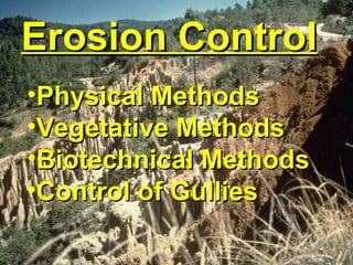
- 1. Erosion ControlErosion Control •Physical MethodsPhysical Methods •Vegetative MethodsVegetative Methods •Biotechnical MethodsBiotechnical Methods •Control of GulliesControl of Gullies
- 2. Goals:Goals: •Control of WaterControl of Water •Restore the sponge effect ofRestore the sponge effect of native soilnative soil
- 6. • Happens on a tiny scale • Repeats over and over • Can become a huge problem Where it all startsWhere it all starts R. Douglas
- 7. • Raindrop • Sheet • Rill • Gully • Channel Types of erosionTypes of erosion USFS Stream DiversionCulvert Scour
- 11. StabilizingStabilizing Roads andRoads and ConstructionConstruction Sites in PalauSites in PalauBob GavendaBob Gavenda USDA-NRCSUSDA-NRCS
- 14. Ngerikiil WatershedNgerikiil Watershed erosion from different land useserosion from different land uses land useland use relative erosionrelative erosion roadsroads 244244 developeddeveloped 6 – 396 – 39 agricultureagriculture 2.5 – 1642.5 – 164 grasslandgrassland 0.5 - 490.5 - 49 forestforest 11
- 15. General Erosion Control and Revegetation Plan A Description of Project 1.Project Objectives 2.Project Location 3.Work Plan 4.Description of Local Environment B Planning 1. Site Analysis a.Climate and Microclimate b.Vegetation Spectrum c.Soils, Erosion Potential, and Fertility 2. Project Scheduling to Minimize Area of Disturbance (Stage Construction?) 3. Physical, Vegetative, or Biotechnical Measures?? A Mix? 4. Water and Sediment Control, Ground Cover Measures 5. Developing the Revegetation Plan a.Plant Species Selection c. Aesthetics b.Site Preparation d. Sources 6.Types of Plant Materials a.Seeds c. Tublings b.Cuttings d. Other Container Plants 7. Importance of Ecotypes and Use of Native Species
- 16. General Erosion Control and Revegetation Plan C Implementation 1. Purchasing and Placing Fencing, Ground Cover, Mats, Etc. 2. Planting Methods--Cuttings and Transplants – Tools and Materials – Planting Holes and Methods 3. Planting Methods--Seeding and Mulching – Hydroseeding - Fertilizer – Range Drills - Holding Mulch in Place – Type and Quantity of Seed -Tackifiers – Type and Quantity of Mulch -Netting 4. Other Planting Methods--Biotechnical – Live Stakes - Brush Layering – Wattling - Brush Matting 5. Timing – Fall versus Spring Planting – Summer Plantings Advance Planning 6. Hardening-off and Holding Plants (Acclimatized) 7. Handling Live Brush and Cuttings D Maintenance and After Care 1. Short and Long-term Care Irrigation Weed Control Fertilization Replanting 2.Plant Protection Wire Caging, Fencing the Entire Site
- 17. PHYSICAL METHODS
- 46. AMANCO-Colombia
- 49. • Minimize Site Disturbance • Schedule Work to Reduce Erosion Risk • Use Locally Available Materials • Cover Disturbed Areas • Control Water Flow • Install EC Measures Prior to Rain • Save Organic Topsoil • Separate Clean and Dirty Water • Rehabilitate Disturbed Areas Progressively SUMMARYSUMMARY Key Erosion Control Measures
Editor's Notes
- This presentation briefly looks at road and construction sites in Palau and difficulties in revegetating and stabilizing disturbed sites on volcanic soils.
- This photo shows roadside drainage that is actively eroding. Same development project as shown in the previous slides. Establishing a vegetative cover would help alleviate some of the runoff problem. Airai State, Babeldaob Island.
- Revegetating construction sites in Babeldaob’s volcanic soils is challenging. The people living in this house would probably prefer a vegetated landscape but don’t know how to do it. Airai State, Babeldaob Island. Very infertile subsoil combined with high levels of soluble aluminum (at levels toxic to most plants) make revegetating construction sites (or any disturbed site) very difficult. Soil properties at sites on disturbed volcanic soils are similar to the data shown for the fern subsoil in the following tables. Deeper in the soil profile the soluble aluminum may not be as high but then subsoil (saprolite) will be quite dense and act as an effective root barrier.
- An NRCS team evaluated various sources of erosion in the Ngerikiil Watershed, Airai State, Babeldaob Island. Data normalized so that forest erosion = 1. Relative numbers compared with forest erosion. The data point to roads as the major source of erosion.
- The vegetated area on the left had a 6-inch thick layer of mulch, fertilizer and seeds applied to the eroded soil surface. This photo shows the plot five years after mulch etc. application. Nekken, Palau